Military and Industrial Tramways & Light Railways
Credits, Many thanks to all contributors - please see a list on the home page.
Entries are arranged in alphabetical order.
N.B Articles on the Sennen Cove and St Michaels Mount railways appear at the end of this section.
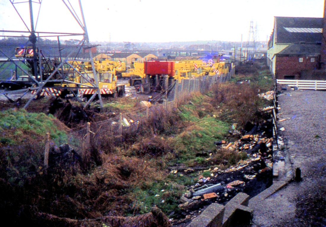
Camborne and Redruth Tramway
Hi Gents,
Not sure if you are aware of this: https://wpehs.org.uk/camborne-redruth-light-railways-tramway
Take Care,
Chris Bellett
Retired S&T Engineer. CRS Member
Not sure if you are aware of this: https://wpehs.org.uk/camborne-redruth-light-railways-tramway
Take Care,
Chris Bellett
Retired S&T Engineer. CRS Member
Many thanks to Chris Bellett for this link to a very interesting site.
Charlestown Harbour tramways
Peter Murnaghan.
Peter Murnaghan.
Charlestown
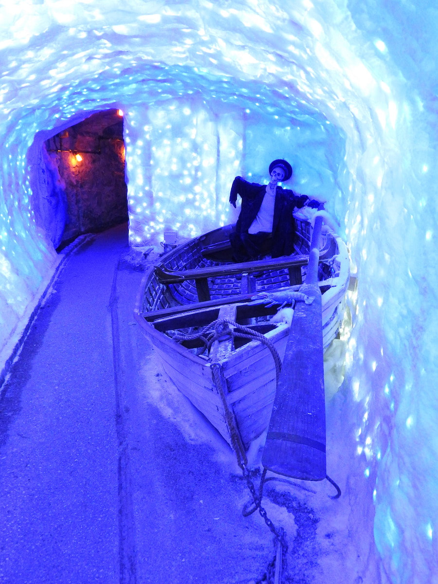
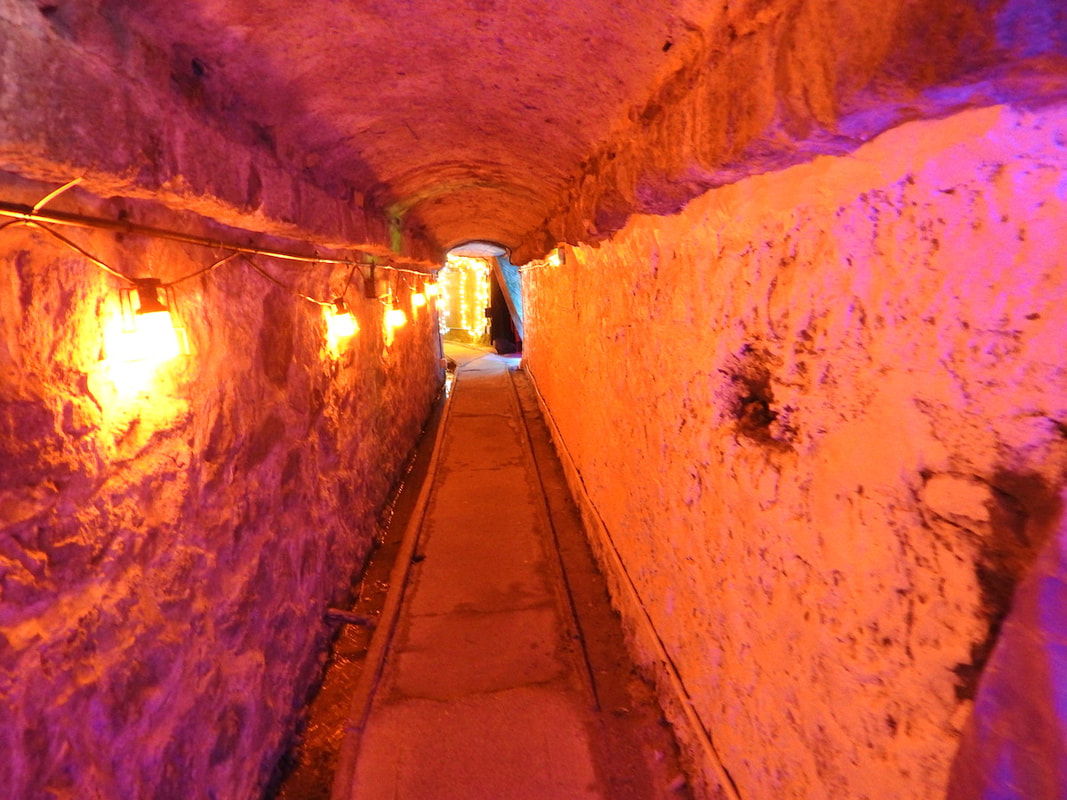
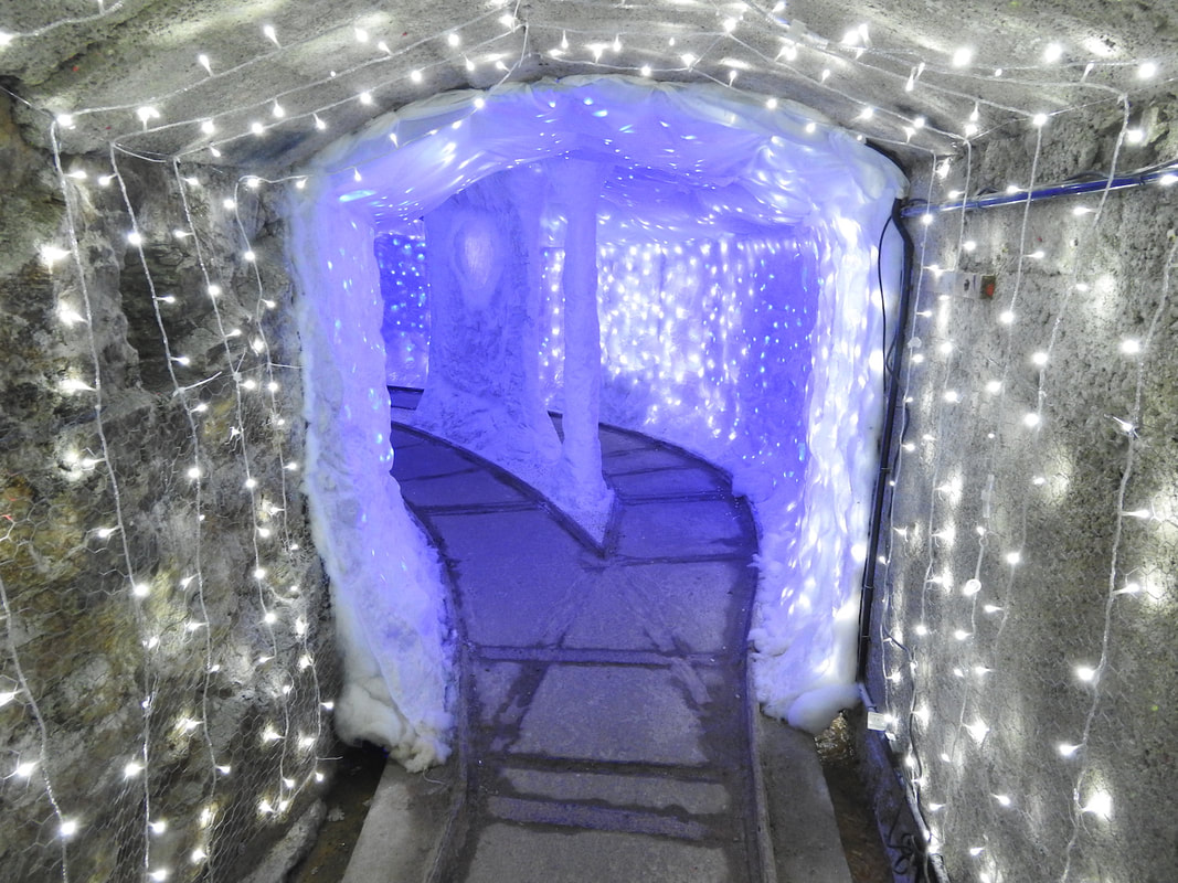
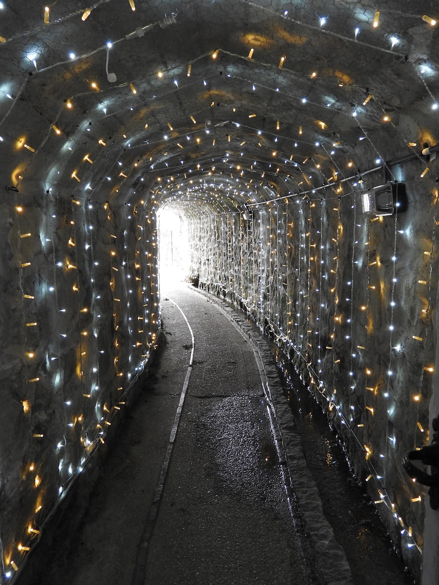
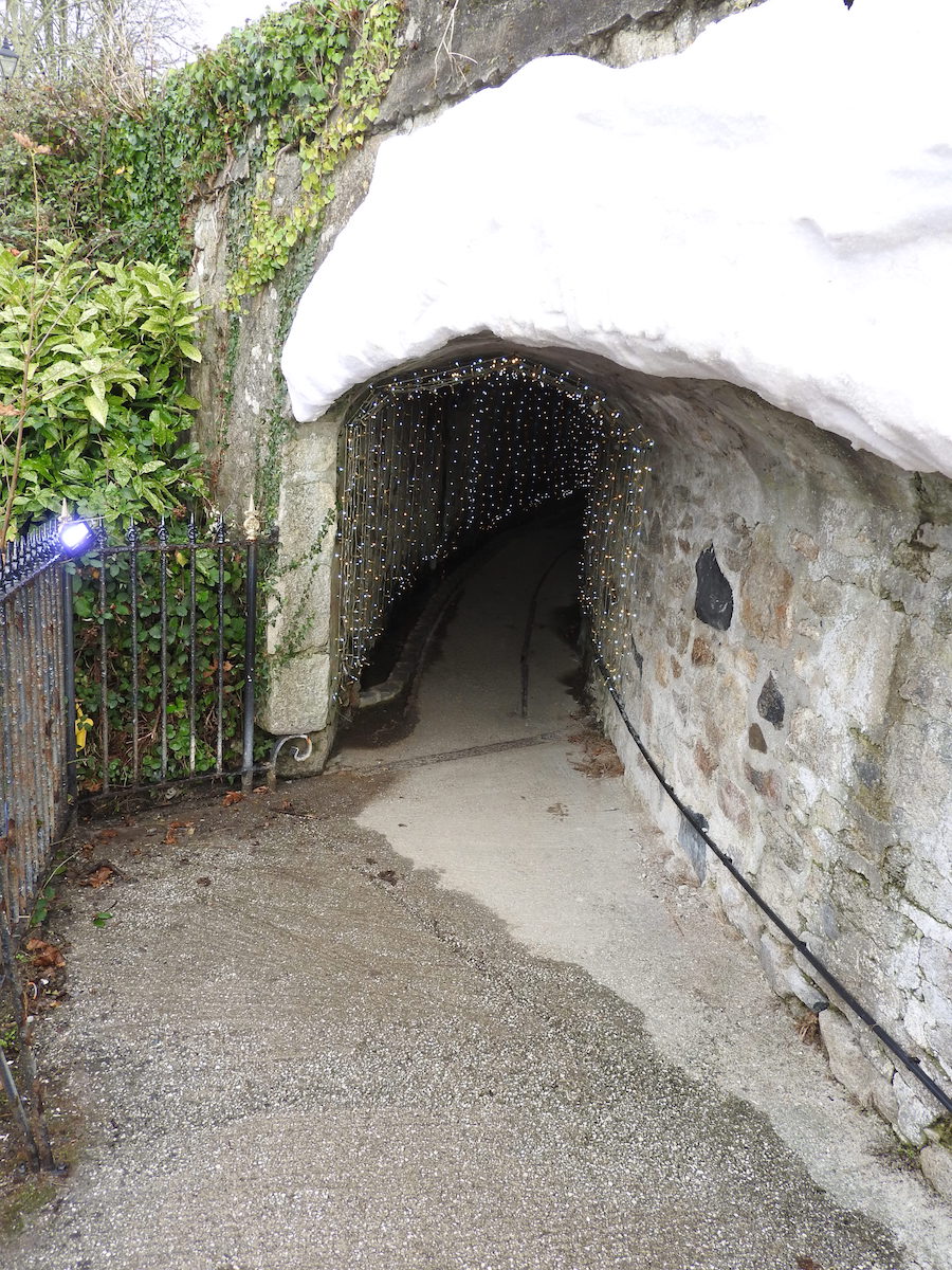
A network of china clay tunnels leading to Charlestown harbour is open to the public for a limited period, until 9th January 2022.
The tunnels were underground access routes for trucks containing dry china clay, to gain access to ships moored alongside in Charlestown harbour. The china clay used to travel down from its source 3 miles away at Carglaze, in the form of slurry by gravity in a pipe to settling tanks at Charlestown. In 1907, a clay dry was erected where the Shipwreck Museum now stands. The tunnels were constructed at the same time and remained operational until 1968.
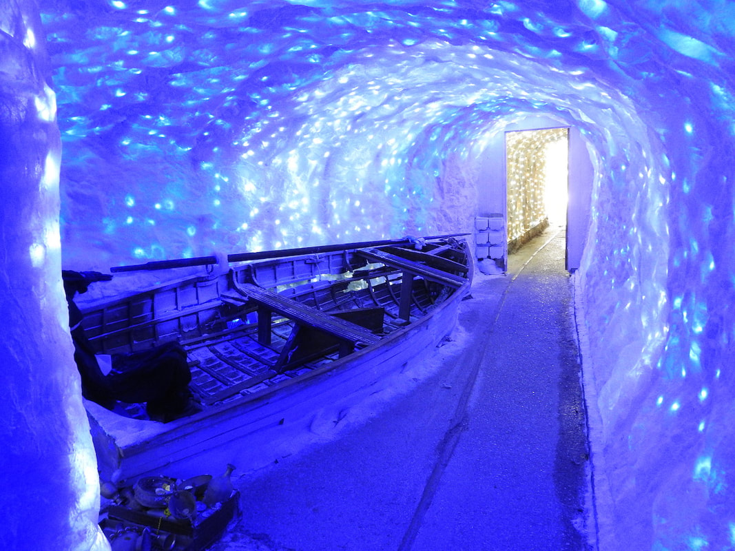
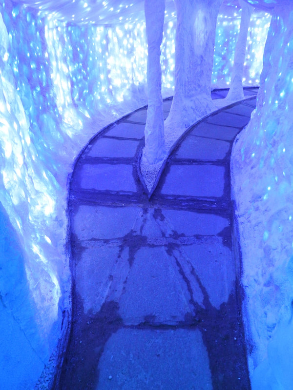
The tunnels have been opened in recent years, for special occasions and are open again this winter as the 'Tunnel of Lights: Arctic Adventure'. More than 100 metres of tunnels are illuminated as they cross beneath the road to emerge above the harbour, where china clay used to be emptied down chutes into the holds of ships below. The tunnels run in various directions and a passing loop is included in the layout.
From 1st December, a newly excavated tunnel at the site that has never been opened to the public before, as part of the Museum, will be decorated with thousands of festive lights, as a Christmas feature.
To visit the tunnels, timed entry tickets must be booked in advance via shipwreckcharlestown.co.uk. There is limited availability. The Tunnel of Lights are open to the public from 23rd October 2021 until Sunday 9th January 2022.
Admission will also include access to the Shipwreck Museum.
This is a rare opportunity to see this network of tunnels that have been disused for over 50 years. A couple of end-loading wagons can be seen at the Museum, together with the remains of track and chutes alongside the harbour.
Peter Murnaghan
Charlestown
A network of china clay tunnels leading to Charlestown harbour is open to the public for a limited period, until 9th January 2022.
The tunnels were underground access routes for trucks containing dry china clay, to gain access to ships moored alongside in Charlestown harbour. The china clay used to travel down from its source 3 miles away at Carglaze, in the form of slurry by gravity in a pipe to settling tanks at Charlestown. In 1907, a clay dry was erected where the Shipwreck Museum now stands. The tunnels were constructed at the same time and remained operational until 1968.
The tunnels have been opened in recent years, for special occasions and are open again this winter as the 'Tunnel of Lights: Arctic Adventure'. More than 100 metres of tunnels are illuminated as they cross beneath the road to emerge above the harbour, where china clay used to be emptied down chutes into the holds of ships below. The tunnels run in various directions and a passing loop is included in the layout.
From 1st December, a newly excavated tunnel at the site that has never been opened to the public before, as part of the Museum, will be decorated with thousands of festive lights, as a Christmas feature.
To visit the tunnels, timed entry tickets must be booked in advance via shipwreckcharlestown.co.uk. There is limited availability. The Tunnel of Lights are open to the public from 23rd October 2021 until Sunday 9th January 2022.
Admission will also include access to the Shipwreck Museum.
This is a rare opportunity to see this network of tunnels that have been disused for over 50 years. A couple of end-loading wagons can be seen at the Museum, together with the remains of track and chutes alongside the harbour.
Peter Murnaghan
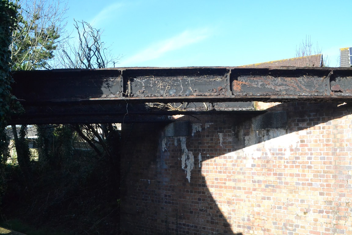
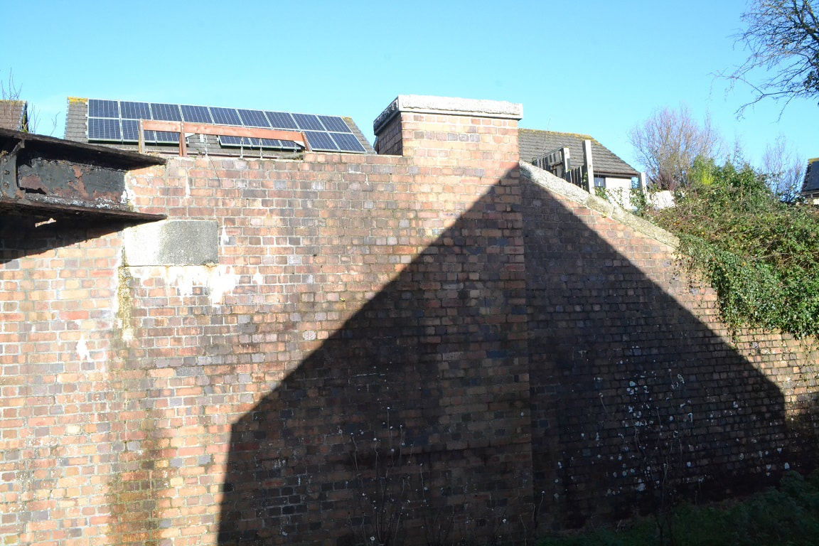
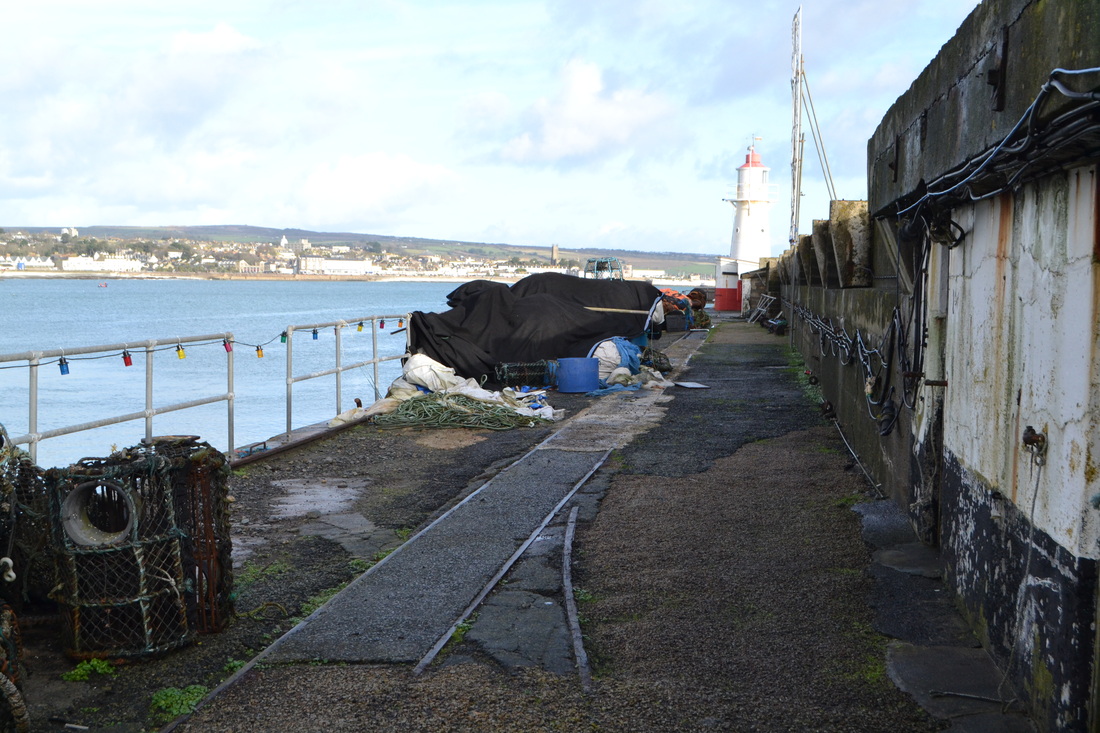
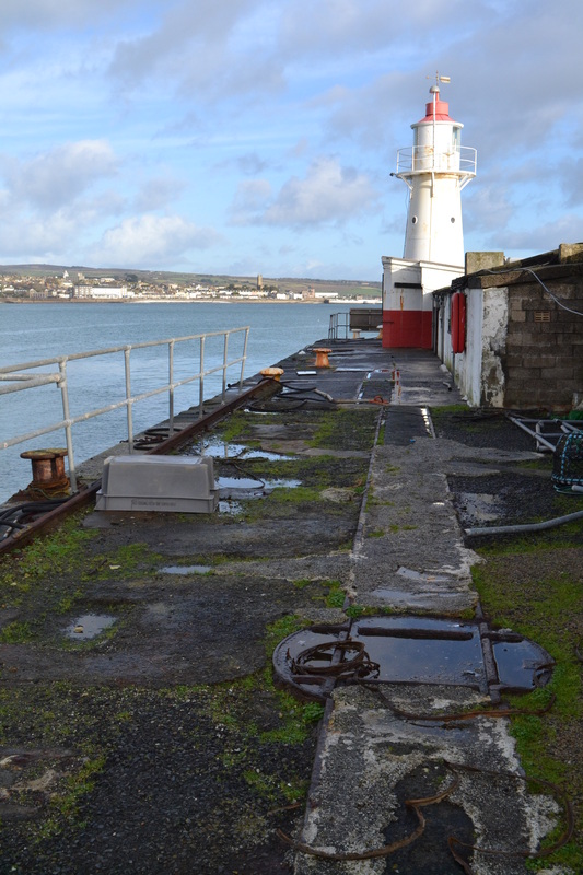
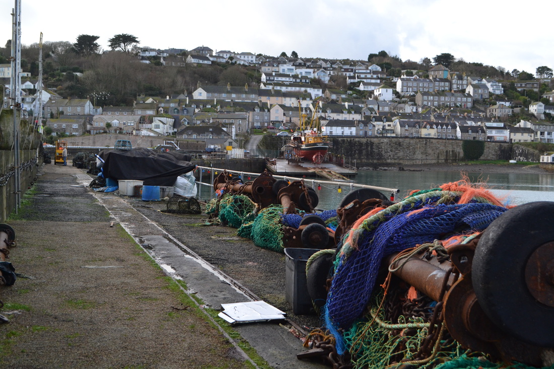
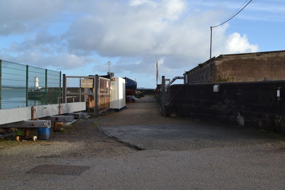
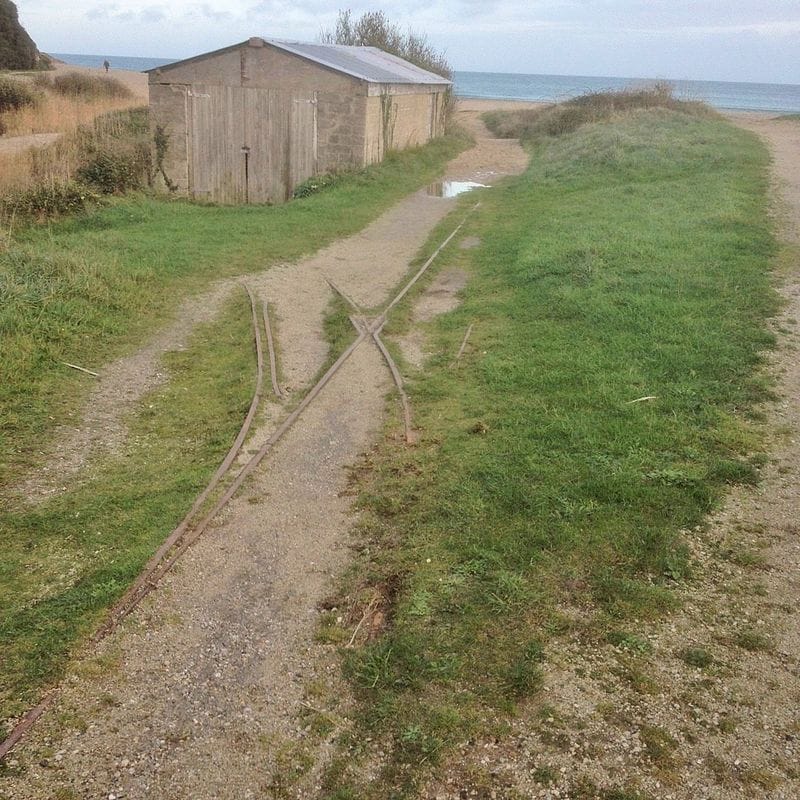
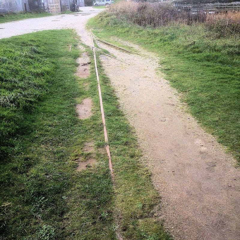
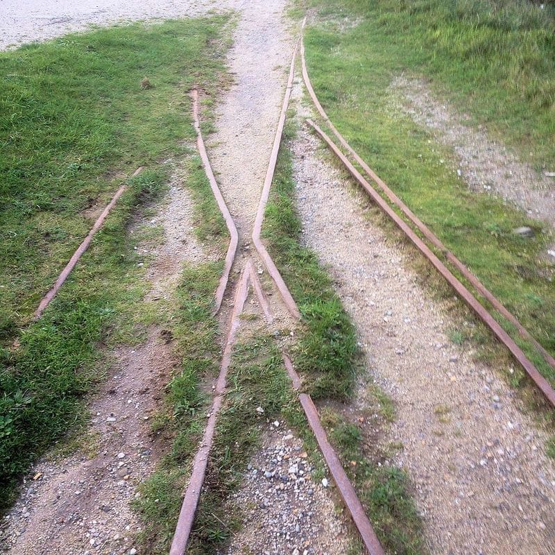
Charlestown Harbout Tramway (1) - 24th November 2021. Copyright Peter Murnaghan.
Charlestown Harbout Tramway (2) - 24th November 2021. Copyright Peter Murnaghan.
Charlestown Harbout Tramway (3) - 24th November 2021. Copyright Peter Murnaghan.
Charlestown Harbout Tramway (4) - 24th November 2021. Copyright Peter Murnaghan.
Charlestown Harbout Tramway (5) - 24th November 2021. Copyright Peter Murnaghan.
Charlestown Harbout Tramway (6) - 24th November 2021. Copyright Peter Murnaghan.
Charlestown Harbout Tramway (7) - 24th November 2021. Copyright Peter Murnaghan.
Charlestown Harbout Tramway (8) - 24th November 2021. Copyright Peter Murnaghan.
Charlestown Harbout Tramway (9) - 24th November 2021. Copyright Peter Murnaghan.. Note - a sign of the times - a hand sanitiser clipped to the tram wagon.
No doubt there will be summertime openings, without the lights, but your will need to enquire in advance. Many thanks indeed Peter.
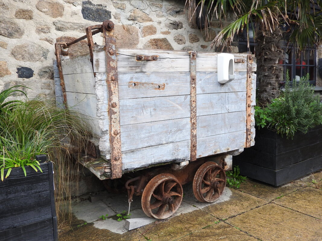
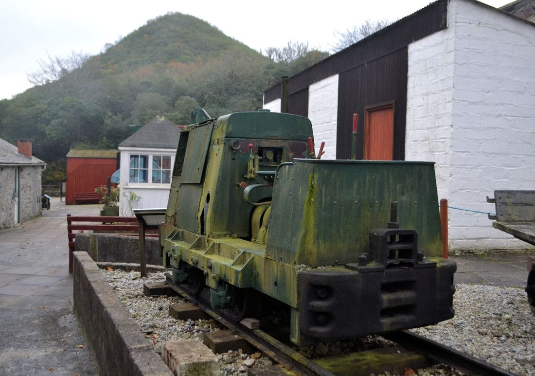
Gothers Tramway - Goss Moors
Pochin’s Puffing Billies - I have recently been researching the history of the Pochin family of Barkby Hall Leicestershire and discovered that there are interesting links to the Cornish China Clay industry and its associated Tramways.
Henry Davis Pochin (1824-1895) was an industrial chemist who invented white soap and a china clay compound used in glossy paper manufacture. He owned several china clay pits in Cornwall and coal mines in Wales. His company was part of the ECLP consortium that later became English China Clays and, latterly Imerys.
A particular angle I wanted to follow up is the four engines (Pochin’s Puffing Billies) that used to operate on the Gothers Tramway. The engines were apparently named Dinah (bought new), Crookfoot, Brooke and Greenfield, all acquired second hand.
From your records, do you know whether any of these engines survive to this day and, failing that, whether there are any photographic records?
Yours sincerely,
Piers Gough
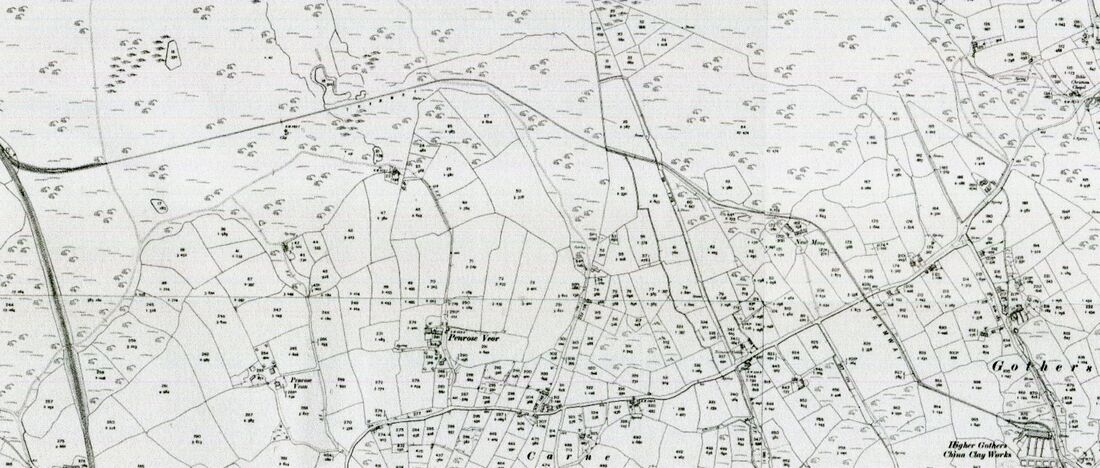
Reproduced from NLS site - non commercial use.
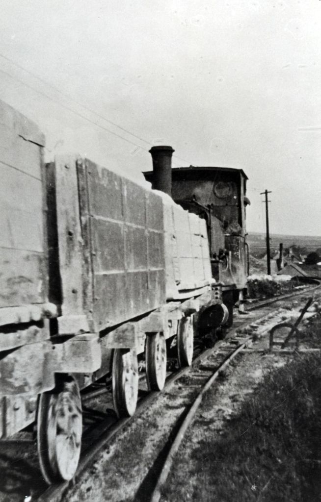
A rare view of a Gothers Train.
------------------------------------------------------------------------------------------------------------------------------------------------------------------------------------------
Gwithian Explosive Works - see the National Explosives Works at Upton Towans
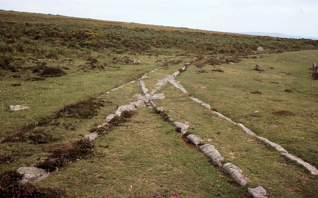
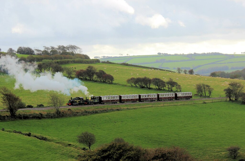
Hay Tor Tramway
Haytot Tramway Copyright Peter Butt
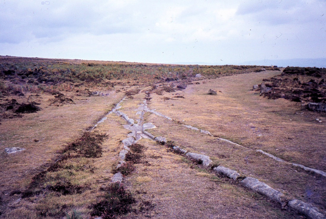


H1 Haytor Tramway 3rd November 2016 Copyright Davis Hibberd
H2 Haytor Tramway 3rd November 2016 Copyright Davis Hibberd
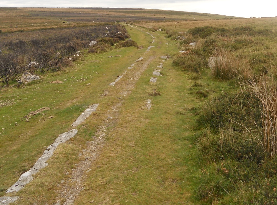
Recent Discoveries
- The Haytor Granite Tramway
Pictures and an article by Colin Burges
- The Haytor Granite Tramway
Pictures and an article by Colin Burges
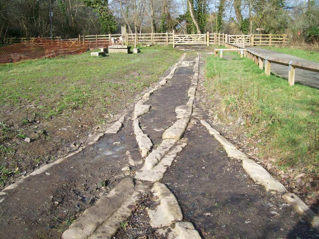
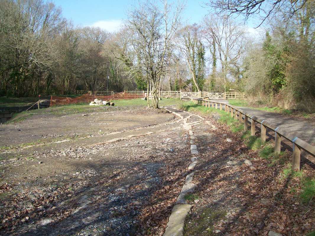
One of the most interesting things to have been uncovered in recent years is the extent of the Haytor Tramway at Ventiford Basin, between Teigngrace and Heathfield on the Moretonhampstead Branch. This was the terminus of the Stover Canal and the tramway, but no one had any idea that the track layout remained beneath the surface; all else beyond where the tramway was buried by the later railway around Granite Siding has gone and it was thought that the section near Pottery Road, Bovey, was the lowest surviving.
Ventiford Basin was in ruins until a few years ago but recent archaeological work by the Stover Canal Society and construction of a neighbouring path as part of the Dartmooor "Granite and Gears" project has transformed the area.
Through M. & S.D.R, G.W.R., B.R. and another ownership, the canal passed to Network Rail as an historical legacy. It leases the dry "waterway" to Teignbridge District Council which sublets it to the society.
Only 24 years after this "stone age" line was built, Daniel Gooch was able to drive a train from Paddington to Exeter and back along the modern railway.
Looking towards Haytor, the line turns left to follow the course of the Moretonhampstead Branch. Colin Burges
Copyright Colin Burges
A turnout in more detail. It is conjectured that a rudimentary point rail deflected wagon wheels in the facing direction. Copyright Colin Burges
Lookng in the opposite direction, the Moretonhampstead Branch is on embankmnt at right. Among those in the know there is always some sadness when a place is opened up & interpreted, but without these works this may never have been discovered. Copyright Colin Burges
Ventiford Basin, the terminus of the Stover Canal recently dug by the tramway is on the left, the later railway on the right. Copyright Colin Burges
An interesting recent discovery - a Cross-over on the Hay Tor Tramway at Ventiford. 10th November 2017 Copyright Colin Burges. This must surely be the only one on the system. What next, a three-way or a compound?
Many thanks to Colin Burges for this most interesting article.
Hythe Pier Tramway
Roger Salter
A collection of pictures taken on a visit on the 30th March 2017
Roger Salter
A collection of pictures taken on a visit on the 30th March 2017
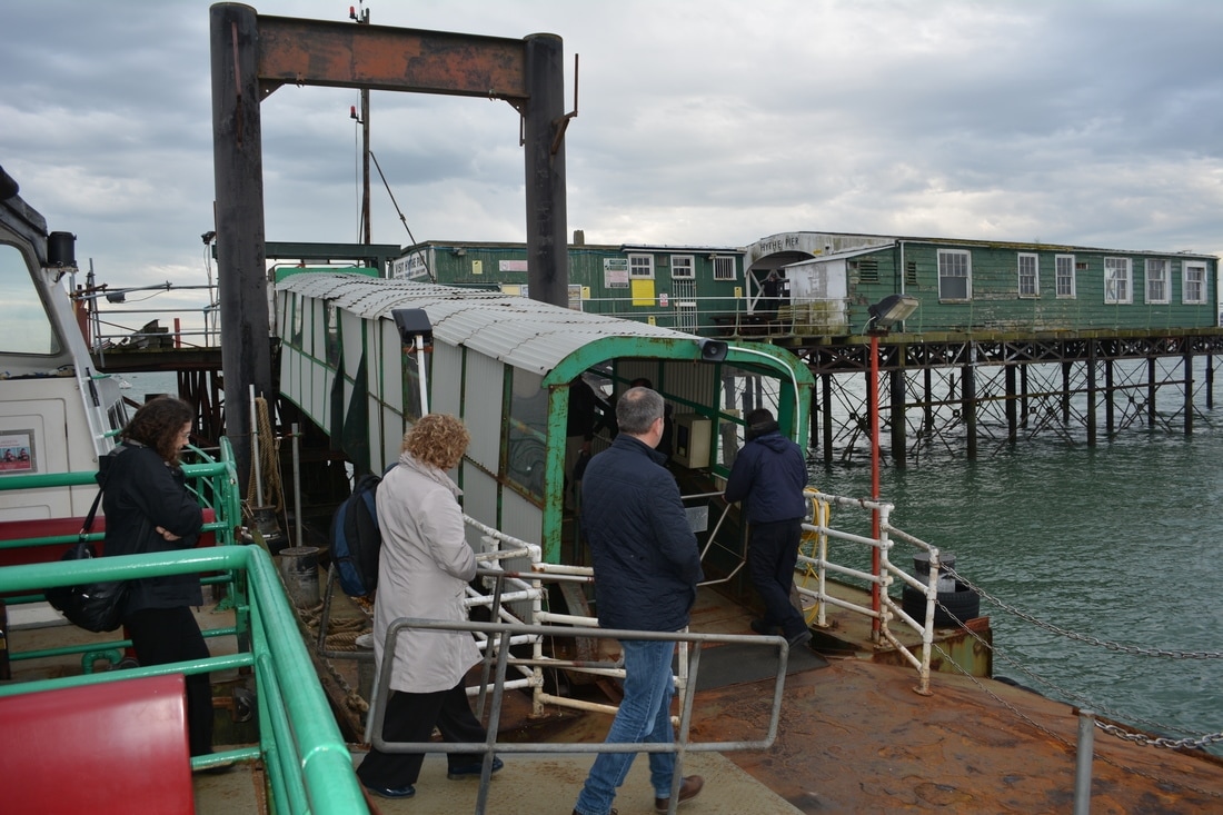
Leaving the ferry from Southampton. 30th March 2017 Copyright Roger Salter
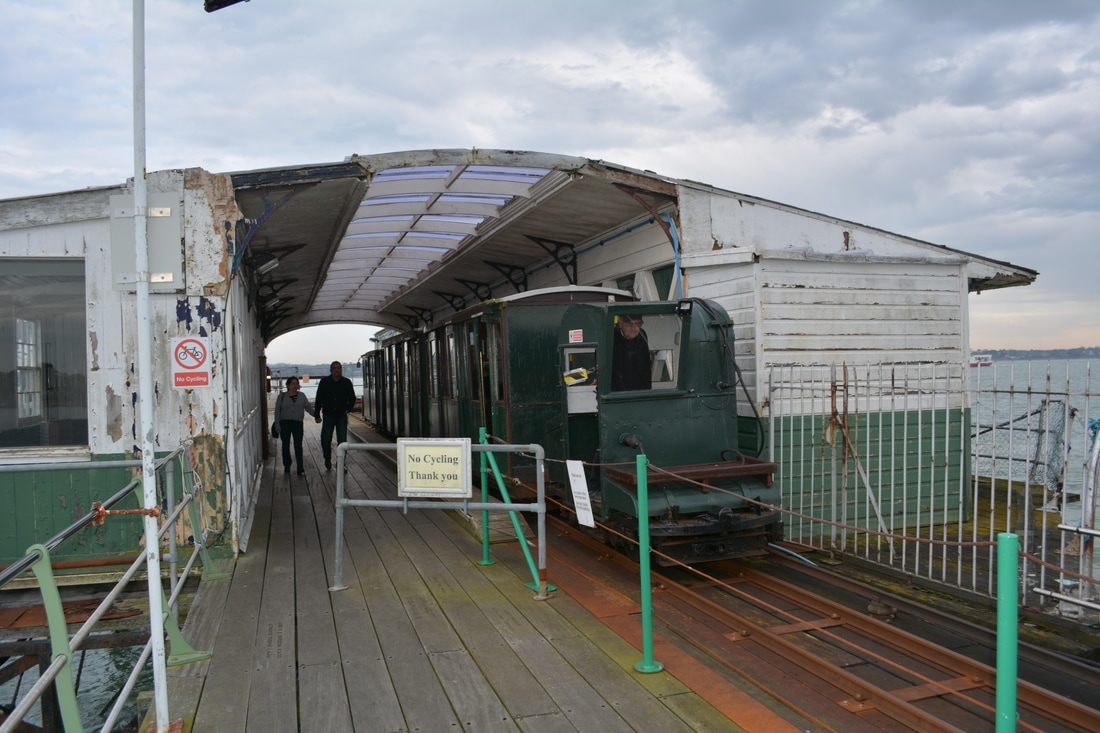
The pier terminus . 30th March 2017 Copyright Roger Salter
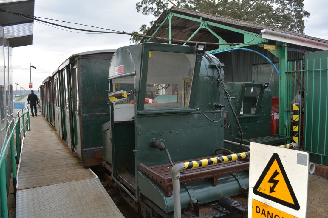
The motive power at the land terminus. 30th March 2017 Copyright Roger Salter

The coaching stock ready to be propelled out to the pier terminus. 30th March 2017. Copyright Roger Salter
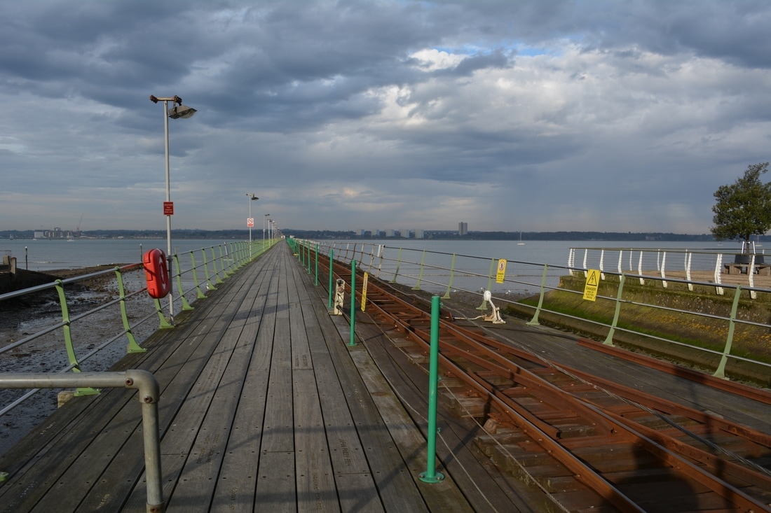
Looking out along the pier. 30th March 2017 Copyright Roger Salter
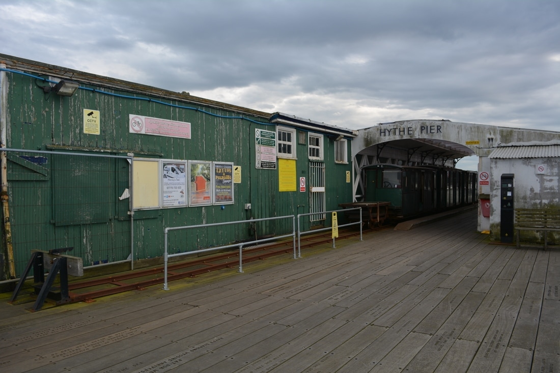
The pier terminus offices. 30th March 2017 Copyright Roger Salter
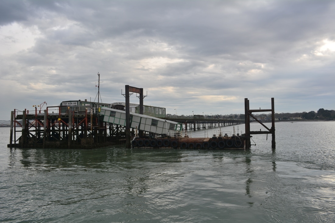
A look back at Hythe Pier. 30th March 2017 Copyright Roger Salter
Just three days to go.
On the last day but one Kevin Jenkin took a sentimental journey on the tramway.
I don't think the CRS website has a nautical section, but this email is partially relevant with the connected Hythe Pier railway and just falls within the boundaries.
Hythe in Hampshire is a growing settlement on the opposite bank of Southampton Water / the River Test to Southampton itself, and is one of the gateways to the New Forest. It was a village in 1950 but is now an ever expanding place with a population of over 20,000.
There has been a ferry between Hythe and Southampton for over 400 years (as recorded on maps from 1575 and 1788), but on new year's eve 2022 the ferry will cease to run because of economic pressures. It has needed financial support in the recent past and the change in working arrangements are not in the ferry's favour. New Forest people enjoy the convenience of the car, but complain constantly of traffic jams on the A326 and the road network into the greater Southampton area. Covid also affected the way that people commute and work, reducing travel demand.
Southampton is clearly visible from Hythe (about 2.7km from land to land) but because of the distance to the channel, 600m of the journey is taken up by the Hythe pier, and the pier incorporates an electric railway. The pier (built in around 1880) seems to be safe (although in need of some TLC in places) as it was recently grade 2 listed, but without the Southampton ferry, the railway seems vulnerable. Volunteers and crowdfunding are keeping things going.
The 2 foot gauge pier railway with 250V third rail was built in around 1920 and the locomotives and stock are of a similar age.
The ferry was busy today - probably on the best weather day since the ferry closure was announced. Fingers are crossed on both sides of the water, but the local authorities who have bailed out the operation in the past have said they won't help because of decreasing budgets and increasing burdens.
If the Fawley branch is re-opened (momentum is growing) then this is likely to make the ferry less viable - a public transport irony.
Hundreds more photos are available!
Kevin
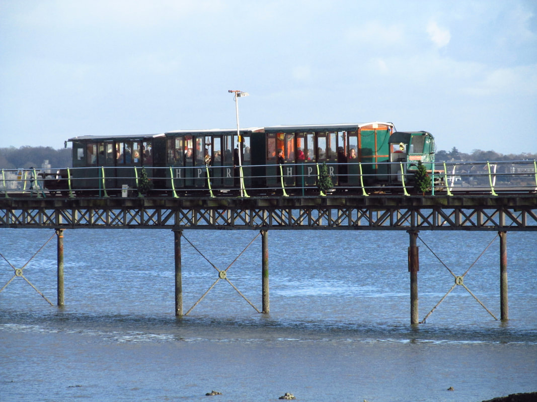
he tramway in operation on Thursday 29th December 2022. Copyright Kevin. P. Jenkin.
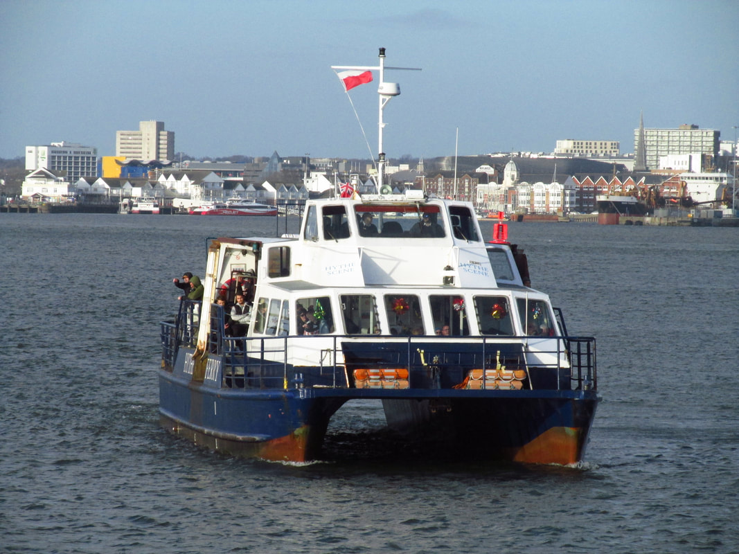
The connecting ferry in operation on Thursday 29th December 2022. Copyright Kevin. P. Jenkin.
Many thanks Kevin.
Lee Moor Tramway
See also Plymouth and Dartmoor Tramway
See also Plymouth and Dartmoor Tramway
The Lee Moor Tramway has been visited on a number of times by the Cornwall Railway Society. Perhaps the most memorable time was, when as the West Cornwall Group Plymouth Railway Circle several members were given a guided tour over the route by Ivor Hocking, himself a member of the group involved in the restoration of the two locomotives which were stored on the upper section of the line. One of the locomotives was eased out of the shed for photographs with the aid of pinch bars. There was a valuable collection of relics already being stored.
A brief history care of Wikipedia:- A new line from Marsh Mills to Lee Moor was opened in 1856, in part to replace the old Plympton branch of the Plymouth & Dartmoor Railway. Two inclines were worked by stationary engines. The lower one, at Cann Wood, was worked by the descending wagons hauling up the ones travelling in the opposite direction, while the upper incline, at Torreycombe, was provided with water tanks that could be used to counterbalance heavy wagons being taken up the slope. The tramway crossed the Tavistock line on a level crossing near Marsh Mills and trains then continued to Plymouth along the old Cann Quarry line and original Plymouth and Dartmoor track. This entailed another level crossing of the South Devon main line between the Embankment Road and Laira engine sheds.
A brief history care of Wikipedia:- A new line from Marsh Mills to Lee Moor was opened in 1856, in part to replace the old Plympton branch of the Plymouth & Dartmoor Railway. Two inclines were worked by stationary engines. The lower one, at Cann Wood, was worked by the descending wagons hauling up the ones travelling in the opposite direction, while the upper incline, at Torreycombe, was provided with water tanks that could be used to counterbalance heavy wagons being taken up the slope. The tramway crossed the Tavistock line on a level crossing near Marsh Mills and trains then continued to Plymouth along the old Cann Quarry line and original Plymouth and Dartmoor track. This entailed another level crossing of the South Devon main line between the Embankment Road and Laira engine sheds.


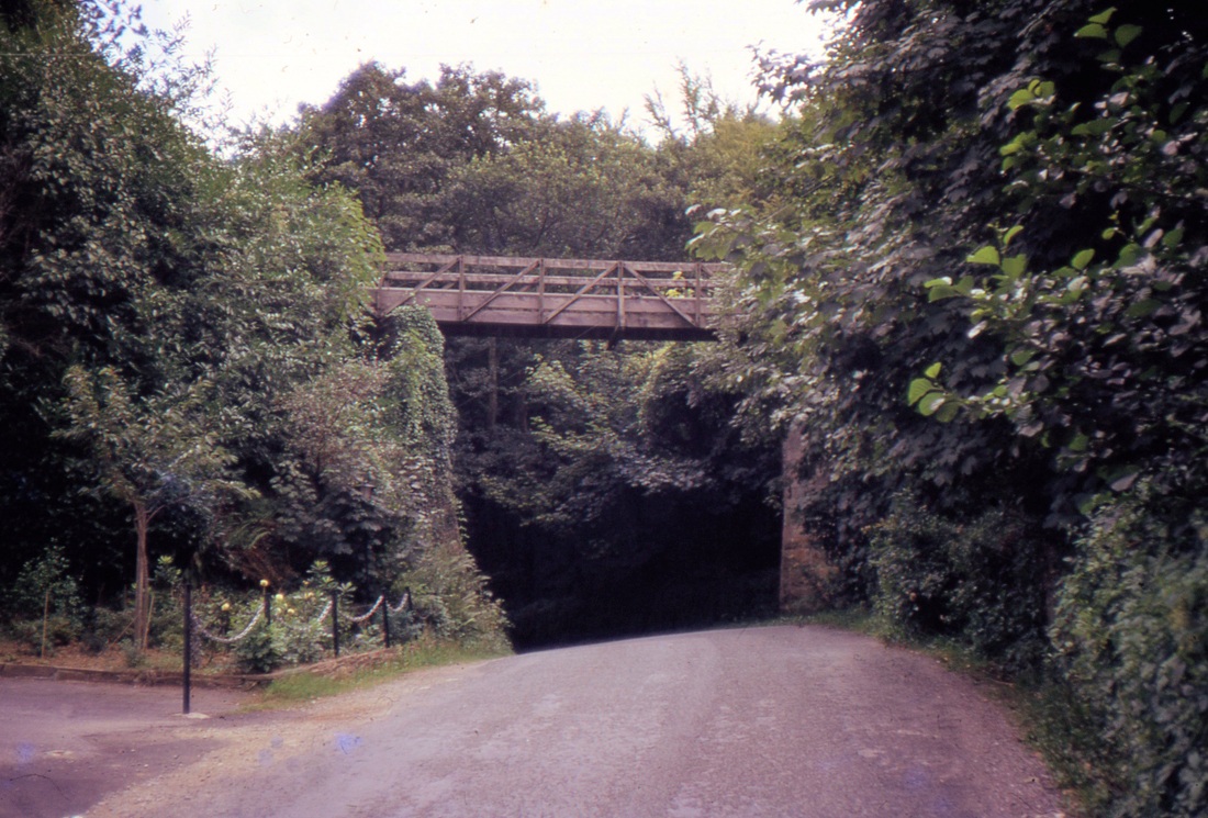


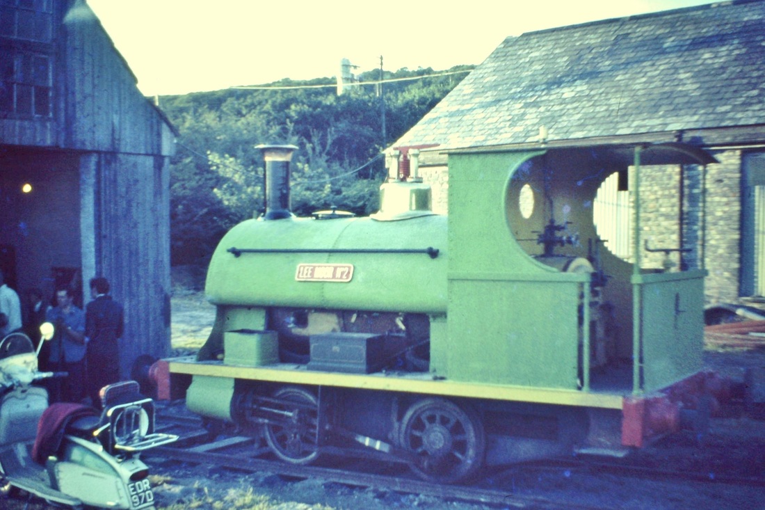
Lee Moor. The river bridge from downstream1960's Copyright Sid Sponheimer
Lee Moor Locos in preservation
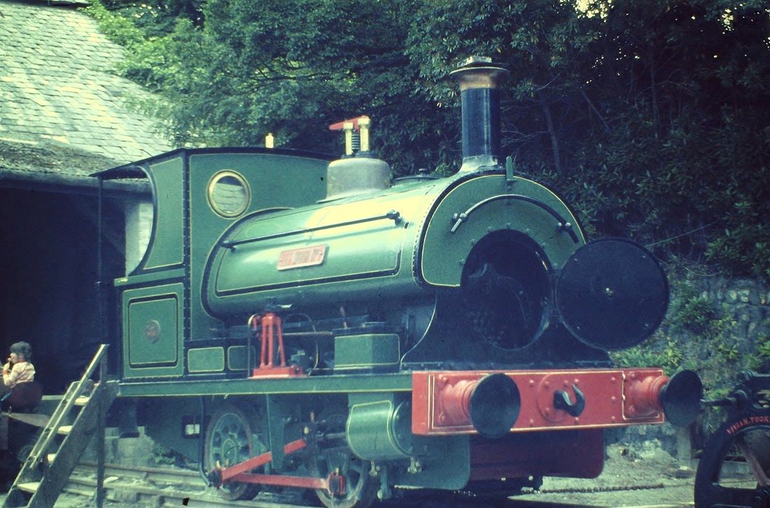
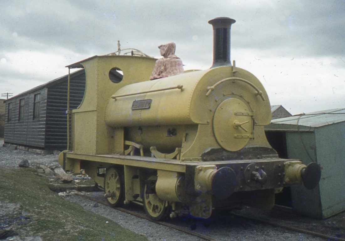
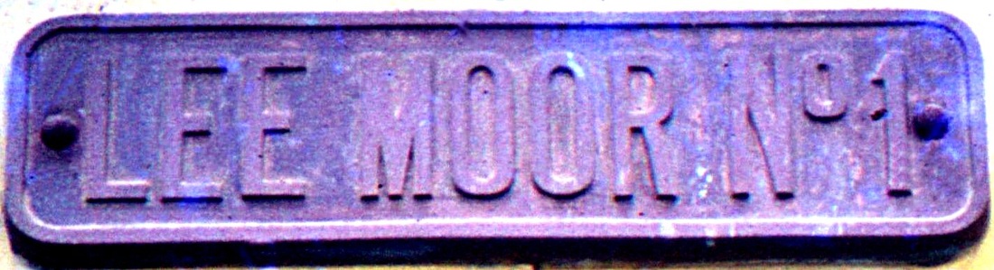
Lee Moor Number 1 at Wheal Martyn Museum, St Austell. Copyright Sid Sponheimer
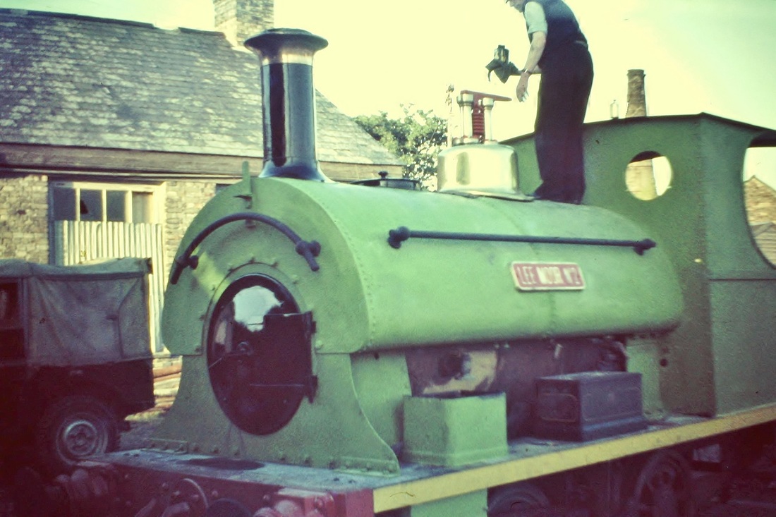
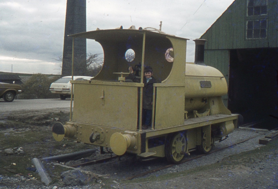
Lee Moor Number 2 at Torycombe. Copyright Sid Sponheimer
Lee Moor Number 2 at Torycombe. Copyright Sid Sponheimer
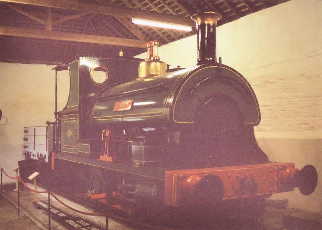
Lee Moor Number 2 at Saltram House - National Trust. Copyright Sid Sponheimer
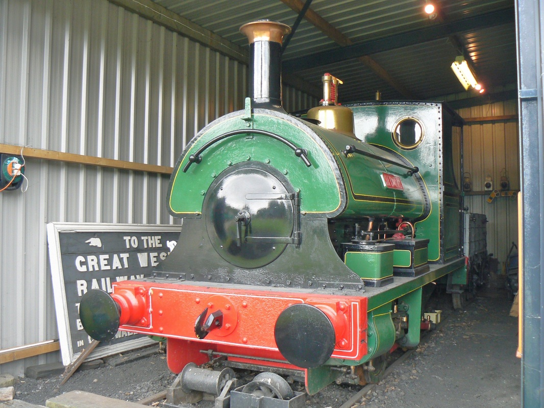
Lee Moor No. 2. gleaming at the Buckfastleigh, South Devon Railway . May 2007 Copyright Sid Sponheimer
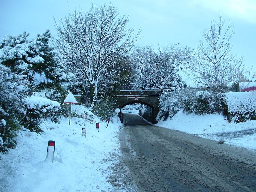
L & C Tremar snowscenes 25th November 2005 Copyright Sid Sponheimer N.B . The chimney of Sids bungalow can be seen to the extreme right.
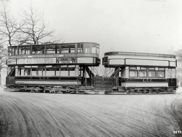
A TALE OF TWO TRAMS
Rosudgeon, Penzance - London Trams
Rosudgeon, Penzance - London Trams
History :- These vehicles were used as living accommodation at Kenneggy Downs for many years by Mr & Mrs Ned Thomas. In the early 1960's the old tram bodies they were moved to another location in the area where they have remained until mid March 2021, however as building work was about to commence on this site these historic vehicles have been been moved and placed into temporary storage locally by Mr Andrew Newport, a haulage contractor and a transport enthusiast of Penzance. Mr. Newport would like to find a good home for these historic trams where they can undergo restoration. UPDATE.
There have been occasions when double decker trams have been split into two and the upper and lower decks used as living accommodation at different locations. We don't know how these tramcar bodies once at Kenneggy Downs and later at Rosudgeon came to Cornwall - but it seems possible that they travelled by train.
The bodies were said to be of London Trams yet a search through various references failed to find anything like them - most London trams had more side windows. However the lower deck of an E3 class tram, a double decker, came close to fitting the bill unfortunately the small windows on the lower deck were not exactly the same. Further proof of their origin came when Andrew Newport acquired a door handle bearing the legend L.C.C. (London County Council)
Two Tram bodies recently came to light at a site on which it is intended to build new properties and the site owner wishes this cleared so that development can take place. There is thus some considerable urgency to remove the bodies to somewhere where the can be safely stored and possibly restored. Firstly
The bodies were said to be of London Trams yet a search through various reference failed to find anything like them - most London trams had more side windows. However the E3 class tram, a double decker, came close to fitting the bill if it had the top deck removed unfortunately the small windows above were not exactly the same.
The bodies were said to be of London Trams yet a search through various reference failed to find anything like them - most London trams had more side windows. However the E3 class tram, a double decker, came close to fitting the bill if it had the top deck removed unfortunately the small windows above were not exactly the same.
On 14/03/2021 11:30, Peter Dale wrote:
Hello Roger,
I found some more about the tram bodies which sounds quite likely posted on rmweb on 4th February – it sounds as though the chap knows more about London trams than I do:
"...........concerning grounded vehicle bodies in Cornwall: I have done some research and they are ex-LCC trailer bodies, the unusual ventilator arrangement, number and proportion of the windows and the straight matchboard sides are the indicators. The LCC trailers were in operation 1913-24 on the south side when their use was discontinued as part of the drive to speed up services in response to growing bus competition, because they were withdrawn early they had a high residual book value so the LCC was keen to sell them intact rather than scrap them. The reason that they made it to Kernow is that there were 150 of them being a Class T and numbered T9 to T158, and in body only form they were easily transported due to their small size and light weight construction. They were for their day technically quite advanced; having ball bearing axleboxes and an ingenious automatic brake held off by spring pressure against drawbar pull, and if the drawgear totally failed on an upgrade a runaway was virtually impossible."
Hope this is of interest, Best Wishes, Pete Dale.
We 'struck gold' when details were found of an identical tram car body which has now been placed in Canvey Island Transport Museum. You will find a most interesting and detailed commentary using the links below concerning the discovery, and the recovery of the same type of tram trailer.
Tram Carriage | Tram Trailer | CanveyIsland.orghttps://www.canveyisland.org › history-2 › old › tram_...
and also on https://www.canveyisland.org/history-2/21st-century-canvey/the_tens/canvey_2015/102_years_old
Tram Carriage | Tram Trailer | CanveyIsland.orghttps://www.canveyisland.org › history-2 › old › tram_...
and also on https://www.canveyisland.org/history-2/21st-century-canvey/the_tens/canvey_2015/102_years_old
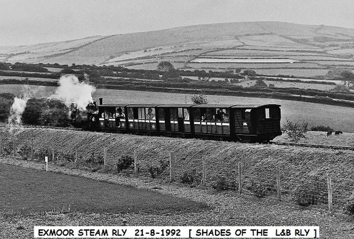
Lynton and Barnstaple
Copyright John Cornelius
Copyright John Cornelius
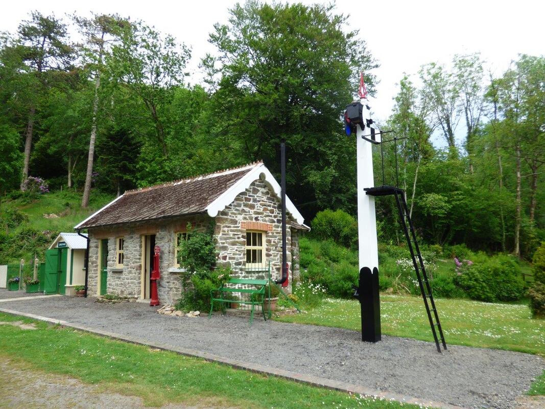
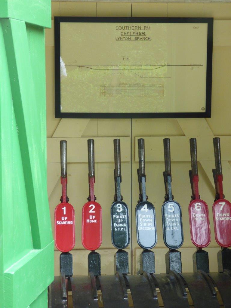
A visit to Chelfam Station in June 2021 by Derek Buttivant

Chelfham station (1) June 2021 Copyright Derek Buttivant
Chelfham station (2) - June 2021 Copyright Derek Buttivant.
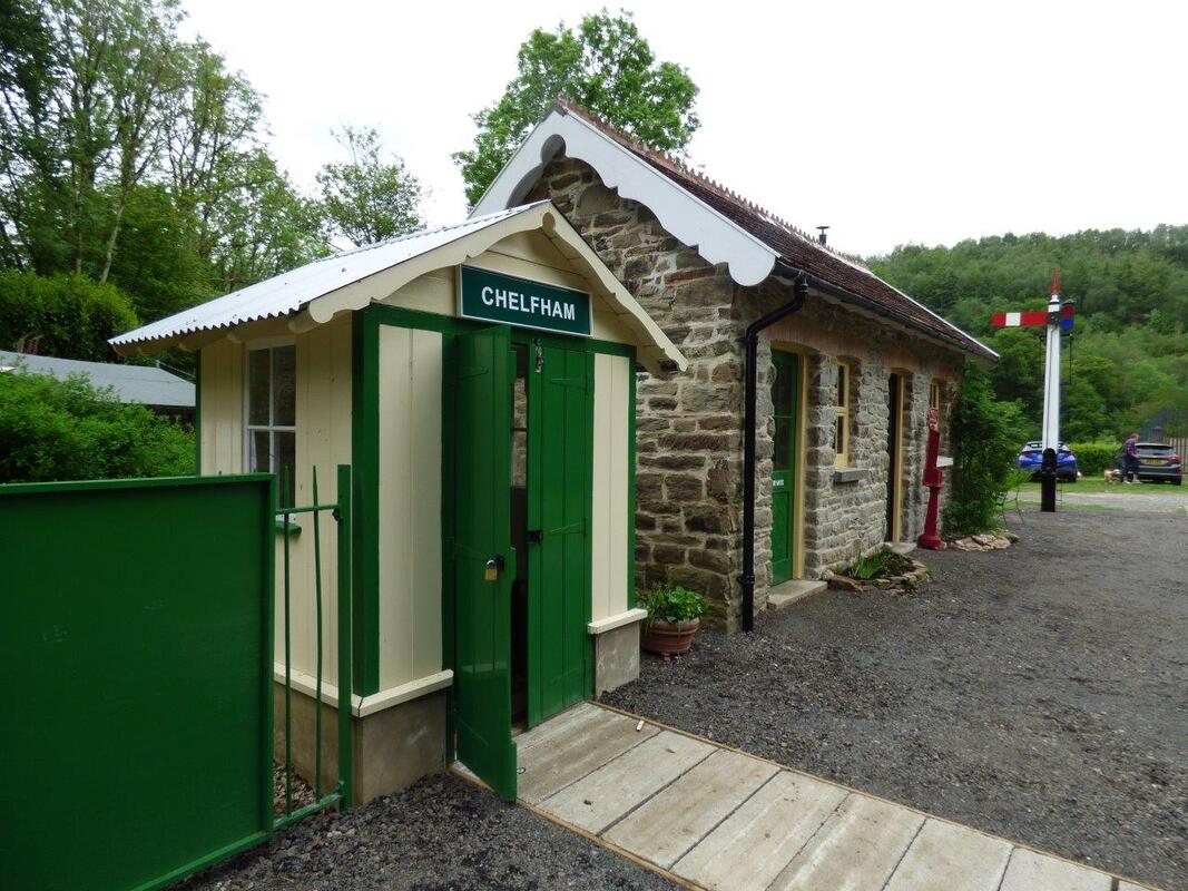
Chelfham station (3) - June 2021 Copyright Derek Buttivant
Chelfham station (4) June 2021 Copyright Derek Buttivant.
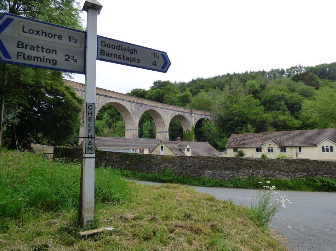
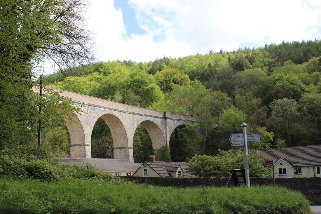
Chelfham station (5) the nearby viaduct looms above the hamlet. June 2021 Chelfham viaduct. Copyright Derek Buttivant.
I wasn't able to go on any of the several visits that the CRS has made to Woody Bay and the Lynton & Barnstaple railway but last week I managed to get there and enjoy the short but scenic narrow-gauge ride. Afterwards I found my way to Chelfham Station where great progress has been made by L&B volunteers in restoring the site and buildings. The other attached photos show how the station now looks - and the adjacent, superbly restored, viaduct. It looks really promising for an eventual extension of the restored line from Woody Bay to Chelfham and, perhaps, beyond.
Best wishes,
Derek Buttivant.
Best wishes,
Derek Buttivant.
Chelfham Viaduct - Martin Tester
Hi Keith,
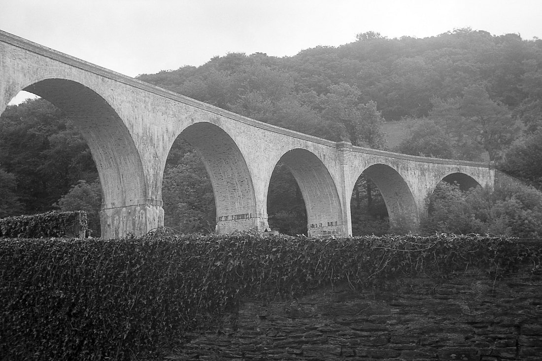
I was delighted to see Mike's excellent 1962 photos of Chelfham Viaduct. (CRS News Column 29th May 2023). I am an L&B enthusiast - but Mike knows that. I attach a couple of photos which I think compliment those of Mike.
The B&W shot taken from the trackbed & looking along the viaduct was taken on 24th August 1966 when I walked from Barnstaple to the viaduct. It shows that most of the parapet walls had been removed to guard against brickwork decay & wall collapse. Of course there were quite high metal fences at each end to discourage access. I think I must have clambered up one to take this photo - it seems to be from quite a high vantage point! The prominent building at the far end was built as the Chelfham station master's house - a remarkably grand house for such a small station. Now named 'Distant Point' it is owned by a consortium of L&B Trust members & operates as a time-share. The station itself is at the far end of the viaduct. It is owned by the L&B Trust together with a 350yd length of trackbed northwards. Below the viaduct are buildings of Chelham Mill Special School which was closed in 2015. The site, disused since then, is currently up for sale but the buildings are in poor condition. Supporters of the L&B are considering whether it would be worth buying. It could provide parking for Chelfham station, volunteer accomodation, a museum, holiday lets, & various other amenities & visitor attractions.
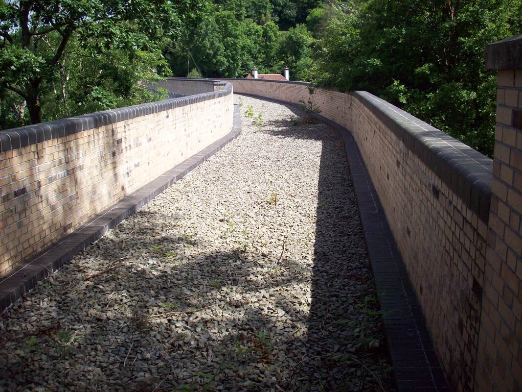
The colour photo dates from 9th May 2015 and remarkably is an almost exact replica of one of Mike's 1962 photos. What is significant is that it shows the parapet walls have been rebuilt to their proper height. This was done as part of a major refurbishment carried out in 2000 by British Rail Property Board which included the installation of a heavy-duty water-proof membrane below the ballast; this will protect the structure & is robust enough to allow the viaduct to carry trains again. The installation of this membrane was financed by the L&B Trust. The viaduct is currently owned by the Highways Agency - successor to BRPB.
Best wishes, Martin Tester.
I was delighted to see Mike's excellent 1962 photos of Chelfham Viaduct. (CRS News Column 29th May 2023). I am an L&B enthusiast - but Mike knows that. I attach a couple of photos which I think compliment those of Mike.
The B&W shot taken from the trackbed & looking along the viaduct was taken on 24th August 1966 when I walked from Barnstaple to the viaduct. It shows that most of the parapet walls had been removed to guard against brickwork decay & wall collapse. Of course there were quite high metal fences at each end to discourage access. I think I must have clambered up one to take this photo - it seems to be from quite a high vantage point! The prominent building at the far end was built as the Chelfham station master's house - a remarkably grand house for such a small station. Now named 'Distant Point' it is owned by a consortium of L&B Trust members & operates as a time-share. The station itself is at the far end of the viaduct. It is owned by the L&B Trust together with a 350yd length of trackbed northwards. Below the viaduct are buildings of Chelham Mill Special School which was closed in 2015. The site, disused since then, is currently up for sale but the buildings are in poor condition. Supporters of the L&B are considering whether it would be worth buying. It could provide parking for Chelfham station, volunteer accomodation, a museum, holiday lets, & various other amenities & visitor attractions.
The colour photo dates from 9th May 2015 and remarkably is an almost exact replica of one of Mike's 1962 photos. What is significant is that it shows the parapet walls have been rebuilt to their proper height. This was done as part of a major refurbishment carried out in 2000 by British Rail Property Board which included the installation of a heavy-duty water-proof membrane below the ballast; this will protect the structure & is robust enough to allow the viaduct to carry trains again. The installation of this membrane was financed by the L&B Trust. The viaduct is currently owned by the Highways Agency - successor to BRPB.
Best wishes, Martin Tester.
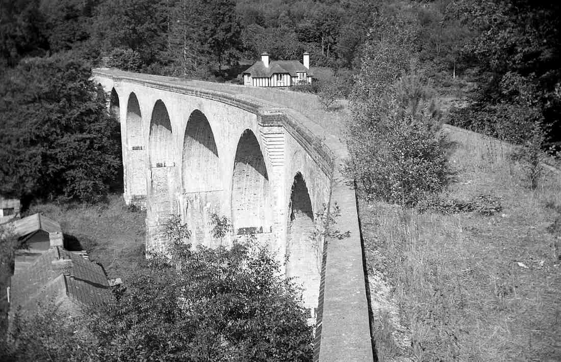
Chelfham Viaduct. 24th August 1966. Copyright Martin Tester
Chelfam Viaduct on the 9th May 2015. Copyright Martin Tester.
Chelfham Viaduct on Bank Holiday Monday 11 June 1962. Copyright Michael L. Roach.
Many thanks Martin - long may the L & B continue to live.
Chelfham about ten years ago (2012)
Chelfham Viaduct - about 2012 L & B Copyright Chris Lunn
A bridge near Chelfham viaduct. Copyright.
Lynton and Barnstaple Coach at York Museum. Andrew Hickson
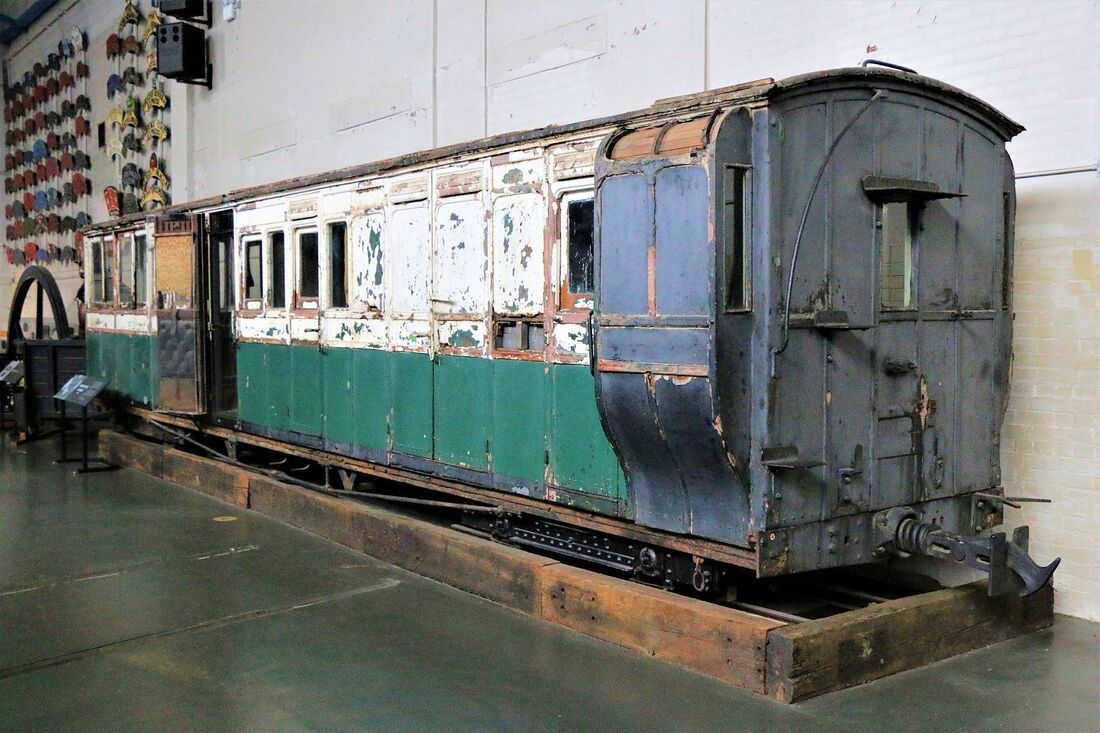
Lynton and Barnstaple Coach at York Museum. Copyright Andrew Hickson.
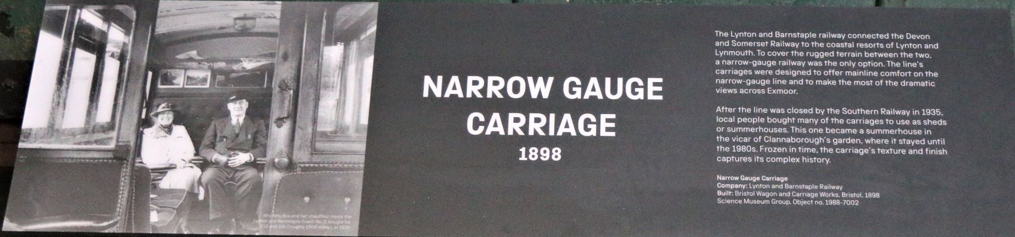
The plaque associated with this exhibit. Copy Andrew Hickson.
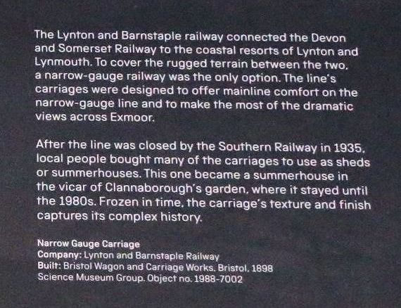
Detail associated with the above plaque. Copy Andrew Hickson.
A visit to the area in 1975.
Barnstable Town Sta A CRS Party contemplates the scene at Barnstaple Town Station 7th June 1975. Copyright Roger Winnen (The Lynton and Barnstaple Railway departed from the opposite side of the platform on the left.
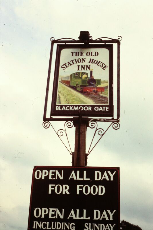
Blackmoor Gate Inn 910629g
Copyright Roger Winnen
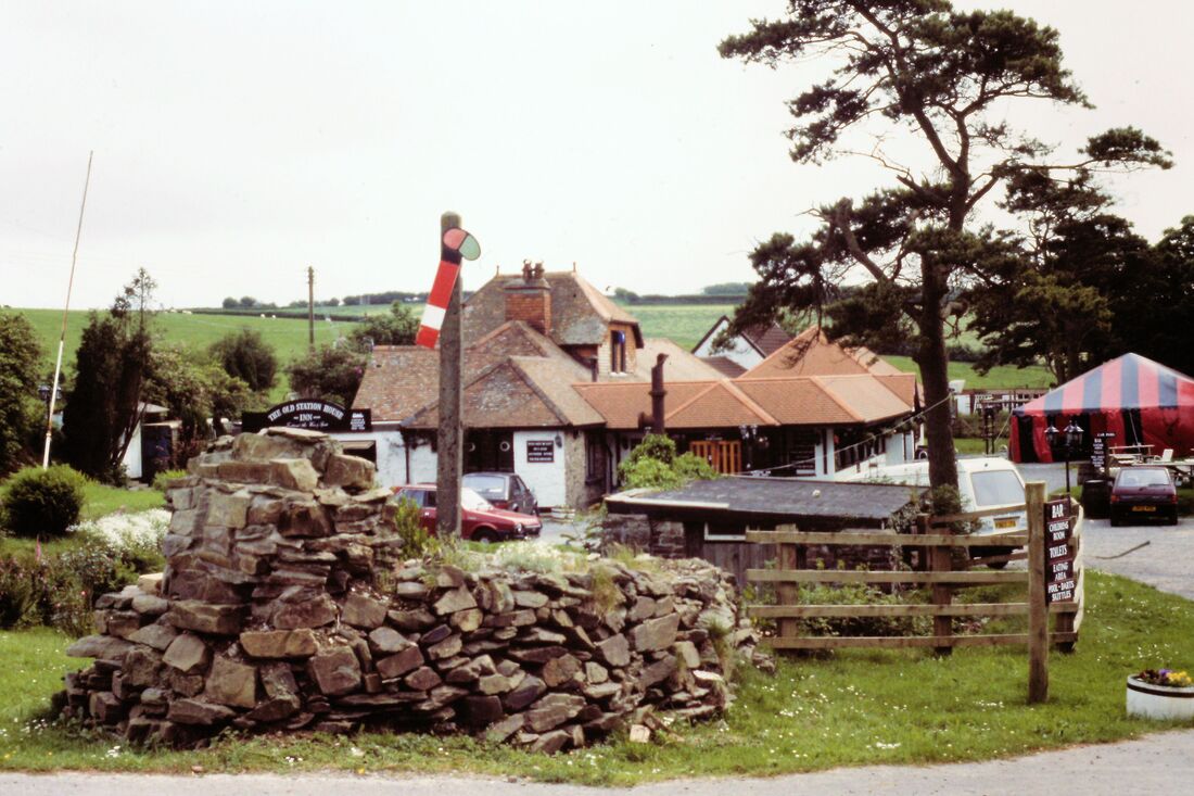
Blackmoor Gate. Copyright Roger Winnen
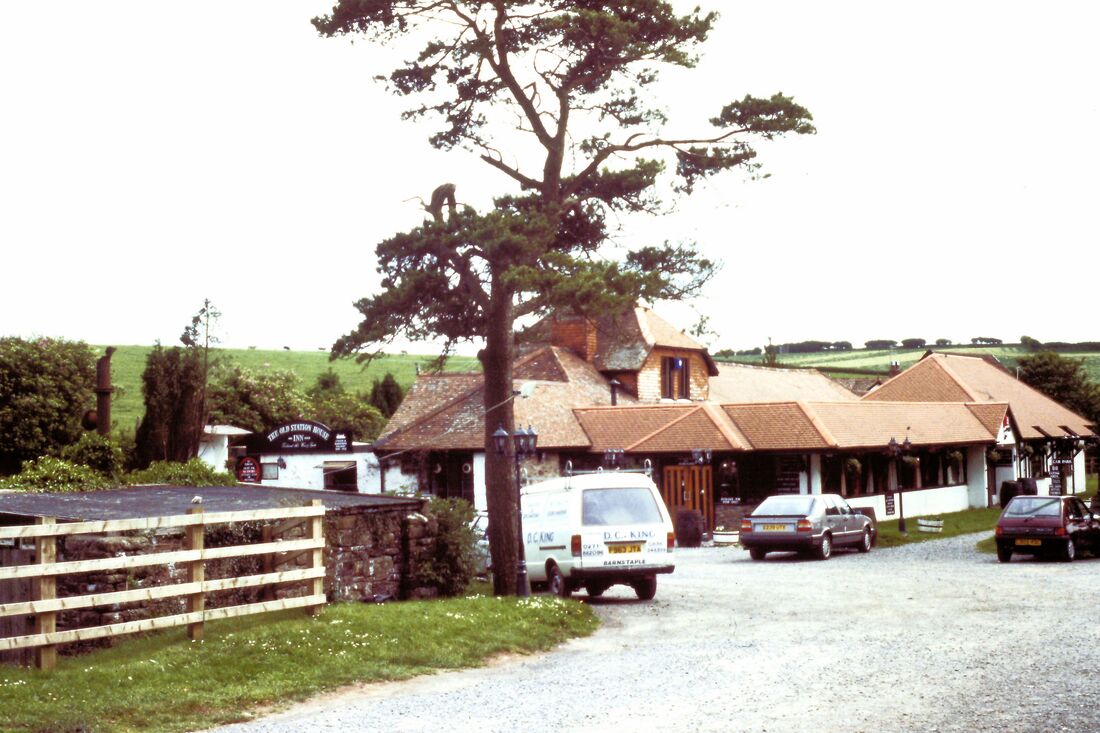
Blackmoor Gate. The Station Buildings at Blackmoor Gate. 910629hCopyright Roger Winnen
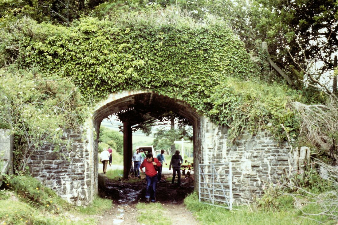
Bratton Fleming An overbridge at 910629e Copyright Roger Winnen
Bratton Fleming miniature railway. 910629k Copyright Roger Winnen
Bratton Fleming minature railway. 910629l Copyright Roger Winnen
Bratton Fleming miniture railway. 910629i Copyright Roger Winnen
Bratton Fleming miniture railway. 910629m Copyright Roger Winnen
Bratton Fleming Station building. 910629d Copyright Roger Winnen
Caffyns Halt. 910629r Possibly. Copyright Roger Winnen
Lynton to Barnstaple in 1966. Martin Tester
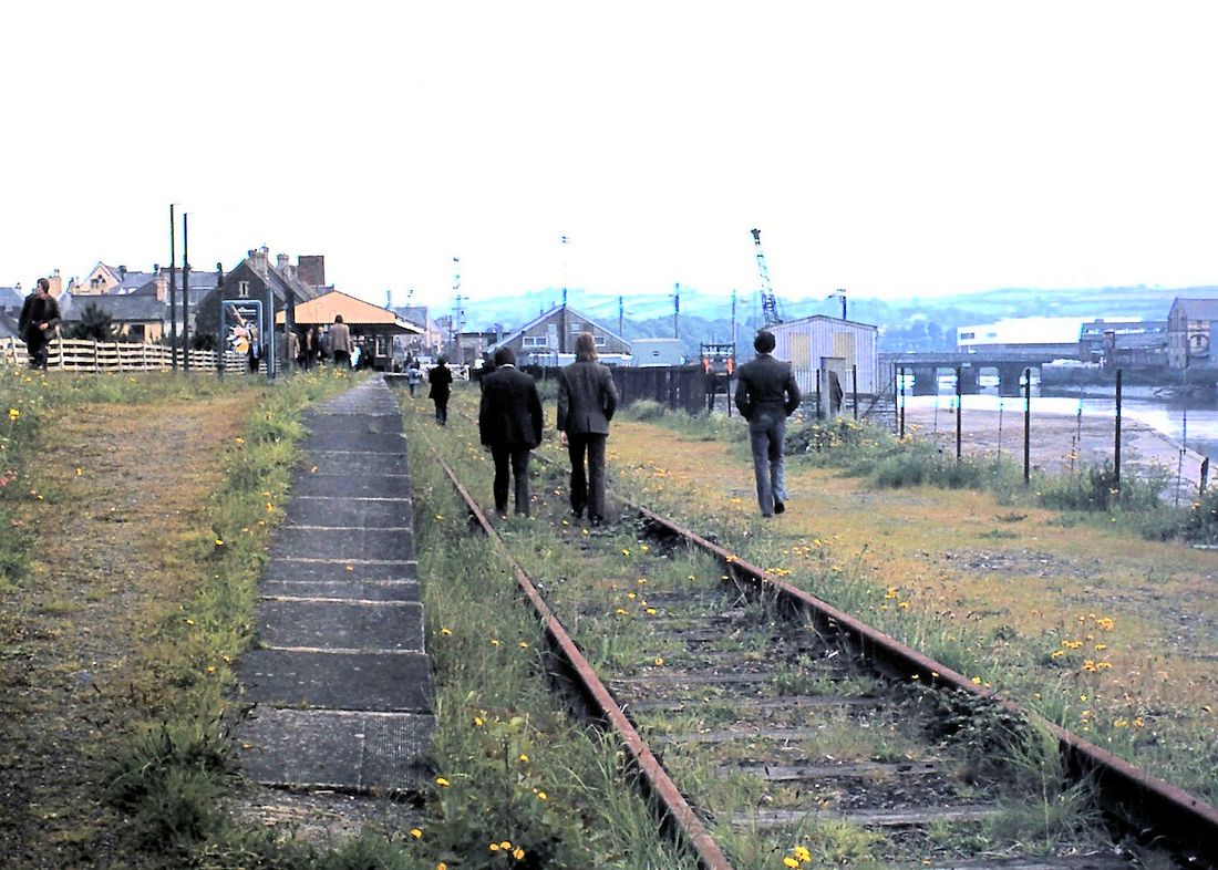
Barnstaple Town Railway Station
Barnstaple Town, the first station on the line from Barnstaple Junction to Ilfracombe, was the interchange point with the narrow-gauge Lynton & Barnstaple Railway. This had closed in September 1935 which explains the lack of trackwork on the left-hand side of the platform. However, on the far side there is still a single track as the line to Ilfracombe didn't close until October 1970. Copyright Martin Tester.
Level Crossing on Pilton Causeway, Barnstaple
31 years after the closure of the Lynton & Barnstaple Rly these level crossing gates with their ornate cast iron gate post caps still indicate the route it took through Barnstaple, and across the A39. The gaps in the masonry walls on either side of the gate posts mark the positions of the 2 flights of steps of a footbridge that allowed impatient pedestrians to cross the railway when the gates were closed to road traffic. I'm looking towards Barnstaple Town station. Immediately behind me & on my right the line passes the railway's Pilton Workshops. At some time in the future the re-invigorated L&BR will reach Barnstaple again but at the time of the photograph that would have seemed an outlandish idea! However, it will never reach this far into town & motorists on the A39 will not be delayed - there has just been too much redevelopment & road change on the site of the track bed to make that possible. Copyright Martin Tester.
Bridge over the River Yeo at Raleigh Weir, Barnstaple. Copyright Martin Tester.
The iron girders of the bridge were no doubt soon removed after the railway closed in September 1935. This was Bridge 8 in the Railway's bridge list. To the immediate right is Rayleigh Weir which marks the highest tidal point on the river. Copyright Martin Tester.
Many thanks indeed Martin for these incredible pictures and detailed text.
Progress report on the Lynton and Barnstaple Railway
21st June 2023
Martin Tester
21st June 2023
Martin Tester
Good evening Keith,
I thought I'd submit some preservation-era L&B photos for a change.
Unfortunately following the recent expiry of the planning permission to extend through the National Park to Blackmoor Gate there has been a lot of negative comment complaining of lack of progress, much of course driven by hindsight. Disappointing as this setback is, not all is doom & gloom; members of the Trust have made some remarkable progress over the last few years as I hope this selection of photos shows.
Some progress I think! Mind you, I'm biased. One of the few advantages of living in East Anglia, some 250 miles away from Woody Bay, is that I'm only 65 miles away from the carriage workshop near Colchester. I'm off there tomorrow!
Best wishes
Martin
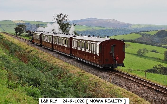
Seen here climbing the last hundred yards or so of the gradient into Woody Bay station is a typical L&BR train of the early preservation years from 2004 until 2013. Ex-industrial loco 'Sid' is hauling 3 coaches which originally had been built for use at Thorpe Park Theme Park in Surrey. By 2013 two of the railway's original coaches of 1898 had been rebuilt & were in use, & the Thorpe Park coaches disposed of. 'Sid' left the railway at the end of the 2013 season & is now in Sweden.
Photo: L&B-2019-train-01.jpg Copyright Martin Tester.
Old & new coaches at Woody Bay, (11th May 2013)
On the right are the coaches, originally built in 1984 for the Thorpe Park Theme Park in Surrey, that had been used for the passenger service since the re-opening in 2004. Their days at Woody Bay are numbered. On the left behind 'Lyd' are the 2 newly rebuilt original L&BR coaches that had been delivered in April. A 3rd coach will join them in September & the Thorpe Park coaches will be redundant. They were sold to Statfold Barn Railway, near Tamworth in Staffordshire.
Photo: L&B-2019-train-02.jpg. Copyright Martin Tester.
The train is headed by newly-built replica locomotives 2-4-2T Baldwin 'Lyn' & 2-6-2T Manning Wardle 'Lyd', the latter visiting from the Ffestiniog Railway for the 2019 Autumn Gala.Photo: L&B-2013-old&new-coaches.jpg Copyright Martin Tester.

Approaching Woody Bay Station 2019 (28th September)
2-year old replica Baldwin loco 'Lyn' returns to Woody Bay on the first day of the 2019 Autumn Gala. This is the first occasion since 1935 that a 5 carriage train has been run on the railway. The 2nd coach in the train (No. 5, a 6 compartment Composite) has just been delivered from the carriage rebuilding workshop near Colchester operated by the Trust's East Anglian Support Team. As ever the 'twin peaks' of Holdstone Down and Trentishoe Down dominate the skyline. Copyright Martin Tester.
Many thanks indeed Martin for your detailed report.
Morwellham Mine Tramway
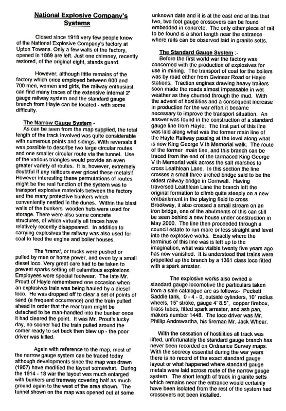
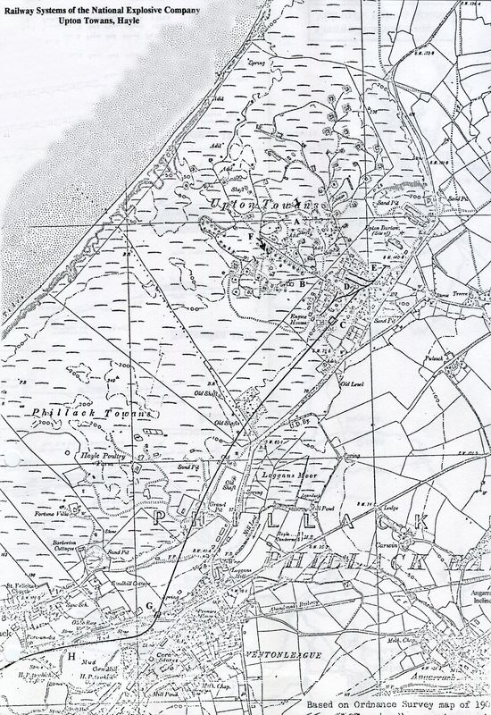
National Explosives Works at Upton Towans - its narrow gauge lines and the connecting standard gauge line from Hayle.
For masses more information and pictures see an extensive article written by Andrew Westcott. This is highly recommended - click here http://www.qsl.net/2e0waw/upton_towans.htm
From an itinerary prepared for a Cornwall Railway Society outing visiting the Helston branch and the Upton Towans Explosive works. Copyright Keith Jenkin.
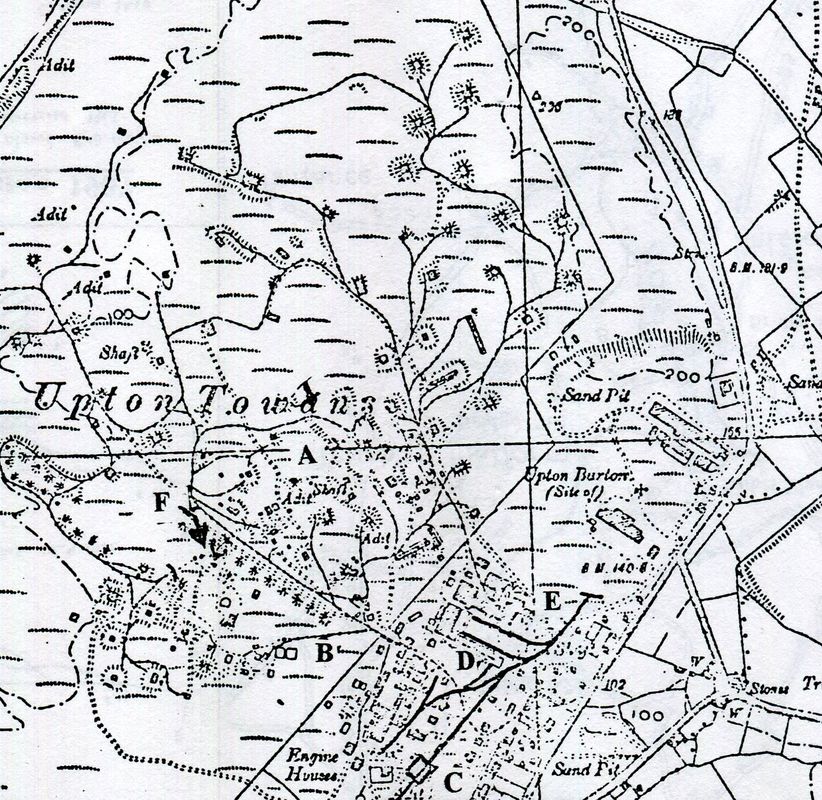
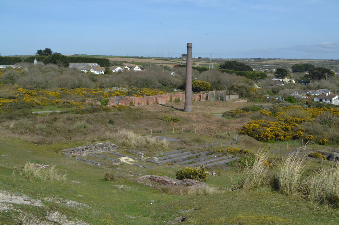
The map shows the very extensive narrow gauge system and the terminus of the connecting standard gauge branch from Hayle.
With reference to the map the additional letters which have been added refer to locations of various points of interest. These are as follows :- (A) Nitro-glycerine plant supply incline number 1. (B) Nitro-glycerine plant supply incline number 2. (C) Loading shed. (D) Nitrate of soda store (E) Gun Cotton Dries (F) Tunnel
The above map is from the 25" to the mile OS map and is reproduced with the permission of the National Library of Scotland.
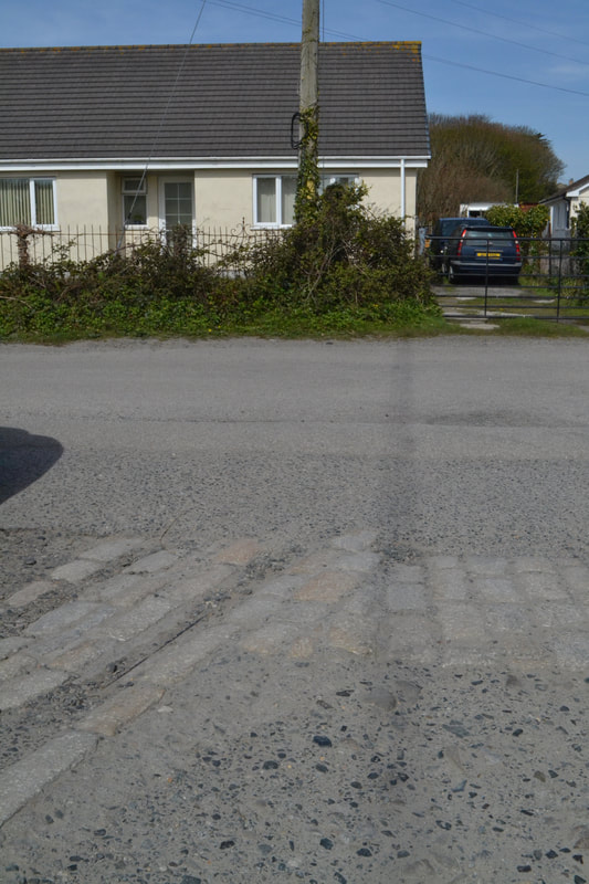
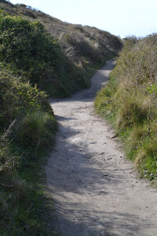
Wandering up a lane off the main road one comes to several bungalows which have been built over the southern side of the works. In amongst the cobbles lie traces of the narrow gauge railway. Copyright Roger Winnen. 11th April 2017.
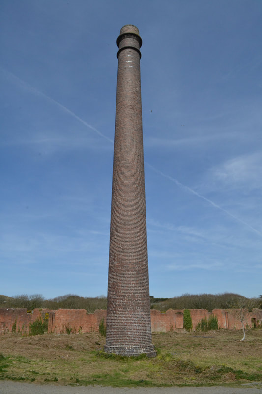
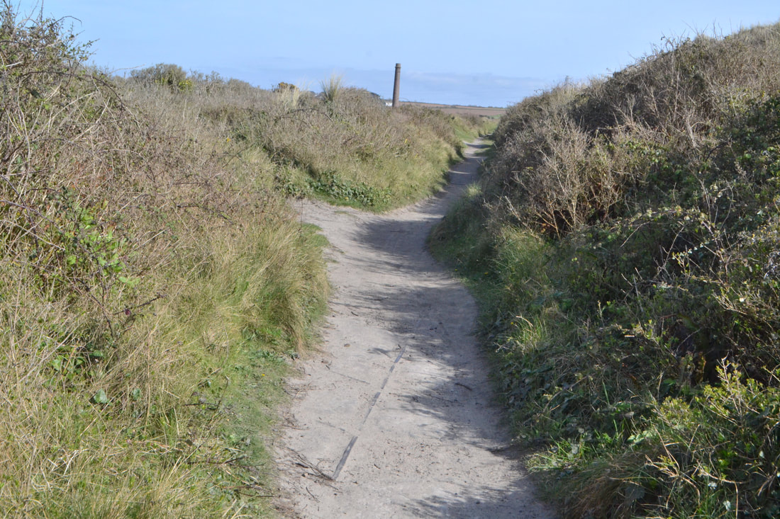
The works area in the back ground is dominated by this very grand chimney. 11th April 2017 Copyright Roger Winnen
Now moving further north away from the chimney further evidence of the existence of industrial buildings is found. 11th April 2017 Copyright Roger Winnen
Now moving further north along the course of the narrow gauge line we find the only other trace of the actual railway. Here, set in concrete, lies a crossover. This is adjacent to what may have been a tunnel, now a cutting leading to another section of the course of the railway. This location is marked (F) on the map. 11th April 2017. Copyright Roger Winnen.
Turning about and viewing the same cross over looking north one gets this view. KJ can vouch for it being a complete crossover having once dug it out and photographed it before carefully replacing the turf. The deep cutting, and maybe at one time, a tunnel lay off to the left in this view. 11th April 2017 Copyright Roger Winnen.
Although no other pieces of track are known other than than those mentioned above, the very extensive system can be easily followed with the aid of a map. It is recommended that the explorer takes a copy of the map along. In view of the very high risk of explosions trucks carrying explosives were carefully man or woman propelled along the tracks. You will notice that many of the off shoots (sidings), go into burrows within the dunes. These were 'blast walls' which surrounded concrete storage huts once located within the burrow. The majority of the 'explosives' area was securely fenced off until perhaps forty years ago. Once the fences were down it is thought that the huts began to be used for camping and 'other uses' and were destroyed to prevent other illegal activities.
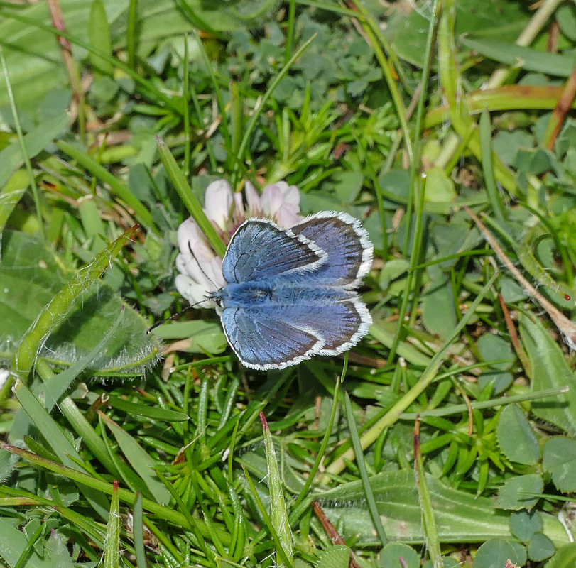
If your interests extend beyond standard and narrow gauge railways here is a Silver-studded Blue seen here in the Spring of 2017 at the National Explosives Works at Upton Towans. Copyright Brian Pibworth. There is also a variety of rare plants and even a mining tram emerging from the cliff face if you know where to look!
The standard gauge connection to the National Explosive Works at Upton Towans Hayle
In summary then:
Explosives works opened 1888 and developed its own n/g rail system. During WW1 great expansion takes place. GWR (under government control in wartime) built a new branch line to connect explosive works with Hayle wharves, the new line occupying
1. Track bed of former Hayle Railway (1837-1852) along north side of Copperhouse creek.
2. New formation from Loggan's Mill to Upton Towans (the subject of Derek's map).
Line opened 1917.
The product probably left Hayle by sea.
Works closed by 1920. Track remained into 1930s.
Roy Hart Many thanks Roy
A map showing the approximate route of the standard gauge connecting line between the Explosive Works at Upton Towans and the course of the Hayle Railway. The Hayle Railway had remained in situ along what is now King George V walk.as a siding. From the end of this siding it is assumed that an extension
crossed Leathlean Lane and the playing field on a curving embankment raising the branch to a level to cross Brookway and access a bridge at (G) which crosses a stream. The ironwork of this bridge still remains behind modern housing alongside Brookway.
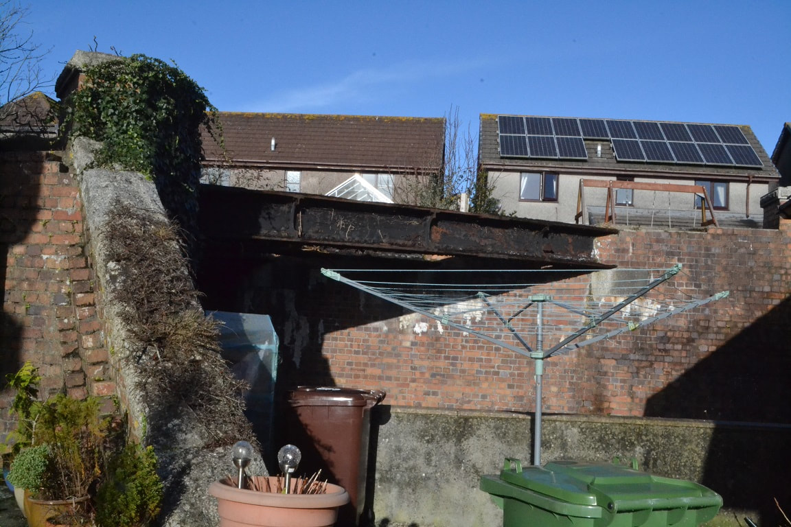
A view of the only remaining relic of the Explosive Works Branch - a bridge crossing a stream. Our sincere thanks to a lady who lives in the adjoining property on Brookway who gave Roger permission to take photographs. 10th January 2018 001 - Copyright Roger Winnen
The bridge crosses a small stream. 10th January 2018. Copyright Roger Winnen
Having crosed the bridge the line continued to climb towards the explosive works. All other traces of this line have disappeared beneath a housing estate, allotments and a holiday park. 10th January 2018 Copyright Roger Winnen
Very close to the National Explosive works this trackway may have been the route to the works from Hayle. 11th April 2017. Copyright Roger Winnen.
At the National Explosive Works no real trace of the standard gauge line remains. This may be the edge of the platform serving the very short lived standard gauge branch from Hayle. 11th April 2017 Copyright Roger Winnen
Locomotives on the branch to the National Explosive Works at Gwithian.
John Gabb - Hayle Heritage Centre. I really appreciate and value your offer to share your photographs, information and knowledge about our local railways with me; I will happily reciprocate. As I mentioned, a colleague, Dave Birch, and I who are both volunteers at the Hayle Heritage Centre are currently tasked to prepare an 'exhibition' covering the railways of Hayle. We hope to cover not only the Hayle Railway (and its successors) as such but also the National Explosives works branch and the wharves branch (as well as the companies/activities it served).
Attached are two photographs which may be of interest. The first comprises the photograph, which we have in the Hayle Heritage Centre, which was probably given by the Peckett company to the National Explosives works when it purchased locomotive no.1448 in 1917. I think it is a stock photograph of the M5 class of locomotive and, therefore, not a photograph of the particular locomotive, no. 1448. The second is a photograph no.1448 in service in 1952 at J. C. Hill & Company in Cwmbran, to whom no. 1448 was sold in 1924. I understand that this locomotive was scrapped in 1966.
My thanks again for your help and I look forward to future contact with you and Roger.
Wishing you well and, particularly, good health during the current Corona virus crisis,
John Gabb 17th March 2020
We would further like to know over what extent of the branch from Hayle Harbour to the Explosive Works did the loco operate - has anybody any knowledge please?
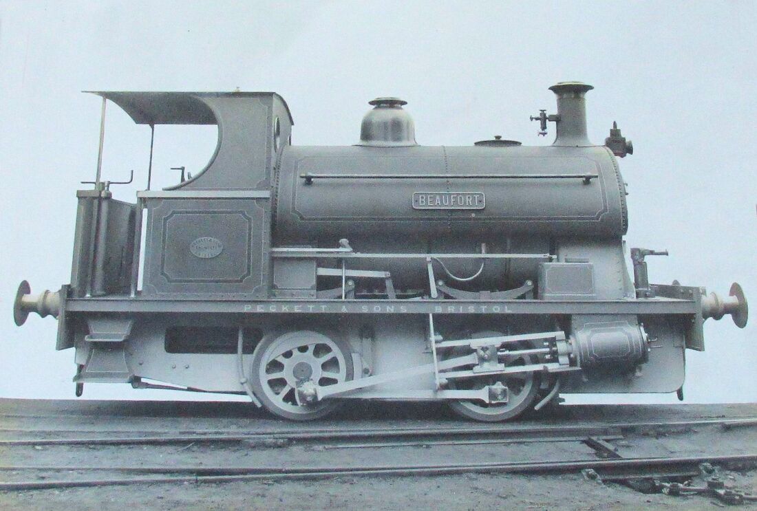
National Explosives works 0-4-0 Peckett locomotive, Type M5, No. 1448. Copyright Hayle Heritage Centre.
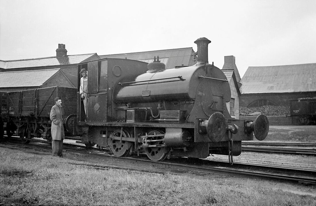
National Explosives works Peckett 1448 at Whitehead, Hill & Co, Cwmbran, on 7 July 1952. Copyright.
Penlee Quarry Tramway
- Newlyn, Penzance
- Newlyn, Penzance
History - courtesy Wikipedia
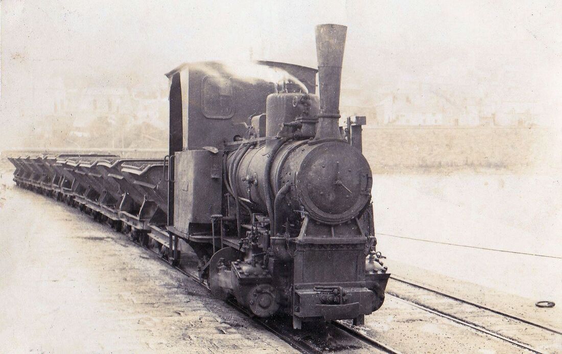
Mineral extraction at Penlee dates back to the early 19th-century when copper, zinc and rare minerals were mined. Stone quarrying was started by James Runnalls of Penzance, at a quarry near the Old Battery in 1879.The operations were transferred to the current site at the turn of the 20th-century, becoming known as Gwavas Quarry. Penlee supplied mainly aggregate (crushed stone) but on occasion also supplied large chunks of stone as rock armour - "armourstone". The full-scale aggregate operations ran throughout most of the century reaching peak output in the 1960s and 1970s.
With production increasing a 2 ft (610 mm) narrow gauge railway was opened around 1900. This connected the quarry with the south pier of Newlyn harbour, approximately ½ mile away to the east. A steam locomotive named Koppel was purchased to work this line. Internal combustion locomotives replaced steam from 1930 onwards. Stone was shipped from Newlyn to destinations around the Bristol Channel and the south coast and in later years to as far afield as Germany.
The railway was more or less straight apart from the curve on to the south pier at Newlyn. It was double track for most of the route although at some point in the past it had been singled, the double track being reinstated as production increased in the later years. In the 1960s when a ship was being loaded, six locomotives were needed for operations, four higher powered ones on the main line and two lower powered ones shunting the empty tipper wagons through the two loading points. The empty trains were reversed back to the loading points from the harbour.
In 1973, the railway ceased operations and was replaced by an electrical conveyor system using the same route. Operations at the quarry then slowed throughout the late 1970s and the 1980s, eventually coming to an end in 1989/90.
Present day An application has been submitted to develop the quarry area with a hotel.
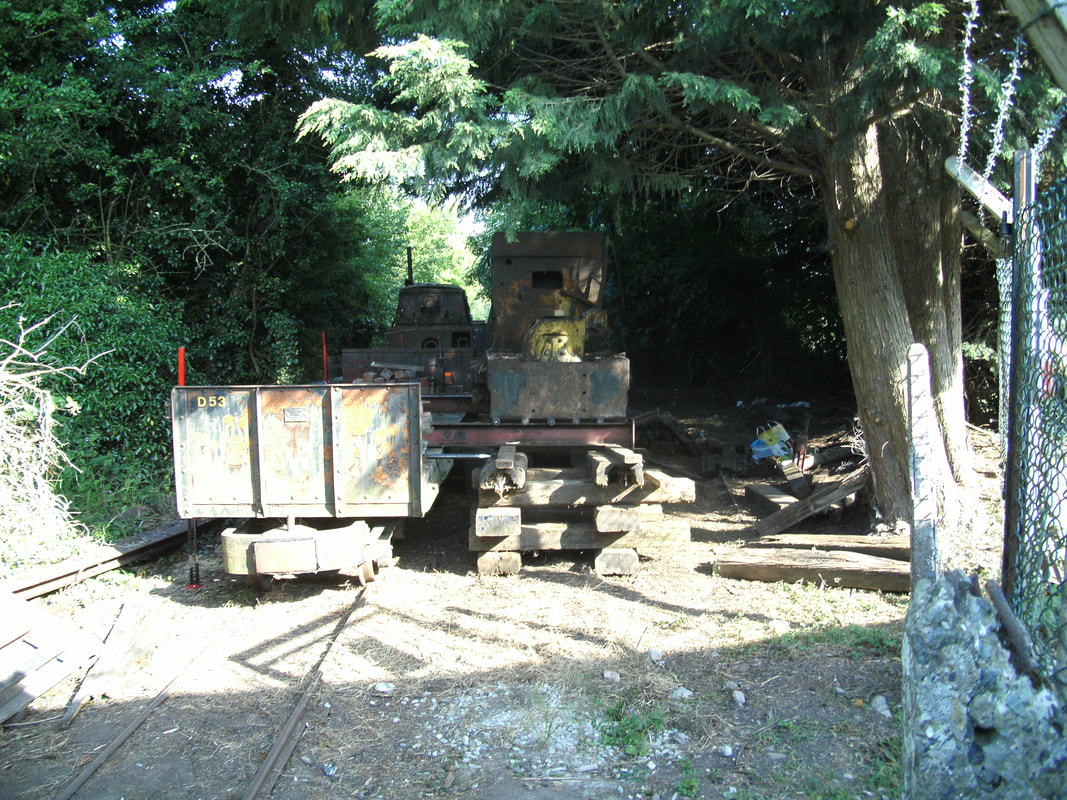
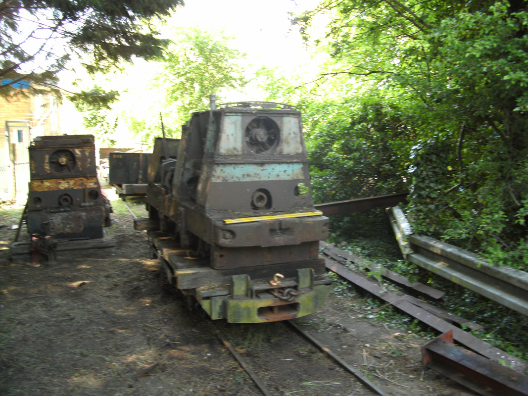
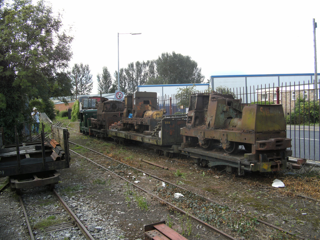
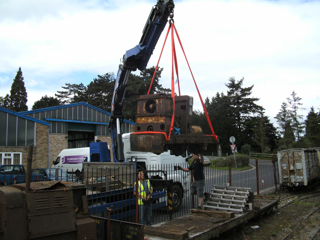
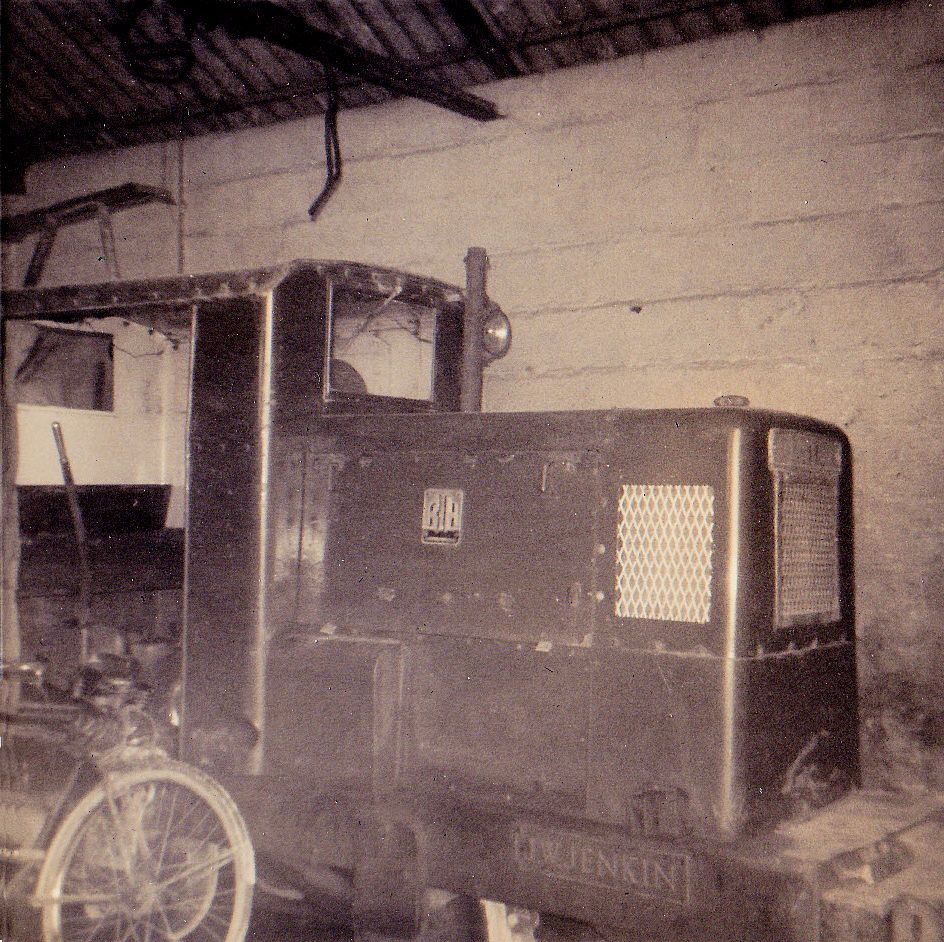
Ex Penlee Quarry Locomotives at Bromyard
Tim Ratcliffe
Tim Ratcliffe
In 1962 Three locomotives were purchased from MacSalvors at Pool Redruth by A.R.C. (South Western) these being Ruston & Hornsby 2' gauge. Numbers LM 30 229656 of 1944 was ex Malvern Works in September 1961 and earlier at St Keverne Quarries. LM 44 (Yard no AD 574) 246793 of 1947 & LM 45 (Yard no AD 573) 213848 of 1942 The later two being purchased from the Admiralty.
On the closure of the rail system at Penlee Quarry on 31st July 1972 these engines were sold to W Morris, Bromyard & Linton Light Railway, Herefordshire in June 1975.
Below are photographs taken of the removal of these engines, 229656 being purchased by Tim Ratcliffe for preservation at the Leighton Buzzard Narrow Gauge Light Railway of which we are extremely grateful for these photographs.
Dear Sirs,
My enquiry relates to the history of this particular locomotive, and as there is a picture of it in Maurice Dart's book Images of Industrial and Narrow Gauge Railways - Cornwall, I wondered if this message could be forwarded to him if no one in the society already knows the answer. I see that Mr Dart's address is displayed on one of your previous web pages, however I feel it more appropriate to contact him through yourselves.
When I purchased this locomotive in 2012 and moved it to the Leighton Buzzard Narrow Gauge Railway in Bedfordshire, I was told by the previous owner that this loco was the one that had been washed into the sea during the great 'Ash Wednesday' storm of March 1962. I wondered if there was any way of confirming this please? I know that another Ruston loco fell off the end of the pier and into the sea, but this was one of the larger Rustons - 200748, and much later on.
The locomotive has now been dismantled, and the chassis has been sent away to be shot blasted this very week, Although progress is being made, it is likely that restoration will still take a very long time. The photo shows the chassis at the time it was dismantled - now some 5 years ago. Note the Fruedenstein is visible in the background!
Thank you in advance for any assistance in this.
Regards - Tim Ratcliffe - Society Officer - Museum Fleet I/C Locomotives, LBNGR
Restoration work on the Ruston & Hornsby 2299656 taking place at Leighton Buzzard, in the background is the 0-4-0- Well tank 'Penlee' which stood on a plinthat the Penlee Quarry for many years Copyright Tim Ratcliffe
Hello Tim
I have just spoken to Maurice Dart who has confirmed that this engine was one of those effected by thr Ash Wednesday Storm at Newlyn in March 1962 of which I can remember to this day whilst working at the Dry Dock in Penzance Maurice tells me that he paid a visit to W Morris, Bromyard & Linton Light Railway some years ago and photographed the engines.
Roger Winnen
All Photographs are the Copyright of Tim Ratcliff
Photograph Copyright Tim Ratcliffe
Photograph Copyright Tim Ratcliff
Photograph Copyright Tim Ratcliffe
Photograph Copyright Tim Ratcliff
Photograph Copyright Tim Ratcliffe
Photograph Copyright Tim Ratcliffe
All of the locos were parked on a short section of unconnected track next to the running line for many years, with no access for lifting equipment. Various pictures taken over the years show the trees and bushes gradually getting higher and higher. The solution devised was to jack one up sufficiently to allow two substantial beams to be placed under each end with rollers to traverse the loco across to a position above the running line. After this the loco was raised up on a cradle of sleepers either side of the track so that a flat wagon could be pushed underneath. The loco was then jacked down until it was securely in place on the wagon. An alternative method evolved to first jack the loco up to the required height and then roll it across onto the wagon - it was much the same. I remember several very hot and sweaty Sundays in June and July recovering each of the three locos on a different day. RH229656 was moved down the line on it's wagon on the 7th July - the same day as Andy Murray was winning the Men's Singles at Wimbledon.
The last part of the exercise did require a crane as the locos had to be flown over a fence and onto the waiting transport - this was on the 12th August.
Regards - Tim
The last part of the exercise did require a crane as the locos had to be flown over a fence and onto the waiting transport - this was on the 12th August.
Regards - Tim
Many Thanks Tim for your Information & Photographs of the
ex Penlee Quarry Engines
ex Penlee Quarry Engines
Pictures from the Peter Dale Collection -
Many thanks Peter.
Penlee 01- From Papa Dale's postcard collection 1930s
Penlee 02- Beyond loading tunnels 20 April 1966 Peter Dale Collection
Penlee 03- J W Jenkin 20 April 1966. Peter Dale Collection.
Penlee 04- Penlee in loading tunnels 20 April 1966. Peter Dale Collection.
Penlee 05- Loading quay 20 April 1966. Peter Dale Collection.
Penlee 06- Beyond loading tunnels 20 April 1966. Peter Dale Collection.
Penlee 07 - Beyond loading tunnels 20 April 1966. Peter Dale Collection.
Thanks to Peter Dale for the above memories.
A delightful shot of a train of empties returning to the quarry from the pier at Newlyn (Seen in the background) Published with permission - from the Alan Harris Collection. A classic picture.
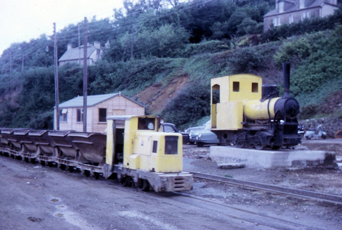
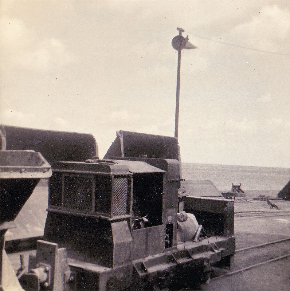
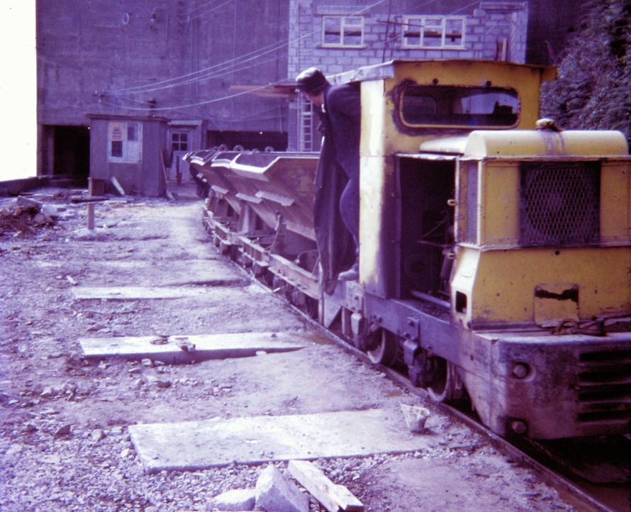
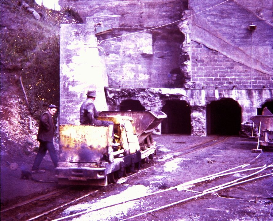
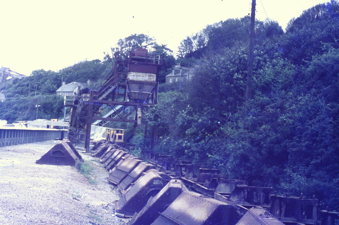
Penlee Quarry tramway A diesel locomotive, its nameplate unreadable, stands with a rake of empty wagons, probably about to propel them back towards the crushers, It is June 1972, about a month before the closure of the system. The redundant steam loco stands witness to the final trains. Copyright Mike Roach
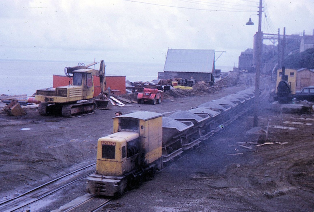
A heavy rake of loaded wagons is drawn away from the crushing plant and begins its three quarter mile journey towards the quay at Newlyn. June 1972. Copyright Mike Roach
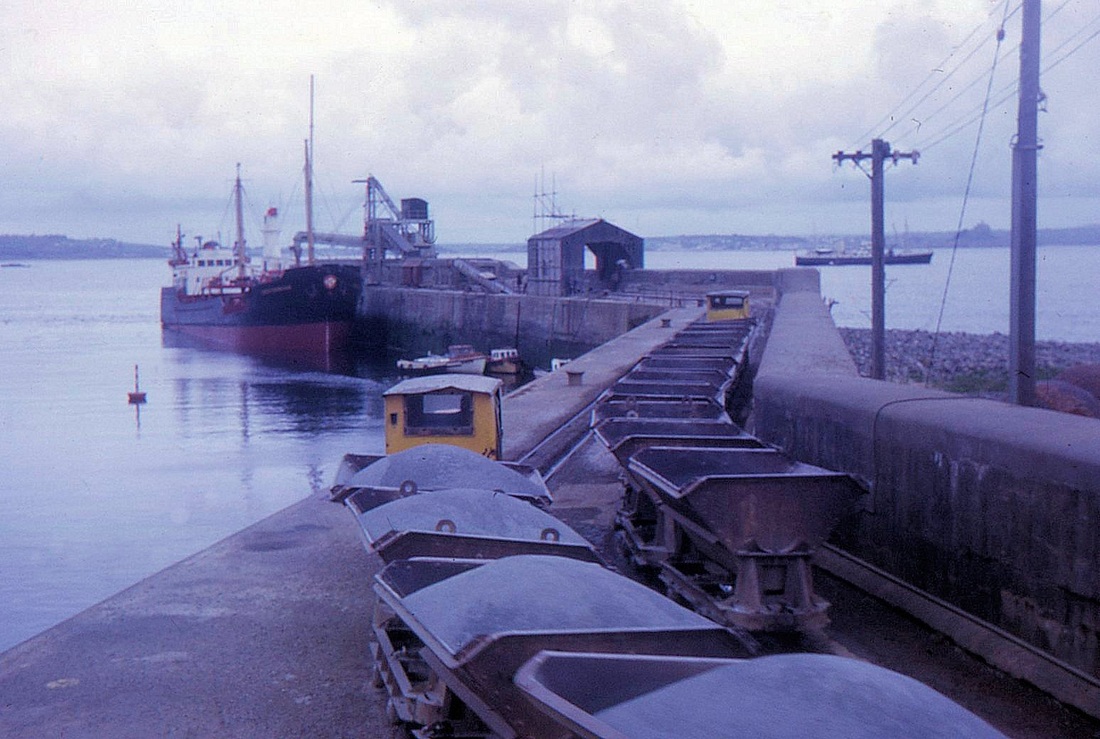
A loaded rake of wagons approaches the quay at Newlyn whilst a sister locomotive waits to propel its now empty rake off the long loop on the quayside and back towards the crusher. There were four places on the line where the locomotives could run round their wagons, the one on the quay was, however, the longest. June 1972 Copyright Mike Roach
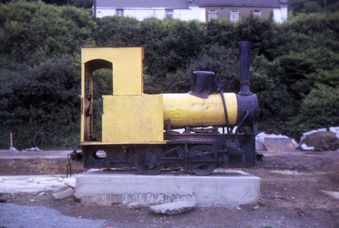
Looking questionably smart in its bright yellow paint the redundant steam loco stands awaiting a new home. June 1972. Copyright Mike Roach
The pier is visited in December of 2013 - surprising what is left.
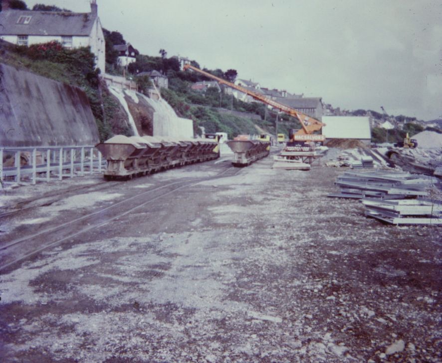
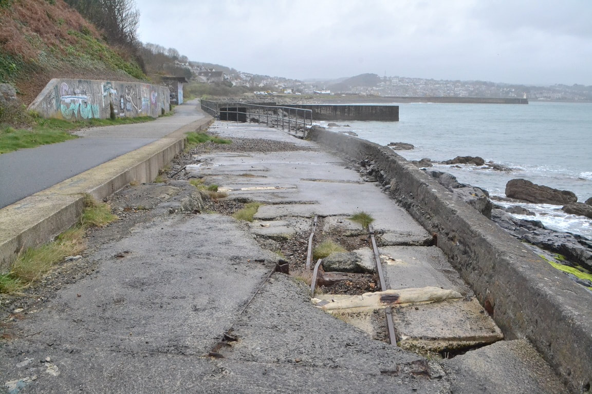
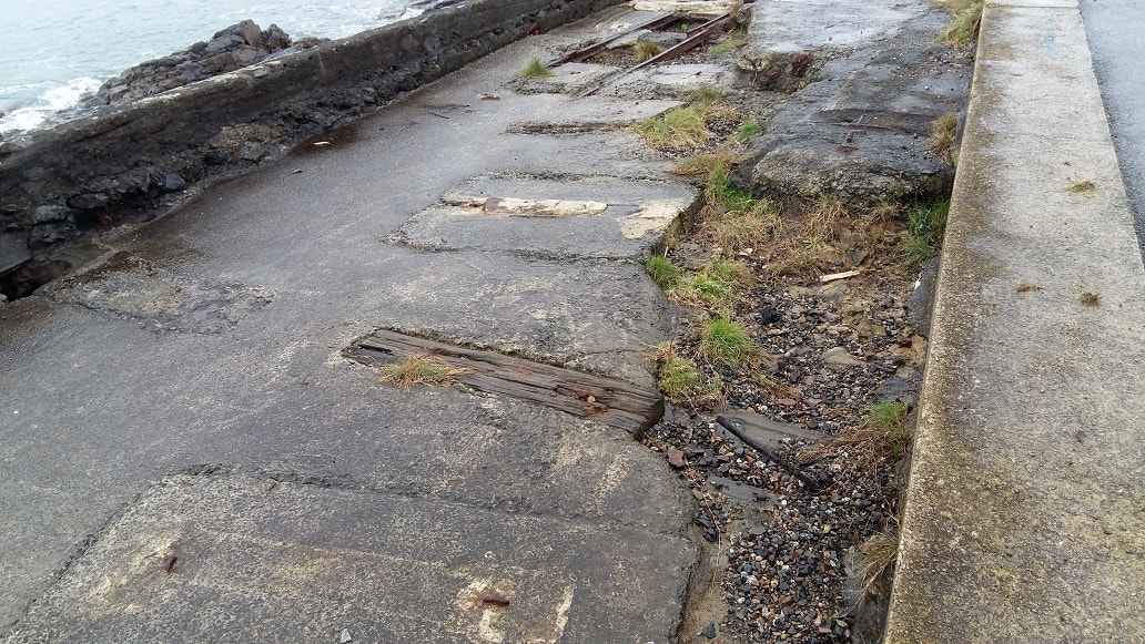
Rails of the former Penlee Quarry Line on Newlyn South Pier 41 yrs after closure. Copyright Roger Winnen 29th December 2013
Notice the miniature turntable on the pier. Copyright Roger Winnen 29th December 2013
Looking back along the quay with a W Stevenson Trawler on the slip. Copyright Roger Winnen 29th December 2013
One piece of rail survives of the line curving around to access the pier. Copyright Roger Winnen 29th December 2013
The Penlee Quarry Railway 16th July 1972
Two weeks prior to closure
Roger Winnen
Two weeks prior to closure
Roger Winnen
720716b-Shunting-by-the-Penlee-Quarry-hoppers-Copyright-
Roger-Winnen
720716b-Shunting-by-the-Penlee-Quarry-hoppers-Copyright-Roger Winnen
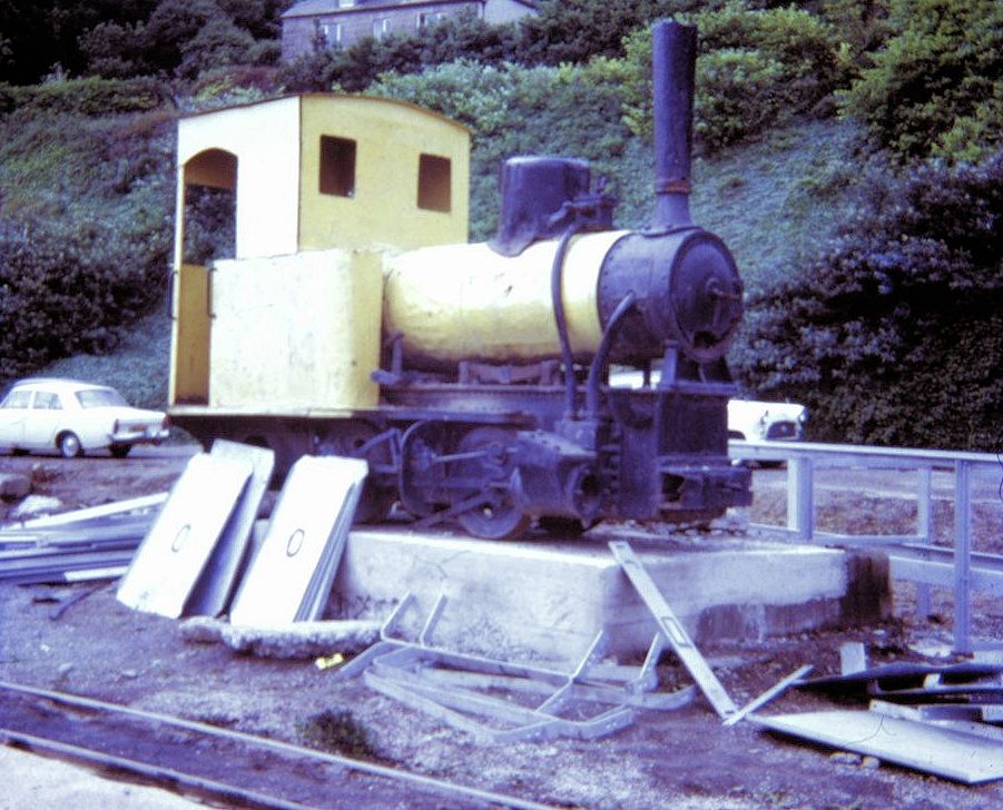
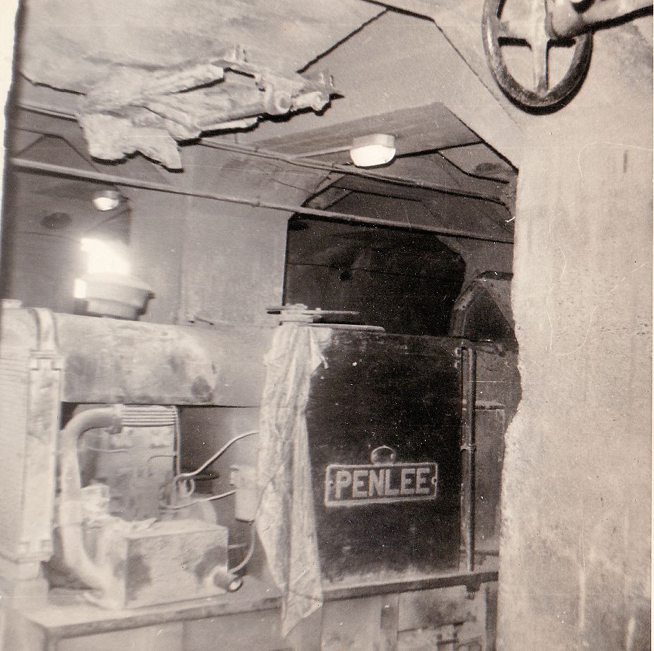
720716c-This-was-the-Freudenstein-on-a-plinth-at-the-quarry-in-later-years-it-carried-the-nameplate-Penlee-Copyright-Roger Winnen
720716e-Here-we-see-two-trains-passing-one-going-to-Newlyn-pier-and-the-other-with-empty-wagons-returning-from-the-pier-Copyright Roger Winnen
720716d-A-train-for-Newlyn-pier-rounds-the-sharp-bend-which-lead-onto-the-pier-Copyright_Roger Winnen
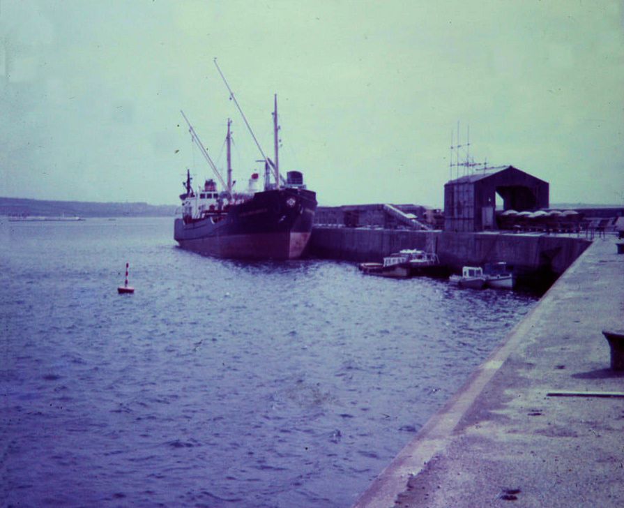
720716f -Loading-at-Newlyn-Pier-onto-a-Comben-Longstaff-motor-vessel whose names ended in brook.. These vessels ran regularly into Penzance with coal for J.H.Bennetts then going across the bay to load stone at Newlyn. Copyright Roger Winnen
The Penlee Quarry Railway after closure
Photographs by Roger Winnen
Photographs by Roger Winnen
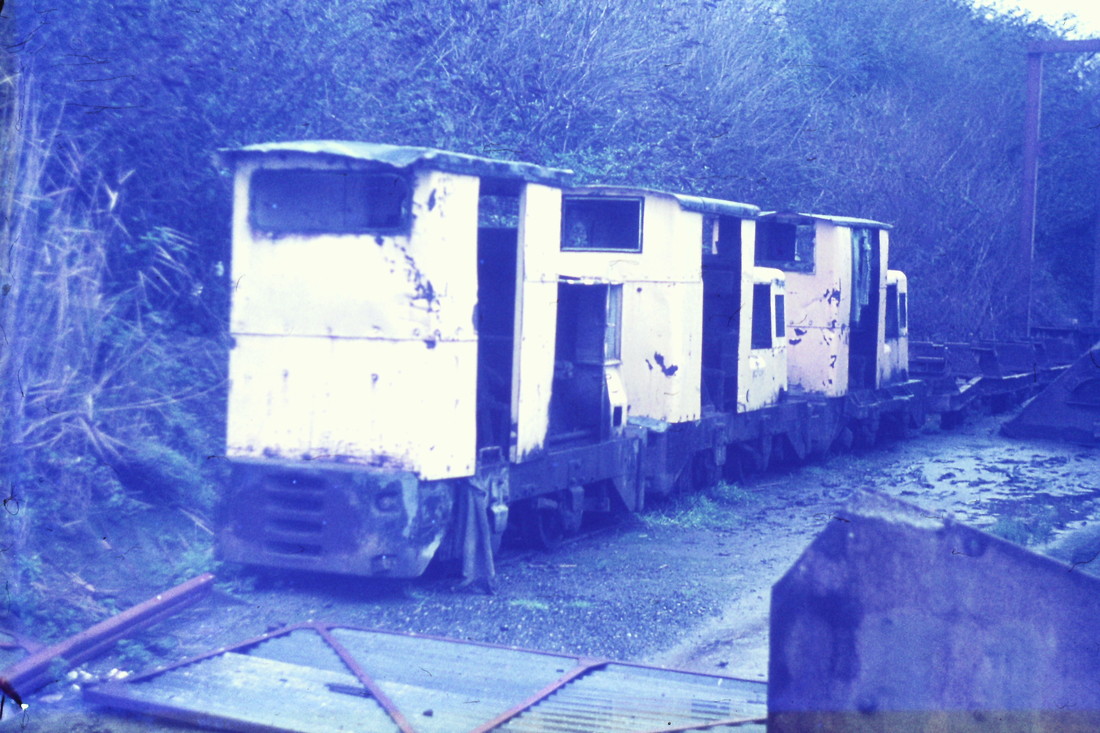
730507a Redundant Diesel Locomotives awaiting their fate at Newlyn. 7th May 1973 Copyright Roger Winnen

730507b Penlee Quarry Locomotives await their fate. Copyright Roger Winnen
730616a Redundant wagons and locomotives abandoned. 16th June 1973 Copyright Roger Winnen
731226a Rails leading onto Newlyn Pier taken after closure. 26th December 1973 Copyright Roger Winnen
Remains of the Railway photographed on 28th March 2017
170328ee A visit to the site a couple of days revealed this section of rail still in situ. Copyright Roger Winnen
170328f Could this be the same location as the first photograph taken some 45 years later. Roger Winnen Collection
The Penlee Quarry Railway remains taken on 25th September 2017
Peter Murnaghan
Peter Murnaghan

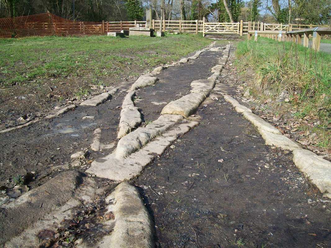
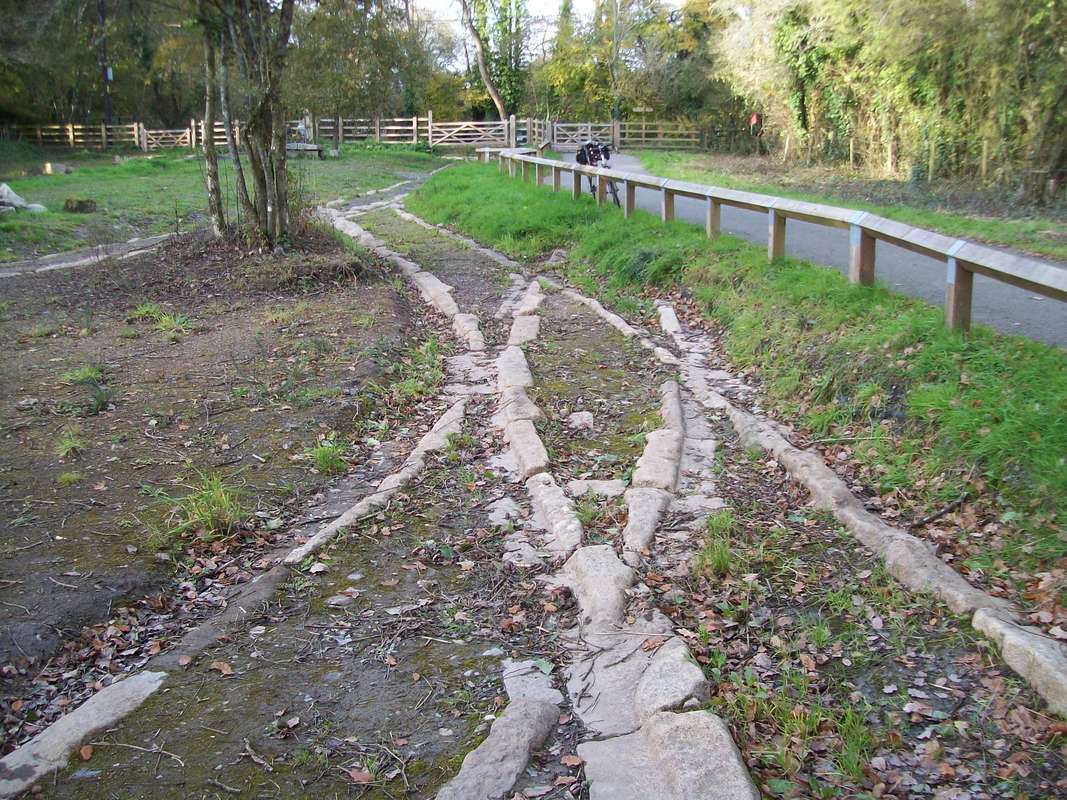
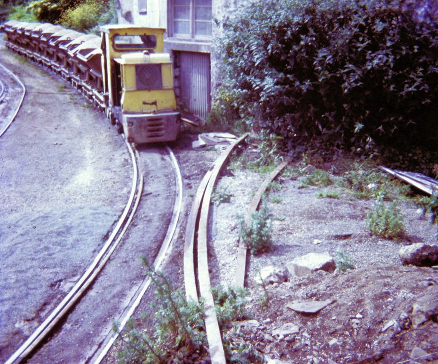
170925 Penlee Quarry Tramway. Remains of track on the southern run round loop, with check rail revealed, set in. Copyright Peter Murnaghan
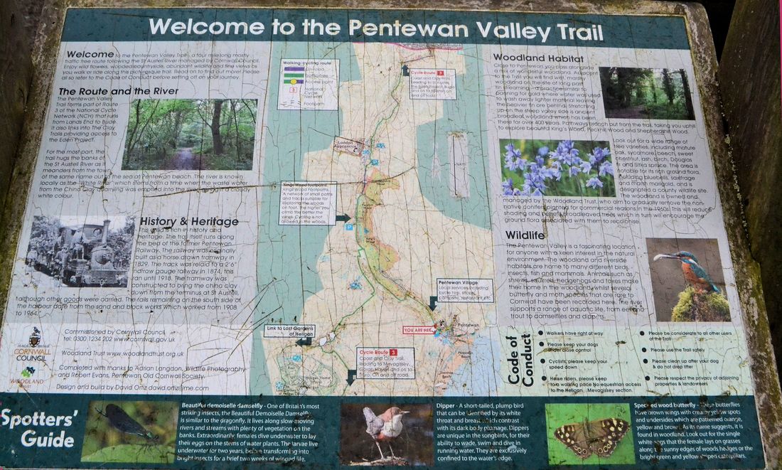
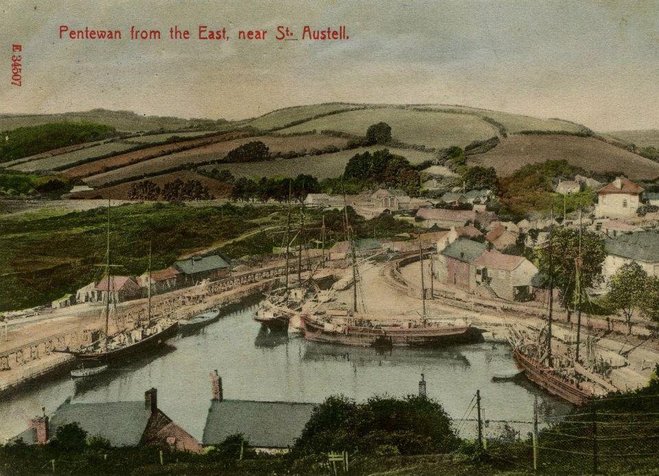
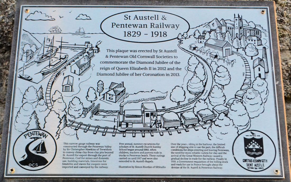
Pentewan Railway
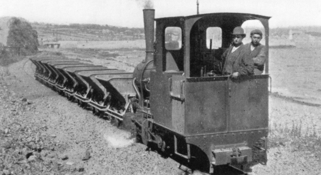
The Pentewan Railway was a 2' 6" railway in Cornwall, England. It was built as a horse-drawn tramway carrying china clay from St Austell to a new harbour at Pentewan, and was opened in 1829. In 1874 the line was strengthened for locomotive working. It finally succumbed to more efficient operation at other ports and closed in 1918.
In 1829, Sir Christopher Hawkins made further improvements by linking the harbour to St Austell by means of a horse-drawn tramway that hauled china clay from the quarries on St Austell moor and tin from the Polgooth mines for shipment from Pentewan. Coal was shipped in and transported to the mines and (later) to the St Austell gas works . In 1874, the engineer John Barraclough Fell replaced the tramway with a narrow gauge railway. This operated till 1918, when the rails and locomotives were requisitioned by the War Office. The Pentewan Railway was almost entirely a mineral line, but did occasionally transport passengers on special excursions. A Sunday school outing was described by A.L. Rowse in his memories of a Cornish childhood. Part of the old railway line, from the village of London Apprentice to Pentewan, is now a footpath and cyclepath.
The last trading ship left in 1940. After that, the harbour entrance gradually silted up, though it was still possible for small boats to enter the harbour in the 1960s. Now, although the water-filled basin remains, Pentewan harbour is entirely cut off from the sea.
For more details and pictures of the line in operation click here https://en.wikipedia.org/wiki/Pentewan_Railway
The above courtesy Wilkipedia.
N.B. Please scroll to the end of this section for the most recent addition - that by Michael Bussell
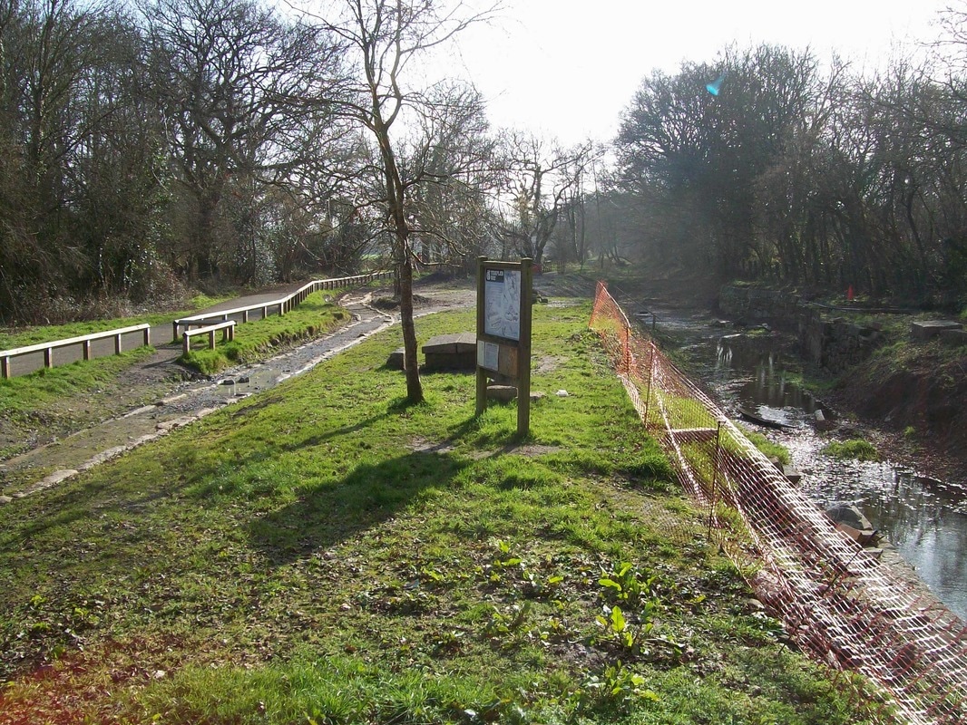
The information board at Pentewan sadly vandalised by those with little better to do - what a shame. Some of the scratches have been removed by editing. Photographed by Roger Winnen on the 28th March 2016
From the Alan Harris Collection
28th March 2016. Believed to be a pictures of a rare passenger train - a Sunday School tea treat. Photographed by Roger Winnen.
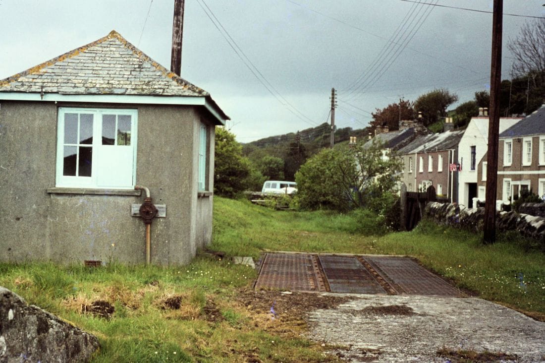
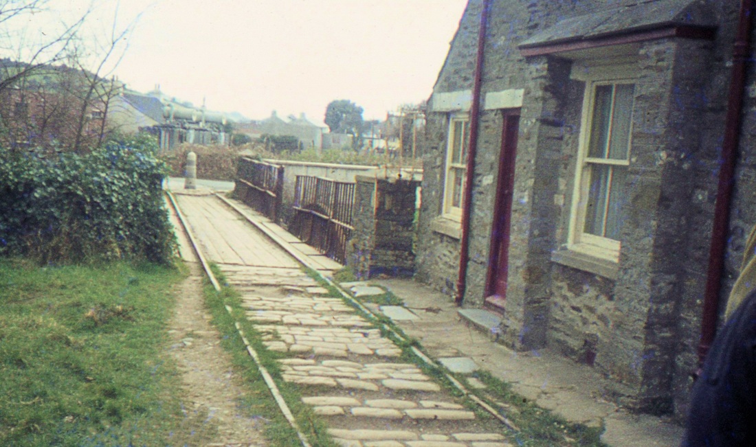
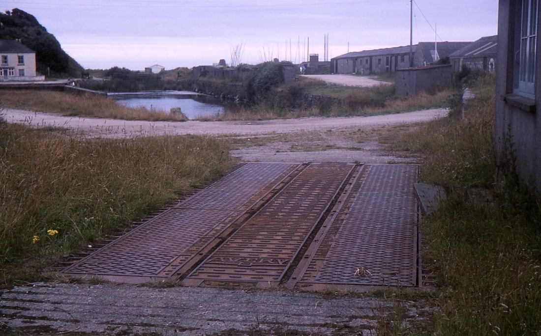
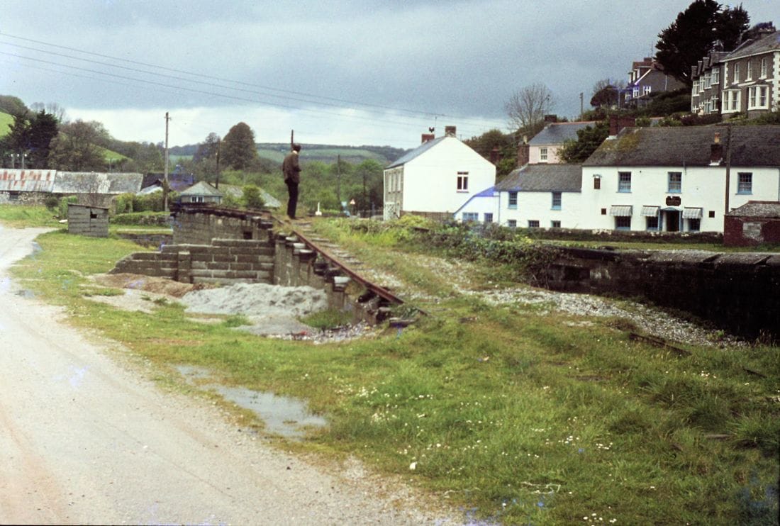
The Weighbridge at Pentewan. 11th May 1974 Copyright Roger Winnen N.B. The railway arriving from the St Austell direction came for the direction of the white van parked in the distance.
The weighbridge at Pentewan Harbour on the 25th July 1978 Copyright Mike Roach
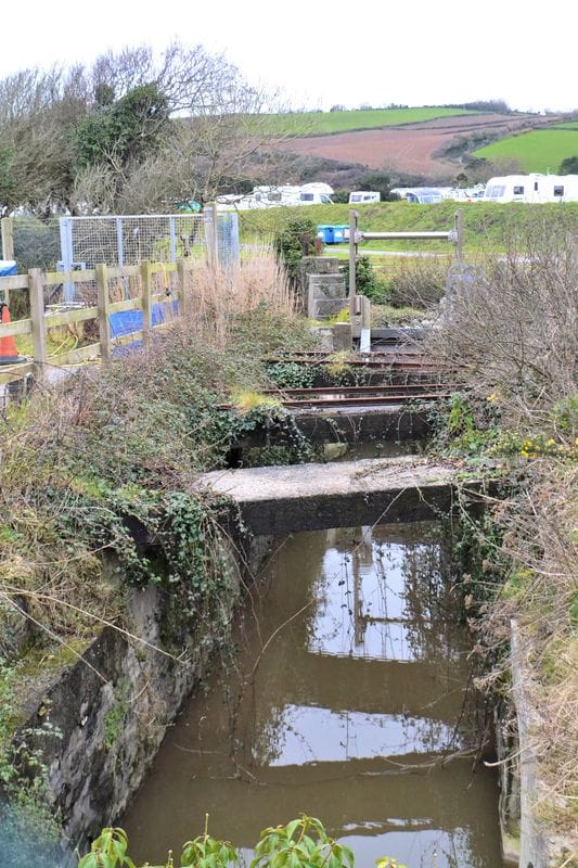
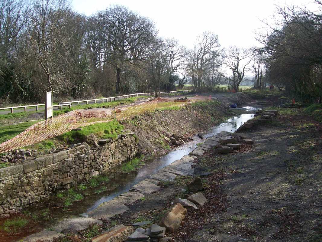
Rails crossing a culvert at Pentewan This picture 28th March 2016 . Copyright Roger Winnen
Rails on the harbour side, a ramp leading to screens for sifting the sand. 11th May 1974 Copyright Roger Winnen
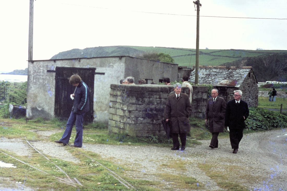
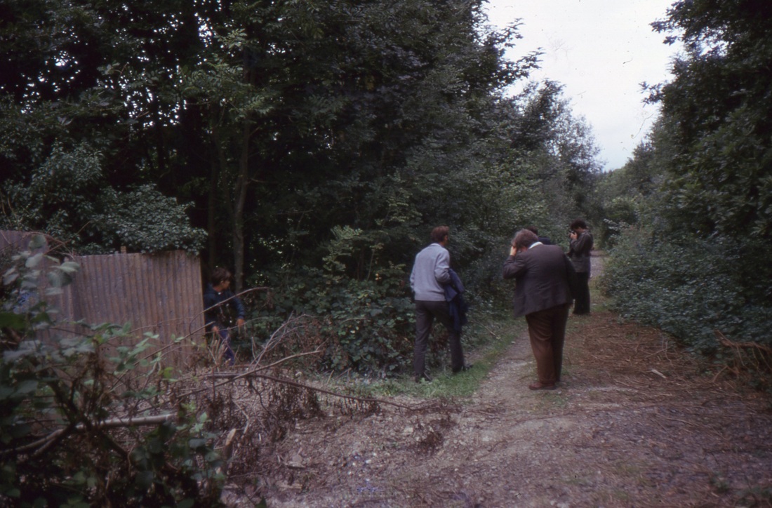
Rails at the harbour, a group inspecting the area. The late Jack Trounson one time president of the Cornwall Railway Society is seen in the centre of this picture. 11th May 1974. Copyright Roger Winnen
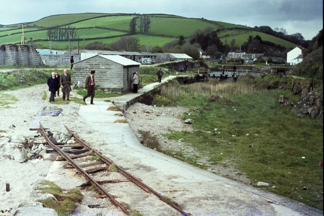
The visiting party move towards the seaward entrance of the harbour passing the loco shed used during the sand removal from the beach period of operations. . The heavy silting up of the harbour is evident in this picture of the 11th May 1974. Copyright Roger Winnen
Pentewan the old loco shed. Nov 15th 2016 Copyright Dave Hibberd
Looking from the old loco shed at Pentewan harbour Nov 15th 2016 - Copyright Dave Hibberd
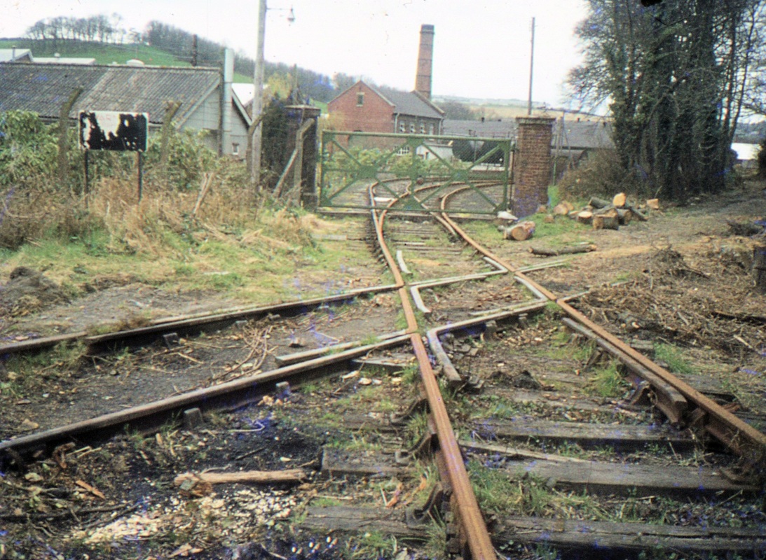
A closer look at the virtually complete pointwork and the entrance to the shed. November 15th 2016 Copyright Dave Hibberd
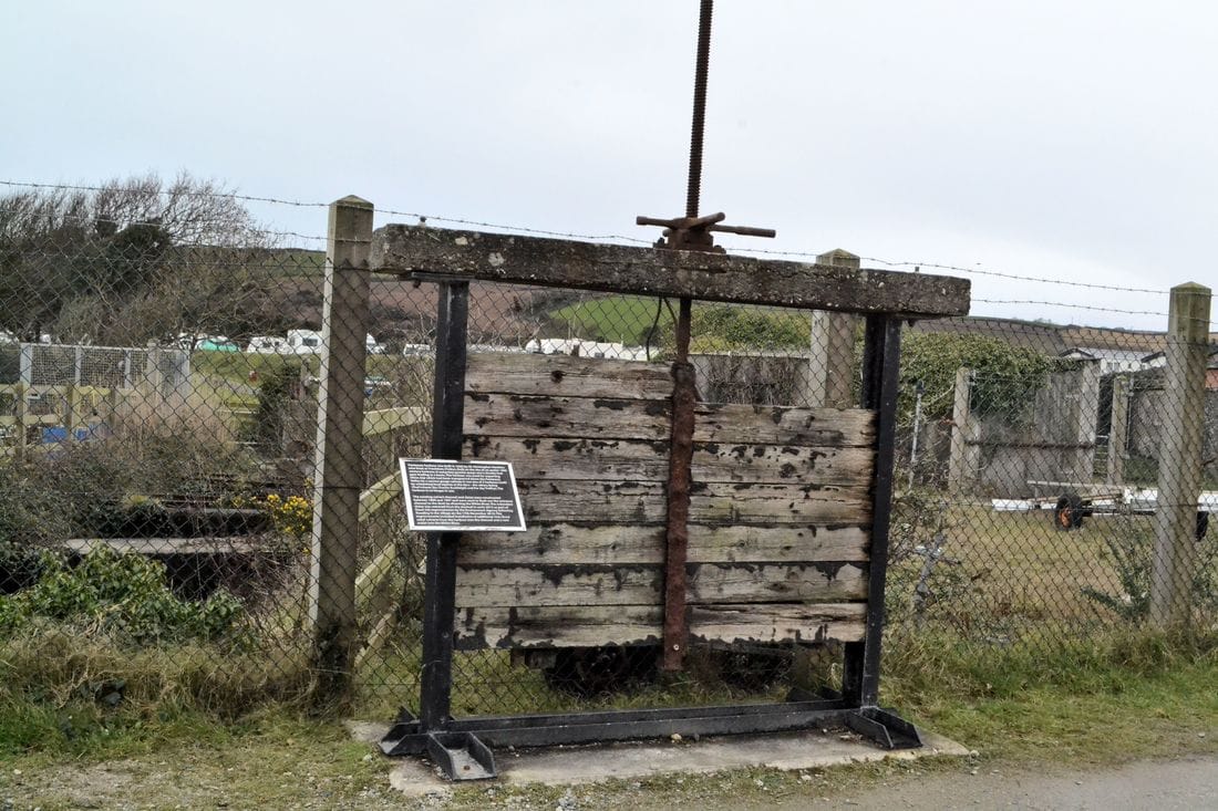
Pentewan Old sluice Gate. 28th March 2016 Copyright Roger Winnen
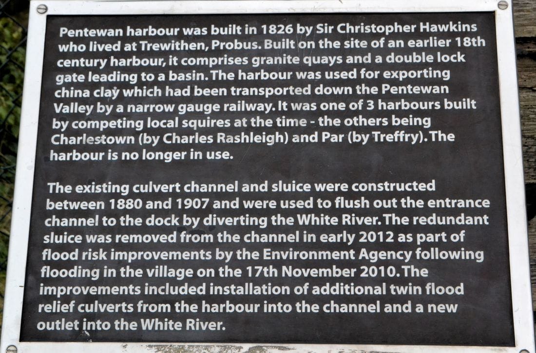
Pentewan Information board by the sluice gate 28th March 2016 Copyright Roger Winnen
En Route - very close to St Austell
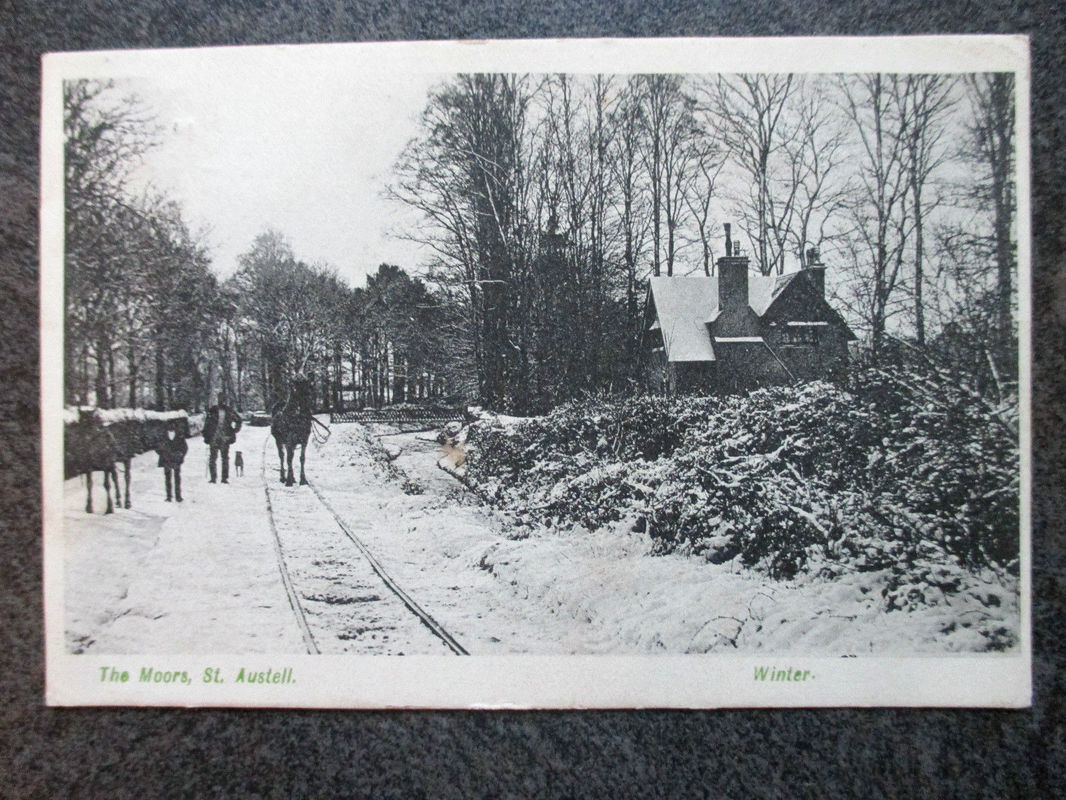
Picture supplied by Alan Harris from his own collection.
We are most grateful to Robert Evans for this detailed reply.
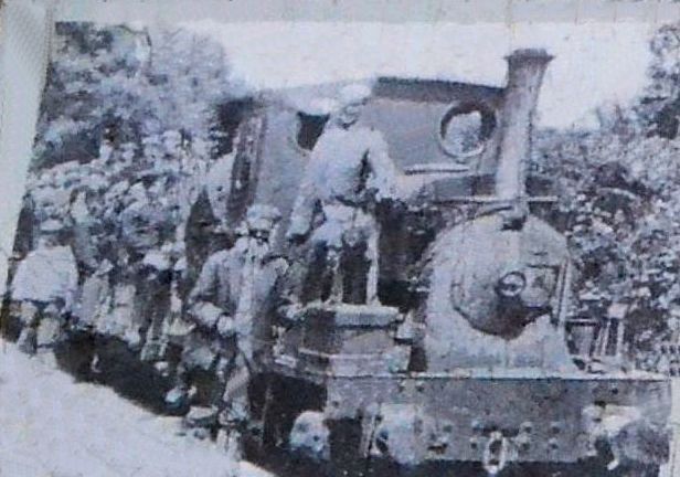
Regarding the postcard on your website with information wanted. The view has been taken on the Mevagissey road just below the double roundabout on the St Austell by pass. This is Pentewan Road running from the roundabout today there is Macdonalds, B and Q etc. and bungalows behind the photographer on the left. As you look at the postcard on the left a little further down is a turning to Tregorrick, and just below that is Trewhiddle where the railway crossed the road but no gated level crossing, and after crossing the road there was the only passing loop on the railway. On the right today is the Cornwall Hotel and grounds. The bridge has been renewed, the house is still there and behind the house are the wooden lodges which are part of the Cornwall Hotel complex. As you can see the Pentewan railway track ran along what is today a pavement which is much higher than the road the horse and man on the left are standing down in the road. Horses were used on this section up until 1908, after this date locomotives were allowed to continue all the way into the terminus at the bottom of the town West Hill, St Austell. Railway enthusiasts may be interested to know that Michael Messenger, Twelveheads Press will be publishing a new edition of the book The Pentewan Railway possibly this year 2017. Rob Evans Local Historian Pentewan
Regarding the postcard on your website with information wanted. The view has been taken on the Mevagissey road just below the double roundabout on the St Austell by pass. This is Pentewan Road running from the roundabout today there is Macdonalds, B and Q etc. and bungalows behind the photographer on the left. As you look at the postcard on the left a little further down is a turning to Tregorrick, and just below that is Trewhiddle where the railway crossed the road but no gated level crossing, and after crossing the road there was the only passing loop on the railway. On the right today is the Cornwall Hotel and grounds. The bridge has been renewed, the house is still there and behind the house are the wooden lodges which are part of the Cornwall Hotel complex. As you can see the Pentewan railway track ran along what is today a pavement which is much higher than the road the horse and man on the left are standing down in the road. Horses were used on this section up until 1908, after this date locomotives were allowed to continue all the way into the terminus at the bottom of the town West Hill, St Austell. Railway enthusiasts may be interested to know that Michael Messenger, Twelveheads Press will be publishing a new edition of the book The Pentewan Railway possibly this year 2017. Rob Evans Local Historian Pentewan
Holiday photos of Pentewan in 1962. Mick Bramich.
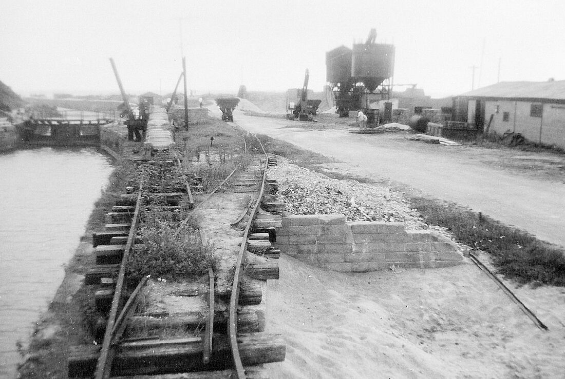
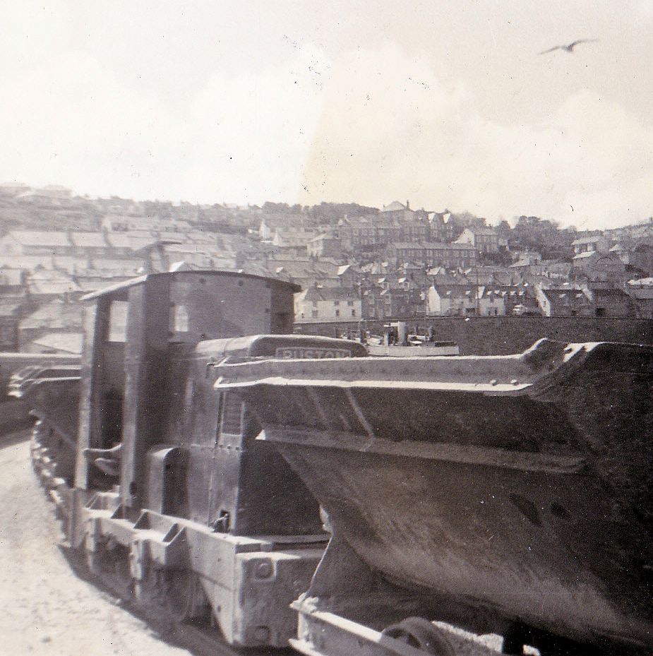
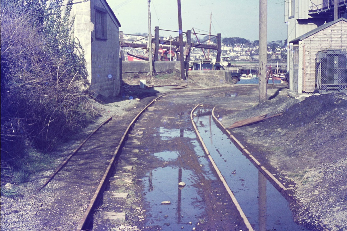
Pentewan Harbour in 1962. The trackwork still appears to be in use but the point up onto the loading ramp is very much out of use!! Note the sand processing plant on the right, the sand hopper looking rather precarious standing on the rails and the still clearly visible though silted up way towards the sea beyond the lock gates. 1962 Copyright Mick Bramich
A view of the loading ramp in 1962. Copyright Mick Bramich.
A view of a very smart sand hopper standing on a bridge over a watercourse at the harbour. 1962. Copyright Mick Bramich.
The St Austell Terminus.
The Clay Cellars - Pentewan Railway
The Clay Cellars - Pentewan Railway
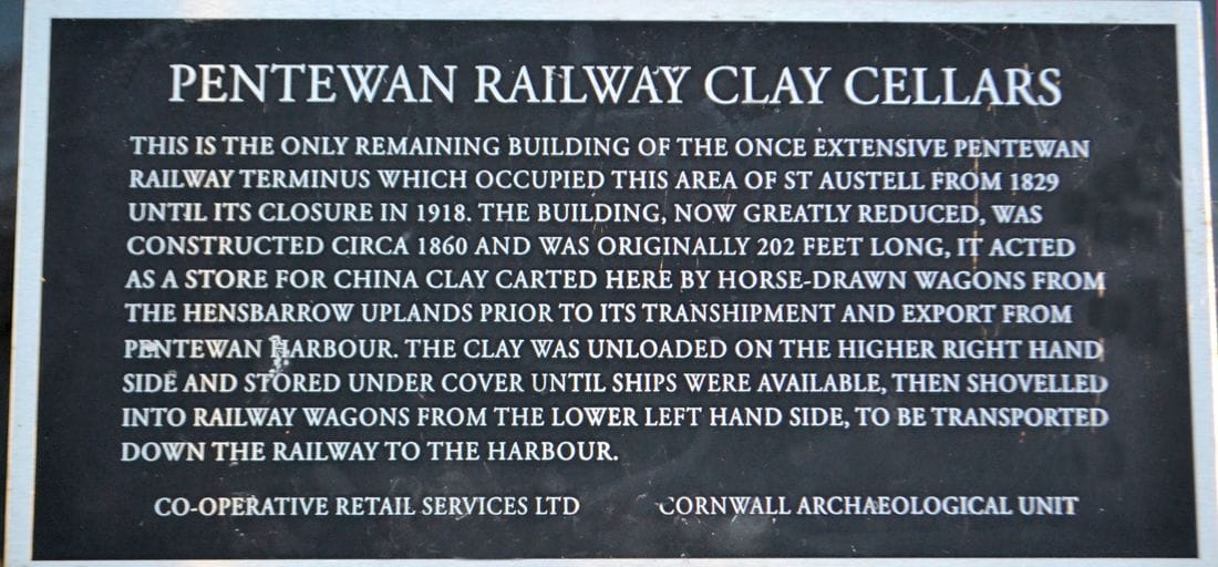
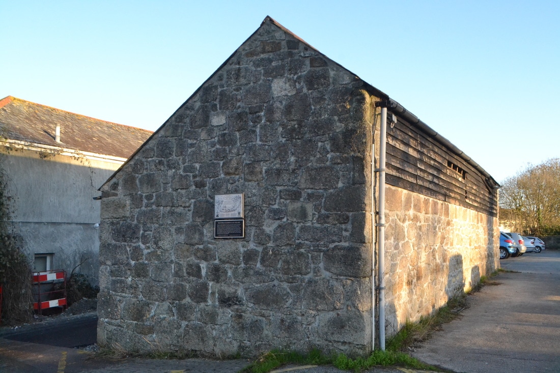
The St Austell Clay Cellers - Pentewan Railway St Austell 29th December 2016 Copyright Roger Winnen
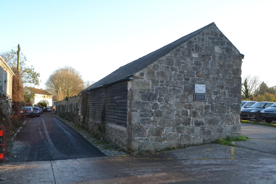
The St Austell Clay Cellers - Pentewan Railway St Austell 29th December 2016 Copyright Roger Winnen
The other display board on the St Austell Clay Cellers building.Note the harour at Pentewan on the left hand side and the St Austell terminus overlooked from some distance away by Holy Trinity Church. Photograph 29th December 2016. Roger Winnen.
Pentewan Railway
- relics at Wheal Martyn Musuem
- relics at Wheal Martyn Musuem
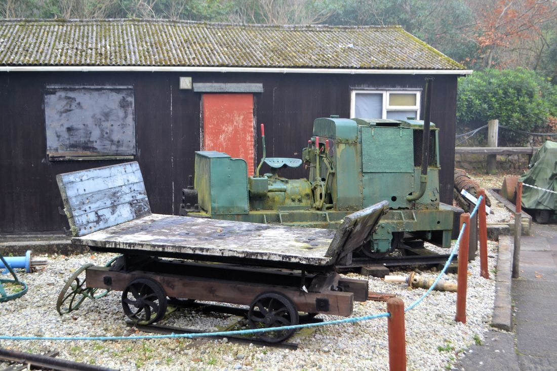
Relics of the sand recovery operation at Pentewan, seen at the Wheal Martyn Museum. 28th November 2014 Copyright Roger Winnen.
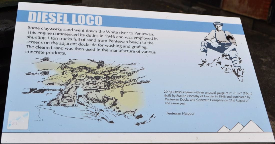
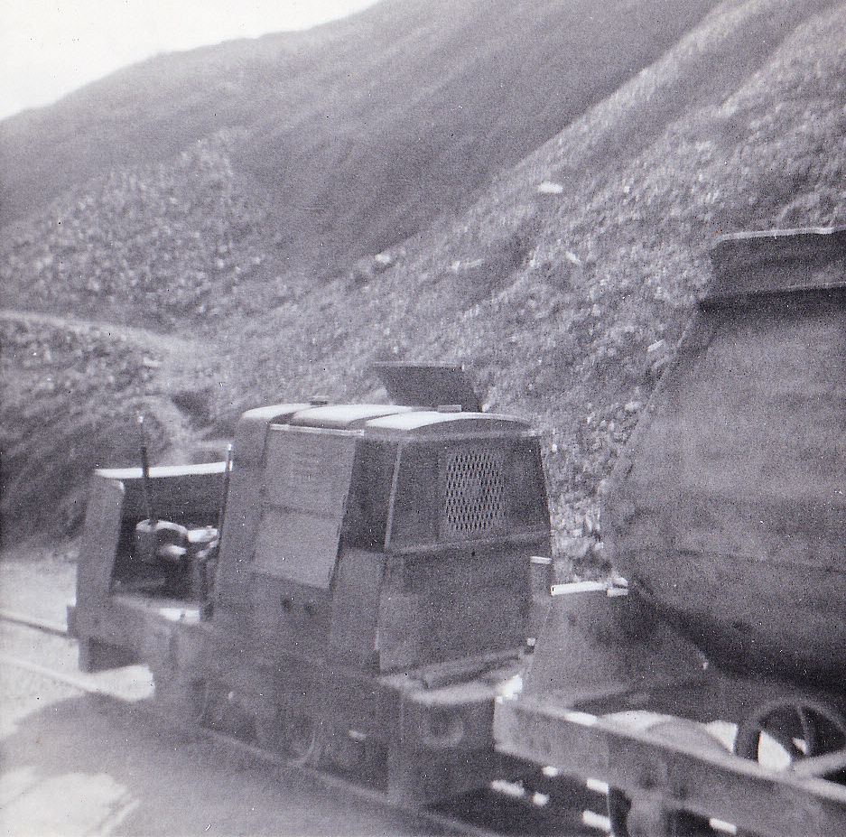
Information about the diesel loco formerly used at Pentewan for the recovery of sand off the beach. 28th November 2014 Copyright Roger Winnen
The 'bare bones' of the diesel loco used for the recovery of sand from Pentewan beach. As seen at the Wheal Martyn Museum on the28th November 2014. Copyright Roger Winnen
Pentewan Railway
New Findings
Michael Bussell
New Findings
Michael Bussell
A Visit to Pentewan in April 1965
Michael Bussell
During a family spring holiday in 1965 I was able to visit Pentewan on a bright dry Saturday morning and take these photographs. I had first learned of the original St Austell & Pentewan Railway a few years earlier from a brief entry in Mineral Railways by R W Kidner, one of the slim Light Railways Handbook series published by the Oakwood Press. The appearance of the first edition of The Pentewan Railway 1829-1918 by M J T Lewis further stimulated my interest; this was, for its time, a pioneering study of a small narrow-gauge line, built primarily to transport china clay from the hinterland to be shipped from the small harbour at Pentewan. This had ceased operations in 1918, but the book noted that industrial activity and rail working continued in a modest way at Pentewan. (Both lines were of 2 feet 6 inches gauge). My visit in April was, I subsequently discovered, just two months after the sand and concrete block-making works with its railway had in its turn closed down.
Once back home, I wrote up my visit, and filed my notes and photos as I started a working life as a structural engineer. A mere 34 years later(!) I tidied up my notes and submitted a text and photos to Railway Bylines, which published my ‘Pentewan’s Other Tramway’ piece in its October 1999 issue. And a mere 23 further years later I have now passed my negatives (original and scanned images) to the care of the Cornwall Railway Society.
More comprehensive information on both the original St Austell & Pentewan Railway and its successor at Pentewan has been published in recent years. A well-illustrated article on the original railway by local historian Robert E Evans appeared in Railway Archive issue 29, December 2010, which included a full-page reproduction of the Pentewan Harbour area from the 25 inch 1907 edition OS map. This was followed in Archive issue 74, June 2012, by an equally well-illustrated account of the Pentewan Sand and Block Works by the same author. Most recently, the third and much enlarged edition of The Pentewan Railway was published by the Twelveheads Press in 2018, with Michael Messenger providing additional material to that of the original author M J T Lewis.
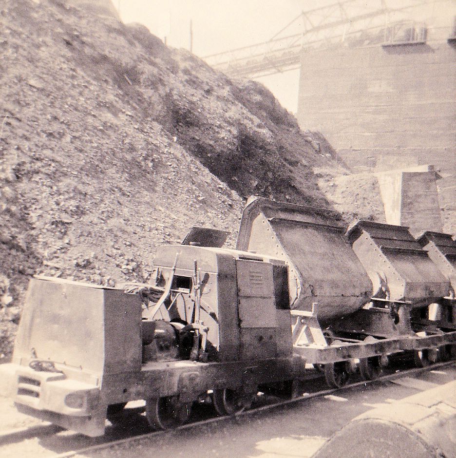
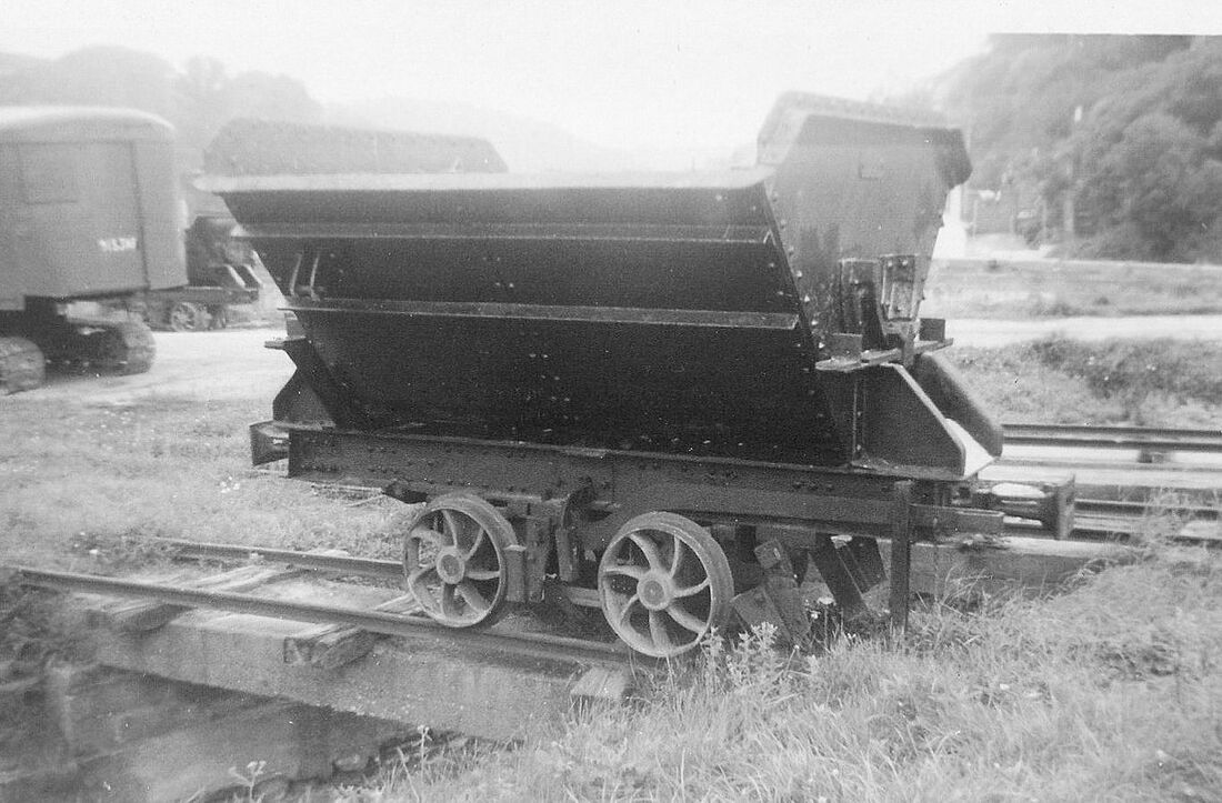
My interest in railways has always been more in their buildings and civil engineering rather than locomotives and rolling stock, so I should perhaps explain that I did not investigate or photograph the nondescript shed which, at the time of my visit, still housed three small diesel locos – which others than I would undoubtedly have found of more interest! (I understood that although one was later scrapped in situ, the other two survived into preservation, one at the Wheal Martyn China Clay Museum and one privately.)
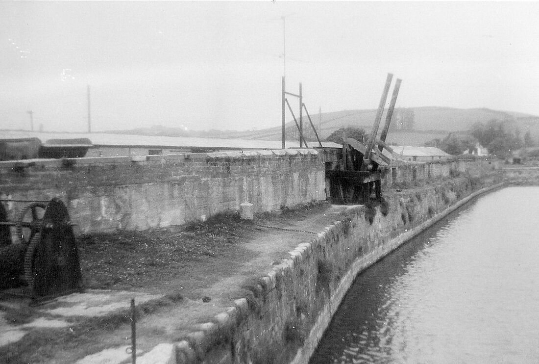
For those unfamiliar with the geography of Pentewan, it may be helpful to note that the St Austell River runs roughly north-west to south-east, discharging into Mevagissey Bay. The man-made Harbour is to the north of this, with a basin extended further north from the channel. The quays on the west, north, and east sides of this basin all previously held waterside sidings of the St Austell & Pentewan Railway, which entered Pentewan paralleling the course of the St Austell River on its north side, and terminated on the south quay.
The formation of the Harbour meant that the land between it and the St Austell River had become what was in effect a peninsula. This offered a south quay to the basin, and was wider at its seaward end, where beach sand deposits were extracted for dispatch inland by rail, and subsequently for use by the adjacent sand and concrete block works located westwards along the ‘peninsula’ and a little further inland. The sand here actually included gravel, which meant that – suitably graded and mixed – both sand and gravel could form the aggregate. This, when mixed with cement and water and placed in moulds, would harden as the cement set, to form concrete blocks for use in building.
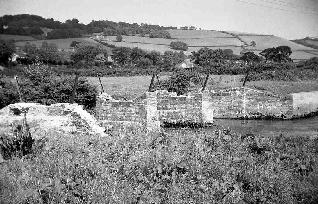
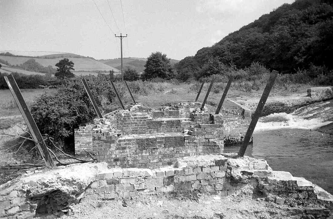
The St Austell & Pentewan Railway ran onto this south quay, with an elevated timber trestle viaduct built along the waterside, and originally three timber chutes from which wagons loaded with china clay could be discharged from the viaduct into shipping moored alongside. The later tramway associated with the sand and concrete works made use of this viaduct; at some time much of its timber had been encased with concrete, presumably as a result of timber decay.
Further sand supplies were extracted from the dunes south of the St Austell River. To facilitate this, the works railway added a line that ran from the peninsula across the St Austell River to these dunes, where it branched into several sidings (largely buried under drifting sand at the time of my visit).
Michael Bussell
During a family spring holiday in 1965 I was able to visit Pentewan on a bright dry Saturday morning and take these photographs. I had first learned of the original St Austell & Pentewan Railway a few years earlier from a brief entry in Mineral Railways by R W Kidner, one of the slim Light Railways Handbook series published by the Oakwood Press. The appearance of the first edition of The Pentewan Railway 1829-1918 by M J T Lewis further stimulated my interest; this was, for its time, a pioneering study of a small narrow-gauge line, built primarily to transport china clay from the hinterland to be shipped from the small harbour at Pentewan. This had ceased operations in 1918, but the book noted that industrial activity and rail working continued in a modest way at Pentewan. (Both lines were of 2 feet 6 inches gauge). My visit in April was, I subsequently discovered, just two months after the sand and concrete block-making works with its railway had in its turn closed down.
Once back home, I wrote up my visit, and filed my notes and photos as I started a working life as a structural engineer. A mere 34 years later(!) I tidied up my notes and submitted a text and photos to Railway Bylines, which published my ‘Pentewan’s Other Tramway’ piece in its October 1999 issue. And a mere 23 further years later I have now passed my negatives (original and scanned images) to the care of the Cornwall Railway Society.
More comprehensive information on both the original St Austell & Pentewan Railway and its successor at Pentewan has been published in recent years. A well-illustrated article on the original railway by local historian Robert E Evans appeared in Railway Archive issue 29, December 2010, which included a full-page reproduction of the Pentewan Harbour area from the 25 inch 1907 edition OS map. This was followed in Archive issue 74, June 2012, by an equally well-illustrated account of the Pentewan Sand and Block Works by the same author. Most recently, the third and much enlarged edition of The Pentewan Railway was published by the Twelveheads Press in 2018, with Michael Messenger providing additional material to that of the original author M J T Lewis.
My interest in railways has always been more in their buildings and civil engineering rather than locomotives and rolling stock, so I should perhaps explain that I did not investigate or photograph the nondescript shed which, at the time of my visit, still housed three small diesel locos – which others than I would undoubtedly have found of more interest! (I understood that although one was later scrapped in situ, the other two survived into preservation, one at the Wheal Martyn China Clay Museum and one privately.)
For those unfamiliar with the geography of Pentewan, it may be helpful to note that the St Austell River runs roughly north-west to south-east, discharging into Mevagissey Bay. The man-made Harbour is to the north of this, with a basin extended further north from the channel. The quays on the west, north, and east sides of this basin all previously held waterside sidings of the St Austell & Pentewan Railway, which entered Pentewan paralleling the course of the St Austell River on its north side, and terminated on the south quay.
The formation of the Harbour meant that the land between it and the St Austell River had become what was in effect a peninsula. This offered a south quay to the basin, and was wider at its seaward end, where beach sand deposits were extracted for dispatch inland by rail, and subsequently for use by the adjacent sand and concrete block works located westwards along the ‘peninsula’ and a little further inland. The sand here actually included gravel, which meant that – suitably graded and mixed – both sand and gravel could form the aggregate. This, when mixed with cement and water and placed in moulds, would harden as the cement set, to form concrete blocks for use in building.
The St Austell & Pentewan Railway ran onto this south quay, with an elevated timber trestle viaduct built along the waterside, and originally three timber chutes from which wagons loaded with china clay could be discharged from the viaduct into shipping moored alongside. The later tramway associated with the sand and concrete works made use of this viaduct; at some time much of its timber had been encased with concrete, presumably as a result of timber decay.
Further sand supplies were extracted from the dunes south of the St Austell River. To facilitate this, the works railway added a line that ran from the peninsula across the St Austell River to these dunes, where it branched into several sidings (largely buried under drifting sand at the time of my visit).
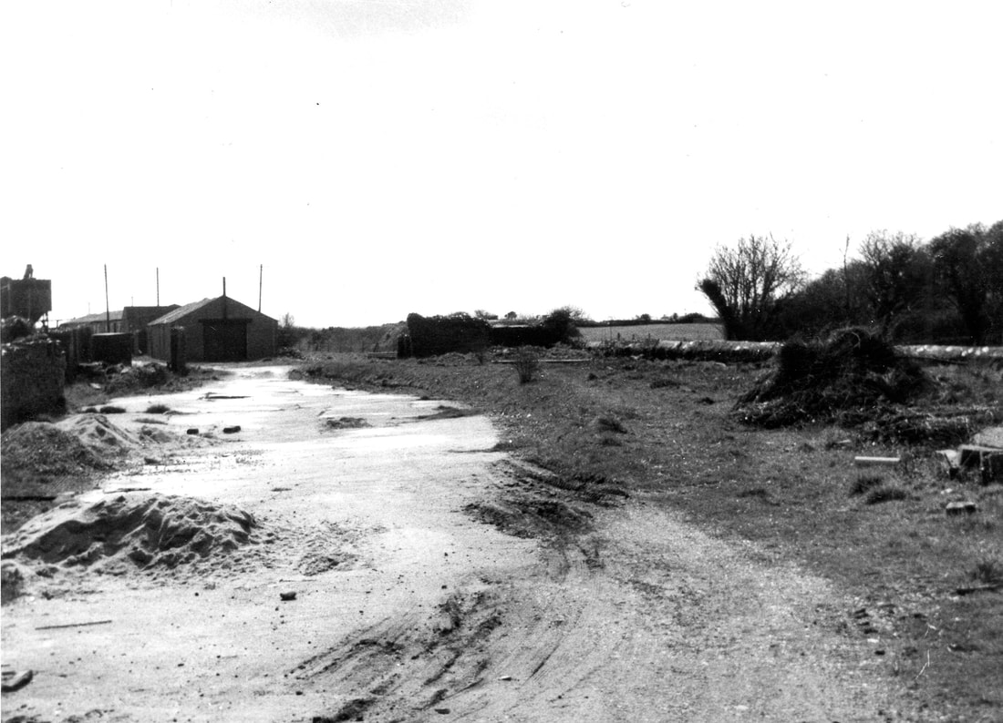
1 The approach to the works from the north-west, with Pentewan village behind the camera. Sheds and sand storage hopper are in the distance. April 1965. Copyright Michael Bussell.
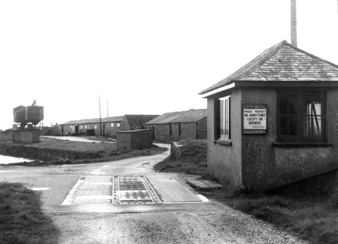
2 The road entrance to the works from the north-west, with weighbridge and adjacent weigh-house. The building is not shown on the 1907 OS map and is therefore unlikely to be an original Pentewan Railway structure, particularly as the road weigh-bridge is on the line of the original railway track leading to St Austell. Beyond is the south quay of the basin, on which some at least of the sheds visible may well be from the earlier railway. April 1965. Copyright Michael Bussell.
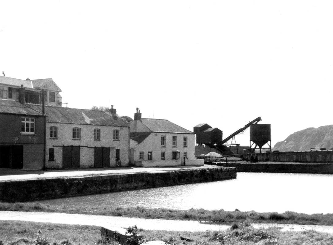
3 View from the north quay. Across the basin on the south quay is the sand and block works, with to its right the concrete-encased timber trestle viaduct along the quay wall. Cement for the works came in by ship, and was stored in one or both of the buildings on the east quay buildings, to the left, which show evidence of having been altered by the insertion of wide ground floor doors for this storage. April 1965. Copyright Michael Bussell.
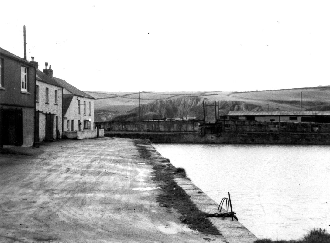
4 View along the east quay and towards the viaduct and the sole survivor of what were once three timber chutes used to load sand (and, earlier, china clay) into the small ships that once came into the harbour. April 1965. Copyright Michael Bussell.
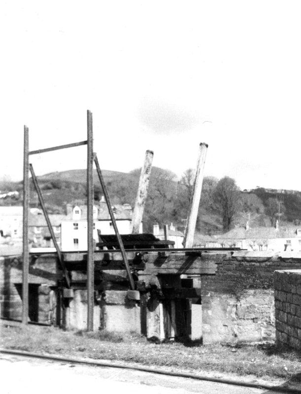
5 The tipping apparatus leading to the shute to the vessel below. April 1965. Copyright Michael Bussell.
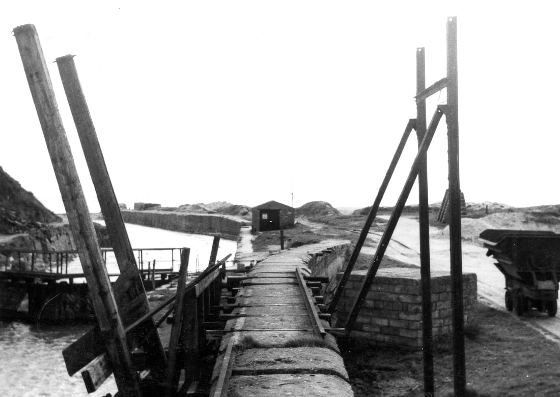
6 Looking south-east from the viaduct through the loading chute, with the harbour dock gate on the left and beyond that the channel leading out to Mevagissey Bay. The shed in the middle distance once housed works locomotives. To the right a tipper wagon stands on the track. April 1965. Copyright Michael Bussell.
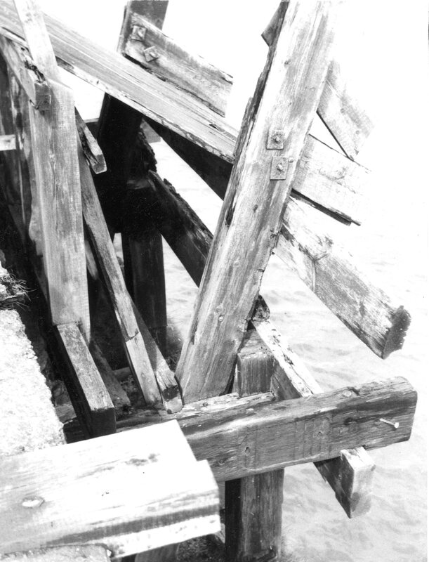
7 A closer look at the timbering of the loading chute on the south quay. April 1965. Copyright Michael Bussell.
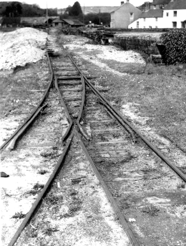
8 A point on the disused track looking north-west towards the weigh-house in the distance, with the basin and trestle viaduct on the right. April 1965. Copyright Michael Bussell.
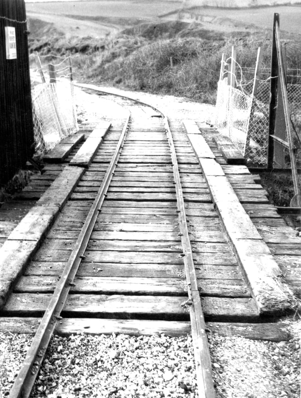
9 The railway bridge built to carry sand excavated from the dunes south of the works across the St Austell River, also known as the White River because of the colour of the slurry that was washed down from upstream china clay working. This bridge was built just after World War II, of simple construction with two steel I-beams under the rail tracks and a deck of close-laid baulks of timber (possibly old railway sleepers), which also served as a footway. A gate, partly visible on the left, could be closed across the bridge. April 1965. Copyright Michael Bussell.
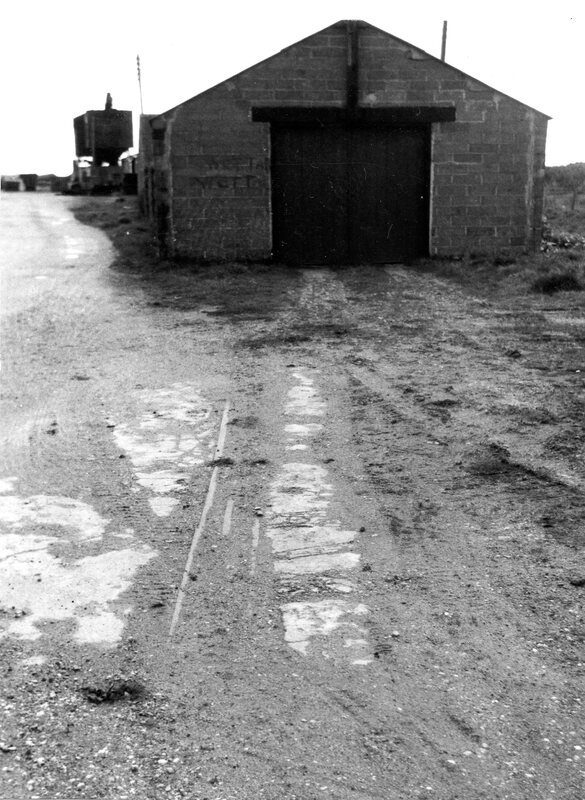
10 Sheds on the south quay, looking south-east, with the sand plant beyond. The track in the foreground is largely obscured by mud. The sheds walls are of concrete blocks, probably made on site. April 1965. Copyright Michael Bussell.
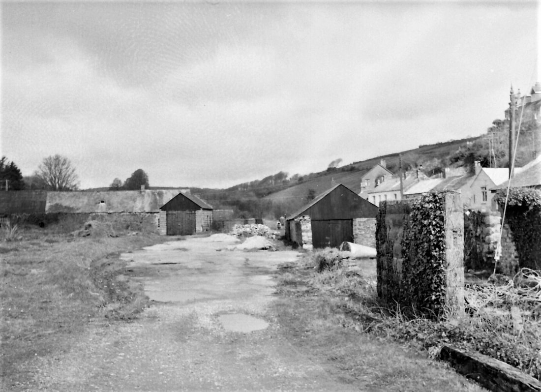
11 Looking north-west along the roadway on the south side of the basin towards sheds at the north-west end of the works. April 1965. Copyright Michael Bussell.
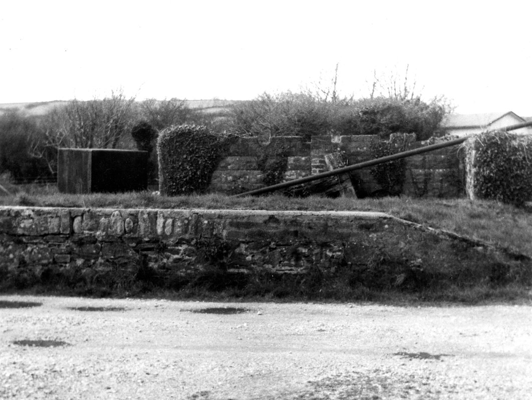
12 A raised loading platform and shed on the south side of the works roadway along the south quay. April 1965. Copyright Michael Bussell.
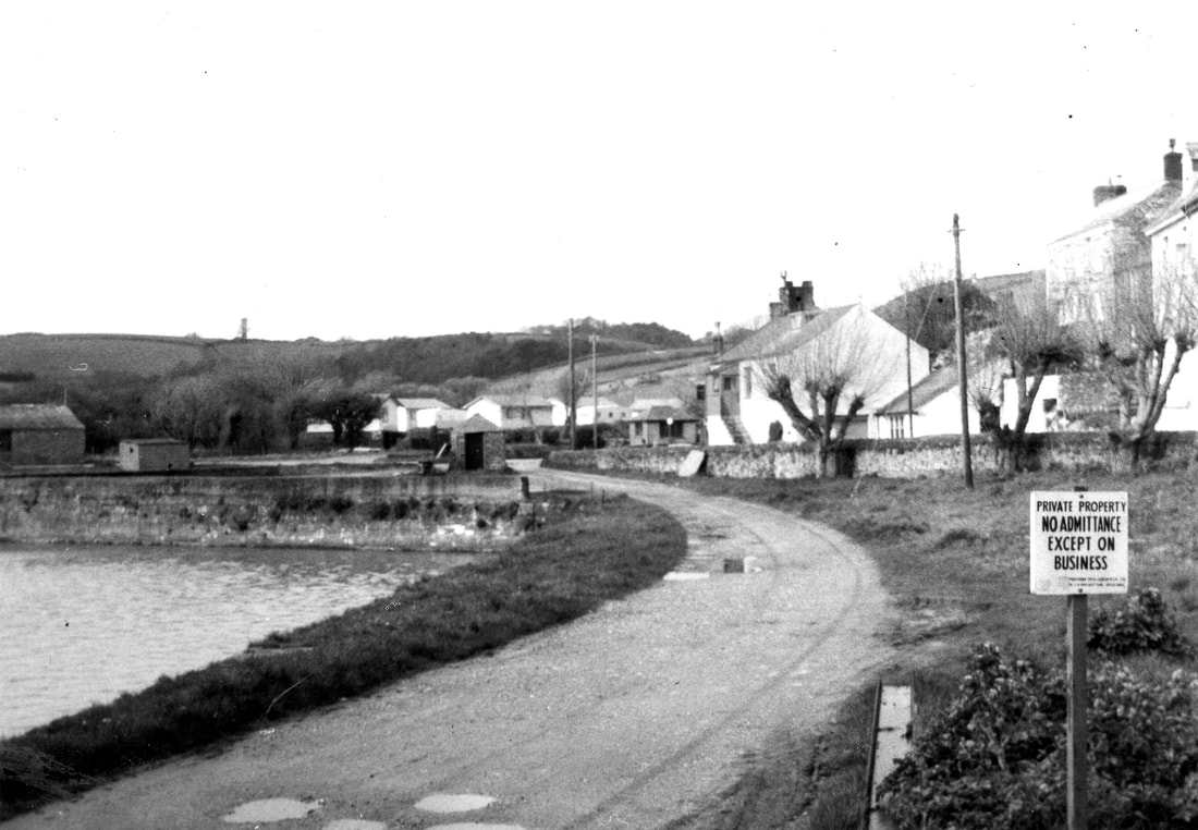
13 A view west along the north quay towards the north-east corner of the basin. The St Austell & Pentewan Railway had tracks alongside the quays on all four sides of the basin, but the later sand and block works confined its activities and its trackwork to the south quay. April 1965. Copyright Michael Bussell.
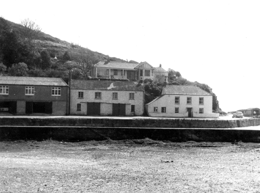
14 Buildings at the southern end of the eastern quay, which, as evidenced by old photographs of the harbour, and apart perhaps from the insertion of wider loading doors at ground floor in two buildings here for cement storage, appeared in 1965 to have changed little over the preceding century, like their neighbours on the western and northern quay. April 1965. Copyright Michael Bussell.
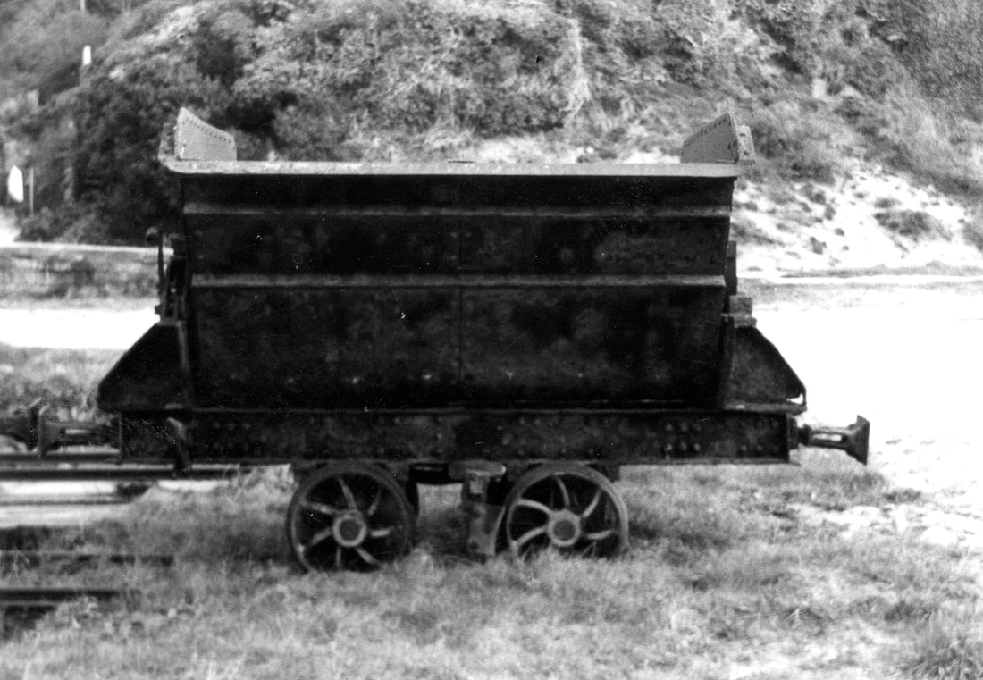
15 Side view of a disused Robert Hudson tipper wagon on the south quay, with distinctive seven ‘curly-spoke’ wheels. April 1965. Copyright Michael Bussell.
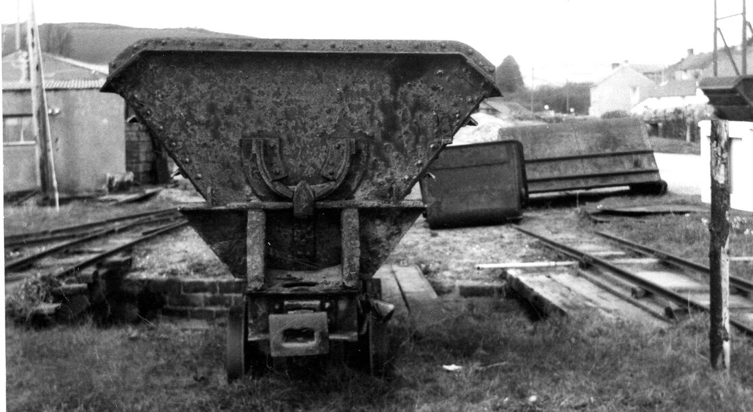
16 End view of a tipper wagon. The centre coupling is of a type different from the more usual ‘chopper’ coupling used on many narrow-gauge railways. Clearly visible is the central pivot at one end; these pivots allow the tipper wagon body to be swung sideways to discharge its contents. Another tipper wagon is visible to the right, close to the loading chute on the trestle viaduct. Just visible behind the nearer wagon are brick walls enclosing a narrow channel that links the harbour basin to the St Austell River, crossed by the rail tracks on short-span bridges of timber beams and decking. April 1965. Copyright Michael Bussell.
Many thanks indeed to Michael Bussell who has honoured us with his article and pictures taken in 1965. Also thanks to Mick House who has been in contact with Michael over the inclusion of this item on our website.
Plymouth & Dartmoor Railway by Edward Hooper
Edward Hooper has written an extensive artcle on a an exploration of this line which can be found in our October to December Features section - please use this link.
Plymouth Corporation Tramways
Briefly. Plymouth Tramways were of standard gauge operating as three independent systems until 1915. The oldest of the three was opened on a line of just under two miles in length on 17th March 1872. There were four depots, a larger one at Prince Rock near the power station, Milehouse, Compton Road. and a small one at Millbay - this closed in 1907.
Lower Compton Road depot
This is Lower Compton Road Tram Depot which was discovered, almost by accident by the webmaster in 1973 - the area has now been re-developed. This depot was in use from 1893 to 1934. there were five roads in the yard and four in the shed to hold 16 trams. This was the original depot for horse drawn trams. Final abandonment of the Plymouth system came in September 1945.
This story starts when I had an occasion to visit a very old friend of mine - Len Baker a former S.E.C.R driver who on retirement settled in Redruth with his wife Cath. He lived in a bungalow behind mine - the bungalow was called 'Er Tis'! Len was a good friend of the Railway Society attending most meetings at the Bullers Arms and joining us on various trips - on one occasion he gave us a talk on his experiences on the Southern, mainly in the London area during wartime. He recalled hiding under trucks while the bombs fell!
Later Len moved to Pymouth where he lived in Desborough Road, close to his one time shed at Friary. There came a time when Len had to move from his home into a residential home in the Compton area.
In March 1973 I decided to pay our good friend a visit in Plymouth, I took our eldest son Kevin along with me - Kevin was only five at the time.
Not really knowing Plymouth we walked up to Mutley Plain and headed out towards the Compton area. (Never thought of catching a bus) We were walking up Tavistock Road when I noticed a road sign bearing the name Compton Road, or was it Lower Compton Road. I must admit that as a lifelong tram fan I had it in my mind that a long time ago this must have been a tram route. The Compton Tram Depot came to my mind having read of a depot of that name in Mr. P.W. Gentry's book 'Tramways of the West of England'.
It was but one hundred yards along Compton Road when we came across, 'joy oh joy' the tram depot there in all it's glory some 40 years after it had closed.
The depot had seen use as a base for some kind of transport firm and maybe housed lorries. I'm not one for trespassing and I wandered about fearing a shout of "Get out of here" or some such words.It wasn't until I got home I was able to put together what I had seen and remember that films took some time to be printed, not like the digital cameras of today! We couldn't have been at the depot for more than ten minutes as we had a call to pay on Len Baker. However I was more than chuffed to have seen that relic of from before WW2 still in existence after all those years.
I have drawn a rough sketch map of the depot using details from Mr. Gentrys book. It was interesting to note that looking at old maps none of these showed details of the four tracks within the depot plus a short siding outside or of the steep gradient leading up to the Overhaul shed. I very much regret that I didn't wander further into the overhaul works where I might have found traces of the traverser used to move the trams between various locations.
Trams operated route 1 - Theatre to Compton from 1915 to 1932. The final abandonment of the Plymouth Tramway system came on the 29th September 1945.
A look at the area of the depot using Google Earth shows that in the intervening years all traces of the 'Glory' which once occupied the site have been removed.
Recommended viewing There is an excellent section on the Tramways of Plymouth Courtesy of Wilkipedia please click below to see this.
Tramways in Plymouth - Wikipediaen.wikipedia.org › wiki › Tramways_in_Plymouth
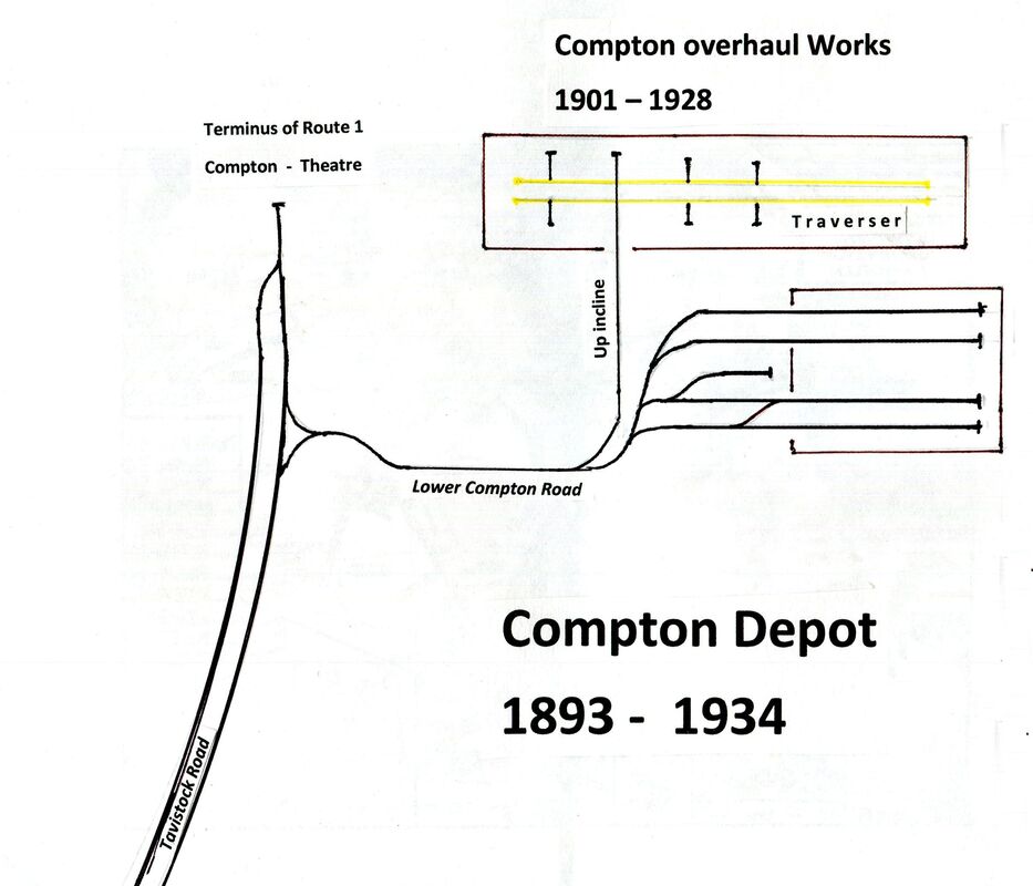
Plymouths Trams, Compton Depot Plan (1) The lines into the depot could be numbered 1 to 4 from top to bottom of this sketch,
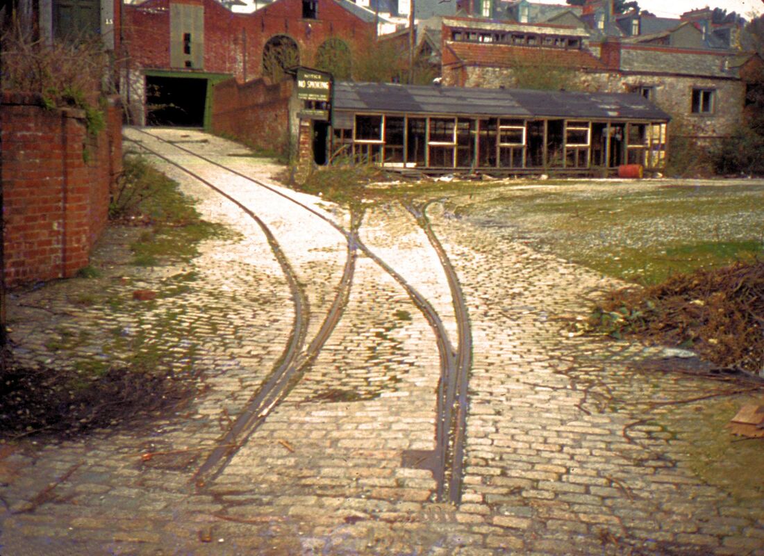
Plymouth Compton Tram Depot - first impressions seen from the Compton Road entrance.
The left hand rails lead up a gradient towards the 'Overhaul Shed' within which the trams would have been moved sideways by means of a traverser. Theline to the right leads to the 'depot fan' from which stem four lines right into the depot and one short siding between track 2 & 4. Straight ahead lies the remains of a timber shed used by later occupiers of the depot area. March 1973. Copyright Keith Jenkin.
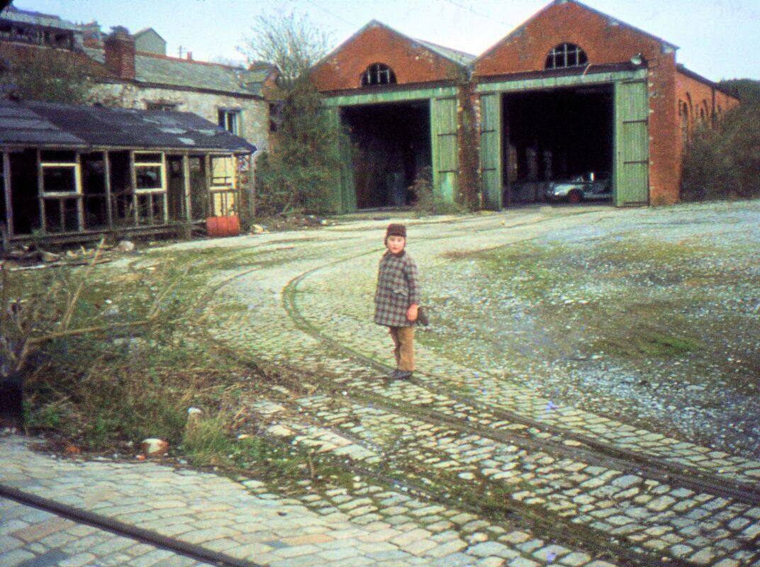
Plymouth Tram Compton Depot (3) Closed 1934 this picture taken 39 years later in March 1972 Copyright Keith Jenkin. The young lad standing on the tracks is Kevin quite how he lasted such a long and arduous day is difficult to say - he was already a 'rail enthusiast;! N.B. In the foreground the incline rising to the overhaul sheds. Kevin is standing on the 'depot fan' leading towards the depot.
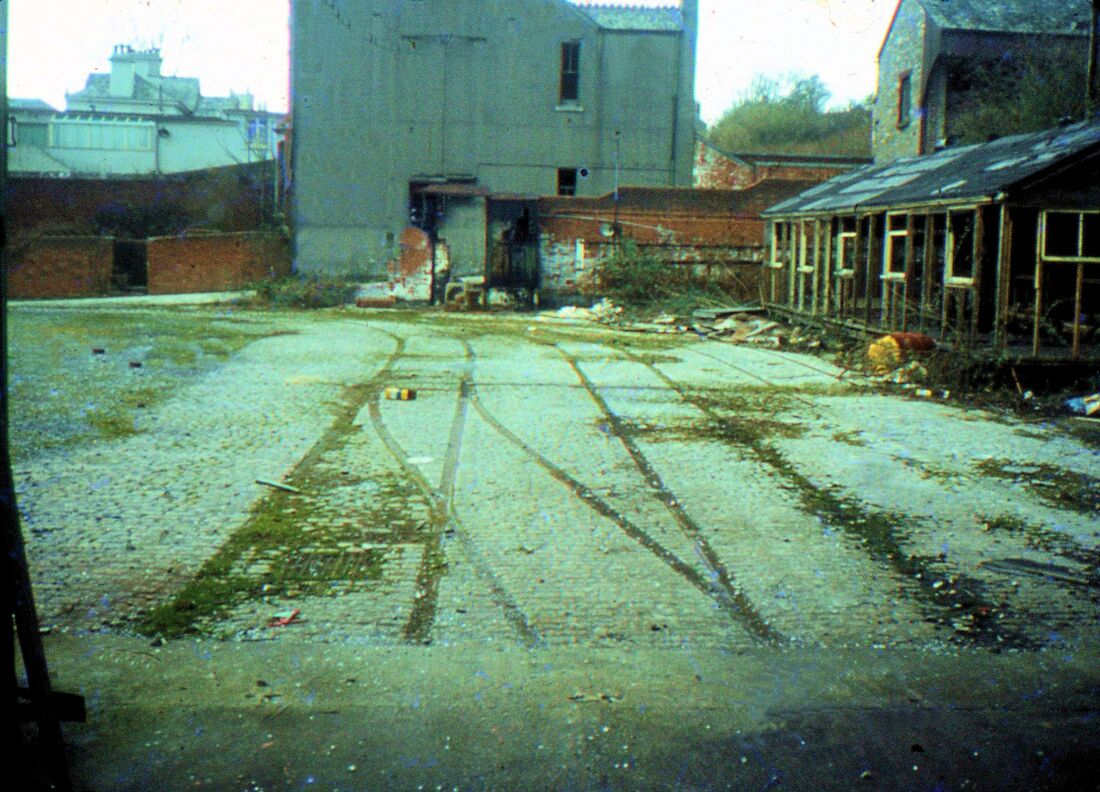
Plymouth Tram Compton Depot (4) Looking out from the depot. Lines 1 and 2 are buried beneath the timber shed to the right. March 1972 Copyright Keith Jenkin.
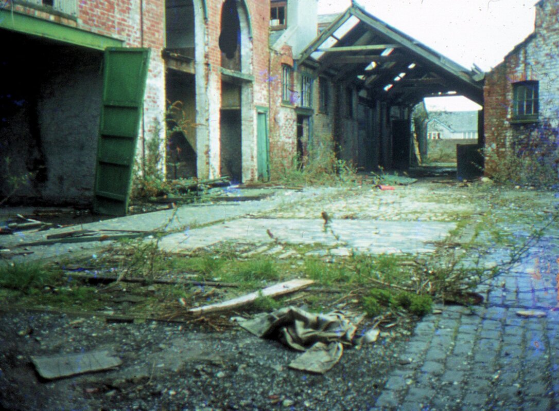
Compton Tram depot March 1972. Not quite sure where this was taken, maybe along the floor of the 'Overhaul Shed. March 1972. Copyright Keith Jenkin.
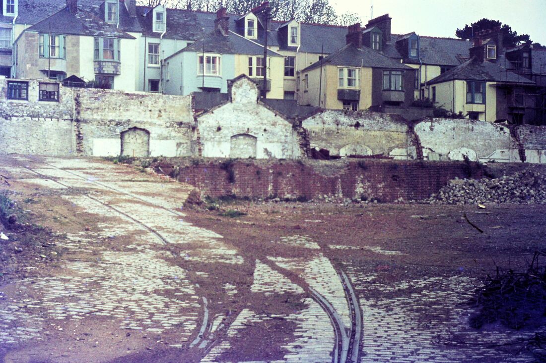
Plymouth Tram Compton Depot (6) 1st December 1973 Copyright Roger Winnen This view taken almost a year later with a superior camera shows the line rising up towards the Overhaul shed and the imprint of the overhaul sheds roof structure in the back wall. Quite what the recesses might have been used for is not known. The considerable height difference between the tram depot fan level and the floor of the overhaul shed is obvious. Hence the need for a considerable gradient. The demolition gang have made short work of removing the remains of the timber shed. Rogers camera hasn't pointed in the tram depots building.
Camels Head Tram Depot
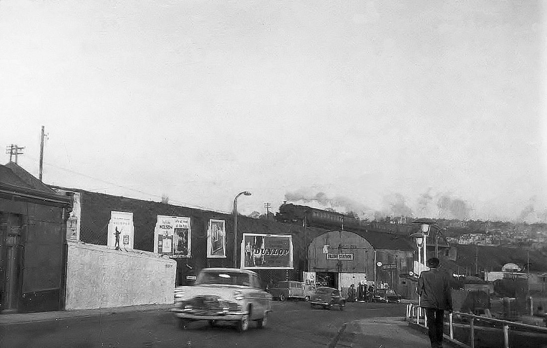
Camels Head Tram Depot - in use up until the 1930's is galvanised iron structure seen in the centre of this picture by Sid Sponheimer. 1960
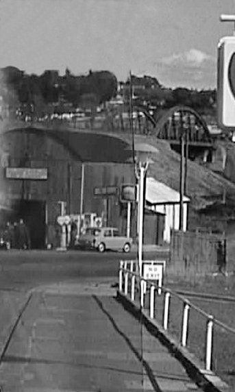
Another view of the one time tram depot at Camels Head. In the background is a girder bridge part of the 'Southern Railway' route into Plymouth. Both the tram depot and railway route have totally vanished. Copyright Sid Sponheimer. 1960
Milehouse Depot
A collection of pictures taken by Sid Sponheimer during the 1980's and 1990's. Various bits of tram track are still present. Sid has also given details of the various buses present.
A collection of pictures taken by Sid Sponheimer during the 1980's and 1990's. Various bits of tram track are still present. Sid has also given details of the various buses present.
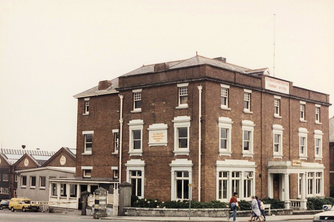
Plymouth Milehouse Depot Offices 19th September 1987. Until shortly before I took it there was a nice square clock on the street frontage. Copyright Sid Sponheimer
.
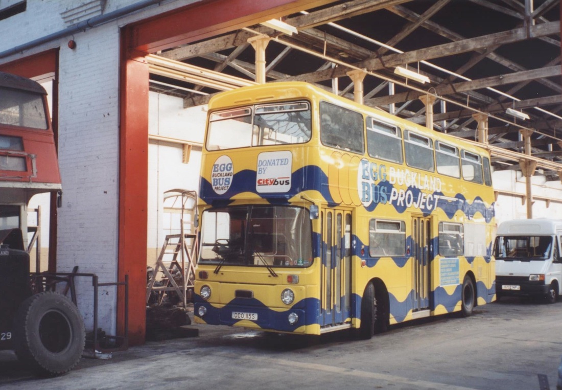
Plymouth Milehouse Depot Ex Plymouth Corporation No: 115 Leyland Atlantean AN68A Manufactured in 1978.
This picture in July 1995 Copyright Sid Sponheimer
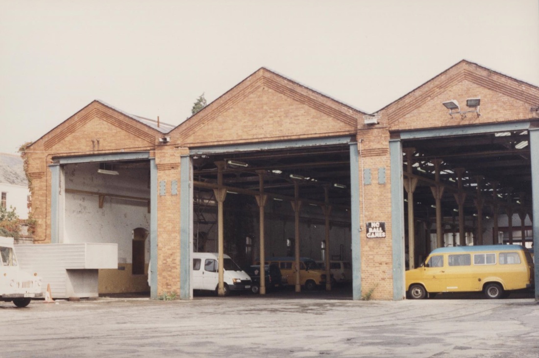
Plymouth Milehouse Depot Depot 19th September 1987 Copyright Sid Sponheimer Traces of tramway tracks in foreground
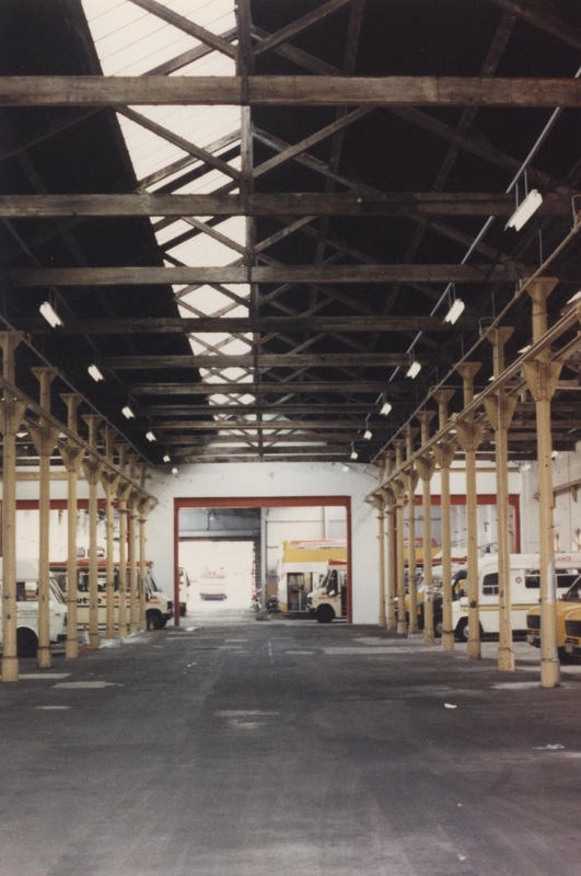
Plymouth Milehouse Depot internal view 19th September 1987 Copyright Sid Sponheimer
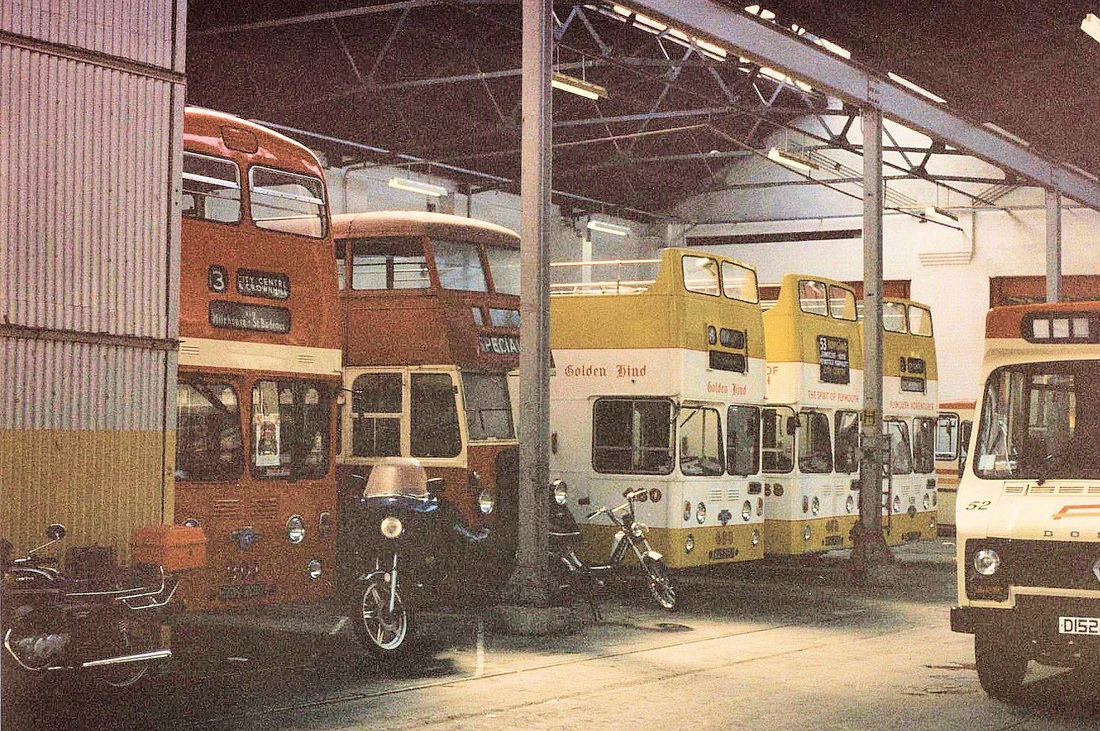
Plymouth Milehouse Depot. Includes 3 open-topped - PCT Nos: 158;159 & 160. Named Golden Hind; Spirit of Plymouth & Plymouth Adventurer. All Leyland Atlantean PDR/1 of 1962/63. Picture taken on 19th September 1987 Copyright Sid Sponheimer
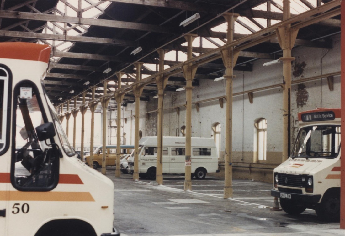
Plymouth Milehouse Depot Internal views with Renault Dodge S56's of 1986 vintage .Nos: 50 & 53. 19th September1987 Copyright Sid Sponheimer
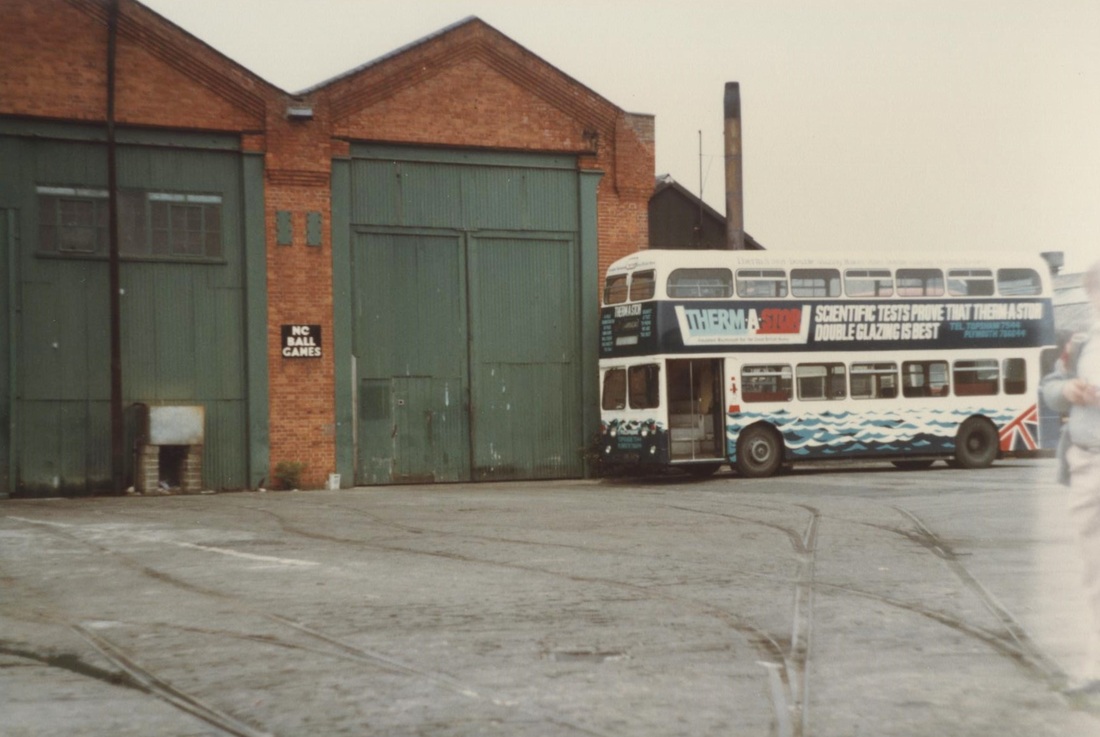
Plymouth Milehouse Depot 4th May 1983 Copyright Sid Sponheimer Very clear evidence of a 'depot fan' of tramway tracks here.
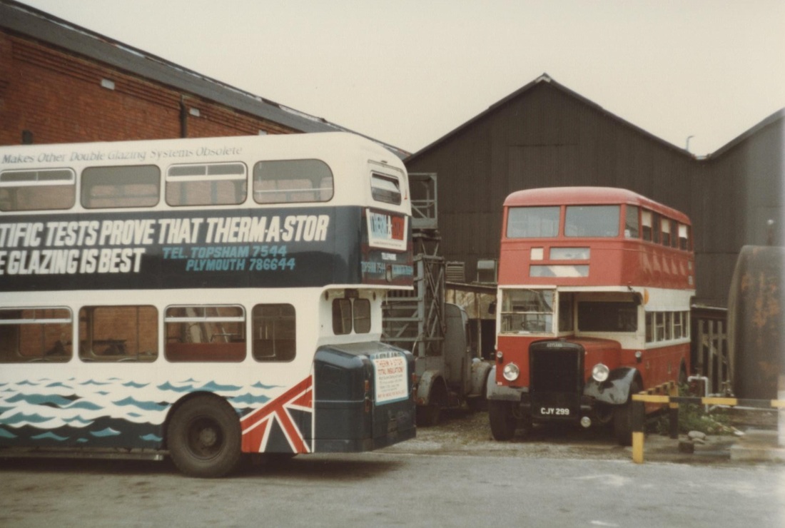
Plymouth Milehouse Depot. Preserved PCT. Leyland PD1 1946 CJY 299. Fleet No: 89. 4th May 1983 Copyright Sid Sponheimer
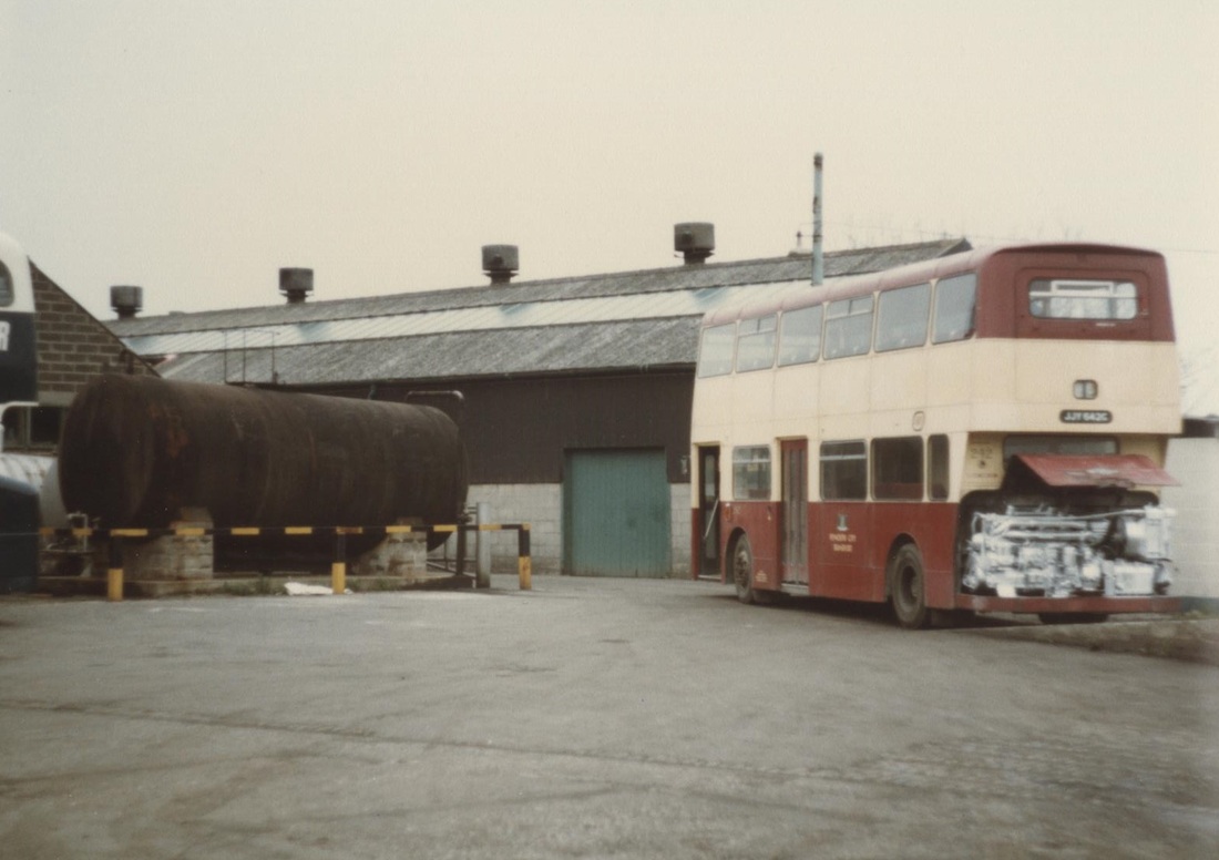
Plymouth Milehouse Depot. PCT 243 of 1968 Leyland Atlantean PDR2/1 4th May 1983 Copyright Sid Sponheimer
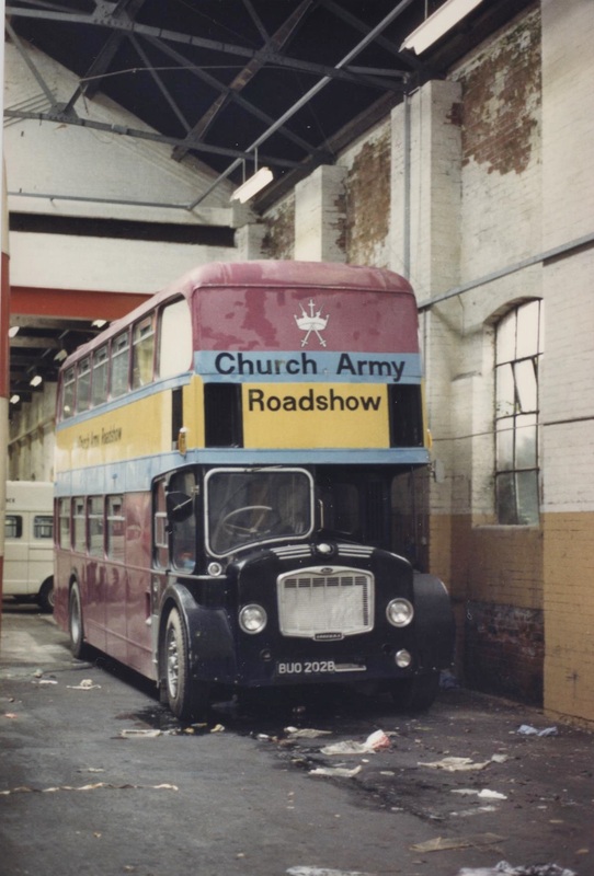
Mileshouse Depot. Ex Western National 2077 Bristol FLF6G 1964. Church Army. 19th September 1987 Copyright Sid Sponheimer
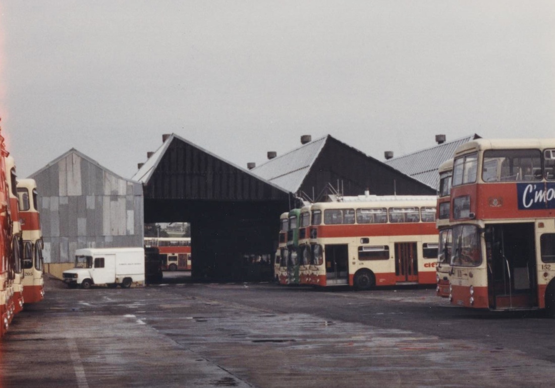
Plymouth Milehouse Depot. External view of east side. 19th September 1987 Copyright Sid Sponheimer
Plymouth Milehouse Depot. Preserved Exeter Corporation No:15 1948 Leyland PD2/1 & London Transport Routemaster Coach RMC 1497 1982. On 28th May 1997 Copyright Sid Sponheimer
Near Derry's clock The webmaster has for many years been a bit of a tram fan. The current revival of this source of transport is very pleasing. During World War Two a very young webmaster was taken out of doors in Redruth and can just remember seeing the sky lit up by the fires in Plymouth as a result of the blitz. Of course I didn't know what it was all about. Shortly after the war I was taken up there and can clearly remember the devastation which I saw there, and also in London. I found it pleasing therefore for many years after the war this short section of Plymouth's tramways near Derry's clock was preserved. Sadly however this track was removed quite soon after the photograph below was taken. Maybe this site is now the Theatre Royal.
Peter Bragg, President of the Cornwall Railway Society writes:- Just noticed Tramway Pictures Near Derrys Clock.
L H Picture. The curved tram lines between the parked cars outside the marooned Provincial Bank did lead westward to Union Street top centre border. Derrys Clock has chimney to right, further right pitched roof of Lloyds Bank.
R H Picture. This is taken from the middle of the curve of L H picture in the opposite direction, note same pitched roof and chimney of each shot. First floor of Lloyds contained noisy Comptometer Machinery for Bank Statements plus stores for old cheques after reading. Just above significant white car centre may be glimpsed the roof of one of two telephone kiosks. Over used, swines to maintain, (when near by underground toilets closed, use your imagination), all this was on my "walking linesman's" load, 1950 to 1951, the squalor of many premises had to be seen to be believed some 10 years after the Blitz.
I stood aged 11 near where U stand looking at the still smouldering many acres of former shops! < [email protected] >
A picture of a tram rosette - used to fix overhead cabling to existing buildings - this is a photograph of a restored example supplied by by William Brown. Not sure if this is Plymouth item
Plymouth and Dartmoor Tramway
For a history of this tramway please click below:-
https://en.wikipedia.org/wiki/Plymouth_and_Dartmoor_Railway
https://en.wikipedia.org/wiki/Plymouth_and_Dartmoor_Railway
Leigham Tunnel
For a map showing the location of this tunnel courtesy of the National Museum of Scotland please click below:-
https://maps.nls.uk/geo/explore/#zoom=16&lat=50.4083&lon=-4.0928&layers=168&b=1
https://maps.nls.uk/geo/explore/#zoom=16&lat=50.4083&lon=-4.0928&layers=168&b=1
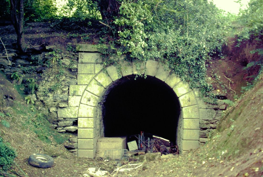
Plymouth and Dartmoor Tramway, the south end of Leigham tunnel 1985 Copyright Peter Murnaghan .
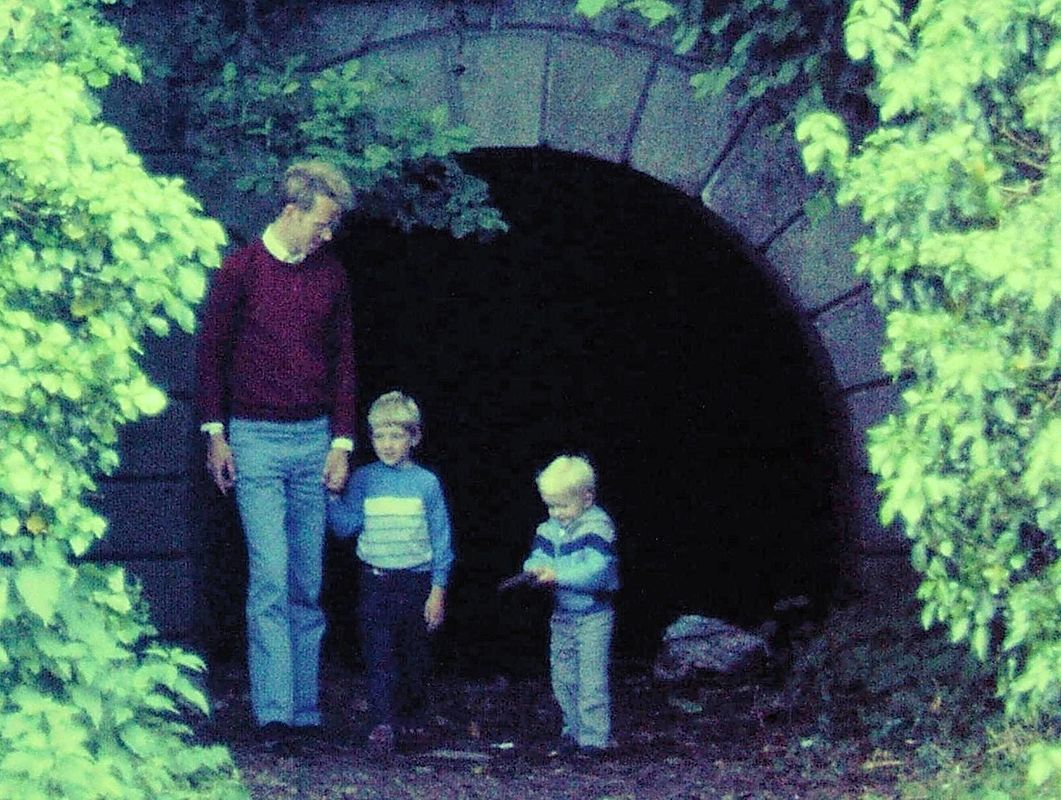
Leigham tunnel , the north end in 1985. Nearby are 'Tunnel Cottages'. Copyright. Peter Murnaghan with two eldest boys, James and Dan Murnaghan
Porthallow & Porthoustock Quarry Tramway
St Keverne and Associated Quarries
A report by Peter Murnaghan
St Keverne and Associated Quarries
A report by Peter Murnaghan
The most southerly disused tramway in mainland Britain – unless you know otherwise !
Whilst the Penlee Quarry tramway on the quay at Newlyn is the furthest west railway relic in Britain, another Cornish industrial tramway can hold the title of the most southerly, if you discount the lines on the Channel Islands.
On the east coast of the Lizard peninsula, the remains of the St Keverne and Associated Quarries tramway system are surprisingly easy to discover. The geology to the north of Coverack provides gabbro rock and hard schist to make gravel for roadbuilding. Quarries along the coast between Porthallow and Porthoustock offered easy access for the dispatch of the roadstone by ship to distant markets.
The stone was first extracted on an industrial scale in the late 19th century, but it was not until 1934 that a rail system was laid to connect four separate quarries along the coast to a combined grading and stone-crushing plant and a quay for loading onto ships. The 2-foot gauge tramway is believed to have started at Porthallow, although there are no obvious signs at this point.
The line is understood to have closed as long ago as 1958, but the route between Porthkerris Cove and Porthoustock is open to all as a Permissive Path and relics of the old tramway can be seen by those who know where to look.
The line ran for over a mile and the best way to see it is to walk along the coast path from Porthallow. Leave the beach at the southern side up a steep path beyond the Five Pilchards public house. Keep to the coast and head for the Diving Centre at Porthkerris Cove. At the south end of this beach, you will find the first part of the line, a causeway with a concrete-edged sea wall, with one line of rail still in situ, together with the remains of plentiful wooden sleepers. The line passed in front of an old quarry, which was probably already disused when the track was laid. This leads up the old rope-worked Pencra Head incline, which took the trucks of stone up from sea level to a height of over 150 feet at a gradient of around 1 in 4. This incline can easily be spotted and can be walked, although gorse is trying to dissuade walkers. Nevertheless, wear strong trousers and push through; you will spot sleepers, still with their rail spikes in place. At the top would have been the winding mechanism and machinery for crushing and grading. There is also a fine view back down to Porthkerris and the former wartime Royal Navy Torpedo station.
Continue on along the coast path, where the huge (and still working) Porthoustock Quarry comes into view. This was not connected to the tramway that you are following, although it once had a short stub of its own to transfer stone to its storage hoppers for dispatch by road or ship.
However, the line we are following appears again in the surface of the path on the way to Batty’s Point, a huge concrete silo at the north side of the bay, which was used to load ships. Wagons were pushed onto the structure and emptied their stone cargo down shutes, which can still be seen. It is not possible to safely get onto this quay as the timber linkspan has long since disintegrated. However, behind Batty’s Point there are some disused buildings associated with the quarry, one of which is the former engine shed that would have housed the petrol driven 4-wheel locomotive. Behind the engine shed is another long stretch of rail, embedded in the gravel path, which was probably a headshunt for wagons. This path leads on down into Porthoustock, which features a number of interesting buildings, including a lifeboat house at the head of the beach.
This is a very pleasant route to explore, which can form a morning’s circular walk from St Keverne, served by the 36 bus from Truro and Helston. Pubs and eating places can be found in St Keverne and, at Porthallow Cove, the Five Pilchards is a particularly lively pub serving the day’s freshly caught fish.
Peter Murnaghan
Very many thanks indeed for this very carefully prepared and researched report, Peter.
For a map please click below:-
http://maps.nls.uk/geo/explore/#zoom=15.613333333333324&lat=50.0617&lon=-5.0655&layers=171&b=1
http://maps.nls.uk/geo/explore/#zoom=15.613333333333324&lat=50.0617&lon=-5.0655&layers=171&b=1
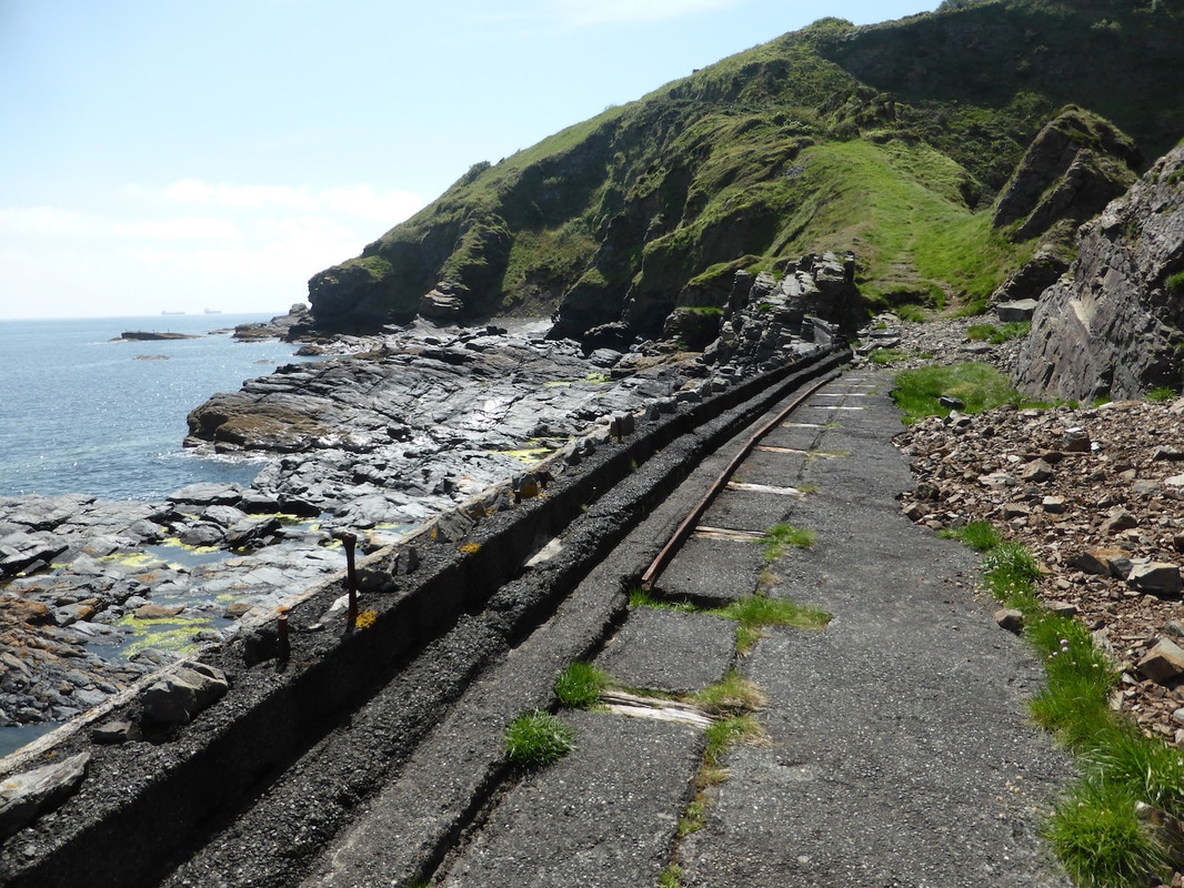
Portkerris Cove. Sea wall with trackbed and incline beyond. Copyright Peter Murnaghan

View down incline south of Porthkerris Cove. Copyright Peter Murnaghan
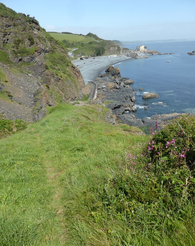
Portkerris Cove with quarry on left and the former torpedo station top right. Copyright Peter Murnaghan
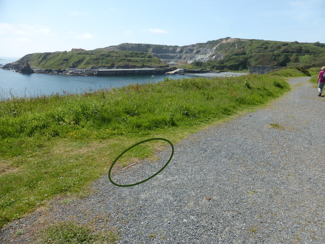
Porthoustock quarry in the distance with section of rail on the left of the path. Copyright Peter Murnaghan
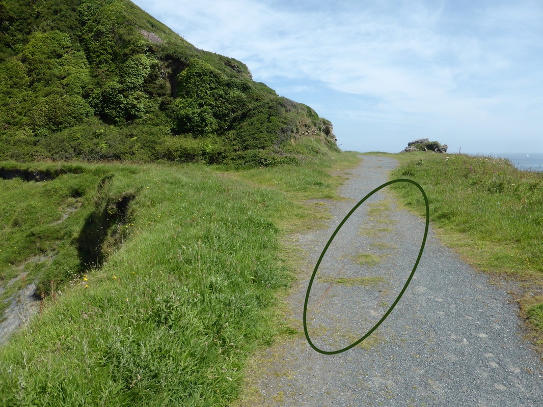
Surviving sections of rail in the path near Porthoustock. Copyright Peter Murnaghan
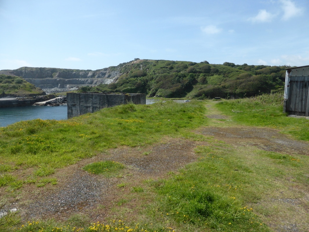
Old loading silo at Batty's Point, which was connected to the tramway in the foreground, by a trestle. Porthoustock quarry in the background was never connected. Copyright Peter Murnagan
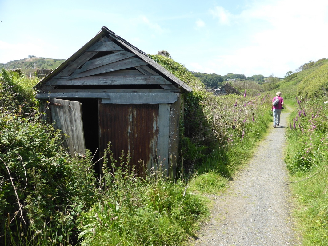
The rather dilapidated engine shed alongside Batty's Point. Copyright Peter Murnaghan
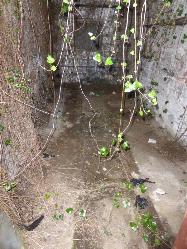
Inside the engine shed, the 2ft gauge rails remain, set in the concrete floor. Copyright Peter Murnaghan
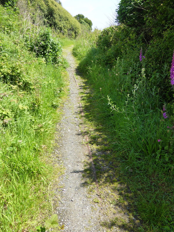
Beyond Batty's Point, the rails continue on the path for a short distance towards Porthoustock. Copyright Peter Murnaghan
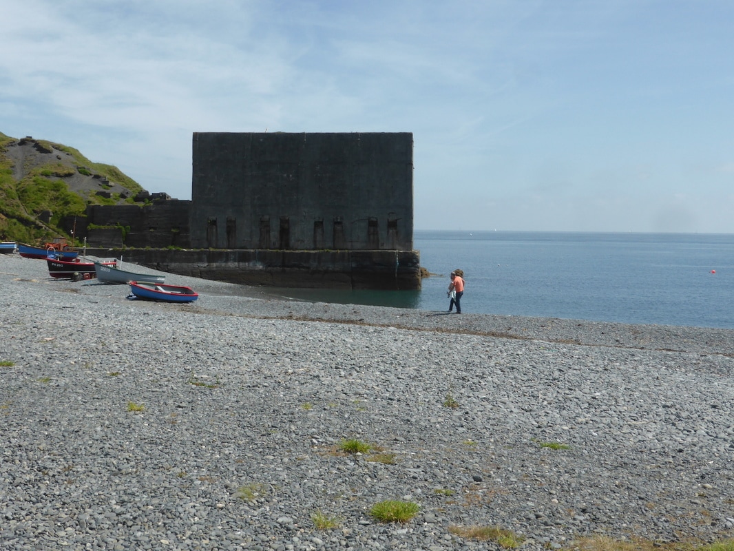
Batty's Point loading structure from Porthoustock beach, showing the 8 shutes. Copyright Peter Murnaghan
More on Porthoustock
Dear Keith, following on from Peter Murnaghan and his excellent article on the Quarries at Porthoustock, there is a very good article on Amalgamated Roadstone, who owned the quarries on the following link http://www.irsociety.co.uk/Archives/20/ARC.htm
Which includes a photograph of an operational locomotive at this site and some interesting facts on other local quarries.
Diane and I visited Porthoustock last week and a very interesting place it is.
Best wishes Andrew (Jones)
Rattlesbrook Peat Railway.
Part 1 by Andrew Jones
Part 1 by Andrew Jones
Andrew Jones writes:- I recently stayed at Lydford, and cycled the splendid Granite Trail to Okehampton.
Passing Bridestowe Station, the trail has been diverted slightly to the east of the exLSWR mainline, for a short distance, to give the present owners some privacy.
It appeared that an existing track had been used for this purpose and on further investigation, consulting an old ordnance survey map, I found the existence of a tramway leading from Bridestowe Station to a point some 7 miles distant at Kitty Tor and Amicombe Hill.
Please see attached map.
It transpires from some research, that the tramway was built for the Duchy of Cornwall in 1879 for the extraction of Naptha Oil from peat.
It was built to the standard gauge, although horse drawn for almost it entire life it served some kilns at Rattlebrook and involved a reversal near Corn Ridge.
During the 1920’s a petrol lorry was converted for use on railway and was used to dismantle the railway in 1932.
The railway is still traceable and makes an enjoyable and accessible walk to the heart of Dartmoor with relative safety and gentle gradients.
I have not been able to find any historic photographs of the line and wonder if society members know of the existence of any?
Best wishes Andrew

Rattlesbrook Peat Railway Pt 1 A. Andrew Junes Copyright Clix14a-Rattlebrook Peat Railway peat loading into a hudson v skip. Copyright not fully established.
Rattlesbrook Peat Railway.
Part 2 by Clive Smith
Part 2 by Clive Smith
Further to an article by Andrew Jones about this railway in the website's archive Military and Industrial Tramways and Light Railways archive. I'm currently on 'restricted working' with a broken ankle although still mobile and I've been perusing through some of my old walking photos where I walked part of the old railway in 2007 and dug around a bit to find out some further information which I have added . A small part of my piece duplicates Andrew's information but I have included that here for those unfamiliar with the railway or who may have not seen his article. The Border Collie in the pictures was my faithful Megan (good Cornish name) who accompanied me on many of my coastpath and moor walks. The standard gauge railway from Bridestowe down line siding on the London & South Western Railway to the peat works at Rattlebrook on Dartmoor is one of the lesser known railways on the moor. The line was built in 1879 and was seven miles long. In that distance it rose 1000 feet with cuttings, embankments, sidings, points and crossover loops. It was operated for almost all of its life by horse and had only one passing place, just over half way along the line from Bridestowe where the line reversed direction. At Rattlebrook there was an assortment of building and kilns for drying the peat which was brought from the cuttings by trucks run on a network of narrow gauge lines. At one time the operation employed around 100 men. Only in the final days of the railway was their any form of mechanisation when a petrol lorry was converted at Okehampton to run on rails. Its final job in 1932 was to remove all the metal as scrap from Rattlebrook and lift the rails. The peat works continued until 1955 with road vehicles using the track bed and it was blown up in 1961 as part of an army military exercise as the M.O.D. use this sector of Dartmoor for military firings. Andrew asks whether there are any historic photos of the railway. There is one photo of the Peat Works in the 1920s where the rails can be seen in this link here - https://dartmoorexplorations.co.uk/rattlebrook-head-peat-works/ Regards Clive Smith The above links above and below give access to excellent pictures and diagrams (HIGHLY RECOMMENDED).
Rattlesbrook Peat Railway Pt 2 A Walk in 2007.Copyright Clive Smith Including Megan.

Rattlesbrook Peat Railway Pt 2 B Walk in 2007. Megan rests on one of the bridges which had to be replaced. Copyright Clive Smith
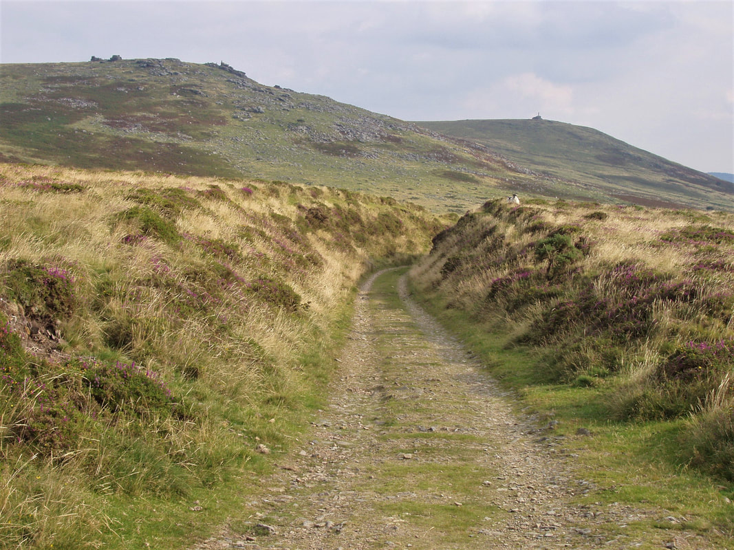
Rattlesbrook Peat Railway Pt 2 C Walk in 2007. Copyright Clive Smith
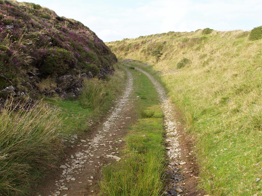
Rattlesbrook Peat Railway Pt 2 D Walk in 2007. Copyright Clive Smith
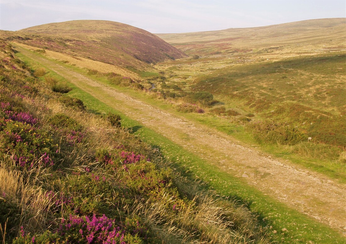
Rattlesbrook Peat Railway Pt 2 E Walk in 2007. Copyright Clive Smith
_______________________________________________________________________________________________________
Redruth & Chacewater
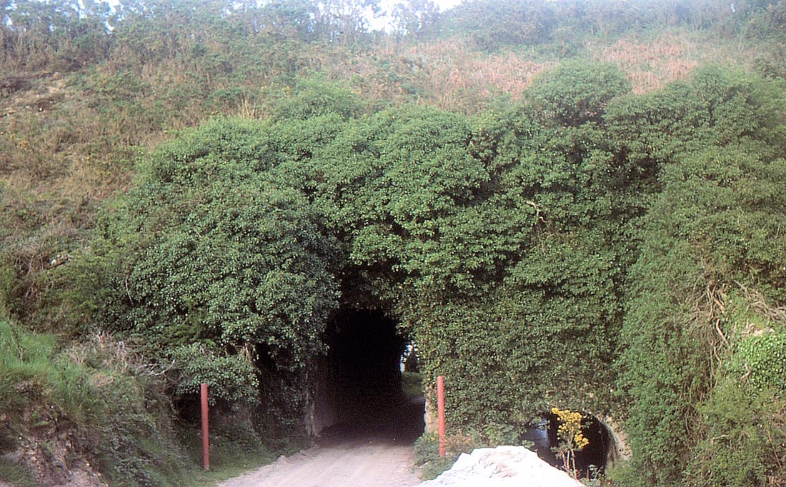
Hale Mills Embankment - Redruth and Chasewater Railway. This embankment was intended to provide access to the Wheal Busy area but rails were never laid on it. Copyright Mike Roach
Good Afternoon Keith
I did say that I would take some photographs of what remains of the Redruth and Chasewater Railway (1824-1915).
So, this afternoon, I’ve been out, close to home for starters, with my camera (well, it’s an iphone actually).
I have no intention of describing the history of the line, fascinating as it is, as this has been done admirably in the past by several people and in various publications.
Instead, I thought that I would try to photograph what remains today.
We start off looking along the trackbed just South West of Carharrack towards the village where there are two short sections of track laid out.
Behind us the line progressed towards the top of Lanner Hill with Ting Tang sidings, passing loop and water tank only about 250 yards distant.
I believe that local historian Eric Rabjohns was responsible for recreating this little memorial.
Redruth and Chasewater RailwayFrom Wikipedia, the free encyclopedia
Jump to navigationJump to search
Redruth and Chasewater RailwayOverview
HeadquartersDevoran
LocaleEngland, UK
Dates of operation1825–1915
SuccessorAbandoned
Technical
Track gauge4 ft (1,219 mm)
Length9 miles (14 km)The Redruth and Chasewater Railway, (otherwise called the Redruth and Chacewater Railway using modern spelling), was an early mineral railway line in Cornwall, England, UK. It opened in 1825 and was built to convey the output from copper mines in the Gwennap area to wharves on Restronguet Creek (off the Fal Estuary) around Devoran, and to bring in coal to fuel mine engines; later it carried timber for pit props and also house coal.
A little over 9 miles (14 km) long, it was built to a 4 ft (1,219 mm) narrow gauge and used horse traction at first, later using steam locomotives. Solely dependent on the economy of the mines it served, it prospered when they did, and when they declined, the railway declined too; it finally closed in 1915. It never carried passengers.
Much of its route can still be traced, and part of it forms the course of the Redruth and Chasewater Railway Trail, an outdoor leisure facility.
ContentsHistory[edit]Antecedents[edit]
System map of the Redruth & Chasewater RailwayPrior to the nineteenth century, much mineral extraction had taken place in the Cornish peninsula, but this had been limited by the non-existence of industrial methods; thus the depth to which shafts could be sunk, and at which water inundation overwhelmed the workings, and the cost of transporting extracted minerals to market, all proved limiting factors, and many mines were abandoned as exhausted using available methods. (Transport of minerals was chiefly done on the backs of mules.)
As the industrial revolution gathered pace, steam engine power became available to overcome these limitations, and new seams were developed at greater depths, and in some cases abandoned mines were re-opened. Moreover copper began to supersede tin as the dominant mineral for exploitation. Because the process of smelting copper required large quantities of coal – in the proportion of 18 to 1 – the copper ore was transported by sea to South Wales, where Swansea was dominant.
The focus, then, was on transporting copper and tin ore to a sea port for onward movement, and to bring in coal to fuel the increasing number of steam engines operating at the mines. In 1809 a privately owned tramway was constructed to connect the harbour at Portreath on the north coast, with mines around St Day and Scorrier; at first called the Portreath Tramway, with later extensions it became known as the Poldice Tramway. It was a horse-worked plateway and it was an immediate success financially. However it was in private ownership, as was the harbour at Portreath, and was not made available to the proprietors of competing mines.[1]
Consolidated Mines[edit]In 1819, the dynamic entrepreneur John Taylor took a lease on the dormant Consolidated Mines (usually referred to as Consols). These were a group of five mines that had been abandoned in 1811 and flooded, and Taylor installed two 90-inch pumping engines – then the largest of their kind in the world – and within a year opened a 1 mile (1.6 km) long copper lode, itself the largest in the world. Consols had become the prime copper mine in Cornwall, and remained so until 1840, gaining its shareholders huge capital gains.
The issue of transporting the extracted minerals to market had always been prominent, and canal and other schemes had been proposed but never implemented, and Taylor now promoted a railway to transport his mine's output to Point on Restronguet Creek. He obtained financial backing in London without any support from Cornish interests.[1]
The Railway gets its Act[edit]Notwithstanding obstruction from the Portreath interests, Taylor got his Act of Parliament on 17 June 1824, with a capital of £22,500, and authority to increase this by another £10,000 if necessary.[2] The railway was to be a toll operation, allowing any carrier to convey his vehicles on the line on payment of the toll, and the terms of the Act did not envisage actual train operation by the Company itself.
The Act specified the main line to be from Redruth to Point, with several branches, including one from Twelveheads to Chacewater. There were also to be improvements to the harbour at Narabo (near Devoran).[1][3] The route went via Carharrack and down the Carnon Valley, via Bissoe.[4]
Construction and opening[edit]Actual construction of the railway proceeded swiftly, being conducted by William Brunton, son of the Scottish inventor of the same name. Considerable earthworks were necessary in places – crossing the Carnon Valley in particular – in order to avoid excessive gradients, and there was a 600 feet vertical interval between the summit of the line and the wharves at Devoran. In fact there was a gradient of 1 in 35 falling from Lanner to Carharrack.
The track gauge was 4 ft (1,219 mm) this was commonly employed in South Wales, with which the engineering of the mines had close contact at that time, and edge rails were used: a considerable technical advance, and the first such use in Cornwall. (The Poldice and other tramways had used plateways, in which the plates are flanged and the wagon wheels are plain; in an edge rail system, the flanges are on the wheels of the vehicles.) The rails were wrought iron, carried in cast iron chairs supported on granite blocks.
As parts of the line were completed, hauliers were allowed to use them forthwith, and this took place from 1824; it was not until 30 January 1826 that the line was considered substantially complete (although the Chacewater branch had not been started, and in fact was never built) and an official opening took place, when some of the proprietors travelled from Wheal Buller to Devoran (by gravity) and then back to Redruth (pulled by a horse).
In 1827 extensions were constructed and opened; from Wheal Buller junction to Redruth itself, serving the Pen-an-Drea mine and the town itself, and an additional 1 mile (1.6 km) from Devoran to Point Quay.
Operation: first years[edit]Built as a horse-operated tramway, the early operations followed that model, with short groups of wagons hauled by horses. Although the line had been designed with a view to gravitational operation for loaded traffic towards Devoran, it appears that this was not done, and the wagons were hauled in both directions.
The line was single throughout, with numerous passing places. In the event of two "trains" meeting between passing places, the advantage was to be decided by lot.
Tonnages carried exceeded expectations, at over 58,000 tons annually and the company was financially very successful, with annual profits of over £2,000. Additional passing places were installed in 1831 and the wharves at Devoran were much extended.
Renewal of rails became necessary in 1831 – this on a railway with no locomotive traction – and considerable difficulty was experienced with displacement of the stone blocks, causing gauge widening problems.
Inwards traffic of coal steadily increased as the mines mechanised: by 1835 Consols and United mines had sixteen engines working, consuming 15,000 tons of coal annually.
First challenges[edit]In 1839, the West Cornwall Railway opened its lines, to Tresavean, near the mines served by the Redruth company, and to Portreath, giving improved access to that port, which gave easier access to Welsh ports as it lay on the north coast of Cornwall.
In the same year, Taylor's lease of the Consols mines came to an end; in the final months he extracted as much material as possible without the development work normally used to maintain future extraction, and when the new lessees took over, they found it impossible to maintain the volume of extraction that Taylor had achieved. This directly affected the railway's carryings and its profitability.
In 1840 profits fell by 20%, though with increased tonnages carried, reflecting the downward pressure of rates. In the following year, a severe winter led to great difficulties with displacement of the stone blocks, and with embankment subsidence, costing considerable expenditure on repairs.
In 1848 Thomas Hall was appointed engineer and superintendent of the railway for the next 20 years.
Locomotive operation[edit]By the early 1850s, trade in general was more buoyant, and the company decided to apply for parliamentary authority to build a branch line to Wheal Busy (a little over 2 miles (3.2 km) long). The junction was to be near Hale Mills, and the Act was obtained on 9 May 1853. (This line was never completed.)
The Act also permitted the use of locomotives. This necessitated the relaying of much of the track, and this was done with 50 lb per yard bullhead rails, re-using the original stone blocks. Two locomotives were acquired from Neilson & Co; they were named Miner and Smelter; they were 0-4-0 saddle tanks and they were delivered in November 1854. New larger capacity wagons were also acquired with a payload of over 4 tons. The new locomotives and wagons cost £5,565.
Although crude in appearance, the locomotives were successful operationally, being able to take 8 loaded wagons (50 tons gross) up to Wheal Fortune loop. However locomotive operation caused considerable friction with the existing horse hauliers, who operated the upper part of the line; in addition the weight of the locomotives caused subsidence problems in the weaker parts of the track.
In 1855 the Company made a loss, of £548. This was taken hard, although it was brought about by the considerable expenditure on one-off items (charged to current account) — the locomotives and rolling stock, the work on the Wheal Busy extension, and major repairs to the company's steam tug, kept at Devoran.
The locomotives were now regularly working up to Tingtang (west of the Consols); traffic was increasing markedly on the Wheal Buller branch (and declining on the Redruth main line) and the decision was taken to operate the locomotives to Wheal Buller, involving relaying the track, as soon as the traffic justified it. In fact this was done by 1857, and they took over operation of the whole line.
The locomotives were worked very hard and continuously, and in 1858 a decision was taken to acquire a third: in September 1859 Spitfire, an 0-6-0 saddle tank from Neilson started work. She usually operated the section above Nangiles loop, making four round trips daily, with the earlier locomotives feeding traffic up to her. The traffic was almost entirely coal upwards and copper ore downwards. Shunting on the quays at Devoran, and on the eastward extension to Point, was in the charge of horses.[1]
Decline of copper extraction[edit]By the late 1860s copper mining in the area was declining, and by 1870 it became a depression, when the Clifford Amalgamated Mines closed. This resulted in a disastrous loss of income, and decline continued. Catastrophe struck in the heavy winter of 1876–77 when the Great County Adit (a common drainage system formerly used by several deep mines) which had fallen into disrepair and become blocked, suddenly burst and caused the instant silting of Devoran Harbour, forcing vessels to discharge by tender.
It was plain that the company had no trading future, and on 18 July 1879 it passed into receivership, continuing to trade, however.
Miscellaneous[edit]Today the restored Count House of Old Wheal Buller Mine overlooks the trackbeds of two early and unrecorded sidings, and beyond, to the Buller branch of the railway).
Route[edit]Writing in 1831, Priestley said:
The main line of this railway commences at the extensive tin works on the east side of the town of Redruth, whence it takes a south-easterly course round the mountain of Cam Marth; thence north-easterly by Carrarath to Twelve Heads, whence it takes a south-eastward course by Nangiles and Carnon Gate to Point Quay, situate on an estuary branching out of Carreg Road. Its length is nine miles, two furlongs and four chains; in the first mile and seven chains of which, to Wheel [sic] Beauchamp, there is a rise of 103 feet; from thence to its termination it is one gradual inclination with a fall of 555 feet to high-water-mark. From Carnon Gate there is a branch to Narrabo of one mile one furlong; another branch from Nangiles to Wheel Fortune of three furlongs and five chains; another from Twelve Heads to Wheel Bissey, two miles, two furlongs and five chains in length; and another from Wheel Beauchamp to Wheel Buller, of two furlongs four chains in length. The total length of main line and branches is thirteen miles, three furlongs and eight chains.[2]
Reference Kidner [5]
Initially the railway company had not been carriers, and up to 1854 the line was worked throughout by horses, but in November 1854 two tank engines, Miner and Smelter were delivered and began working between Devoran and Carharrack, making the Redruth and Chasewater one of the first narrow gauge railways to introduce steam locomotives. They were delivered as 0-4-0ST's, but were rough riders due to excessive overhang at the rear, so were soon rebuilt as 0-4-2ST's. At this time the remainder of the railway was operated by the company's own horses. By 1859 traffic had increased to 90,000 tons annually leading to the acquisition of a third engine, Spitfire. Spitfire was named after an incident where Miner and Smelter working hard uphill would scatter cinders and sparks. As a result, a nearby thatched cottage was in danger. The company was persuaded to rebuild it at a safe distance from the line and replace the thatch with slates. The owner was a valued shareholder in the company. The acquisition of Spitfire enabled the whole line from Devoran to Redruth to be worked by steam except the final 1 1⁄2 miles (2.4 km) from Devoran to Point Quay which remained horse-worked until final closure.
Decline[edit]The railway workshops, like the offices, were located in Devoran, and Miner was substantially rebuilt here in 1869, but traffic began to decline as the copper mines closed and in 1879 a receiver was appointed. Smelter was relegated to the status of reserve engine; but lack of maintenance meant that the line deteriorated and derailments were common. Spitfire was rebuilt, but this was a disaster compared to that of Miner. A new firebox was ordered, it was slightly too big, and apparently the frames were forced apart to accommodate it, with subsequent wear on the rear springs and bearings.
The coming of the Great Western Railway eventually ended the R&C as the last major customer of the R&C, Basset Mines, switched to using the GWR. The R&C, in the following six months only carried around 6,500 tons of goods as opposed to some 22,000 for the previous year. The extension to Chacewater that gave the railway its name was never completed despite works starting in 1853. Closure of the line finally came on 25 September 1915 when Miner took the last train down to Devoran. The line was dismantled, locomotives, wagons and rails became scrap.
As the line depended on the mines, so did the port of Devoran rely on the railway, less than a year after its closure, the last commercial vessel called at Devoran.[1]
Locomotives[edit]NameBuilderTypeDateWorks numberNotes
MinerNeilsonbuilt as 0-4-0T altered to 0-4-2ST1854probably 81Rebuilt in 1869 as an 0-6-0ST
SmelterNeilsonbuilt as 0-4-0T altered to 0-4-2ST1854probably 82
SpitfireNeilson0-6-0ST1859540The three locomotives were very similar to look at, being described as "odd-looking". The boiler was surmounted by a square tank from which projected a tall chimney; the cabs were open with sides lower than the top of the tanks.
Ships[edit]In 1848, the company purchased the steam tug Sydney. On 6 March, she sprang a leak and sank at Falmouth.[6]
Today[edit]Most of the route of the railway is now followed by the Redruth and Chacewater Railway Trail [7][8] which links up with the Great Flat Lode Trail at Redruth.[4] It featured in the BBC TV programme "Railway Walks", first broadcast on BBC Four on 16 October 2008.[9]
References[edit]
Categories:
Jump to navigationJump to search
Redruth and Chasewater RailwayOverview
HeadquartersDevoran
LocaleEngland, UK
Dates of operation1825–1915
SuccessorAbandoned
Technical
Track gauge4 ft (1,219 mm)
Length9 miles (14 km)The Redruth and Chasewater Railway, (otherwise called the Redruth and Chacewater Railway using modern spelling), was an early mineral railway line in Cornwall, England, UK. It opened in 1825 and was built to convey the output from copper mines in the Gwennap area to wharves on Restronguet Creek (off the Fal Estuary) around Devoran, and to bring in coal to fuel mine engines; later it carried timber for pit props and also house coal.
A little over 9 miles (14 km) long, it was built to a 4 ft (1,219 mm) narrow gauge and used horse traction at first, later using steam locomotives. Solely dependent on the economy of the mines it served, it prospered when they did, and when they declined, the railway declined too; it finally closed in 1915. It never carried passengers.
Much of its route can still be traced, and part of it forms the course of the Redruth and Chasewater Railway Trail, an outdoor leisure facility.
ContentsHistory[edit]Antecedents[edit]
System map of the Redruth & Chasewater RailwayPrior to the nineteenth century, much mineral extraction had taken place in the Cornish peninsula, but this had been limited by the non-existence of industrial methods; thus the depth to which shafts could be sunk, and at which water inundation overwhelmed the workings, and the cost of transporting extracted minerals to market, all proved limiting factors, and many mines were abandoned as exhausted using available methods. (Transport of minerals was chiefly done on the backs of mules.)
As the industrial revolution gathered pace, steam engine power became available to overcome these limitations, and new seams were developed at greater depths, and in some cases abandoned mines were re-opened. Moreover copper began to supersede tin as the dominant mineral for exploitation. Because the process of smelting copper required large quantities of coal – in the proportion of 18 to 1 – the copper ore was transported by sea to South Wales, where Swansea was dominant.
The focus, then, was on transporting copper and tin ore to a sea port for onward movement, and to bring in coal to fuel the increasing number of steam engines operating at the mines. In 1809 a privately owned tramway was constructed to connect the harbour at Portreath on the north coast, with mines around St Day and Scorrier; at first called the Portreath Tramway, with later extensions it became known as the Poldice Tramway. It was a horse-worked plateway and it was an immediate success financially. However it was in private ownership, as was the harbour at Portreath, and was not made available to the proprietors of competing mines.[1]
Consolidated Mines[edit]In 1819, the dynamic entrepreneur John Taylor took a lease on the dormant Consolidated Mines (usually referred to as Consols). These were a group of five mines that had been abandoned in 1811 and flooded, and Taylor installed two 90-inch pumping engines – then the largest of their kind in the world – and within a year opened a 1 mile (1.6 km) long copper lode, itself the largest in the world. Consols had become the prime copper mine in Cornwall, and remained so until 1840, gaining its shareholders huge capital gains.
The issue of transporting the extracted minerals to market had always been prominent, and canal and other schemes had been proposed but never implemented, and Taylor now promoted a railway to transport his mine's output to Point on Restronguet Creek. He obtained financial backing in London without any support from Cornish interests.[1]
The Railway gets its Act[edit]Notwithstanding obstruction from the Portreath interests, Taylor got his Act of Parliament on 17 June 1824, with a capital of £22,500, and authority to increase this by another £10,000 if necessary.[2] The railway was to be a toll operation, allowing any carrier to convey his vehicles on the line on payment of the toll, and the terms of the Act did not envisage actual train operation by the Company itself.
The Act specified the main line to be from Redruth to Point, with several branches, including one from Twelveheads to Chacewater. There were also to be improvements to the harbour at Narabo (near Devoran).[1][3] The route went via Carharrack and down the Carnon Valley, via Bissoe.[4]
Construction and opening[edit]Actual construction of the railway proceeded swiftly, being conducted by William Brunton, son of the Scottish inventor of the same name. Considerable earthworks were necessary in places – crossing the Carnon Valley in particular – in order to avoid excessive gradients, and there was a 600 feet vertical interval between the summit of the line and the wharves at Devoran. In fact there was a gradient of 1 in 35 falling from Lanner to Carharrack.
The track gauge was 4 ft (1,219 mm) this was commonly employed in South Wales, with which the engineering of the mines had close contact at that time, and edge rails were used: a considerable technical advance, and the first such use in Cornwall. (The Poldice and other tramways had used plateways, in which the plates are flanged and the wagon wheels are plain; in an edge rail system, the flanges are on the wheels of the vehicles.) The rails were wrought iron, carried in cast iron chairs supported on granite blocks.
As parts of the line were completed, hauliers were allowed to use them forthwith, and this took place from 1824; it was not until 30 January 1826 that the line was considered substantially complete (although the Chacewater branch had not been started, and in fact was never built) and an official opening took place, when some of the proprietors travelled from Wheal Buller to Devoran (by gravity) and then back to Redruth (pulled by a horse).
In 1827 extensions were constructed and opened; from Wheal Buller junction to Redruth itself, serving the Pen-an-Drea mine and the town itself, and an additional 1 mile (1.6 km) from Devoran to Point Quay.
Operation: first years[edit]Built as a horse-operated tramway, the early operations followed that model, with short groups of wagons hauled by horses. Although the line had been designed with a view to gravitational operation for loaded traffic towards Devoran, it appears that this was not done, and the wagons were hauled in both directions.
The line was single throughout, with numerous passing places. In the event of two "trains" meeting between passing places, the advantage was to be decided by lot.
Tonnages carried exceeded expectations, at over 58,000 tons annually and the company was financially very successful, with annual profits of over £2,000. Additional passing places were installed in 1831 and the wharves at Devoran were much extended.
Renewal of rails became necessary in 1831 – this on a railway with no locomotive traction – and considerable difficulty was experienced with displacement of the stone blocks, causing gauge widening problems.
Inwards traffic of coal steadily increased as the mines mechanised: by 1835 Consols and United mines had sixteen engines working, consuming 15,000 tons of coal annually.
First challenges[edit]In 1839, the West Cornwall Railway opened its lines, to Tresavean, near the mines served by the Redruth company, and to Portreath, giving improved access to that port, which gave easier access to Welsh ports as it lay on the north coast of Cornwall.
In the same year, Taylor's lease of the Consols mines came to an end; in the final months he extracted as much material as possible without the development work normally used to maintain future extraction, and when the new lessees took over, they found it impossible to maintain the volume of extraction that Taylor had achieved. This directly affected the railway's carryings and its profitability.
In 1840 profits fell by 20%, though with increased tonnages carried, reflecting the downward pressure of rates. In the following year, a severe winter led to great difficulties with displacement of the stone blocks, and with embankment subsidence, costing considerable expenditure on repairs.
In 1848 Thomas Hall was appointed engineer and superintendent of the railway for the next 20 years.
Locomotive operation[edit]By the early 1850s, trade in general was more buoyant, and the company decided to apply for parliamentary authority to build a branch line to Wheal Busy (a little over 2 miles (3.2 km) long). The junction was to be near Hale Mills, and the Act was obtained on 9 May 1853. (This line was never completed.)
The Act also permitted the use of locomotives. This necessitated the relaying of much of the track, and this was done with 50 lb per yard bullhead rails, re-using the original stone blocks. Two locomotives were acquired from Neilson & Co; they were named Miner and Smelter; they were 0-4-0 saddle tanks and they were delivered in November 1854. New larger capacity wagons were also acquired with a payload of over 4 tons. The new locomotives and wagons cost £5,565.
Although crude in appearance, the locomotives were successful operationally, being able to take 8 loaded wagons (50 tons gross) up to Wheal Fortune loop. However locomotive operation caused considerable friction with the existing horse hauliers, who operated the upper part of the line; in addition the weight of the locomotives caused subsidence problems in the weaker parts of the track.
In 1855 the Company made a loss, of £548. This was taken hard, although it was brought about by the considerable expenditure on one-off items (charged to current account) — the locomotives and rolling stock, the work on the Wheal Busy extension, and major repairs to the company's steam tug, kept at Devoran.
The locomotives were now regularly working up to Tingtang (west of the Consols); traffic was increasing markedly on the Wheal Buller branch (and declining on the Redruth main line) and the decision was taken to operate the locomotives to Wheal Buller, involving relaying the track, as soon as the traffic justified it. In fact this was done by 1857, and they took over operation of the whole line.
The locomotives were worked very hard and continuously, and in 1858 a decision was taken to acquire a third: in September 1859 Spitfire, an 0-6-0 saddle tank from Neilson started work. She usually operated the section above Nangiles loop, making four round trips daily, with the earlier locomotives feeding traffic up to her. The traffic was almost entirely coal upwards and copper ore downwards. Shunting on the quays at Devoran, and on the eastward extension to Point, was in the charge of horses.[1]
Decline of copper extraction[edit]By the late 1860s copper mining in the area was declining, and by 1870 it became a depression, when the Clifford Amalgamated Mines closed. This resulted in a disastrous loss of income, and decline continued. Catastrophe struck in the heavy winter of 1876–77 when the Great County Adit (a common drainage system formerly used by several deep mines) which had fallen into disrepair and become blocked, suddenly burst and caused the instant silting of Devoran Harbour, forcing vessels to discharge by tender.
It was plain that the company had no trading future, and on 18 July 1879 it passed into receivership, continuing to trade, however.
Miscellaneous[edit]Today the restored Count House of Old Wheal Buller Mine overlooks the trackbeds of two early and unrecorded sidings, and beyond, to the Buller branch of the railway).
Route[edit]Writing in 1831, Priestley said:
The main line of this railway commences at the extensive tin works on the east side of the town of Redruth, whence it takes a south-easterly course round the mountain of Cam Marth; thence north-easterly by Carrarath to Twelve Heads, whence it takes a south-eastward course by Nangiles and Carnon Gate to Point Quay, situate on an estuary branching out of Carreg Road. Its length is nine miles, two furlongs and four chains; in the first mile and seven chains of which, to Wheel [sic] Beauchamp, there is a rise of 103 feet; from thence to its termination it is one gradual inclination with a fall of 555 feet to high-water-mark. From Carnon Gate there is a branch to Narrabo of one mile one furlong; another branch from Nangiles to Wheel Fortune of three furlongs and five chains; another from Twelve Heads to Wheel Bissey, two miles, two furlongs and five chains in length; and another from Wheel Beauchamp to Wheel Buller, of two furlongs four chains in length. The total length of main line and branches is thirteen miles, three furlongs and eight chains.[2]
Reference Kidner [5]
- Redruth (Gwennap pit) 0m
- Lanner 1½m
- branch to Wheal Bassett mine
- Carharrack 3m
- Hale Mills
- uncompleted branch to Chacewater
- Bissoe 6m
- Devoran 8m
- Penpol 9m
Initially the railway company had not been carriers, and up to 1854 the line was worked throughout by horses, but in November 1854 two tank engines, Miner and Smelter were delivered and began working between Devoran and Carharrack, making the Redruth and Chasewater one of the first narrow gauge railways to introduce steam locomotives. They were delivered as 0-4-0ST's, but were rough riders due to excessive overhang at the rear, so were soon rebuilt as 0-4-2ST's. At this time the remainder of the railway was operated by the company's own horses. By 1859 traffic had increased to 90,000 tons annually leading to the acquisition of a third engine, Spitfire. Spitfire was named after an incident where Miner and Smelter working hard uphill would scatter cinders and sparks. As a result, a nearby thatched cottage was in danger. The company was persuaded to rebuild it at a safe distance from the line and replace the thatch with slates. The owner was a valued shareholder in the company. The acquisition of Spitfire enabled the whole line from Devoran to Redruth to be worked by steam except the final 1 1⁄2 miles (2.4 km) from Devoran to Point Quay which remained horse-worked until final closure.
Decline[edit]The railway workshops, like the offices, were located in Devoran, and Miner was substantially rebuilt here in 1869, but traffic began to decline as the copper mines closed and in 1879 a receiver was appointed. Smelter was relegated to the status of reserve engine; but lack of maintenance meant that the line deteriorated and derailments were common. Spitfire was rebuilt, but this was a disaster compared to that of Miner. A new firebox was ordered, it was slightly too big, and apparently the frames were forced apart to accommodate it, with subsequent wear on the rear springs and bearings.
The coming of the Great Western Railway eventually ended the R&C as the last major customer of the R&C, Basset Mines, switched to using the GWR. The R&C, in the following six months only carried around 6,500 tons of goods as opposed to some 22,000 for the previous year. The extension to Chacewater that gave the railway its name was never completed despite works starting in 1853. Closure of the line finally came on 25 September 1915 when Miner took the last train down to Devoran. The line was dismantled, locomotives, wagons and rails became scrap.
As the line depended on the mines, so did the port of Devoran rely on the railway, less than a year after its closure, the last commercial vessel called at Devoran.[1]
Locomotives[edit]NameBuilderTypeDateWorks numberNotes
MinerNeilsonbuilt as 0-4-0T altered to 0-4-2ST1854probably 81Rebuilt in 1869 as an 0-6-0ST
SmelterNeilsonbuilt as 0-4-0T altered to 0-4-2ST1854probably 82
SpitfireNeilson0-6-0ST1859540The three locomotives were very similar to look at, being described as "odd-looking". The boiler was surmounted by a square tank from which projected a tall chimney; the cabs were open with sides lower than the top of the tanks.
Ships[edit]In 1848, the company purchased the steam tug Sydney. On 6 March, she sprang a leak and sank at Falmouth.[6]
Today[edit]Most of the route of the railway is now followed by the Redruth and Chacewater Railway Trail [7][8] which links up with the Great Flat Lode Trail at Redruth.[4] It featured in the BBC TV programme "Railway Walks", first broadcast on BBC Four on 16 October 2008.[9]
References[edit]
- ^ Jump up to:a b c d e The Redruth and Chasewater Railway, 1824 - 1915, D B Barton, D Bradford Barton Ltd, Truro, 2nd edition, 1966
- ^ Jump up to:a b Joseph Priestley, A Historical Account of the Navigable Rivers, Canals, and Railways, of Great Britain, Longman, Rees Orme, Brown and Green, London, 1831
- ^ Hamilton Jenkin, A. K. (1972). The Cornish Miner (4th ed.). Newton Abbot: David and Charles. p. 173. ISBN 0-7153-5486-8. (citing Plymouth Institute (1887–90), 90, etc.)
- ^ Jump up to:a b Hancock, Peter (2008). The Mining Heritage of Cornwall and West Devon. Wellington, Somerset: Halsgrove. p. 66. ISBN 978-1-84114-753-6.
- ^ Kidner, R.W. (1938). Mineral Railways. The Oakwood Press.
- ^ "Falmouth Express". The Cornwall Royak Gazette, Falmouth Packet and Plymouth Journal (2333). Truro. 10 March 1848.
- ^ http://kingedwardmine.co.uk/about-us/mineral-tramways/
- ^ http://www.oliverscornwall.co.uk/mineraltramways.html#Chacewater
- ^ "Railway Walks, The Birth of Steam". BBC Four. Retrieved 2 July 2009.
- Fairclough, Tony (1970). The Story of Cornwall's Railways. Truro: Tor Mark Press.
- [1] The History of the Count House of Old Wheal Buller mine which overlooks the Buller branch of the Redruth and Chasewater Railway.
Categories:
- 4 ft gauge railways in England
- Early British railway companies
- Industrial railways in England
- Pre-grouping British railway companies
- Rail transport in Cornwall
- Railway companies established in 1824
- Railway lines opened in 1826
- Railway companies disestablished in 1915
- Horse-drawn railways
- 1824 establishments in England
- British companies established in 1824
- Not logged in
- Talk
- Contributions
- Create account
- Log in
- What links here
- Related changes
- Special pages
- Permanent link
- Page information
- Cite this page
- Wikidata item
- This page was last edited on 10 October 2020, at 22:41 (UTC).
- Text is available under the Creative Commons Attribution-ShareAlike License; additional terms may apply. By using this site, you agree to the Terms of Use and Privacy Policy. Wikipedia® is a registered trademark of the Wikimedia Foundation, Inc., a non-profit organization.
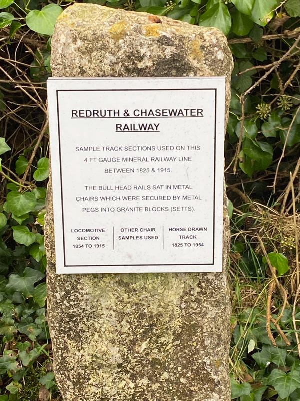
The description board at Eric Rabjohn's track display at Carharrack. 14th October 2020. Copyright Martin Scane.
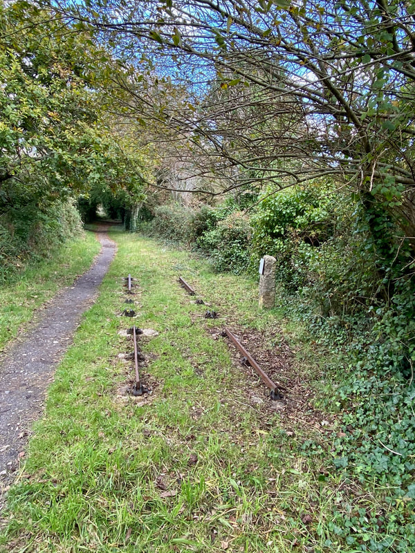
Redruth and Chacewater Railway display showing two kinds of rails at Carharrack. The heavier 'locomotive grade' track is at the far end. 14th October 2020. Copyright Martin Scane
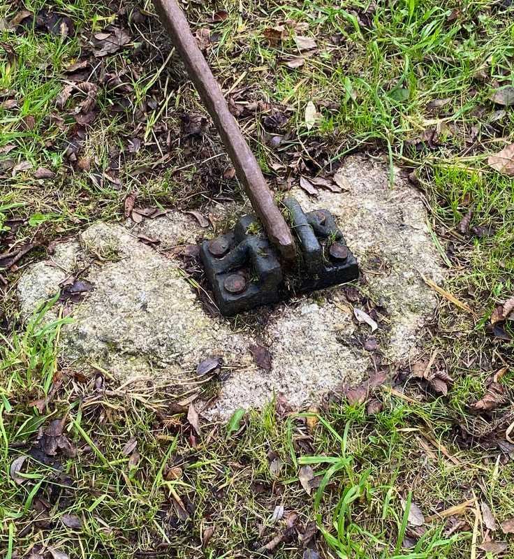
Redruth and Chacewater Close up of railway chair at Carharrack. 14th October 2020. Copyright Martin Scane
Recommended Reading - book by Eric Rabjohns.
Obtainable from the Trevithick Society.
Obtainable from the Trevithick Society.
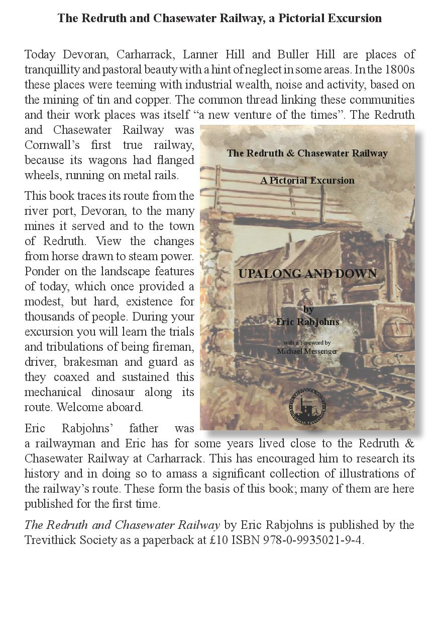
Redruth and Chacewater Recreated at Redruth
Out for a walk yesterday morning 17th February 2021 and walking along South Trefusis Road Redruth and looking over the hedge towards distant Carn Brea I was most pleasantly surprised to see about twenty yards of brand new railway. Below is what I saw, but firstly a couple of maps to give some idea of the location
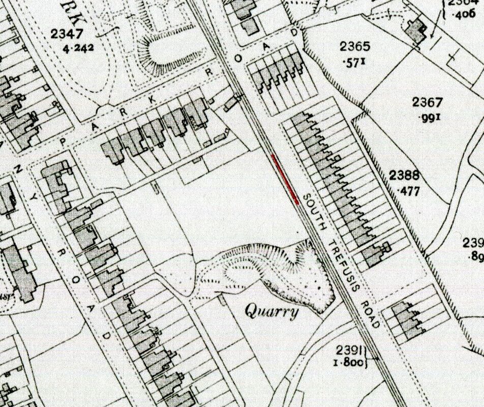
A Redruth map of the 1950's. Courtesy of the National Museum of Scotland - non commercial use.The GW main line crosses from the left and after passing through Redruth station continues on towards Truro. Clearly seen in this view are the junctions off the main line towards Tresavean leaving the view bottom centre left. The other sort branch off the main line leads to Redruth, Hayle railway station. Of greatest interest in the case is the 4' gauge Redruth and Chacewater Railway coming in from Devoran bottom right and proceeding to the R & C Redruth terminus.

An enlargement taken from the Redruth map above showing the R & C railway track running alongside the hedge of SouthTrefusis Rad. The section which has been re-created is shown faintly marked in red. The area once covered with mine waste and occupied by a quarry has been landscaped to form a pleasant recreational area.
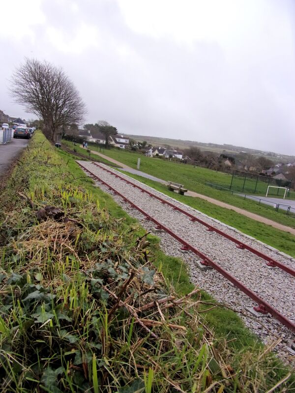
The view over the hedge from South Trefusis Road. With the wind blown tree in the background one can well imagine a steam loco plodding along here with the smoke being blown towards the buildings. 17th February 2021. Copyright Keith Jenkin.
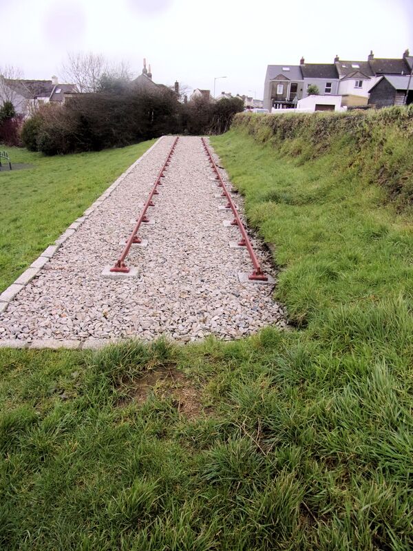
A view looking towards the terminus. 17th Fbruary 2021. Copyright Keith Jenkin.
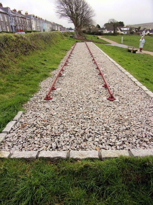
Aview looking towards Devoran with Trefusis Terrace on the left. 17th February 2021. Copyright Keith Jenkin. N.B. A pity the granite boundary wasn't continued all the way around.
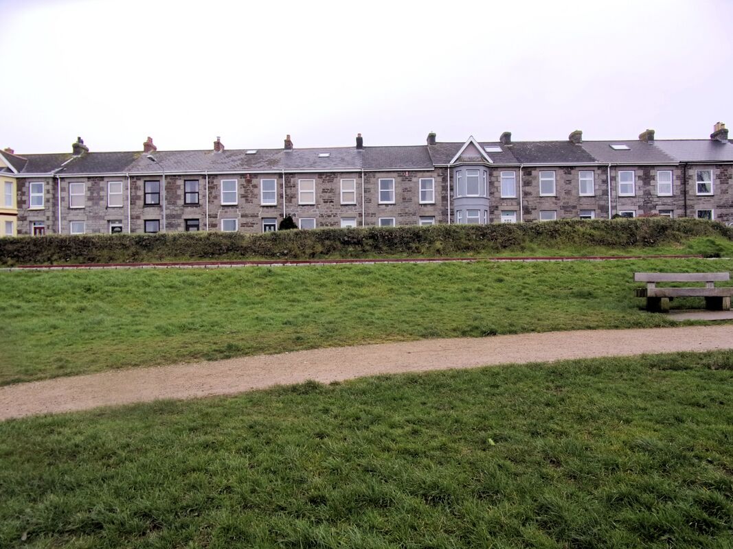
A View of South Trefusis Road. The reconstructed R & C track can just be seen. 17th February 2021. Copyright Keith Jenkin.
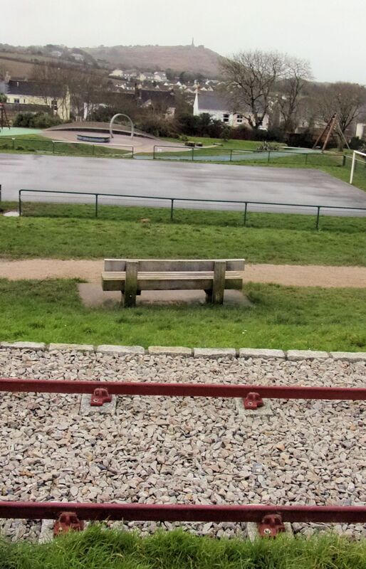
And finally a view over the hedge showing the track and a park bench from which a fine vista can be seen including Carn Brea. 17th February 2021. Copyright Keith Jenkin.
Martin Scane takes a look at the Redruth and Chacewater Railway in Aug 2022.
The former Redruth and Chacewater Railways workshop now beautifully restored as the village hall. 25th August 2022. Copyright Martin Scane
Redruth and Chasewater plaque. 25th August 2022 Copyright Martin Scane
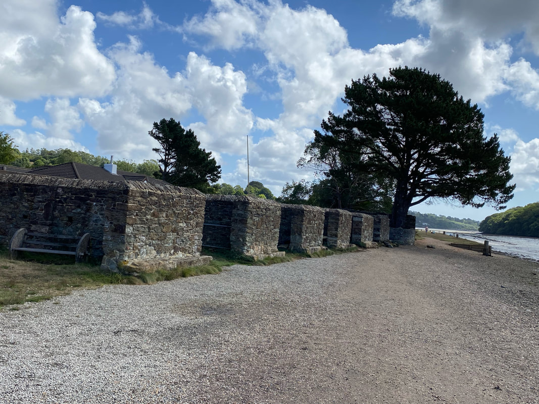
Hutches on the quay at Devoran. 25th August 2022. Copyright Martin Scane
Many thanks Martin.
Redruth and Chacewater Railway
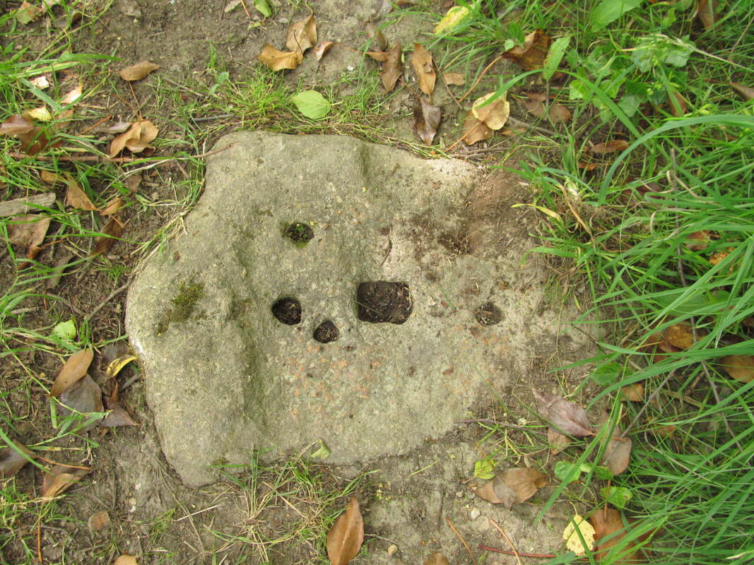
A granite sleeper block on the Redruth & Chasewater railway near Bissoe 30th July 2023. Copyright Peter Flanagan
Rowtor Military Railway
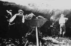 Rattlebrook Peat railway. Peat loading into a Hudson V skip. Copyright not fully established
Andrew Jones writes - Well today I have been exploring a part of Dartmoor, which has proved extremely interesting, from the railway perspective.
For a while, I have been aware of an intact military railway, near Okehampton, so with stout walking shoes, maps and of course, Google Earth, off I went, noting the weather was fine and no risk of mist!
The Row Tor military target railway, is possibly known to the members of the Cornwall Railway Society, but I couldn’t find mention of it on your wonderful website, so I have set about trying to piece a few photographs and some history, which your members could add to or verify.
Finding the railway, proved initially difficult, it is not marked on my ageing ordnance survey map ( so old in fact, that the railway was still shown as open to Halwill and Tavistock!)
Eventually after walking four miles in the wrong direction, I luckily met a dog walker, who was able to correct my terrible map reading and pointed me in the right direction.
The first clue that I was nearby, came when I stumbled over four wooden gun emplacements, but still no railway.
In the distance I noticed a long embankment and a stone mound. Now I was told by the dog walker not to pick anything up whilst on the firing range and I did note some rather military looking objects in the heather, so ignoring them I pressed on, for about half a mile. On reaching the embankment, I hit gold for there was the railway, stretching out in front of me, fully intact.
From the pictures you will see that the embankment, is in fact protecting the railway from gun fire. Their were four sets of points, the rails I judge were 2 foot or 600mm apart and laid on a mixture of metal and wooden sleepers.
The railway has a loop at each end allowing for continuous running.
A building at the west end, heavily fortified, had contained two Wickham Type R1389 Target Trolleys, powered by a twin cylinder J Arthur Prestwick aircooled engine, one of which, No 3236, from my search, had been removed for preservation on the 9th September 2010.
Recently there had been a TV item which mentioned that the other Wickman Trolley had also been removed.
I believe as recently as 2005/6 the railway had been operational, but can find little information on this, hopefully your members can fill in some gaps.
Over the coming days I will sort out some more pictures and anymore information that I can dig out.
You can find it on a Google Earth at Lat 50.702201 Lon -3.992943
See also Wikipedia http hen.wikipedia.org/wiki/Rowtor_Target_Railway
See also Wikipedia http hen.wikipedia.org/wiki/Rowtor_Target_Railway
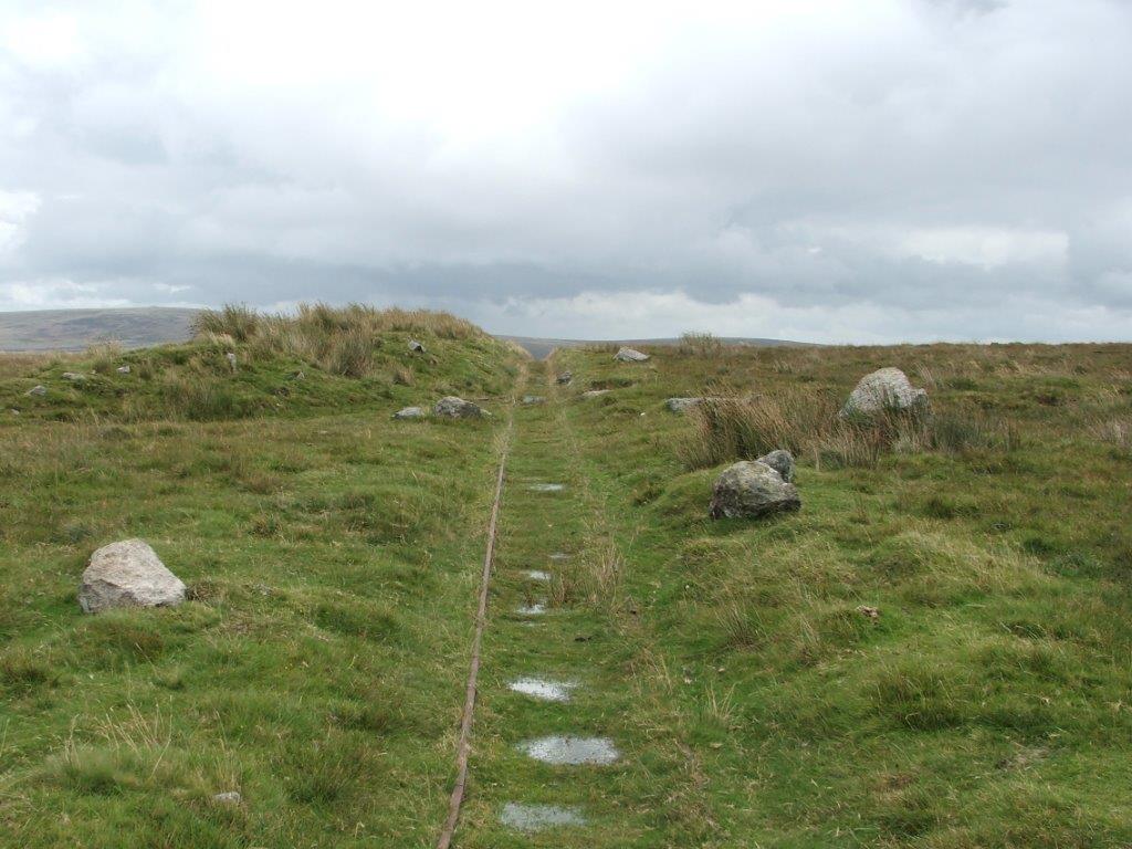
Rowtor 1 Target Railway Embankment protecting the long straight looking east 17th August 2017 Copyright Andrew Jones
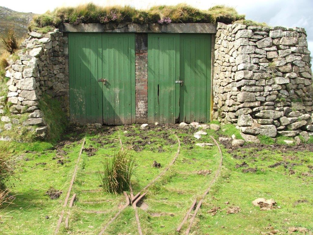
Rowtor 2 Target Railway Engine Shed, West End of the railway 17th August 2017 Copyright Andrew Jones
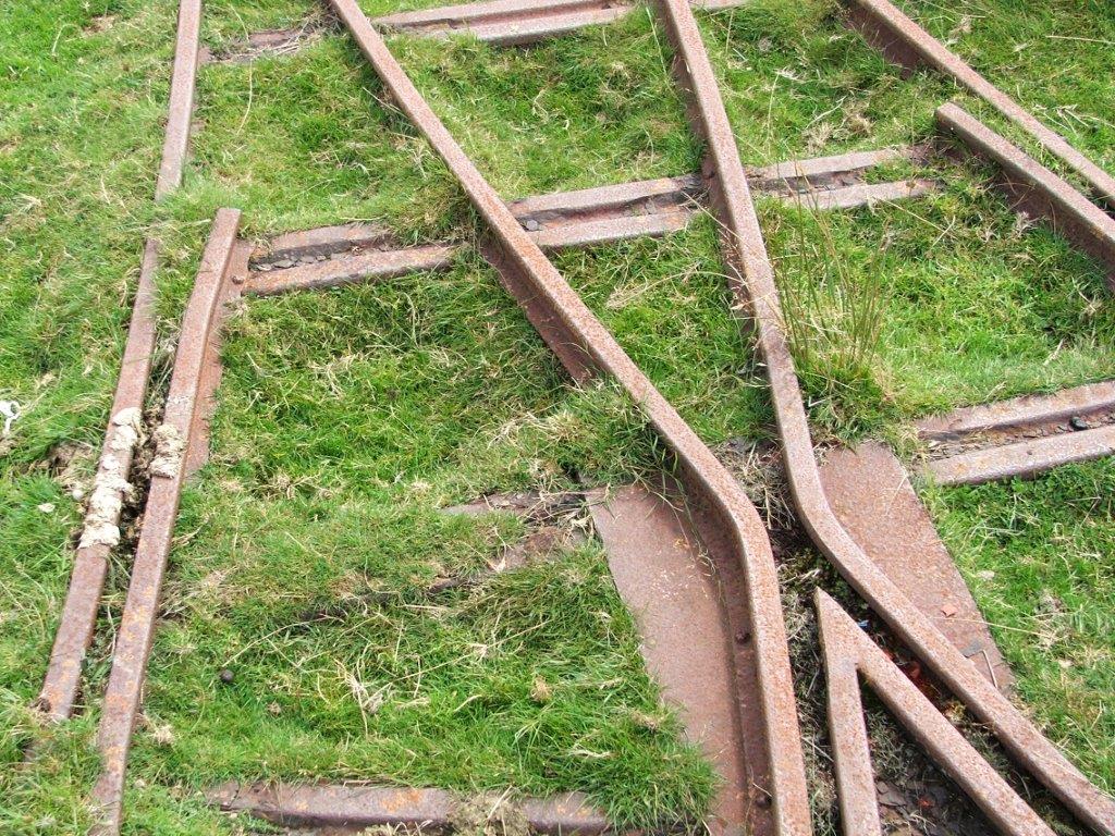
Rowtor 3 Target Railway Points adjacent to the engine shed showing metal sleepers 17th August 2017 Copyright Andrew Jones
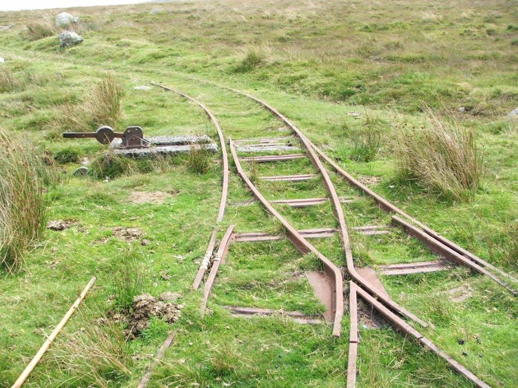
Rowtor 4 Target Railway Embankment Points to the engine shed and first loop. 17th August 2017 Copyright Andrew Jones
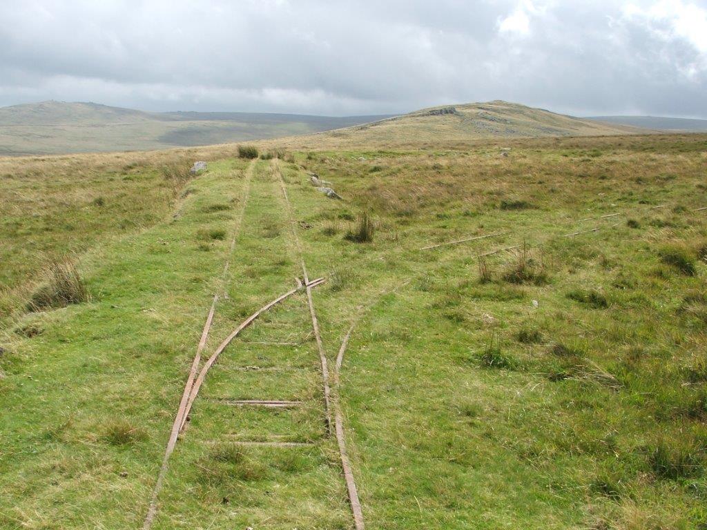
South Crofty to Robinsons Shaft Mineral Tramway
Tuckingmill, Camborne.
Tuckingmill, Camborne.
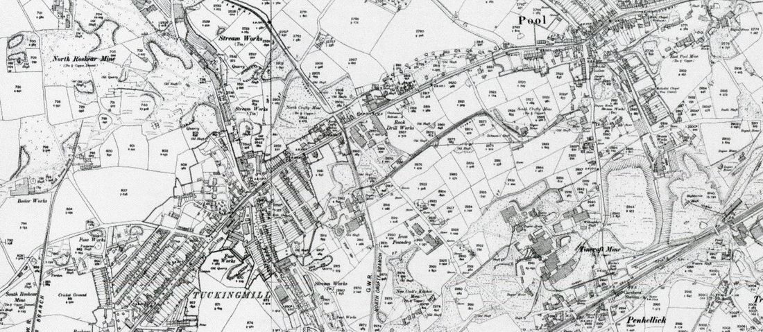
The route of the 2' gauge tramway can clearly be seen in the centre of this map from Robinsons Shaft on the right and then climbing to cross the road to the processiing plant at New Cooks Kitchen shaft, South Crofty. Other points of interest on this map are bottom right, Carn Brea station and yards. Slightly to the left of this the North Crofty branch line passes through the workings of Tincroft Mine and heads for South Crofty. This continued northwards past South Crofty and crossed the the metals of the Camborne - Redruth Tramway at the top of east hill. The metals of the mineral section of the Camborne - Redruth Tramway can be seen heading towards Tolvaddon stamps at the top of this map. Also to the left hand side the metals of the Roskear branch can be seen heading for Holmans Boiler Works. Map 25 inch of c 1905 is with permission of the National Library of Scotland.
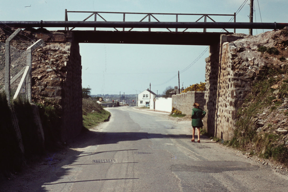
The bridge viewed from below looking towards the road junction at the top of East Hill. Tuckingmill. 27th April 1975 Copyright Roger Winnen
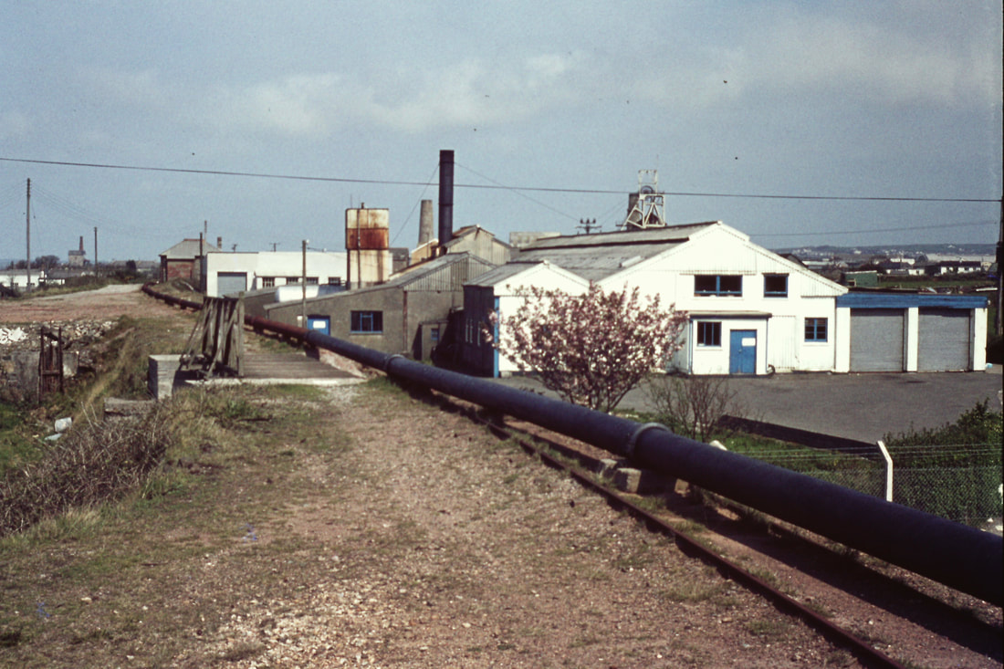
Roger and I scrambled up onto the embankment and found the trackbed of the railway which served South Crofty mine crossing the bridge. Notice the rail still in situ under the pipe line. In the distance can be seen the headgear of Robinsons shaft - that area is now known as Heartlands. The white buildings close by to the right are the premises of Cornish Linen. 27th April 1975. All traces of this bridge and line have been removed. Copyright Roger Winnen
Torquay Tramways
This smart poster photographed by Roger Winnen on 11th December 2013 outside Torre station reminds us that once the area had an extensive 9.4 mile tramway. Laying of the tracks started outside Torre station on 23rd October 1905. Later the trams ran as far as Paignton station and served the whole of the tourist area. The original system used 'dolter studs' laid in the road surface which became live as a tram passed over them. However, as the studs did not always become dead after the tram had passed the overhead method of current collection was later used. Picture 11th December 2013. Copyright.
Tregantle Military Railway
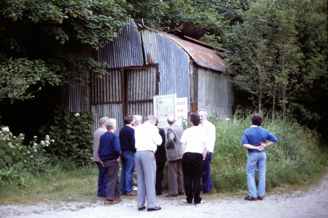
Taken on a CRS visit to Tregantle Military Rly on 6th June 1992 at Wacker Quay 920606g Copyright Roger Winnen (The late Peter Moore is standing alone on the right of this picture)
Very interesting Papers by Bruce Hunt.
We are most grateful to David Critchlow for drawing our attention to four very detailed and most interesting papers written by Bruce Hunt.
These papers are accessed by one link and cover four items of great interest to students of Cornish Railways.
The four items covered are :-
1) The proposed short cut to Looe.
2) Railmotor number 93 on the Looe branch.
3) The Tregantle Military Railway. (Very detailed and deserving of a 'good read'.)
4) The Cornubian Railtour. (3rd May I964)
To locate these papers please click on the following link.
http://brucehunt.co.uk/south%20east%20cornwall/tregantle%20military%20railway.html
Our sincere appreciation to Bruce Hunt for putting the results of his considerable research on the web.
Please note. Clicking on the link above will give access to a very detailed paper on the Tregangle Military Railway by Bruce Hunt.
Many years ago Messrs Roger Winnen, the late Peter Moore and myself decided, for want of something better to do to walk the Newham Branch. Not satisfied with this we caught a train to Plymouth, then a bus to Torpoint where we crossed the Tamar by Ferry. From here we took a taxi to Scraesdon Fort. Once here we explored the fort entering via an open door - this was all new stuff to us! From there we made our way down the very overgrown incline which passed under the A38 - the route under the bridge was blocked but on crossing the main road we regained the trackbed and battled through the undergrowth to the foreshore. Bearing left we arrived at Wacker Quay where the loco shed stood as can be seen in the picture above. St Germans didn't seem all that far away so we started walking the bank of the river - it was quite some way before we were able to cross the stream and walk the considerable way back on the opposite bank to St Germans station.
Not being athletes the nineteen miles we covered on foot that day left us rather wacked!! KJ
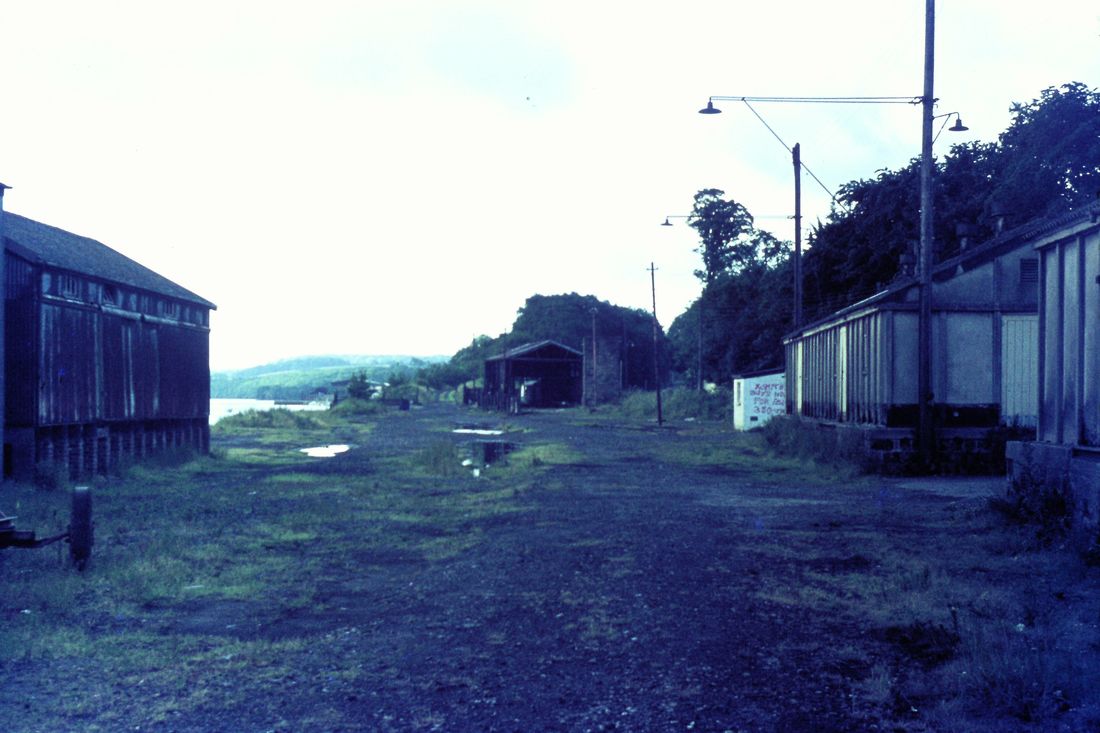
The Newham branch terminus alongside the Truro river - the start of our walking expedition. 30th June 1972 Copyright Roger Winnen
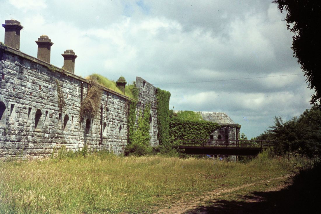
Where the taxi from Torpoint dropped us. The entrance to the fort is across the bridge. 30th June 1973. Copyright Roger Winnen
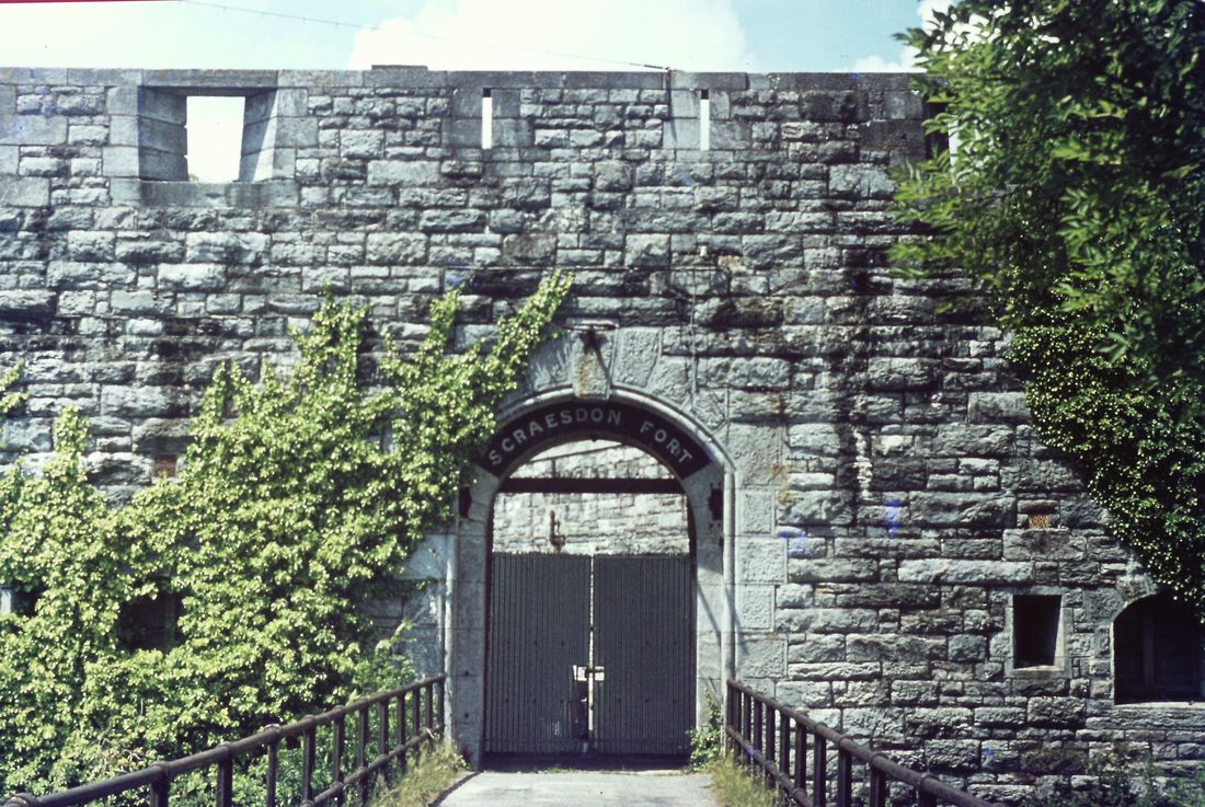
Scraesdon Fort. The gates to the Fort could be pushed open. 30th June 1973 Copyright Roger Winnen
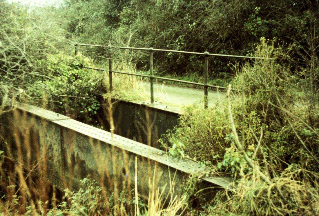
Another view of the bridge at the entrance to the fort. 30th June 1973. Copyright Roger Winnen.
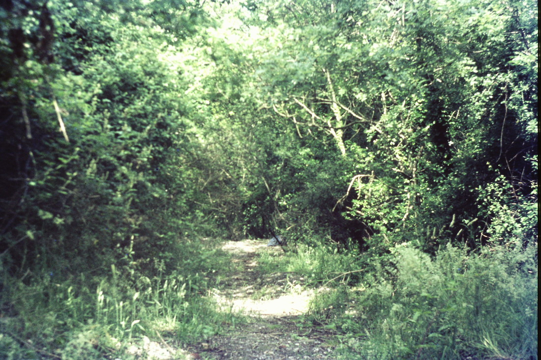
The incline of the railway. 30th June 1973 Copyright Roger Winnen
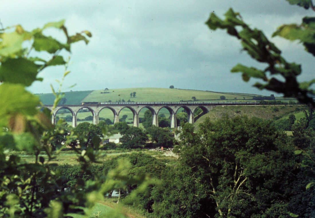
It may not look close but it wasn't ! A western with ten coaches crossing St Germans viaduct. 30th June 1973. Copyright Roger Winnen.
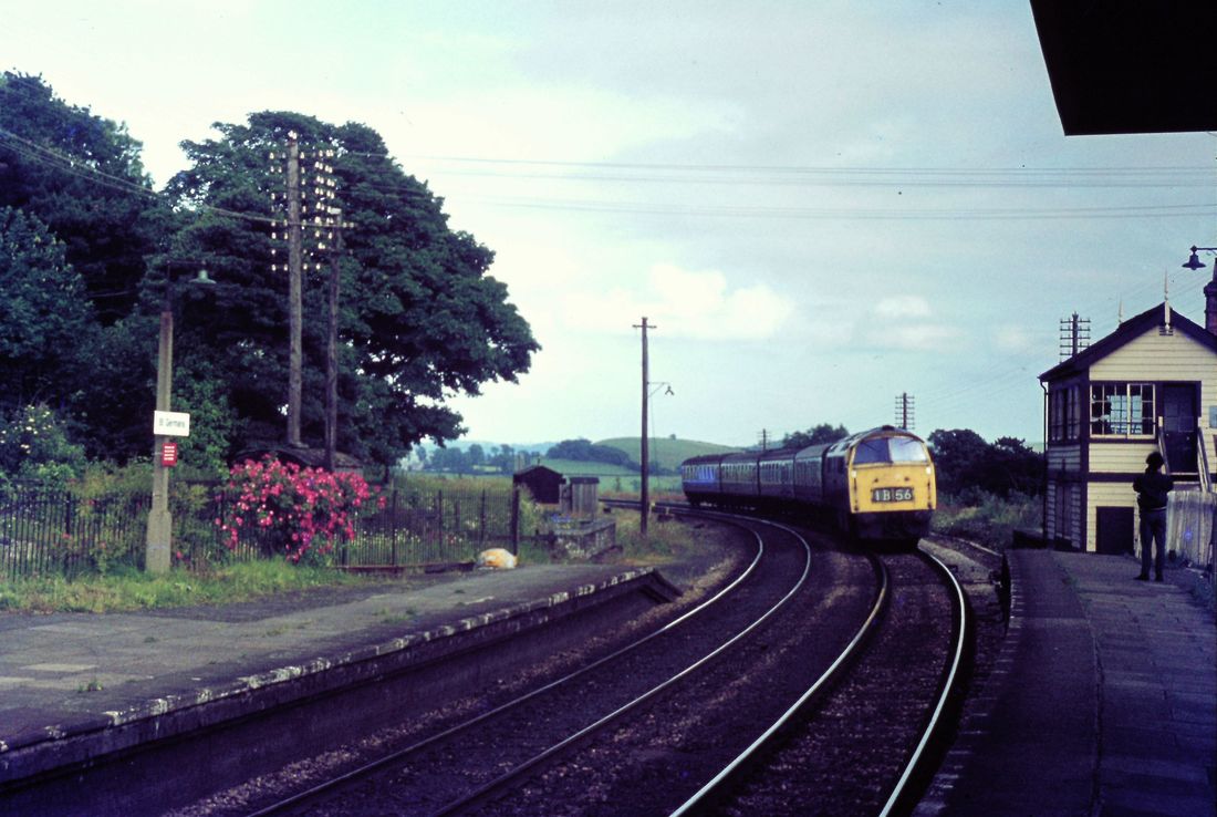
A western brings in the Plymouth to Penzance stopper, or was it shopper to St Germans. The late Peter Moore stands by the long gone signalbox. 30th June 1973
Teffry Tramways
Under preparation
A very detailed history of the routes and extent of the Treffry Tramways is given by Wilkipedia.
To access this please click here :- https://en.wikipedia.org/wiki/Treffry_Tramways
To access this please click here :- https://en.wikipedia.org/wiki/Treffry_Tramways
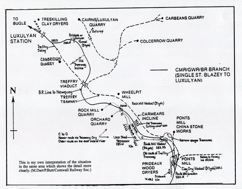
This map was drawn for the Cornwall Railway Society by Peter Butt. many thanks for this. Copyright Peter Butt.
It is our intention to follow the route Treffrys Par tramway from the inland terminus at Bugle down to the Port of Par. We will deviate off the main route at various points.
Railways neither pleasure nor industrial
Sennen Cliff Railway - Private
A short 69cm = 2'3" gauge line used for the transfer of a wheelie bin from house to street level. More pictures on:-
www.swehs.co.uk/swehs-trams/xx15h.html
www.swehs.co.uk/swehs-trams/xx15h.html
The railway at Sennen - taken from the top of a double decker bus on the 17th April 2016. Copyright Roger Winnen
St Michael's Mount Underground Railway - Private
To find out what lies beyond these doors please click the link below for an excellent article and pictures by an author unknown. This picture by Roger Winnen on the 14th April 2014 Copyright
St Michaels Mount Underground Railway click this link for an excellent article and pictures. http://www.hows.org.uk/personal/rail/stm.htm