Wrington Valley branch.
The Wrington Valley branch stemmed from a junction with the Yatton to Witham branch at Congresbury.
Wrington
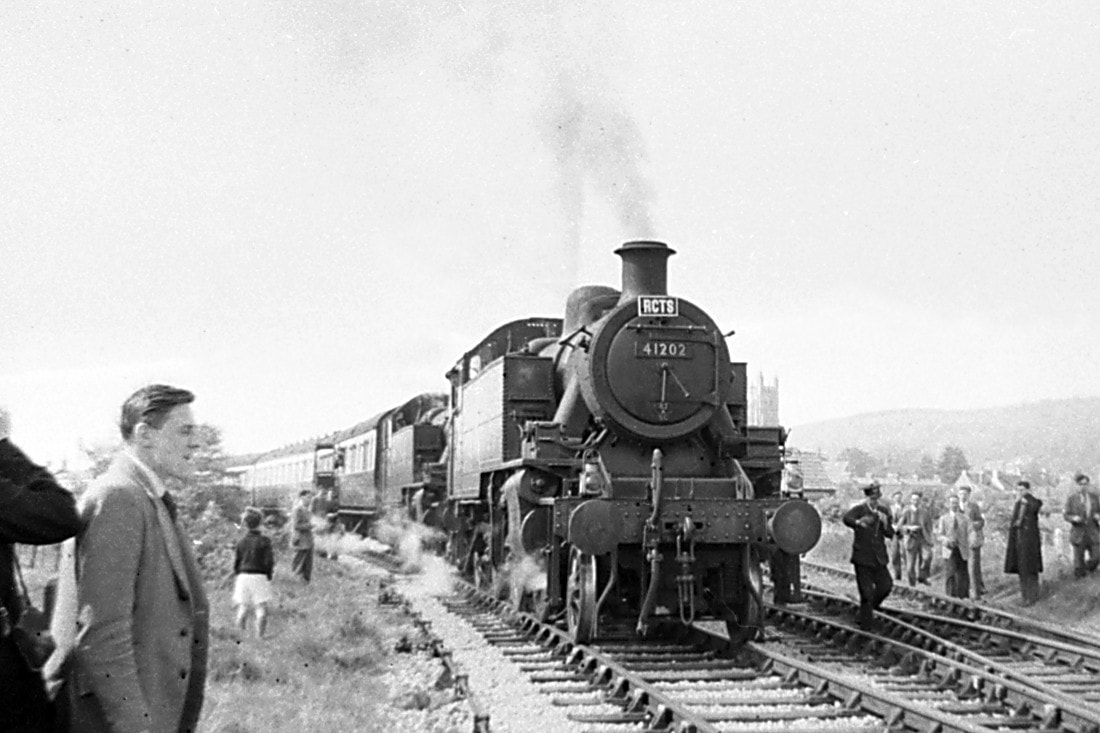
Details of the North Somerset Railtour on the 28th April 1957 - operated by the R.C.T.S.
Locos Used 3440 'City of Truro', 5528, 30453 'King Arthur', 41202 & 41203, 8 (different) coaches
Route London Waterloo - Reading Old Jn - Reading General - Southcote Jn - Heywood Road Jn - Hawkeridge Jn - Bathampton Jn - Bath Spa - North Somerset Jn - Bristol Temple Meads - South Wales Jn - Wapping Wharf Jn - Ashton Jn - West Loop North Jn - Yatton - Congresbury - Wrington - Congresbury - Yatton - Worle Jn - Weston-super-Mare - Uphill Jn - Highbridge - Burnham-on-Sea - Highbridge- Uphill Jn - Worle Jn - Yatton - Pylle Hill Jn - St Philips Marsh Goods Jn - Marsh Jn - North Somerset Jn - Bristol Temple Meads - North Somerset Jn - Marsh Jn - Pensford - Hallatrow - Radstock West - Mells Road Halt - Frome West GF - Clink Road Jn - Westbury - London Paddington
Wrington station gallery - all pictures Michael Bussell Copyright
Wrington Station 1965-66
Michael Bussell
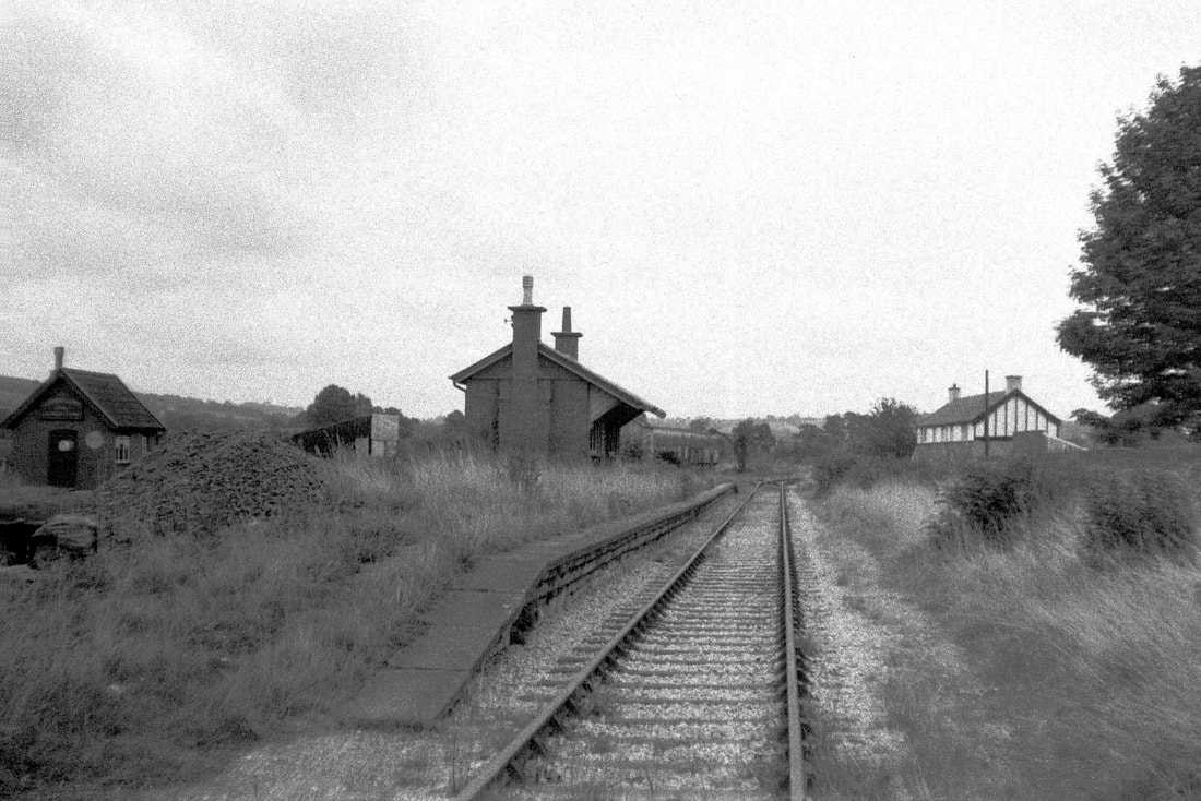
The Wrington Vale Light Railway was built under the provisions of the Light Railways Act of 1896, and opened on 4 December 1901. It was owned and operated from the outset by the Great Western Railway. The single line branched off the Cheddar Valley Railway at Congresbury. It ran just short of 7 miles south and east via Wrington, Langford, and Burrington, terminating at Blagdon where was located a pumping station of the Bristol Water Works Company. The motor bus and later the lorry effectively competed for much of the line’s traffic; passenger services were withdrawn on 14 September 1931, and the section beyond Wrington closed completely on 1 November 1950, with track being lifted in early 1952.
Wrington retained a goods service – mainly carrying coal for domestic use, and most of it doubtless from Somerset collieries, until the last section of the line was closed completely on 10 June 1963, with track lifting taking place in mid-1964. I visited the site three times in 1965, and once more in 1966, when it was still being used by coal merchants W E Clement & Sons. They had been long-established when coal was brought in by train; now it both came in, and was delivered, to customers by road. The site was subsequently redeveloped for housing.
An informative book on the line is by Colin G Maggs, ‘The Wrington Vale Light Railway’ (Oakwood Press, Locomotion Papers LP224, 2004).
Details of the pictures are given below. Picture (1) is at the top left hand side, picture (2) is on the right side, the pictures then follow in sequence down the gallery. Picture (29) is the last one in this selection. Please click on the pictures to obtain an enlargement.
Photograph Notes
Wrington Station - General views 13th March 1965
1.
Looking east from the level crossing along the lifted trackbed, with the station building in the centre, the lamp hut just visible beyond, and Clement’s coal office on the left.
2.
Clements - Panning left from the previous view, with the coal office in the centre.
3.
Clements - Stacks of coal occupy the site of the former passing loop and siding, east of the station building.
Station Building – 13th March and 17th December 1965
4.
The station building from the south-east in March 1965. The modest building was of brick and timber with a zinc sheet roof, the brick gable ends also accommodating fireplaces with their chimney-stacks. Similar buildings were at Langford and Blagdon; the former no longer stands but that at Blagdon survived and has been adapted as a characterful residence. The station building at Burrington was of stone, possibly because that was readily available close to the station site. It too has gone.
5.
The western half of the station’s platform side. A GWR plan shows this to have been the waiting room, but it had at the time of my visit seen no passengers for over 30 years. Now the windows have gone and the room appears to be a store.
6.
The eastern half, designated on the plan rather grandly as ‘Station Master’ – of which there was indeed one, along with one or two porters in busier times. The glazing bars have survived but the glass has gone, partially replaced by a fertiliser bag…
7.
The west gable end of the station, facing towards Station Road.
8.
A view of the back of the station from the north-east, partly masked by stacks of coal at least as high as the platform.
9.
Further photos of the station from a return visit on 17 December 1965. This view is from the south-east.
10
The bay window of the erstwhile Station Master’s office, which presumably also served to issue tickets and handle the station’s paperwork.
11.
The door into this office, missing two of its four panels.
12.
A detail of the eastern canopy end support, a stone corbel set into the gable brickwork.
13.
The same detail at the western end of the building.
14.
The back of the building, apart from the pressure from encroaching piles of coal against its wall, was looking in better condition that the front. This photo shows thoughtful detailing of the chimney stack brickwork as evidence of care being given to the design of even this modest small building.
15.
A similar view with lock-up hut beyond. The gents’ urinal once stood between the two buildings.
16.
A full-face back view. Plastic and paper bags serve as ad-hoc ‘glazing’. The zinc roof sheeting has come away from the eastern end here.
17.
A final view of the back of the station building, now surrounded by piles of coal but once a key part of a valuable local transport link.
Lock-up Hut – 13 March and 17 December 1965
18.
The lock-up hut, of corrugated iron on a light steel framing, was a common feature of small stations, particularly those of the GWR. On my March 1965 visit it was open and in use. Sacks of coal sit on the platform, which is supported on a coursed stone dwarf wall.
19.
In December that year it happened to be locked. It stood just to the east of the station building, visible beyond it in this photo. A cast iron gents’ urinal that stood between them when the line was open has gone.
20.
The west end of the hut. Vegetation is taking over the platform.
Wrington Clements 13th March and 11th December 1965
21.
The western façade of ‘W. E. Clement & Sons Coal & Coke Merchants’ in December 1965, proudly displaying a Coal Utilisation Council Diploma as an Approved Coal Merchant. Times change…
22.
The south side of the office.
23.
The south and east sides; on the fence hang stout coal sacks – once an everyday sight on coal delivery lorries.
24.
A similar but slightly earlier view of the south and east sides from March 1965, with the tower of Wrington parish church in the distance.
25.
Looking west from the office towards the goods yard gates in December 1965. The weighbridge – an essential feature of railway yards, by which the weight of goods being delivered or dispatched could be quickly and simply determined as the difference between the weight of the cart or lorry loaded and unloaded. The weighbridge could weigh up to 20 tons and was made by S Parsons & Co. Ltd.
Wrington Level Crossing Gates – September 1966
26.
The gates across the erstwhile running line on the west side of Station Road, southern section.
27.
The gates on the west side of the road, northern section.
28.
The gates on the east side of Station Road, northern section – including the wide double gates into the former goods yard. Some damage is evident on the crossing gate.
29.
The gates on the west side of the road, southern section.
Langford
Langford Level Crossing Gate 1966
Michael Bussell
The Wrington Vale Light Railway was built under the provisions of the Light Railways Act of 1896, and opened on 4 December 1901. It was owned and operated from the outset by the Great Western Railway. The single line branched off the Cheddar Valley Railway at Congresbury. It ran just short of 7 miles south and east via Wrington, Langford, and Burrington, terminating at Blagdon Station and also serving the adjacent pumping station of the Bristol Waterworks Company. The motor bus and later the lorry effectively competed for much of the line’s traffic; passenger services were withdrawn on 14 September 1931, and the section beyond Wrington closed completely on 1 November 1950, with track being lifted in early 1952. Wrington retained a goods service – mainly carrying coal for domestic use, and most of it doubtless from Somerset collieries – until the last section of the line was closed completely on 10 June 1963.
At Langford the line crossed what is now the A38, a major trunk road linking the Midlands with Bristol and the West Country. When the line was built motor traffic was still in its infancy (and of course the road was narrower than it is today), but as it increased, and particularly in holiday periods, delays often occurred when the gates were closed against road vehicles to pass a train. One single-leaf gate stood on the north side of the road, with its gatepost to the west of the railway track so that the gate would swing clockwise to bar eastbound road traffic. This gate survived closure and lifting of the line in the early 1950s, so I was able to photograph it on my visit in September 1966. It was reportedly still there in the late 1990s. (Has it survived?)
The second gate had long gone when I visited. I assumed that its gatepost was to the east of the trackbed, so that the gate would similarly swing clockwise as it closed to bar westbound road traffic when a train was due. This arrangement seems to be borne out by the top photograph, dated c.1910, on page 53 of the book by Colin G Maggs ‘The Wrington Vale Light Railway’ (Oakwood Press, Locomotion Papers LP224, 2004). The surviving gate also appears in a photo on page 54. Maggs notes on page 55 that the A38 was widened in 1953, for which purpose land at Langford owned by British Railways Western Region was transferred to Somerset County Council free of charge. This is recorded as involving “removal of a gate”, so it seems that this widening of the road – on its south side – accounts for the loss of the second gate.
I took some measurements of the gate components. Key dimensions are given below.
1
The surviving timber gate in 1966, looking across the A38 from its southern verge. It comprised four equal panels with uprights and diagonal cross-bracing, supported at its left-hand (western) end by a stout gate-post 12 inches square and about 9 feet high above ground. (This post would probably have been buried almost as deeply in the ground, to resist the overturning effect of the weight of the gate.) The top rail of the gate was a single timber 24 feet 1 inch long of width 3½ inches, tapering from 5½ inches deep at the hinge end down to 3½ inches. Two ⅝ inch diameter steel tie-rods ran from an anchorage near the top of the 10¾ inches wide by 3¾ inches thick hinge-post (of the same height as the gate-post) down to the foot of the gate three-quarters of the way along its length. The anchorage there, and the lower part of the gate overall, was by now ‘absorbed’ within vegetation growth. The closure post to the right of the gate was 10 inches square and about 5 feet 6 inches high. A central metal warning disc of 2 feet diameter survived on the far side of the gate.
The concrete fence-post in the foreground supporting just two wires presumably dates from the 1953 widening of the A38. The original crossing gate here would have been located a little further north, towards its counterpart on the far side of what was then a narrower road.
2
A detail of the top rail hinge. Part of the weight of the gate was carried into the hinge-post here through two steel straps (the remainder via a similar arrangement at the bottom rail hinge, and via the tie-rod anchorage near the top of the hinge-post). These straps were bolted to the top rail, while their nearer ends, forged into threaded lengths, were anchored against the back (nearer face) of the hinge-post by two nuts. These nuts bore against a cast iron collar that sat over the projecting pin in a cast iron bracket bolted to the gate-post. Similar details would have applied at the bottom rail hinge and at the tie-rod anchorage.
3
Another view of the top rail hinge.
4
The quadrant bracket bolted to the top rail and the hinge-post. As a structural engineer, my opinion is that this is more a pleasant decorative feature rather than a significant functional contributor to the gate’s strength. Altogether the construction is an attractive example of straightforward railway engineering, combining the skills of carpenter and ironworker.
5
Looking north, with the surviving crossing gate just behind me. On the right is the forlorn remains of the platform of Langford Station, which last saw a passenger in 1931.
6
A view from the same location as 1. above, but in the opposite direction, looking south. The abandoned and overgrown trackbed once carried trains to Burrington and Blagdon.
Burrington
Information and pictures of Burrington station can be found at the location below, please click the link.https://commons.wikimedia.org/wiki/File:Burrington_Station_(remains)_-_geograph.org.uk_-_1951605.jpg
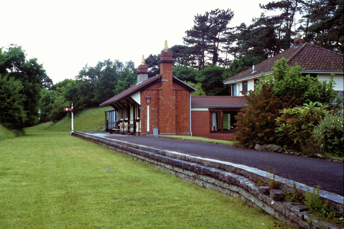
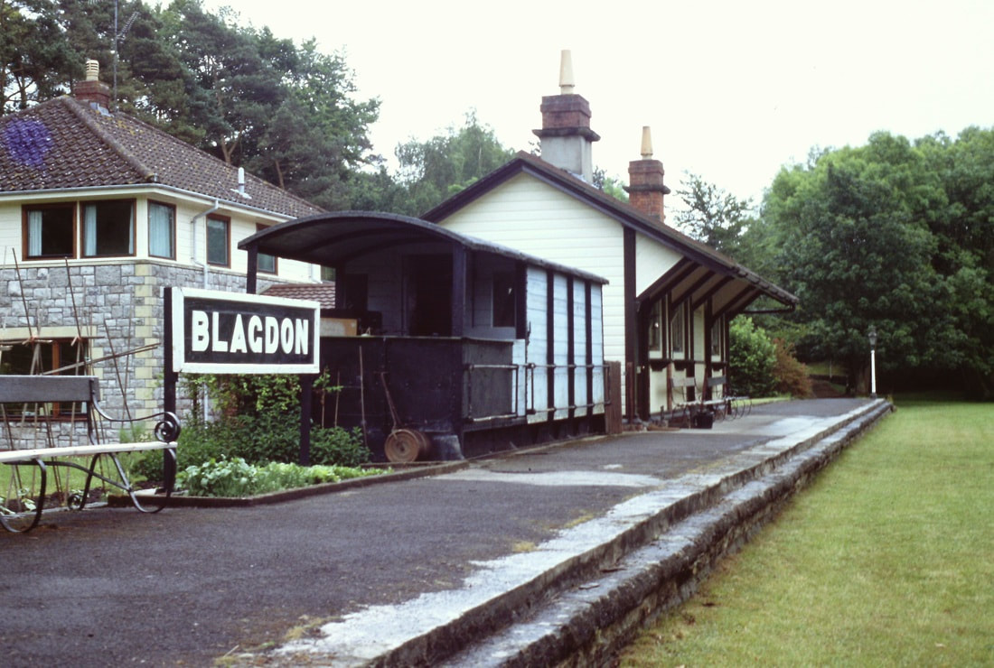
Blagdon - delightful views obtained on a private visit
It is emphasised that the station site is strictly private - do not visit.
