Westbury Excl to Reading
N.B. Westbury is 95.5 miles from Paddington
N.B. Westbury is 95.5 miles from Paddington
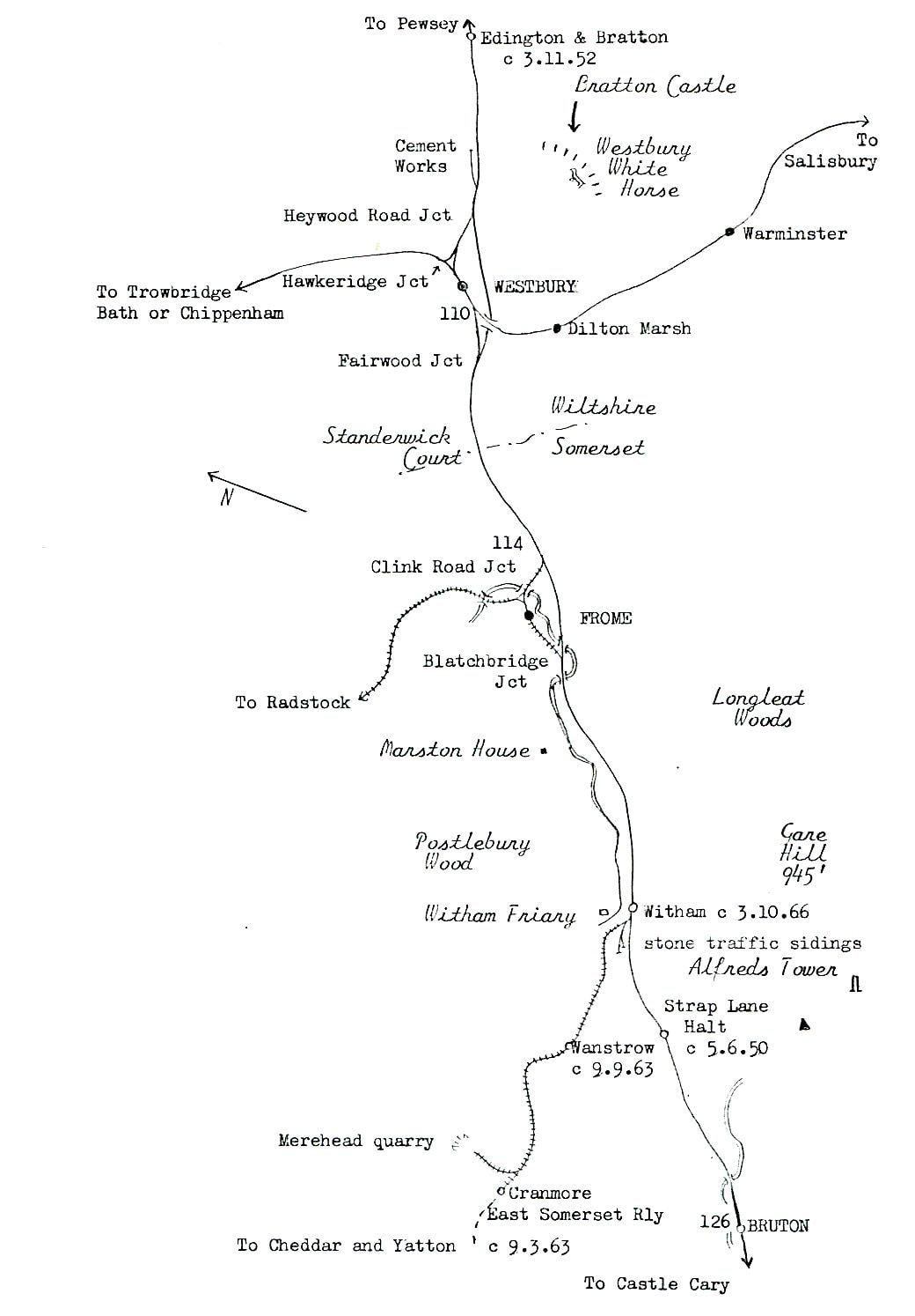
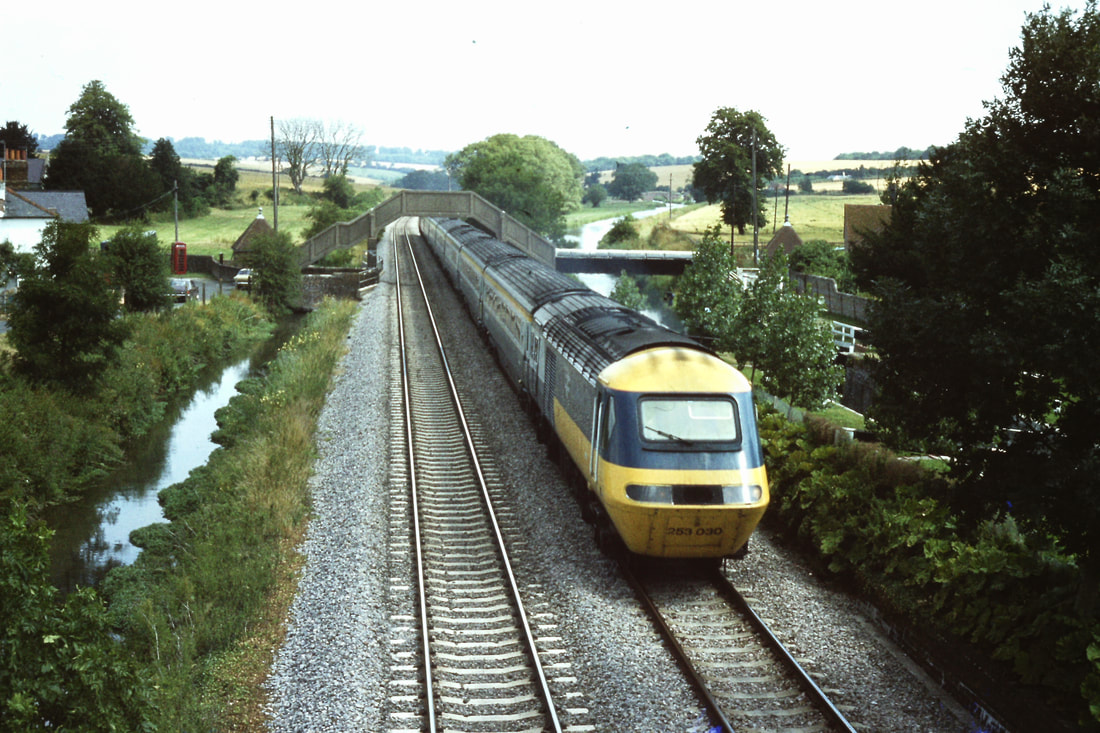
This map covers the first part of this section - from Westbury to Eddington and Bratton. Copyright Keith Jenkin.
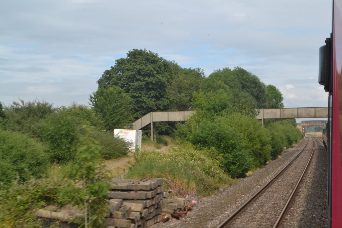
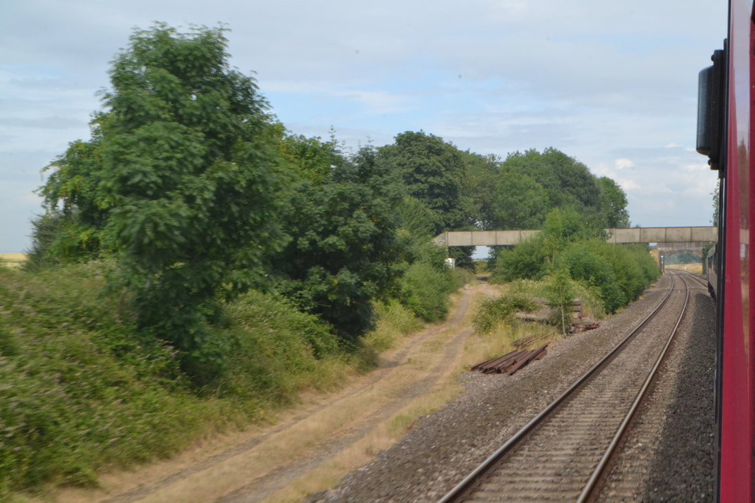
Edington and Bratton Closed 25th November 1963
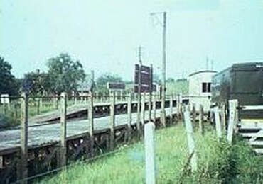
The station at Edington opened for goods traffic on 29 July 1900, a month before passenger trains were allowed to use the line. The village of Bratton is about 1.5 miles (2 km) distant. A brick building containing the main facilities stood on the westbound platform and a waiting shelter was provided for passengers travelling eastwards. The goods shed was to the west of the main building. Passenger trains no longer called after 3 November 1952 and the buildings were demolished, but the goods shed and yard remained open for traffic until 25 March 1963. The site is now an industrial estate.
The station at Edington opened for goods traffic on 29 July 1900, a month before passenger trains were allowed to use the line. The village of Bratton is about 1.5 miles (2 km) distant. A brick building containing the main facilities stood on the westbound platform and a waiting shelter was provided for passengers travelling eastwards. The goods shed was to the west of the main building. Passenger trains no longer called after 3 November 1952 and the buildings were demolished, but the goods shed and yard remained open for traffic until 25 March 1963. The site is now an industrial estate.
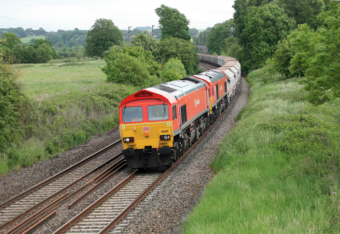
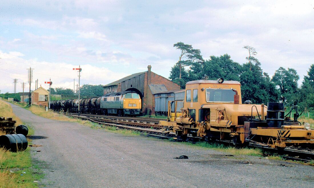
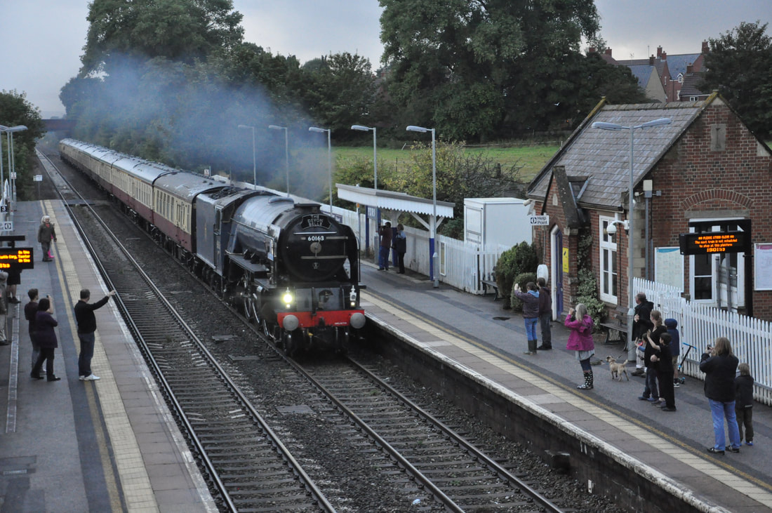
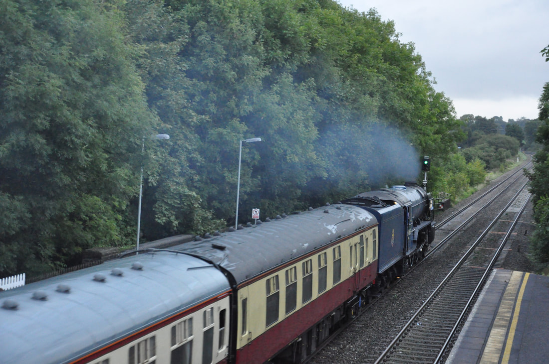
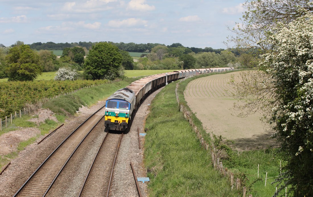
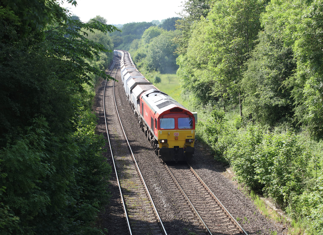
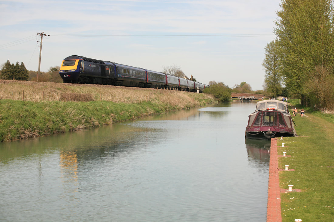
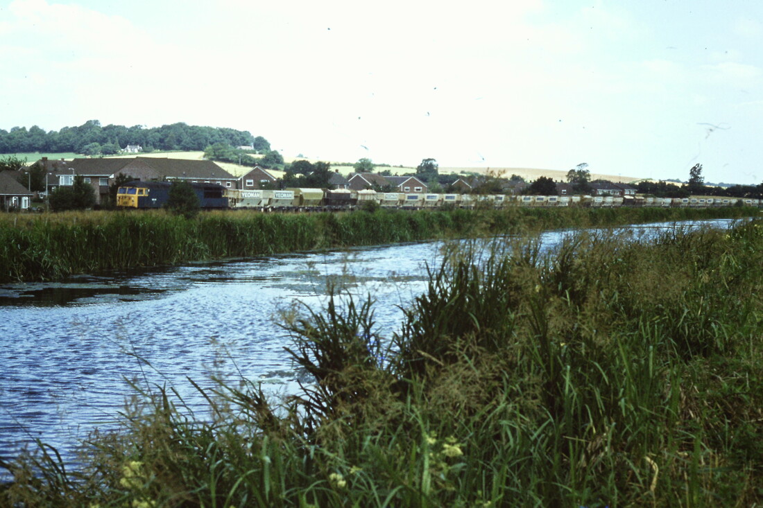
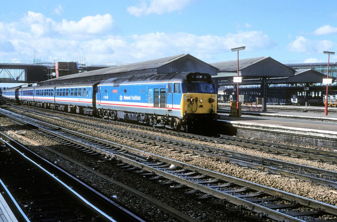
59205 and 203 on the 7C77 the 12.40 Acton to Merehead. Seen at Great Cheverell on Thursday 13th June 2013 Copyright Roger Geach
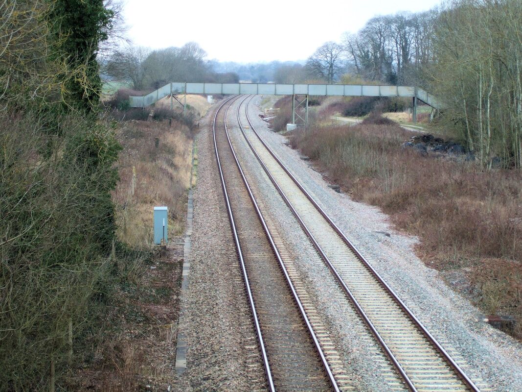
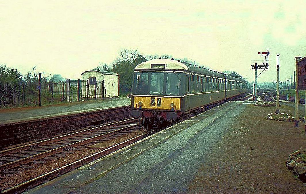
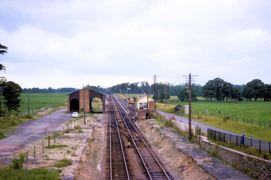
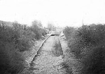
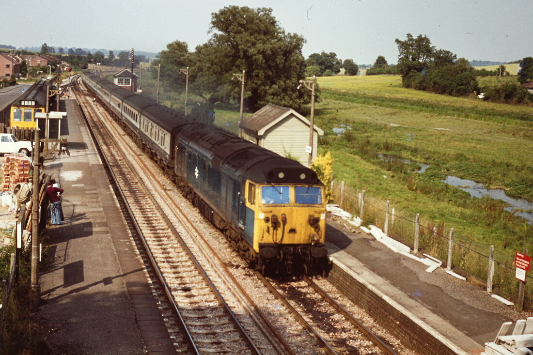
Lavington 87 miles from Paddington. Closed 7th March 1960
The main building was on the westbound platform and a waiting room was built on the eastbound. The goods yard (in use from 29 July 1900) was at the southwest of the station and the West signal box was opposite. A second East signal box on the south side of the line was open from about 1903 to 1914, when it was removed to allow the platforms to be lengthened. The first signal box was retained for occasional use after the station closed until 1979. The goods yard closed on 3 April 1967 and a scrapyard now occupies the site. Courtesy Wikipedia.
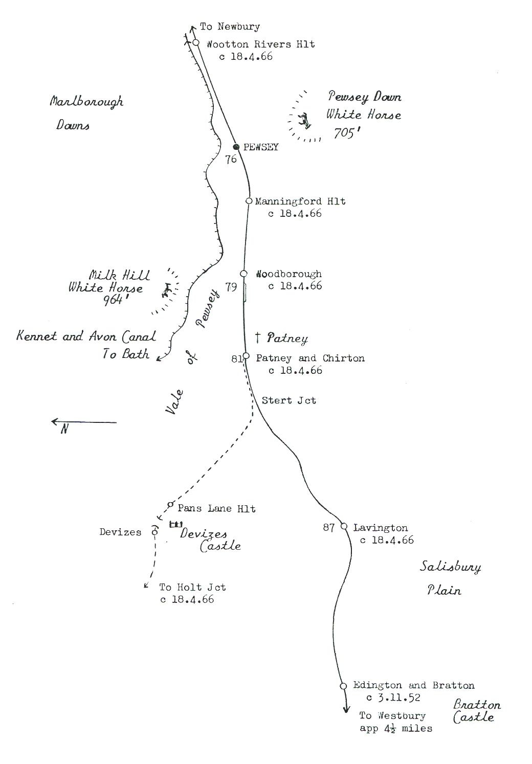
This map covers from Eddington and Bratton to Pewsey and Wootton Rivers halt and includes a section of the Devizes branch. Copyright Keith Jenkin.
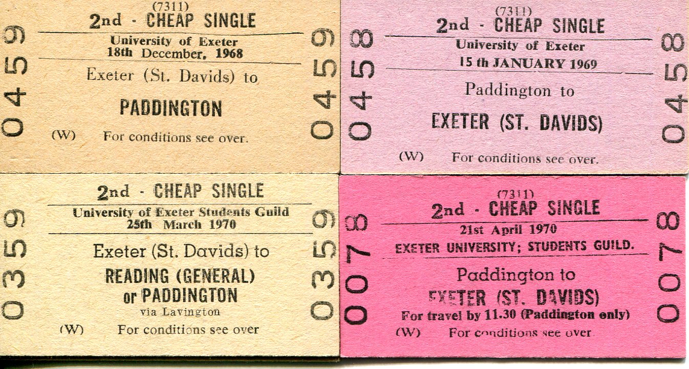
Exeter Guild Tickets. Especially interesting is the one for the 25th March 1970 via Lavington. this station Closed to passengers on the 18th April 1966 and to goodson the 3rd Aprl l967. Chris Osment Collection.
The item from Jeff Vintner brought back a few memories, as I was on the Committee of the Exeter University Railway Society circa-1969 and therefore had some involvement with the ‘Guild Trains’, which certainly did run during that period. It was not uncommon to have some unsold tickets left over after each train and I have ‘hoarded’ a few of those ever since! I have left a message for Jeff on the Railway Ramblers website.
Chris
Chris
Try this link for an old picture of the station. https://marketlavingtonmuseum.wordpress.com/2010/03/06/lavington-station/
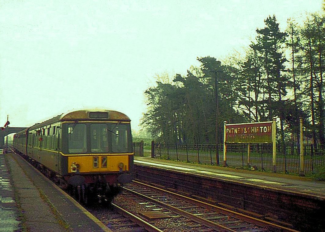
Patney and Chirton 81 miles from Paddington. Closed 18th April 1966
180704l The remains of Patney and Chirton Station. The west end of the station site. Copyright Roger Winnen
180704m The remains of Patney and Chirton Station. Copyright Roger Winnen
Patney & Chirton Footbridge 17th March 2010 Copyright Guy Vincent
Moving from quite recently we go back to the 18th April 1966 when the Devizes branch closed to traffic.
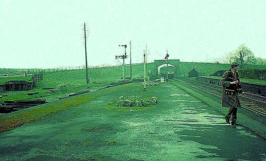
Patney and Chirton the last train ever off the Devizes branch crosses over onto the GW up main. The 70 lever signalbox with the Devizes branch being controlled by an electric key token. 16th April 1966 The goods yard here closed on the 19th May 1966 and the signalbox closed on the 6th July 1966. Copyright Keith Jenkin
The last train off the Devizes branch Patney and Chirton 16th April 1966 Copyright Keith Jenkin This train at around 16.16 and the last ever up train to stop at Patney. There was one more down service, also for the Devizes branch and after that the station closed - forever.
Patney and Chirton - the last train from Devizes having dropped off one passenger heads away towards Reading. 16th April 1966. Copyright Keith Jenkin.
The last passenger to alight at Patney and Chirton obviously an enthusiast doesn't seem interested in the departing train. 16th April 1966 Copyright Keith Jenkin. The disused buffer stop at the extreme left of this view was once at the end of a siding installed in 1909 and used for military traffic.
Patney and Chirton / Stert Junction
Dear Keith,
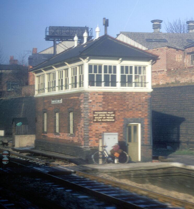
The box in today's photographs is Patney and Chirton. It opened in 1900. Its predecessor, opened in 1897, lasted only 3 years and was called Stert Junction.
Patney box closed on 21-6-66.
Patney never saw much passenger traffic, but before the first world war it had a special connection with the cavalry and there were special sidings at the east end for the loading and unloading of horses.
Roy Hart.
Dear Keith,
The box in today's photographs is Patney and Chirton. It opened in 1900. Its predecessor, opened in 1897, lasted only 3 years and was called Stert Junction.
Patney box closed on 21-6-66.
Patney never saw much passenger traffic, but before the first world war it had a special connection with the cavalry and there were special sidings at the east end for the loading and unloading of horses.
Roy Hart.
The last movement over the Devizes branch. 1010 Western Champion having hauled the Royal Train departed 'light engine' for Westbury via Devizes, Patney & Chirton (rev) and Lavington. occurred on 3rd June 1966.
More on the Patney and Chirton area - a welcome addition by Guy Vincent.
Futher information on the area west of Patney & Chirton towards Stert where the 'new route to the west' leaves the original Berks and Hants Extension line from Hungerford to Devizes.
1) A panoramic view of the old GWR footbridge that still spans the site of the former station at Patney & Chirton. Woodland Road bridge is visible in the background. The single track Devizes line ran parallel to the up main line from just beyond the platform end as far as MP 81.111, Stert Junction (or more accurately, divergence, see below).
2) 'Thames Turbo' 165117 in First Great Western's 'Dynamic Lines' Blue livery speeds westwards under the bridge at 1440 hrs on Wednesday April 3rd 2013 working a special 1K38 1330 Reading - Westbury. This was due to major engineering works taking place at Reading during the large-scale remodelling of the station and its approaches. A couple of Mr Howells' concrete drain covers can be seen to the right of the up line!
3) Looking west where the original route towards Devizes started to curve northwards away to the right of the new Stert Valley route, (MP 81.111 visible on right). The Devizes line ran adjacent on a steadily rising embankment for approximately half a mile before disappearing at Lydeway, a location known locally as 'The Clock Inn' and now the site of a mobile home-type retirement park. The line crossed the A342 Devizes-Andover road on a long-demolished bridge and approx. 500 yards south of this the A342 crosses the main line by way of a 3 arch bridge (photo 3, looking west). In the mid 1930s this structure suffered from major subsidence and was partly infilled during repairs. It has been proposed that a Parkway station be built near here to serve the Devizes area although works have yet to start...
4 and 5) Looking east at MP 81.111, the approximate site of Stert Junction and east again at MP82 showing the start of the rising grade that was until 1966 the single track BHE line to Devizes and beyond to Holt Junction.
6) Photo image of a late period token covering the entire Patney - Holt Junction single line section. This would have been used following the closure of Devizes signal box on 4th July 1965. It appears that Devizes has simply been ground off and Holt stamped in its place.
The milepost references are: Woodlands Road bridge 80m79ch; Patney Footbridge 81m09ch; Stert Junction, (former divergence of the BHE & SWY lines) 81m60ch; A342 Clock Bridge 82m64ch.
Footnote. On the evening of June 2nd 1966 the Royal Train (1X01) was stabled on the northern end of the Devizes branch between the closed Holt Junction station and a river bridge over the Avon near Whaddon. Two ex-works class 52s were used, D1010 Western Campaigner and D1041, Western Prince. D1010 brought the train onto the branch from Frome where the Royal party had boarded following visits to Duchy estate properties in Somerset. D1041 arrived light from Bristol Bath Road minutes after the train had stabled and once it had attached to the rear D1010 departed 'light engine' for Westbury via Devizes, Patney & Chirton (rev) and Lavington. D1041 remained with the train, departing at 0855 the followig day for Castle Cary (for the Bath and West show). D1010 reportedly returned to Holt via Patney and Devizes so was either attached to the rear of the train before departure or followed it light. Both locos happily survive in preservation, D1010 at the West Somerset Railway and D1041 at the East Lancashire Railway. Ivo Peters photographed the train at Hawkeridge near Westbury but the rear is not visible.
Photo 7 Royal train on Devizes branch near Holt Jcn 3.6.1966 (photographer believed to be the late John Sawtell).
According to the 'Royal Train List' Royal Journeys 1966, File G5/66 held by the NRM York the complete itinerary was: 02.06.66 Paddington - Yeovil and 03.06.66 Frome to Windsor & Eton Central. Stock used was 3209, 77, 806, 495, 2013, 2901, 499, 798, 799, 5155. As Windsor & Eton Central is a dead-end station I would suggest the latter train was top and tailed by the 'Westerns'
Hopefully of interest!
Regards, Guy Vincent.
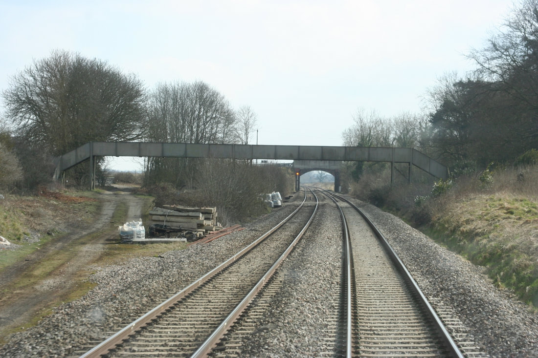
Photo 1 Copyright Guy Vincent.
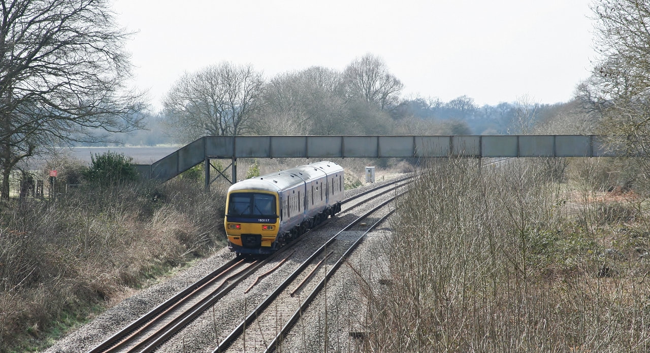
Photo 2. Copyright Guy Vincent.
Photo 3. Copyright Guy Vincent.
Photo 4. Copyright Guy Vincent.
Photo 5. Copyright Guy Vincent.
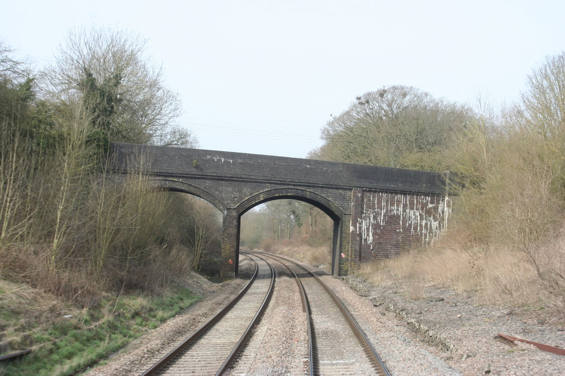
Photo 6. Copyright Guy Vincent.
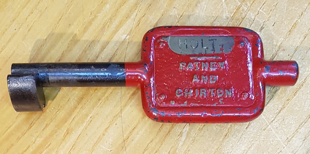
Photo 7. Copyright Guy Vincent.
Photo 8. Copyright Guy Vincent.
For more coverage of the Devizes branch on a special section - please click here.
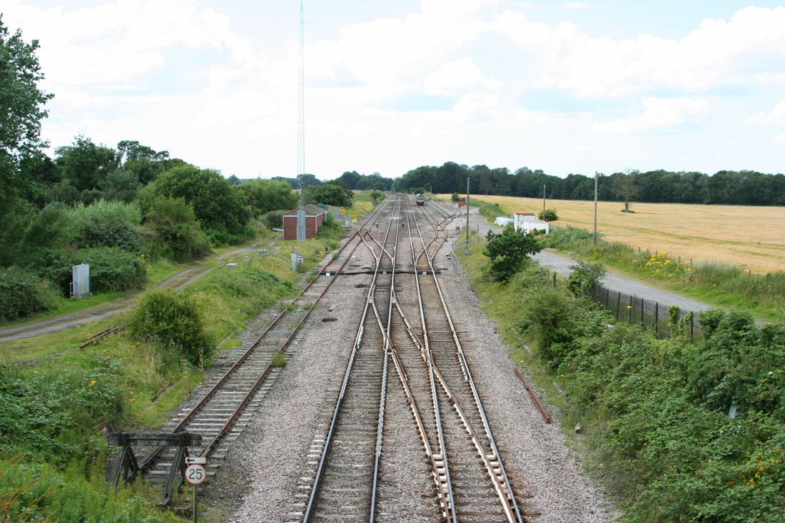
Woodborough 78.25 miles from Paddington. Closed 18th April 1966
Woodborough station was some 78 and a quarter miles from London Paddington was opened in 1862 The station closed to passengers on the 18th April 1966 and to goods on the 15th August 1966.
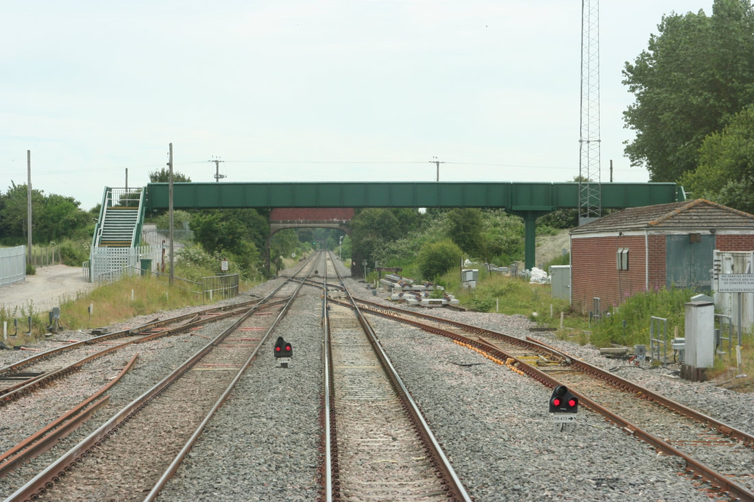
There were up and down platforms both which were some 100 yards long and started immediately to the west of a substantial road overbridge which served a road connection to the north for the hamlet of Woodborough which recently had a population of about 900. The up platform boasted a signalbox,
Passenger accommodation comprised of a small shelter on the up side with a more substantial building not unlike that at Pewsey which incidentally was also on the down side.
The station has loops approximately 900 yards long on both the up and down sides they leave and join their respective the main lines about 110 yards west of the overbridge. There is a trailing cross over between the up and down main lines located some 45 yards west from the road overbridge.
The down loop is simply just that, a refuge. However the up loop has a trailing point at the east end leading to two sidings each of about two hundred yards in length.
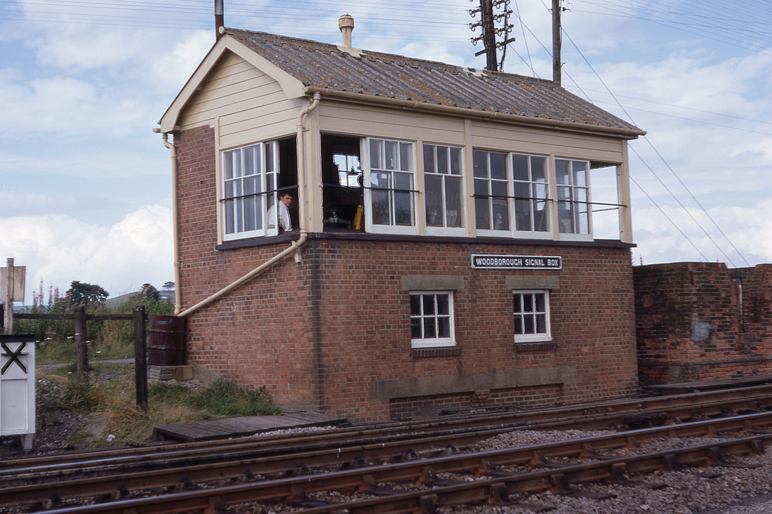
Woodborough signal box. July 1968. Copyright Doug Nicholls
Woodborough july 1968 Copyright Doug Nicholls - Copyright Note the platforms have been partially cleared away but their extent is clearly visible. Also note the trailing crossover and the commencement of the loops. The signalmans car stands in front of the redundant good shed. The signalman is visible leaning out of the nearest window beyond the box can be seen a point leading to a short siging on which a track machine is standing. There are now two 200 yard long sidings served by this point.
A western class diesel D10xx disturbs the peace with the 3c05 milk empties pssing through Woodborough in September 1968 - Copyright Doug Nicholls. Note the signals the taller one for the main line, the lower one controlling the exit from the sidings.
The sidings at Woodborough are used to 'station' plant. Here we see such a machine in July 1968. Copyright Doug Nicholls
1044 Western Duchess is at the head of the 1a63 train through Woodborough in July 1968. Copyright Doug Nicholls
A little more on Woodborough Courtesy Guy Vincent.
On the 10th November 2020 Guy Vincent wrote :- I was very interested in Doug Nicholls archive pictures of Woodborough this morning. The station was, quite literally in the middle of nowhere and the site remains so today with few signs of habitation nearby. In July 2012 I visited the area as loco 59102 had been removed from a loaded eastbound stone train due to a seized axle bearing and left in the up loop pending recovery. At that time a length of GWR spear-tipped fencing remained on the right (up) side. Also notice the footpath crossing the line at the entrance/exit of the loops. This was removed in 2014 and replaced at great expense by a large metal footbridge. Photo taken from the rear of a (Pilton Festival) Castle Cary-bound Turbo I was on in June 2014.
Also, from the loft a copy of a GWR blueprint dated 18.02.1944 for rebuilding the signal box. This was bought in an auction lot of old S&T paperwork many years ago. The box closed on 20 January 1979 when Reading panel box assumed control of the area, around the same time the down loop was extended and this is used daily by freight and engineers trains to allow fast west country services to pass.
Best wishes. Guy Vincent

Woodborough looking west on the 29th July 2012 Copyright Guy Vincent. Note 59102 abandoned on the up loop and the pedestrian crossing at the nearest end of the loops.

Woodborough looking east with the new footbridge in place of the board crossing and that the reverse shunt on the London end of the down loop has been removed.26th June 2014 Copyright Guy Vincent

Woodborough Signal Box Blueprint 1944 - Copyright Guy Vincent Collection
Even more on Woodborough Courtesy Guy Vincent.
Good afternoon Keith / Roger
Woodborough. Literally located 'in the middle of nowhere' it seems odd that it was ever thought necessary to provide a passenger station hereabouts but today the goods loops and engineers sidings are very well used with a number of freight trains held back to allow faster passenger services to pass. One example is the 6B33 1335 Theale-Robeston empty bogie tanks usually powered by a class 60 which is booked into the down goods loop for around 10 minutes until the 1C84 1404 Paddington-Penzance has overtaken.
1 and 2) Postcard views of the station looking east with the road bridge visible at the Newbury end of the platforms and then west from the same bridge.
3) The western end of Woodborough loops looking east.
4) A return ticket from Trowbridge to Woodborough via Devizes, note the 3rd class fare was 6 shillings or 30p in 'new money'.
Regards
Guy Vincent
Woodborough 1 looking west on the 29th July 2012 Copyright Guy Vincent. Note 59102 abandoned on the up loop and the pedestrian crossing. Copyright Guy Vincent.
Woodborough 2 looking east with the new footbridge in place of the board crossing and that the reverse shunt on the London end of the down loop has been removed.26th June 2014. Copyright Guy Vincent
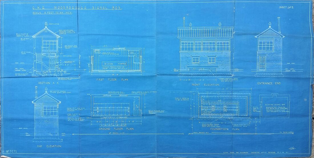
Woodborough 3 Signal Box Blueprint 1944 - Copyright Guy Vincent Collection
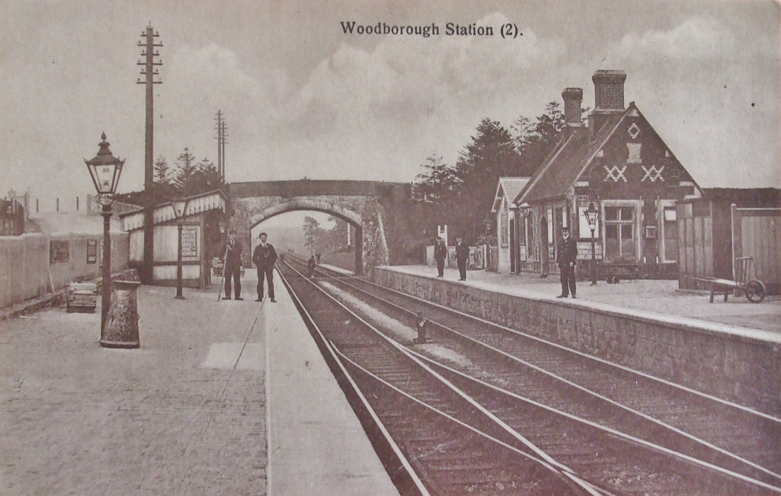
Woodborough 4 Station c1905 Post card Guy Vincent Collection. Copyright.
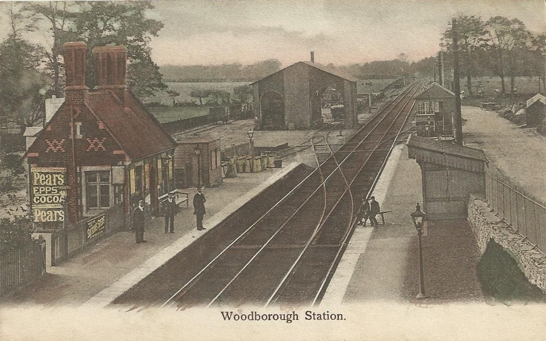
Woodborough 5 Station from the road overbridge . c1905 Post card Guy Vincent Collection. Copyright
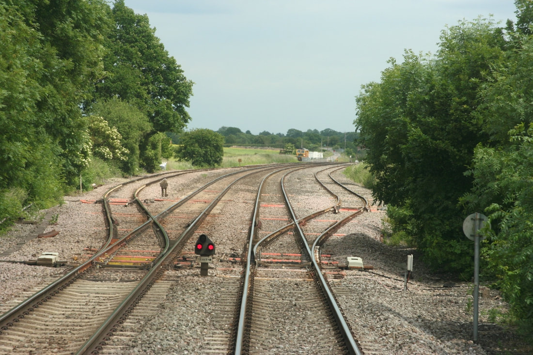
Woodborough 6 B & H Woodborough Goods Loops, western end, 79m30ch from rear of down Turbo. 26th June 2013 . Copyright Guy Vincent
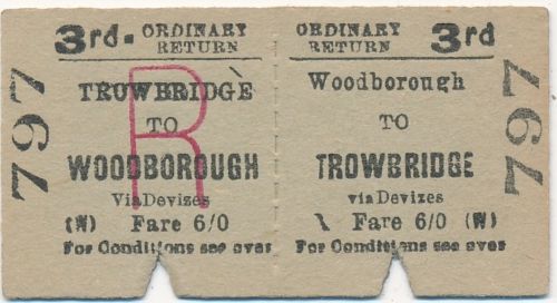
Woodborough Rail Ticket Trowbridge-Woodborough Return From the Guy Vincent Collection.
The service in the winter timetable for 63/64 gave departures at 06.58 and 08.27 arriving Woodborough at 7.37 and 09.06 respectively. Having got there there were two trains back at 08.41 and 17.39 arriving Trowbridge at 09.13 and 18.45 respectively. The rail journey according to the timetable was 18.25 miles whereas the journey by road much the same. The return ticket at six shillings works out at 1.97 pence per mile.
Manningford Halt 76.75 miles from Paddington. Closed 18th April 1966.
Manningford Halt is a former railway station which opened in 1932 in Manningford parish, Wiltshire, England on the Berks and Hants Extension Railway .
Pewsey 75.25 miles from Paddington.
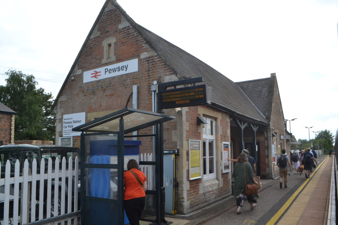
180704i Passengers waiting for the train at Pewsey Station. Copyright Roger Winnen
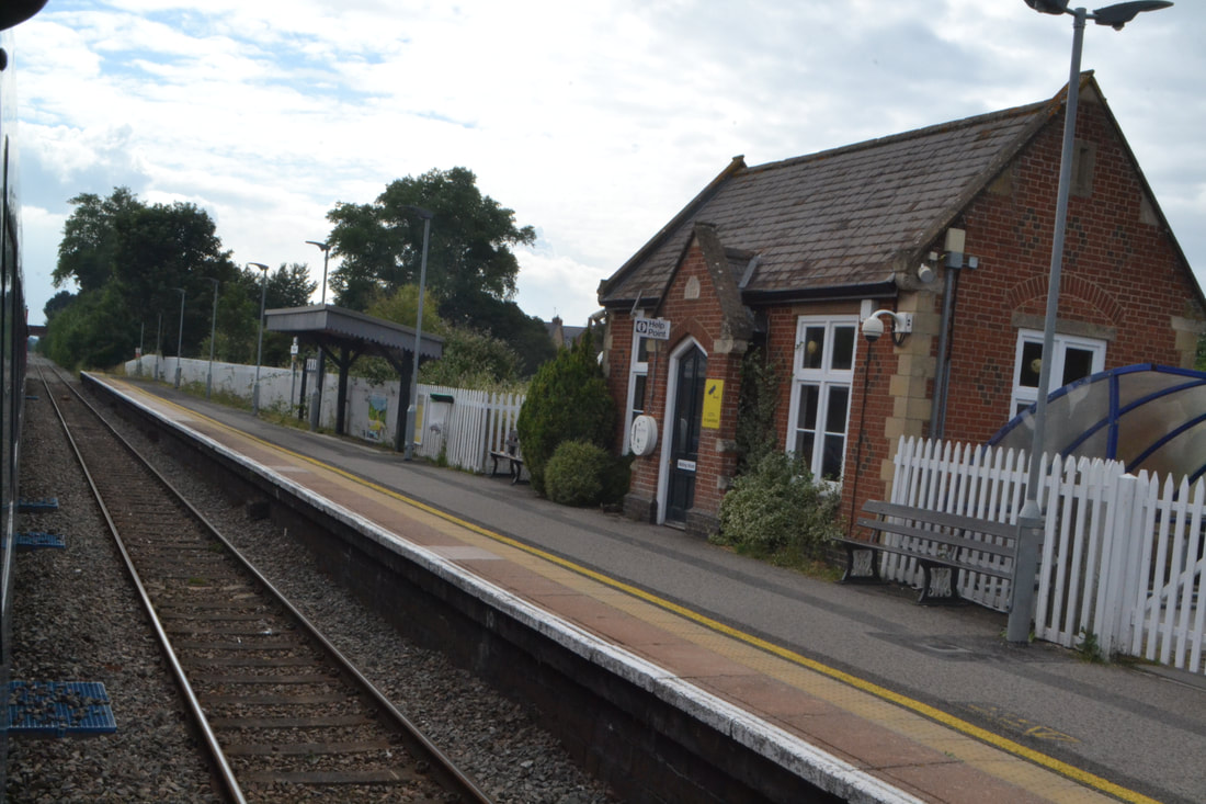
180704j The London bound platform at Pewsey Station. Copyright Roger Winnen
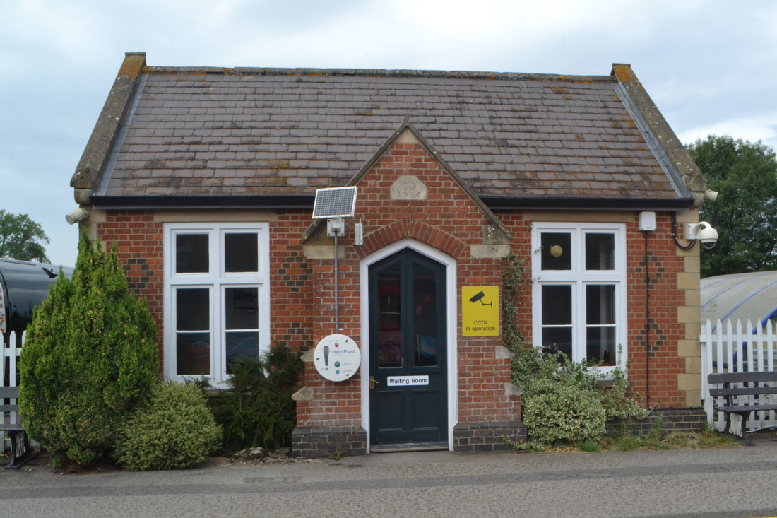
180704k The waiting room at Pewsey Station. Copyright Roger Winnen
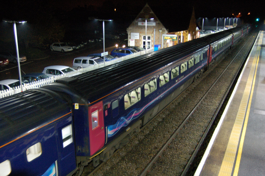
A study of Pewsey at night by Ken Mumford. Copyright
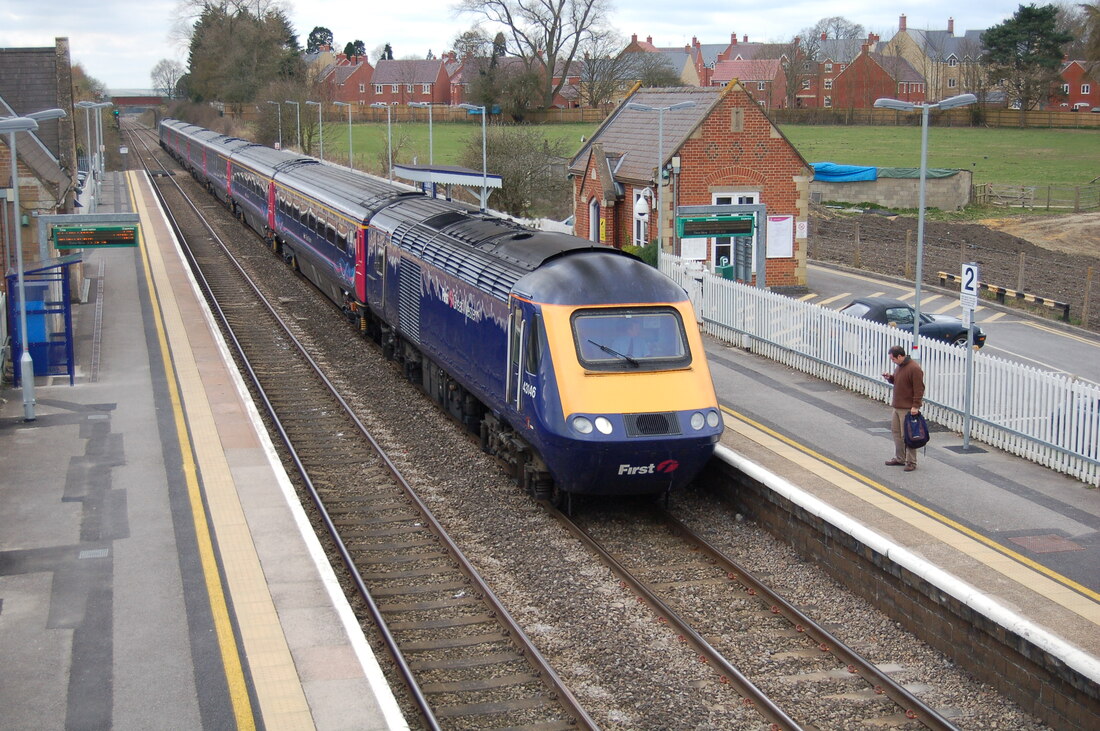
An up service rolls into Pewsey. Is the gentleman checking his photograph or the time? 30th March 2009. Ken Mumford
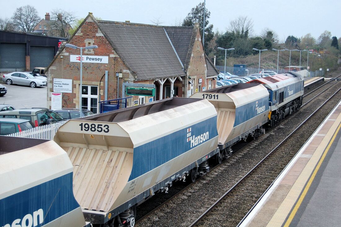
Showing the variety of traffic as a stone train rolls past the main station buildings on the down side. 6th March 2009. Ken Mumford.
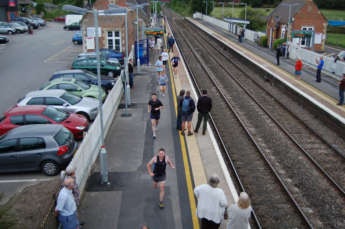
Pewsey - waiting for Tornado - runners ran along the up platform and over the bridge 18th June 2009 Ken Mumford .
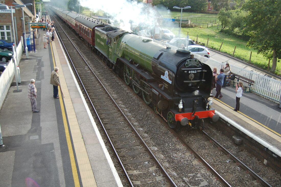
Pewsey - Tornado passes 18th June 2009. Copyright Ken Mumford
Undated Tornado passing Pewsey, London Bound, Copyright Ken Mumford
The going away shot. Ken Mumford
Wooton Rivers Halt 72.5 miles from Paddington. Closed 18th April 1966.
Wotton Rivers Halt is a former station in Wooton Rivers, Wiltshire on the Reading to Taunton line. The station opened at the south end of the village in 1928 and closed in 1966. Quote from Wikipedia.
Wootton Rivers Halt in about 1967. As can be seen the facilities were very limited. Copyright Keith Jenkin.
59005 on the 6V18 Allington to Whatley approaching Wooton Rivers 3 Miles NE of Pewsey on Wed 22nd May 2019 Copyright Roger Geach
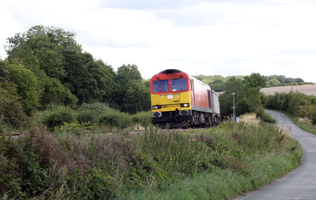
60039 on the 11.45 Oxford. Banbury Rd to Whatley on Crofton Curve Tue 13th August 2019 Copyright Roger Geach
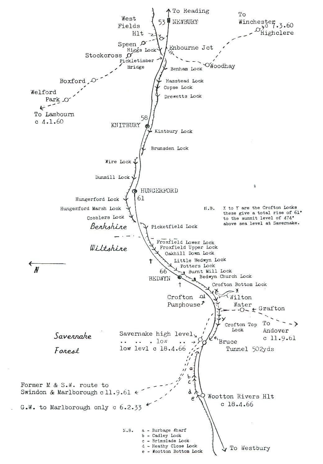
This map shows the route from Wooton Rivers Halt through to Newbury. Note at Savernake the low and high level stations separated by only a 100 yards or so. After Wootton Rivers halt we are joined closely by the Kennett & Avon Canal which is climbing by a series of locks to pass under the railway by means of the 502 yard Bruce tunnel. The railway reaches a summit at Savernake. The two lines towards Marlborough faced further climbs. The GWR branch terminated at Marlborough whereas the M & S.W route continued on past Swindon. Copyright Keith Jenkin.
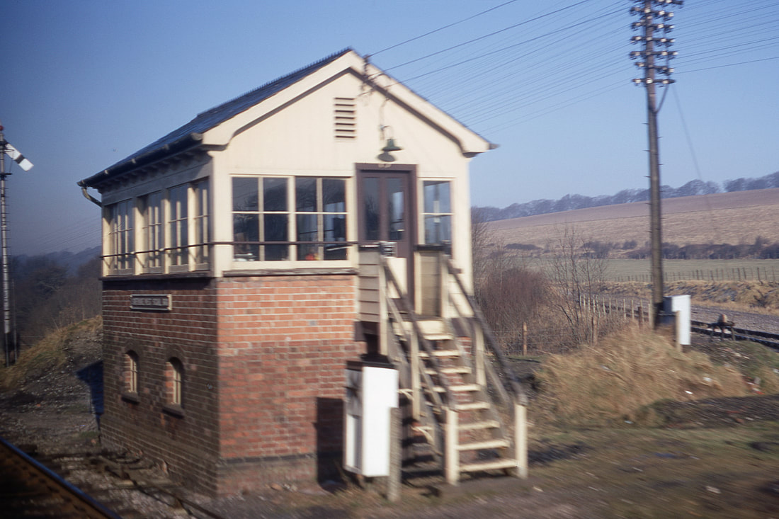
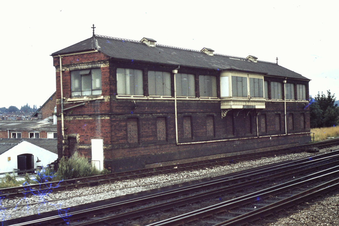
Savernake signalbox. March 1969. Copyright Doug Nicholls.
Additional information supplied by Roy Hart
This box was at the junction of the old Marlborough branch which closed in 1964. After that, it survived as an intermediate block post, though normally switched oit ( hence the telrephone by the box steps). Savernake box was abolished when Reading panel was expanded in 1978.
There is (or was) a Cornish connection: the locking frame of 32 levers found its way to the Bodmin Railway. Is it still there, I wonder?
Roy
Many thanks Roy and Doug.
Savernake (Low level) 70 miles from Paddington. Closed 18th April 1966
Savernake Low Level in 1967. Looking in the London direction. Copyright Keith Jenkin. Apologies for the poor image.
Just out of interest, this is Savernake High Level in 1967. Already closed for six years and used as a farmers track.
Difficult to believe but here we are at Savernake Low Level once a busy little station.
We see 59204 with the 6l21 Whatley climbing to the summit. It's Wednesday 14th June 2017. The station here closed to passengers on the 18th April 1968 and closed to goods on 19th May 1964. The station was just about here and the line to Marlborough which was closed on the 11th September 1961 turned away to the right. Copyright Roger Geach
----------------------------------------------------------------------------------------------------------------------------------------------------------------------
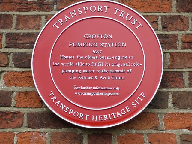
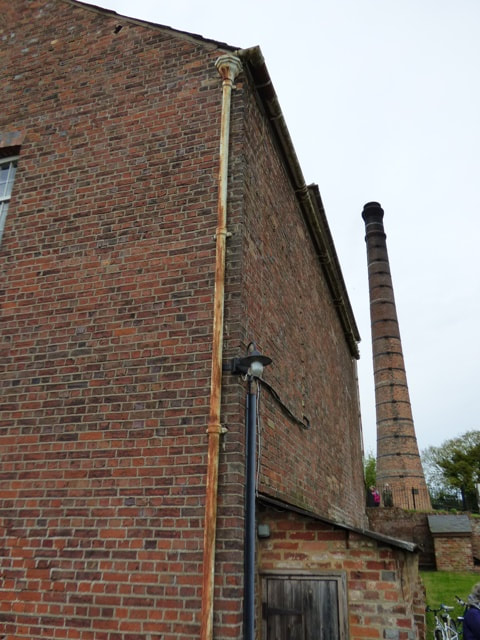
The Crofton Pumping Engine near Bedwyn
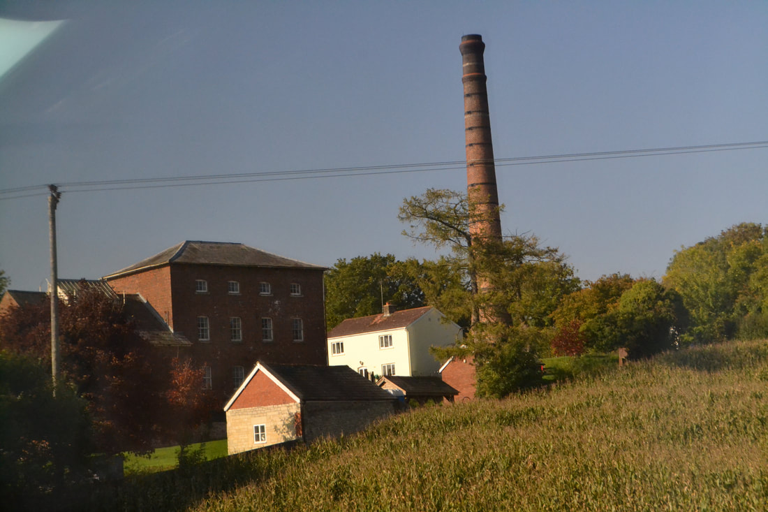
From the train. Crofton Pumping Engine near Bedwyn. 12th October 2015. Copyright Roger Winnen
Crofton Pumping engine. 30th April 2017. Copyright Roger Aston
Crofton Pumping engine. 30th April 2017 Copyright Roger Aston
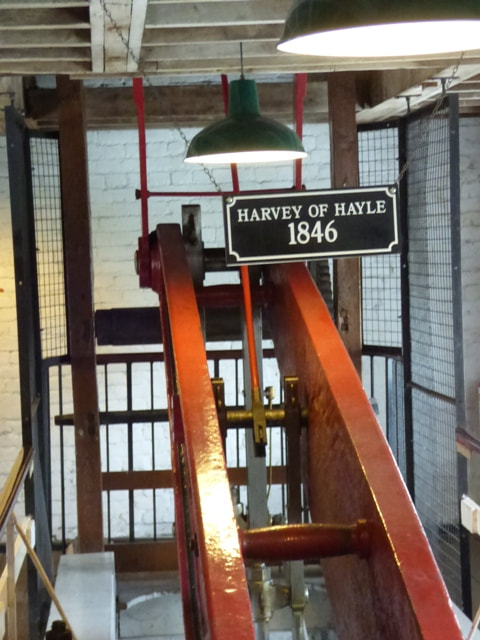
Crofton Pumping engine 3 30th April 2017 Copyright Roger Aston
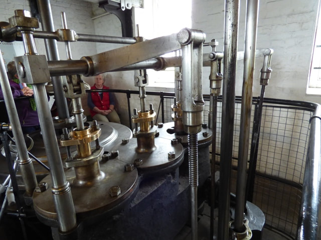
Crofton Pumping engine 4. 30th April 2017 Copyright Roger Aston
Many thanks to Roger Aston for the above four views.
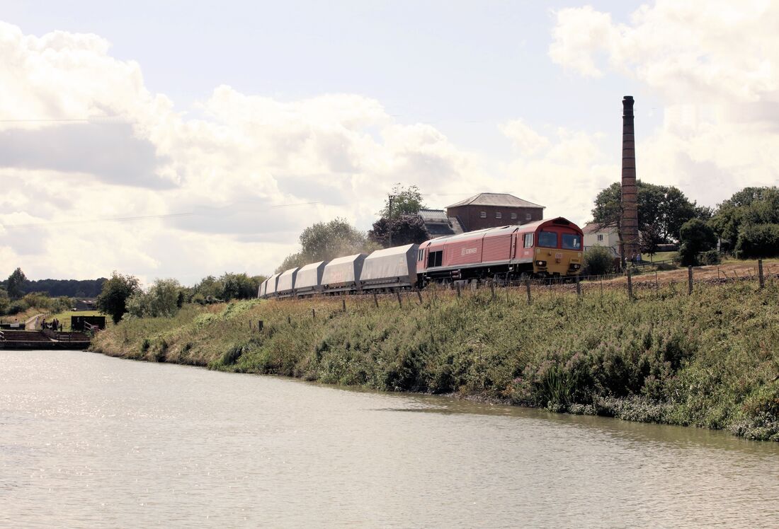
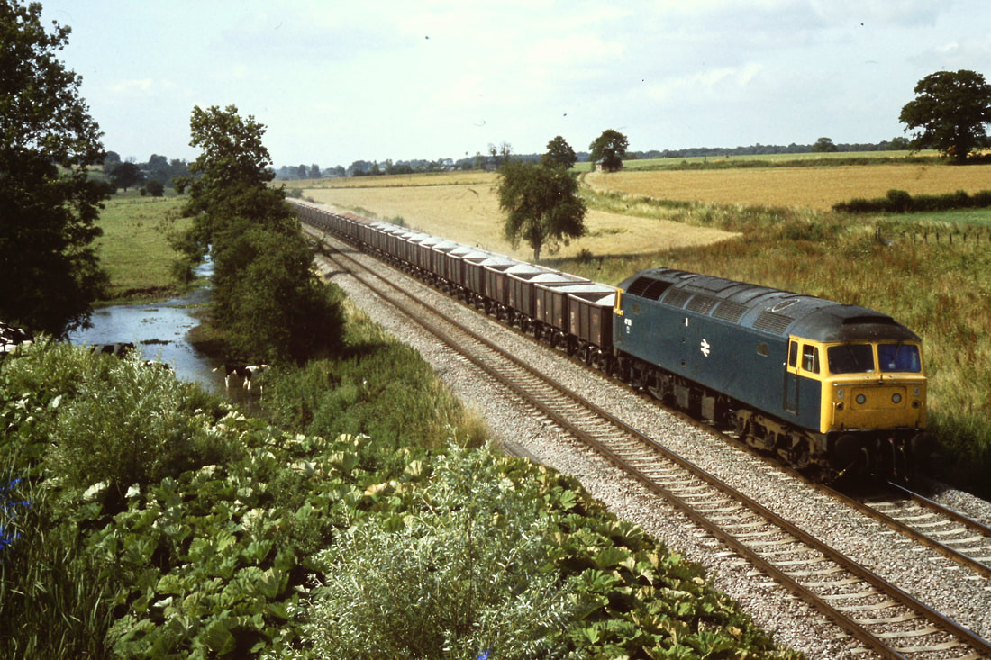
Roger gets down low for this shot across the Kennet and Avon Canal towards the Crofton Pumping Engine as 59204 on the 11.48 Merehead to Theale passes by on Tue 13th August 2019. Copyright Roger Geach
Alongside the Kennet and Avon Canal at Crofton as 1c84 the 14.06 Paddington to Penzance passes by on the 5th May 2016 Copyright Roger Geach.
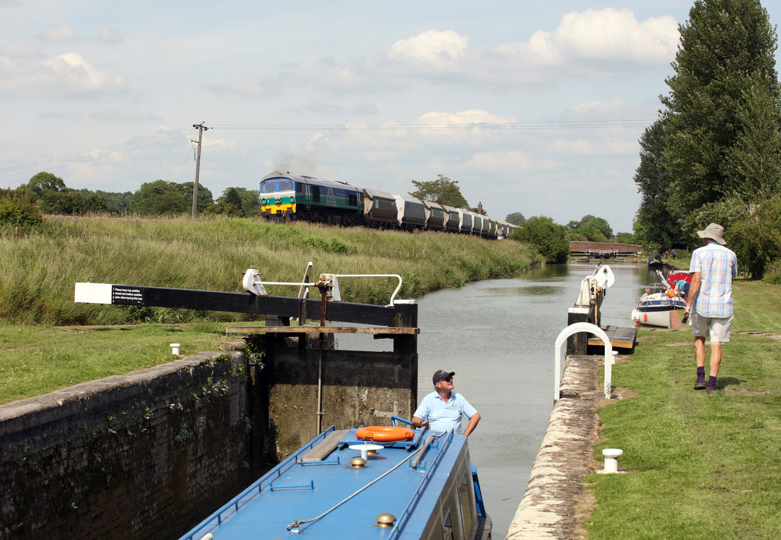
59004 seen here at Crofton obviously with power on climbing the bank towards Savernake with the Allington to Whatey empties. Wednesday 14th June 2017. Copyright Roger Geach. On the Kennet and Avon canal the skipper of the barge patiently waits while his mate goes to close the second gate - oh happy days.
Bedwyn 66.5 miles from Paddington
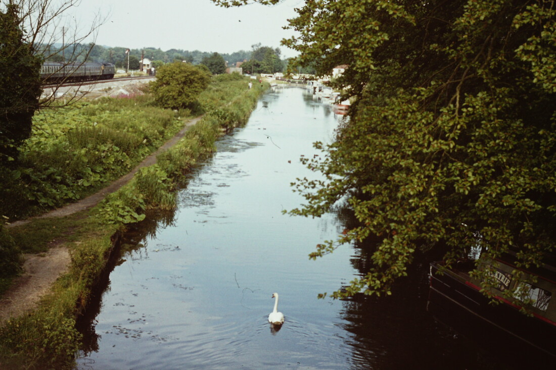
Followed by walking the Kennet & Avon Canal footpath from Bedwyn Station to Little Bedwyn etc
Followed by walking the Kennet & Avon Canal footpath from Bedwyn Station to Little Bedwyn etc
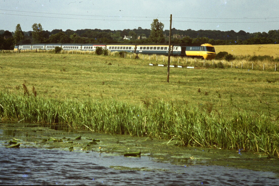
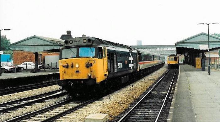
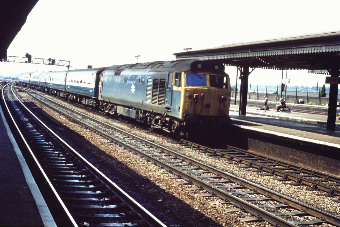
Possibly 50004 passing Bedwyn on route to Paddington. 30th July 1977. Copyright Roger Winnen
770730bb After detraining its passengers the unit moves to crossover to the up main to Newbury then backing into the Bay Platform. Copyright Roger Winnen
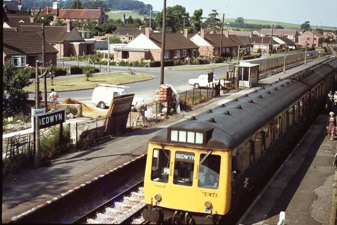
770730c Bedwyn being the limit of the suburban services from London. Copyright Roger Winnen
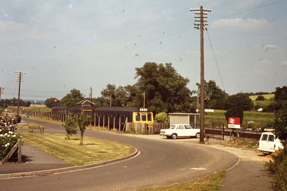
770730d The train sits in the bay platform awaiting a path to Reading etc. Copyright Roger Winnen
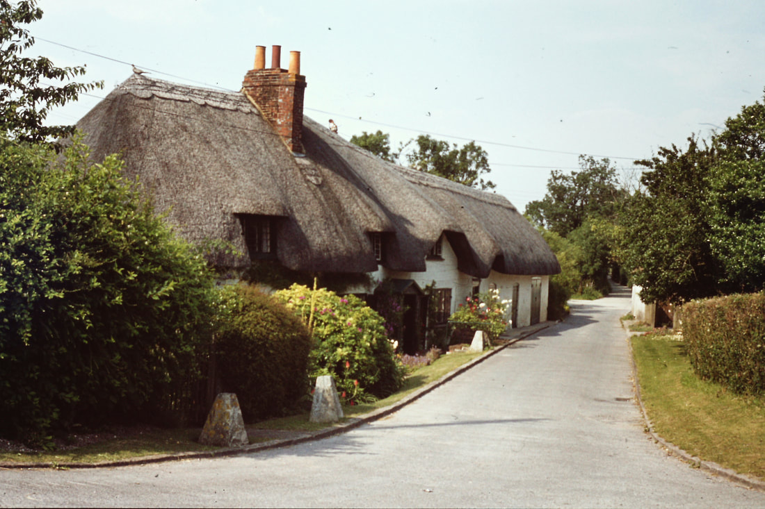
770730e The thatched houses of the village. Copyright Roger Winnen
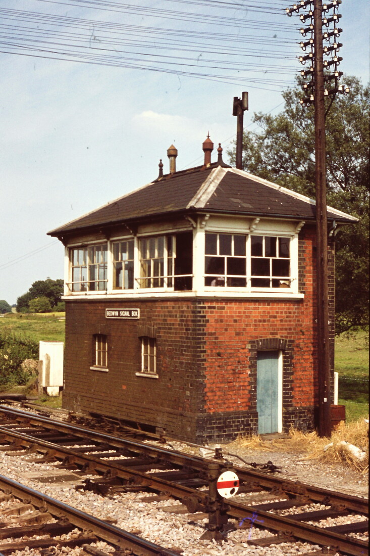
770730h Bedwyn Signal Box. Copyright Roger Winnen
770730i A Class 50 on route to the Westcountry passes Bedwyn. Copyright Roger Winnen
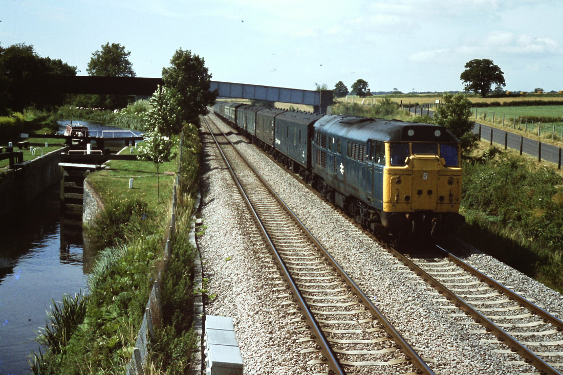
59001 passes through Bedwyn with the 12.40 Acton to Merehead 13th May 2015 Copyright Roger Geach
Squeezing under the footbridge at Little Bedwyn is 59002 with the 6c58 Oxford Rd to Whatley, It's Wednesday 14th June 2017. Copyright Roger Geach
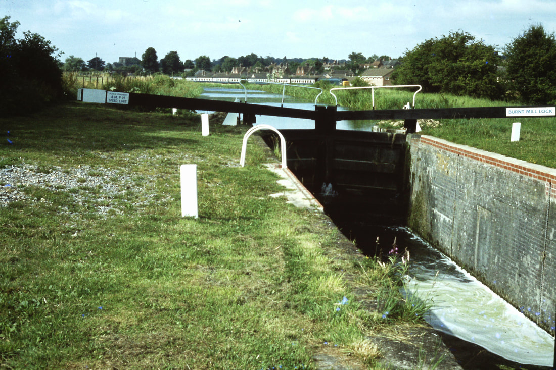
820415a Lock Gates on the Kennet and Avon Canal. Copyright Roger Winnen
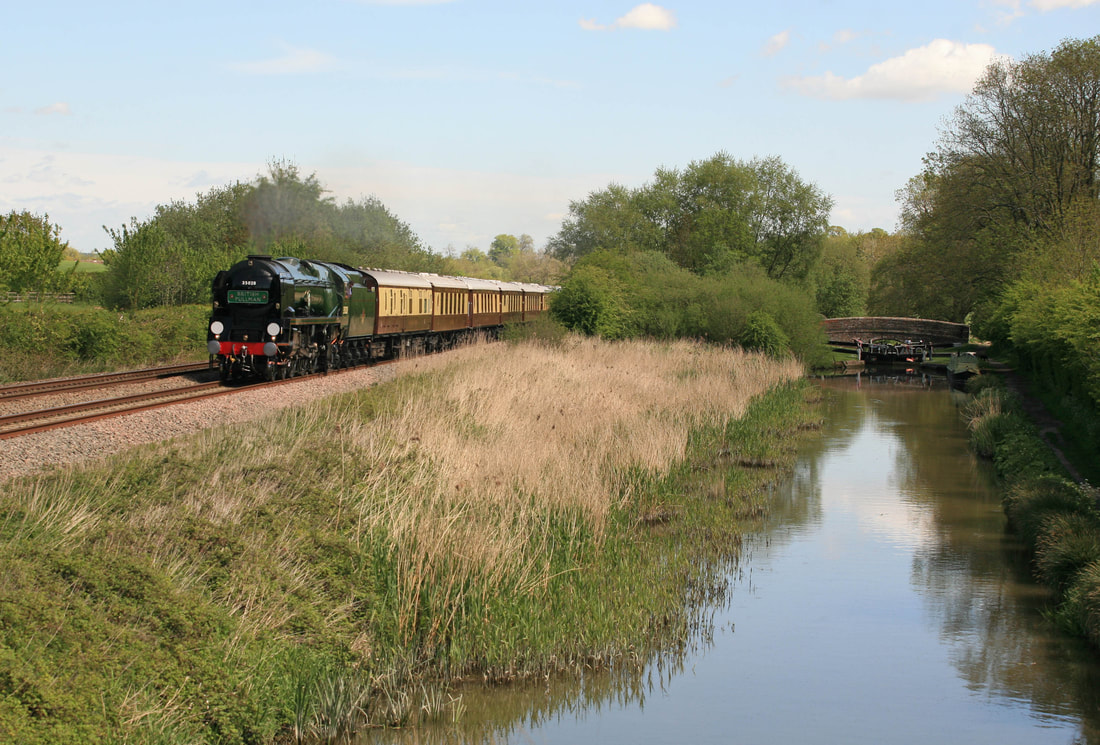
Bedwyn, Near, with 35028 with the 08.45 London Victoria to to Bath Bath Pullman Wednesday. 13th May 2015 Copyright Roger Geach. A delightful scene alongside the Kennet & Avon Canal.
This steam is taken about one mile out of Great Bedwyn heading towards Crofton Pumping engines on the Crofton road from Bedwyn and beside the canal. It is past Mill Bridge and not far from where Brail Farm is on the Hill . It is about half a mile still further on to Crofton roughly.
Glad you like it. No hurry with these as when you have time. They did a good job getting the canal restored. RG
Glad you like it. No hurry with these as when you have time. They did a good job getting the canal restored. RG
830721c From the banks of the canal an HST is seen on route to London. Copyright Roger Winnen
830727b Locks on the Kennet and Avon. A Peak is seen hauling a passenger traiin towards Newbury and Reading. Copyright Roger Winnen
830728eThe locks at Little Bedwyn. Copyright Roger Winnen
830728f The famous footbridge at Little Bedwyn as Pickfords does a removal. Copyright Roger Winnen
830728ff An HST Passing Little Bedwyn on route to the South West. Copyright Roger Winnen
830728j A Class 56 on a Foster Yeoman stone working passes the Church at Little Bedwyn. Copyright Roger Winnen
830728k The Class 50 is seen on an express to the West Country passes Little Bedwyn. Copyright Roger Winnen
830728l A HST heads west at Little Bedwyn. Copyright Roger Winnen
830728m Another stone train headed by a Class 56 skirts the Kennet & Avon Canel. Copyright Roger Winnen
59206 7A77 the 12.22 Merehead to Theale at Little Bedwyn Thur 17th August 2023. Copyright Roger Geach
One doesn't need steam or smoke to emphasise movement - in the above case dust from the loaded stone train provides the speed dimension to the picture.
Hungerford 61.5 miles from Paddington
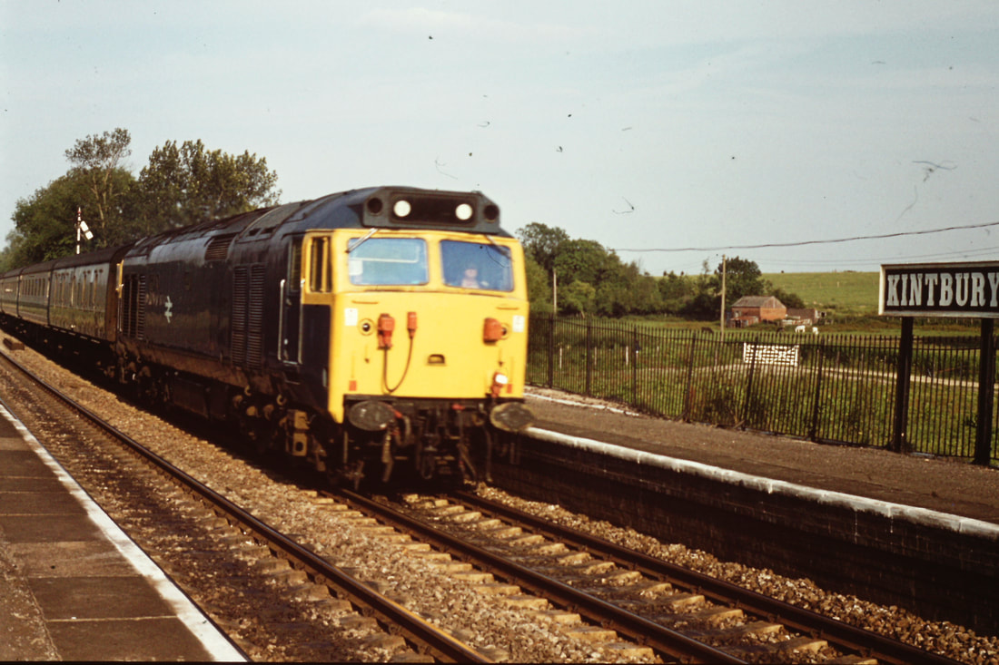
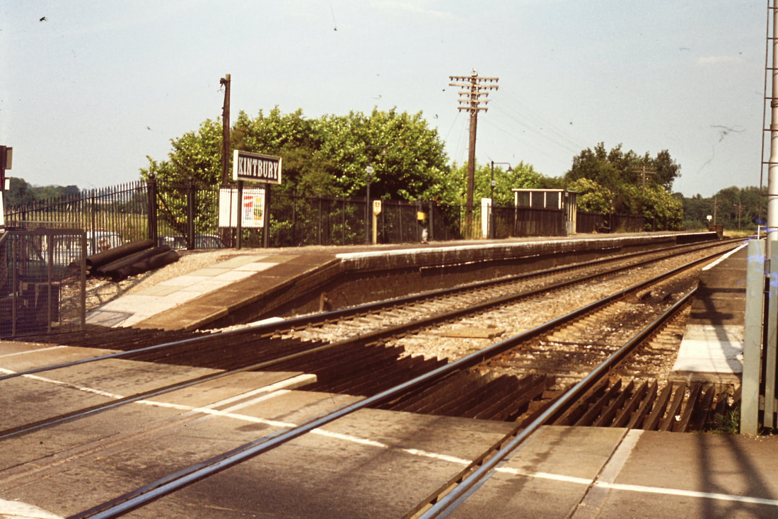
Kintbury 58.5 miles from Paddington
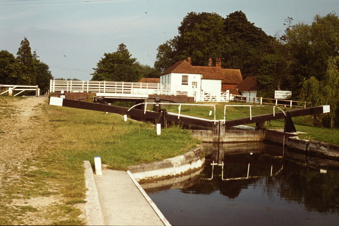
830728n Dundas Arms and locks at Kintbury. Copyright Roger Winnen
770730j The Signal Box at Kintbury can be seen in the distance as a train proceeds towards London. Copyright Roger Winnen
770730k A Class 50 passes Kintbury Station. Copyright Roger Winnen
770730l Basic facilities at Kintbury Station. Copyright Roger Winnen
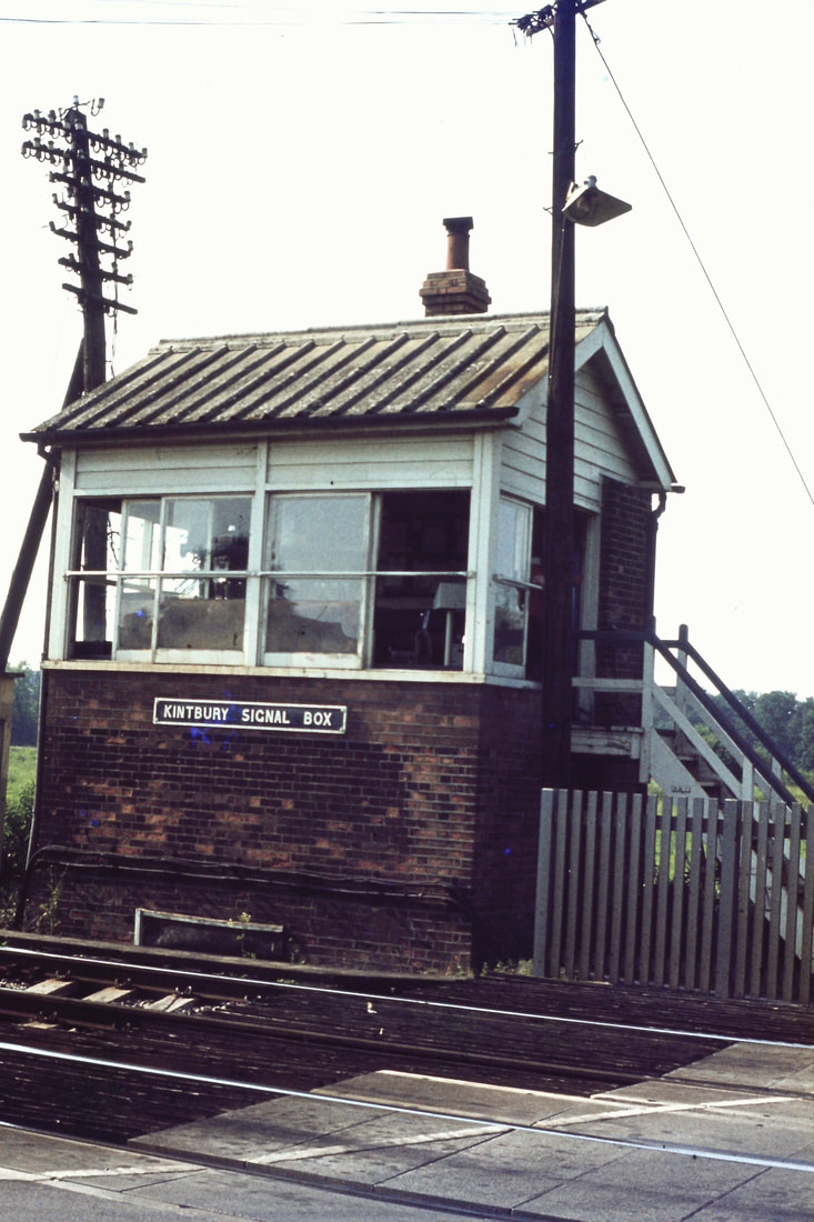
770730m Kintbury Signal Box. Copyright Roger Winnen
830728h Approaching Kintbury a Class 47 on a stone working heads for the capitol. Copyright Roger Winnen
830728i A Class 31 on a Parcels Train pass the locks at Kintbury. Copyright Roger Winnen
Newbury
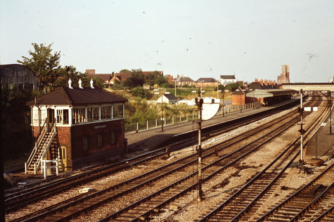
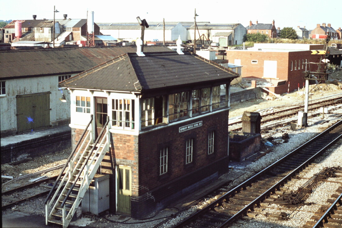
770730n Newbury Station West Signal Box. Copyright Roger Winnen
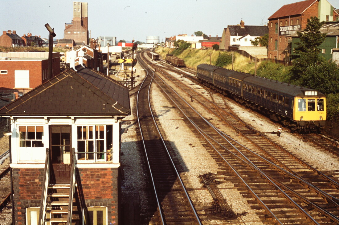
770730o A Train from Reading approaches Newbury Station from the east. Copyright Roger Winnen
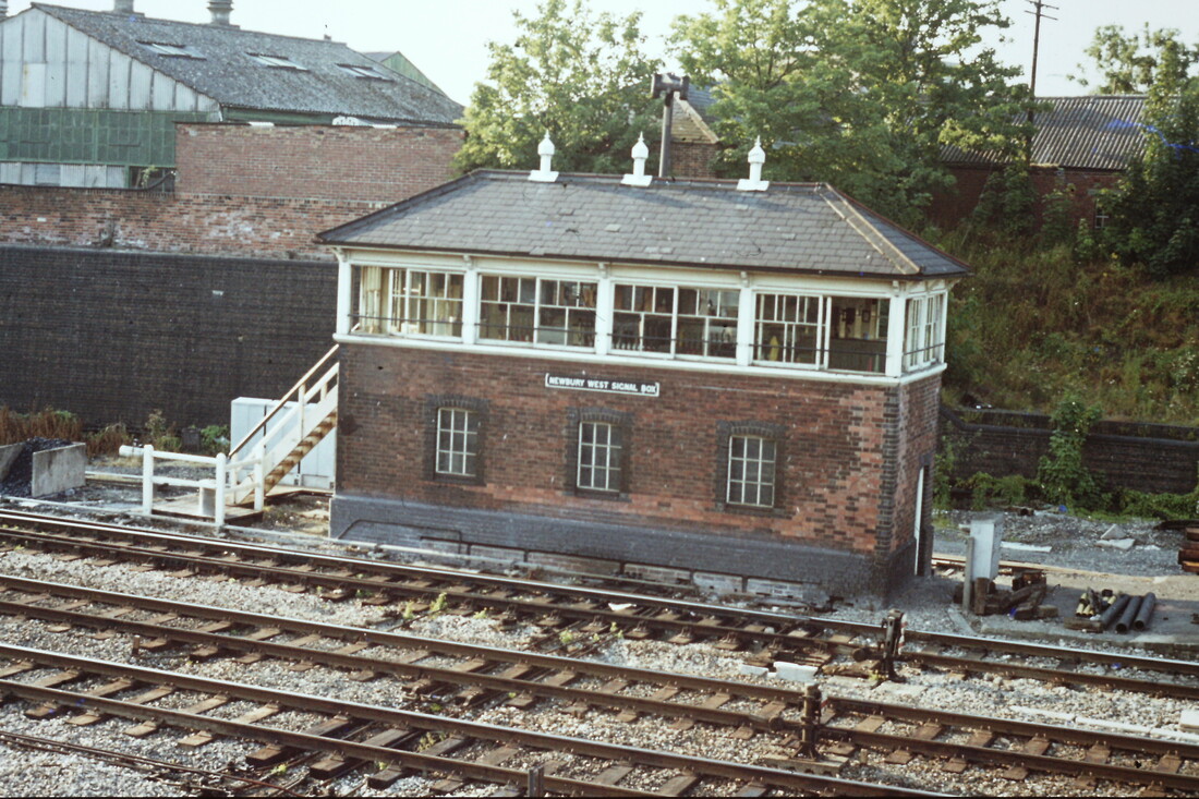
770730p Newbury West Signal Box. Copyright Roger Winnen
Newbury West sigalbox (taken for the train) February 1969. Copyright Roger Geach
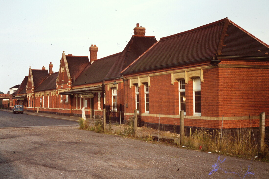
770730q The exterior of Newbury Station. Copyright Roger Winnen
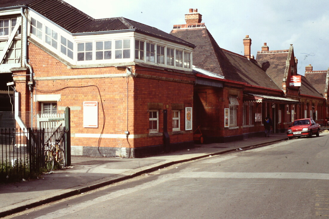
900516a Newbury Station. Copyright Roger Winnen
770730q The exterior of Newbury Station. Copyright Roger Winnen
A summers day at Newbury 28th June 1986 - Michael Forward.
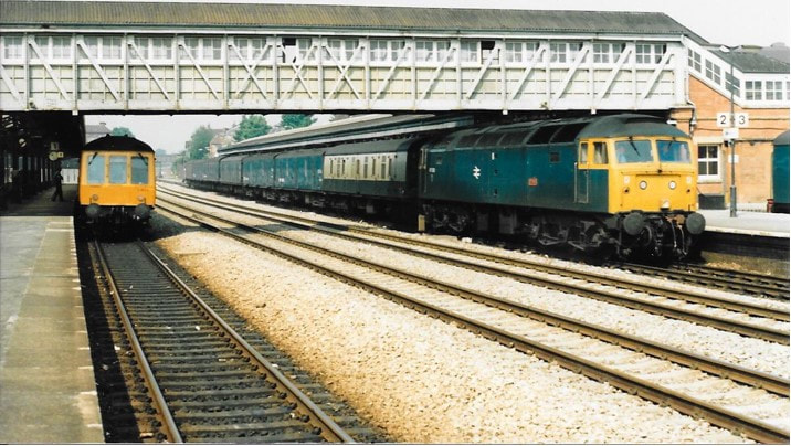
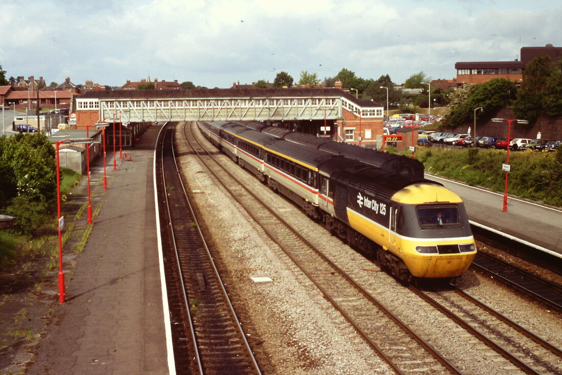
NEWBURY 1 nice warm day at Newbury on 28 June 1986 which shows 47606 ‘Odin’ just arrived with a van train ,it uncoupled, picked up the van you can just see in the bay then continued to Paddington. Copyright Michael Forward.
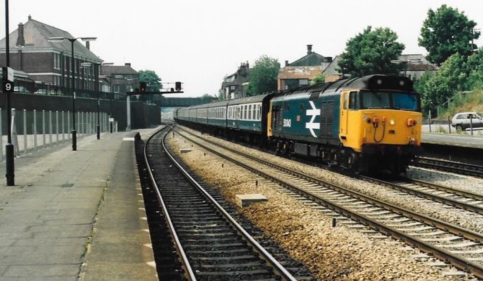
NEWBURY 2 50043 ‘Eagle’ ,at speed, with the 11.30 from Paignton to Paddington.. 28th June 1996. Copyright Michael Forward
NEWBURY 3 50 10 Monarch heading west with the 11.35 Paddington to Paignton dull but warm 28th June 1986 Coyright Michael Forward
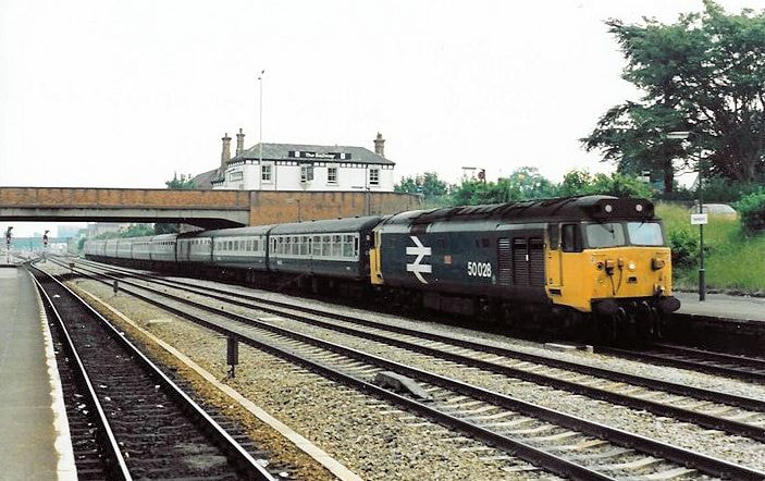
NEWBURY 4 50028 ‘Tiger’ about to call at Newbury with the 12.45 service from Paddington to Paignton. Copyright Michael Forward.
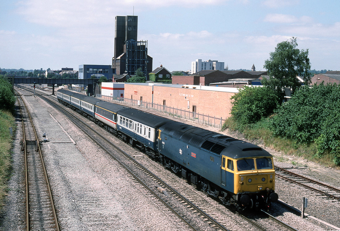
47558 Newbury with a short forned train for Paddington. 18th July 1988, Copyright Ron Kosys.
900516b An HST on the through lines at Newbury bound for London. Copyright Roger Winnen
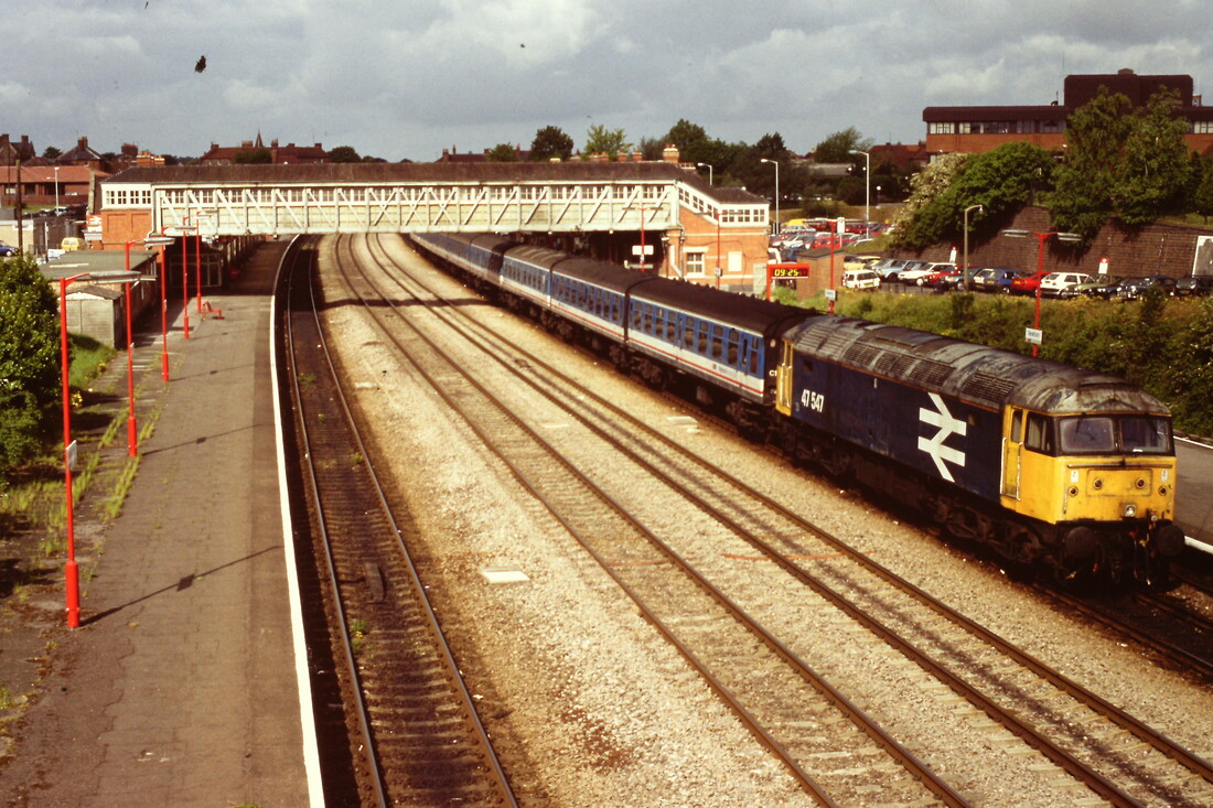
900516c 47547 heads a communter train towards the capital. Copyright Roger Winnen
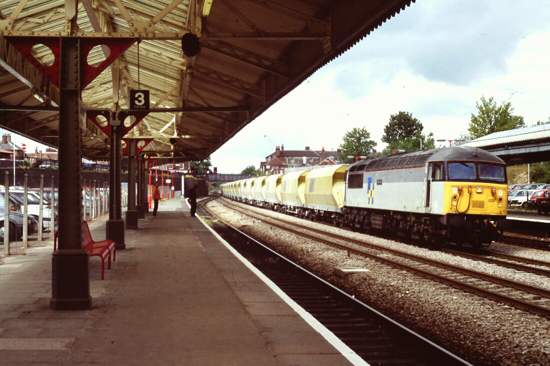
900516g A Class 33 with an engineers train passes Newbury. Copyright Newbury. Copyright Roger Winnen
900516dd A Class 56 storms through Newbury with a stone train bound for the capitol. Copyright Roger Winnen
770730s Passing through Newbury on 4th October 2018. Copyright Roger Winnen
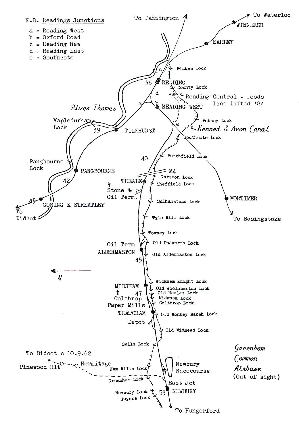
A map depicting the course of the railway and the accompanying canal with all the locks named. Copyright Keith Jenkin.
Newbury Racecourse Station
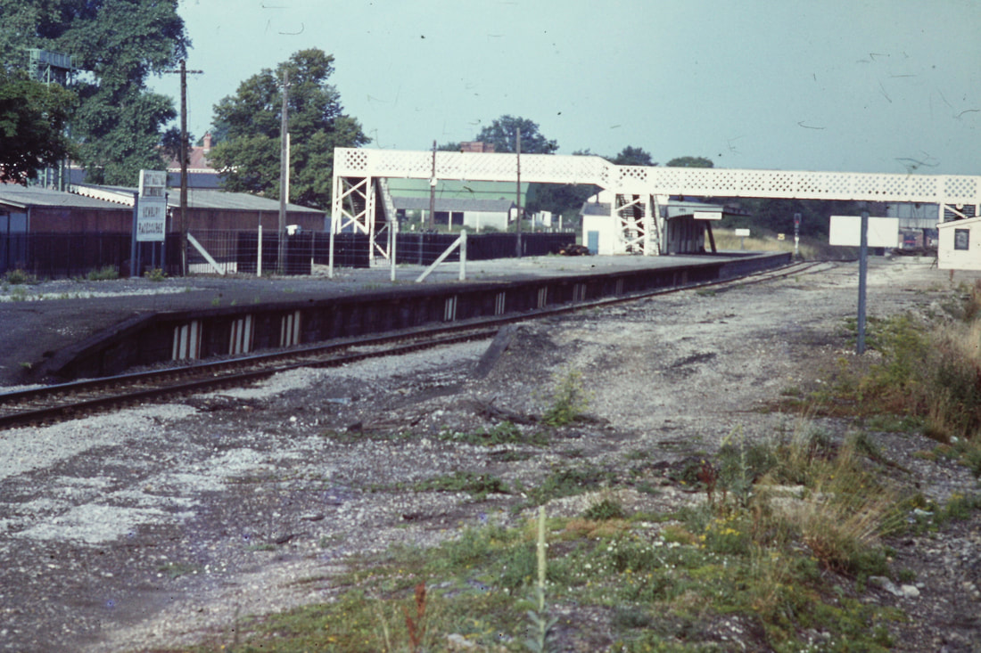
790806a Newbury Racecourse Station on 6th August 1979. Copyright Roger Winnen
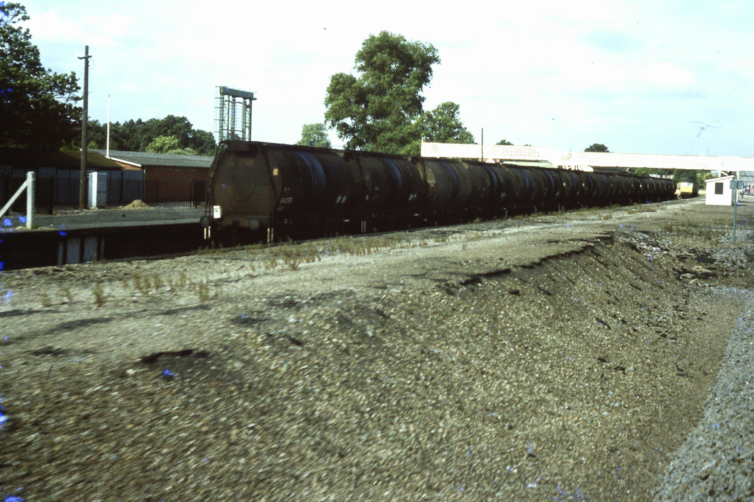
830728q An oil train at Newbury Racecourse Station. Copyright Roger Winnen
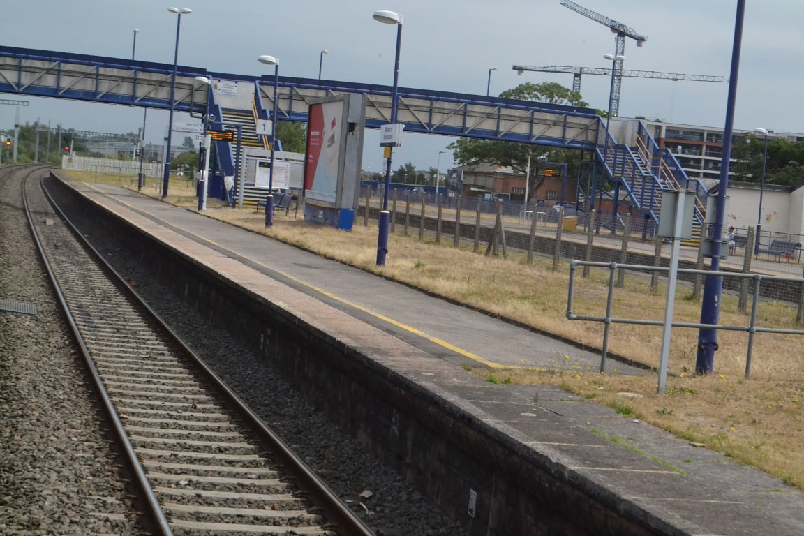
170627a Newbury Racecourse Station. Copyright Roger Winnen
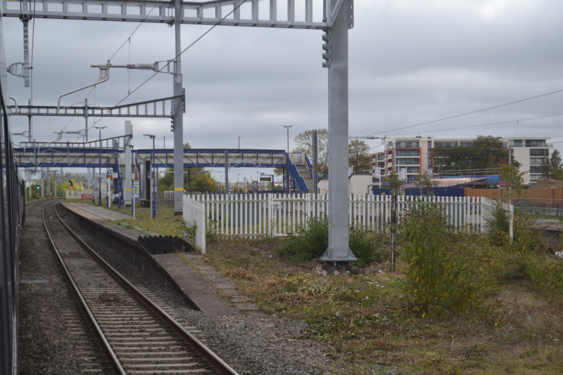
181004d Newbury Racecourse Station. Copyright Roger Winnen
Newbury Racecourse in 2023
There is currently a blockade at Newbury for track works affecting passengers between Saturday 18th February and Thursday 2nd March 2023.
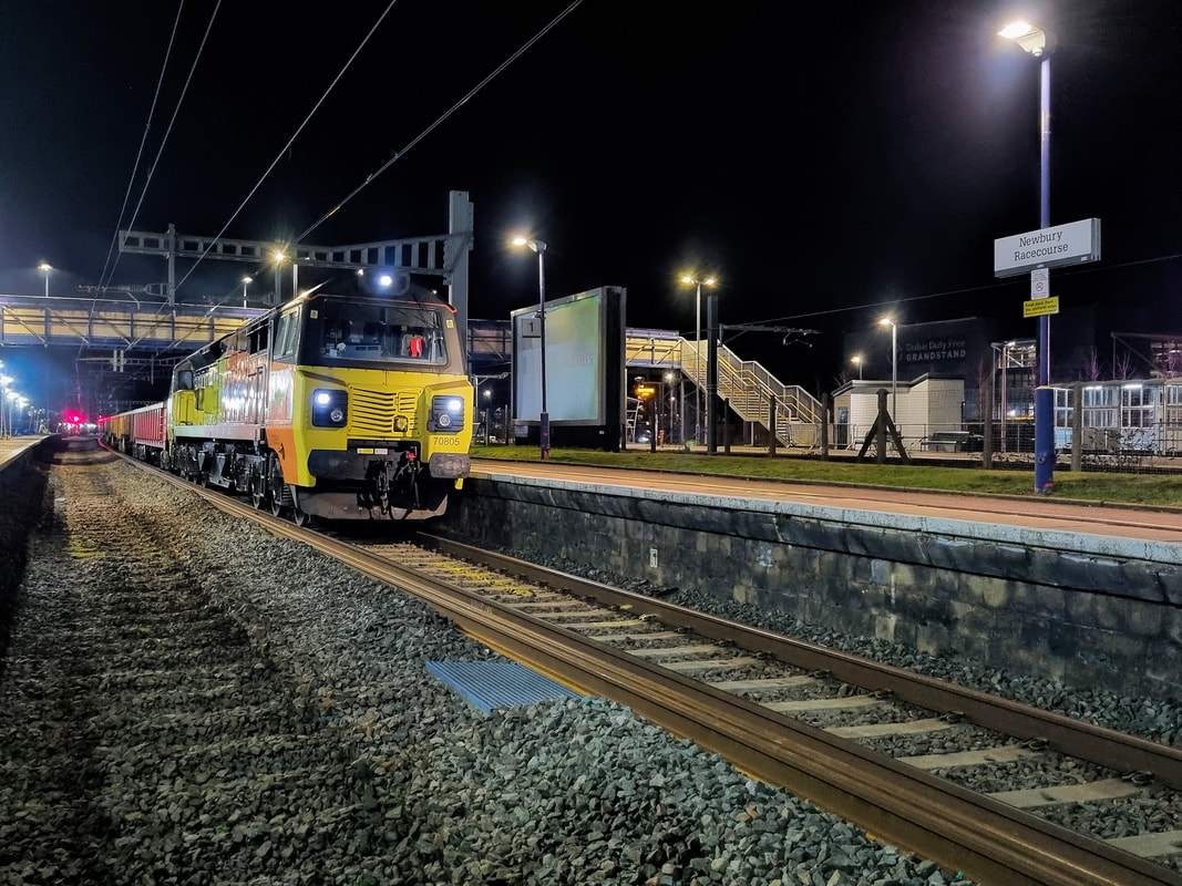
Newbury Racecourse station. 19th February 2023. copyright Driver Alan Peters.
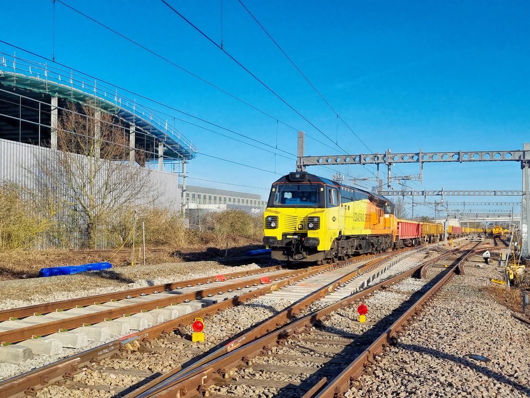
Colas Rail 70805 has now moved to Newbury Racecourse station with 6F05 which will return to Westbury loaded with scrap rail, the 'Up' line has been removed pending renewal, taken during T3 conditions on 19/02/23
Alan Peters
Thatcham 49.5 Miles from Paddington.
Midgham 46.75 miles from Paddington.
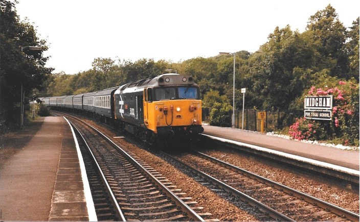
50032 ‘Courageous’ passing through Midgham station 0n 27 July 1985 with the 08.50 service from Paignton to Paddington. Copyright Michael Forward
181004a Passing through Midgham Station on route to Paddington. Copyright Roger Winnen
Aldermaston 44.75 miles from Paddington.
Theale 41.25 miles from Paddington.
170627b The Murco Oil Terminal at Theale. Copyright Roger Winnen
Southcote Junction
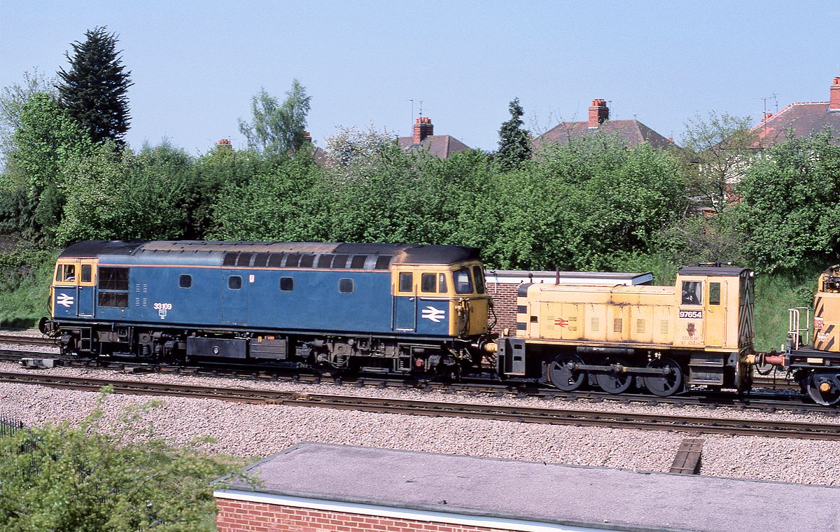
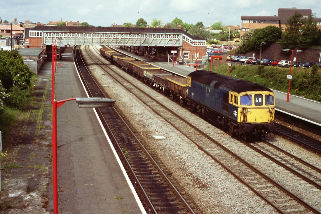
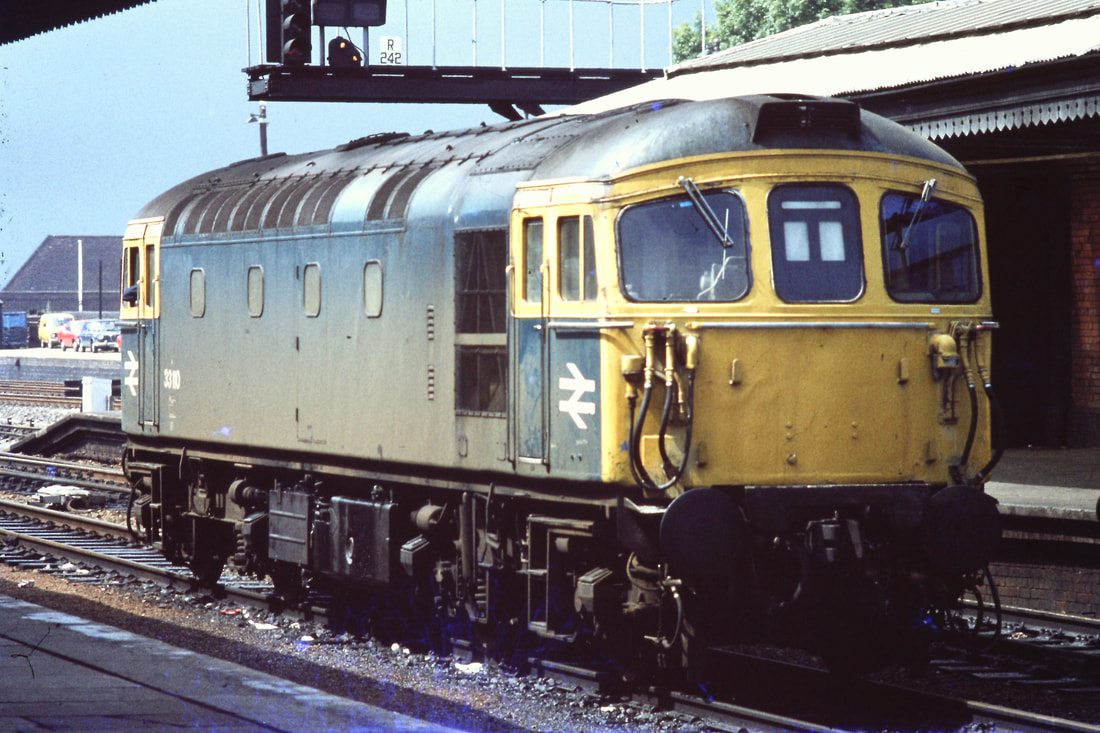
33109+97654 Southcote 28th April 1990 Reading to -Westbury. Copyright Ron Kosys
A regular feature on the Berks & Hants on Saturdays around this time was a Reading to Westbury engineers working.
This included one of the Reading based Departmental shunters for working at the work site on the Sunday as required. It returned to Reading in a similar working for attention should it be required.
33109 and 97654 did the honours on Saturday 28th April 1990.
This included one of the Reading based Departmental shunters for working at the work site on the Sunday as required. It returned to Reading in a similar working for attention should it be required.
33109 and 97654 did the honours on Saturday 28th April 1990.
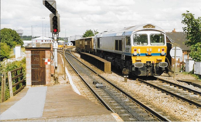
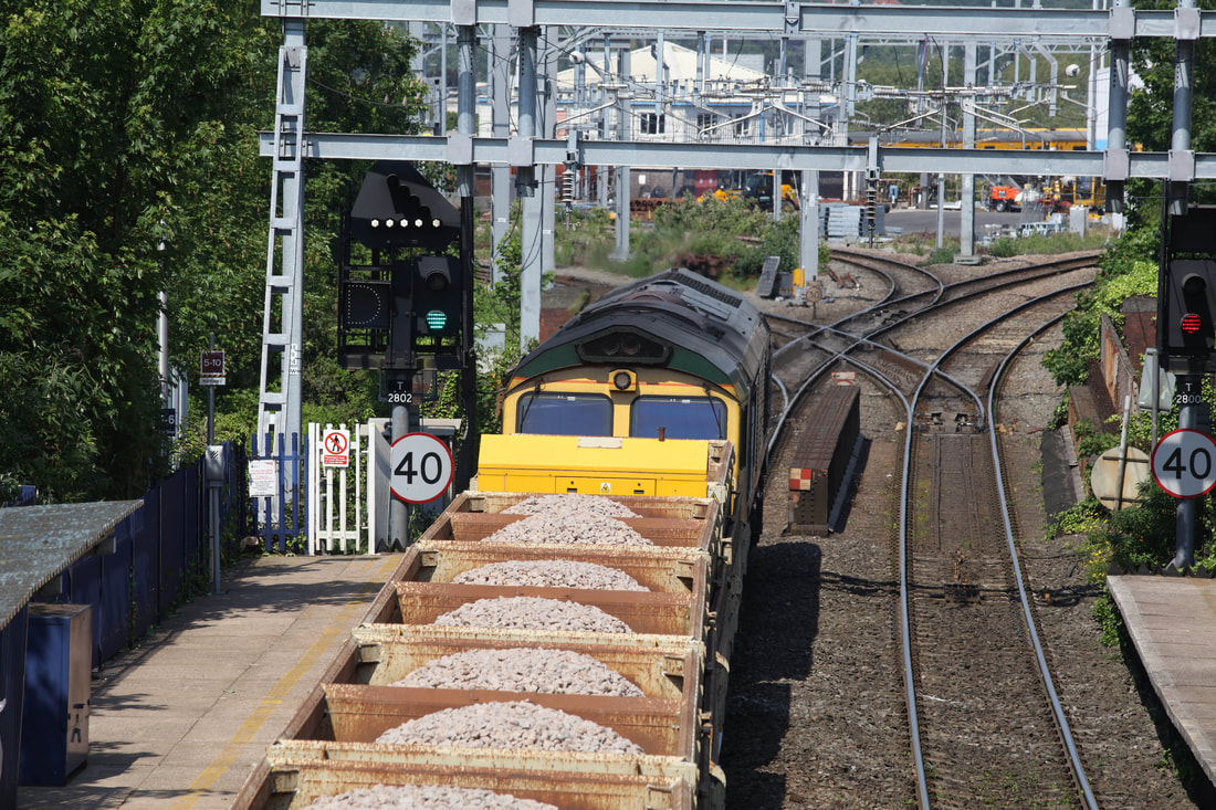
Reading West 37 miles from Paddington.
181004a Reading West. Copyright Roger Winnen
930823a This photograph taken on a very warm 23 August 1993 of 59005 at Reading West with the mid-afternoon Acton To Merehead Jumbo train empties. Copyright Michael Forward
Roger is looking down on 66565 the 13.31 Eastleigh to Hinksey at Reading West on Wednesday 23rd May 2018. Ahead lies Oxford Road Junction. Copyright Roger Geach.
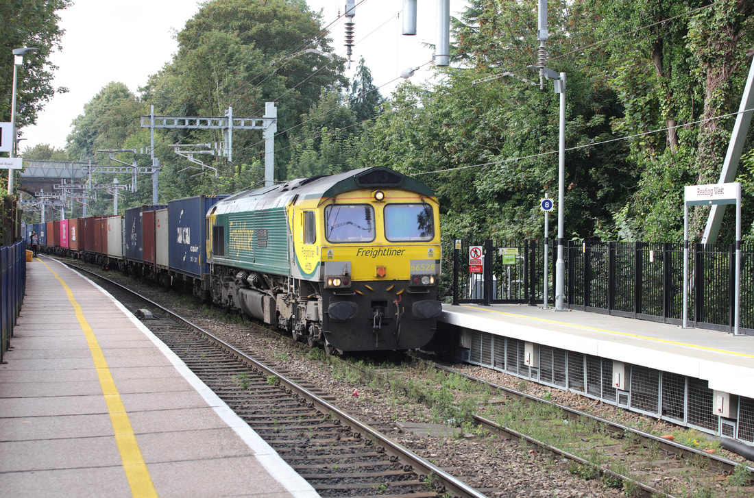
66528 on the 08.47 Southampton to Birmingham Lawley Street at Reading West on Wednesday 7th August 2019 Copyright Roger Geach.
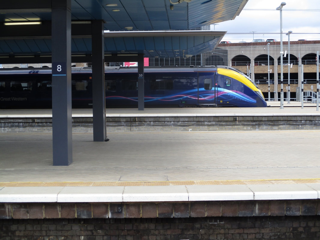
Reading 36 miles from Paddington.
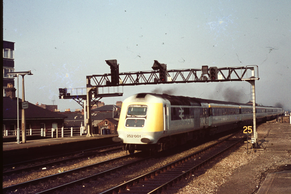
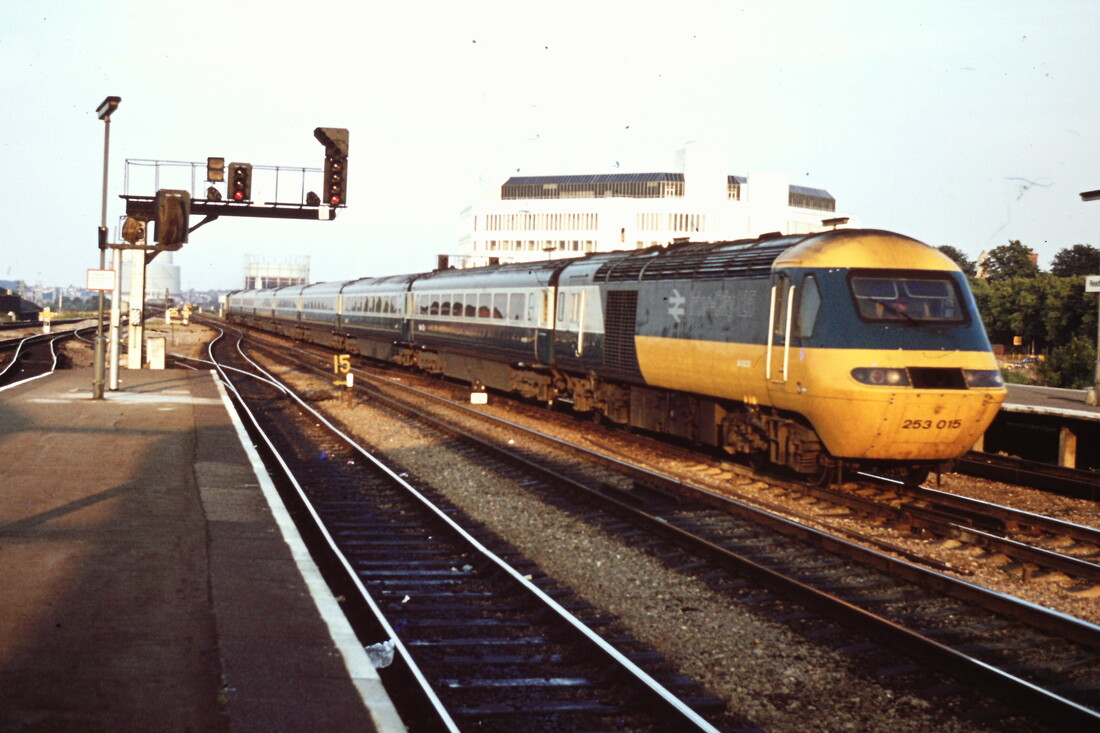
750807a The prototype HST passes through Reading. Copyright Roger Winnen
750807a The prototype HST passes through Reading. Copyright Roger Winnen
770730a A Class 50 heads a london bound train at Reading. Copyright Roger Winnen
790803a 33110 at Reading Station. Copyright Roger Winnen
130813a 150002 Departs Reading on a service to Basingstoke. Copyright David Tozer
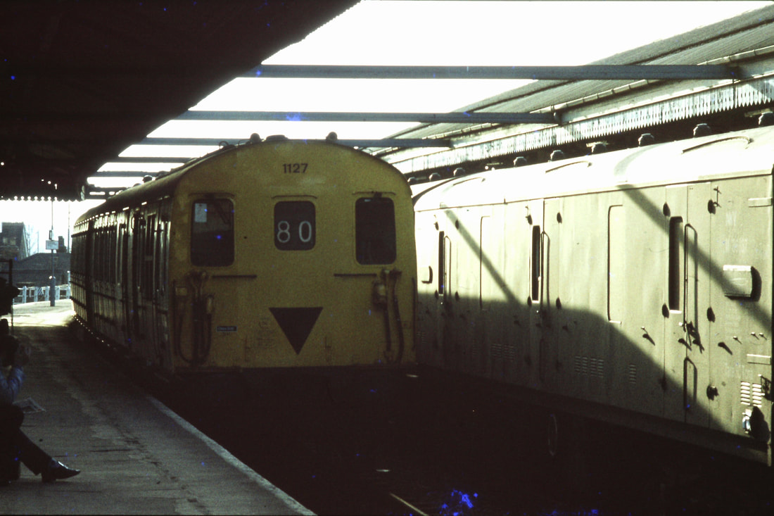
830421a EMU 1127 at Reading Station. Copyright Roger Winnen
830728o 33211 Passes through Reading on a container train to the Southern Region. Copyright Roger Winnrn
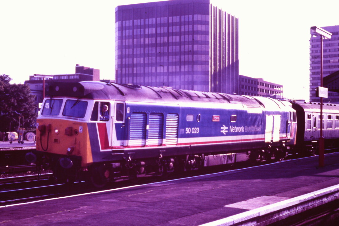
860711aa 50023 Howe in Network South East Livery leave Reading. Copyright Roger Winnen
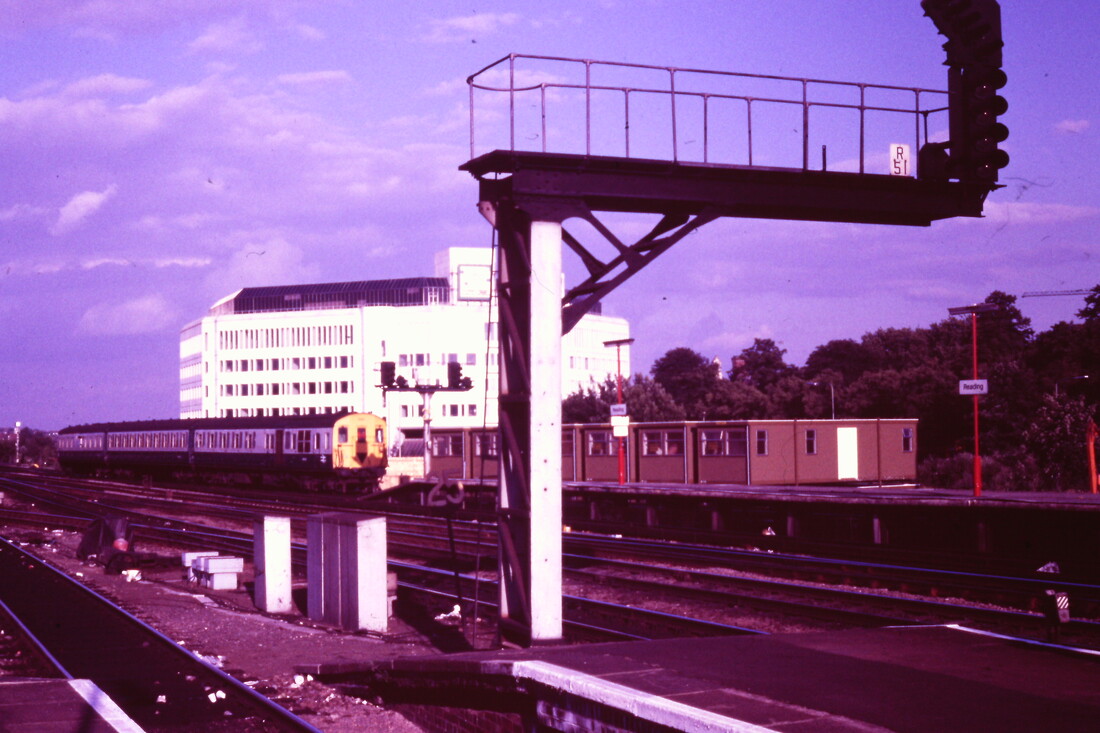
860711c The Southern enters Reading from London Waterloo. Copyright Roger Winnen
Unit 458 8021 Awaiting departure from Reading on 2nd November 2015. Copyright David Tozer
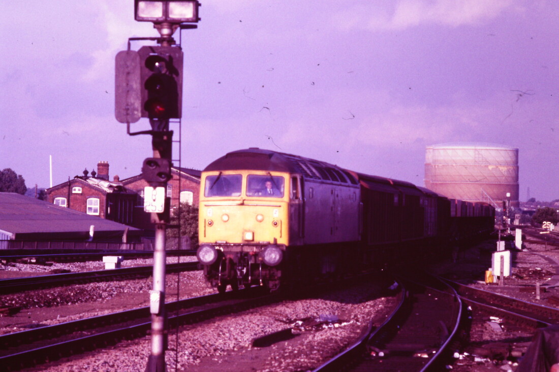
860711b A Class 47 with a freight arrives at Reading. Copyright Roger Winnen
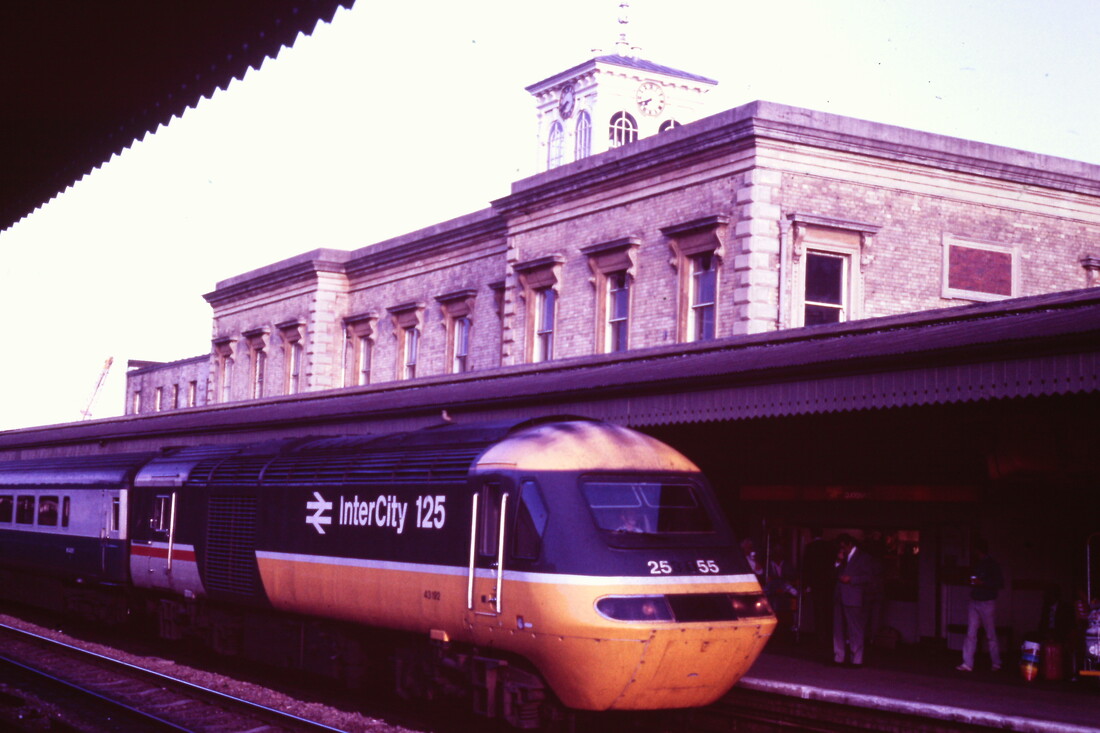
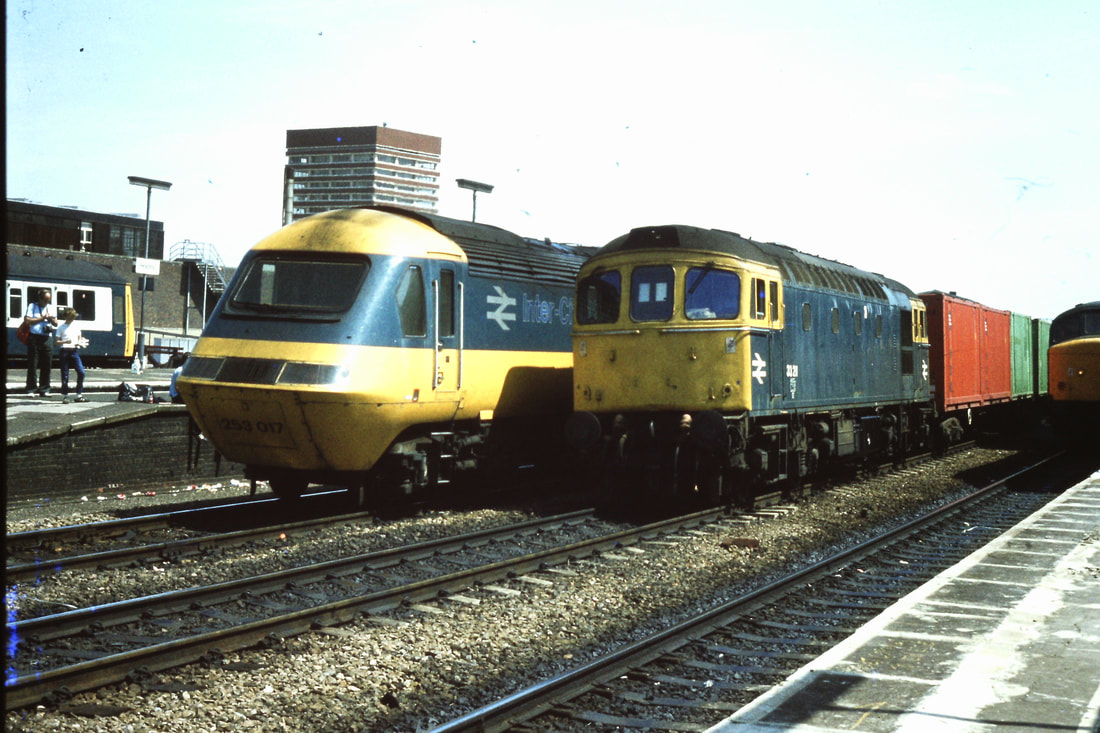
860711d An HST alongside the now old station buildings at Reading. Copyright Roger Winnen
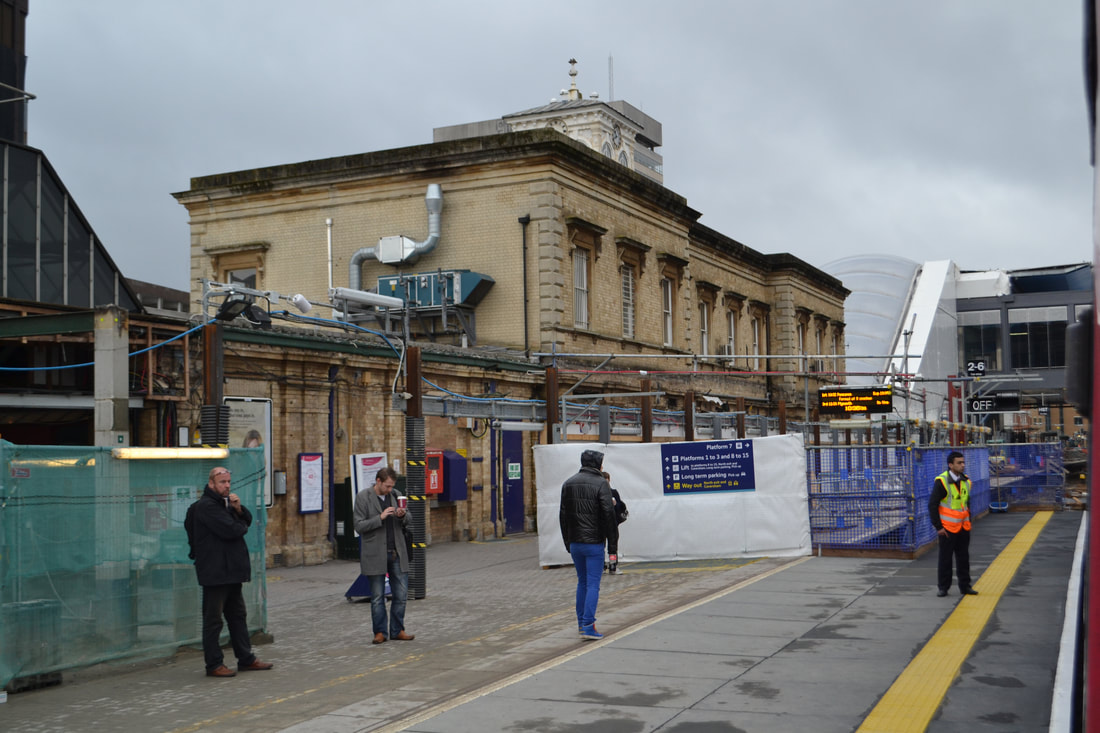
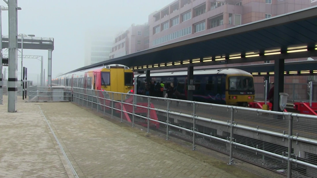
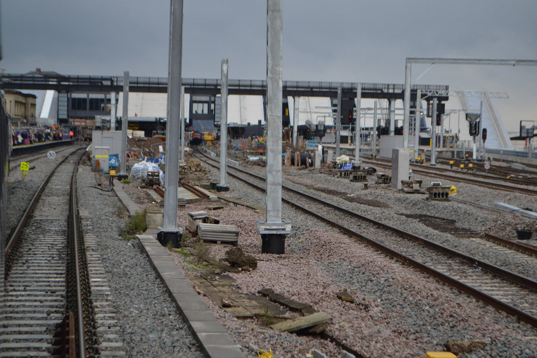
141013a The rebuilding of Reading Station in 2014. Copyright Roger Winnen
141013c The rebuilding of Reading Station. Copyright Roger Winnen
141013b Running into Reading Station from Paddington on 13th October 2014. Copyright Roger Winnen
770730u An HST arrives at Reading on a service from London Paddington. Copyright Roger Winnen
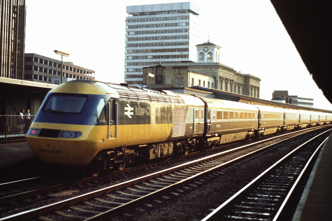
770730v The original station buildings is seen behind the HST. Copyright Roger Winnen
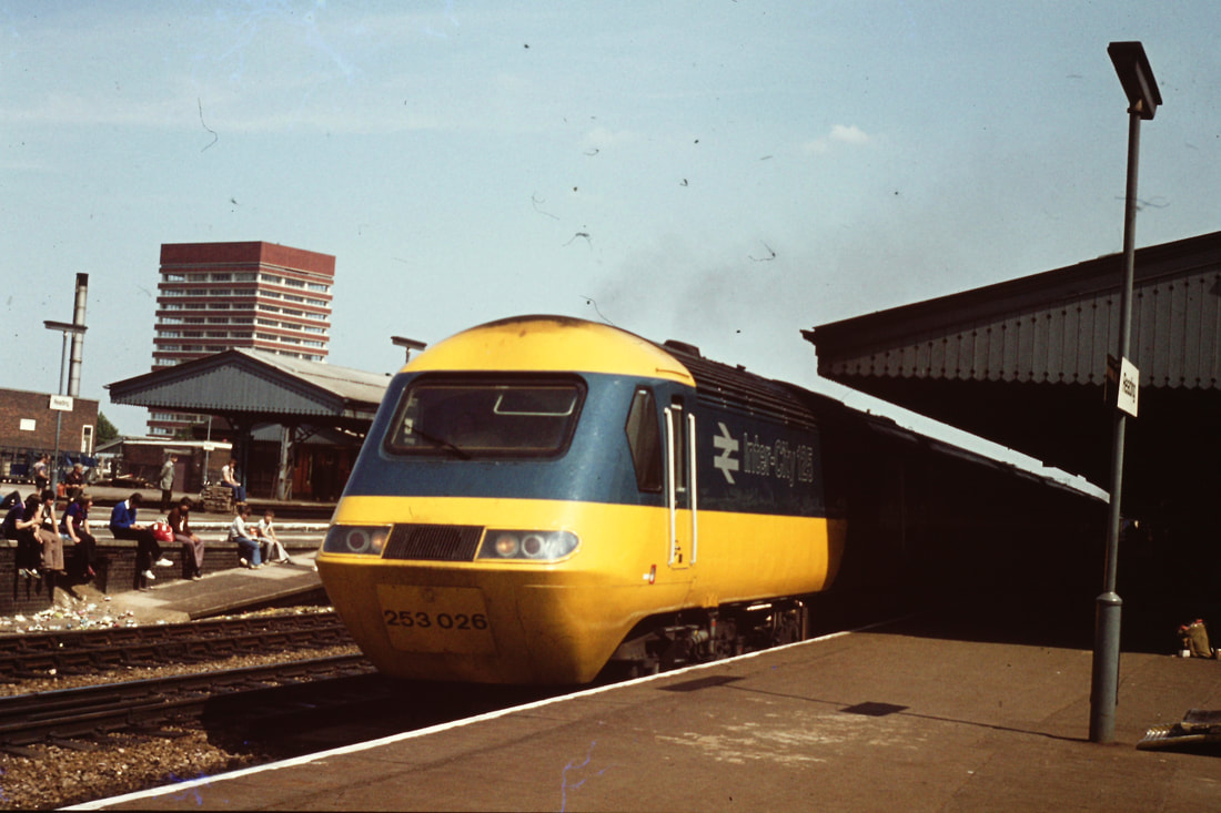
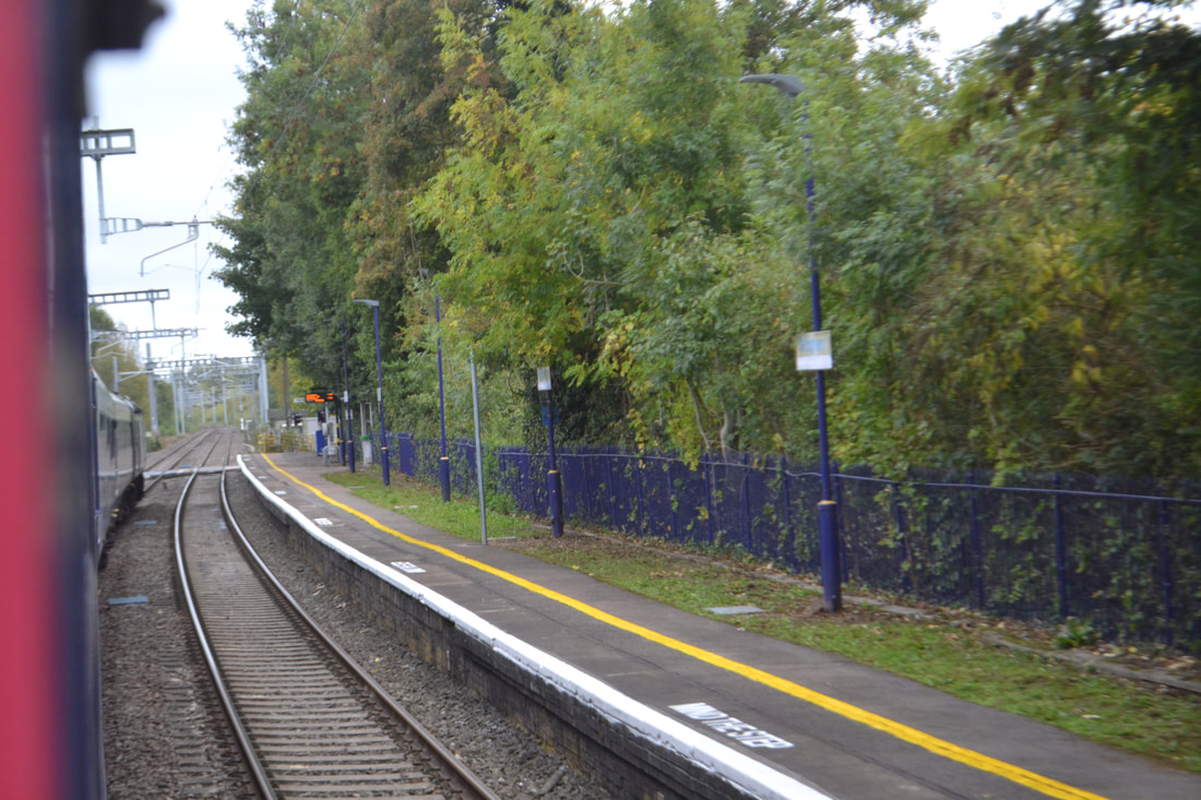
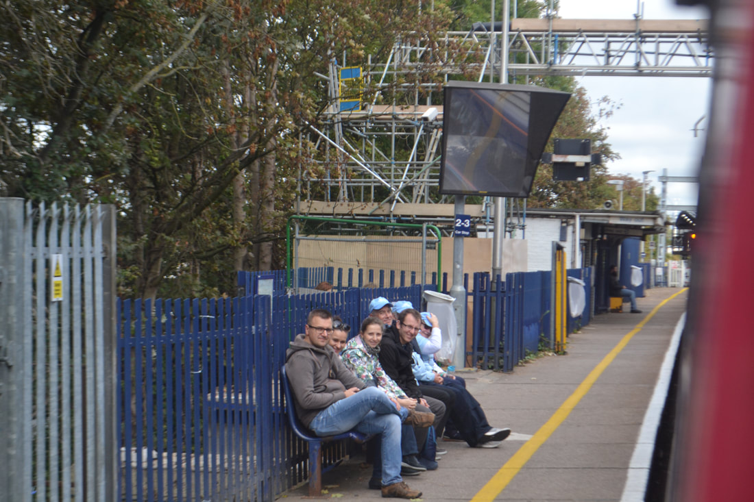
770730w Rail Enthusiats sit on the end of the platform at Reading. Copyright Roger Winnen
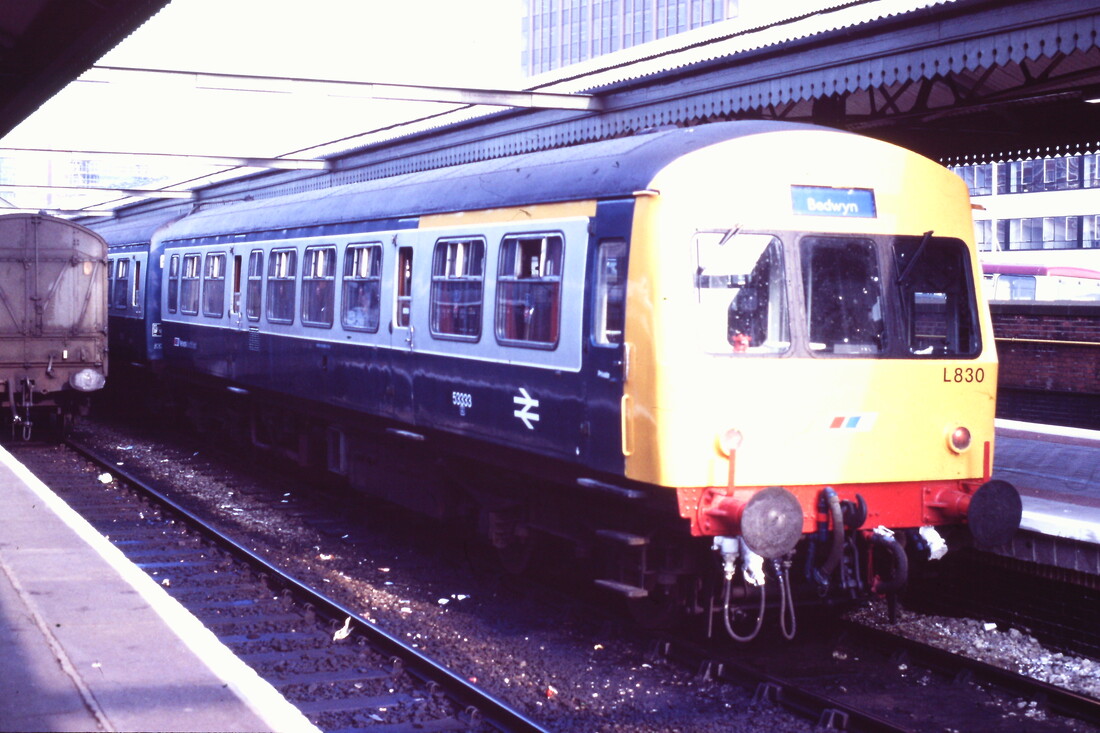
860711e Metro Cammel DMU on the Bedwyn service at Reading. Copyright Roger Winnen
930630a A train from Paddington enters the bay platform at Reading. Copyright Roger Winnen
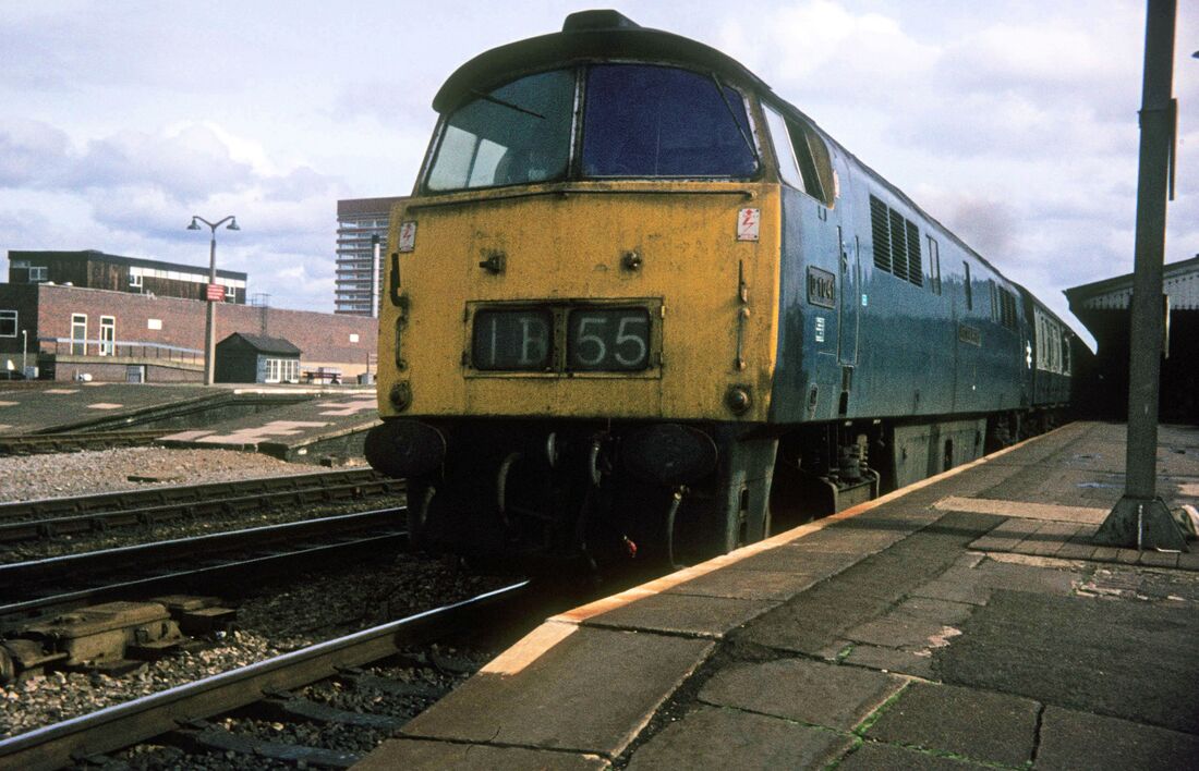
1041 Western Prince 1b55 12.30 Paddington to Paignton at Reading on Friday 28th September 1973 Copyright Roger Geach
Looking very smeart in NSE colours we see 50001 Dreadnought on the 14.00 Oxford to Paddinton seen at Reading on the 23rd September 1988 Copyright Roger Geach
770805a The former Reading General Station West Signal Box. Copyright Roger Winnen
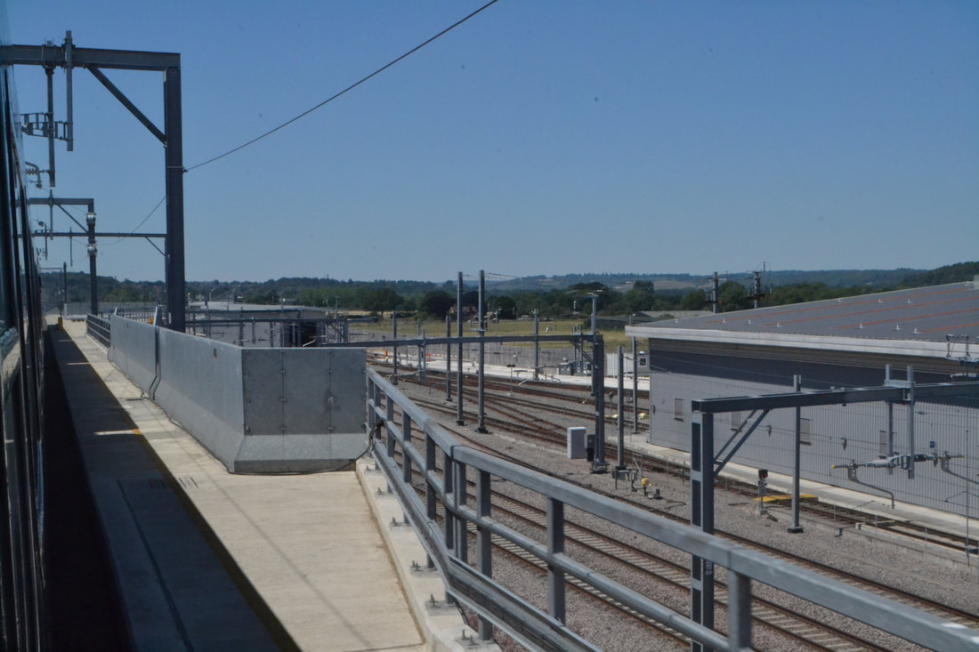
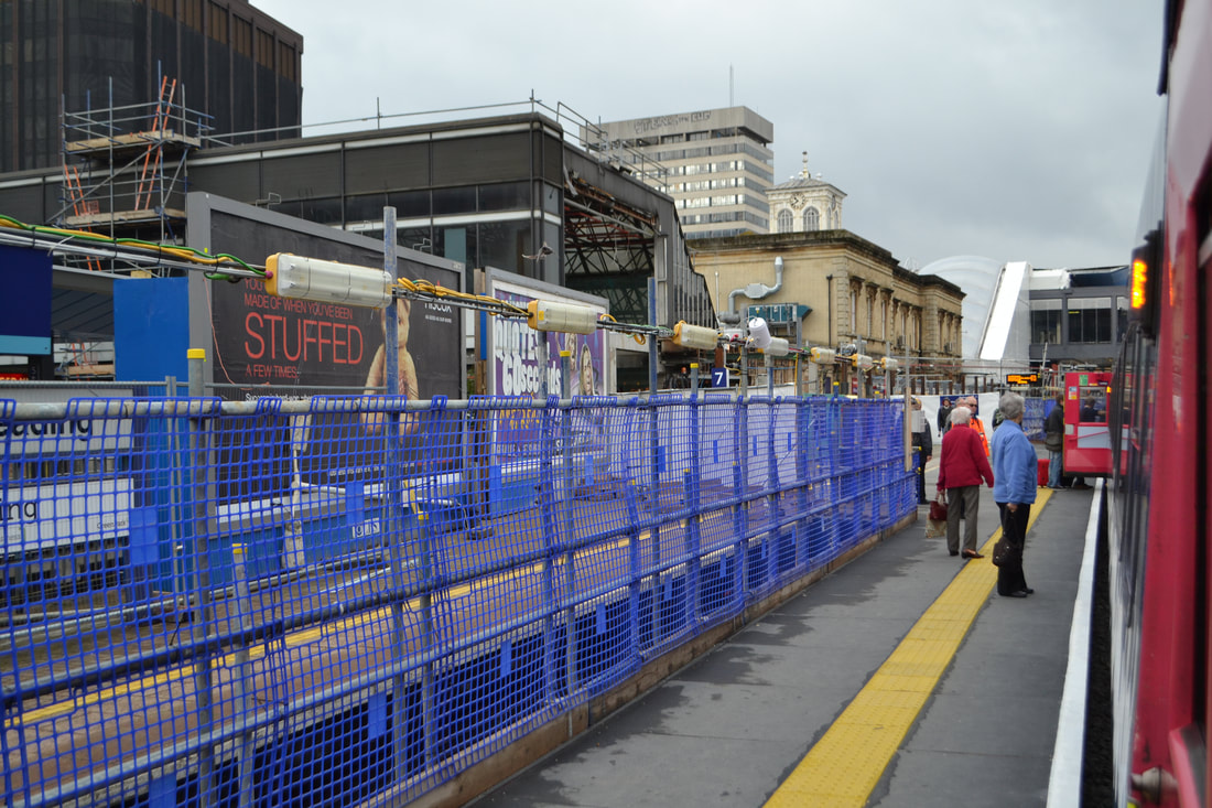
180626a The new Reading takes shape as we cross the new flyover on the approach to Reading Station Roger Winnen
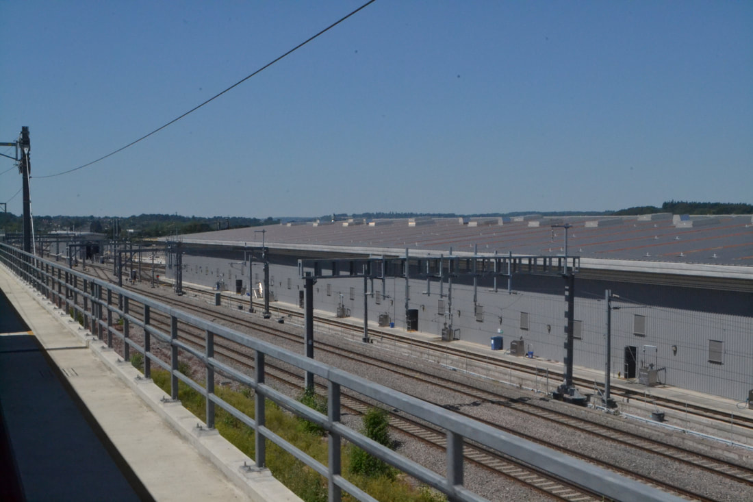
180626b The new facilities at Reading. Copyright Roger Winnen
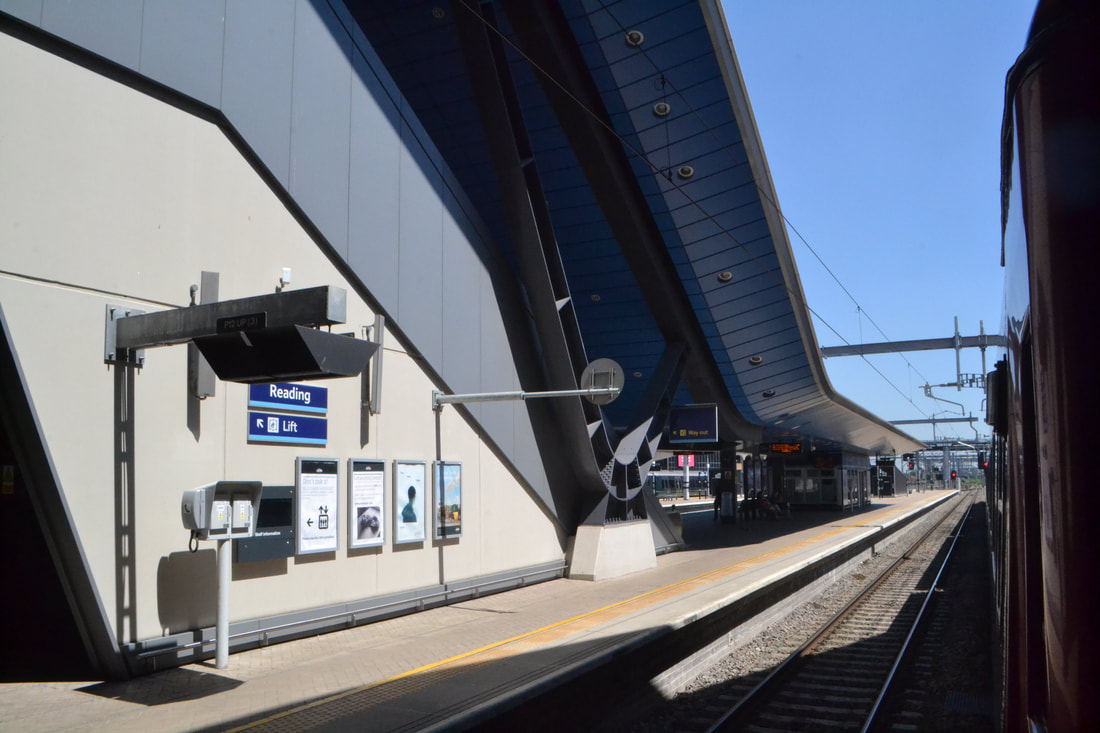
180626c The new Reading Station Roger Winnen
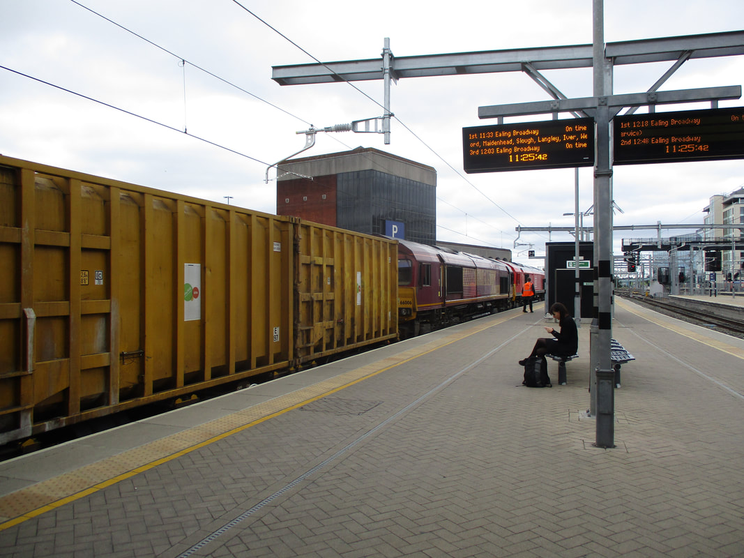
3rd July 2017 Class 66149 & 66006 on the bin liner train awaits departure from Reading. Copyright David Tozer
Adelantie Set 180103 awaits departure from Reading on 3.7.2017. Copyright David Tozer