The West Somerset
Mineral Railway
Mineral Railway
The West Somerset Mineral Railway was a standard gauge line in Somerset, England. It was originally expected to be 13 miles 420 yards (21.3 km) long however its built length was 11 1⁄2 miles with a 310 yards branch to Raleigh's Cross Mine. The line's core purpose was to carry iron ore northwards from the mines on the Brendon Hills to Watchet harbour from the ore was shipped northwards to Newport where it was unloaded onto railway wagons and hauled to ironworks at Ebbw Vale. The line opened as intended in 1861. Passenger services commenced in 1865. The mines' and line's "period of prosperity" ended in 1875and by 1883 all mining had ceased. The line lingered on for passengers and small goods until 1898, when it closed.
A new mineral venture was attempted in 1907, for which much of the line was re-opened and a 2 ft gauge extension was added, but this failed and the line closed again in 1910. .
The line included a rope-worked one in four incline which was a 3,272 feet and lowered the wagons of ore 770 feet.
There were stations on the sections of the line below the inclined plane at Watchet, Washford, Roadwater and Comberrow. Trains also called by request at stopping places at Torre and Clitsome.. Three stations were built above the incline but they never carried fare paying passengers. Further extensions were proposed but not built. Several different locomotives were used during the operation of the line including 0-4-0 "Box" tanks built by Neilson and Company and also larger Sharp. Stewart 0-6-0s.
The above is an extract from an excellent description of the line to be found in Wikipedia. This also contains photographs and maps to see this detailed coverage please click on the link below.
https://en.wikipedia.org/wiki/West_Somerset_Mineral_Railway
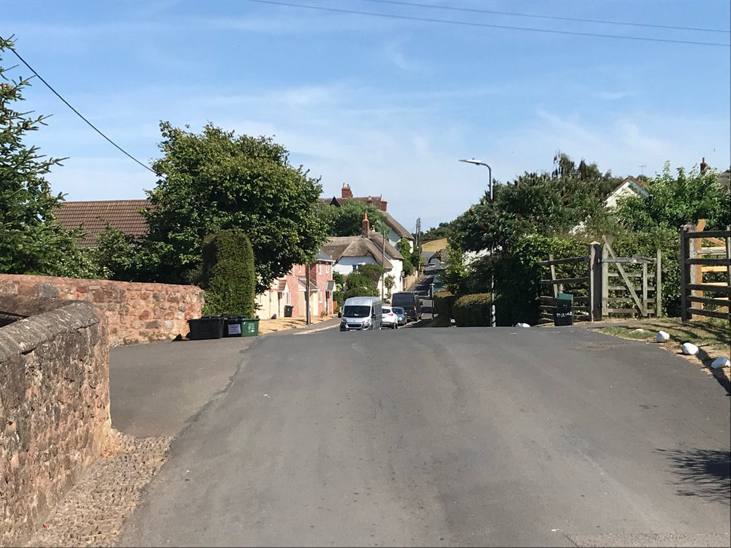
On the 21st October 2002 the Cornwall Railway Society touring the area by minibus found several points of interest associated with the West Somerset Mineral Railway - pictures taken during this minibus visit are included. A special thanks to Robert Lindley who has researched and visited the line several times providing many photographs. Additional material has been provided by Colin Burges, the late John Cornelius and Roger Winnen.
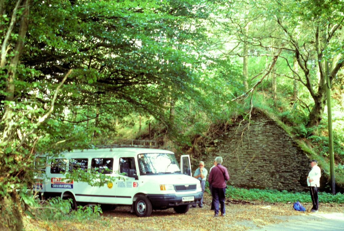
Our minibus on tour of the West Somerset Railway. 21st September 2002. Copyright Roger Winnen (We are at the top of the Brendon Incline)
On the 25th September 2018 Colin Burges traced the route of the WSMR from the incline to the harbour. His report and pictures can be access using this link. Please scroll to the bottom of the section.

West Somerset Mineral Railway courtesy Wilkipedia
The above map provided by Wilkipedia can be accessed by means of this link. This source is well worth a visit as there is a lot of the lines history available plus when clicking of various points of interest on the above line diagram even more pictures etc.
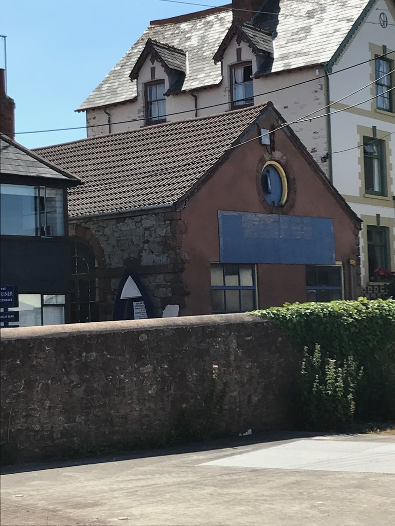
The West Somerset Minerals Railway at Watchet
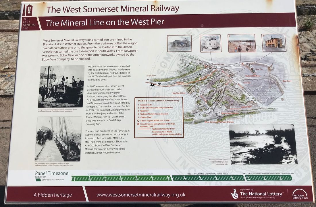
The information board about the railway, next to the uncovered rails on the harbour.25h July 2018 Copyright Rob Lindley
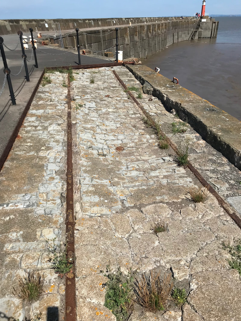
This small sectof rails were uncovered from the concrete cap a few years ago. The rest are still under the concrete. The 25h July 2018 Copyright Rob Lindley
Connection between the West Somerset Railway and the West Somerset Mineral Railway
Taking a look at the excellent maps provided by the National Library of Scotland one can see - using this link that both railways served the harbour at Watchet, the WSR on the NE side and the WSMR on the NW side - the latter having much more extensive sidings. https://maps.nls.uk/geo/explore/#zoom=17&lat=51.1827&lon=-3.3317&layers=168&b=1
At one time tests of a new signalling system using GWR tender locos were carried out on the WSMR tracks. However although the two companies lines ran parallel for some distance out to Washford there seems to be no indication of connecting metals.
You can use the above maps to follow much of the WSMR.
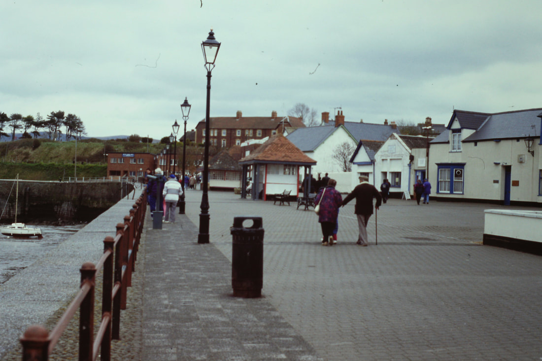
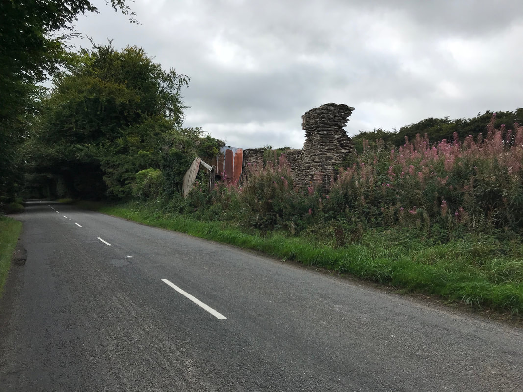
Watchet Harbour. The railway ran along the quay at right angles to this one and is behind the photographer. Copyright Roger Winnen
The building in the middle was the carriage shed at Watchet Station, taken from the harbour. The coast road runs behind the wall. It is only in the last 10 years that the roof lost its louvre top that let out the smoke - unusual for a carriage shed anywhere! 25th July 2018 Copyright Rob Lindley
The old wooden goods shed at Watchet Station. The carriage shed is behind this building. The roadway was where the tracks ran from the station and across the road to the harbour behind me. 25th July 2018. Copyright Rob Lindley
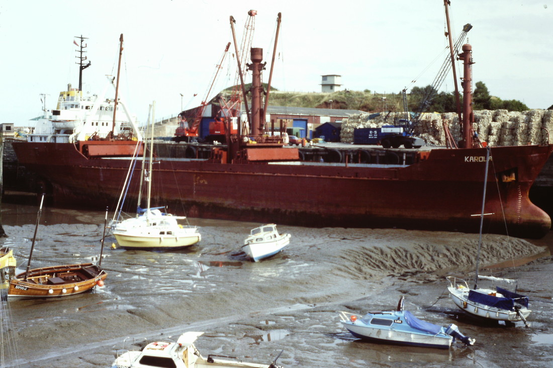
Low tide at Watchet Harbour. The Karoua berthed, this picture is taken from the west quay looking southwards towards Watchet station which lies at the foot of the hill in the background. Copyright Roger Winnen
This is a general view of the station. The building on the left is the old station masters house (as named!). The steps mark the end of the platform, the rest having been covered in. The wooden goods shed is to the right. The car is sat on the track bed as it ran towards the Brendon Hills and the Iron Ore Mines. Behind me is the harbour. 25th July 2018. Copyright Rob Lindley
For a map click here and zoom and pan as necessary.
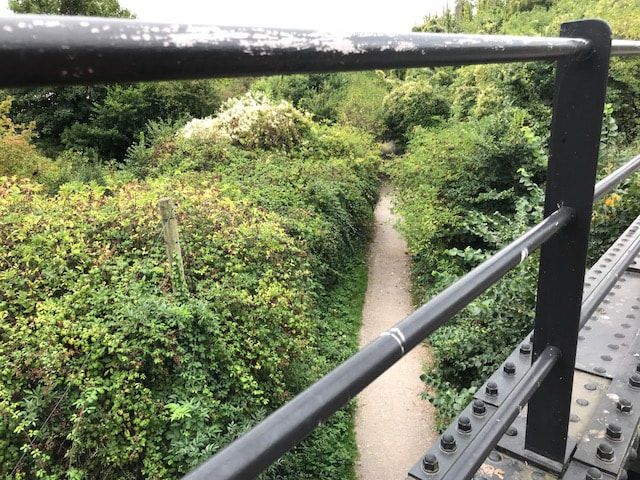
The West Somerset Railway bridge where its route crosses the course of the West Somerset Mineral Railway.
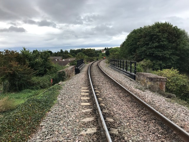
A WSR drivers eye view of the Mineral Overbridge. Watchet harbour is to the left. This bridge was substantially rebuilt by the WSR about 5 years ago, with most of the deck girders being replaced. West Somerset Rly. the bridge crossing the West Somerset Mineral Railway. This photograph taken on the 8th September 2018 Copyright Robert Lindley
West Somerset Rly. the bridge crossing the West Somerset Mineral Railway Looking south towards Washford and the Bredon Hills 8th September 2018 Copyright Robert Lindley
West Somerset Rly. the bridge crossing the West Somerset Mineral Railway looking north towards Watchet which is a quarter mile away. 8th September 2018 Copyright Robert Lindley
Signalling trials between Watchet and Washford.
Rob Lindley
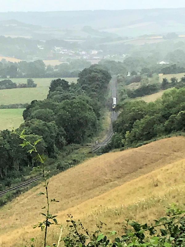
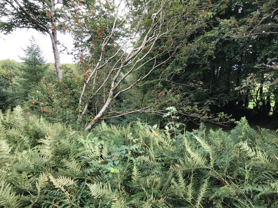
The line ran parallel to the West Somerset Railway, the line of trees marking the route which is now a footpath from Watchet to Washford, (the village visible in the background). It was along here, near to were you can see the DMU, that the Angus Automatic Train Control system was trialed on 5th July 1912. Crowds had gathered on the steep hillsides to the right in the expectation of two locomotives running headlong into each other. Unfortunately for the spectators, the system worked and the locomotives came to a stop! The Brendon hills can be seen in the background, where the Iron Ore Mines were located. Many thanks to Rob for the above note.
Rob Lindley
The line ran parallel to the West Somerset Railway, the line of trees marking the route which is now a footpath from Watchet to Washford, (the village visible in the background). It was along here, near to were you can see the DMU, that the Angus Automatic Train Control system was trialed on 5th July 1912. Crowds had gathered on the steep hillsides to the right in the expectation of two locomotives running headlong into each other. Unfortunately for the spectators, the system worked and the locomotives came to a stop! The Brendon hills can be seen in the background, where the Iron Ore Mines were located. Many thanks to Rob for the above note.
The scene of the signals trials photographed on the 8th August 2018 by Robert Lindley. Copyright.
Washford WSMR
A map of this area courtesy of the National Library of Scotland can be found using this link - zoom in and out and traverse as you wish.
A map of this area courtesy of the National Library of Scotland can be found using this link - zoom in and out and traverse as you wish.
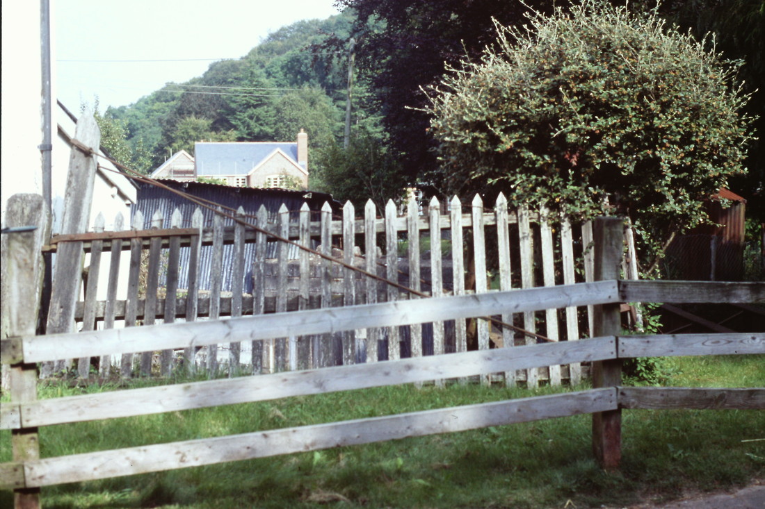
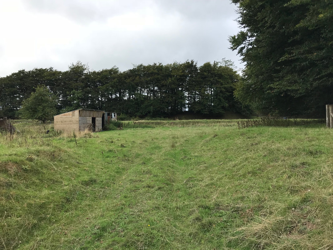
The railway level crossing at Washford, about 2 miles from Watchet (to the left) The road still climbs up over the line today, a hundred years after the rails were lifted! Washford Station was to the right. 25th July 2018 Copyright Rob Lindley
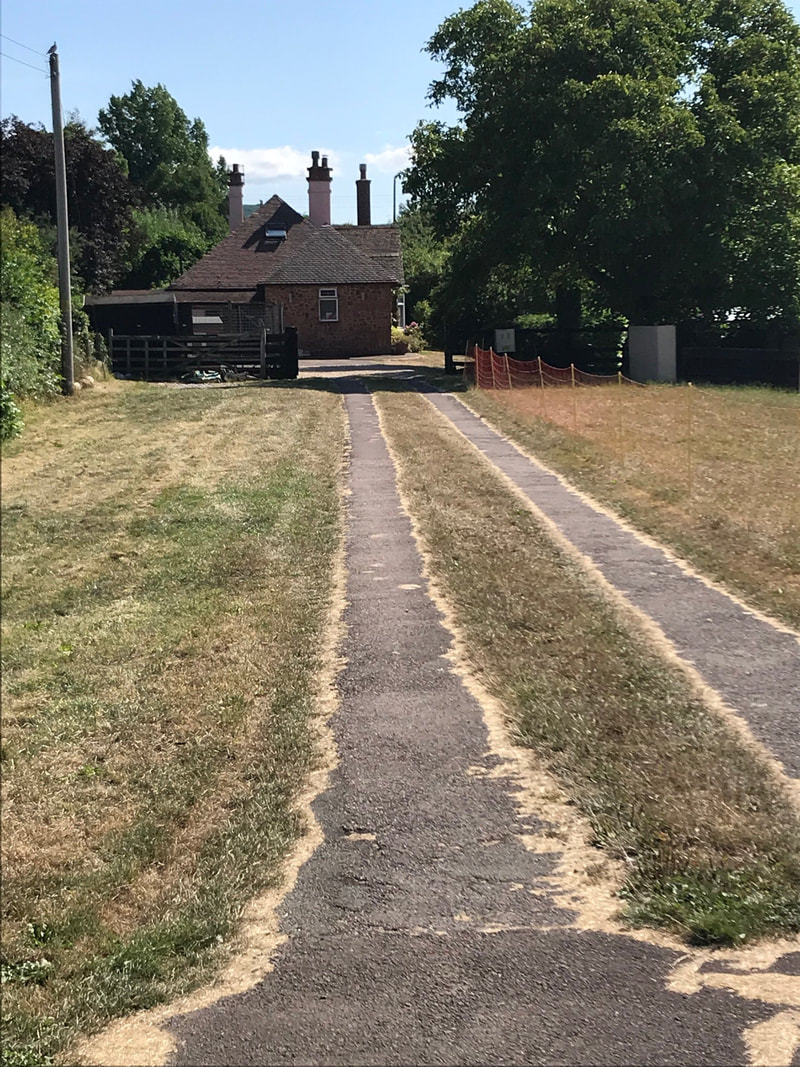
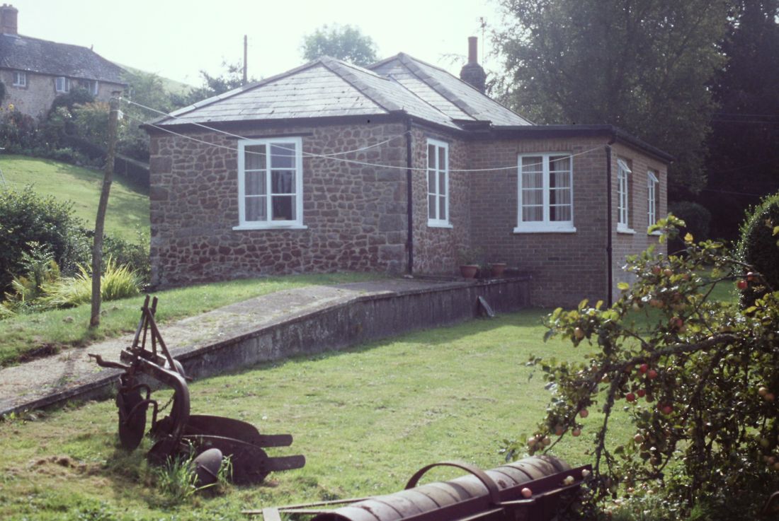
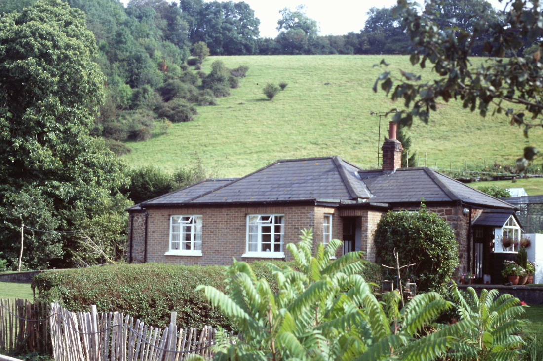
Taken from the level crossing, the bungalow is built across the track bed, the old station building used to stand to the left half of the house. To the right behind the trees used to be the Mineral Syndicates “bricketting works”.
This was where they used to part process the ore, before shipment, towards the end of the life of the mines, when cheap Spanish ore of better quality started the downturn, ending in final closure in 1907. Copyright Robert Lindley
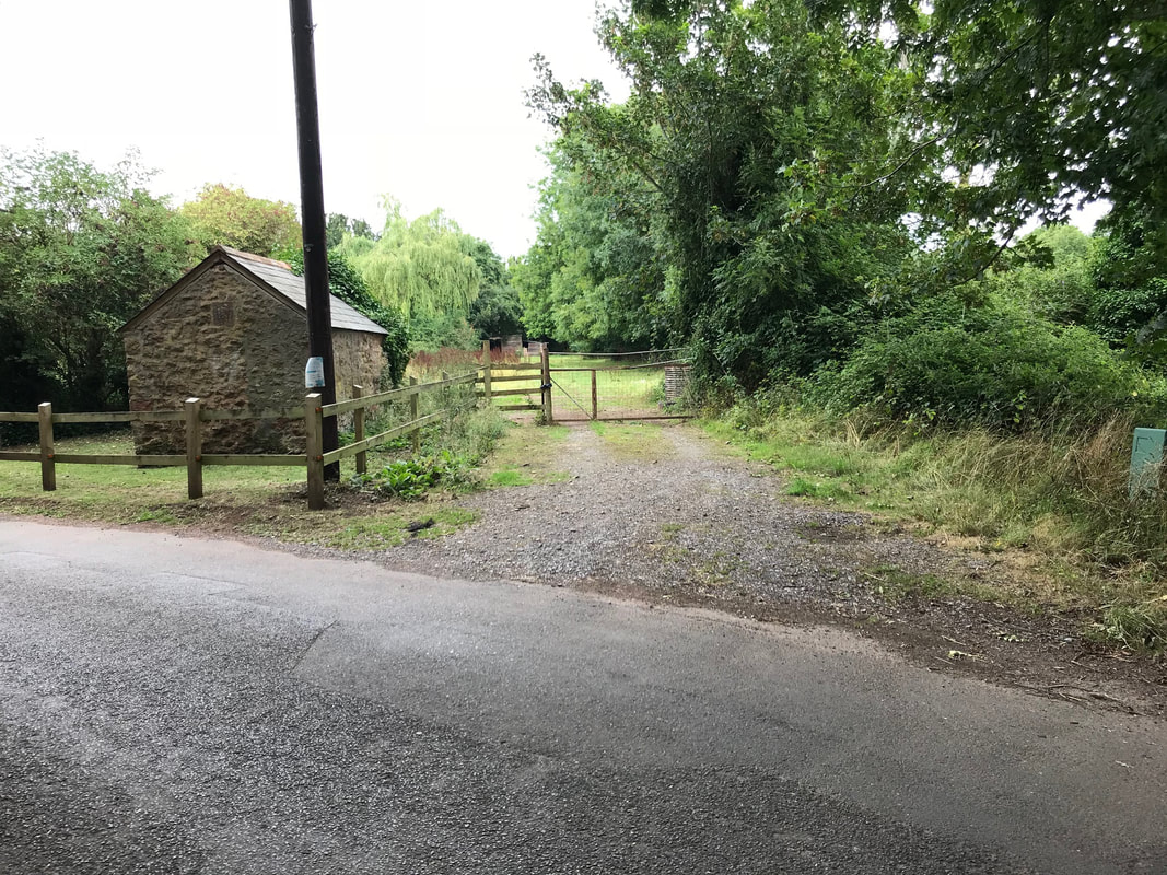
Torre Level Crossing
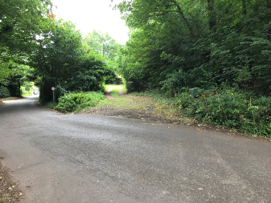
The Crossing at Torre, about a mile from Washford. The railway went through the wooded bit, no. Beyond is rock cutting which once had a footbridge. Copyright Robert Lindley
The crossing looking south towards the Brendon Hills. The crossing keepers hut survives to this day. 15th August 2018 Copyright Robert Lindley
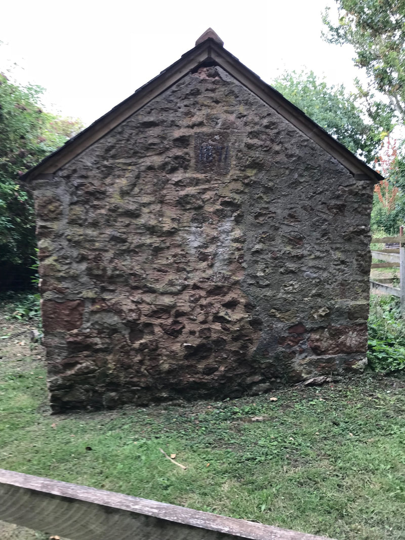
The crossing keepers hut with datestone 1871 Copyright Robert Lindley
There was a siding at this location please click on the link below. You will also see the footbridge Robert referred to in the next but one photograph above.
https://maps.nls.uk/geo/explore/#zoom=18&lat=51.1524&lon=-3.3658&layers=168&b=1
https://maps.nls.uk/geo/explore/#zoom=18&lat=51.1524&lon=-3.3658&layers=168&b=1
Roadwater station
A map of this area can be found using the 25" map courtesy of the National Library of Scotland. Please use this link and zoom in and out and traverse as you wish.
A map of this area can be found using the 25" map courtesy of the National Library of Scotland. Please use this link and zoom in and out and traverse as you wish.
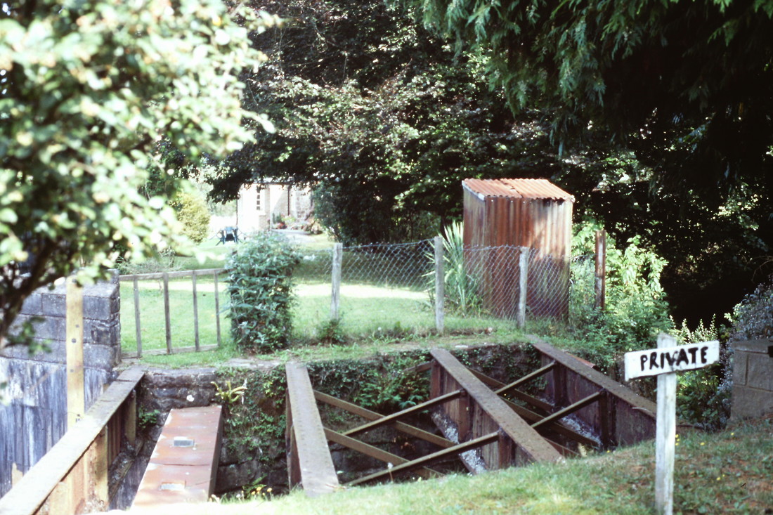
Site of bridge over a waterway at Roadwater Station 21st September 2002. Copyright Roger Winnen
Possible site of a level crossing. Roadwater. West Somerset Minerals Railway. Copyright Roger Winnen
Roadwater station. West Somerset Minerals Railway. 21st September 2002. Copyright Roger Winnen.
Roadwater station West Somerset Minerals Railway. 21st September 2002. Copyright Roger Winnen.
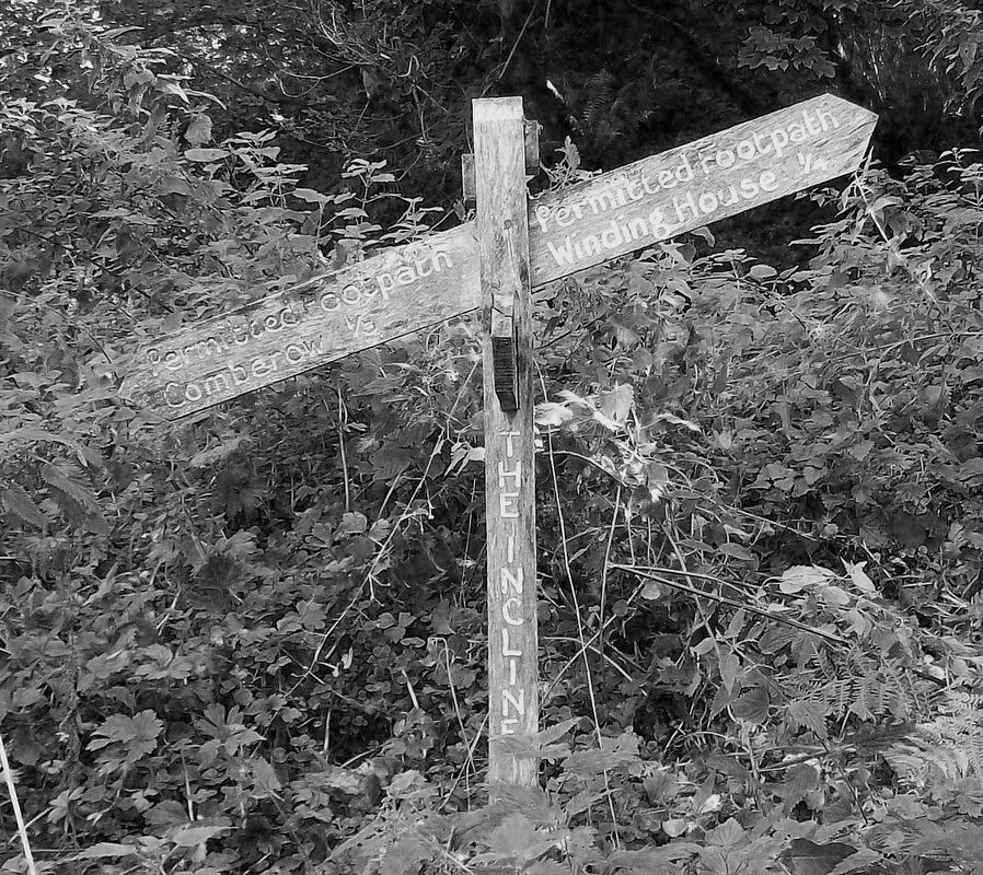
Comberow station - we do not have picture of this station or site as yet.
However by using this link you can see the station plan and the Comberrow Incline.
Please zoom in and out and traverse as you wish.
However by using this link you can see the station plan and the Comberrow Incline.
Please zoom in and out and traverse as you wish.
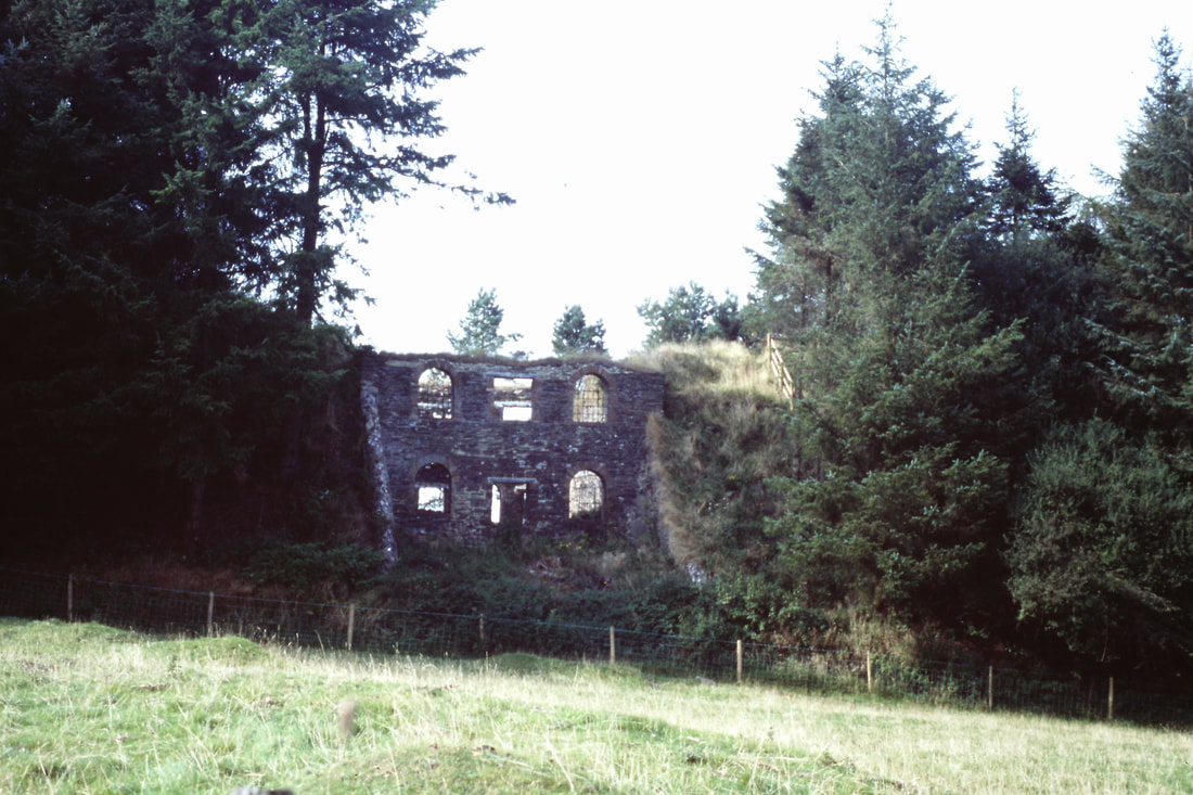
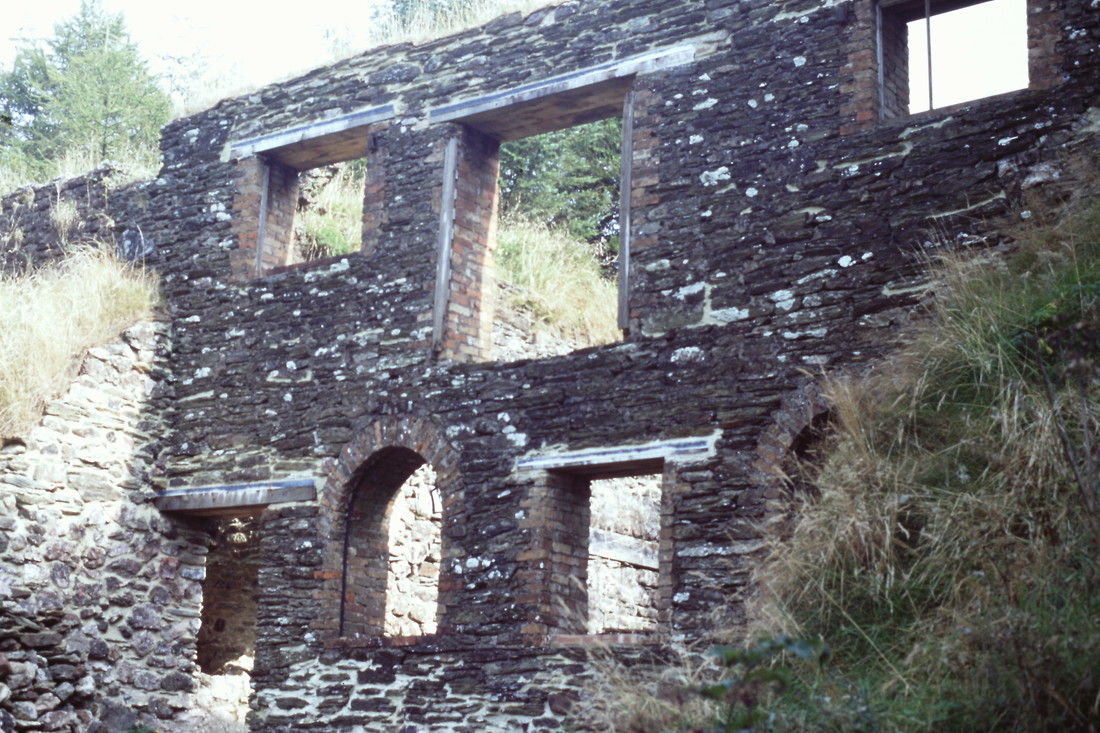
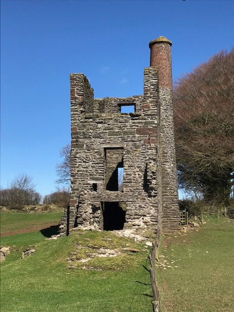
Comberow or Brendon Incline and winding house.
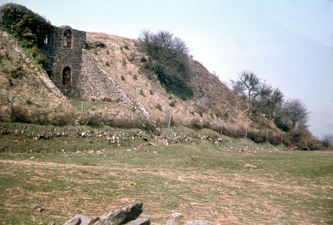
The fist picture taken in the late 60's shows how the winding house was set into a bank and not in the midst of a collection of trees as the later pictures which follow would seem to indicate. Many thanks to John Thorn for opening up his archive to reveal the location of the winding house - the incline was off to the right. Copyright John Thorn
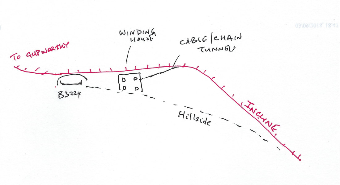
Brendon Incline, a sketch by John Thorn. The top of the incline was raised above the surrounding hillside on an embankment that was high enough for the level track to cross the B3224.
The engineer's cottage was indeed incorporated within the winding house; obviously the dividing wall has long gone. While there was ore being sent down to Watchet, the incline was self-actuating. When the mines closed, an engine was installed to lift loaded wagons from Comberow, but I doubt that this was a substantial affair, there being not much of a future for the railway. C.B.
Links to useful websites. The upper link gives details of the Winding house including drawings. The lower link gives general views of the incline.
http://www.westsomersetmineralrailway.org.uk/explore-incline-winding-house.php
https://www.google.co.uk/search?q=Comberow+Incline&tbm=isch&source=iu&ictx=1&fir=rUdbiwrK4G8daM
http://www.westsomersetmineralrailway.org.uk/explore-incline-winding-house.php
https://www.google.co.uk/search?q=Comberow+Incline&tbm=isch&source=iu&ictx=1&fir=rUdbiwrK4G8daM
The winding engine house at the top of the Comberow Incline. 21st September 2002. Copyright Roger Winnen
Inside the winding engine house. Comberow Incline, Brendon Hills. 21st September 2002. Copyright Roger Winnen.
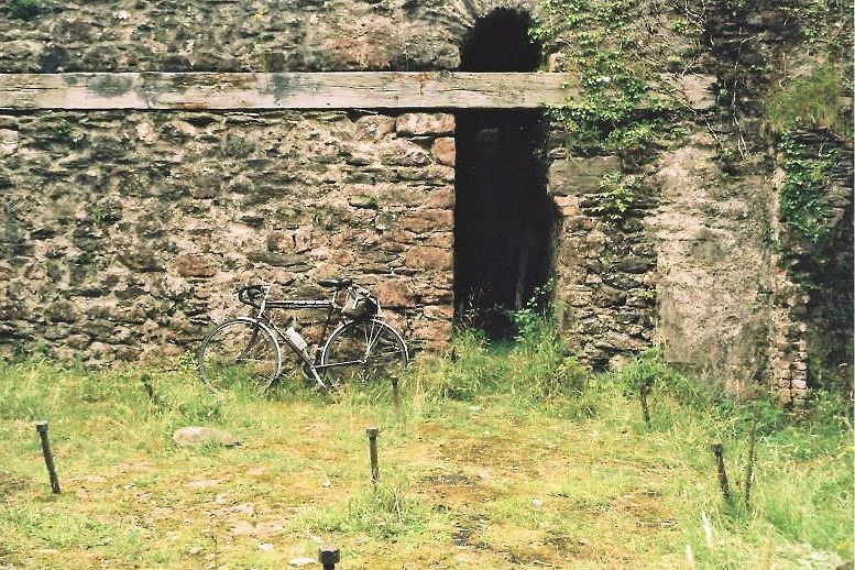
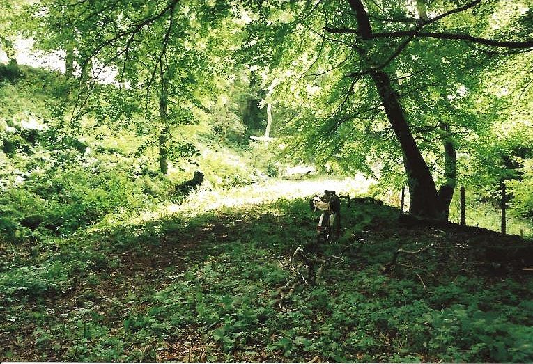
Colin's bike gives some scale to this view of stonework of the winding house. 2008 Copyright Colin Burges
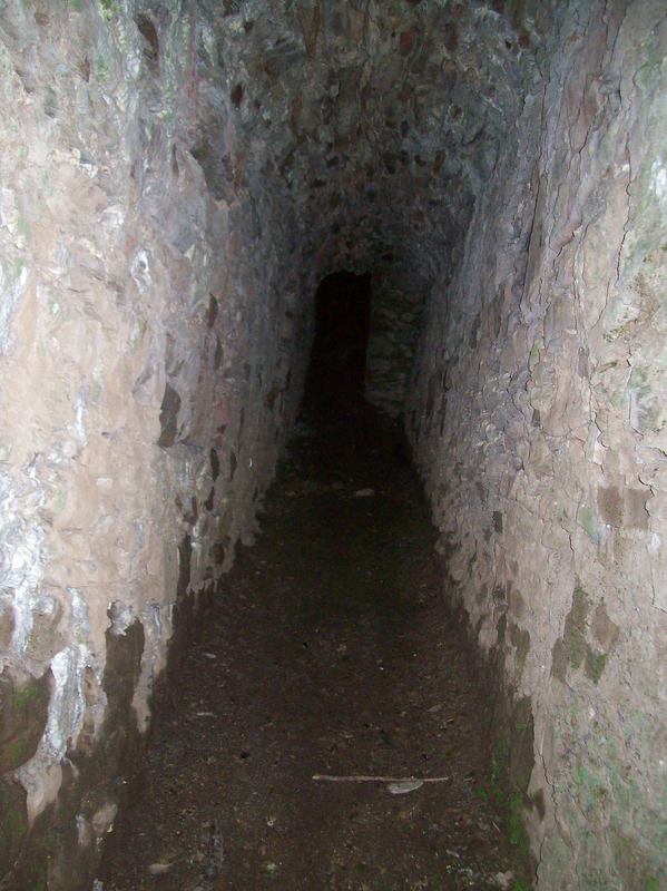
A view into one of the cable tunnels which led from the winding house to the incline. 25th September 2018. Copyright Colin Burges.
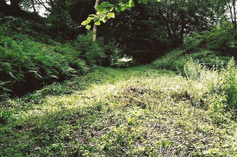
Looking down the incline towards Roadwater. 21st September 2002. Copyright Roger Winnen
Midway on the incline. 2008 Copyright Colin Burges
Another view of the formerly double track incline taken in 2008 by Colin Burges. Copyright.
____________________________________________________________________________________________________________
Recently received pictures taken of the incline in1981 - many thanks John.
Recently received pictures taken of the incline in1981 - many thanks John.
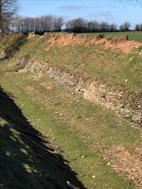
John Cornelius has very kindly sent us some pictures he took of the incline way back in 1981, even then it was quite heavily overgrown. The Incline 1,000 yards long rose from the valley at Comberow to a summit up on the Brendon Hills. From here the main line headed NW to Gupworthy, there was also a standard gauge spur to Raleigh Mine. The spur was short lived and doesn't appear on maps and neither does a later narrow gauge line from the summit. Reference to the map courtesy of the National Library of Scotland (Click) will show the arrangements at the top and bottom of the incline as well as the location of the winding house which lay to the NE of the local road. Zoom in and out and pan as you wish.
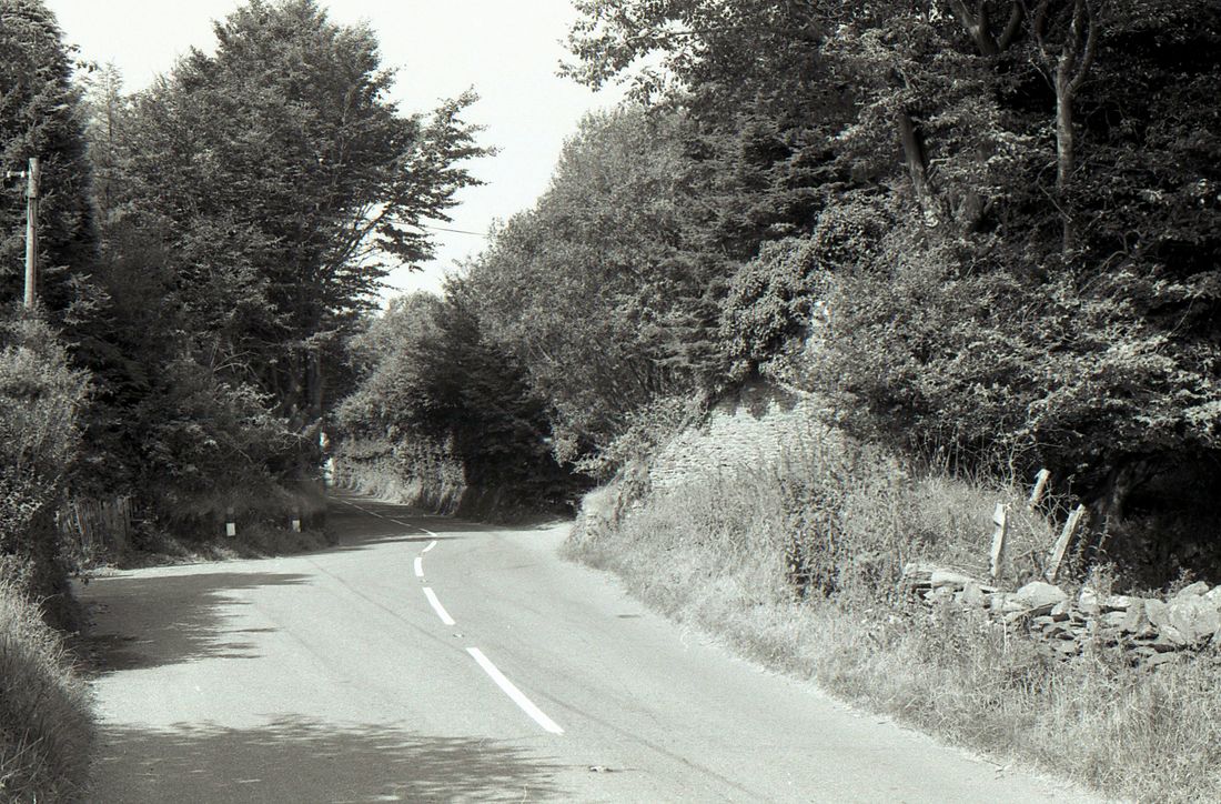
Photo 1 The WSMR having passed the top of the Brendon incline crosses the B3224. We are looking east. Remains of bridge abutment to the right. 27th Aug 1981 Copyright Cornelius
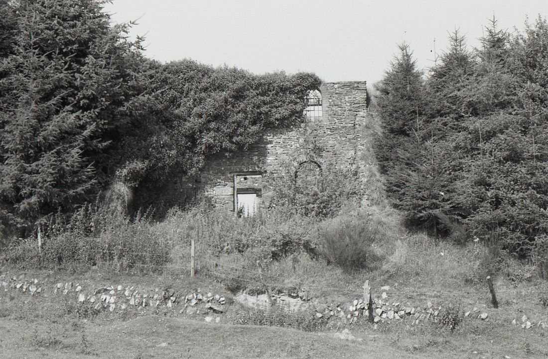
Photo 2 The winding house in 1981 Copyright John Cornelius
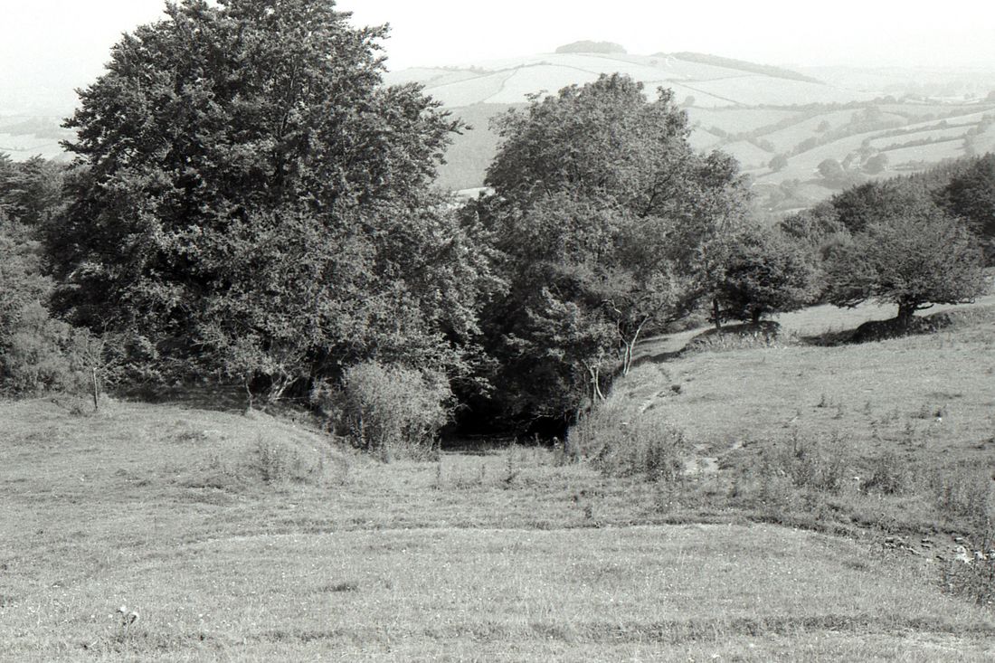
Photo 3. Looking down the incline from the top. The former cable worked incline descended the 1 in 4 gradient to Comberow. Copyright John Cornelius
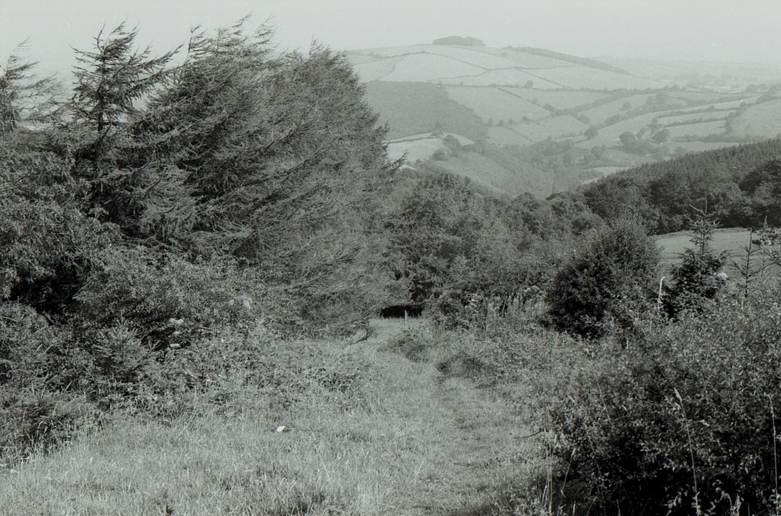
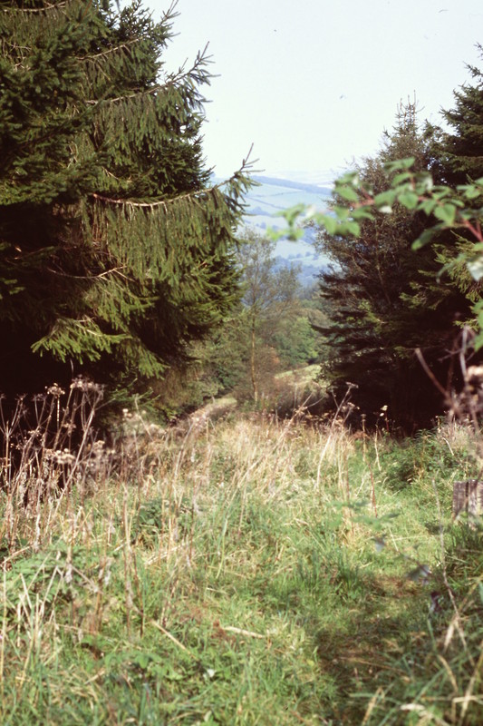
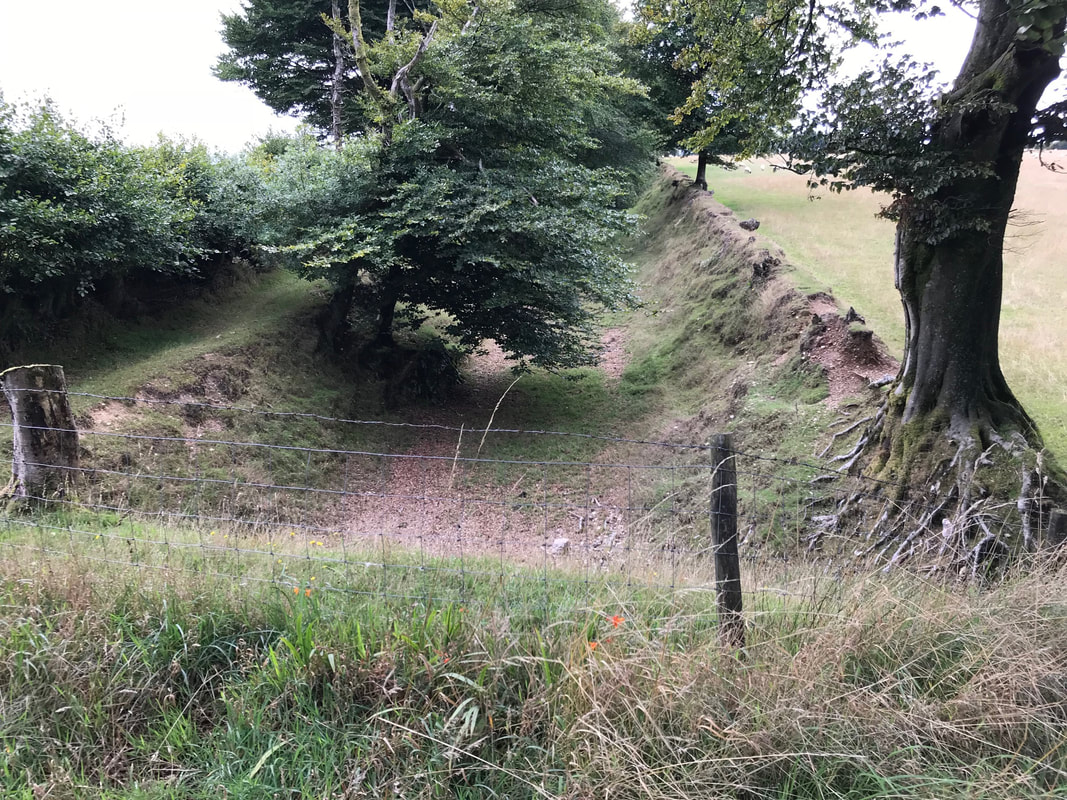
Photo 4. Part way down the incline is overgrown with trees and nature takes its course. 1981 Copyright John Cornelius (Note the distant hills)
Halfway down, or up, the incline this gradient post has been erected. 25th September 2018. Copyright Colin Burges.
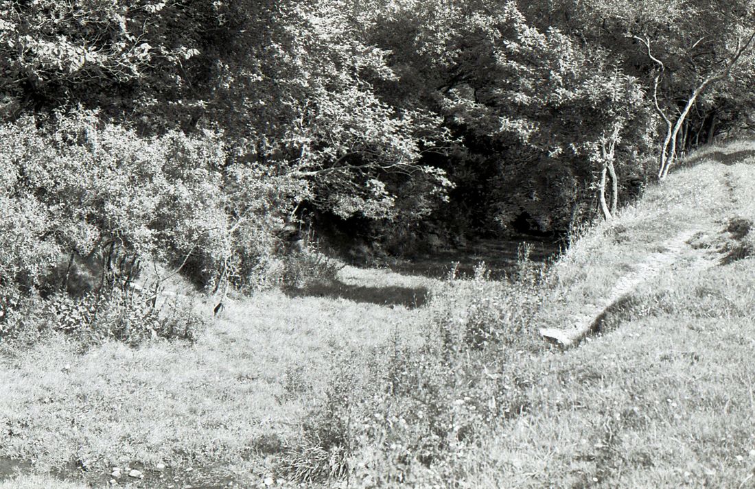
Photo 5 The line descending into a cutting and trees. 1981 Copyright John Cornelius
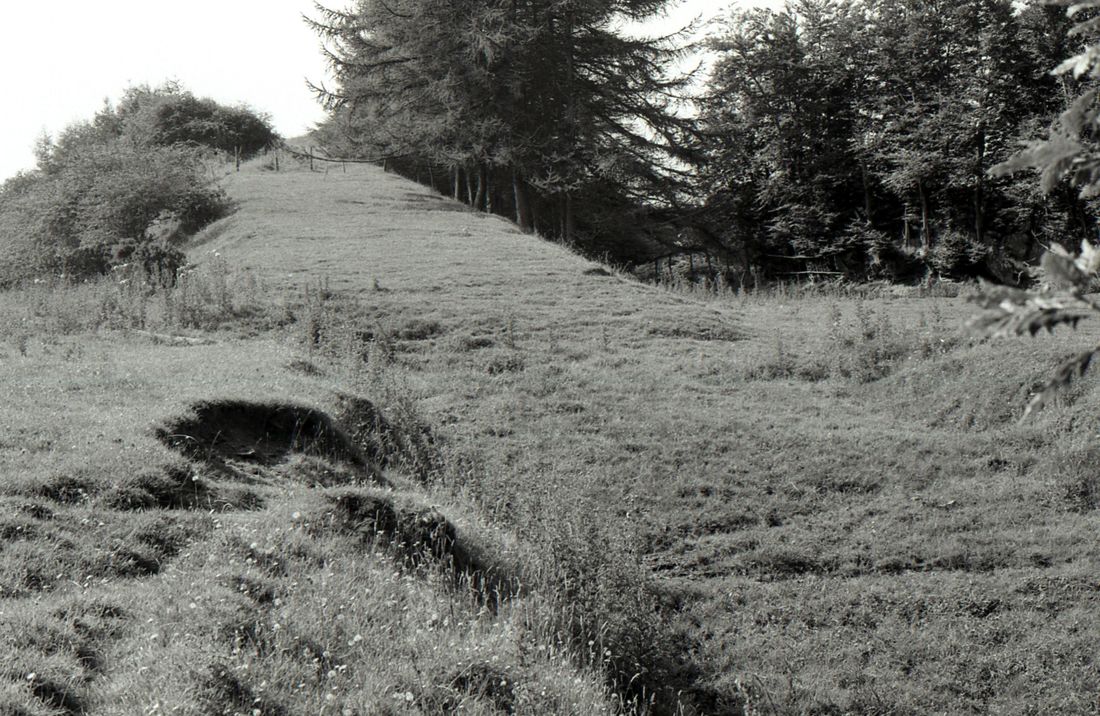
Photo 6 Looking up the incline the steepness of the 1 in 4 gradient can be seen to advantage. 1981 Copyright John Cornelius
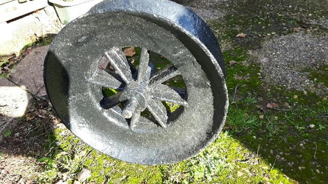
One of the cable guides from the Comberow Incline nicely preserved. Here is a photo of one of the cable guide wheels from the incline on the WSMR. It was found by a friend of mine’s father a number of years ago, on the Comberow incline. Copyright Robert Lindley
____________________________________________________________________________________________________________
The top of the Comberow or Brendon incline and onwards.
The railway continued on west to Gupworthy, however there was for a time a tramway serving Raleighs Cross mine to the east.
The railway continued on west to Gupworthy, however there was for a time a tramway serving Raleighs Cross mine to the east.
A 25" map courtesy of the National Library of Scotland is available using the link below. This shows the arrangement at the top of the incline with the main line heading west towards the curiously named 'Naked Boy's' bridge. A standard gauge railway spur also served Raleigh's Cross mine though this is not shown. However one can see the site of Raleigh's Cross and presumably the Methodist Church seen below. Robert adds, furthermore A narrow gauge tramway was built by the later mining syndicate from the top of the incline along the road past the then closed Raleigh’s Cross Mine, for about 2 miles, whence it went across the fields, down another incline to Colton Mines. Again no trace on the map.
https://maps.nls.uk/geo/explore/#zoom=16&lat=51.0995&lon=-3.3987&layers=168&b=1
https://maps.nls.uk/geo/explore/#zoom=16&lat=51.0995&lon=-3.3987&layers=168&b=1
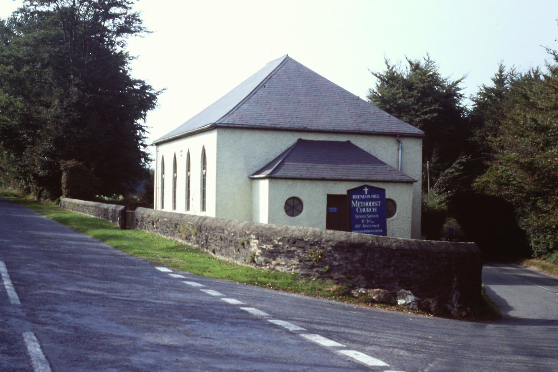
Looking in very good condition. Brendon Hill Methodist Church. 21st September 2002. Copyright Roger Winnen. After the mines closed in 1883 the congregation dwindled and by 1900 it was derelict. When it re-opened in 1910, the Bible Christians had been amalgamated into the United Methodist Church, who reunited with the ‘Prims’ and Wesleyans into today’s Methodist Church in 1932.
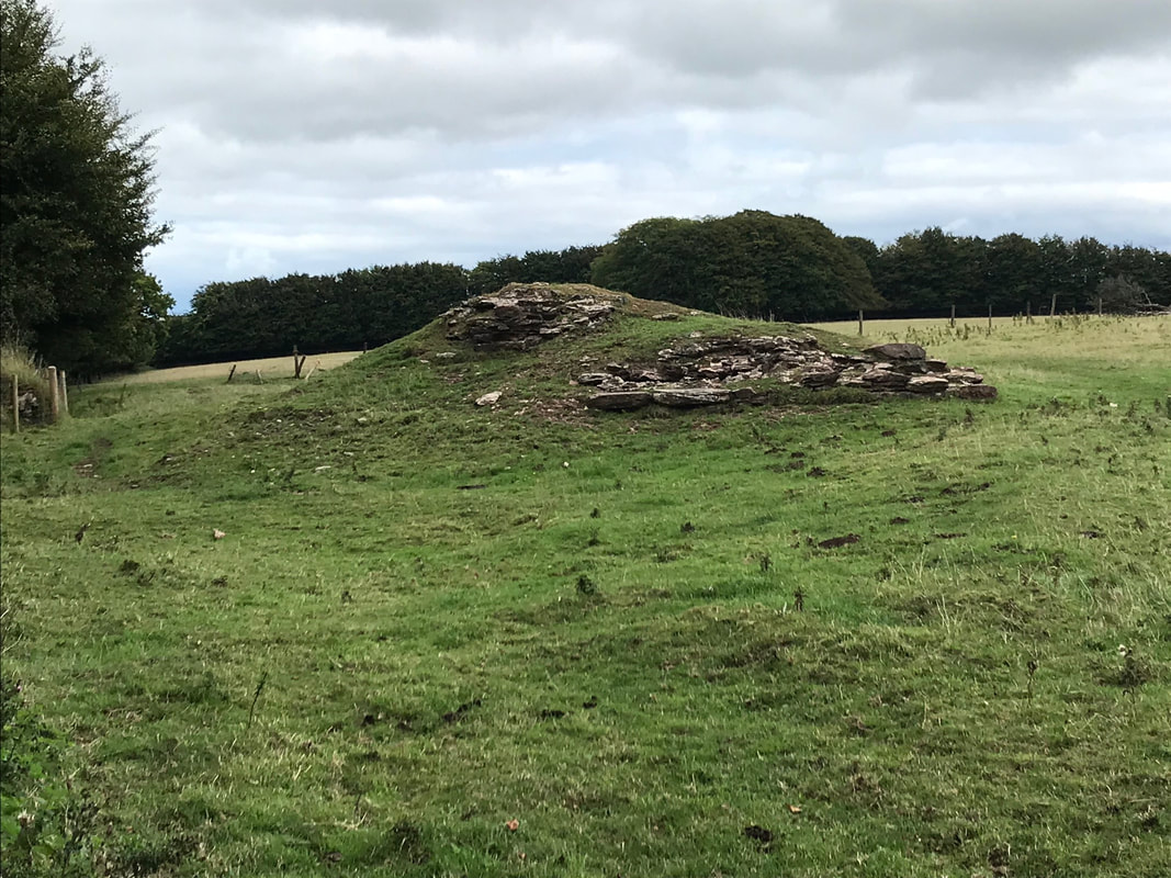
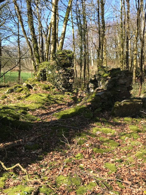
All that remains of Raleigh's Cross Mine. 22nd August 2018. Copyright Rob Lindley
Remains of the stores alongside the B3224, about 100 yards from Raleigh’s Cross Mine. 22nd August 2018 Copyright Robert Lindley
Looking through the gate (this is all private land), the stores in the previous photo is just to the left. Beyond the stable can be seen the embankment of the railway curving to the left. The line curved through nearly 90 degrees here to run along the top of the Brendon Hills to Gupworthy. Straight ahead and through the trees to the right of the photo is a small rock cutting followed by the top of the double track incline. The spur to Raleigh’s Cross Mine went off to the right. There also used to be a siding here serving the stores. Copyright Robert Lindley 22nd August 2018.
Heading west from the top of Comberrow Incline.
Brendon Hill station.
Please use the following link for a picture of Brendon Hill station.
http://www.disused-stations.org.uk/b/brendon_hill/
Please use the following link for a picture of Brendon Hill station.
http://www.disused-stations.org.uk/b/brendon_hill/
This is the cutting between Naked Boy bridge and Burrow Farm Mine 24th March 2019 Copyright Robert Lindley
Looking west towards Gupworthy from the site of Naked Boy bridge. 22nd August 2018 Copyright Robert Lindley
The site of Naked Boy bridge. Looking east back towards the top of the incline. . 22nd August 2018 Copyright Robert Lindley
Burrow Farm Mine - the only mine left standing on the Brendon hills. 24th March 2019 Copyright Robert Lindley
Above is Burrow Farm Mine, the only Mine building still standing on the Brendon Hills. The shaft was just behind me, and the hedge line in the background marks the line of the railway, left to Gupworthy Terminus, Langham Hill and Luxborough Road Station, right to the Incline and Raleigh’s Cross Mine. This Mine also has a short spur from the railway.
Robert says :- I thought I’d wait for Autumn 2018, when the leaves have dropped to get some shots at a number of places along the line. However, below are a couple of shots of Eastcott Farm Bridge, showing the embankment to the east, and remains of the bridge abutment on the west side of the road. This bridge is the next bridge eastwards from Naked Boys Bridge. Burrow Farm Mine is about half a mile to the east of this spot.
Eastcott Farm bridge. WSMR remains of the embankment 29th August 2018 Copyright Robert Lindley
Another at the site of Eastcott Farm bridge. 29th August 2018 Copyright Robert Lindley
About a mile west of the top of the incline the formation crossed a minor road at Withiel Bridge. Here access has been improved by the demolition of the bridge. 2008 Copyright Colin Burges
The remains of Luxborough Road Station (Otherwise called Langham or Langham Hill) , high on the Brendon Hills 24th March 2019 Copyright Robert Lindley
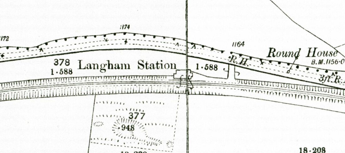
Langham station otherwise called Luxborough Road station. WSMR From 25 inch OS Map 1904 Courtesy National Library of Sctoland
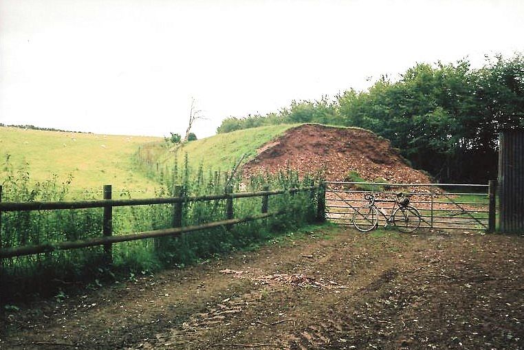
Gupworthy Terminus
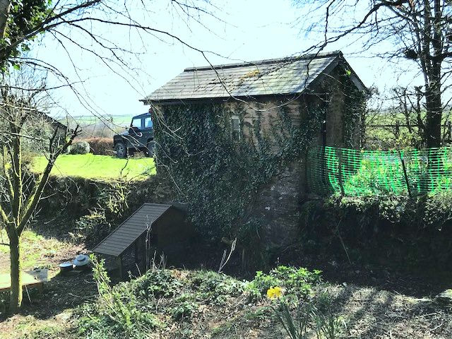
Gupworthy Terminus, The weighbridge house, the station lies beyond. 16th August 2018 Copyright Rob Lindley
You will find a map of the location - 25" courtesy the National Library of Scotland using this link.
https://maps.nls.uk/geo/explore/#zoom=17&lat=51.1099&lon=-3.4818&layers=168&b=1
https://maps.nls.uk/geo/explore/#zoom=17&lat=51.1099&lon=-3.4818&layers=168&b=1
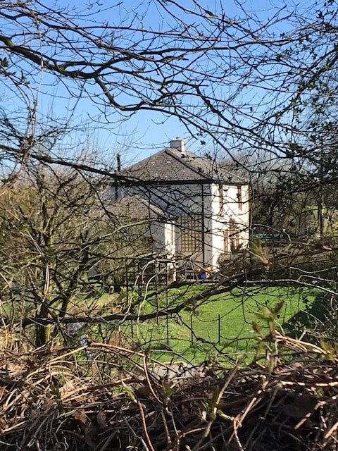
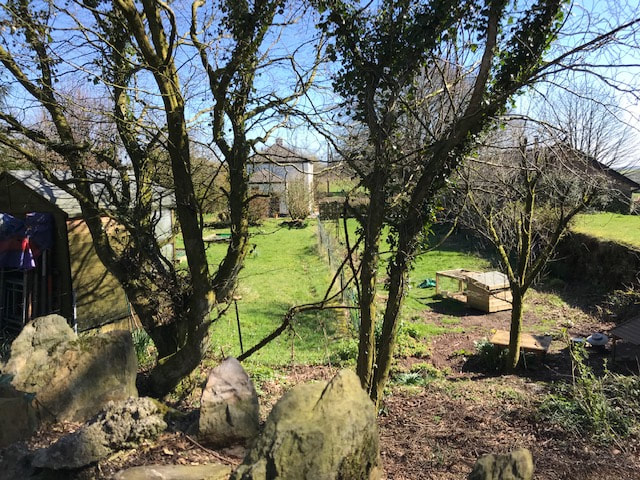
Seen in lovely spring sunshine a shot of Gupworthy Terminus Station house, now a private dwelling The two tracks in the Station. With owners permission 24th March 2019 Copyright Robert Lindley
Gupworthy station - a general view. The terminus was for goods only, v
Very occasional passenger traffic. Picture taken with the owners permission 24th March 2019 Copyright Robert Lindley
Gupworthy To the left of the previous shot is the old weighbridge. Taken with the owners permission. 24th March 2019 Copyright Robert Lindley
The terminal station at Gupworthy From 25 inch map -1904 Courtesy National Library of Sctoland
Branches off the main route - above Brendon Incline.
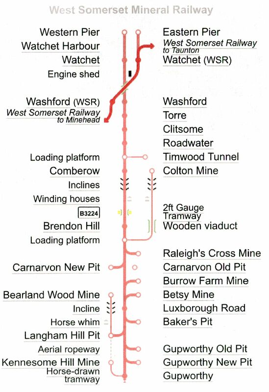
This expert diagram shows the entire West Somerset Mineral Railway from Watchet to its extreme end at Gupworthy.Also shown are the lines serving the various pits and mines. These being of a very temporary nature re not shown on the 25" 1904 map. Note the three inclines - one on the main line up the Brendon Hill and two on the narrow gauge tramways to Colton Mine and also Bearland Wood mine.
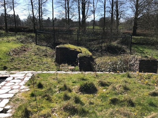
Langham Hill Mine - the fenced area is around the shaft. The trees in the background are the line of the spur from the old railway. 24th March 2019 Copyright Robert Lindley
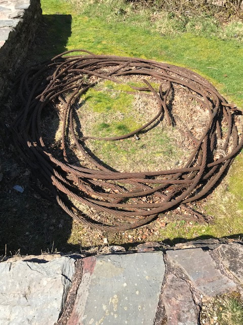
Winding Cable at Langham Hill Mine. 24th March 2019 Copyright Robert Lindley
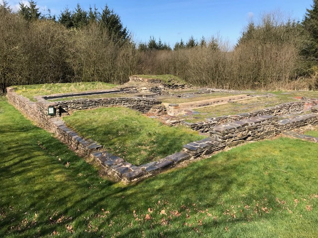
Another view at Langham Hill Mine. 24th March 2019 Copyright Robert Lindley
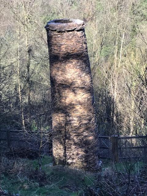
Bearland Wood Mine ventilation chimney. A fire was lit in this chimney which drew air from a lower level into the workings below. 24th March 2019. Copyright Robert Lindley