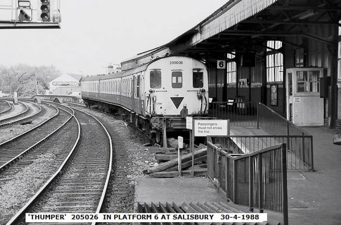
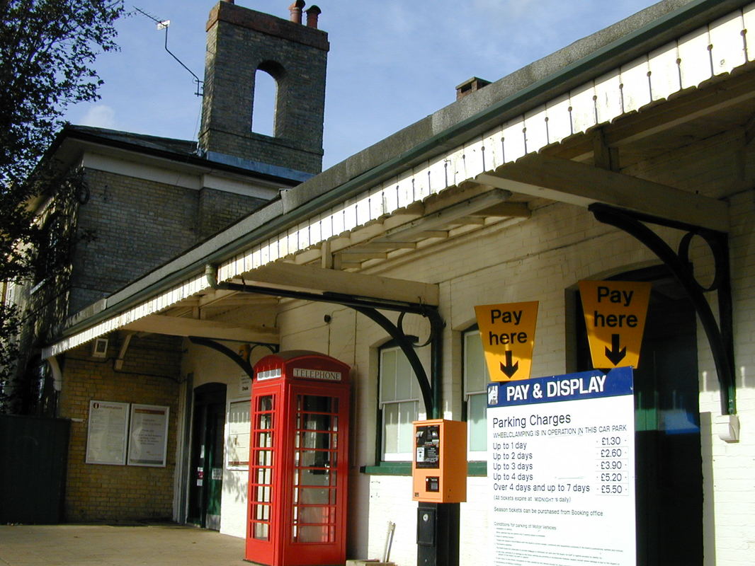
Salisbury to Southampton direct and via Eastleigh
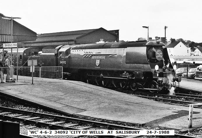
Copyright John Cornelius

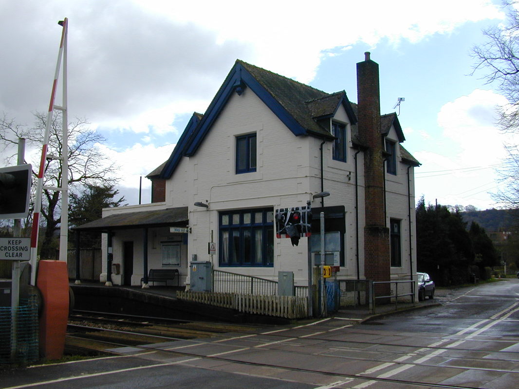
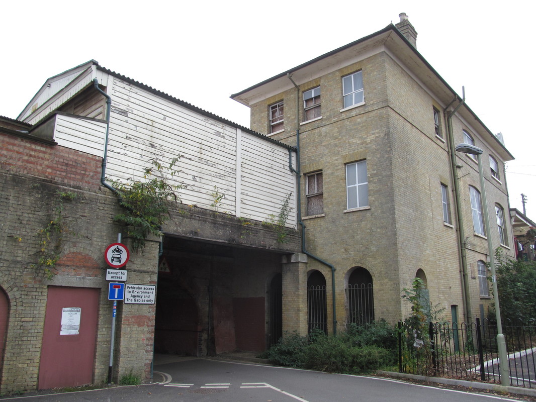
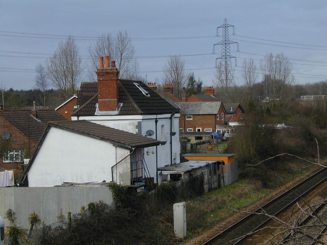
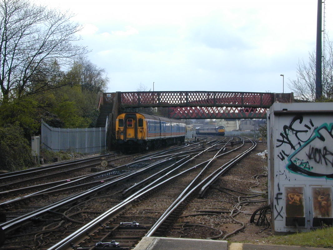
Crossing Fisherton Road bridge. Copyright John Cornelius

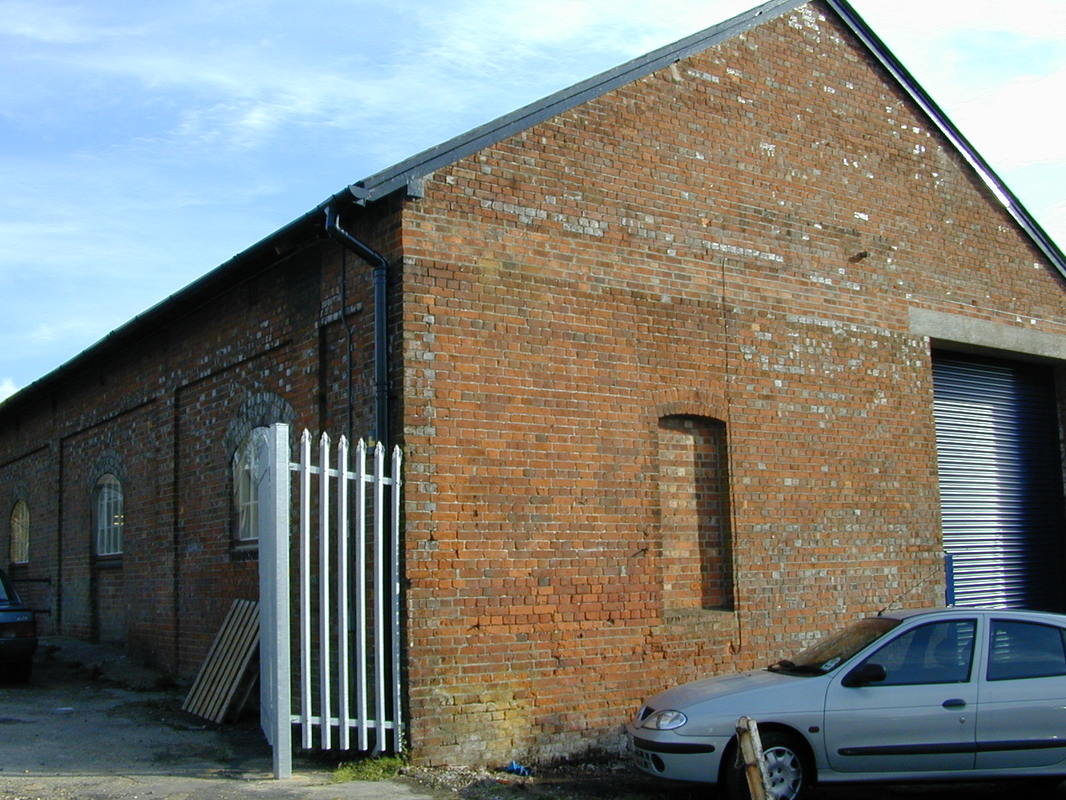
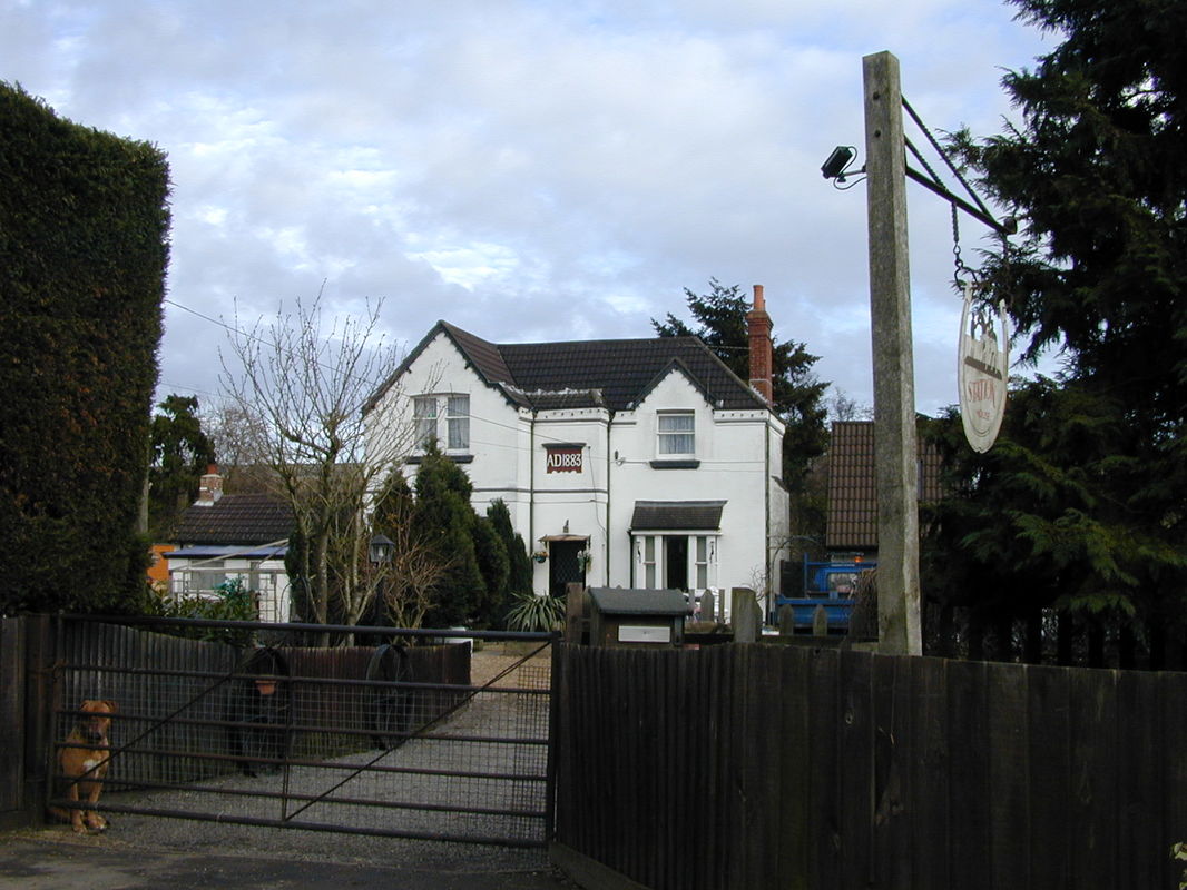
Copyright John Cornelius
Copyright John Cornelius
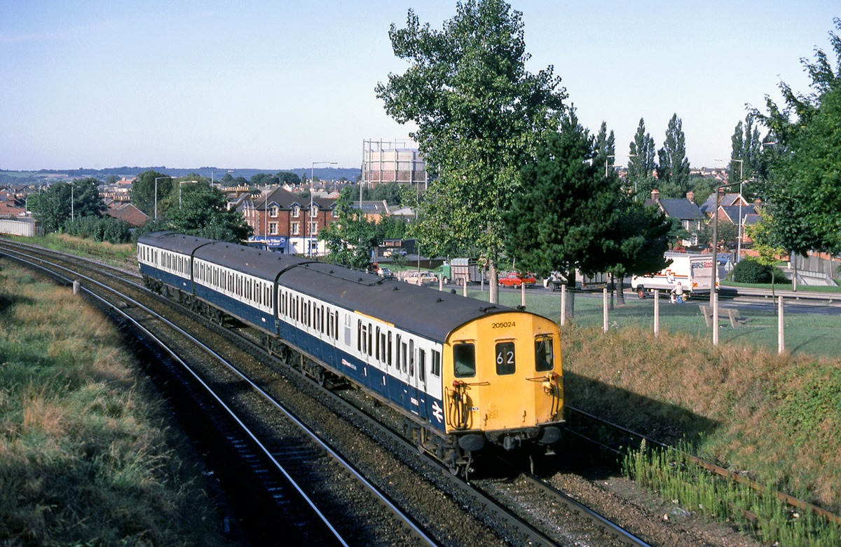
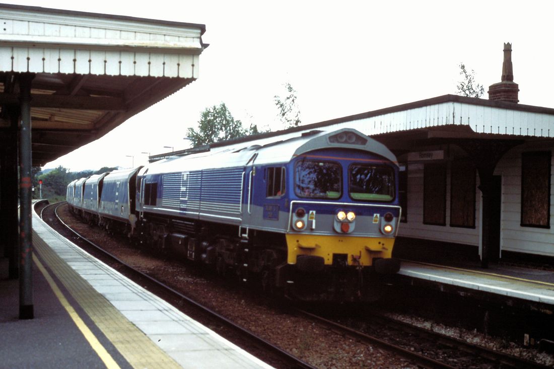
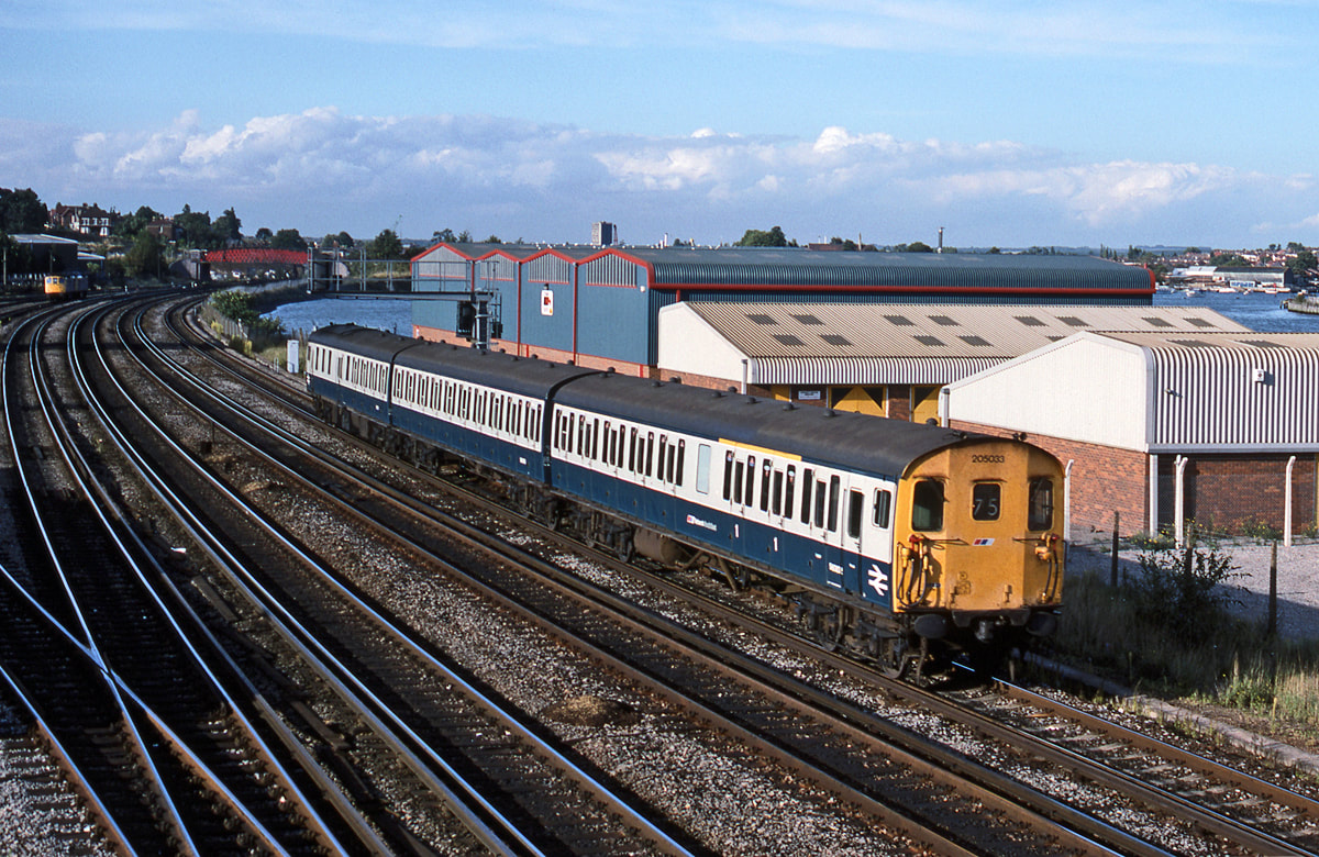
Thumper 205024 heads away from Salisbury with a stopping service to Basingstoke. 22nd September 1987 Copyright Ron Kosys
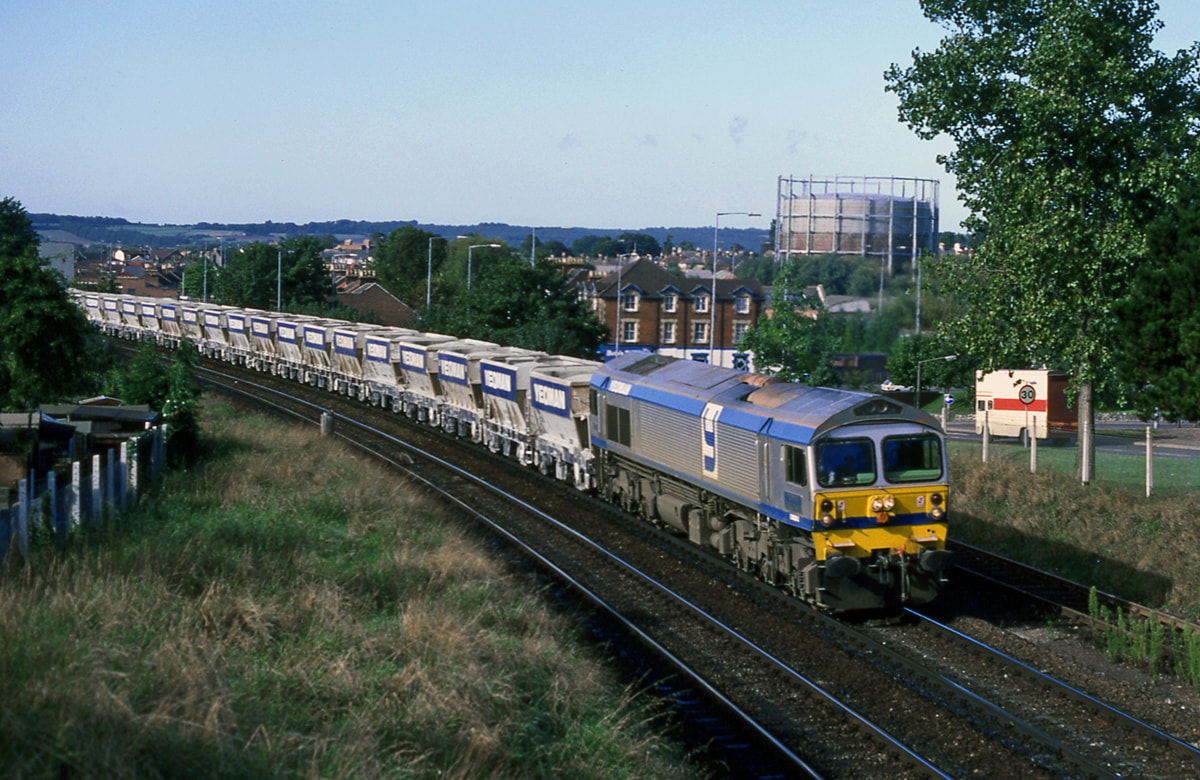
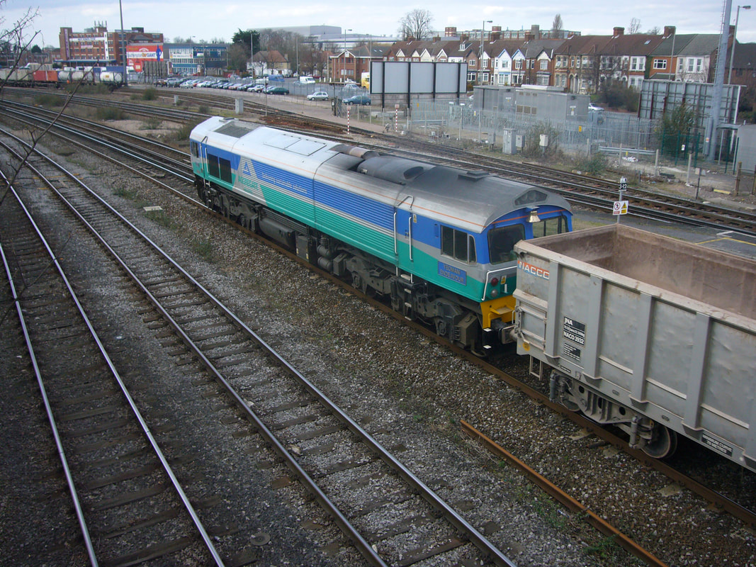
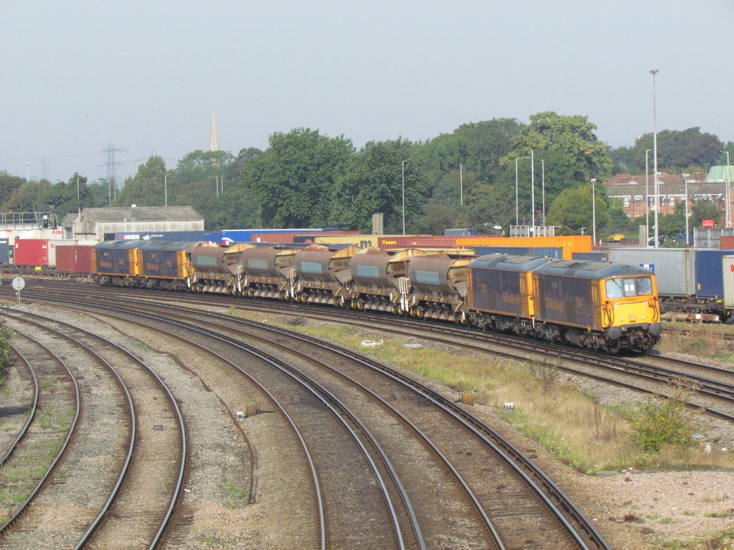
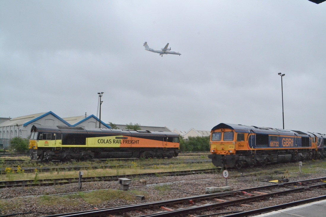
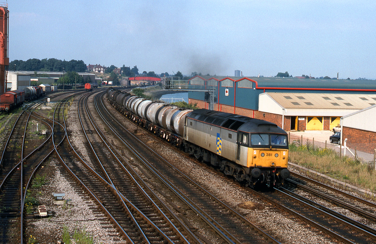
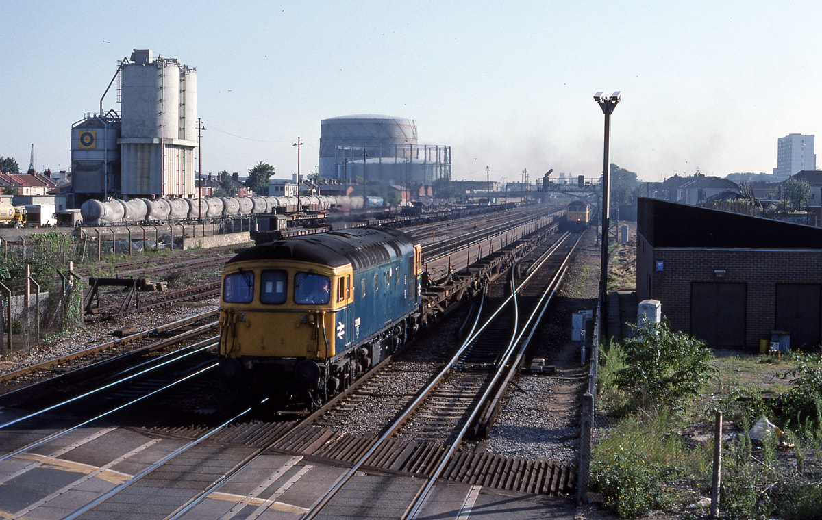
59004 climbs towards the tunnel at Salisbury on the 22nd September 1987 with a Merehead to Eastleigh stone working on the 22nd September 1987. Copyright Ron Kosys. Note Gas Holder.
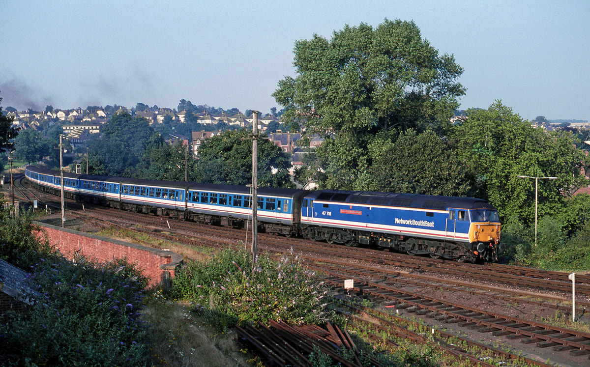
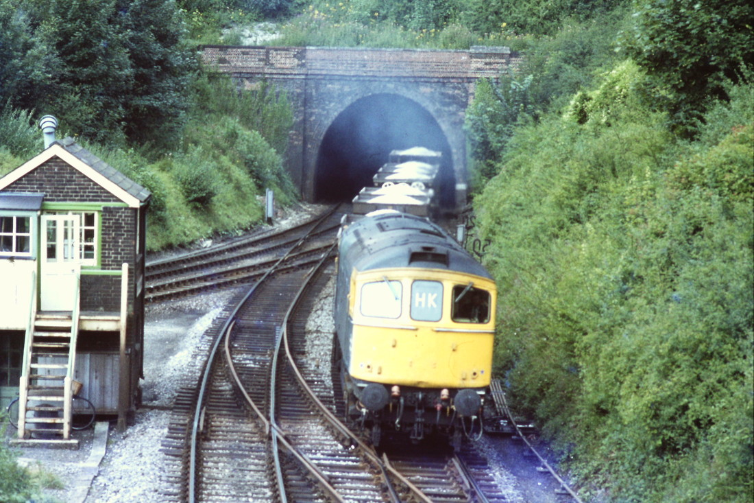
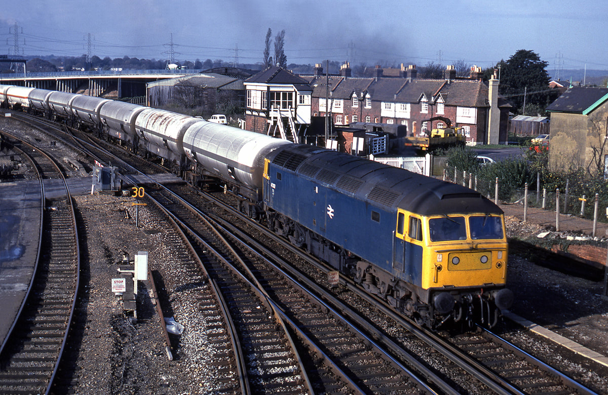
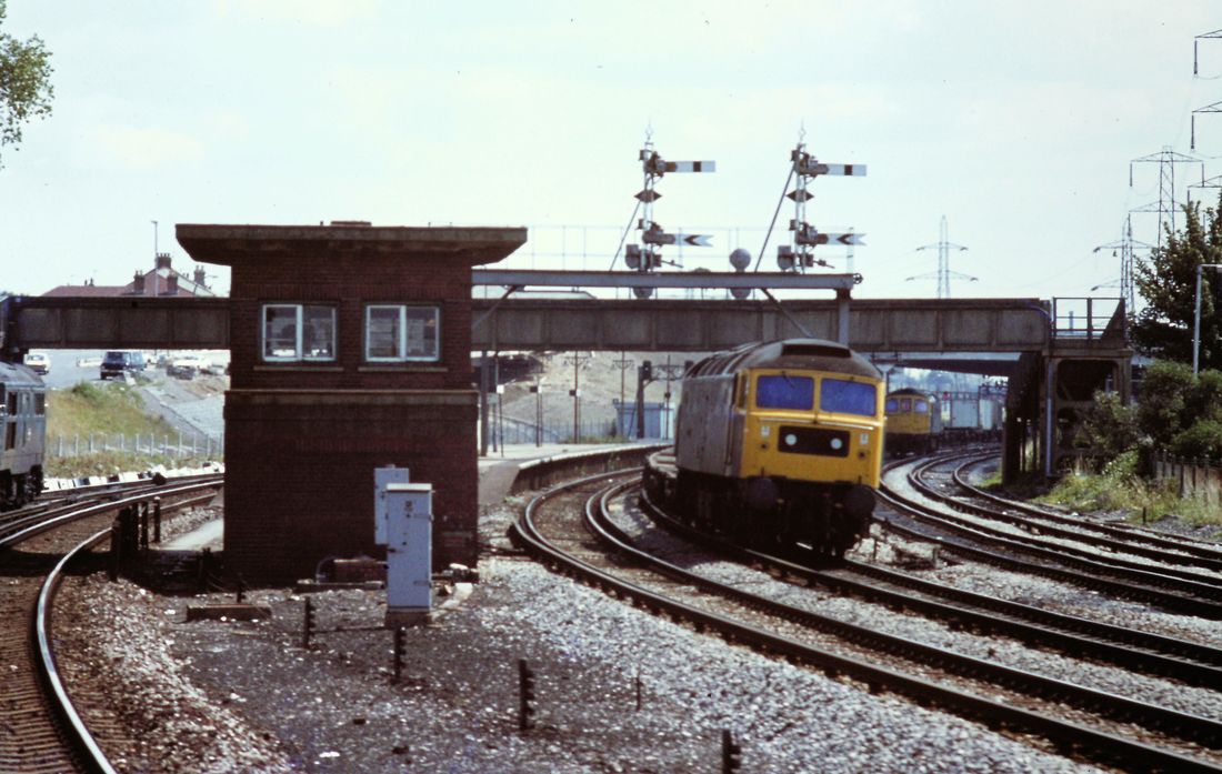
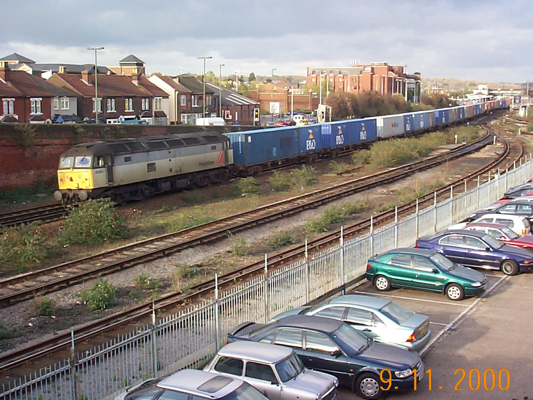
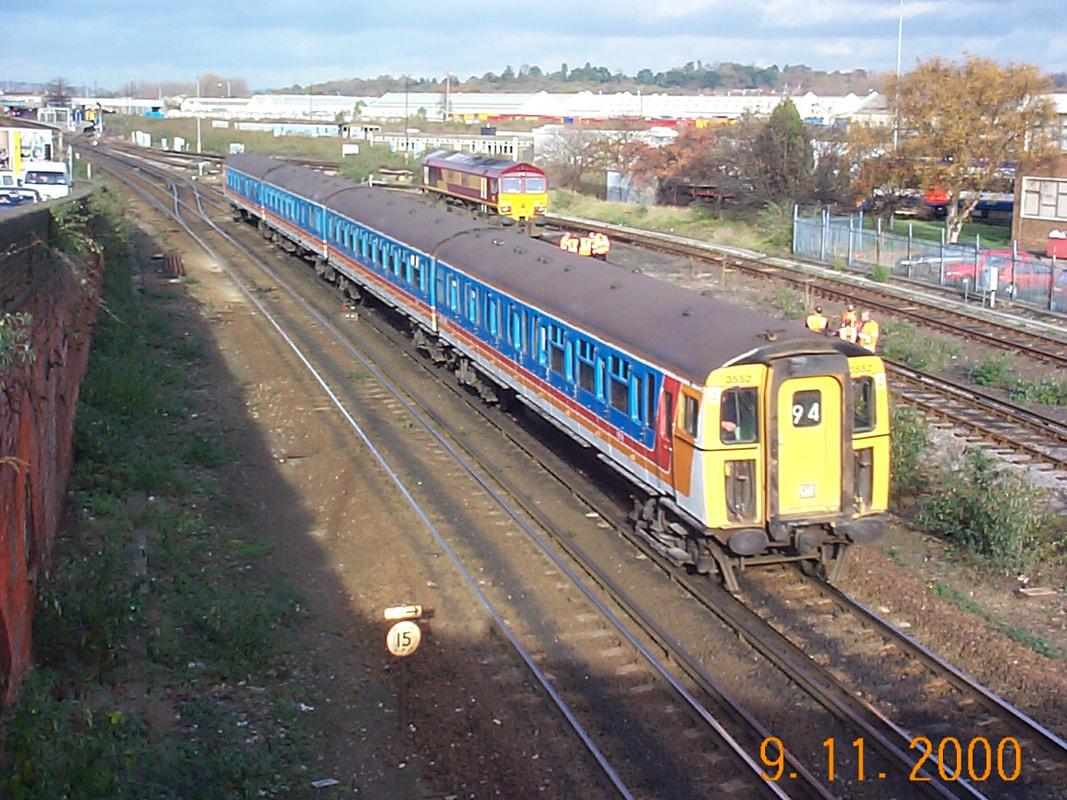
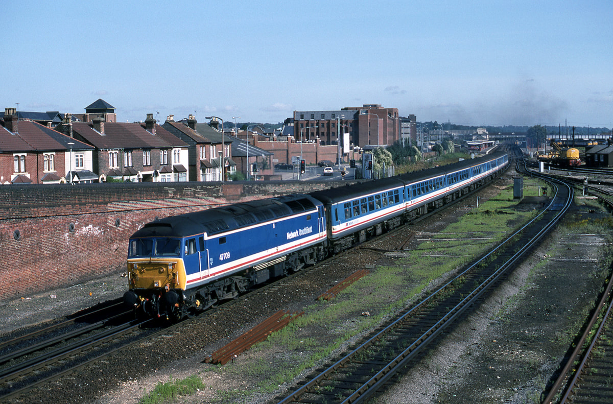
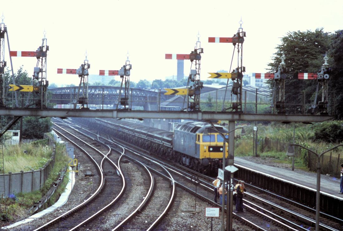
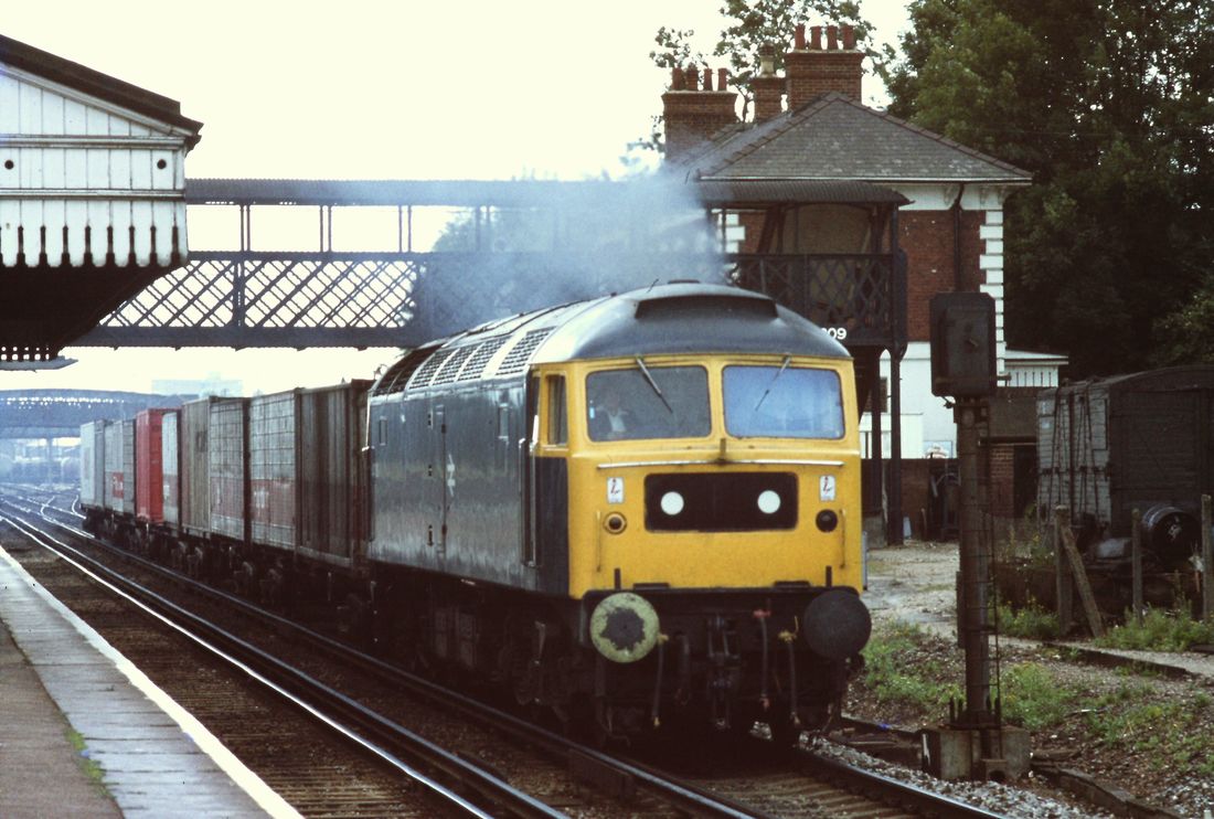
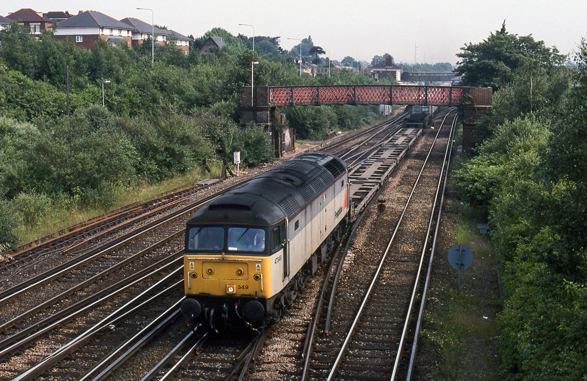
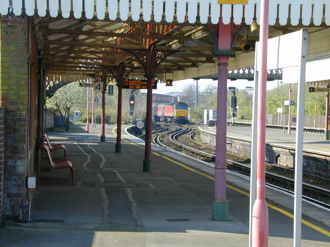
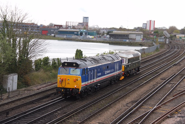
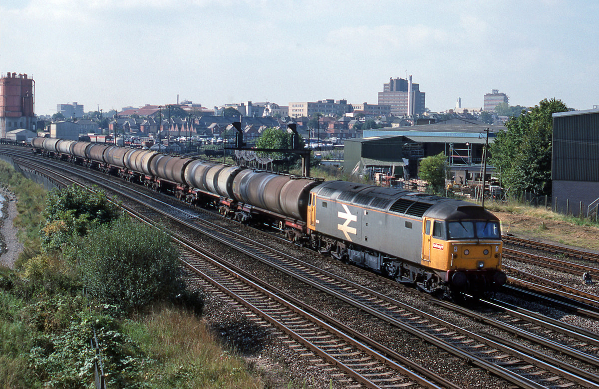
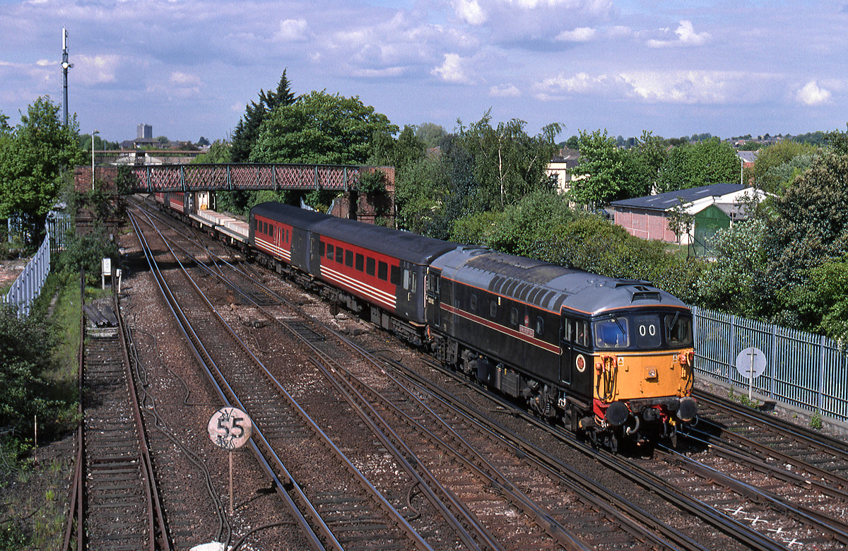
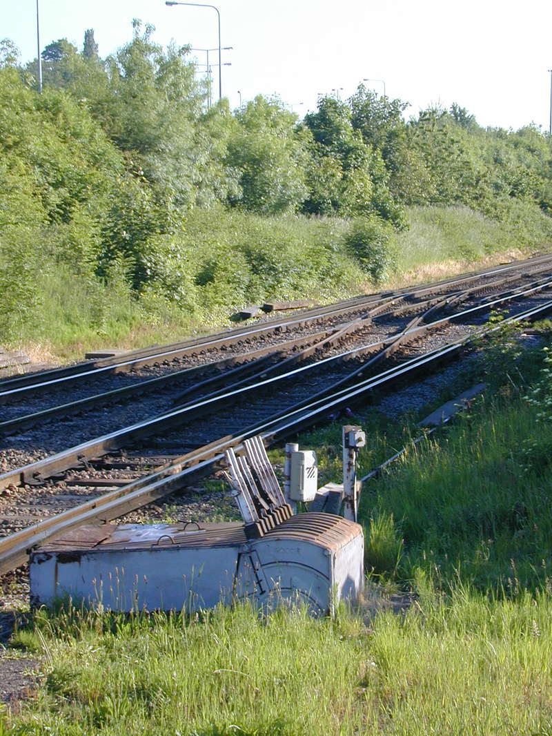
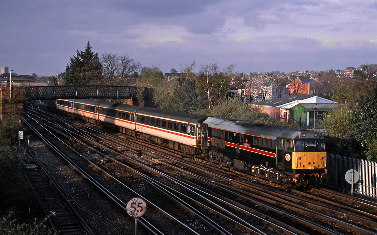
Salisbury 47716 1V17 1655 Su W-E The train has just cleared the tunnel remains of the yard pointwork in the foreground. 28th July 91 Copyright Rob Kosys
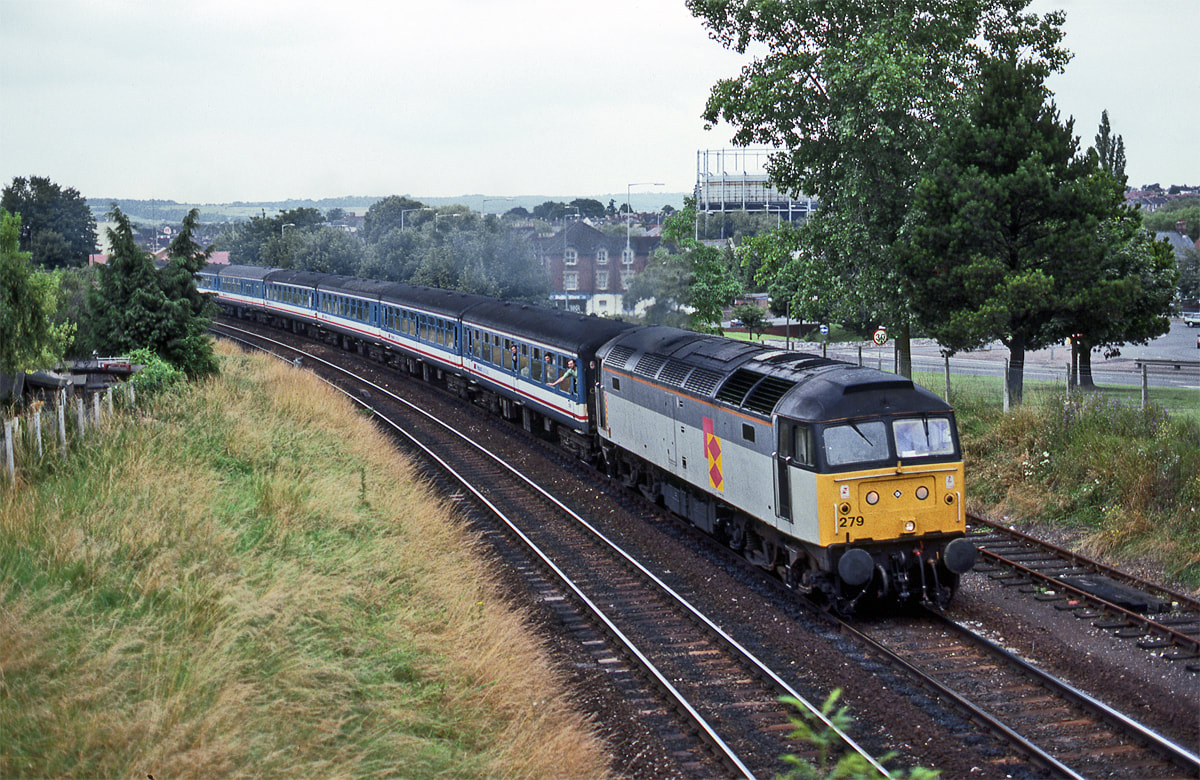
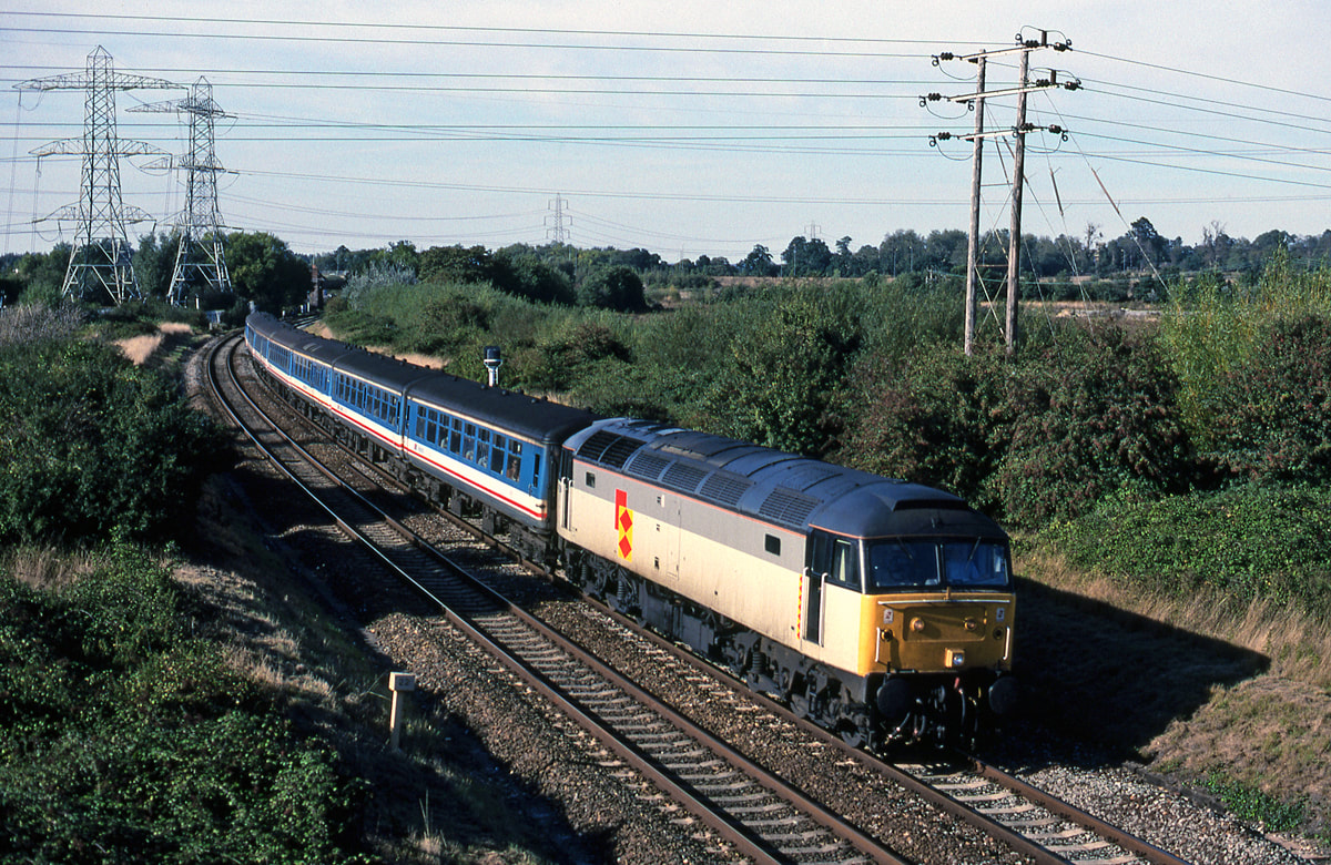
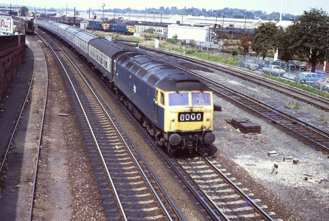
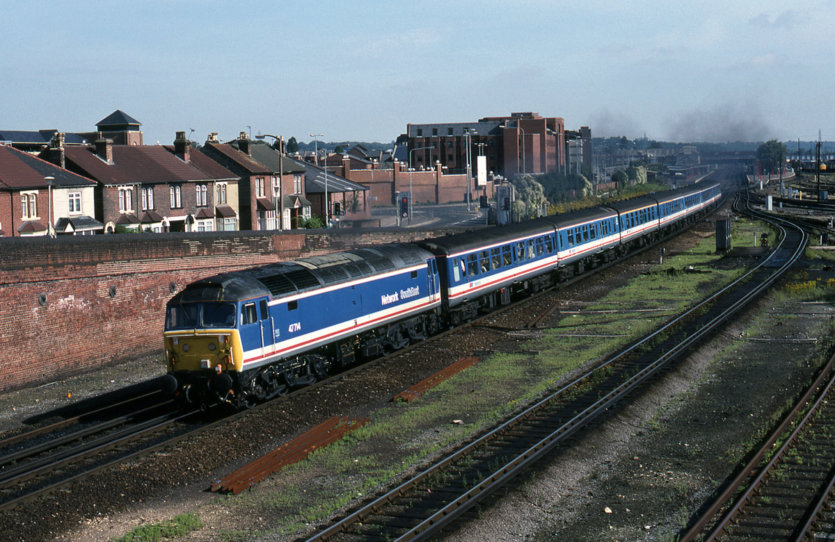
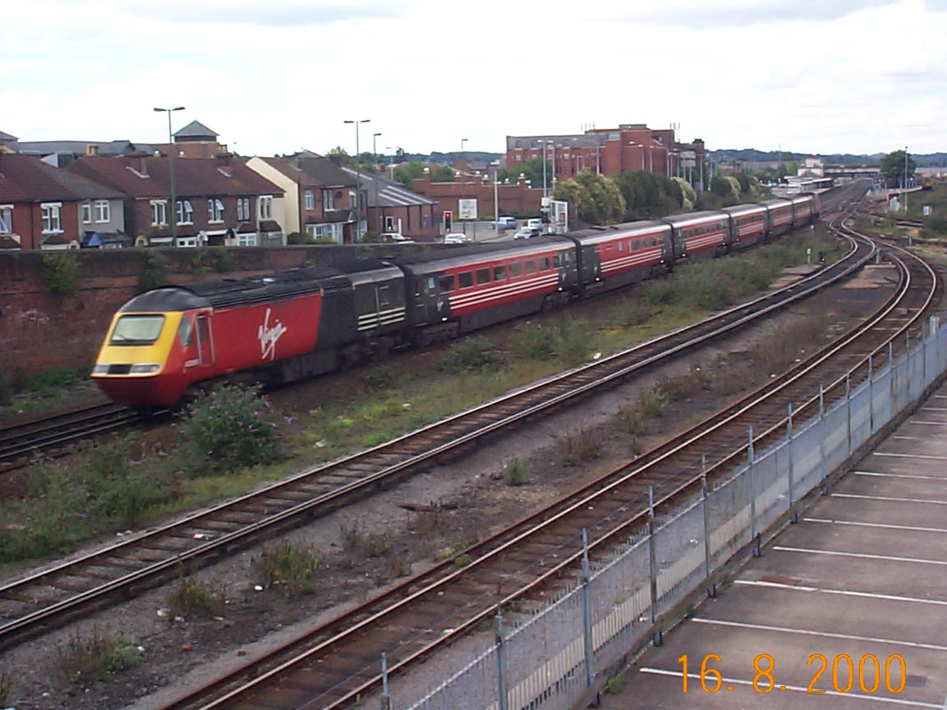
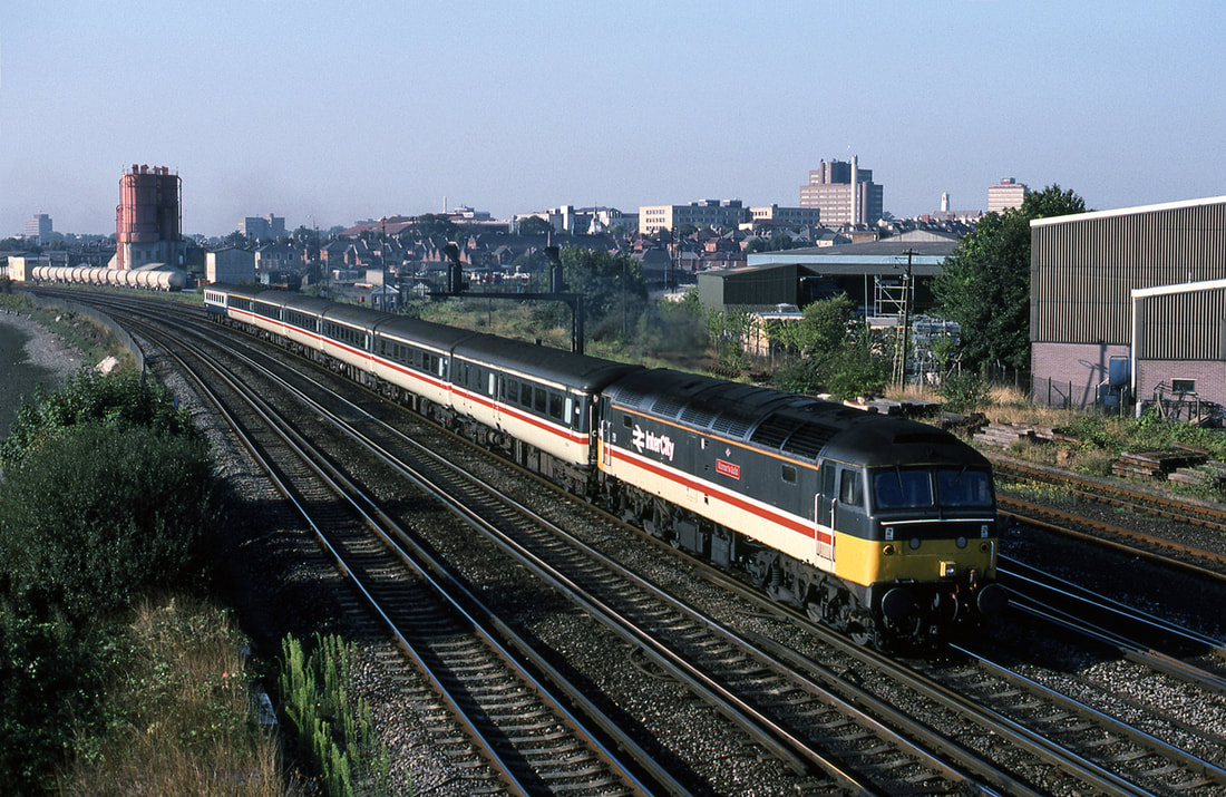
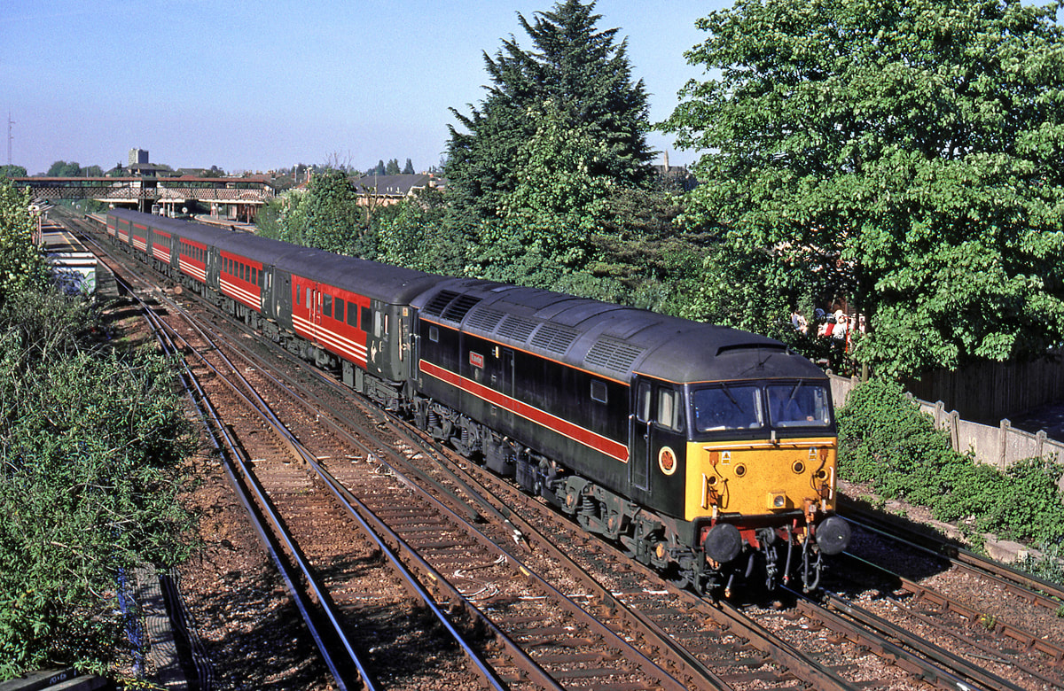
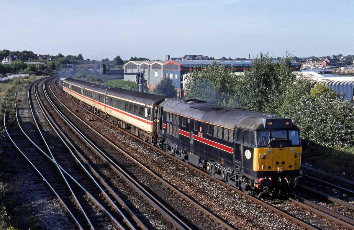
Non-heat Class 47 47279 departs Salisbury with 1O39 1548 Exeter to Waterloo. Sunday 21st July 1991 Copyright Ron Kosys
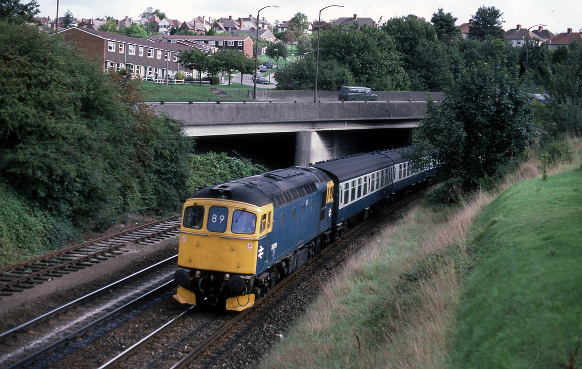
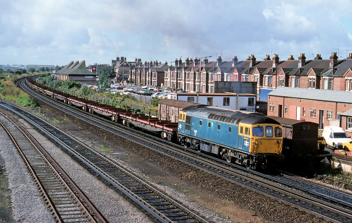
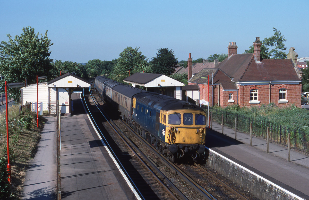
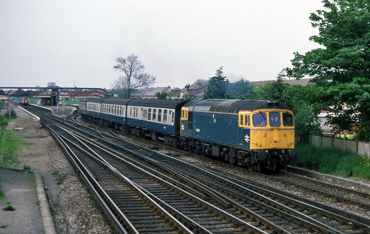
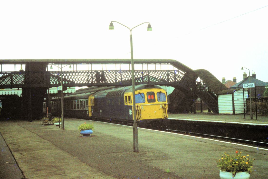
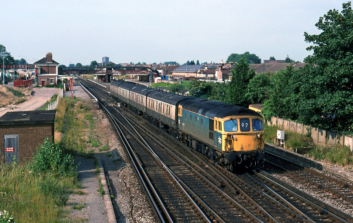
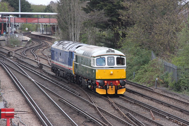
33206 approaches Salisbury on the 24th September 1987' The train is a Portsmouth to Cardiff service. Copyright Ron Kosys.
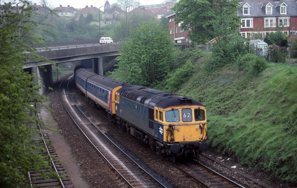
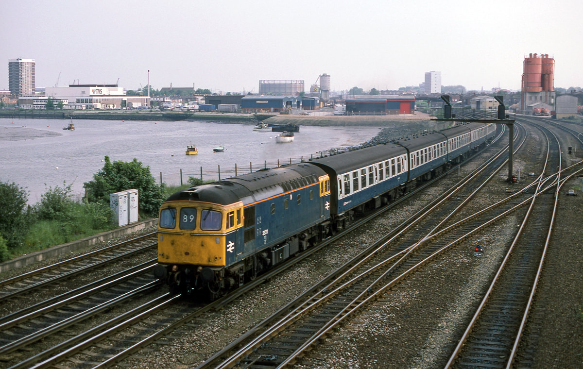
33102 approaches Salisbury on the 3rd May 1989 with the 08.10 Waterloo-Salisbury Copyright Ron Kosys
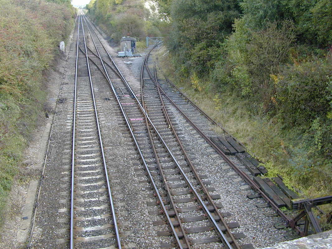
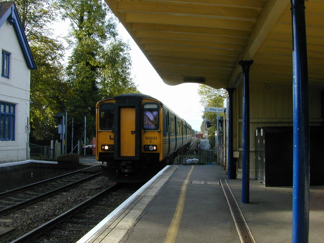
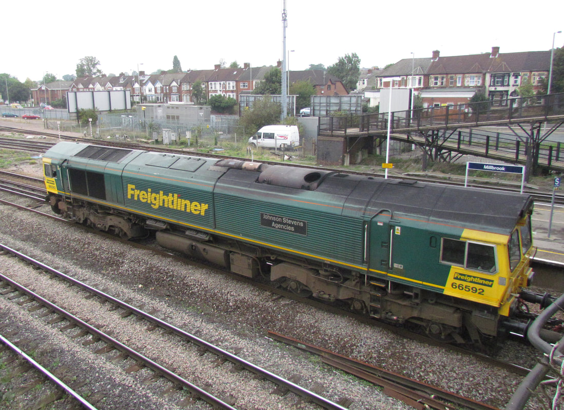
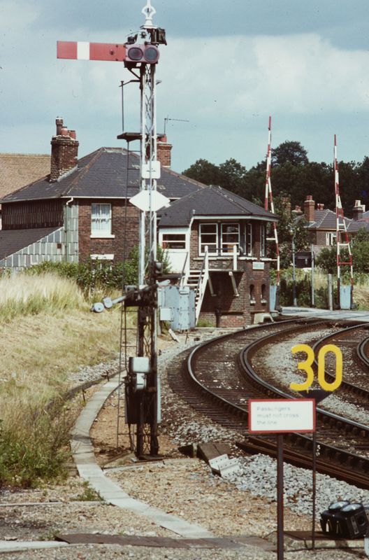
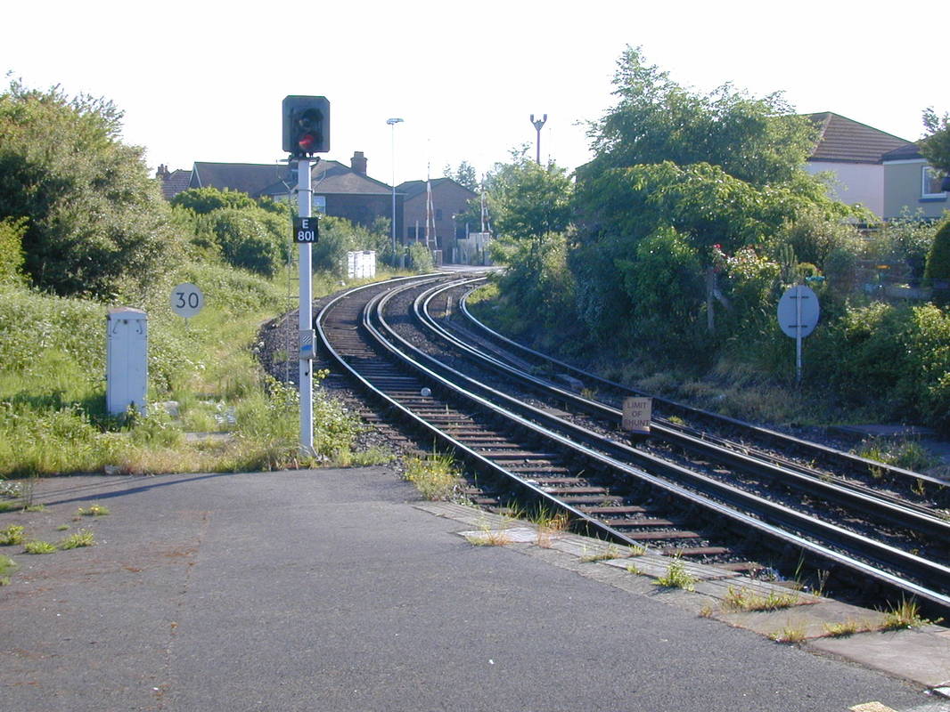
Fisherton Tunnel 443 Yards
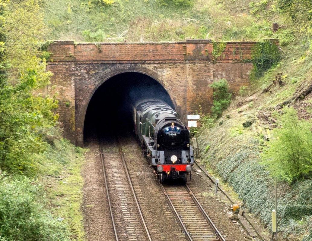
Fisherton tunnel, 34046 Braunton, emerges from the tunnel on the 23rd April 2014 Copyright Terry Waldron
Braunton was coming out of the west end of the tunnel (Salisbury end) and stopped in Platform 4. Braunton had brought its train from London Victoria (and was first day of Great Britain VII). After taking water Braunton took the train onto Exeter, where steam gave way to diesel, and the train ended up at Truro. (so Day 2 of Great Britain VII started from Truro.
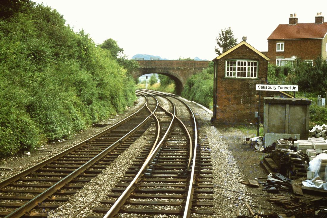
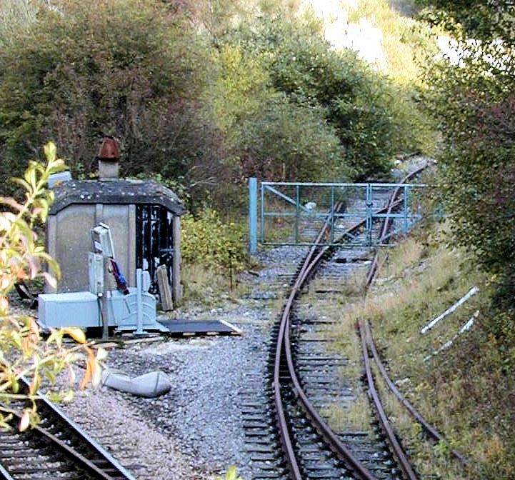
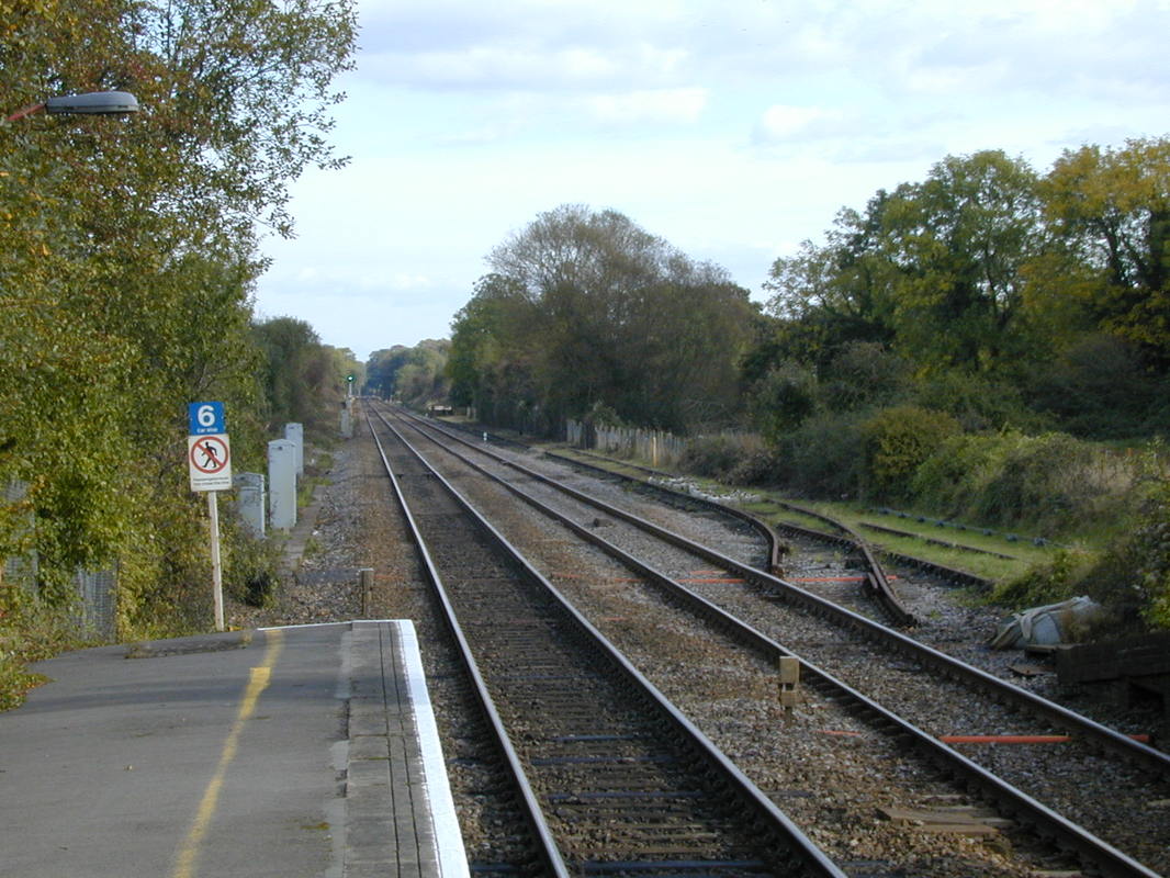
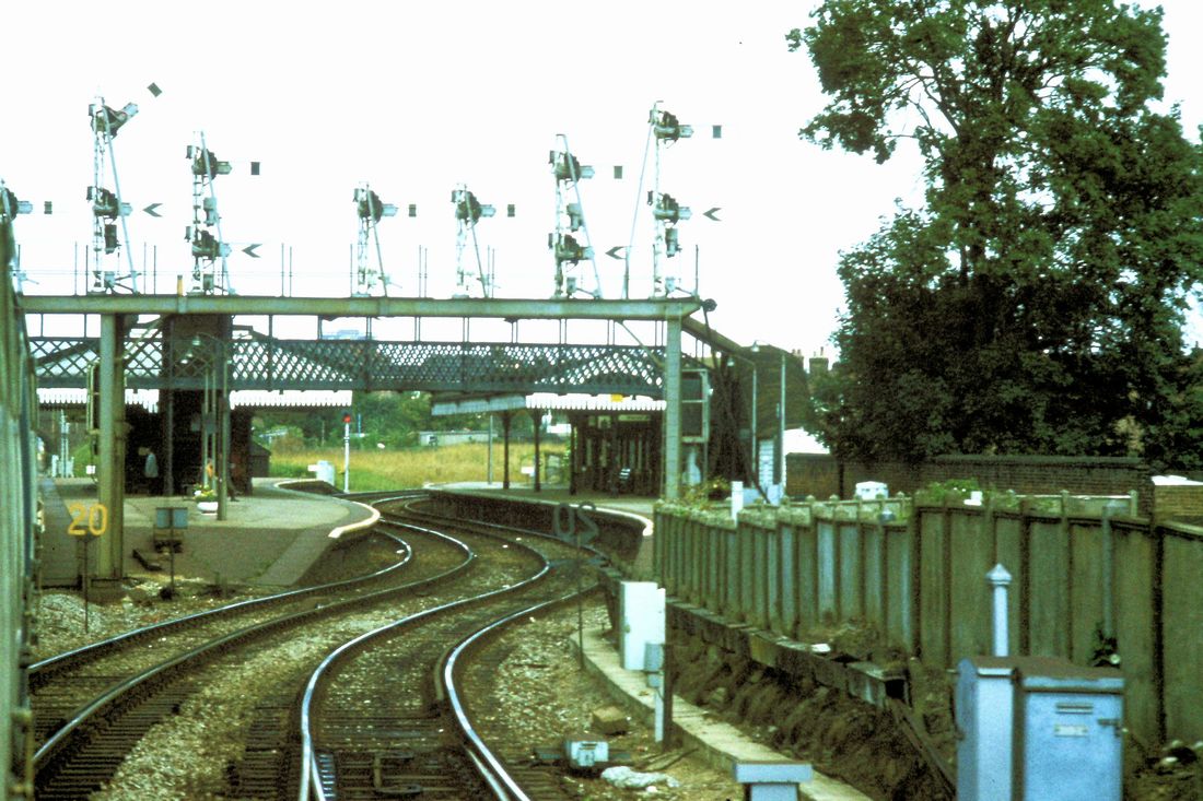
Salisbury Tunnel Junction
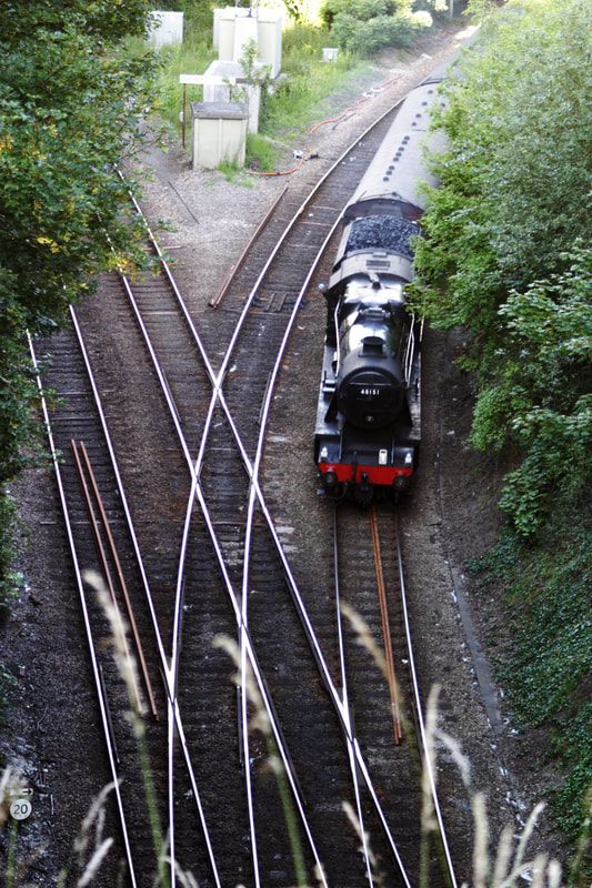
30th June 2011. The 8F (48151) started off from Swanage via Southampton to Salisbury (the photo shows the train about to enter the East Portal of the tunnel). At Salisbury the train loco was changed to 34067, (Tangmere) which took the train onto London Victoria. This would entail going back through the Salisbury tunnel and taking the left 'road' (at Tunnel Junction) to Andover. I took the photo from above the scrub grass you see in Roger Winnens photos**, there is a park that allows you to get to a fence (so it is not quite as precarious as you imagine). ** Rogers photo referred to is below - A Portsmouth bound train turns off at the junction. 7th August 1979 Copyright Roger Winnen N.B. This photograph is copyright Terry Waldron
Salisbury Tunnel Junction Signal Box. Looking towards Waterloo. 23rd August 1981 Copyright Roger Winnen
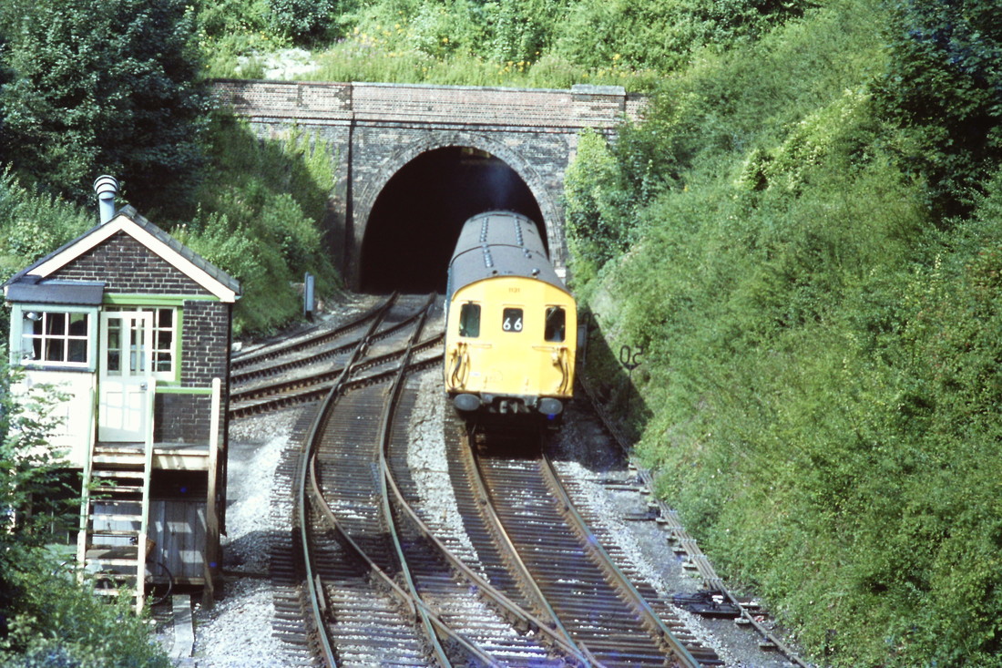
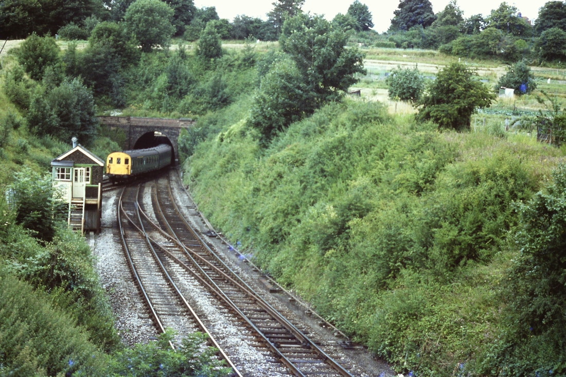
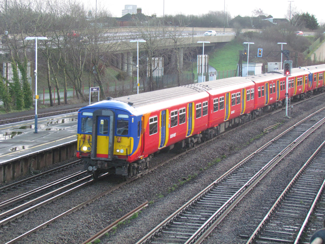
Passing Salisbury Tunnel Junction Unit 1131 emerges from the 443 yard Fisherton tunnel and heads for Andover etc. 7th August 1979 Copyright Roger Winnen
A Class 33 with a ballast train at Salisbury Tunnel Junction. 7th August 1979 Copyright Roger Winnen.

A Portsmouth bound train turns off at the junction. 7th August 1979 Copyright Roger Winnen
A stopping service to Southampton emerges from the tunnel on route to Romsey etc. 7th August 1979 Copyright Roger Winnen.
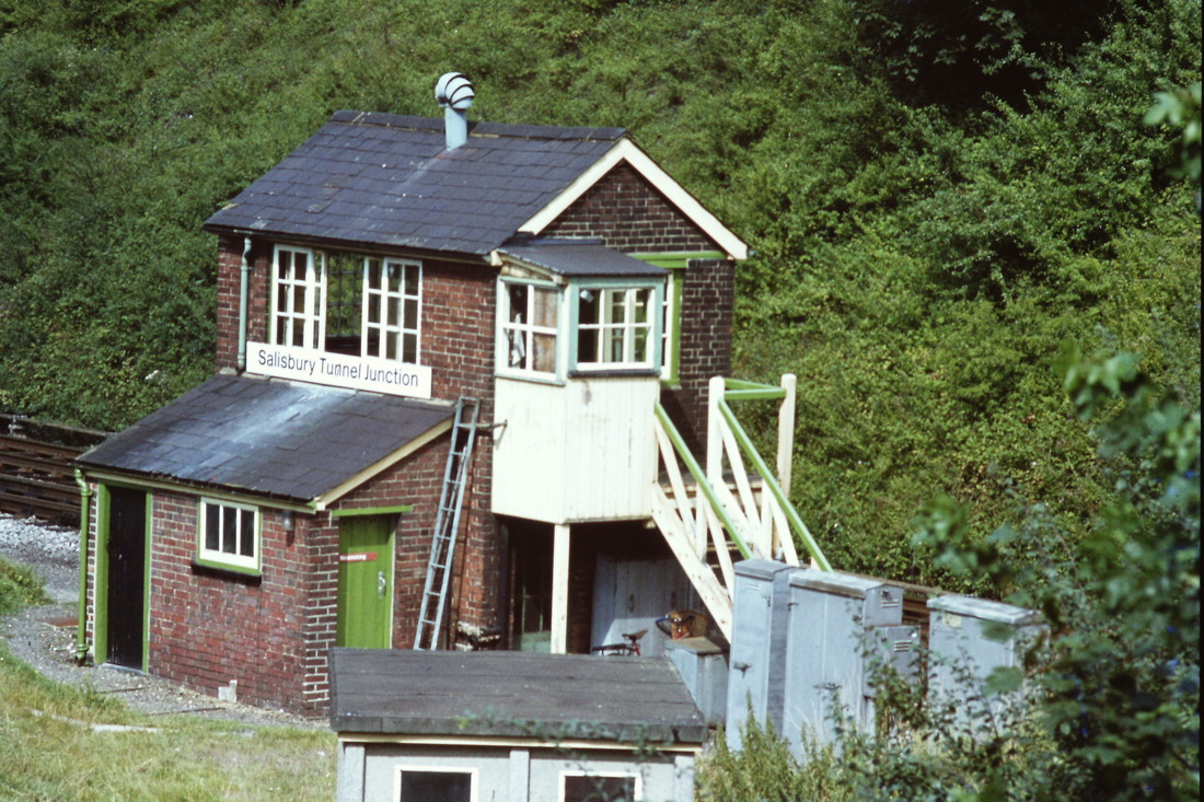
Salisbury Tunnel Junction Signalbox. 7th August 1979 This box closed in 1981 and control was passed to Salisbury Station. Copyright Roger Winnen
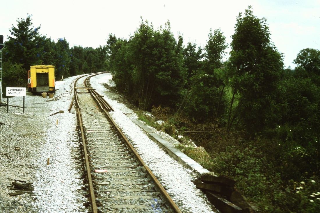
A most interesting picture of Laverstock South Junction in the process of being installed. Note the new ballast and rails which are not connected. The connecting chord had been out of use for some years. This picture dates the re-installation as seen on the 23rd August 1981 Copyright Roger Winnen
Alderbury Junction was about 3 and three quarters of a mile from Salisbury . West Grimstead about one mile further on.
East Grimstead Quarry
East Grinstead Chalk Quarry entrance 2002/3. Dean is straight ahead. The sidings here were laid in in 1972 and for ten years chalk was taken from here to Quidhampton.
Copyright Kevin Jenkin
East Grimstead Quarry Ground Frame. 2002/3 Copyright Kevin Jenkin Reference Middleton Press Fareham to Salisbury these sidings were used to store withdrawn 4TC sets.
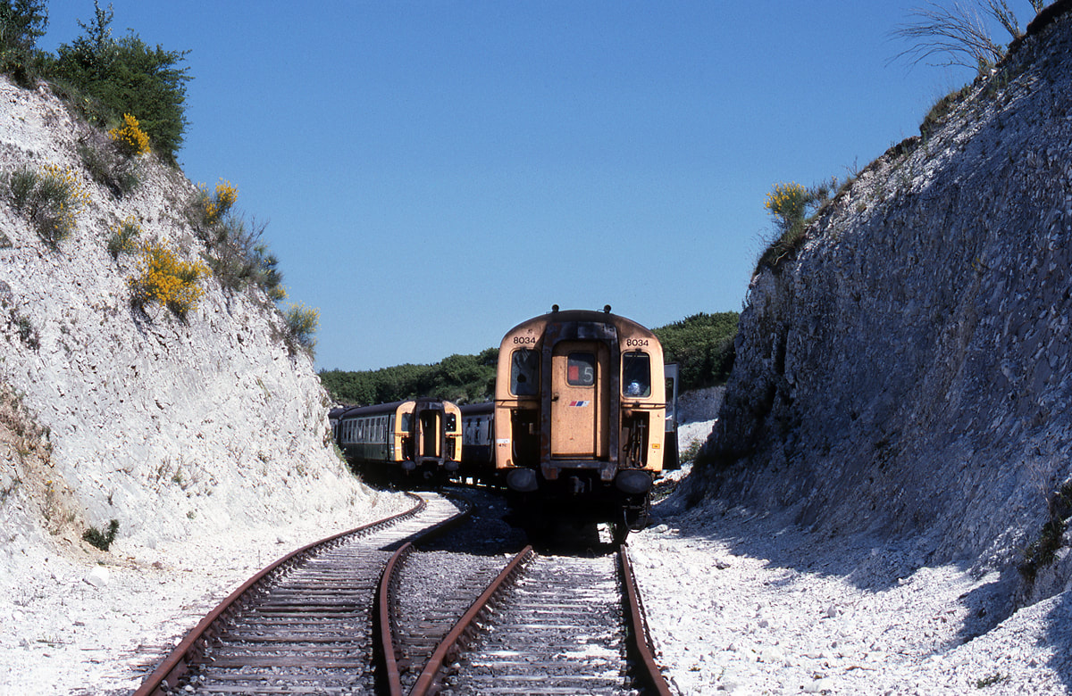
East Grimstead Quarry Stored 4TC sets No 8034 25th June 1989 Copyright Ron Kosys
Dean
Dean, a view looking towards Salisbury. 7th August 1979. Copyright Roger Winnen
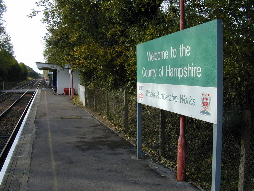
Dean railway station, also known as Dean (Wilts) railway station serves the village of West Dean in Wiltshire. The station is 9 miles south east of Salisbury. Interestingly whilst the station building is in Wiltshire, the platforms straddle the county boundary with Hampshire.
A siding from the goods yard led to a Military Establishment which itself was served by a narrow gauge railway system. This narrow gauge railway was used to transport various forms of ordnance around the site between various servicing enclosures and bunkers dug deep into the eascarpment of a hill which lay to the south.
A most interesting and profusely illustrated fact sheet detailing the history of the site can be viewed by clicking here:- http://www.deanhillpark.co.uk/history-office-complex.php
A most interesting and profusely illustrated fact sheet detailing the history of the site can be viewed by clicking here:- http://www.deanhillpark.co.uk/history-office-complex.php
More Photographs of Dean
This bit of the platform is in Hampshire, beyond is in Wiltshire. 2002/3 Copyright Kevin Jenkin
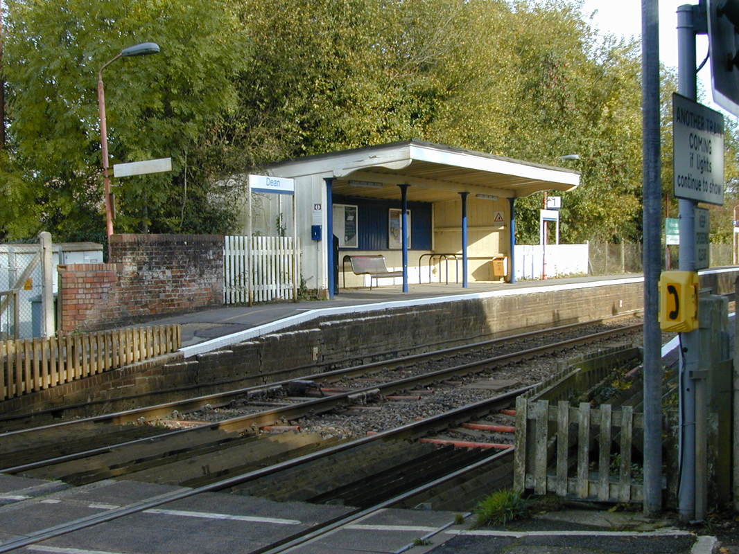
The up side platform at Dean in 2002 seen from the level crossing. A station building lay between the crossing and the waiting shelter
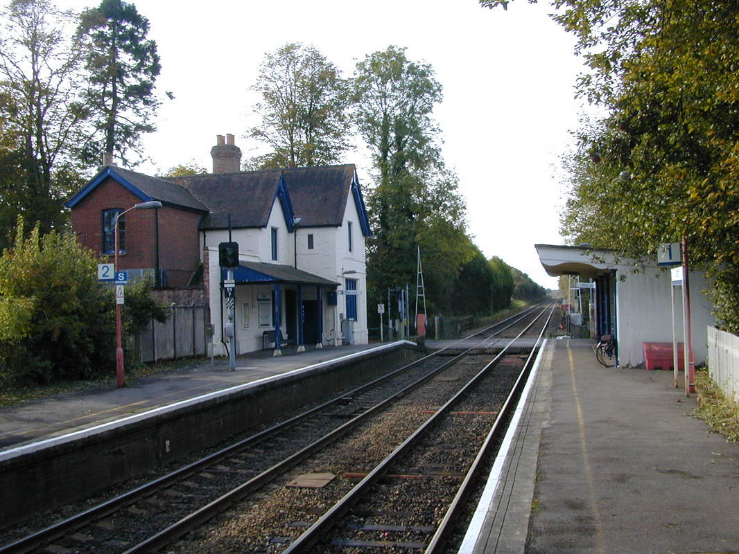
The main station building lies on the down side - this grand building was bult in harmony with the local church.
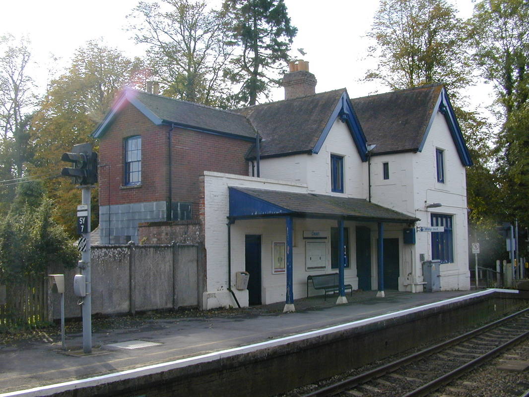
A closer view of the main station building. 2002 Copyright Kevin Jenkin
Dean, the crossing and house. 2001 Copyright Kevin Jenkin
An up train runs into Dean, 2002 Copyright Kevin Jenkin AHB's came into use until 9th September 1980
Dean 2002 looking towards Romsey. The remains of the goods yard can be seen. Copyright Kevin Jenkin
A Christmas Card scene, indeed it was intended to be so, taken by Guy Vincent - see details below.
Copyright.
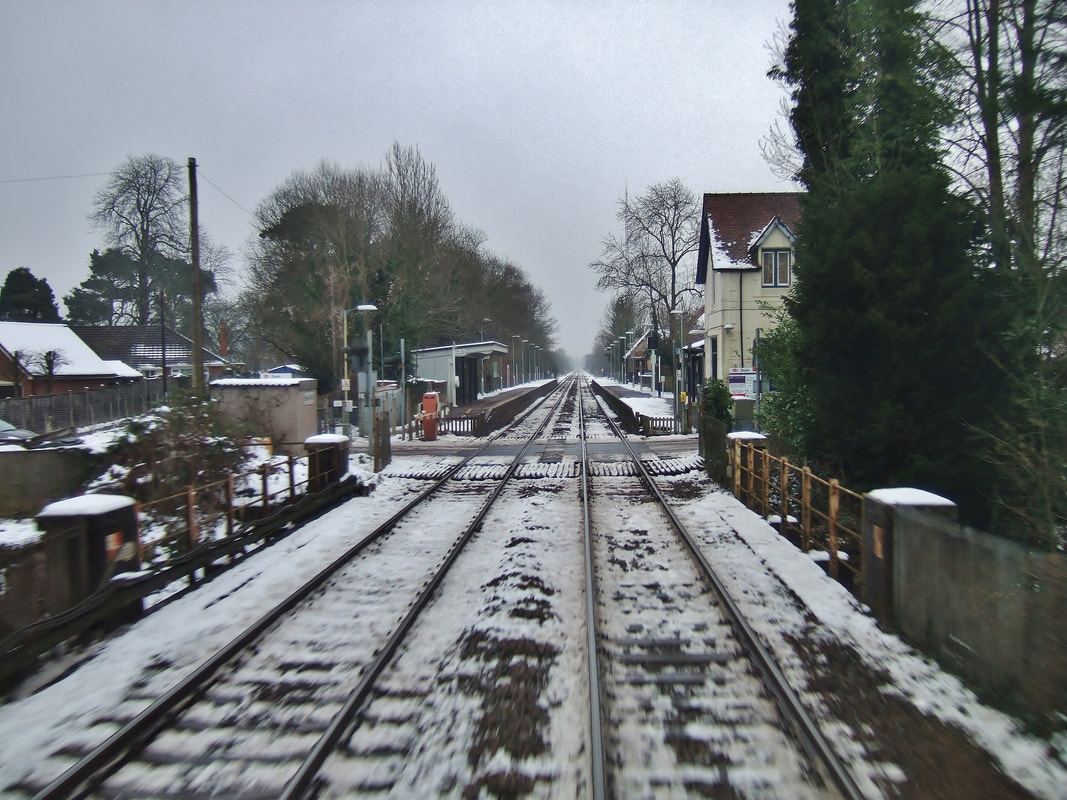
By way of return here is an image from 2013 from the digital route-refresh file I compiled and keep for easy reference should the need ever arise. It shows a rearward-facing view of Dean station on the Wilts/Hants border looking towards Romsey on a cold January day in 2013. The level crossing here was upgraded in 2015 and now has full barriers and obstacle detection equipment in place. It is a fast stretch of line, 85mph in both directions with signals either side of the crossing offering protection until it is proven to be clear and the barriers are down. Lines here are 'Up and Down Dean', up being towards Romsey. From Romsey you are on the 'Down Test Valley' towards Redbridge, Up being vice-versa. This goes back to the days of the now closed Andover Jctn-Redbridge via Stockbridge 'Sprat and Winkle' line the closed section of which diverged in a northerly direction at Kimbridge Junction between Romsey and Dunbridge. See Wikipedia for more info. Many thanks Guy for the info and amazing picture.
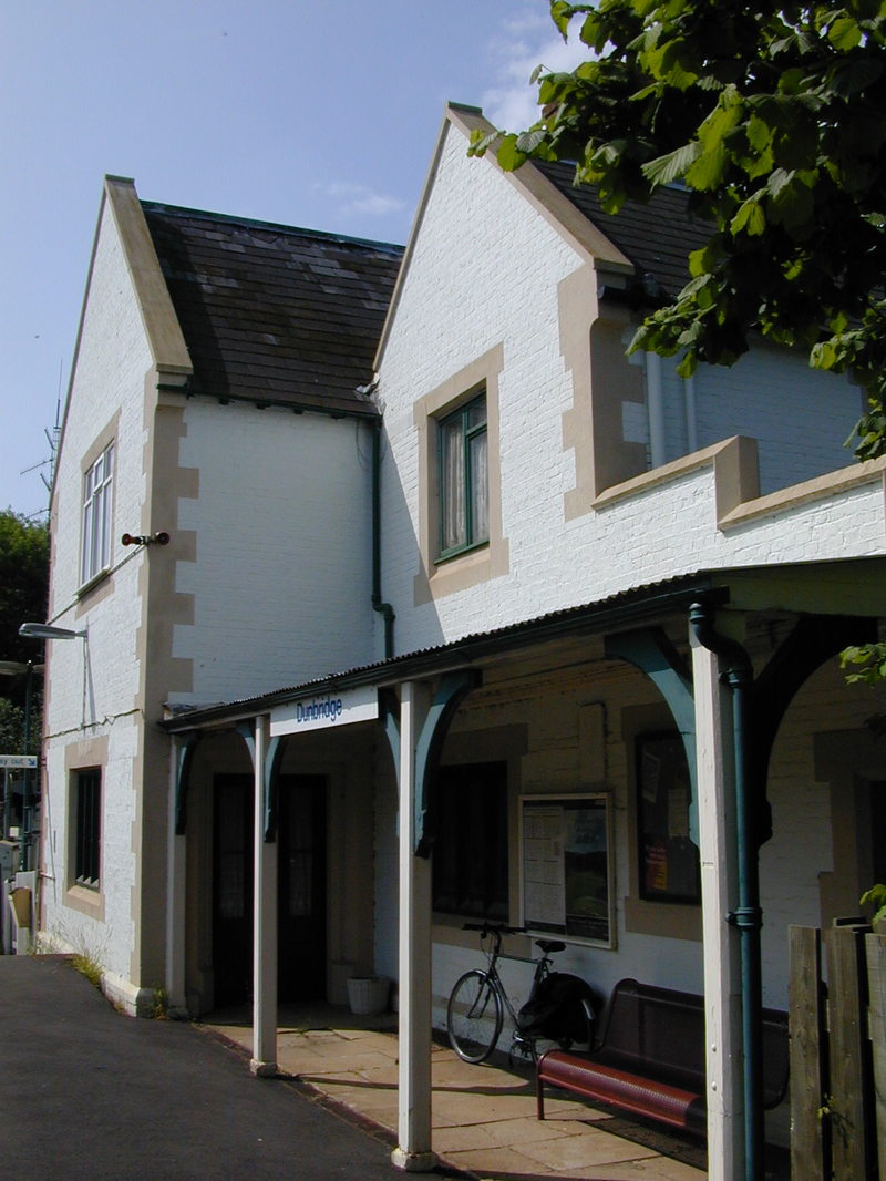
Dunbridge for Mottisfont
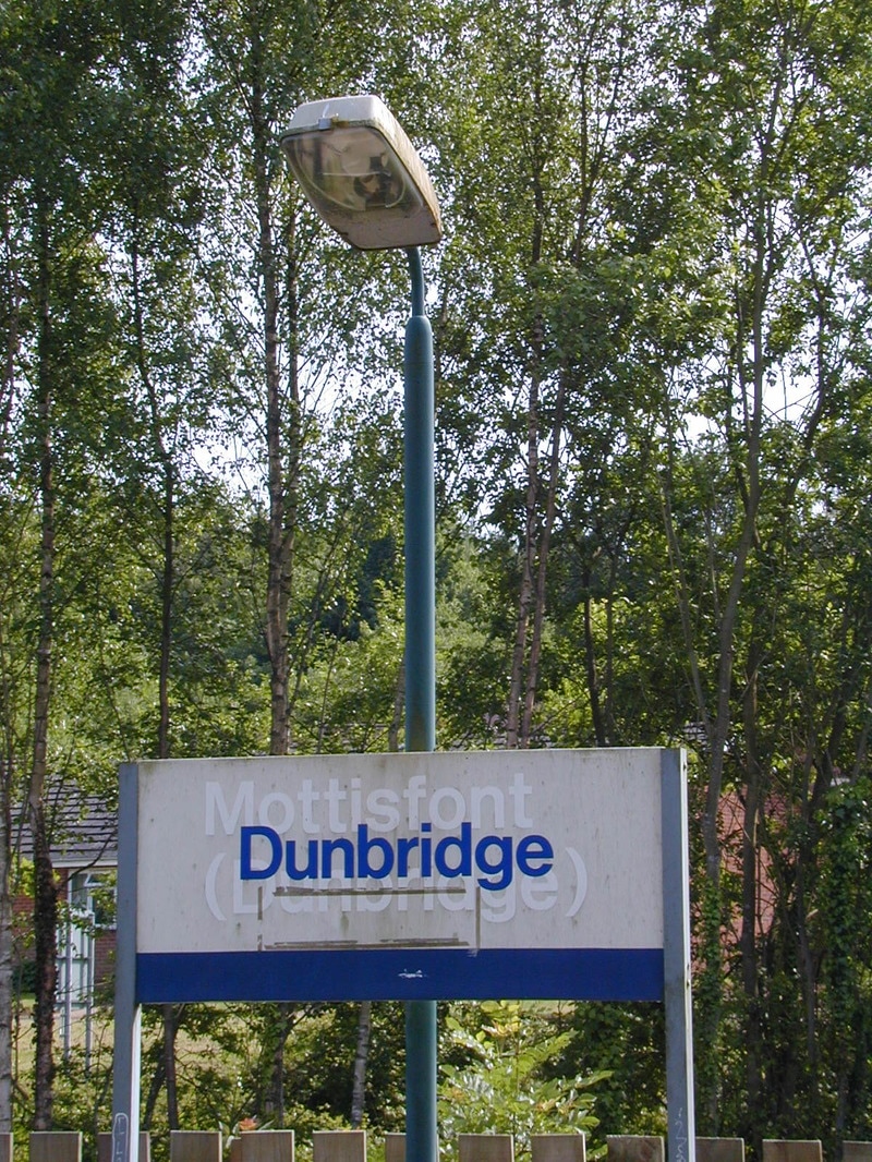
A change of name has occurred. 2001 Copyright Kevin Jenkin Mottisfont is the name of house and gardens situated about a mile away across a fieldpath
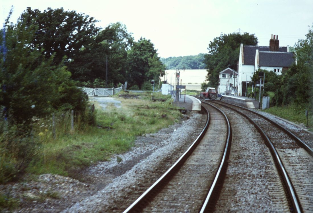
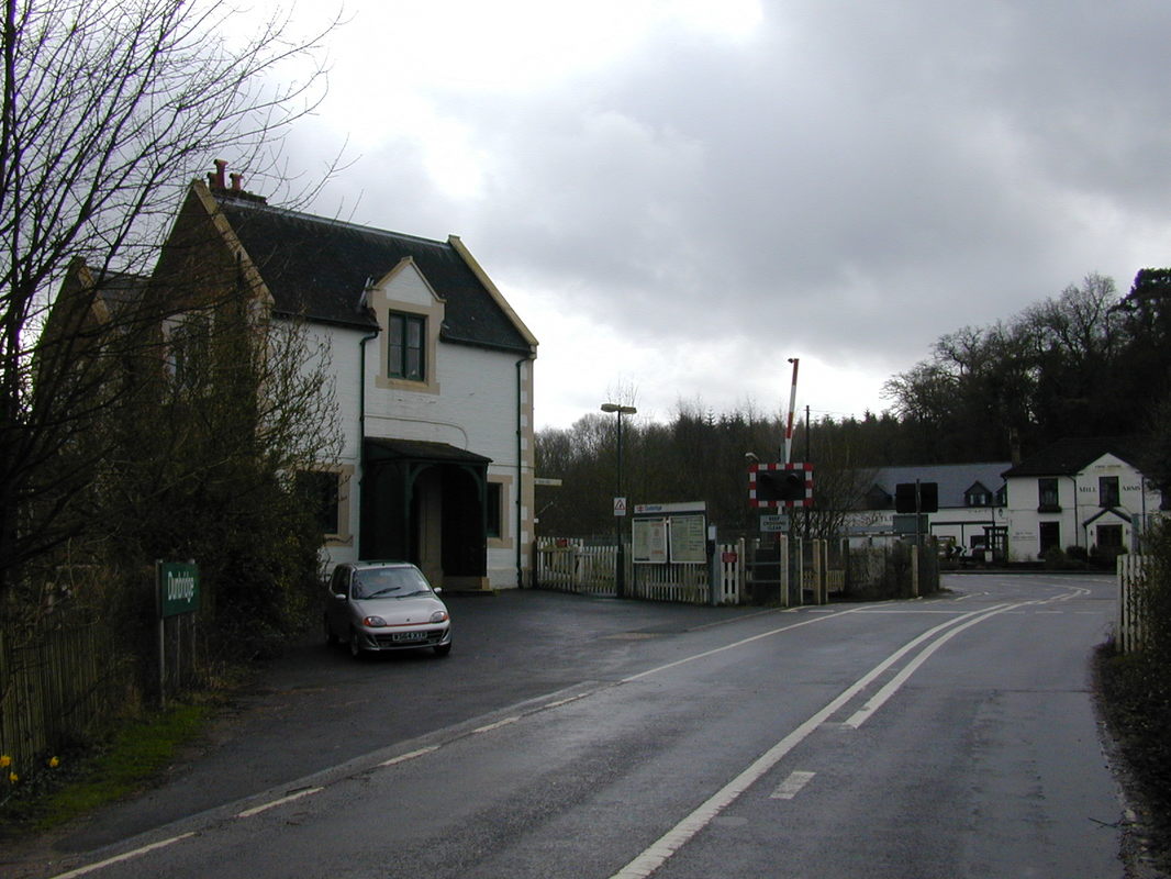
A tractor crosses the line under the watchful eye of the signalbox at Dunbridge. We're looking towards Salisbury. 7th August 1979 Copyright Roger Winnen
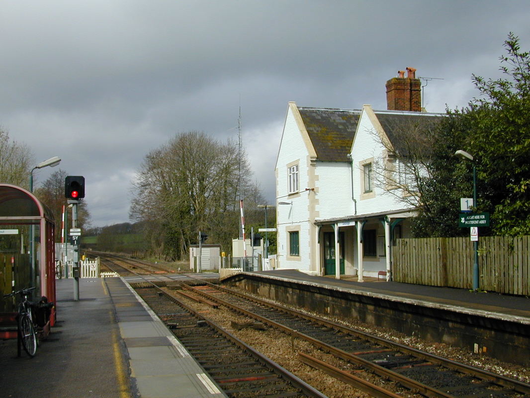
The main station building at Dunbridge is on the Southampton bound platform. Seen in 2001. copyright Kevin Jenkin
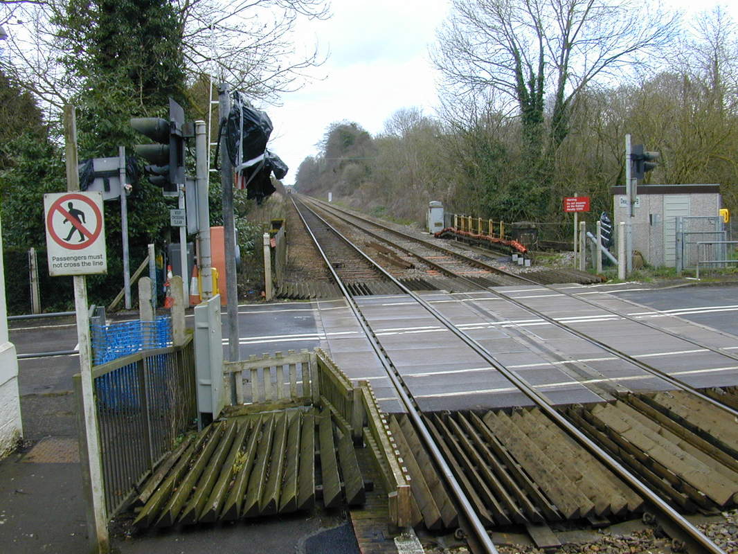
The level crossing at Dunbridge looking towards Salisbury. 2001 Copyright Kevin Jenkin.
Dunbridge. 2001 Copyright Kevin Jenkin 2001
Dunbridge station house in 2001. Copyright Kevin Jenkin
Romsey Junction for Southampton or Eastleigh
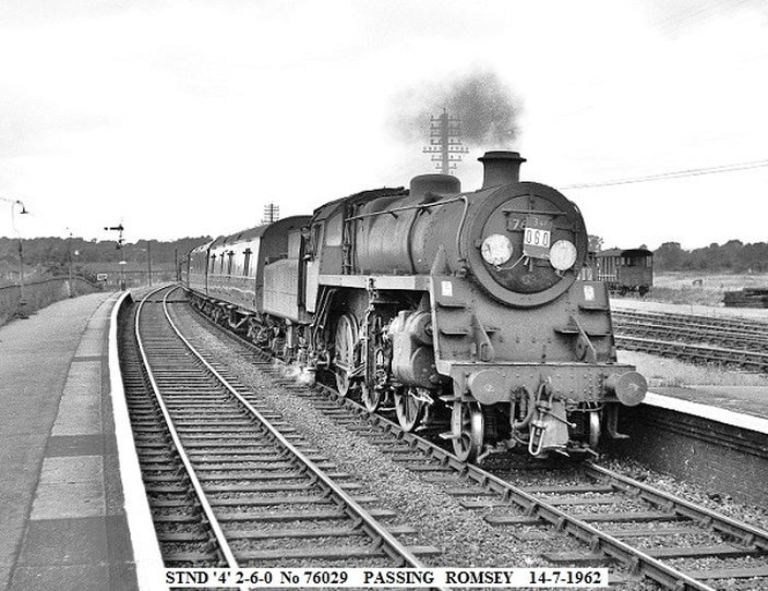
Romsey Standard Class 4 Withdrawn in 1964. Note all the sidings, and the wide open space. Copyright John Cornelius
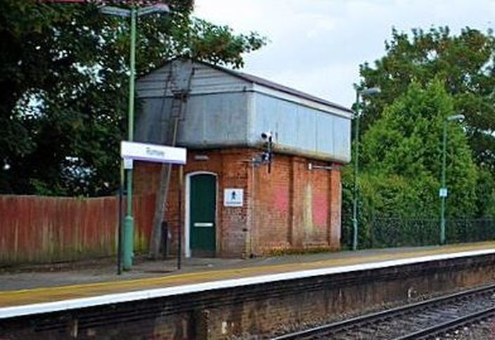
Romsey water tower. Coypright Kevin J enkin
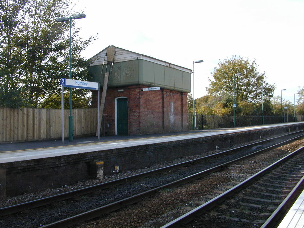
Romsey - the former water tank provides an excellent roof for the 'Gentlemans'. Coypright Kevin Jenkin
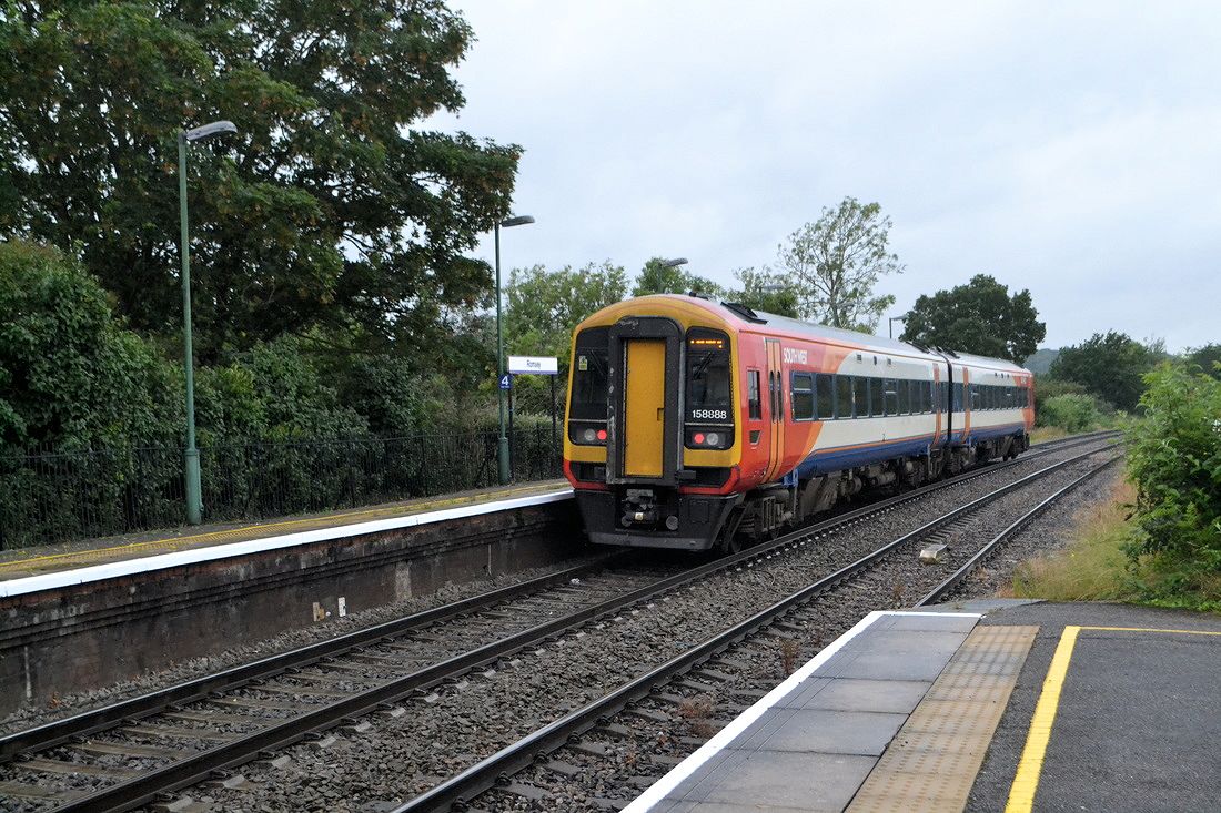
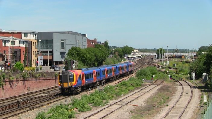
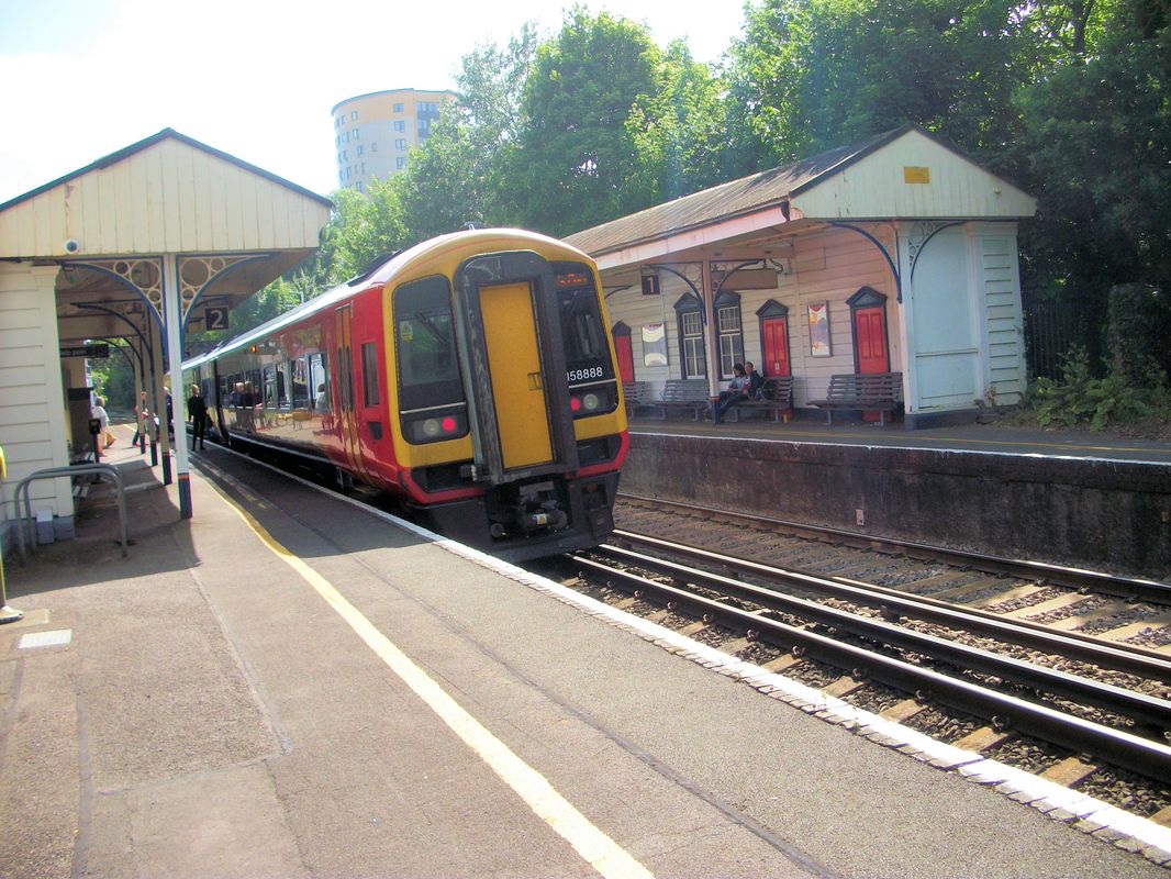
158888 departs Romsey towards Salisbury on the 29th June 2016. Copyright Roger Winnen
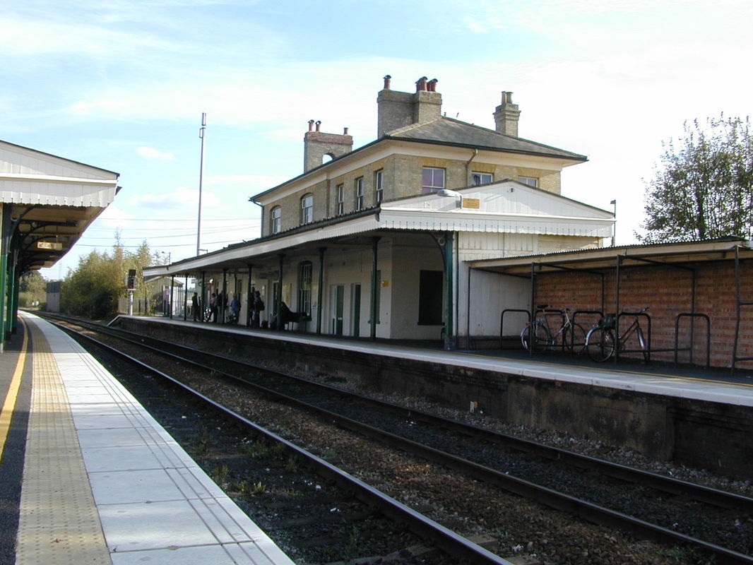
The grand style of the main station building, 2001 Copyright Kevin Jenkin
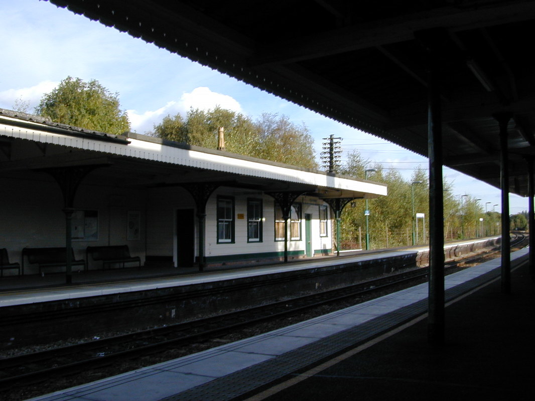
The up side platform building. 2001 Copyright Kevin Jenkin
Presumably the car parking charges have risen since 2001!! Copyright Kevin Jenkin
A very low bridge ahead - just 8' 9". Access between the platforms is by means of a subway. The tall station house dominates the scene. 2001. Copyright Kevin Jenkin
The goods shed finds alternative uses. 2001. Copyright Kevin Jenkin
A Foster Yeoman Class 59 heads an empty stone train throuth Romsey. 21st August 2007 Copyright Roger Winnen.
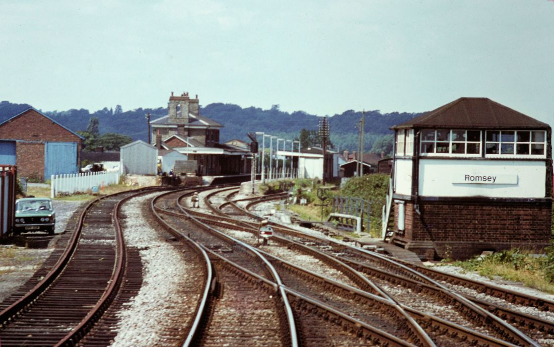
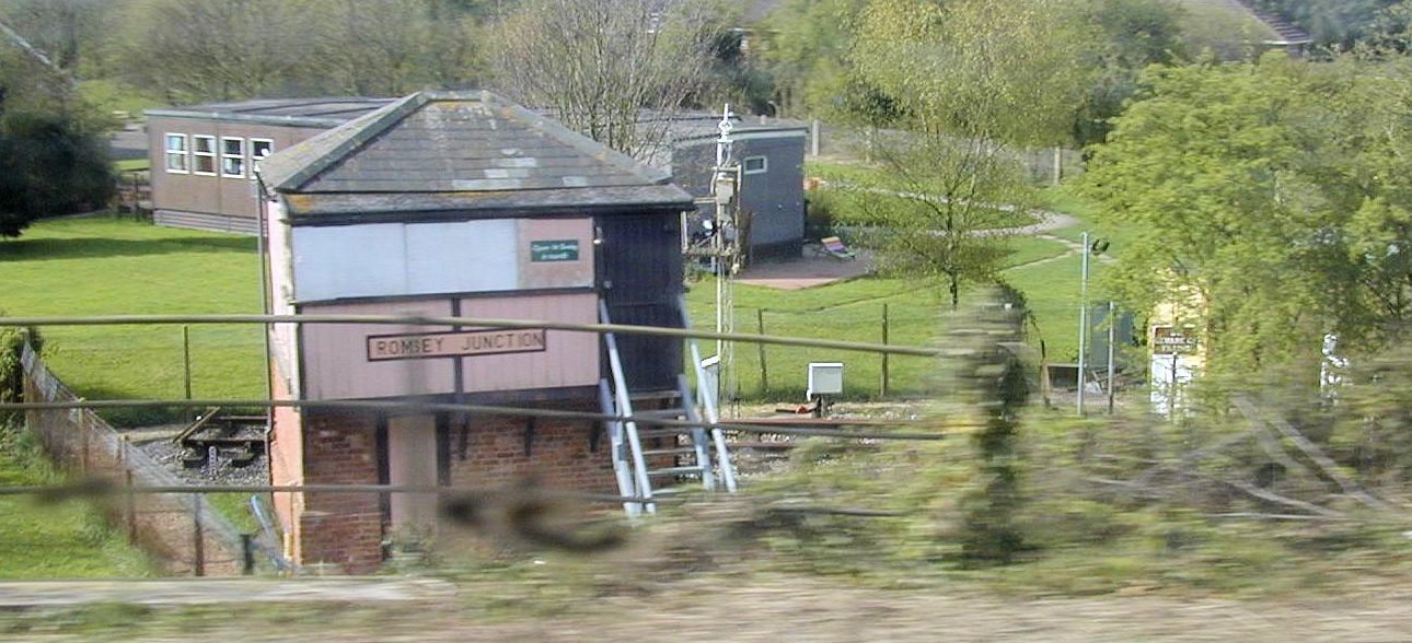
A fine view of the junction and Romsey Signal Box taken on the 7th August 1979 Copyright Roger Winnen
Romsey Signalbox
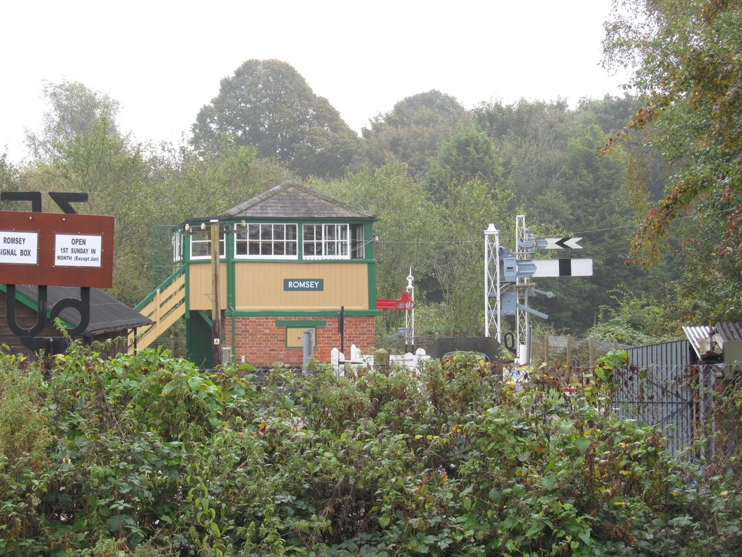
After closure this was lifted from its operational position and moved a short distance to a location within yards of the main line. It has been carefully restored and connected to a simulator such that the lever operations for passing traffic through the junction can be faithfully carried out.
After closure this was lifted from its operational position and moved a short distance to a location within yards of the main line. It has been carefully restored and connected to a simulator such that the lever operations for passing traffic through the junction can be faithfully carried out.
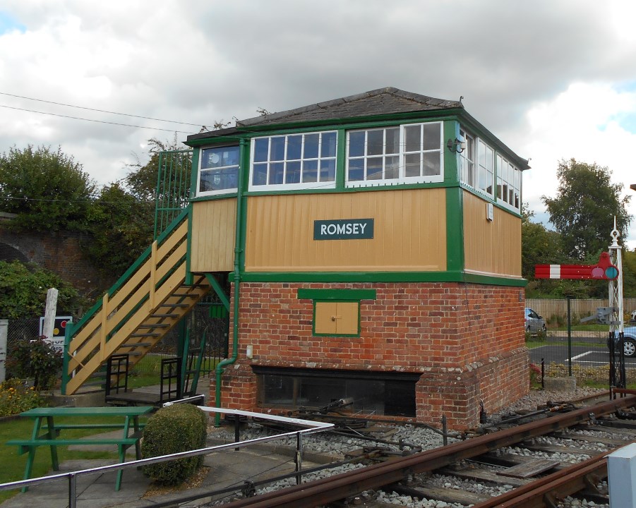
Romsey Signalbox in its 'new' location taken on the 12th September 2015 Copyright Chris Osment
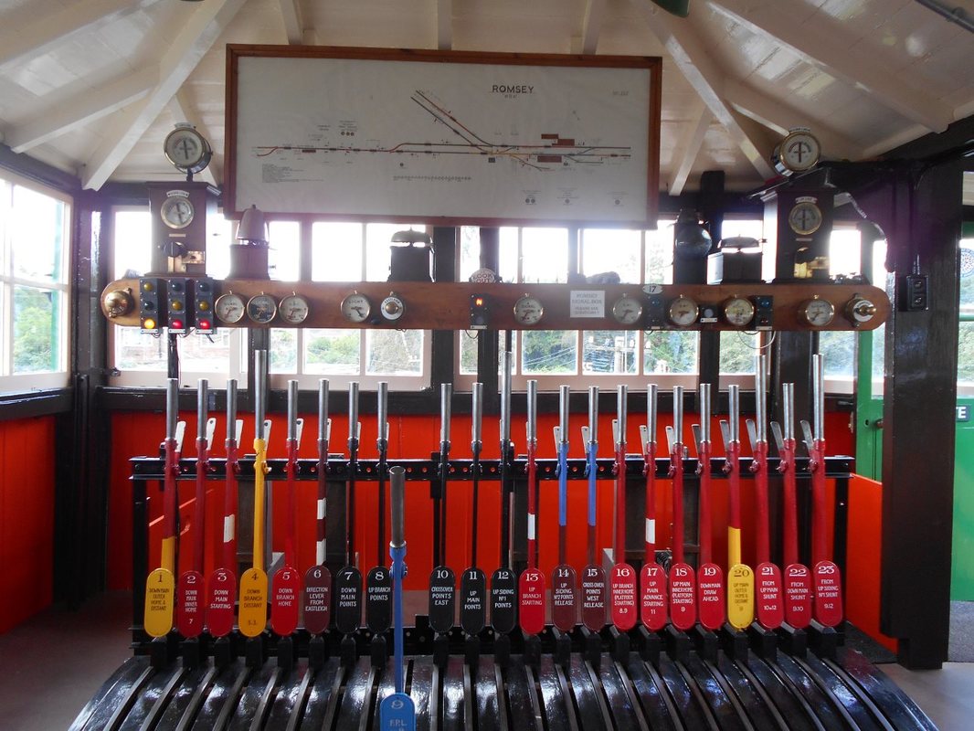
Romsey Lever Frame - taken in its 'new' location on the 12th September 2015 Copyright Chris Osment
Romsey Signal Box has been restored to full working order, with all the equipment and furniture to have been found in a traditional signal box.
Several of the levers have been connected to a point and signals outside. Visitors are invited to operate the point and signals, and to observe the actions necessary to operate the junction as it once was.
Several of the levers have been connected to a point and signals outside. Visitors are invited to operate the point and signals, and to observe the actions necessary to operate the junction as it once was.
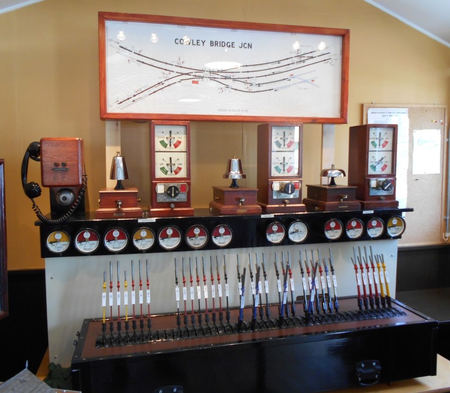
Located also in Romsey Signalbox is a simulator of Cowley Bridge Junction - Cowley bridge junction is at the divergence of the North Devon line from the GW main line about two miles east of Exeter St Davids.. 12th September 2015 Copyright Chris Osment
For more information from 'Friends of Romsey Signalbox' please click here. www.romseysignalbox.org.uk/
Here is an early view of Romsey Signalbox from a passing train soon after it was lifted from its operational position and lowered into a local school grounds. Copyright Kevin Jenkin
A view some time later, after a re-paint and track and signals had been installed. Copyright Kevin Jenkin
The direct route to Southampton via Redbridge, and Millbrook.
Just west of Nursling station site
47284 seen here at Nursling heads the diverted 1O38 1428 Exeter to Waterloo on Sunday 9th September 1990 Copyright Ron Kosys
Nursling
Nursling station closed on 16 September 1957. The station house is in use as a private residence although the platforms have been demolished.
Viewed from a nearby road bridge. 2001 Copyright Kevin Jenkin
The remains of Nursling close up. 2001 Copyright Kevin Jenkin
The roadside view of Nursling station - beware of the dog!! 2001 Copyright Kevin Jenkin
Redbridge Junction
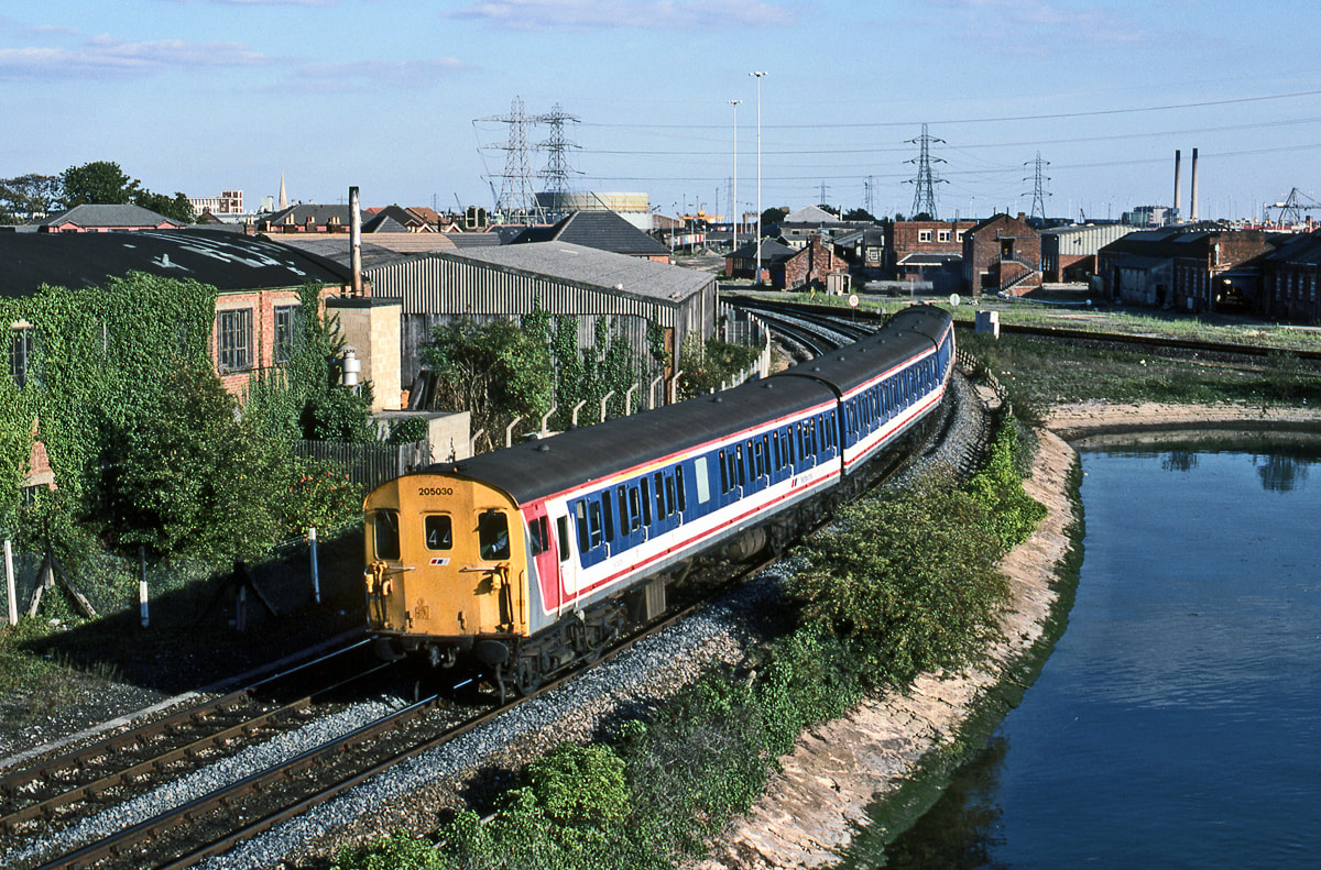
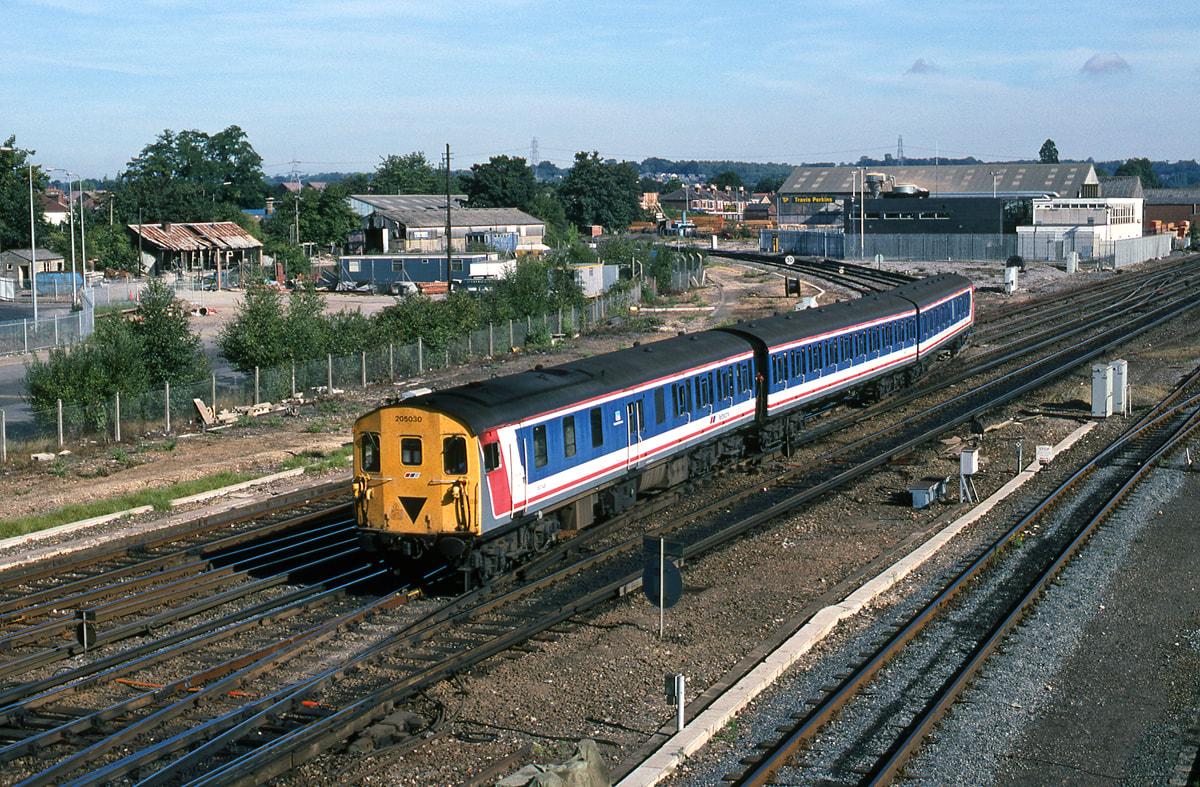
Redbridge Junction at very nearly high tide as 205030 leaves Redbridge Junction and heads for Romsey and beyond. 9th September 1990 Copyright Ron Kosys
Redbridge
47287 seen here at Redbridge on the 9th November 1992 with the Fawley-Longport. Copyright Ron Kosys
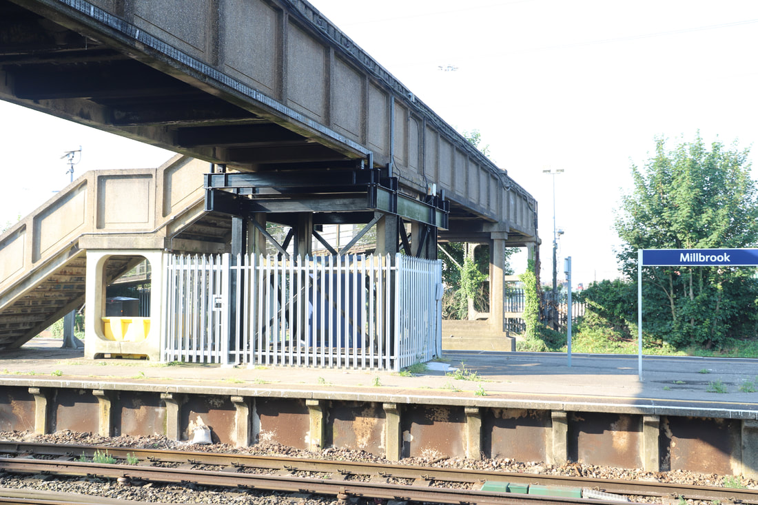
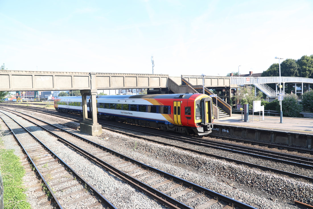
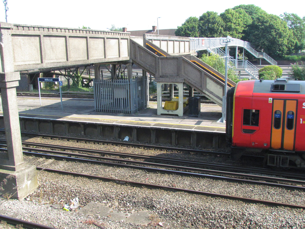
Millbrook
Approaching Millbrook Station on a service from Bristol. 7th August 1979 Copyright Roger Winnen
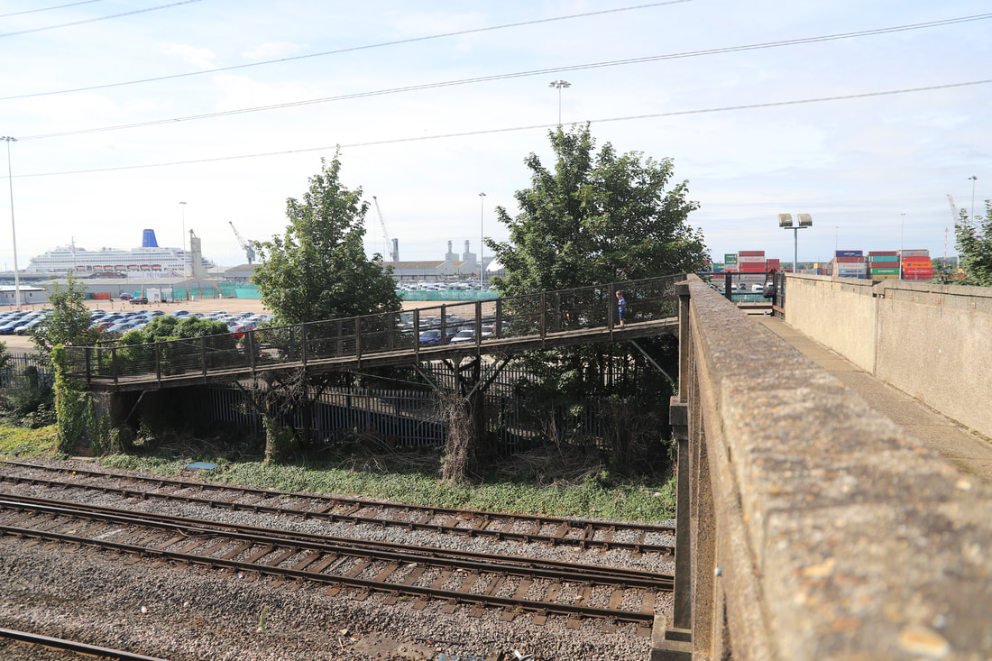
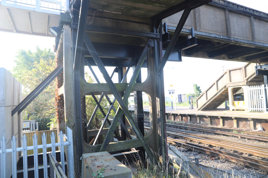
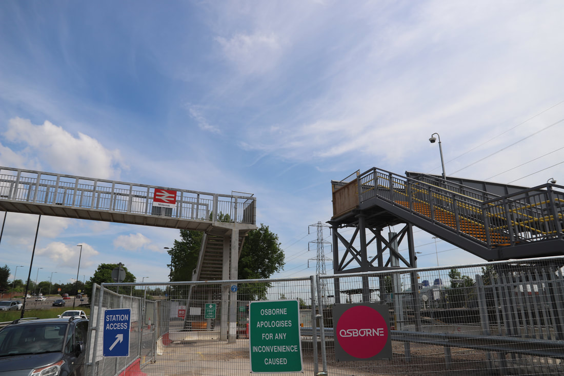
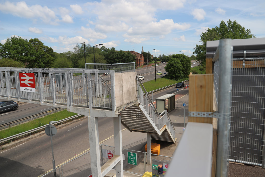
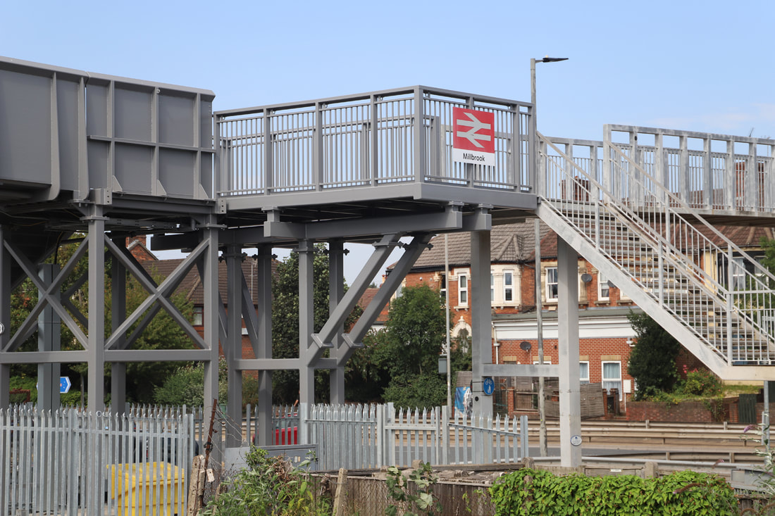
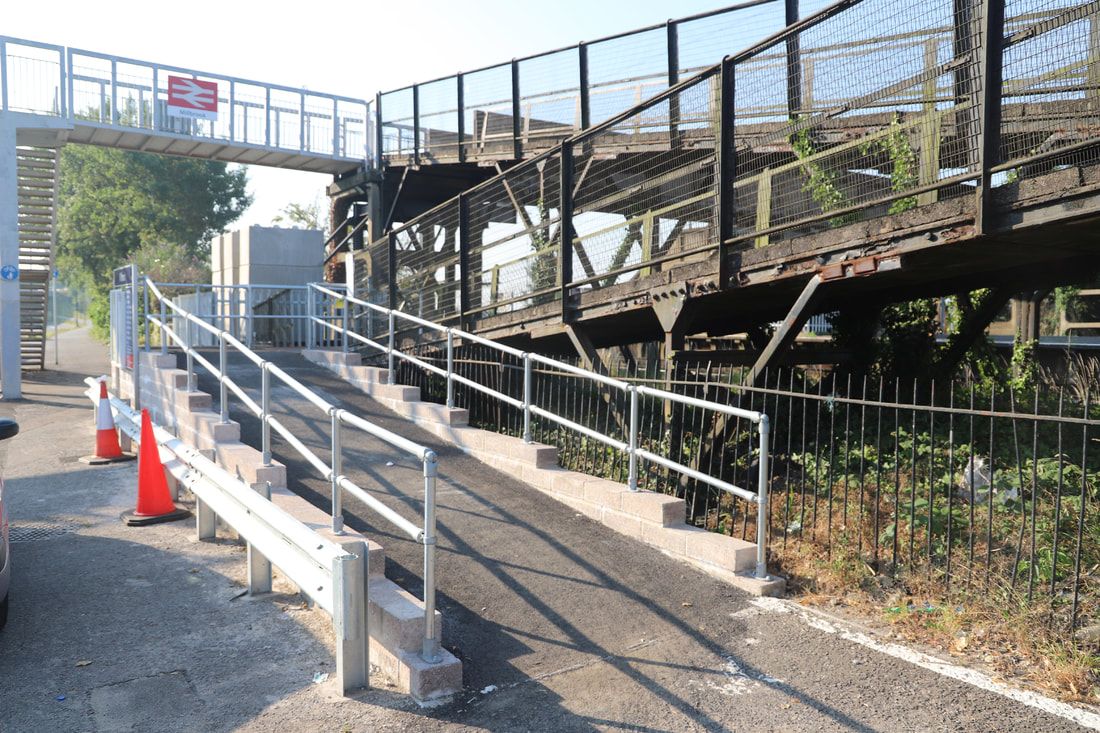
Millbrook’s Concrete Footbridge is no More - Feature by Mick House.
It is uncertain when precast concrete was introduced into the UK but early applications revolved around railway footbridges, with the Southern Railway leading the way at Oxshott, Surrey (1908) and Exeter (1923). A lot of the Southern Region prefabricated concrete footbridges have badly rusted reinforcement and have effectively rotted from the inside. Poor quality control at the manufacturing plant at Exmouth Junction allowed the inclusion of aggregate directly off the local beaches without being washed, therefore leaving the salt to do its worst.
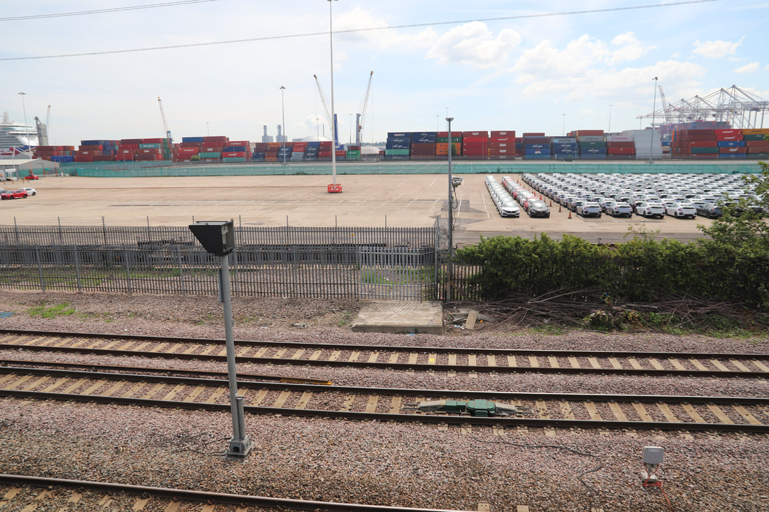
Millbrook’s iconic Southern style concrete footbridge has been completely removed (Photos 1 & 2) and only half has been replaced with a brand new steel structure that now only serves the station (Photo 3), wear as before it went over to a footpath via a zigzag ramp (photo 4), that took you into Southampton following the main line and into Southampton station car park. Now all you can see is the car storage facility and the container port (photo 5). The bridge has suffered over the years and the legs on the station platform and road side had to be reinforced with steel RSJs and Bullhead rail (Photos 6 & 7), I suspect the rest of the structure was heading the same way and it was cheaper to remove than replace, also on my many visits over the years I could see signs of alcohol and drug abuse as at the bottom of the ramp leading to the footpath, more often than not you would see evidence of empty beer cans and needles, this could have also added to the bridges demise. It is sad to see structures like this disappear, as not too many still survive, that’s progress I suppose. Also I should mention the extension that was added when the main road was improved many years ago, although this is not part of the railway it is physically attached, having said that it was cut off for a time during the demolition of the old bridge and building of the new (photos 8, 9 & 10). The zigzag ramp on the road side has also been removed and replaced with a steel staircase (photos 11 & 12). All in all the new bridge its self with staircases leading to the platform and road is an unimpressive but functional structure (photos 13 & 14). Finally a selection of photos never to be recreated (Photos 15, 16, 17, 18, 19, 20, 21, 22, 23 & 24).
It is uncertain when precast concrete was introduced into the UK but early applications revolved around railway footbridges, with the Southern Railway leading the way at Oxshott, Surrey (1908) and Exeter (1923). A lot of the Southern Region prefabricated concrete footbridges have badly rusted reinforcement and have effectively rotted from the inside. Poor quality control at the manufacturing plant at Exmouth Junction allowed the inclusion of aggregate directly off the local beaches without being washed, therefore leaving the salt to do its worst.
Millbrook’s iconic Southern style concrete footbridge has been completely removed (Photos 1 & 2) and only half has been replaced with a brand new steel structure that now only serves the station (Photo 3), wear as before it went over to a footpath via a zigzag ramp (photo 4), that took you into Southampton following the main line and into Southampton station car park. Now all you can see is the car storage facility and the container port (photo 5). The bridge has suffered over the years and the legs on the station platform and road side had to be reinforced with steel RSJs and Bullhead rail (Photos 6 & 7), I suspect the rest of the structure was heading the same way and it was cheaper to remove than replace, also on my many visits over the years I could see signs of alcohol and drug abuse as at the bottom of the ramp leading to the footpath, more often than not you would see evidence of empty beer cans and needles, this could have also added to the bridges demise. It is sad to see structures like this disappear, as not too many still survive, that’s progress I suppose. Also I should mention the extension that was added when the main road was improved many years ago, although this is not part of the railway it is physically attached, having said that it was cut off for a time during the demolition of the old bridge and building of the new (photos 8, 9 & 10). The zigzag ramp on the road side has also been removed and replaced with a steel staircase (photos 11 & 12). All in all the new bridge its self with staircases leading to the platform and road is an unimpressive but functional structure (photos 13 & 14). Finally a selection of photos never to be recreated (Photos 15, 16, 17, 18, 19, 20, 21, 22, 23 & 24).
All photographs Copyright Mick House.
Click on an image to obtain a larger version.


Southampton
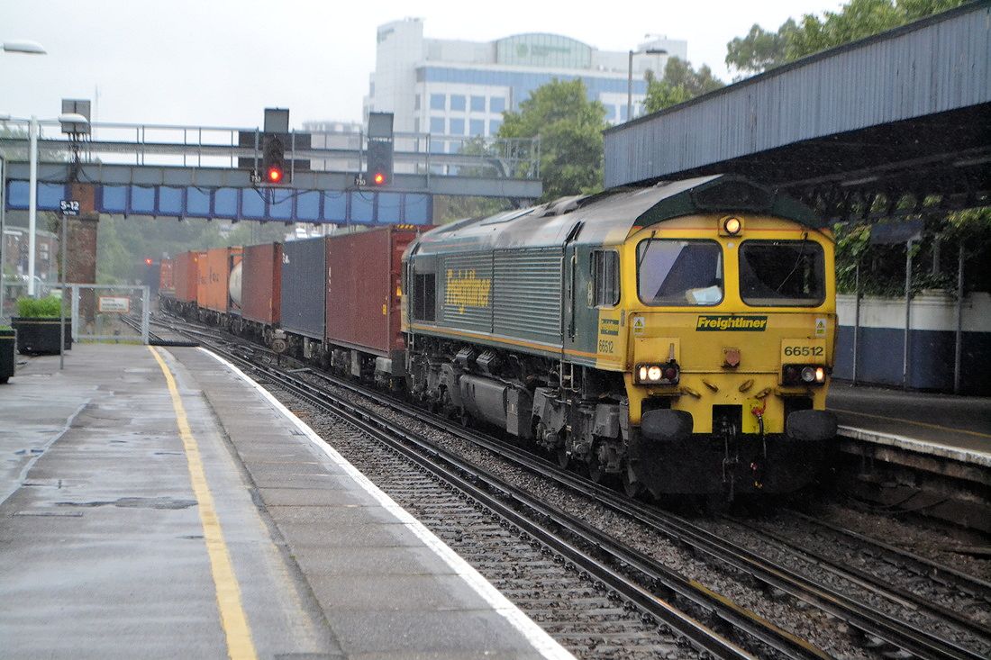
66 512 approaches Southampton Central with traffic for the docks on the 29th June 2016. Coming from the north this train is more than likely to have passed through Eastleigh and of course St Denys. Copyright Roger Winnen
And the alternative route to Southampton via Eastleigh
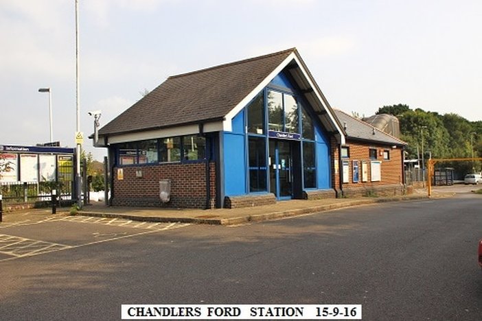
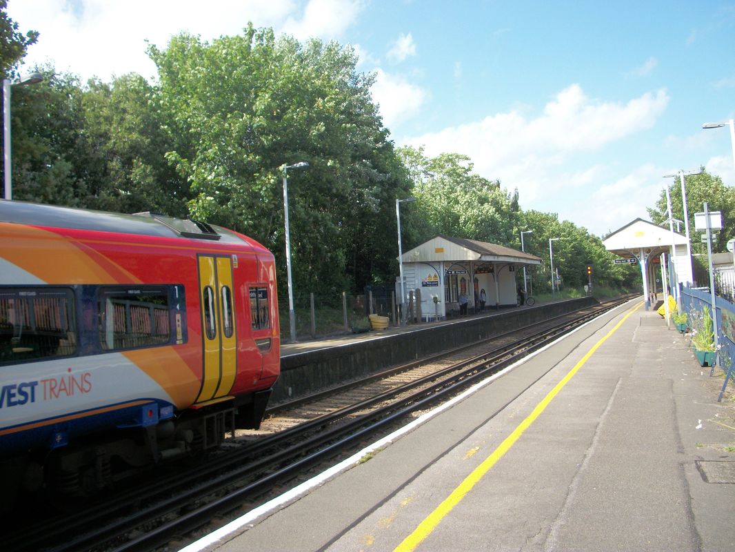
Chandlers Ford
Chandlers Ford station opened in 1847 and then closed 5th May 1969 to passengers and to goods on 4th May 1964. It reopened amid great celebration on the 13th June 2013 - 60009 Union of South Africa covered the line on a railtour to celebrate the re-opening.
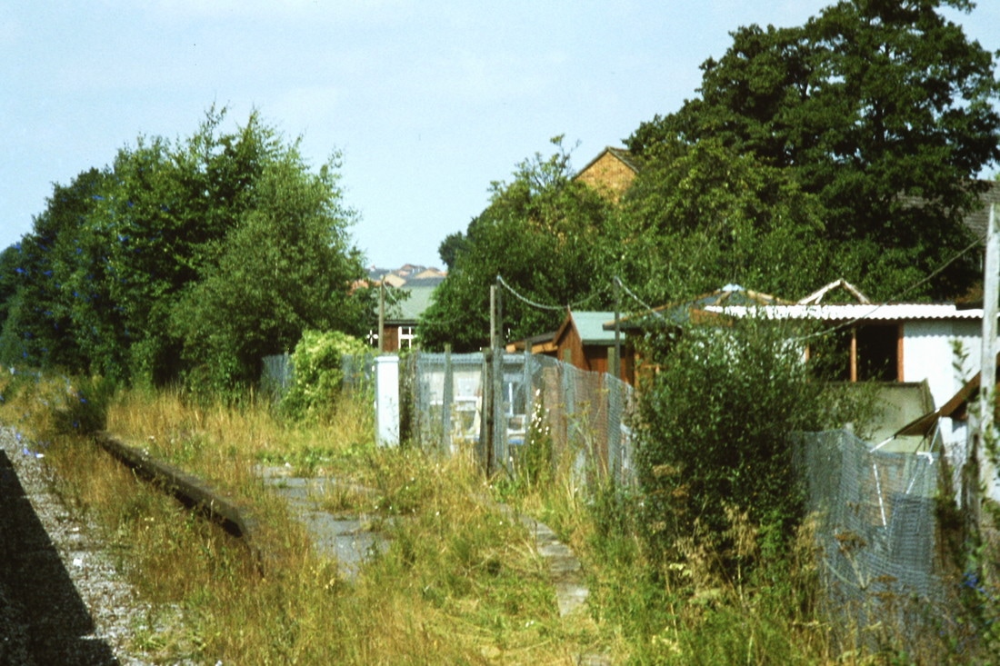
It was difficult to spot Chandlers Ford during its period of closure -
but here it is on the 23rd August 1981 Copyright Roger Winnen
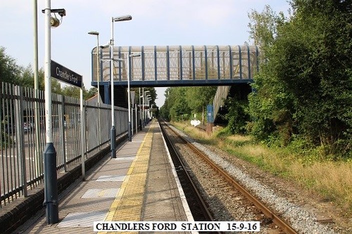
Copyright John Cornelius
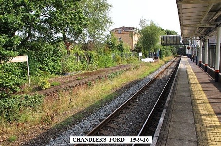
Looking towards Eastleigh. The former up platform is still in situ. Copyright John Cornelius
Looking towards Romsey. Copyright John Cornelius
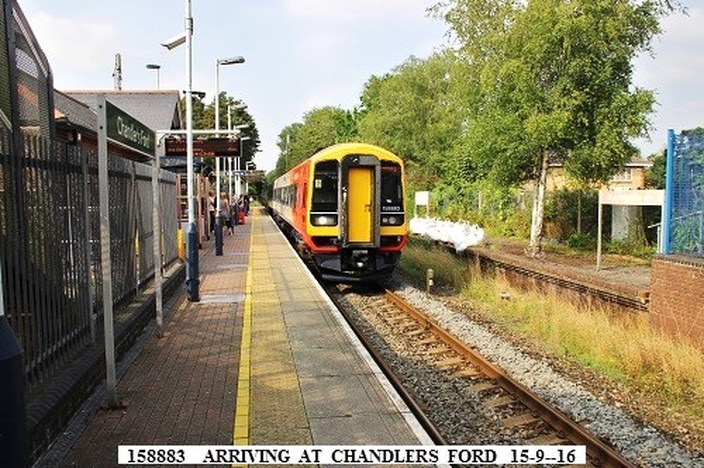
Train arriving from Romsey, about to leave for Eastleigh. It will then likely call at Eastleigh, Southampton Parkway, Swaythling, St Denys, Southampton Central, Millbrook, Redbridge, Romsey (Again), Dunbridge, Dean and terminate at Salisbury. Copyright John Cornelius
A short branch of roughly three quarters of a mile headed SSW from the Goods Yard at Chandlers Ford which lay just the Eastleigh side of Chandlers Ford station. This little branch, long gone can be seen Courtesy of the National Library of Scotland click below:- maps.nls.uk/geo/explore/#zoom=16&lat=50.9815&lon=-1.3914&layers=168&b=1 http://maps.nls.uk/geo/explore/#zoom=16&lat=50.9815&lon=-1.3914&layers=168&b=1
Note : - There was once a short branch some three quarters of a mile long heading roughly SSW from the goods yard at Chandlers Ford which lay just the Eastleigh side of the station. This branch served clay pits and brick works all of which have been long gone. The layout of this short branch can be seen if you click here.
Eastleigh
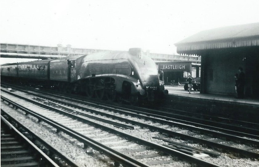
Eastleigh Sir Nigel Gresley 4th June 1967 Copyright Martin Scane
Taken on a visit to Eastleigh Works in 1979 by Paul Barlow
74005 and 74003 at Eastleigh works 16th August 1979. Copyright Paul Barlow
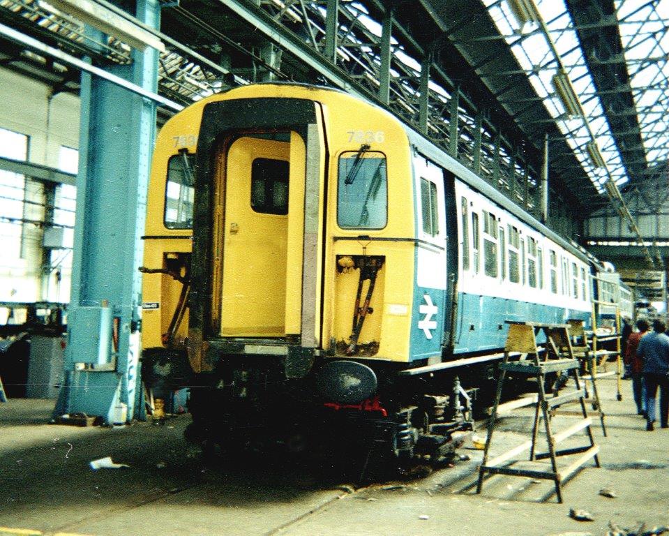
4-VEP 7836 under inspection at Eastleigh works 16th August 1979. Copyright Paul Barlow
33002 and 33013 receive attention at Eastleigh works 16th August 1979. Copyright Paul Barlow
---------------------------------------------------------------------------------------------
A Class 47 heads through Eastleigh towards Southampton. 3rd August 1978 Copyright Roger Winnen
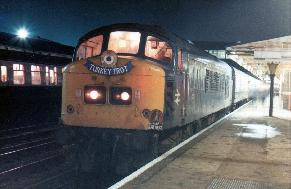
Eastleigh around 17.30 at Eastleigh and 45128 is back on the front of the tour.Turkey Trot Railtour 8th January 1983 Copyright Clive Smith
33119 at Eastleigh on the 31st August 1988 with the Hamworthy to Eastleigh. Copyright Ron Kosys.
Eastleigh 205030 comes off the Chandlers Ford ECS Salisbury to Eastleigh depots. 2nd September 1990 Copyright Ron Kosys
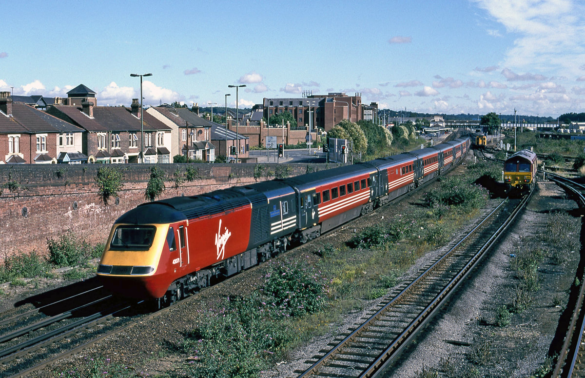
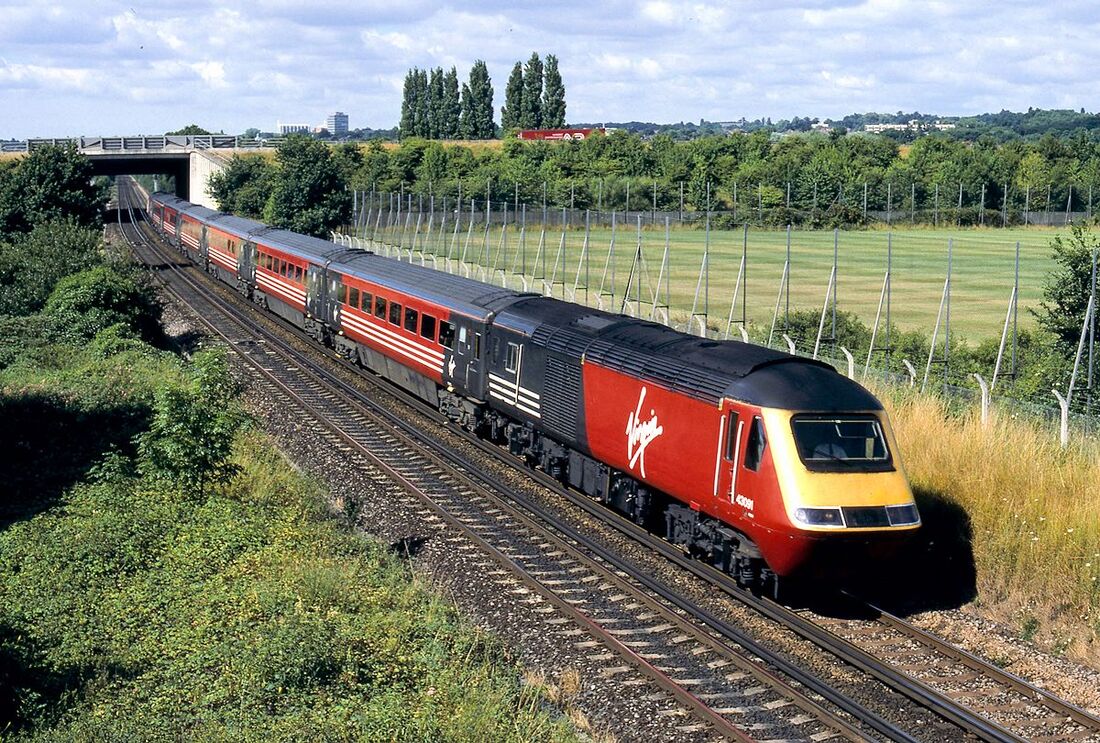
Virgin HST with 43071 leading at Eastleigh heading for Southampton and Bournemouth. 21st August 2000 Copyright Ron Kosys
Eastleigh - a station study 2001. Copyright Kevin Jenkin
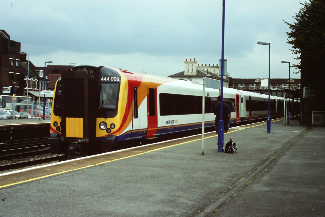
444002 at Eastleigh 13th July 2006 Copyright Roger Winnen
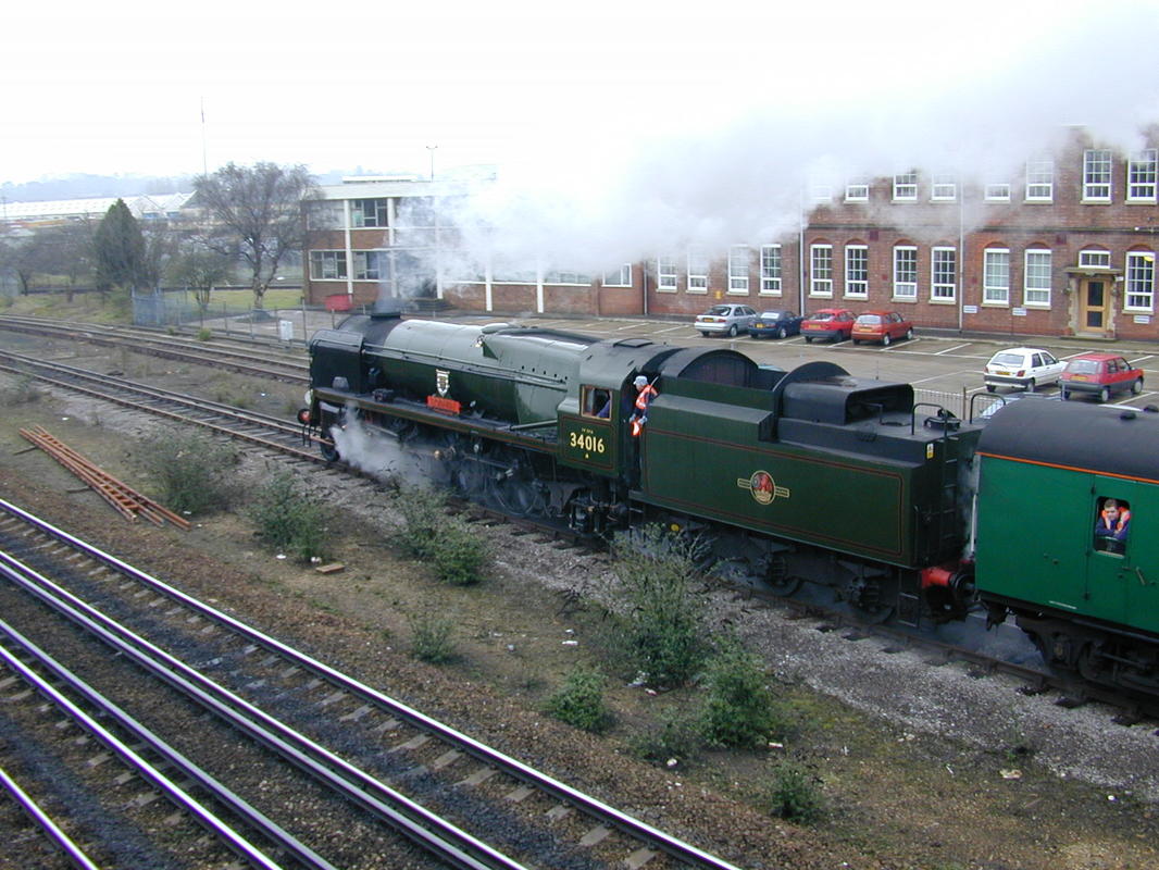
34016 Bodmin leaving the sidings and heading north towards the station.
Copyright Kevin Jenkin
Class 66 heads a load new cars waiting to proceed N from Eastleigh. The metals diverging off to the left beyond the bridge are of the route to Romsey 29th June 2016 Copyright Roger Winnen
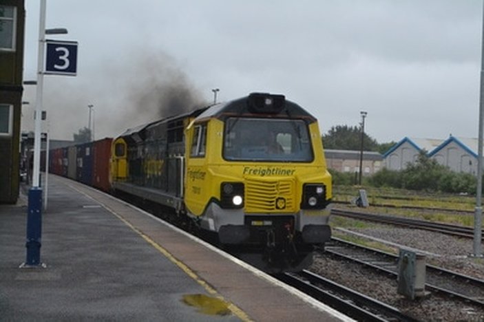
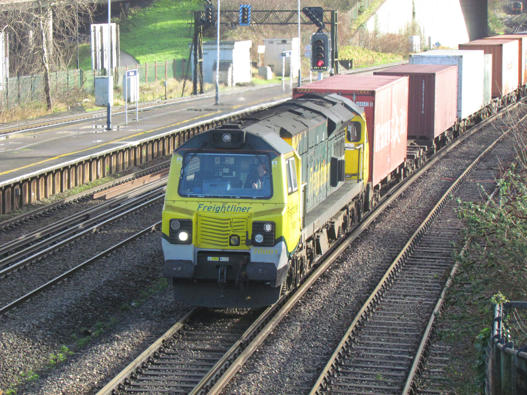
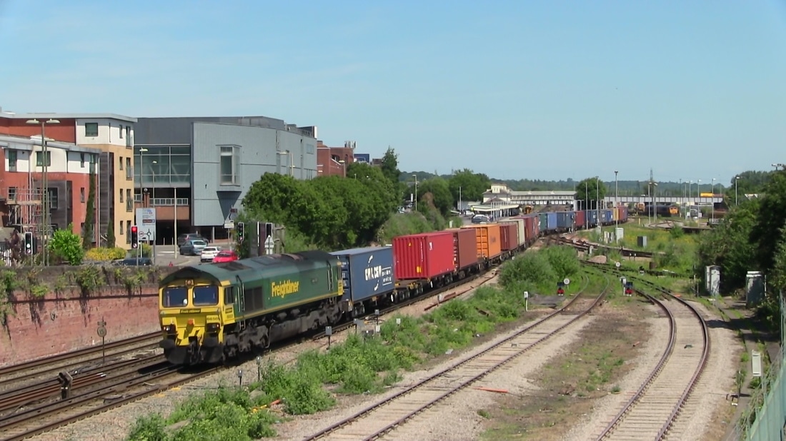
A class 70 opens up hauling a freighliner bound for Southampton Docks 29th June 2016 Copyright Roger Winnen
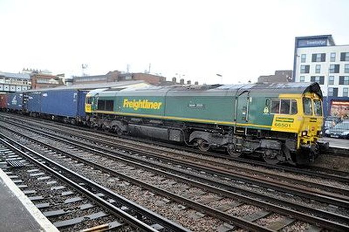
66501 Japan 2001 heads a freightliner north through Eastleigh on the 29th June 2016 Copyright Roger Winnen
In addition to the interest of the flow of considerable rail traffic one can also spot a variety of aircraft on the approach to Southampton Airport 29th June 2016 Copyright Roger Winnen
A familiar view from Campbell Road Bridge Eastleigh of 47714 with the 1O04 0755 Sundays Ealing Broadway-Weymouth 4th August 1991 Copyright Ron Kosys.
A grey '47' heads south through Eastleigh making for the Docks - good to see heavily laden Freightliners. Copyright Kevin Jenkin
A Virgin HST heads for Southampton. A view from Eastleigh Campbell Road Bridge 16th August 2000 Copyright Kevin Jenkin
A view from Eastleigh Campbell Road Bridge on the 9th November 2000 Copyright Kevin Jenkin
Eastleigh from the south with 66501 'Japan 2001 ' with the 07.33 Lawley Street to Southampton MCT 17th June 2017 Copyright David Tozer
450003 leaves Eastleigh with the 11.29 Basingstoke to Poole 17th June 2017 Copyright David Tozer
A copy of the 1902 map courtesy of the National Library of Scotland of Eastleigh station can be seen by clicking below :- N.B. This before the days of Eastleigh works as we know it.
http://maps.nls.uk/geo/explore/#zoom=15&lat=50.9682&lon=-1.3551&layers=168&b=1
http://maps.nls.uk/geo/explore/#zoom=15&lat=50.9682&lon=-1.3551&layers=168&b=1
Brand new Class 707's 707004 and 707006 stop at Eastleigh on the 26th August 2017 with the 1050 Brockenhurst - Wimbledon. Life expectancy only two years with the new South Western Railway franchise. Meanwhile I guess we will still have the Class 143's. Copyright and comment David Tozer
47709 lays a trail of exhaust as it leaves Eastleigh and heads under Campbell Road Bridge with the 1V09 0840 Waterloo - Exeter on Sunday 18th August 1991 Copyright Ron Kosys
47715 approaches Eastleigh on Saturday 18th August 1991 with the diverted 1O39 1548 Exeter to Waterloo Copyright Ron Kosys
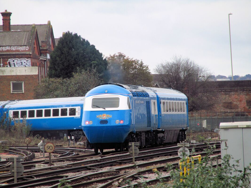
HST Pullman at Eastleigh Copyright Kevin Jenkin
A case of right place right time with this picture. There were photographers on the bridge which crosses Eastleigh station, so I loitered for a few minutes and was rewarded with a sighting of the Midlands Pullman HST heading into the works from the Winchester direction. I know it was repainted and left ESL heading North about a week ago (after dark) so presumably there's some more work to be done. Is this just within your area? I thought this could add a bit of colour to the CRS website - some bright blue rather than the more normal dull green! Kevin Jenkin
Eastleigh Works
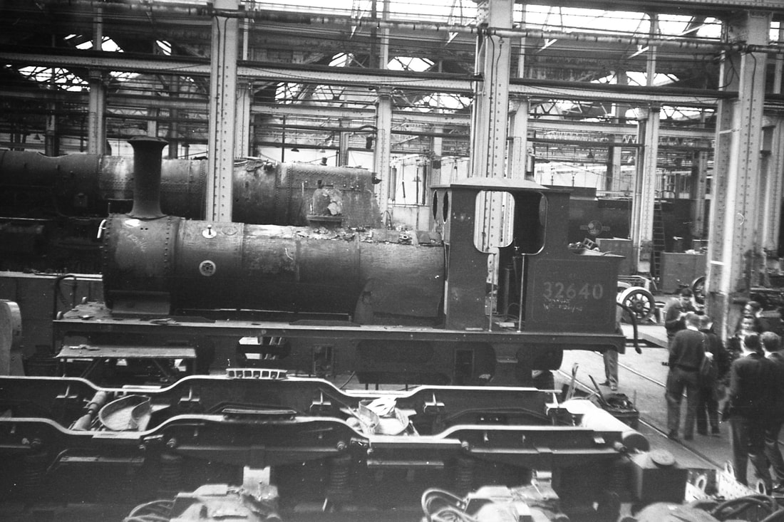
L.B & S.C.R Terrier 32640 inside Eastleigh Works being done up before going to Butlins at Pwllheli.9th May 1966 Copyright Geoff Matthews
Southampton Airport Parkway
Courtesy Wikipedia :- A station opened on the site as the Atlantic Park Hostel Halt in 1929 by the Southern Railway, though later closed. In 1966, the station was built by British Rail as Southampton Airport before changing to Southampton Parkway (in 1986), with another name change in the 1990s to Southampton Airport Parkway.
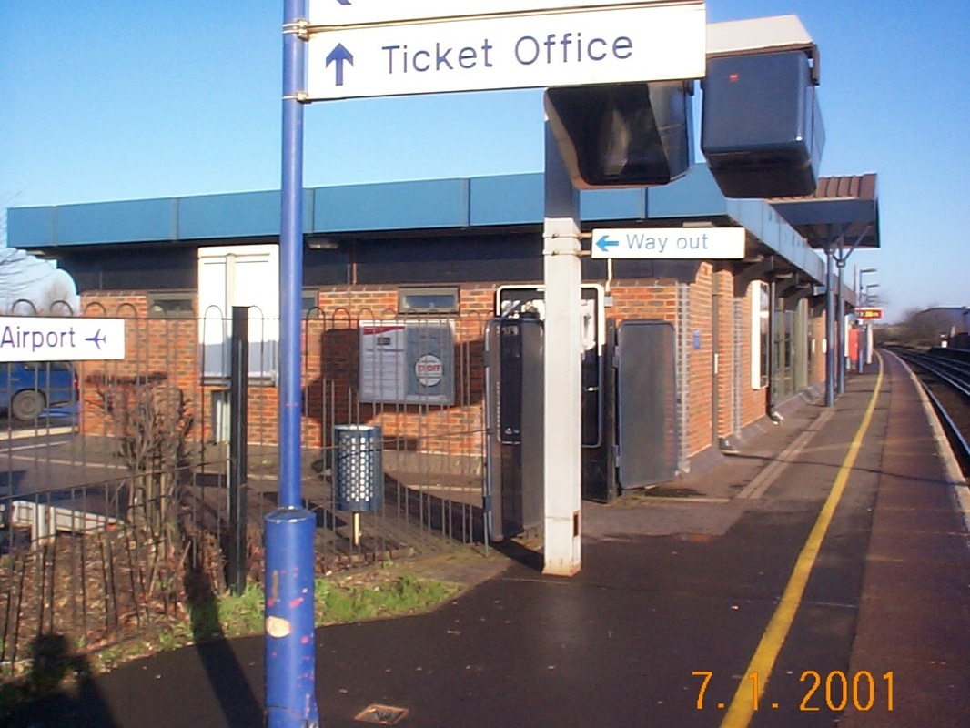
Southampton Airport Parkway station building in 2001. Copyright Kevin Jenkin
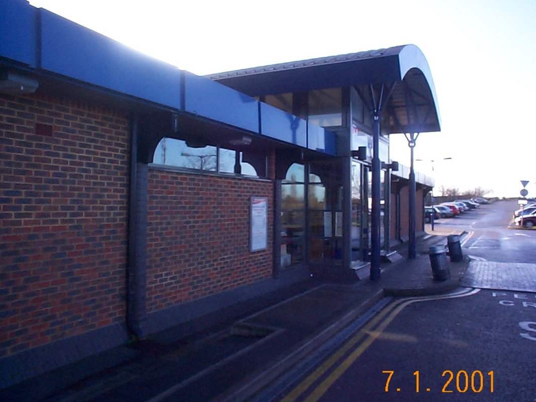
The station entrance in - 2001. Copyright Kevin Jenkin
The station in 2001. Copyright Kevin Jenkin
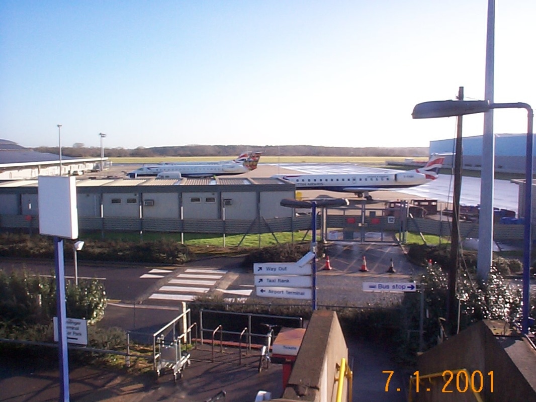
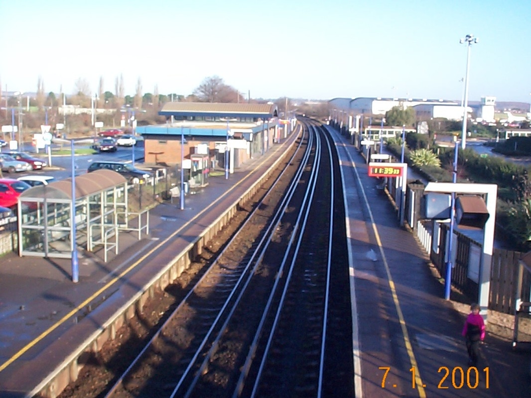
The station is very convenient for the airport as this view from the footbridge shows. Frequent buses on the UC1 service provide transport to the university and the city centre.
Copyright John Cornelius
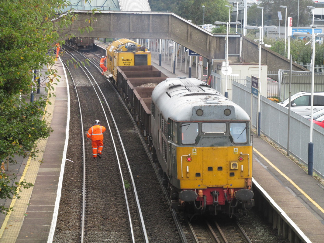
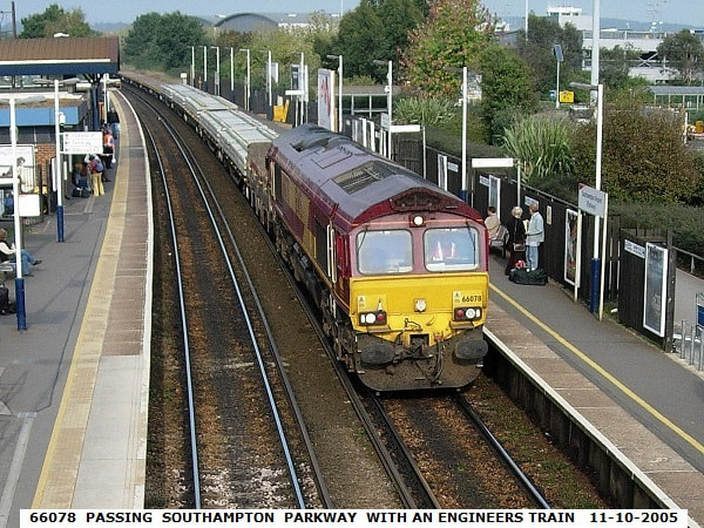
An engineering train pauses at Southampton Parkway. Copyright Kevin Jenkin
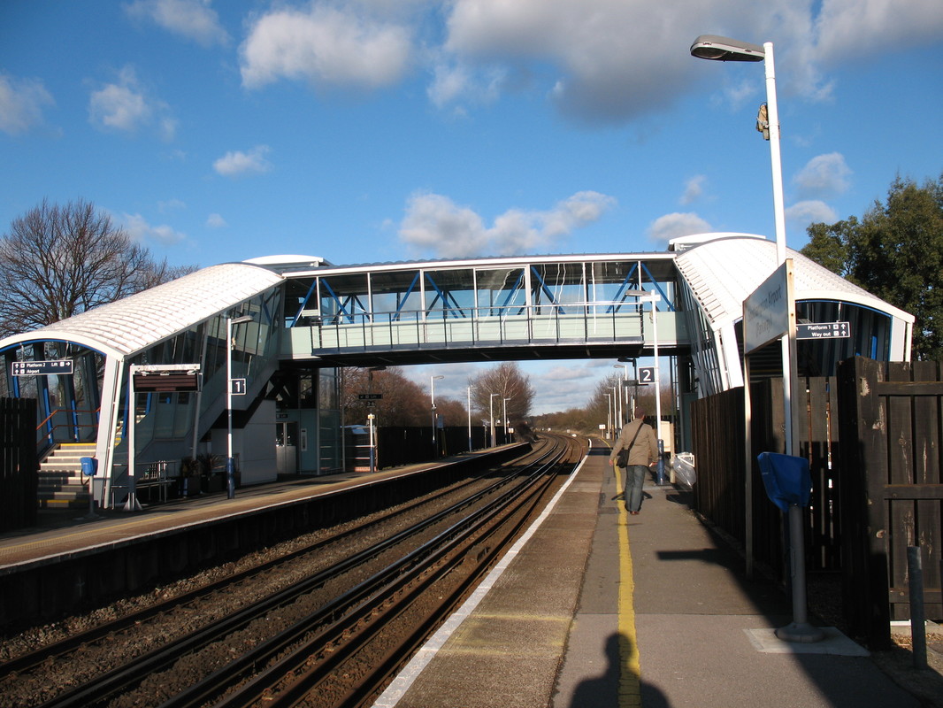
The narrow footbridge seen in the previous photograph on which it is difficult for two people to pass has now been supplemented by the much wider bridge and lifts. Copyright Kevin Jenkin

as another 442 heads away in the distance towards Southampton and Bournemouth. Copyright Ron Kosys
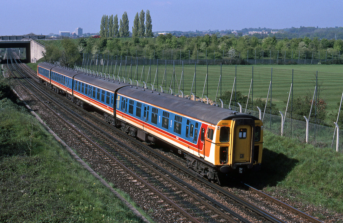
1880 near Southampton Parkway with a semi fast to Waterloo 1st May 2000 Copyright Ron Kosys
43091 slows for Southampton Airport Parkway on the 20th July 2001 Copyright Ron Kosys
Swaythling
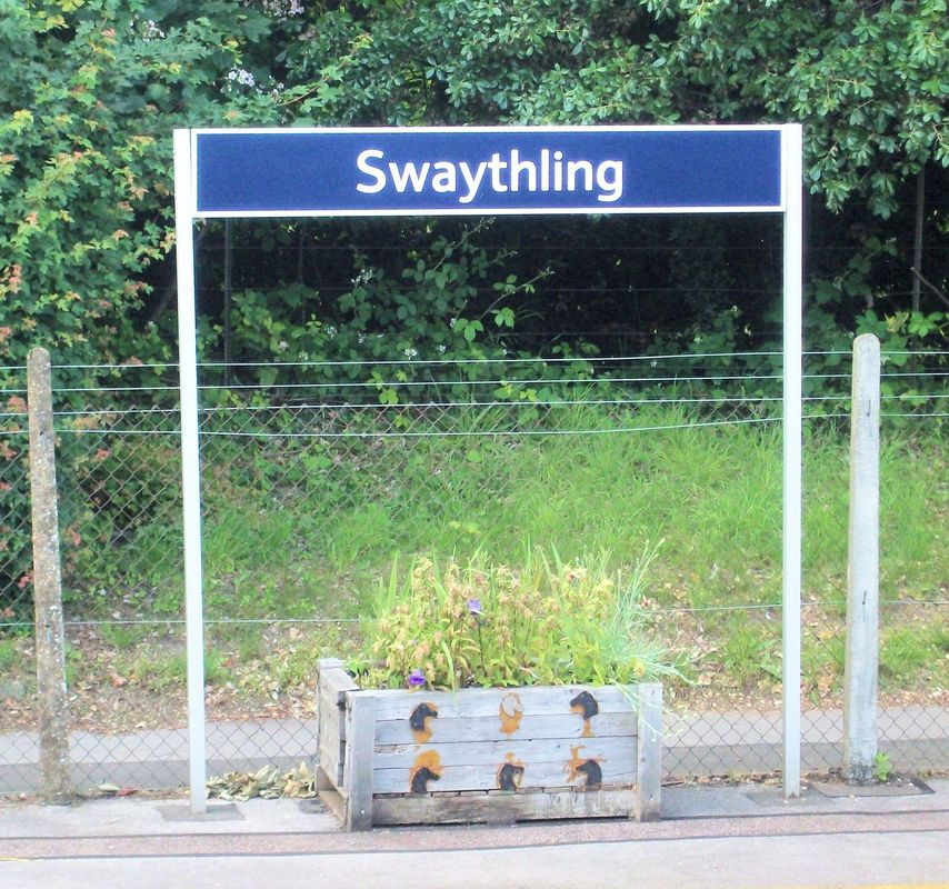
The down platform nameboard at Swaythling station. Note the horses heads depicted on the flower tub. 11th June 2017 Copyright Keith Jenkin
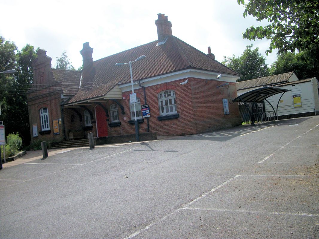
Swaythling station building is to the east of the main line. During WW2 the station had a direct by a bomb which fortunately didn't go off. It did however kill the porters dog which was sleeping in an office cupboard.
11th June 2017. Copyright Keith Jenkin
The goods yard was situated on the east side of the station - an area now occupied by housing.
To see a map showing the station and yard click below :-
http://maps.nls.uk/geo/explore/#zoom=17&lat=50.9407&lon=-1.3762&layers=168&b=1
To see a map showing the station and yard click below :-
http://maps.nls.uk/geo/explore/#zoom=17&lat=50.9407&lon=-1.3762&layers=168&b=1
33113 passes Swaythling station with the 3B01 the 15.59 Waterloo-Bournemouth. 25th June 1989. Copyright Ron Kosys
Swaythling station, looking north, as the 16.01 service to Romsey runs in on the 11th June 2017 . The goods yard lay off to the right beyond the end of the down platform from which this photograph was taken. . Copyright Keith Jenkin
Swaything the 16.07 for Salisbury via Southampton calls on the 11th June 2017 KJ
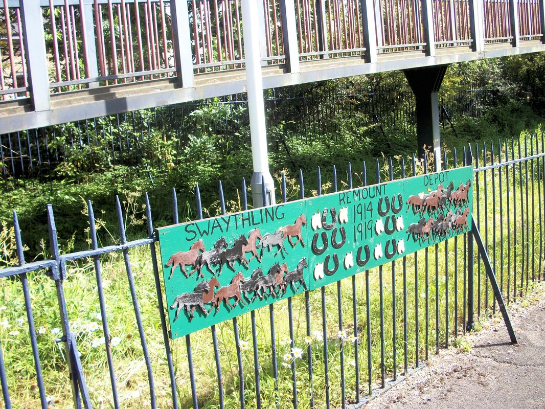
The outbreak of the 1st World War in August 1914, saw the construction of the Swaythling Remount Depot begin at nearby North Stoneham. This supplied 40,0000 horses & mules for the War Effort. A one way journey. The depot closed 1920. This plaque remembers the loss of our dumb friends. 11th June 2017.
St Denys
Class 47 with ballast at St Deny's, Southampton. The train is coming from Southampton Central direction and going on towards Eastleigh. The metals going off left on this picture are of the 'Netley Road' this serves Netley, Fareham, Cosham, and Portsmouth / Brighton.
Behind the signals Crescent bridge crosses the lines. Also note that the 'Netley Road' doesn't have 3rd rail electrification yet. 7th August 1979 Copyright Roger Winnen
A view of St Denys taken in 2001. The bright sky in otherwise low light serving to illuminate the complexities of a 'third rail electrified track' junction. Graffitti on the railway equipment in this case adds a little colour but emphasises the risks these vandals take particularly in area such as this. Copyright Kevin Jenkin
33208 passes St Denys 15th May 1988 with the Brighton to Cardiff. Copyright Ron Kosys
The span of the awning on the centre is clearly illustrated in this view. The centre complex contains a peak hours booking office and waiting room. 2001. The platform on the left is for services from Portsmouth, this centre platform serves, on the left trains to Portsmouth and on the right trains from Winchester and Waterloo. The platform on the far right is for services to London Waterloo. Copyright Kevin Jenkin.
Adelaide Road level crossing and signalbox at St Deny's (on the route to Fareham and Portsmouth ) 7th August 1979 Copyright Roger Winnen
The view above with colour light signals and electrified track. In more recent years a foreign univeristy student decided to take a short cut to his 'digs' along these third rail lines and lost his life. Copyright Kevin Jenkin.
Decorative tile work on the station building. 2001 . Copyright Kevin Jenkin
Waiting for a service to Fareham and Portsmouth. 2001 Copyright Kevin Jenkin
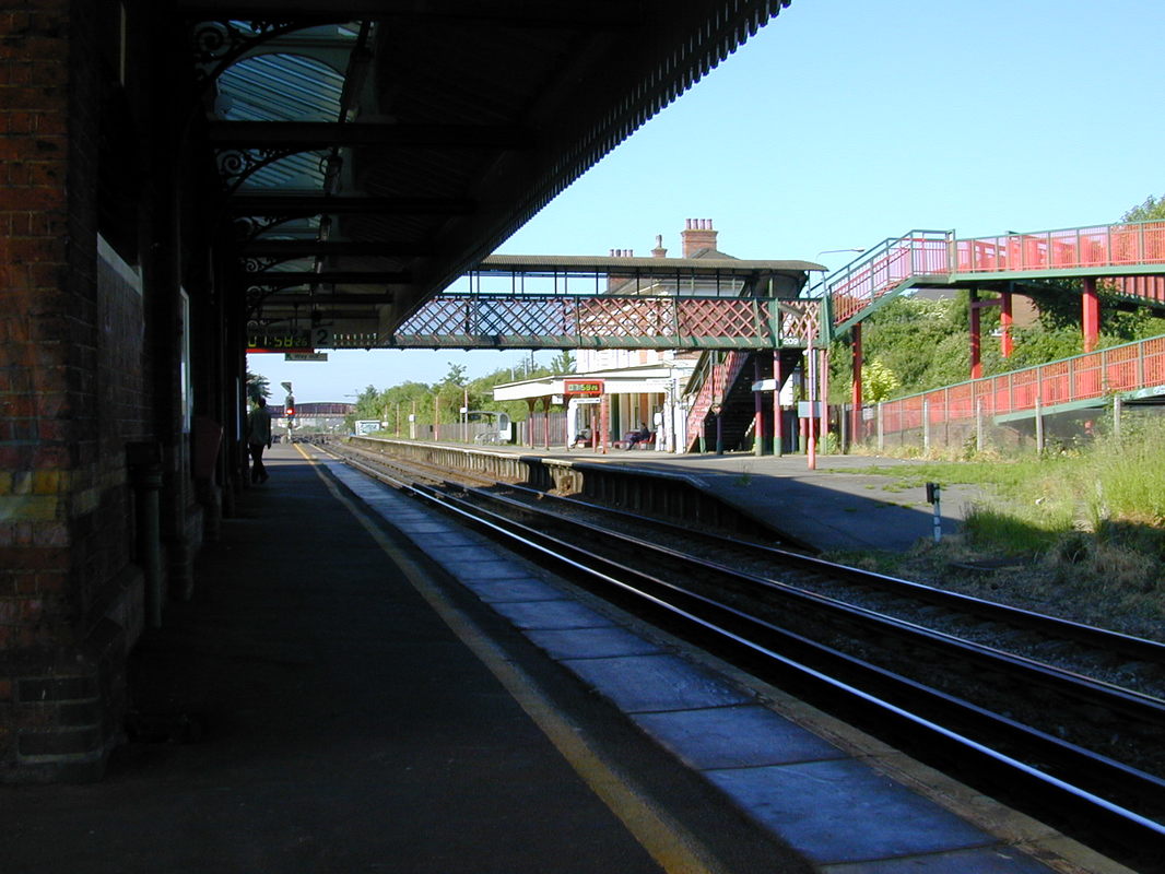
A general view towards Southampton the railway footbridge provides access to a much more modern footbridge crossing Thomas Lewis Way. 2001. Copyright Kevin Jenkin The substantial up platform buildings can be seen beyond the foot bridge. 2001 Copyright Kevin Jenkin
St Denys Station buildings 13th July 2006 Copyright Roger Winnen
Class 47 with containers pulls out of Bevis Yard at St Deny's, Southampton. 7th August 1979 Copyright Roger Winnen
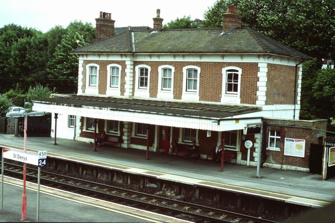
St Deny's Station 31st July 1973 . Copyright Roger Winnen
A historical scene not only in the rolling stock but in the bridges. The footbridge which spans the tracks was probably installed on the construction of the line to continue a 'right of way' along Priory Road, taking pedestrisns onto a continuation of Priory Road. The relatively recent construction of Thomas Lewis Way cut through Priory Road again and the footbridge gave little advantage to pedestrians who would now cross the line using Crescent Bridge in the behind. The footbridge was lifted out sometime around 2004. Copyright Kevin Jenkin
St Denys 47349 works the 4O18 0517 Lawley St-Soton on the 28th June 2000 Copyright Ron Kosys N.B. Alas the footbridge was removed several years ago.
St Deny's Station. 23rd August 1981 Copyright Roger Winnen
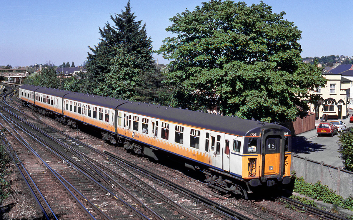
VEP 1705 in Connex livery passes St Denys 12th May 2001 working a Portsmouth to Southampton service. Copyright Ron Kosys (Taken from a footbridge which no longer exists)
A Virgin train takes to the Netley - Fareham route via platform 3. St Denys 7th April 2002 Copyright Kevin Jenkin
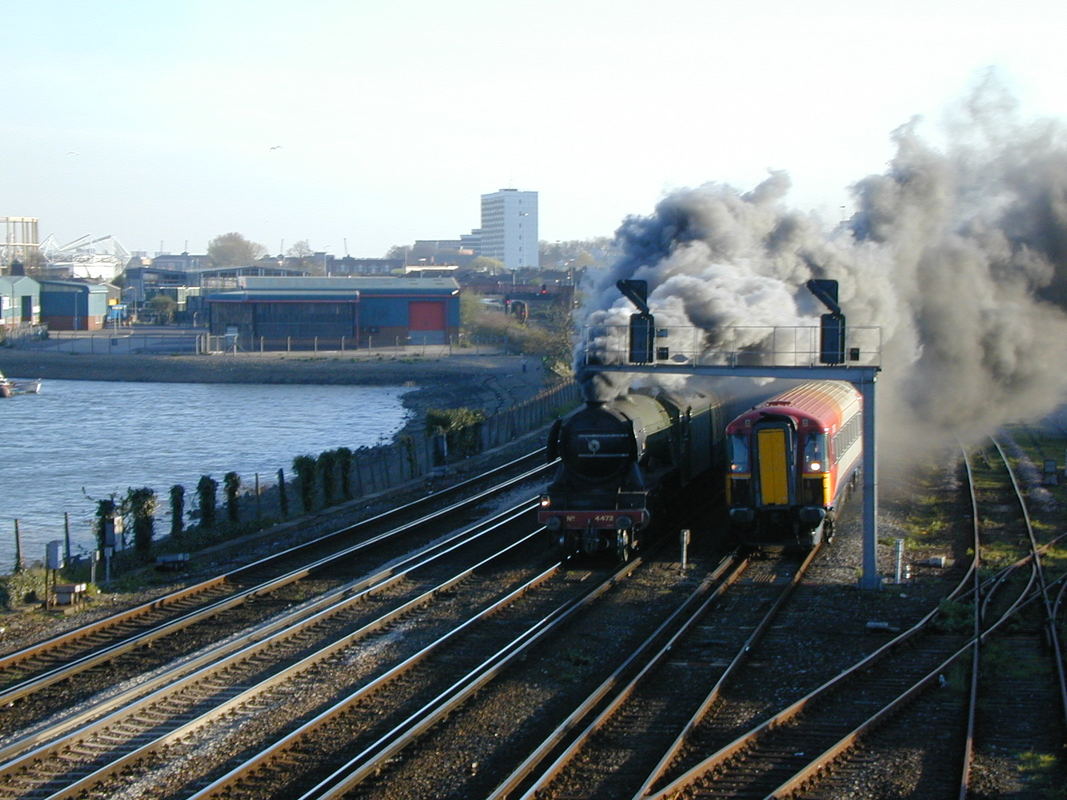
4472 Flying Scotsman overhauls a Class 442 just to the South of St Denys. 7th April 2002 Copyright Kevin Jenkin
33106 passes through St Denys on the 2nd July 1989 with the 3B01 15.59 Sundays Waterloo to Bournemouth. Copyright Ron Kosys.
Ron Kosys writes :- Over the years I have spent quite some time in the Southampton area for one reason or another.
In the early 1980’s, it was a fantastic area for freight traffic, which was very varied in the extreme, as was the motive power. At the same time, the Bristol/Cardiff to Portsmouth/Brighton services were loco and stock, before Sprinterisation took away the interest later in the decade.
On a number of Sundays each year, the diversion of the Waterloo-Exeter and vv services via Southampton enticed me down again.
Then back in the early 2000’s, the taking up of employment with a Channel Islands airline for some three and a half years, flying from and to Southampton Airport, got me back again. Sessions photting trains before and/or after the flights became the norm. Unfortunately the days of ‘real’ interest had passed, but there was still more than enough to keep that deep-down interest alive.
The two easily accessible locations close to Bevois yard were particular favourites.
Immediately to the north of Bevois yard – and to the south of St Denys station – was a road bridge with superb two way views.
Immediately to the south of Bevois yard is the magical Mount Pleasant footbridge – also with superb two way views.
This section of railway can only be described as incredibly busy!! Then – and even more so now. The reduction overall in freight traffic (other than Freightliners) has been made up by the increased frequency of passenger services.
33211 approaching in St Denys station passing Bevois yard with a train for Portsmouth 15th May 1988. Copyright Ron Kosys.
I was in the Southampton area yesterday (14th April 2022) and took these two pictures at St Denys. 33012 hauled 50026 from Eastleigh Arlington to Swanage. I believe that 50026 is going to the Swanage Railway to get some running time before it’s main line test. It looked very tidy in the Network South East livery. 33012 looked in excellent condition too, Regards, Dennis Clarke.
33012 and 50 026 Indomitable St Denys. 14th April 2022 Copyright Dennis Carke
St Denys 50 026 Indomitable being towed by 33012 en route to Swanage. 14th April 2022. Copyright Dennis Clarke.
205033 passes Bevois yard with a Portsmouth to Romsey local service. Note the 33 awaiting a path towards Eastleigh on the left. 31st August 1988. Copyright Ron Kosys
47381 passes with 6V62, the Fawley to Tavistock Junction tanks on 9th September 1988.
This train took a circuitous route dropping off tanks as it made its way west, the loco returning the following day collecting whatever empties were available. Copyright Ron Kosys
St Denys looking south 47358 passes Bevois yard with 6Y50, the 0950 Totton to Holybourne tanks 9th September 1988 Copyright Ron Kosys
47707 Bevois Yard Sunday 4th August 1991 47707 passes with the 1V17 16.40 Sundays Waterloo to Exeter diverted via Soton Copyright Ron Kosys
47803 passes Bevois Yard on the 9th September 1990 with the 1M99 08.20 Sundays Poole to Birmingham New Street. Copyright Ron Kosys
St Denys Bevois Yard 47312 heads the 7Z16 ballast empties - the 10.00 Laverstock-Eastleigh on the 4th August 1991 Copyright Ron Kosys
33116 passing Mount Pleasant level crossing with a train of rails from the now closed Redbridge depot on the evening of 7th September 1988. Copyright Ron Kosys.
St Denys looking north Fraggonset 47701 passes thro St Denys sta with 1O38, the 0910 Edinburgh to Bournemouth 12th May 2001 1038 Copyright Ron Kosys
33103 passes through St Denys on the 9th May 2003 with the StrawberryHill to Bournemouth Train Care Depot. Copyright Ron Kosys (N.B. The footbridge was removed sometime ago,)
Just north of St Denys
Relatively low voltage third rail systems need frequent sub stations and here is one at St Denys viewed from the platform. 2001. Copyright Kevin Jenkin
And finally a maunually operated crossover complete with lever frame - seen in 2001. Whether this is still in existence is not known. Copyright Kevin Jenkin
Class 31's in the St Denys area. Ron Kosys
Mention has been previously made of the Class 31’s that were hired by Wessex Trains in 2003 to operate a round trip from Cardiff to Brighton and back on Fridays only.
The trains involved were the
1O98 1200 Fridays only Cardiff to Brighton
1V96 1700 Fridays only Brighton to Cardiff
And the locos were any two from four
31452 31454 31468 31601
These were owned by Fragonset Railways, a company that provided spot hires to the rail industry.
If I returned home from work in the Channel Islands to Southampton Airport on a Friday and if the weather allowed, I’d take a look at this working.
Unfortunately time restrictions meant that photographic locations would be somewhat limited meaning I had little variation in the photographs I obtained. (All were taken either from the road bridge just south of St Denys station or from the footbridge spanning the four tracks at Mount Pleasant Level Crossing).
The shots clearly illustrate the much clearer skies that were regularly seen over Southampton Water to those seen inland.
Many thanks Ron - glad you paused on your way home from work.
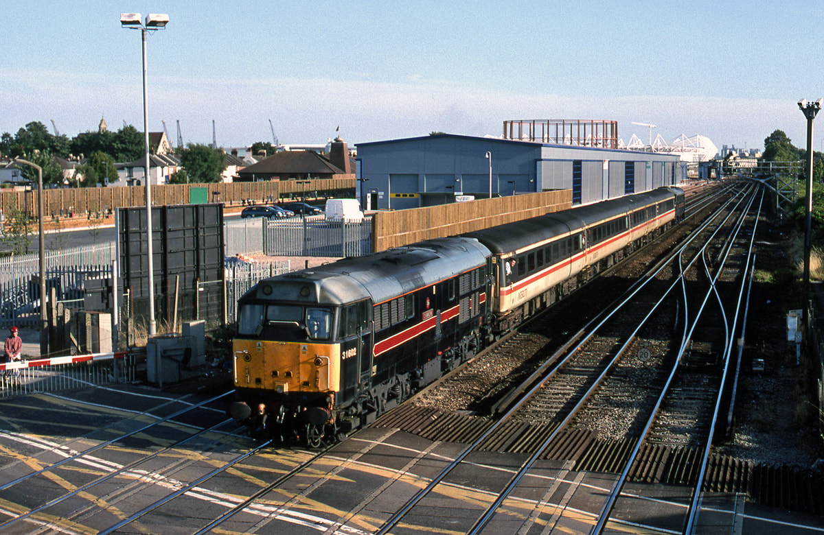
31602 St Denys 1V96 1700 FO Brighton-Cardiff11th April 2003 Copyright Ron Kosys
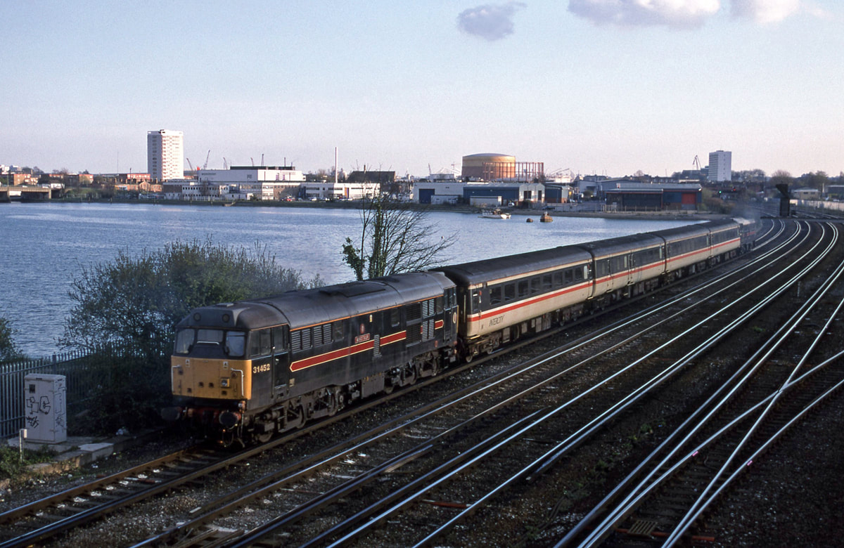
31452 St Denys 1V96 1700 FO Brighton-Cardiff 11th April 2003 Copyright Ron Kosys
31468 Bevois 1V96 1700 FO Brighton-CWL 18th July 2003 Copyright Ron Kosys
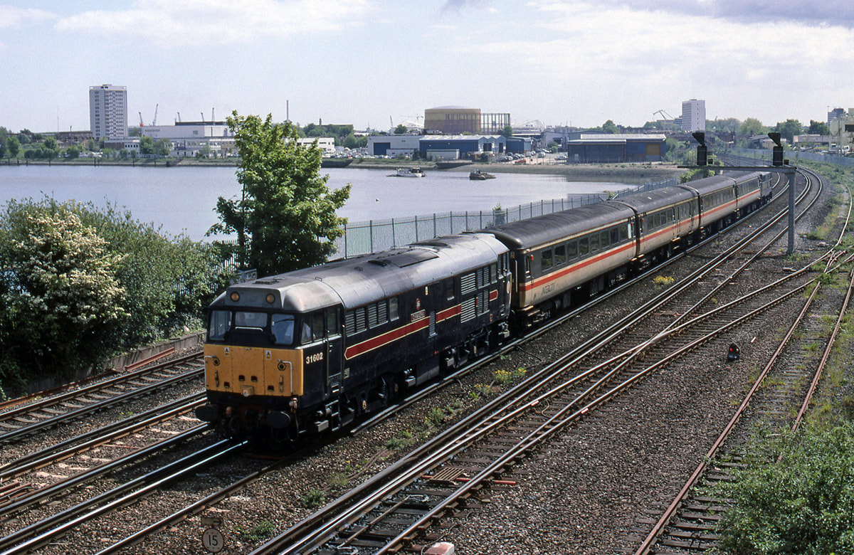
31602 Bevois 1V96 1700 FO Brighton-Cardiff 18th July 2003 Copyright Ron Kosys
31602 St Denys 1Oxx Cardiff-Brighton 9th May 2003 Copyright Ron Kosys
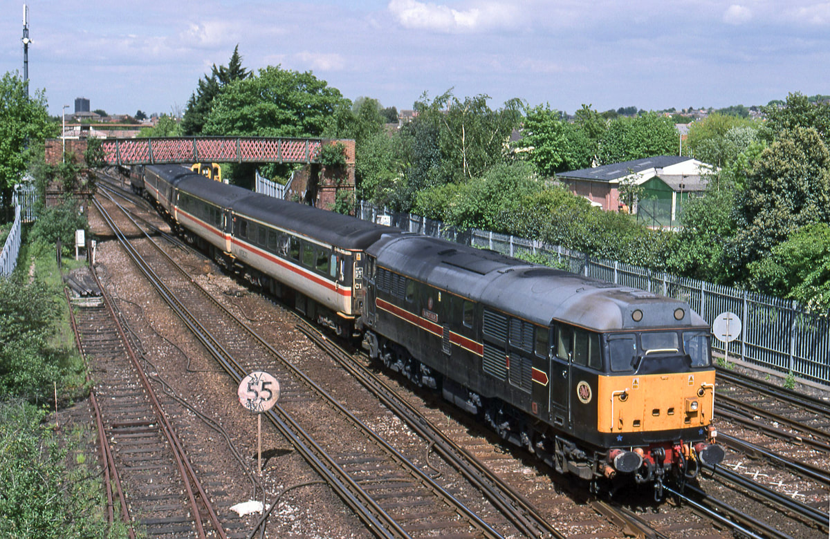
31452 St Denys 1Oxx 1200 Cardiff-Brighton 9th May 2005 Copyright Ron Kosys

We're very close to Sothampton Central now as 33101 exits Southampton tunnel and heads for Eastleigh. Sunday 23rd June 1989. Copyright Ron Kosys
An old friend, driver and CRS Member the late:Len Baker told us how they had to watch out here as within yards 33101 is going to pass by some elderly houses which almost overhang the line - a hazard here was that the inhabitants occasionally emptied the contents of their tea pots over the wall onto the line.
For Southampton Central and Southampton Docks please see the next section.