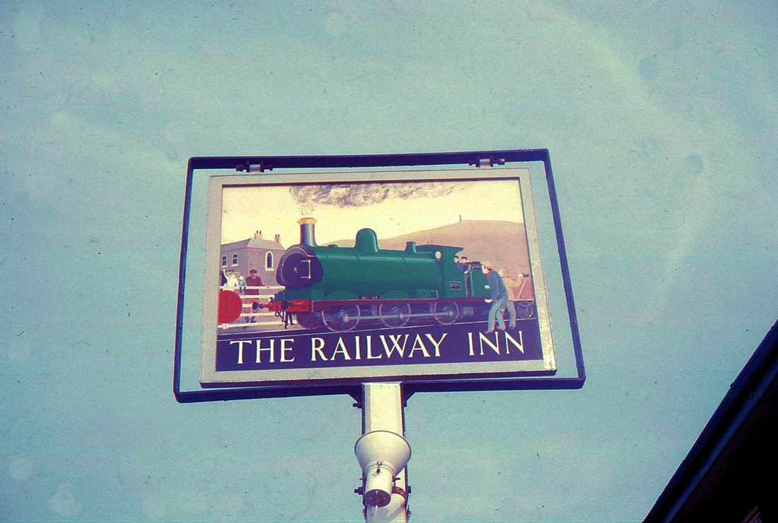
Roskear, Portreath and Tresavean Branches
Do you wish you were on this one? On 14 April 1963 a single car DMU provided a fascinating railtour from Penzance to Plymouth. The lines covered were - St Erth to St Ives, Hayle to Hayle Wharves, Camborne to Roskear Siding, Penwithers Junction to Newham, St Austell to Lansalson, Burngullow to Drinnick Mill and through to St Dennis Jct, Tolcarne Curve, Trevemper Siding, Bugle to Carbis Wharf, St Blazey, Fowey and Lostwithiel, Coombe Junction to Moorswater, and finally to Plymouth.
If you do not see what you want try :-
Go to the Links page and select Cornwall Centre, then on their home page select 'Cornwall Image Bank'. There is a selection of photographs by John Vaughan, Arthur Trevan, George Ellis and others.
You could always visit the Cornwall Centre at Alma Place, Redruth. Very near the station.
You could always visit the Cornwall Centre at Alma Place, Redruth. Very near the station.
Credits, Many thanks to all contributors - please see a list on the home page.
This section is under construction and is regularly up-dated
N.B Click on picture to obtain an enlargement and further details
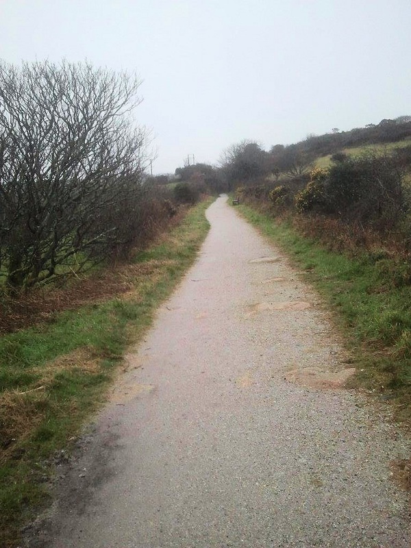
ROSKEAR BRANCH
The Roskear branch, part of the Hayle Railway opened 23 Dec 1837. The line closed beyond the A30 crossing in 1963 and was ifted in that year. On Saturday 14 April 1963 Mr. Cyril Hitchens was on duty in Roskear Junction signalbox on the occasion of the first and last passenger train to traverse the line. Cyril contacted his son Mike who cycled to the A30 crossing to witness the event. Unfortunately Mike didn't have a camera in those days. Please if you know of any photos of this historic event when the train visited several rare branches please let us have them. Many thanks. See front of this section for details of the route covered.
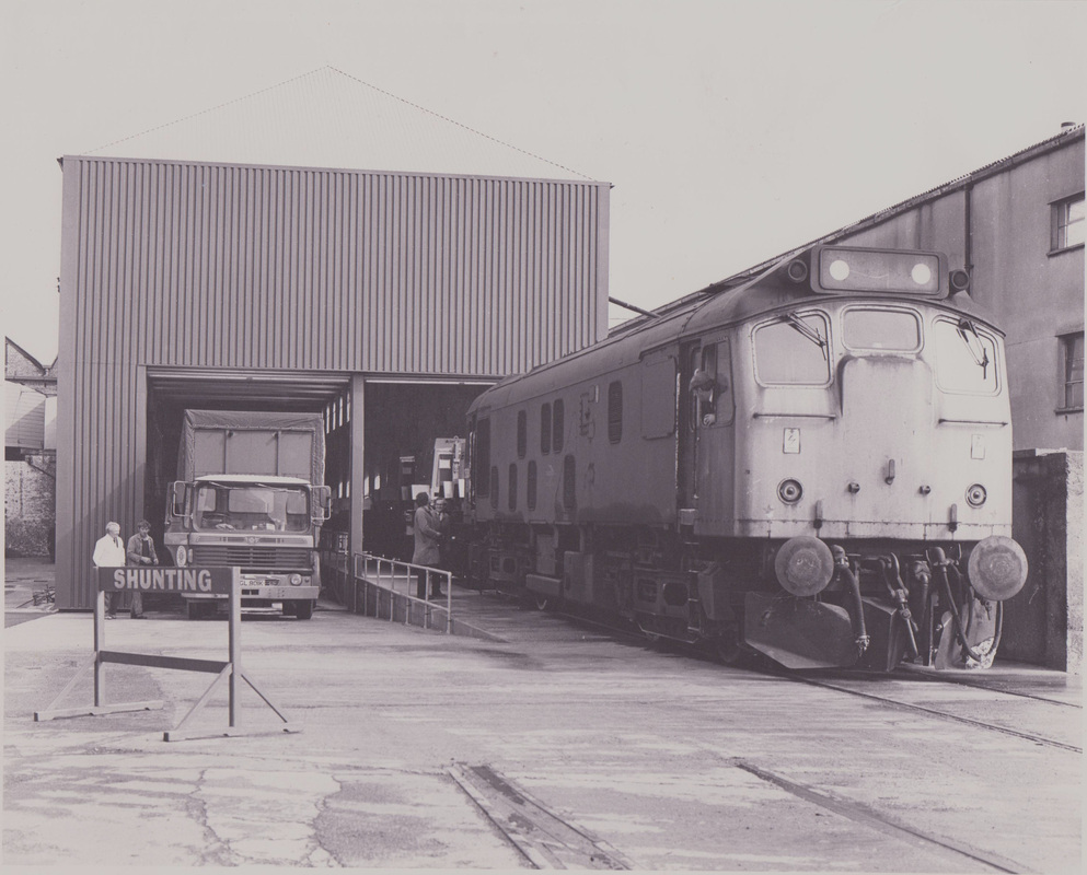
Of the remainder of the branch Holmans purchased the section between MP's 313.34 and 313.44. A new road/rail transfer depot was created in the 70's (See picture 9 below). This remaining stub of the branch was closed on 6 Sept 1987.
Of the remainder of the branch Holmans purchased the section between MP's 313.34 and 313.44. A new road/rail transfer depot was created in the 70's (See picture 9 below). This remaining stub of the branch was closed on 6 Sept 1987.


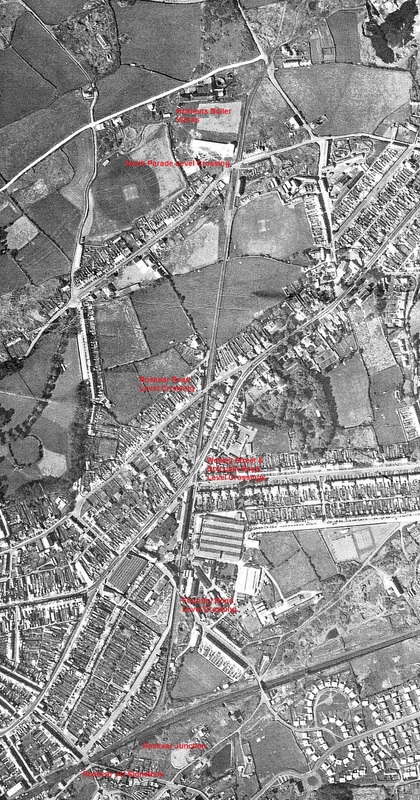
A 1958 view of the Roskear branch in its entirety, the 77 chains from Roskear Junction to the head shunt serving the kick back at Holmans Boiler works. In addition to the branch itself Mike draws our attention to the array of prefabs at the bottom right hand side. The bridge over the main line at this point still has rails of an old mineral tramway beneath its tarmac - these become visible when the surface is worn. Picture from the late Cyril Hitchens Collection Copyright. From Mike Hitchens MBE
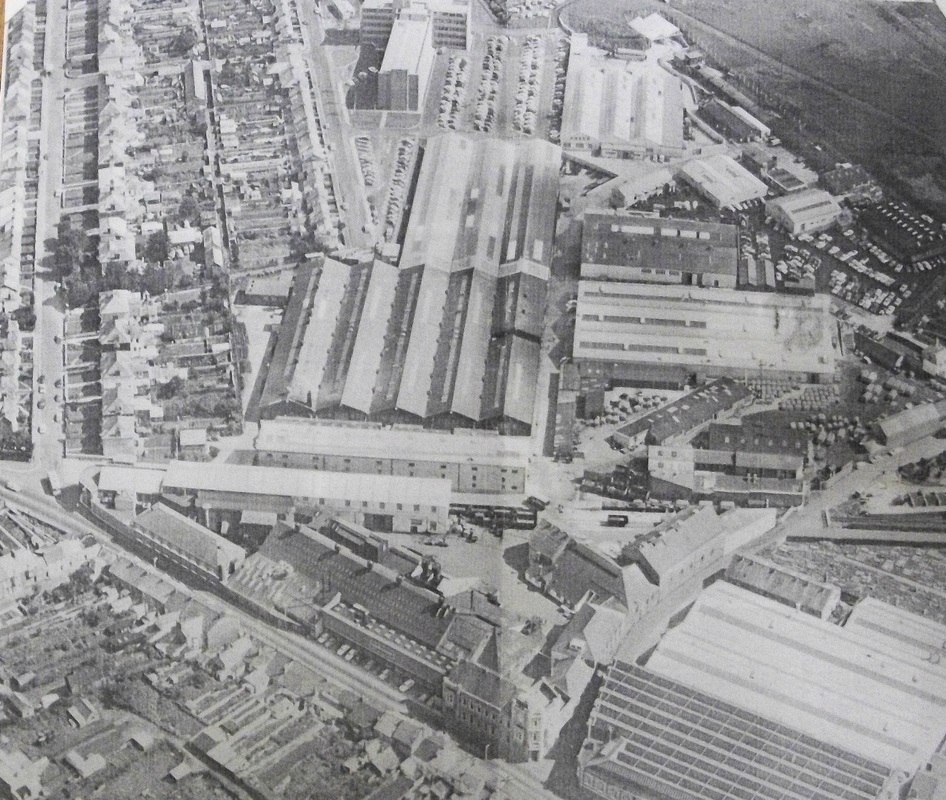
A post 1996 view of the Holmans complex taken from the north west. In the foreground lies Treowarren Street, The course of the truncated branch from the Dolcoath road junction is evident, the line having been removed in 1963. The terminus at this time was the centre of the picture. Seen just to the left of Foundry Road level crossing are a number of Lowfit wagons on which completed Holmans compressors have been loaded ready for dispatch. From the collection of the late Cyril Hitchens submitted by Mike Hitchens. Copyright
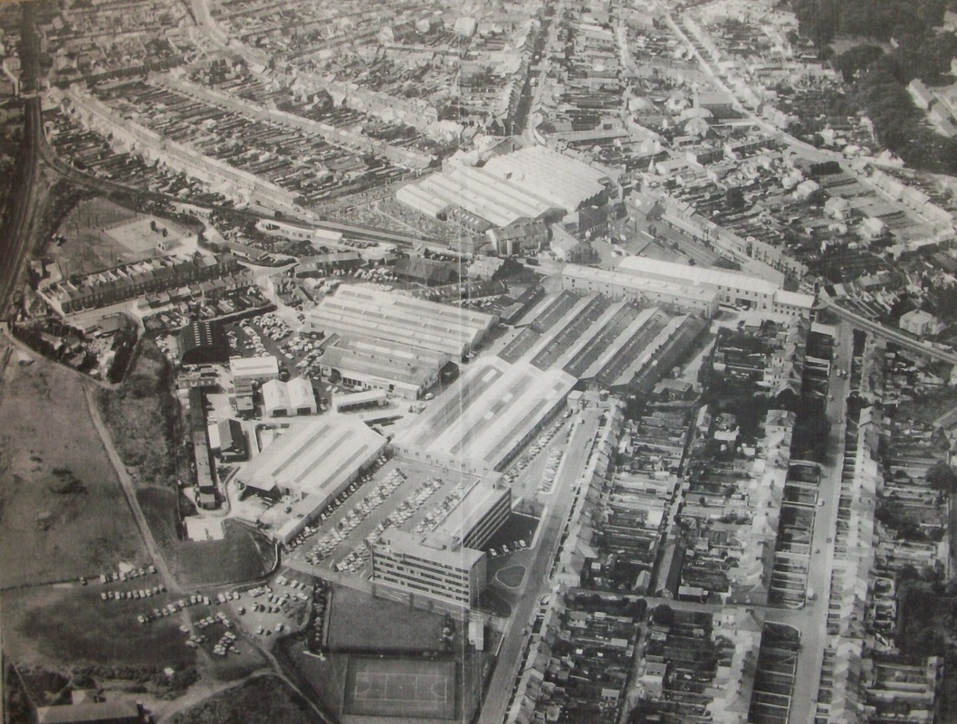
Looking from the south east. The very large Holmans complex. This area has now largely been taken over by Tescos beyond the branch and new housing in the foreground. Just beyond the level crossing at the top left of the picture lies Roskear Junction Signalbox. It was from this box that Cyril Hitchens signalled the only ever passenger train on the branch on the 14th April 1963. Visible in this picture is the Holmans shop window which overlooked the pair of level crossings at the Wesley St and Dolcoath Road Junction. Virtually the only non-residential building left in this picture is in the foreground - the office block built in about 1966 and latterly used by Kerrier District Council and now by Cornwall Council. Picture from the late Cyril Hitchens collection, from Mike Hitchens MBE. Copyright.
PORTREATH BRANCH
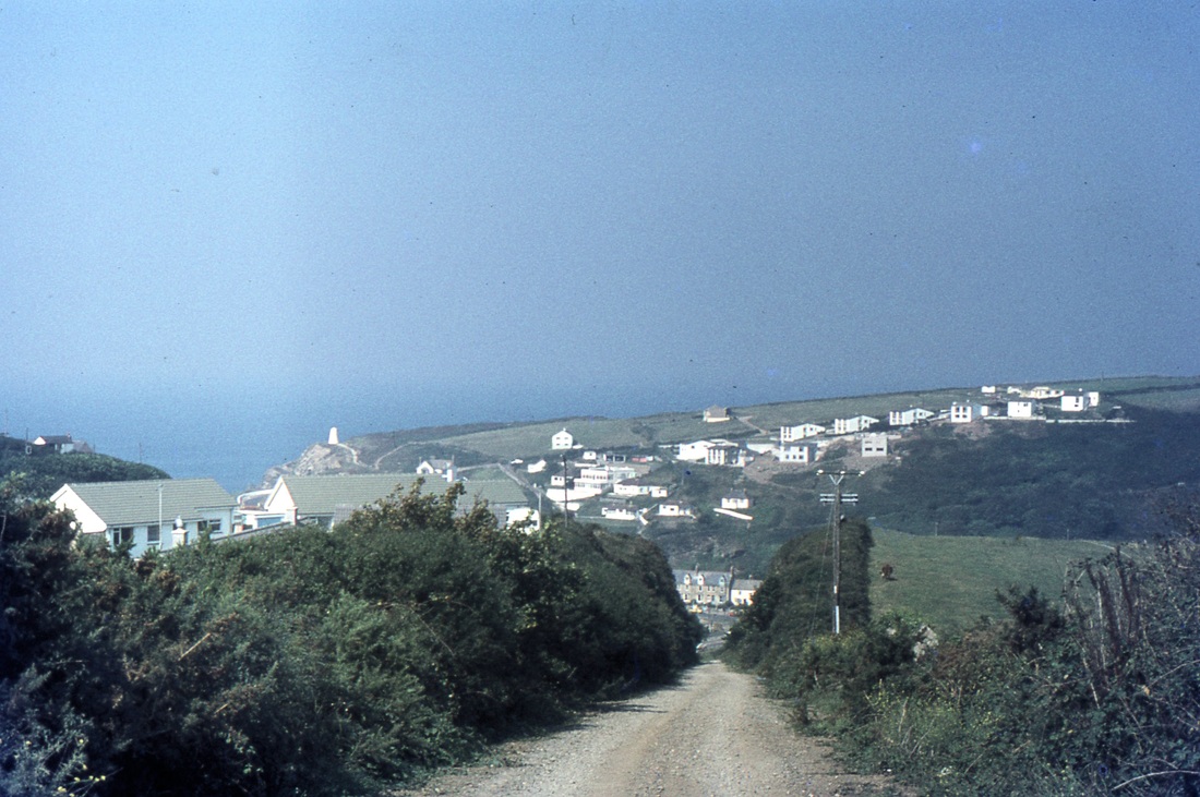
The line opened as part of the Hayle Railway on 23rd December 1837. It was single track with intermediate loops serving Illogan Highway, or Agar siding and North Pool siding. There was a double track incline worked by a winding engine, at the foot of the incline there was a level crossing prior to entry to the docks. Portreath goods closed on 1st January 1936. However the line remained in position over the war years and was used for the dispersal of rolling stock. Passengers were never officially carried though it had been know for people to hitch a lift.
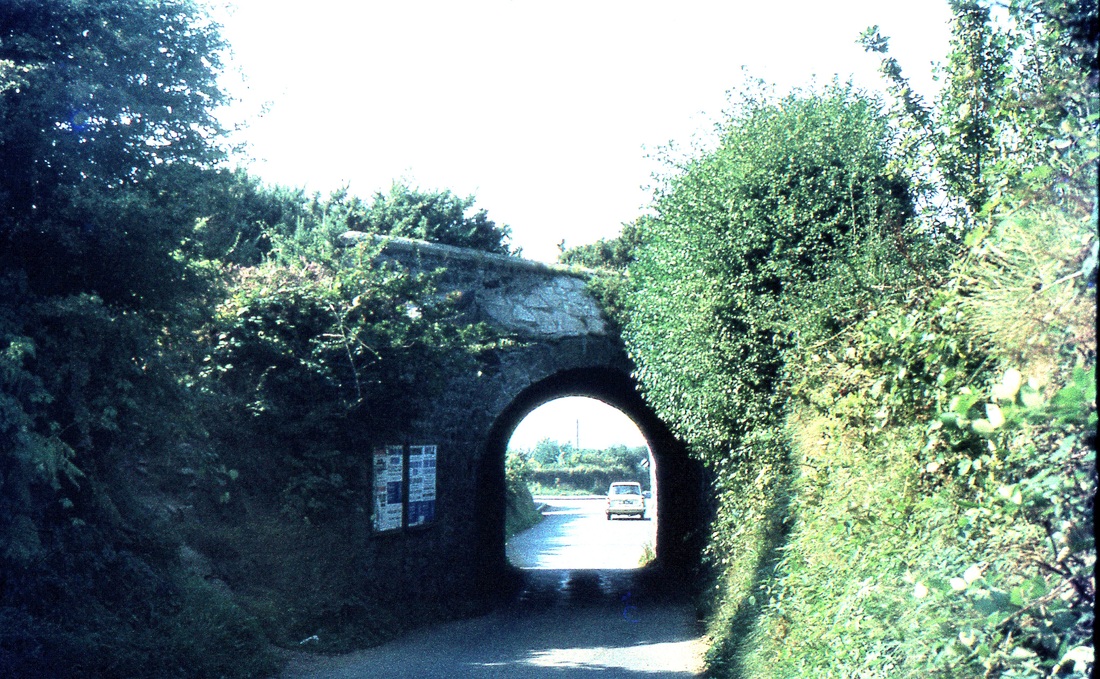
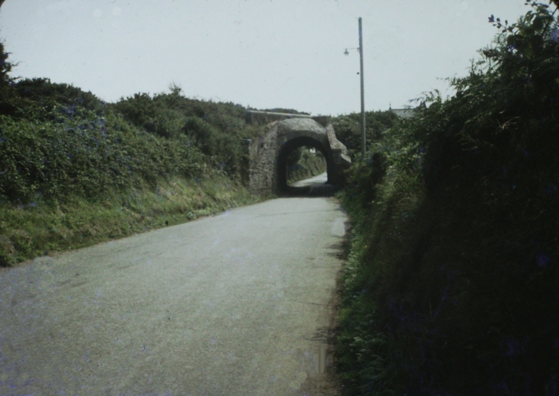
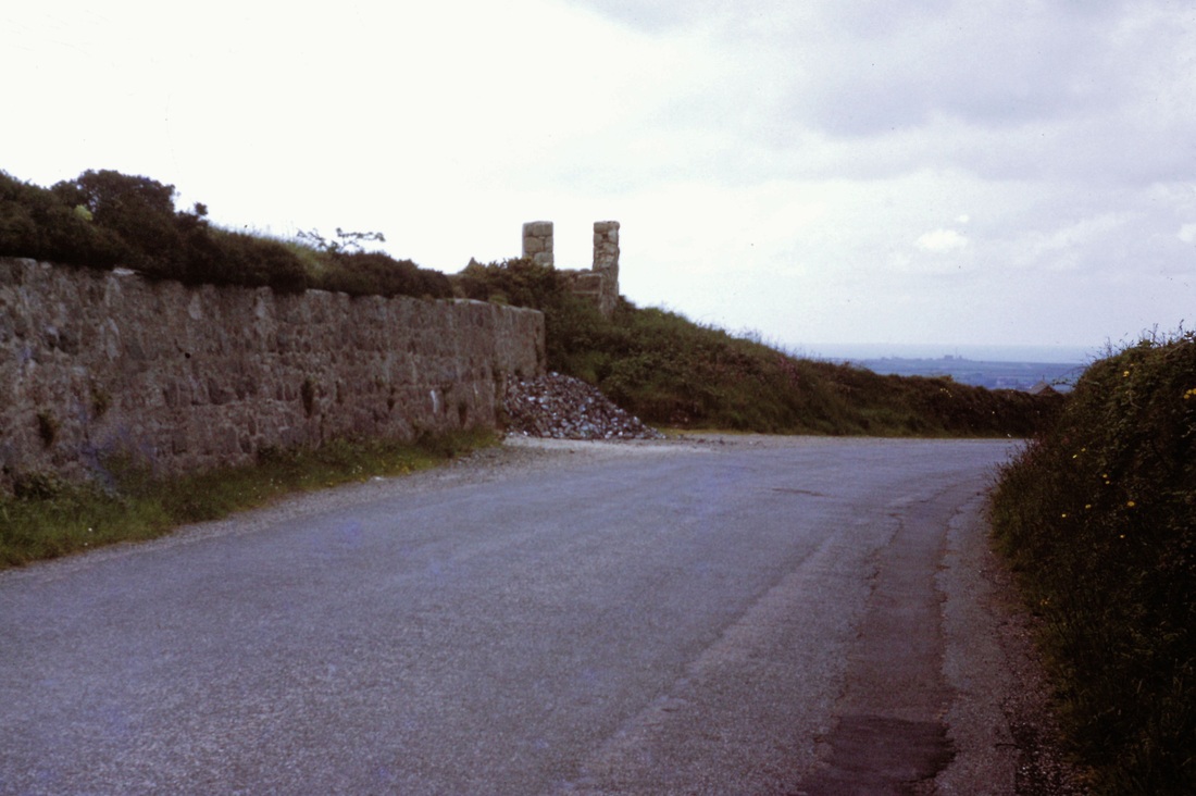
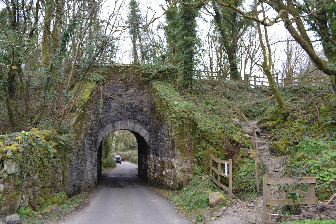
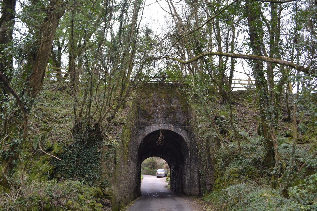
The bridge over Spar Lane, one of two bridges on the branch where the line passed over a road way, was, as can be seen, a serious obstruction to traffic. It succumbed to a demolition gang in the early 70's. The other bridge, which is still extent, is very near the foot of the Portreath Incline. All other crossings were by means of level crossings, there were no road overbridges.
The bridge over Spar Lane, one of two bridges on the branch where the line passed over a road way, was, as can be seen, a serious obstruction to traffic. It succumbed to a demolition gang in the early 70's. The other bridge, which is still extent, is very near the foot of the Portreath Incline. All other crossings were by means of level crossings, there were no road overbridges.

TRESAVEAN BRANCH
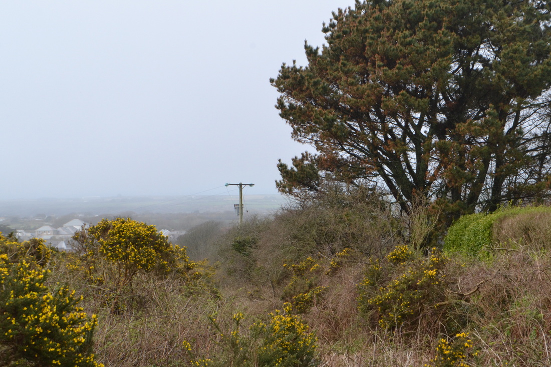
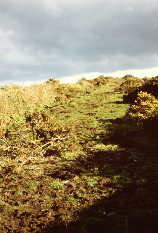
The Tresavean branch left the main line at Redruth Junction and headed up a steep rope worked incline before heading over top of Lanner Hill where it crossed the Redruth and Chasewater Railway on the level. However as the R & C was of 4'gauge and the Tresavean of standard gauge there was no rail interconnection. The incline was double tracked throughout its length, haulage was by means of the train loco. The loco, having left its wagons at the foot of the line proceeded to the top on its own. At the top the loco was attached to the 'rope' and then proceeded back down the incline passing its own train midway. The line closed on 1 Jan 1936
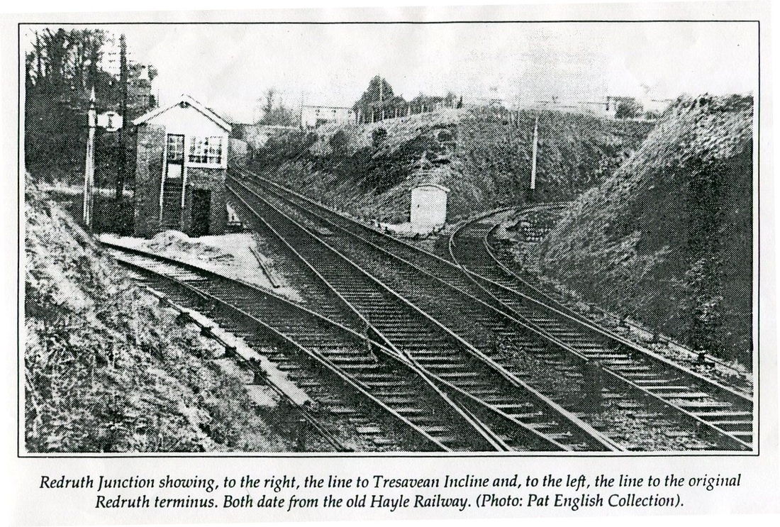
The picture is from the Late Patrick English collection and shows Redruth Junction with the line into the original Redruth terminus of the Hayle Railway off to the left, The line to the right led to the Tresavean incline. Catch points protect the main both from trains from the terminus and from the incline. There was at least one instance of a runaway train down the incline - it was smashed to smithereens when it derailed on the curve by the branch signal. When first opened there was no line straight ahead under Coach Lane Bridge. This was to come with the opening of the West Cornwall Railway.
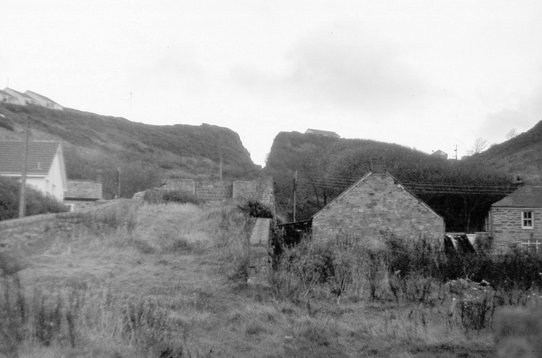
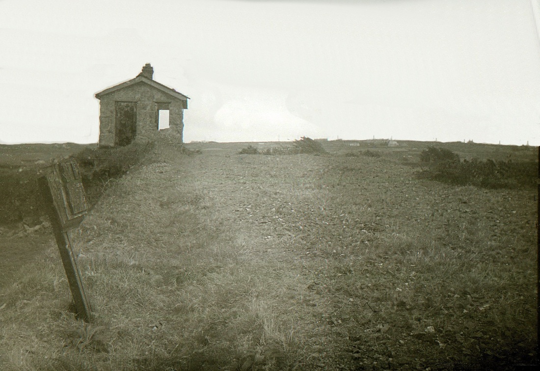
A photograph taken on the 8th June 1974 looking towards the former Redruth Junction. The PW hut is sited just before the point where the branch would have joined the main line. By this time the cutting leading to the Tresavean incline had filled in. Copyright Roger Winnen
Just over one hundred yards from its junction with the main line the double track incline passed under this bridge, it was climbing from left to right. This picture dates from the early 70's when the incline cutting was being filled in - a bungalow now stands on the formation of the picture to the right The nearest bridge parapet disappeared with the widening of Trevingey Road. However the furthest parapet is still in place with an arch beneath it. Coach Lanes leads down to the left, the buildings ahead are named Higher Sentry. Copyright K. Jenkin
Looking down the incline from the site of a level crossing where an access track to the Wheal Uny mine workings crossed the lines. 5th April 2014 Copyright Roger Winnen.
Looking up the incline of the Tresavean Branch. Copyright Roger Winnen 18th April 1998. In 2014 this area is sadly overgrown.
Presumably it was possible to cross the line at this point, however, if the incline was in use it would have been extremely dangerous as the engine driver would not be able to see anyone or anything if he was at the bottom of the incline.
Here a view looking east, the boundary wall of the incline which is on a low embankment at this point can be seen climbing towards the summit on the right. 5th April 2014 Copyright Roger Winnen
The top of the Tresavean incline. In this view Jon is looking up the last few yards of the incline. The line was horseworked beyond this point. The route continued on a much easier grade rougly along the hedgeline to be seen to the left and once over the top of the hill it continued in a southerly direction towards the terminus above the mine. 4th May 1957 Copyright the Late Jon Wood collection

The remains of the incline control cabin in 1970. The slope is clearly visible. steel cables would have come up past this point to pass around a large horizontal pulley wheel. Copyright K. Jenkin
The summit of the Tresavean Incline. By this time the old cabin had been further reduced - it looks as if the pile of rubble at the roadside may be recovered stone by persons unknown for use elsewhere. The site of the old cabin is in 2014 barely visible and access to the top of the incline is prevented by barbed wire fencing. Copyright Roger Winnen 8th June 74

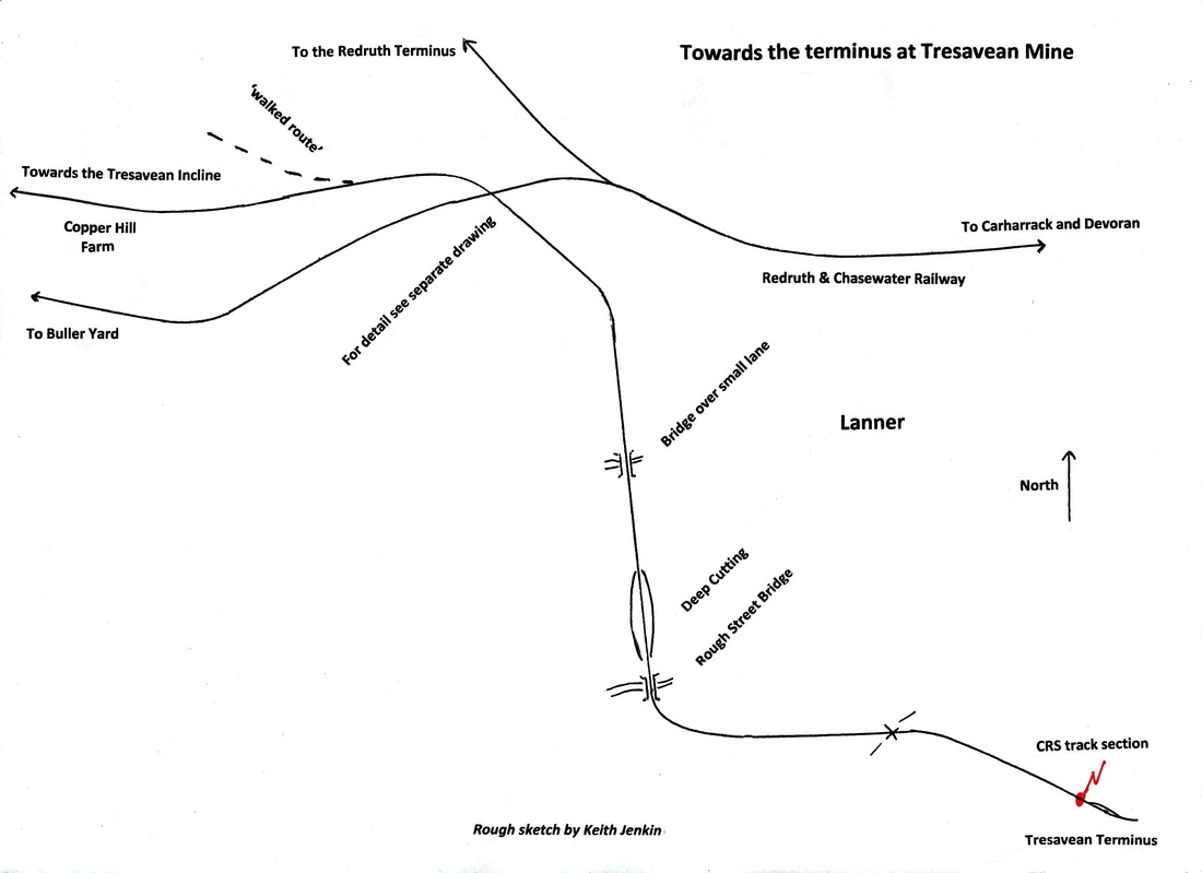
A visit to the Cornwall Centre and inspection of an early tythe map showed a hatched line marked as intended route of the West Cornwall Railway. This discovery was of great interest, and commanded speculation as to its purpose. Jof Bullen, Mining expert, came to our aid with suggestion that it was probably a 'walked route' showing a means by which easier gradients could be achieved to the top of Lanner Hill to permit locomotive operation by adhesion. This map kindly drawn for us by Peter Butt Vice President clearly shows the relationship between not only Tresavean branch and the possible repalcement for the incline but also of the nearby metals of the Redruth & Chasewater Railway to Wheal Buller and Redruth.
After the summit there were various sidings exact details of which are not known. With reference to the above map we are at the location of the first level crossing after the railway looking back towards the summit yards. Here two tracks crossed the road, one the running line to Tresavean and the other a long siding which extended very nearly to the next level crossing. Copyright Roger Winnen 5th April 2014
Now looking towards Tresavean the line continued alongside the hedge to the right - a second hedge which bordered the two tracks has been 'grubbed up' the pile of rubble bears testimony to this. The siding stopped short of the next level crossing which can be seen in the distance. Just before the crossing there was stop board forbidding locomotives over the crossing. Copyright Roger Winnen. 5th April 2014
The late Leslie Wallace recalled that when he used to watch the railway in operation that the locomotives used to push a rake of wagons at great speed towards the level crossing sharply applying the brake to shop by the board. Haulage past the crossing towards Copper Hill farm was by horse. This operation must have been risky and today with the heavy and fast traffic on the main road to Helston would have been impossible.
Looking back from the main road crossing one can again see the pile of grubbed up railway hedge. The Stop Board was located alongside the existing hedge just before this crossing. 5th April 2014 Copyright Roger Winnen.
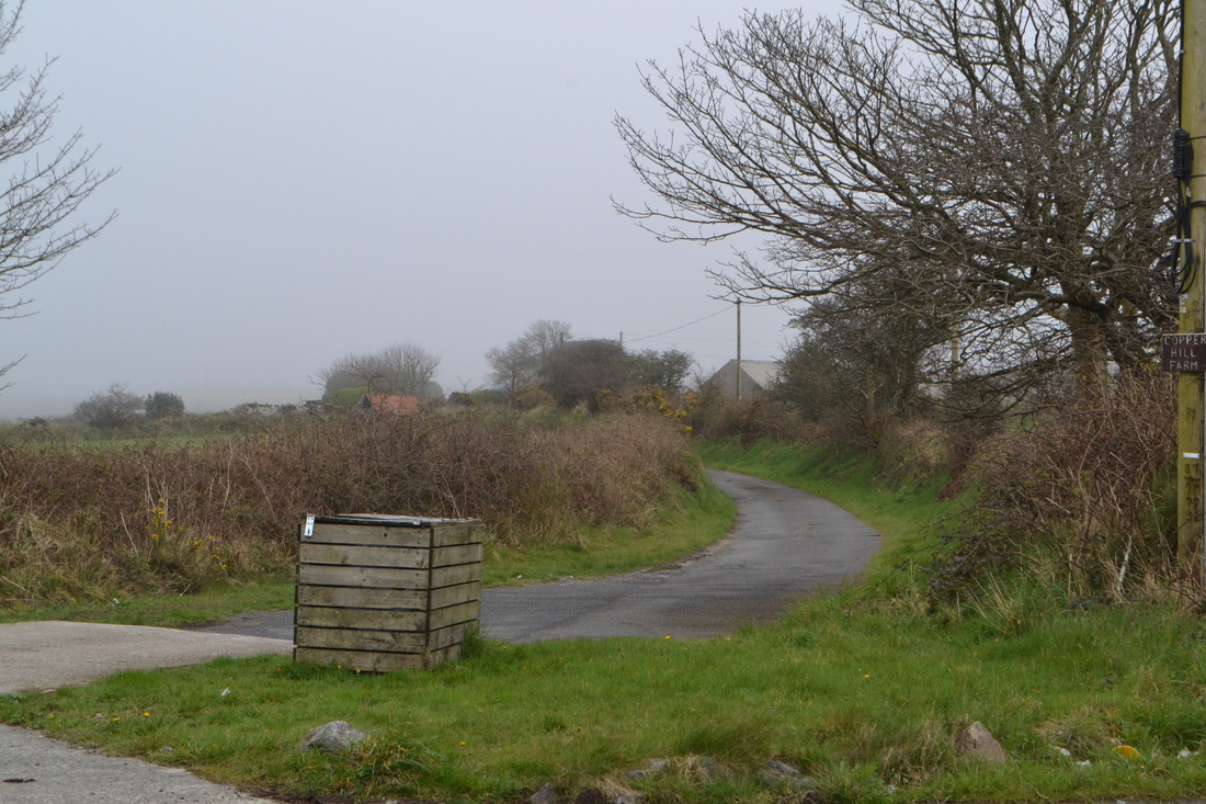
Looking across the main road level crossing the route becomes the private access signposted to Copper Hill Farm 5th April 2014 Copyright Roger Winnen

A 'close up' of the arrangement where the four foot gauge Redruth and Chasewater Railway crossed the standard gauge Tresavean branch. There were sheds on both lines to tranship materials to road transport but there was very little exchange of goods between the two railways.
The Redruth & Chasewater was the first railway at this location opening on 30th January 1826, it wasn't until the 23rd June 1838 that the Tresavean branch arrived to cross the R & C. The R & C, first to come was also the first to go closing with effect from 27th September 1915. The Tresavean closed with effect from 1st January 1936, the rails being removed in March 1938.
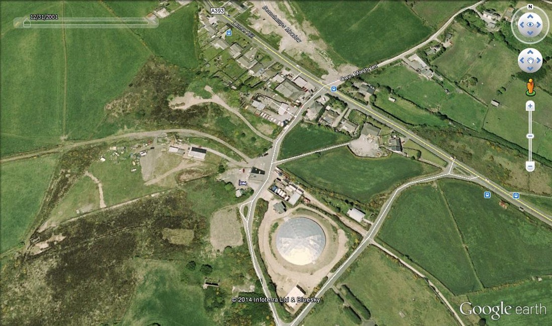
The location at the top of Lanner Hill otherwise called Wheal Beauchamp courtesy of Google Earth 2001. In this view, with reference to the sketch map the area, now dominated by a large covered resovoir, can be seen. The Tresavean branch enters this view at centre left and exits at bottom right. The Wheal Buller branch of the Redruth & Chasewater can be seen leaving this view towards the bottom of the left hand side. Following this line to the right it crosses the Tresavean branch, and after crossing the main road can be seen to merge with the main line of the R & C. The trackbed to the Redruth terminus can be ascertained. The transhipment yards of both the Tresavean branch and the smaller shed of the Buller branch can clearly be seen. This area has recently been developed.
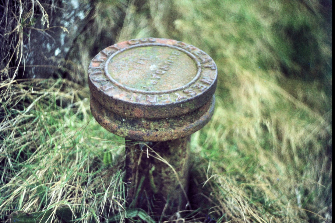
A Boundary Post on the Tresavean Branch. Top of Lanner Hill. Copyright Roger Winnen 1st January 1975 Unfortunately none of these remain, presumably taken to 'safe homes' by somebody!
Eric Rabjohns, our expert guide explains details of the area where the two lines crossed to the assmbled party. 5th April 2014 Copyright Roger Winnen
We are looking east towards Tresavean, the main line ran outside the transhipment shed - the other half of the loop passing through it. The area's Tramway trails are well signposted. 5th April 2014 Copyright Roger Winnen

A picture from the Maurice Dart Collection of the area in the previous view but taken about 15 yards back. The metals are of the Tresavean branch which are seen to be mounted on wooden sleepers at this location rather than on granite setts as elsewhere. One set of rails clearly passes by the outside of the enclosure whereas the other passes through it.

A view looking along the Redruth and Chasewater Railway alignment towards the main road, Penance Mine Engine house dominates the scene. Copyright Roger Winnen. 18th April 1998
Walking a short distance beyond the transhipment shed and looking back rewarded one on the 1st January 1975 with this view of the shed walls, granite setts and the reservoir enclosure to the left. Copyright Roger Winnen
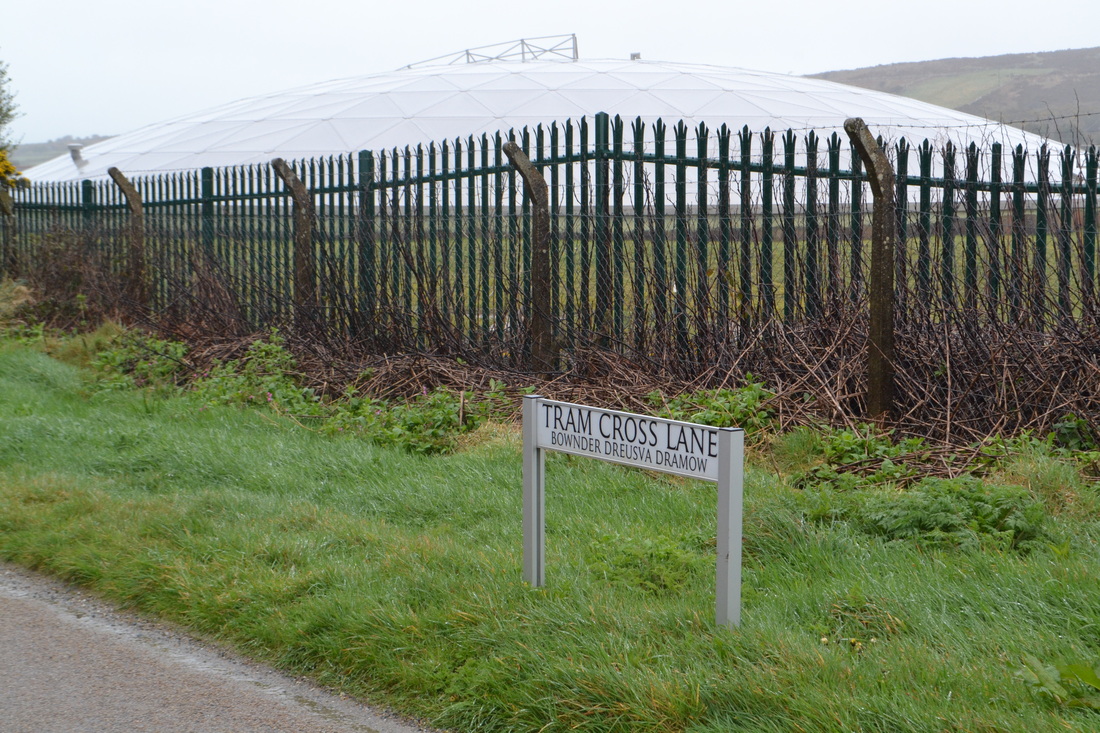
A local lane given a confusing name - they weren't tramways, but railways. Copyright Roger Winnen 5th April 2014
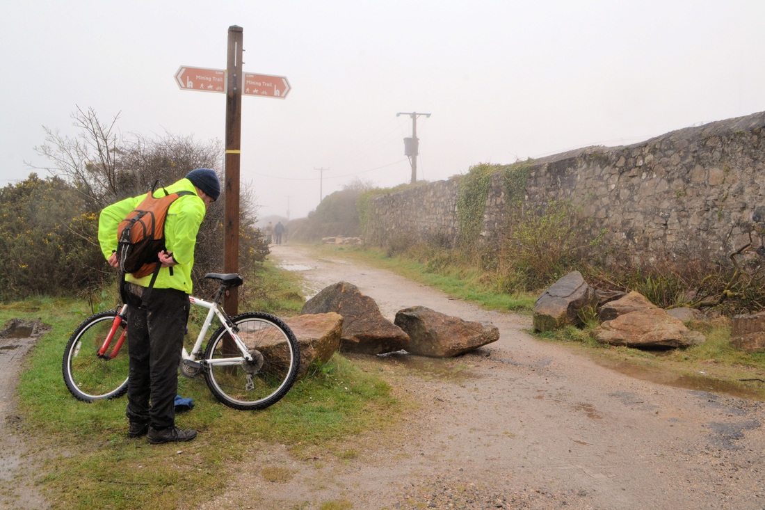
The route of the railway has, for the enthusiast, been spoilt by improvements to its surface for the benefit of cyclists and walkers. The majority of the granite setts having been either removed or covered. However, here is a picture on 5th April 2014 which gives a clue to the pathways previous use. Copyright Roger Winnen

From the Redruth direction this is the first bridge where the Tresavean branch crosses a road, or rather rough lane in this case, there is access from the old line down to this point. 5th April 2014 Copyright Roger Winnen
Another view of the same bridge. 5th April 2014 Copyright Roger Winnen.
A view through the deep cutting looking north, this view taken on 8th of May 1976 is one that would be preferred by the enthusiast. Sleepers are still evident in plenty though the mud might not have been appreciated by the walkers or cyclists. Copyright Roger Winnen
Emerging from the deep cutting the line takes a sharp change of direction to the left and heads east, on the bend it curves over this bridge which takes the track over Rough Street a narrow twisting lane though less rough than that under the previous bridge. This picture 11th March 2014 Copyright Roger Winnen
Anther view of the same bridge from downhill. The car is parked outside the appropriately named 'Rough Street' Farm. 11th March 2014 Copyright Roger Winnen
Heading towards the terminus - this is the location where Chapel Hill, climbing steeply from left to right, eases for a moment to cross the old line. 11th March 2014 Copyright Roger Winnen
Very near the end of the line, this view on 3rd May 1998 shows a long line of stone sleeper blocks in situ. Copyright Roger Winnen
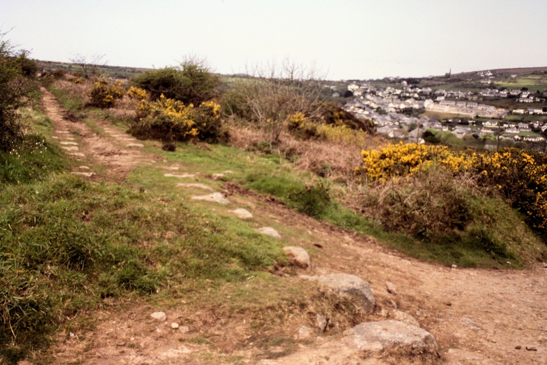
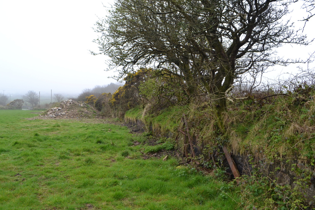
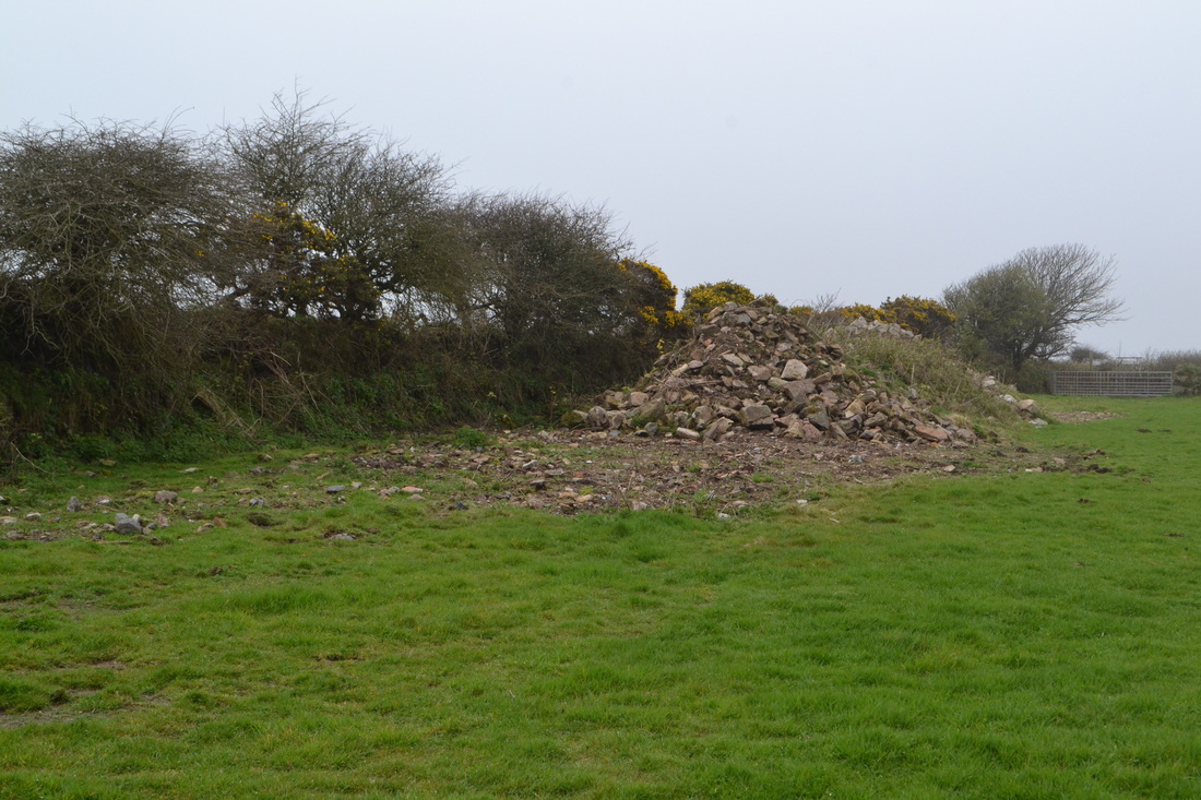
The end of the line, well very nearly, unfortunately removal of mine waste by JCB behind the cameraman at this point has removed all traces of the terminal loop bar a stone sett or two. This is the site where the short section of rail was laid in 1999 by CRS Members. Copyright Roger Winnen 3rd May 1998 For reference that's Pennance Mine enginehouse in the distance
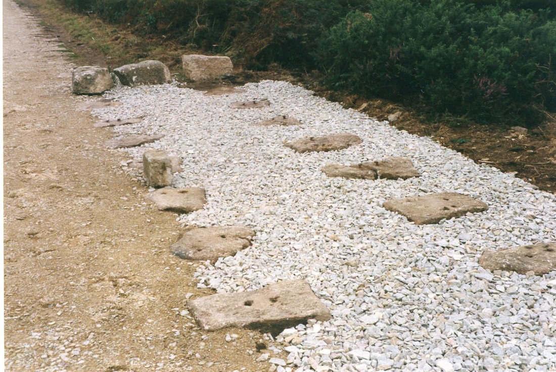
In 1998 at the request of the Mineral Tramways project this short section of the former Tresavean branch was selected to demonstrate to show the public what it may have been like. The gorse was cleared back and the waste around the granite setts cleared away. Fresh Ballast was laid. One or two of the steel rail fixing nails were removed to provide samples for the manufacturer of replacements. Copyright K. Jenkin.
At the time it was unclear as to what type of rail was used and as some flat bottomed rail had been kindly donated to the project by Mr David Shepherd this was used. Our appreciation for the donation.
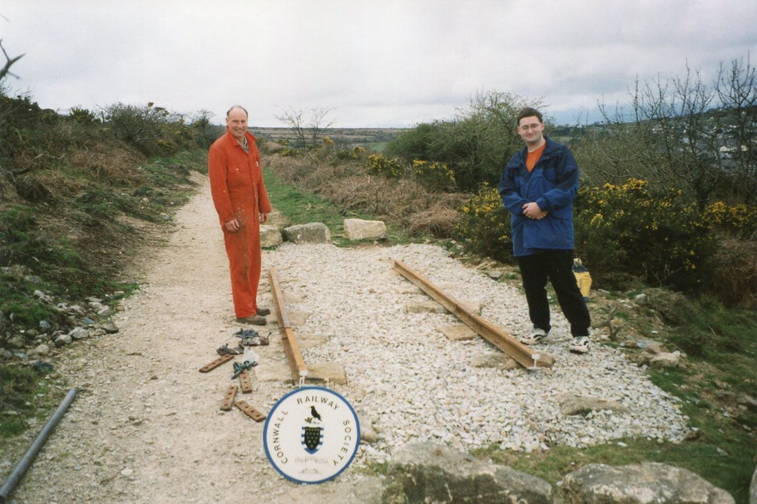
Peter Butt and Peter Jenkin pose for a picture partway through the installation. 1999 Copyright Keith Jenkin.
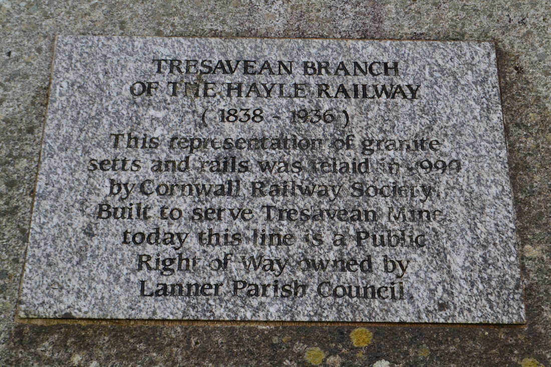
A plaque was duly erected in the form of this engraving on polished granite.


We were concerned at the loneliness of the spot might attract rather undesirable people and this proved true in November 2006 when thieves attempted to steal the rail. Luckily they were defeated by the weight of the rail and the last couple of fixing nails which were reluctant to let go. However Councillor Mark Kaczmarek kindly arranged for the rail to be completely removed and then restored in position.
With a walk along the branch planned for 5th April 2014 it was decided to visit the site. We found the 'exhibit' well overgrown with gorse and grass. The maintenance of the actual track bed is the responsibility of Cornwall Council and Lanner Parish Council for clearing the undergrowth. In the current times of tight finances with no money available we were advised the 'nobody would mind' if we were to clean up the site ourselves. So on March 11th 2014 Christine Simmonds, Roger Winnen and Keith Jenkin put in several hours clearing up.
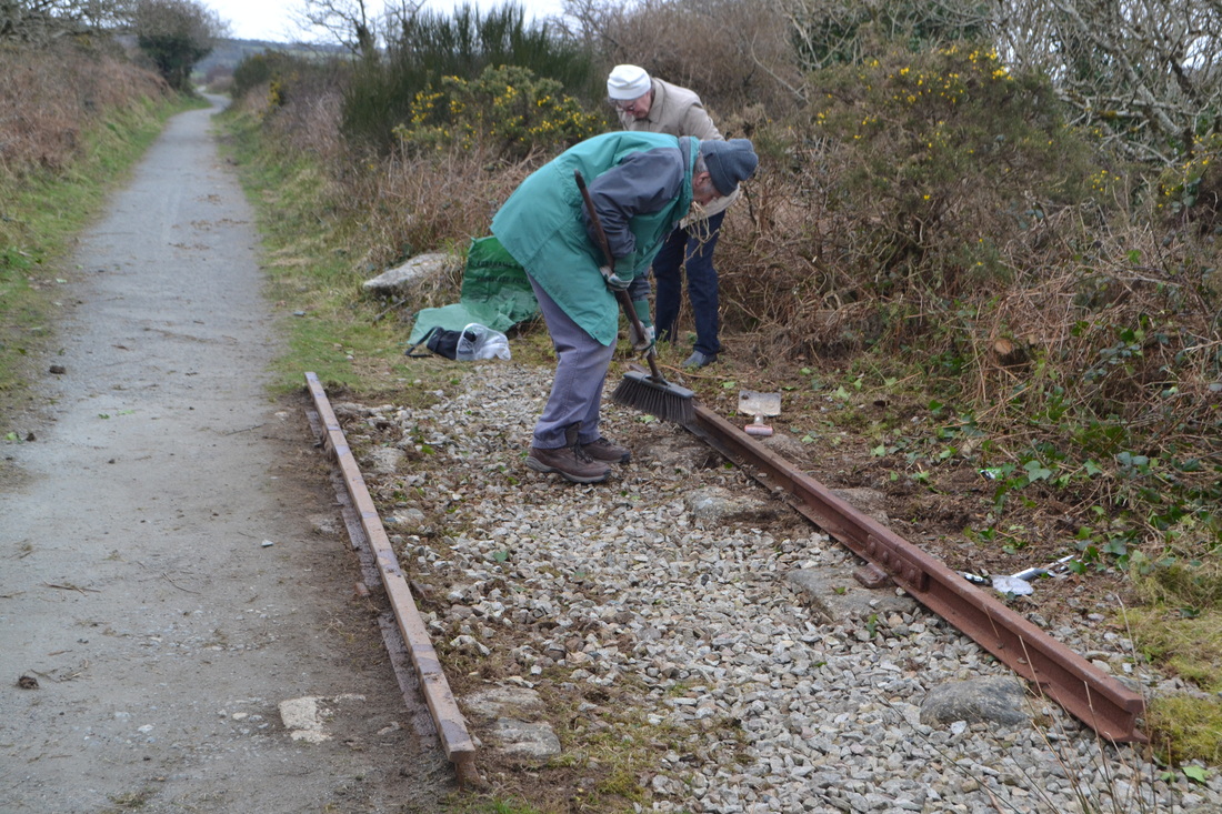
Two of the team at work, Roger did his fair share when not manning the camera. 11th March 2014 Copyright Roger Winnen
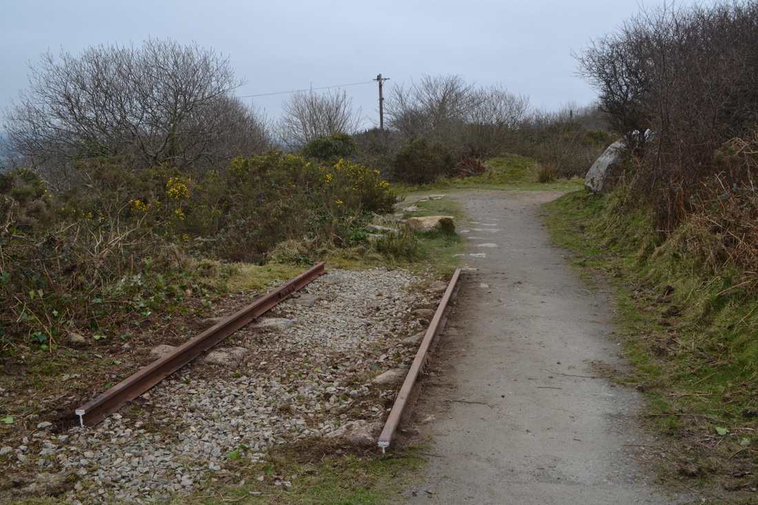
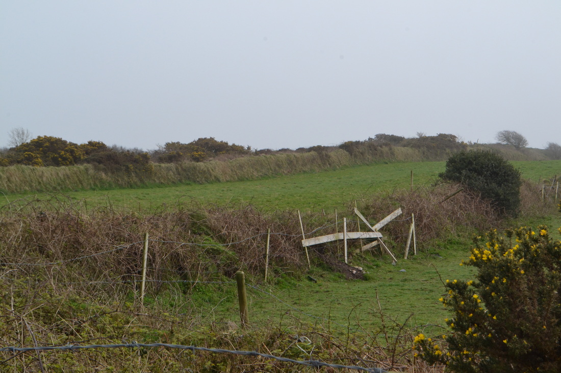
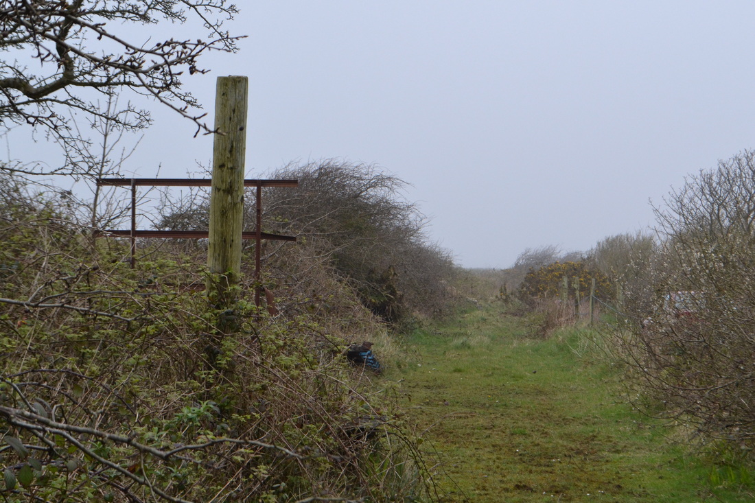
Looking towards the end of the branch where there was a terminal loop. The site of the loop, about 75 yards further on has been lost amongst various mine waste recovery operations. It can be seen that the 'exhibit' is not on the path and consequently not the responsibility of Cornwall Council.
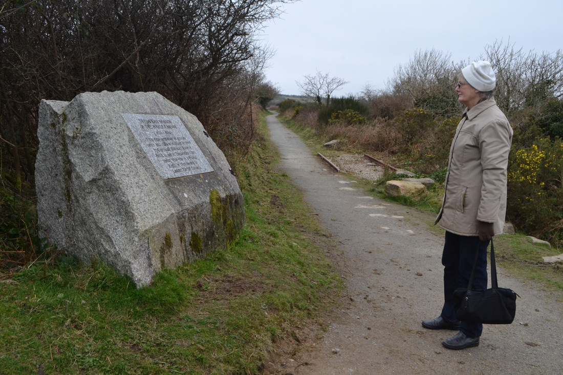
Work completed, Christine reads the plaque which has also been carefully cleaned whilst in the background the exhibit which ad been overgrown with gorse and grass is revealed for all to see. March 11th 2014 Copyright Roger Winnen
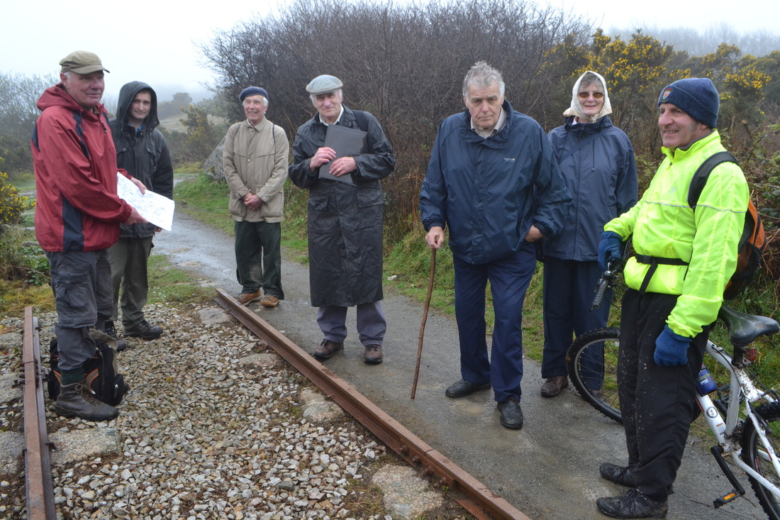
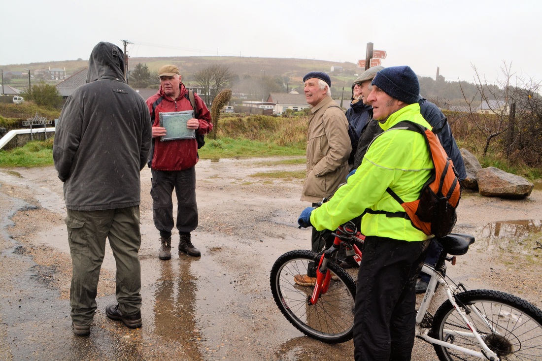
Finally the great day dawns, the walk started in driving rain, however conditions improved during our three hour walk to be almost acceptable by the time we reached 'the exhibit'. In this picture you see our expert guide Eric Rabjohns, Peter Jenkin, Jerry Chandler, Keith Jenkin, Mike ?, Christine Simmonds and Mike Hitchens. Roger is manning the camera. 5th April 2014 Copyright