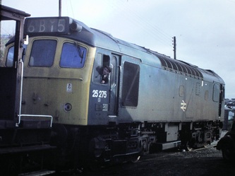
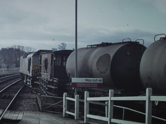
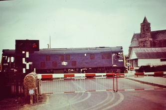
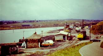
The Hayle Wharves Railway
N.B. Coverage of the original Hayle Railway route to Foundry Square is covered at the end of this section.
The idea of this section is to publish photographs of the Cornwall Railway scene before 1980. However, in the interests of continuity we might include a later picture. If you are interested in contributing and seeing your work on the net then please let us have your material. You will be fully credited and you can state copyright. It is important that the material is your own work or that of a member of your family who approves or would approve of your action. Please state who took the original picture. You will be listed as the contributor and as such take responsibility for the material submitted. Please do not submit professional photographs or any which are copyright.
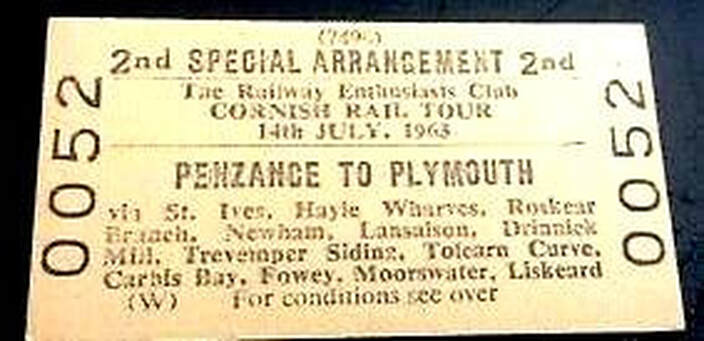
Do you wish you were on this one? On 14 July 1963 a single car DMU provided a fascinating railtour from Penzance to Plymouth. The lines covered were - St Erth to St Ives, Hayle to Hayle Wharves, Camborne to Roskear Siding, Penwithers Junction to Newham, St Austell to Lansalson, Burngullow to Drinnick Mill and through to St Dennis Jct, Tolcarne Curve, Trevemper Siding, Bugle to Carbis Wharf, St Blazey, Fowey and Lostwithiel, Coombe Junction to Moorswater, and finally to Plymouth. What a day out - do you have any pictures taken on this railtour, we'd be delighted to show them with due credits.
N.B. If you would like pictures of this train they are available from Transport Treasury as follows:- At St Ives B6325, at Hayle Wharves B6326 and at Newham B6327
If you do not see what you want try :-
Go to the Links page and select Cornwall Centre, then on their home page select 'Cornwall Image Bank'. There is a selection of photographs by John Vaughan, Arthur Trevan, George Ellis and others.
You could always visit the Cornwall Centre at Alma Place, Redruth. Very near the station.
You could always visit the Cornwall Centre at Alma Place, Redruth. Very near the station.
Credits, Many thanks to all contributors - please see a list on the home page.
Moule's Cornwall Map
The Hayle Railway
The Hayle Railway
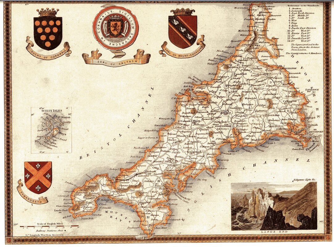
MOULE'S COUNTY MAP of CORNWALL
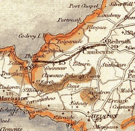
Thomas Moule (1784 – 1851) did various things in his life but is probably best known for his series of “County Maps” published from 1830 onwards. The maps are decorative and useful for recording the roads and railways then existing; e.g there is no direct road from Hayle to Penzance on the Cornwall Map. The AA's 2022 Road Atlas is already on sale and it was no different in the 1830s. Moule's County Map of Cornwall was dated 1837 but was in fact published in 1836. The Map shows just one railway that from Hayle to Redruth which was still under construction at the time the map was published. The first length of the Hayle Railway was opened to goods traffic on 29 December 1837 but did not carry passengers until 22 May 1843. The map should also have shown the Bodmin & Wadebridge Railway which had opened in 1834.
5092 Scan of Moule's Map of Cornwall 1837
MLR / 14 August 2021
Many thanks to Mike Roach for his research.
HAYLE HERITAGE CENTRE
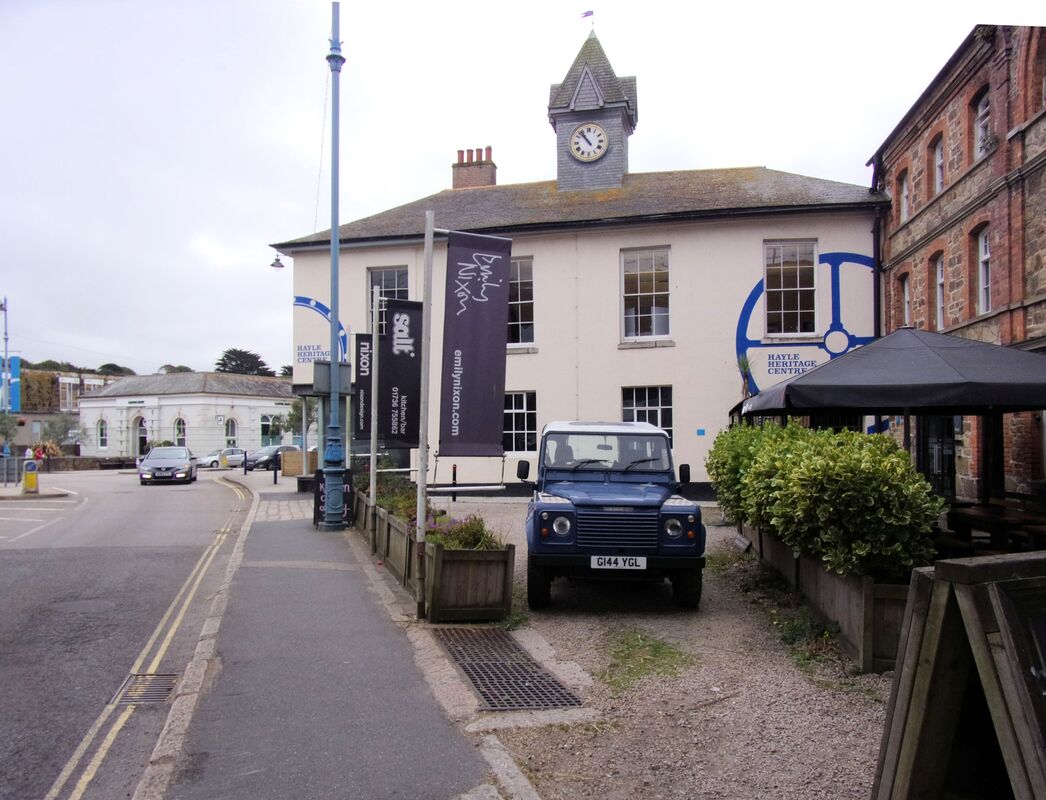
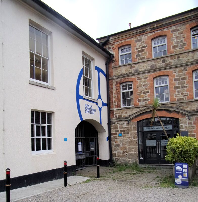
No visit to Hayle is complete without calling in at the Hayle Heritage Centre - this is located at Foundry Square just yards from a large Car Park at Asda . There is also a frequent bus service T1 & T2 within 100 yards and Hayle station is but 400 yards away. See also https://www.hayleheritagecentre.org.uk/
No visit to Hayle is complete without calling in at the Hayle Heritage Centre - this is located at Foundry Square just yards from a large Car Park at Asda . There is also a frequent bus service T1 & T2 within 100 yards and Hayle station is but 400 yards away. See also https://www.hayleheritagecentre.org.uk/
The Heritage Centre is open - in August on Tuesday to Saturday 11.00 to 16.00
In September it is open for the above hours Tuesday to Friday. For further details or updated information please ring 01736 757683
In September it is open for the above hours Tuesday to Friday. For further details or updated information please ring 01736 757683
The Heritage Centre is located on the first floor of the building - access is via a stairway - a lift is also available.
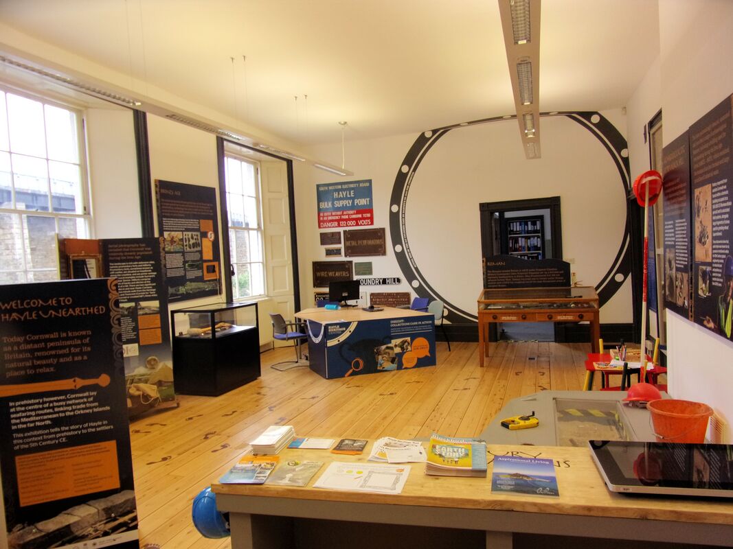
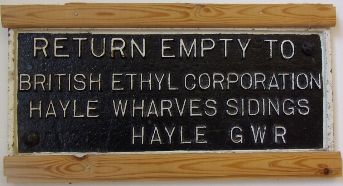
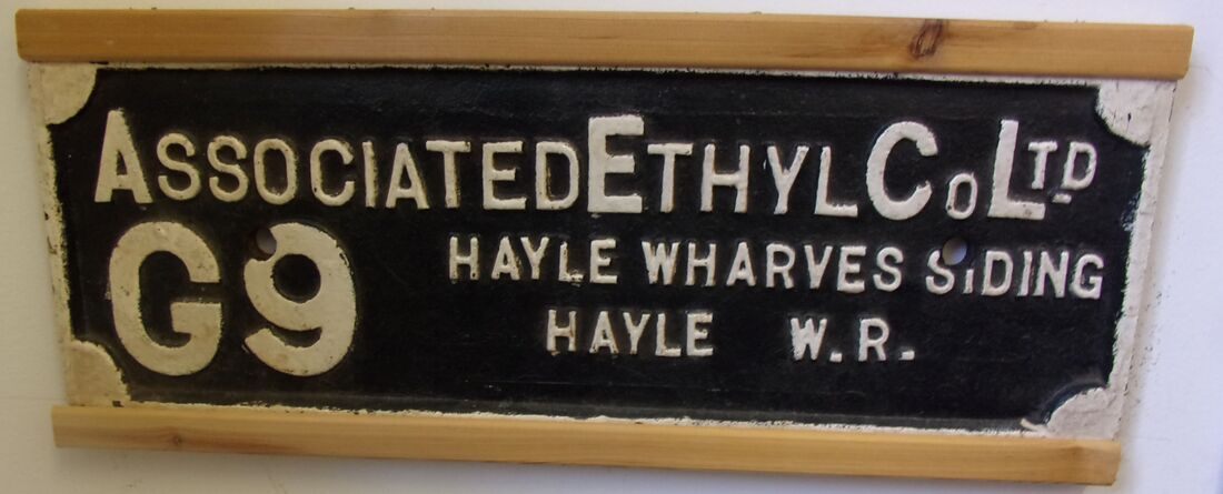
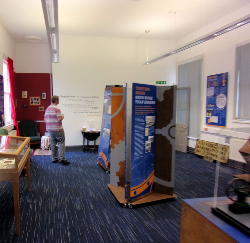
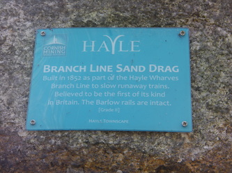
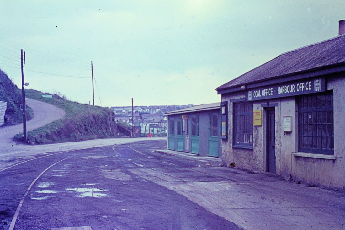
There are two display rooms - this one is at the head of the stairs. There are a large number of railway relics on display here. Note through the window a glimpse of Hayle Viaduct. 8th August 2019. (Two of the plates particular to the Hayle Wharves branch are affixed to the end wall and shown below. Photographs courtesy of Hayle Heritage Centre.
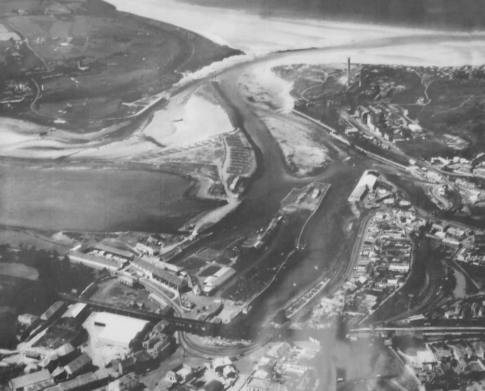
A general view of Hayle Harbour area looking north. Carnsew pool is to the left. Note the indentations in the quay wall clearly visible in this view - these constructed in this manner to permit vessels to be close to the quayside along their whole length. Towards the top of this picture can be seen the treacherous Hayle Estuary and the sand bar which required precise navigation at High Tide. Also to be seen on the east side of the estuary are the chimneys of Hayle Power station which drew cooling water from Carnsew pond. Picture courtesy Hayle Heritage Centre.
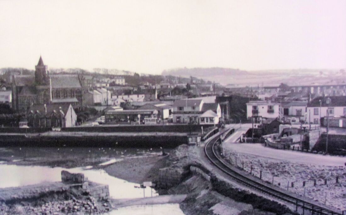
Looking south the prominent building on the left is St Elwyns Church. The Hayle Wharves branch came down an incline from the main line to cross the swing bridge in the centre of this picture and on to serve the power station and industries on North Quay. The stub of an embankment on the left carried the Hayle Railway across a water way- this line continued across the route of the branch line shown and headed alongside Penpol Terrace to the original Hayle station which was located just beyond the viaduct seen in the distance. This picture courtesy of the Hayle Heritage Centre.
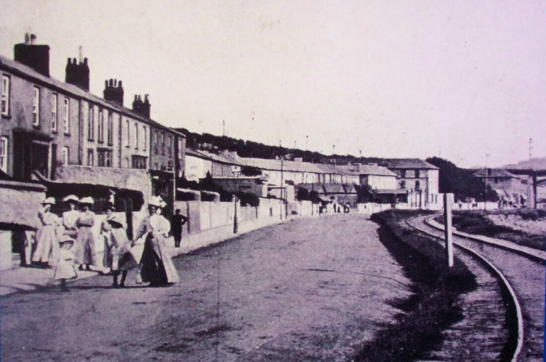
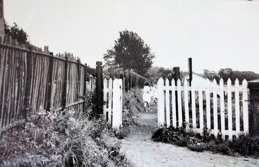
Again another 'Gem' from the many photographs on display - there are also several carefully prepared photograph albums available for inspection. This picture looking south alongside Penpol Terrace towards the original Hayle station which lay at this level just beyond the viaduct. Note the ladies in their perhaps 'Sunday best apparel'. Picture courtesy Hayle Heritage Centre.
Production of Bromine etc at the Hayle Wharves site.
Incidentally on completion of the supergrid, Hayle Power Station which had already been rationalised was decommissioned in 1973, and there is a very interesting article and some archive railway photographs at www.octelamlwch.co.uk/hayle
or look up the Hayle section. who used the spent hot water from the power station and were the eventual cause of its demise.
Hayle power station was subsequently completely levelled due to a construction agreement that stated that the surrounding area should be reinstated to its natural state on closure.
Many thanks to Andrew Jones who advised us of the above link clicking on which will be most rewarding.
THE HAYLE WHARVES BRANCH
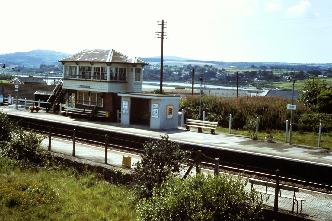
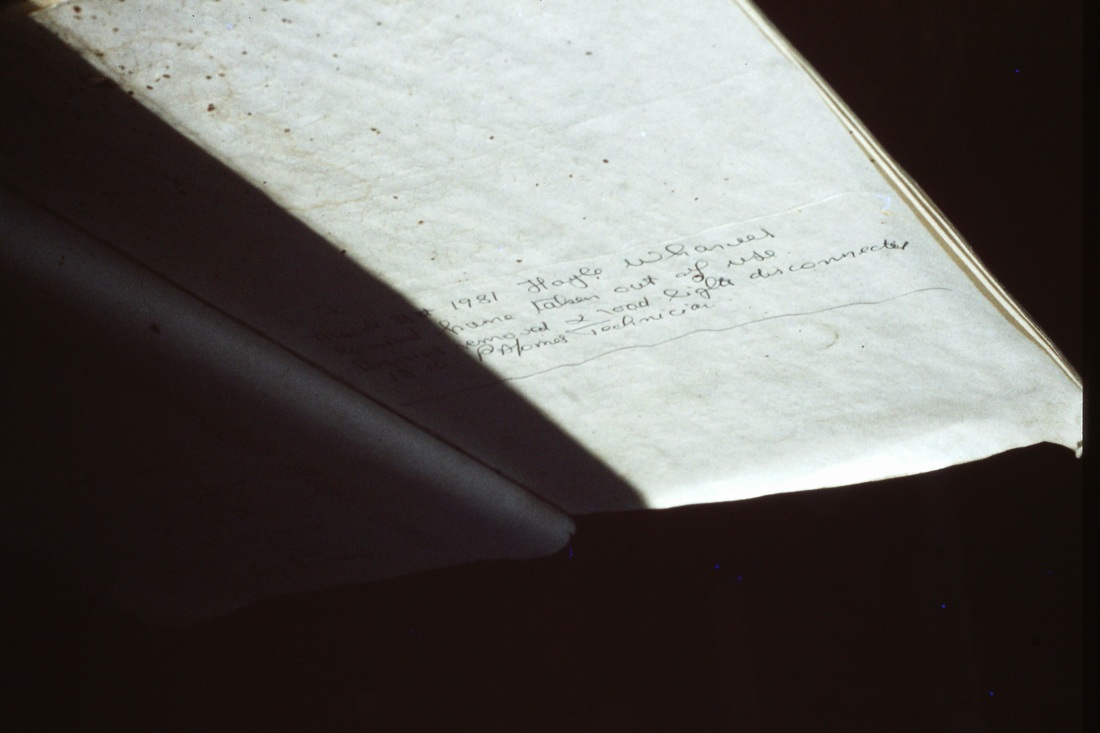
The Hayle Wharves branch was taken out of use on 7th July 1982 - the signalbox at Hayle closed the same day.
The Hayle Wharves branch was taken out of use on 7th July 1982 - the signalbox at Hayle closed the same day.
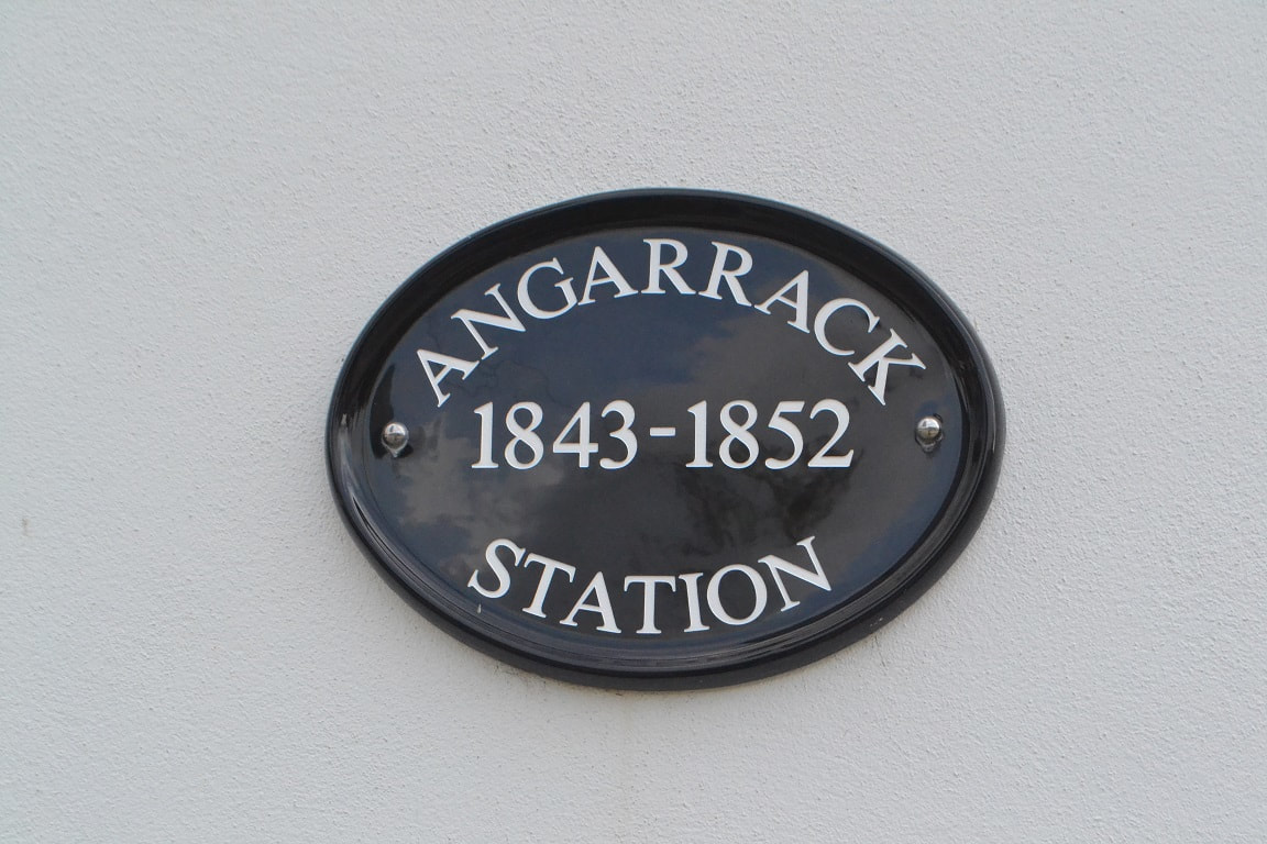
The Hayle Railway opened in December 1837 between Redruth and Hayle. Hayle station at that time being located below the current viaduct opposite the Post Office. This line came down two inclines from Camborne, one at Penponds, the other at Angarrack. Once down to almost sea level the line ran along the north side of Copperhouse creek along what is now King George V Walk. This original line crossed the creek very close to the current, though disused, rail swing bridge and continued along side Penpol Terrace to the original station site. The Hayle Railway via the Angarrack incline closed 16 Feb 1852. A new line to the West Cornwall Railway station at Hayle was opened 11 March 1852. The line along King George V walk saw further use as a branch serving an explosive works up on Mexico Towans.
1910 saw the opening of Hayle Power Station on Harvey's Towans. It was coal-fired and the coal was supplied by ship from South Wales until the station was closed in 1977. At the same time Hayle Harbour was also closed to commercial shipping, although a locally important fishing fleet, specialising mainly in shellfish.
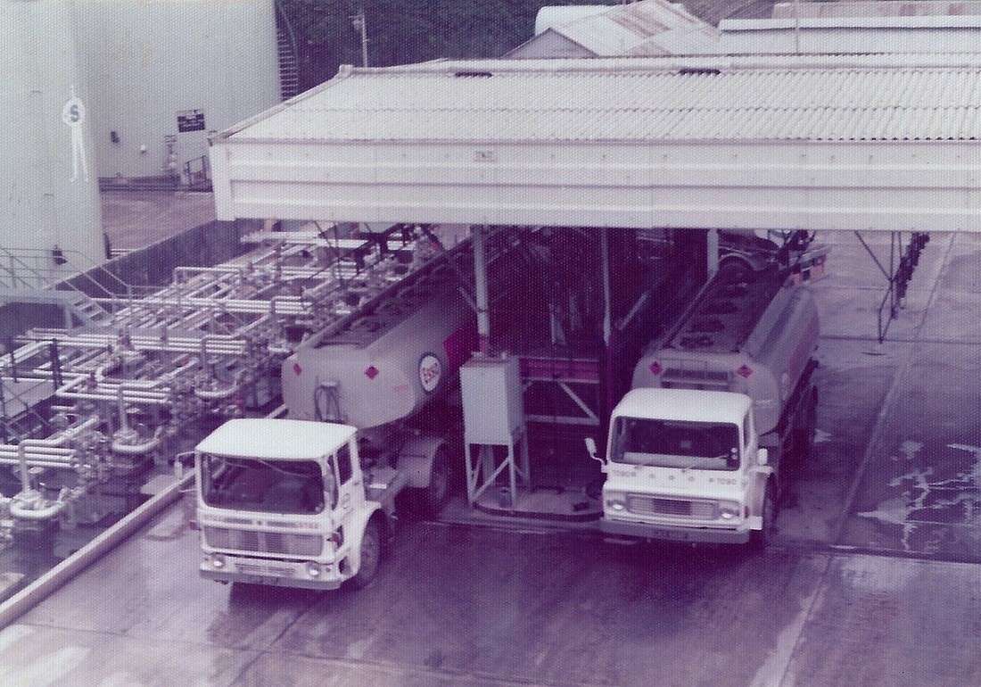
In the years between the World Wars a number of small works were established on North Quay, including a glass works, a small oil depot and an ICI plant for producing bromine –a fuel additive for high octane aviation fuel. The ICI plant used the power stations waste hot water and which also supplied the electricity. The bromine was shipped by rail across the old A30 to the main GWR railway line, thence to England. Can anybody advise what traffic might have been carried in the tanks after the ICI works closed?
Andy Carlson knows, see his article after 'More Hayle Wharves Action'
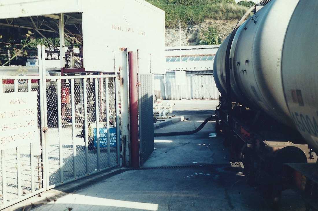
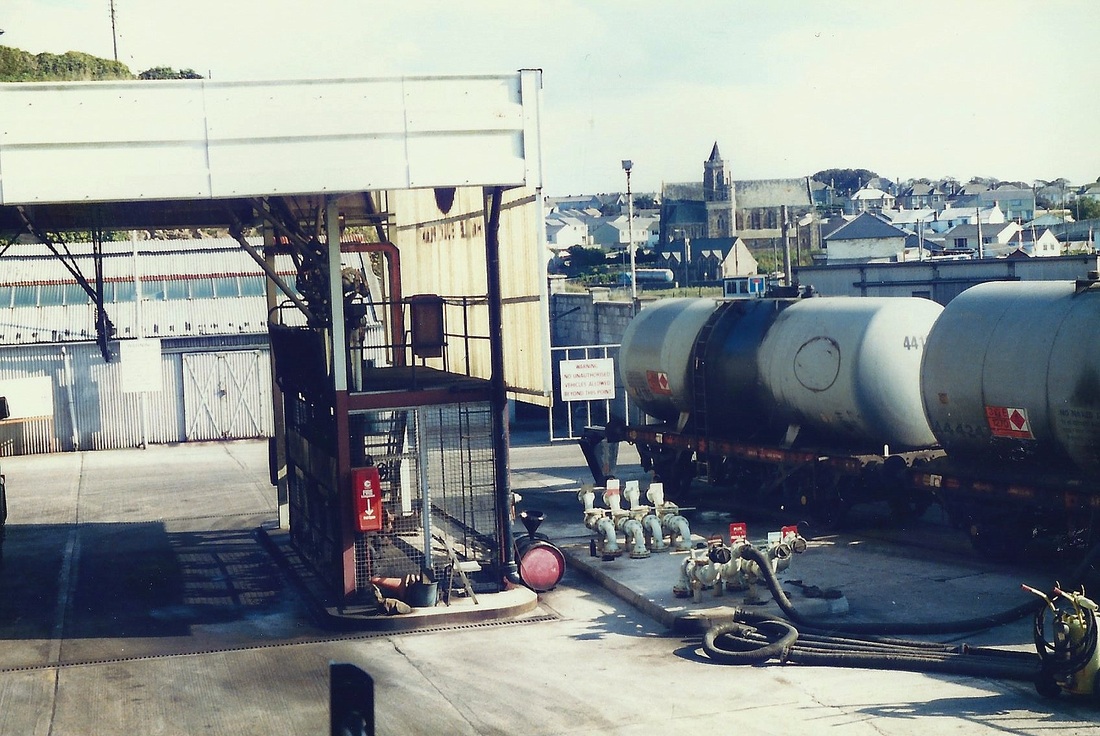
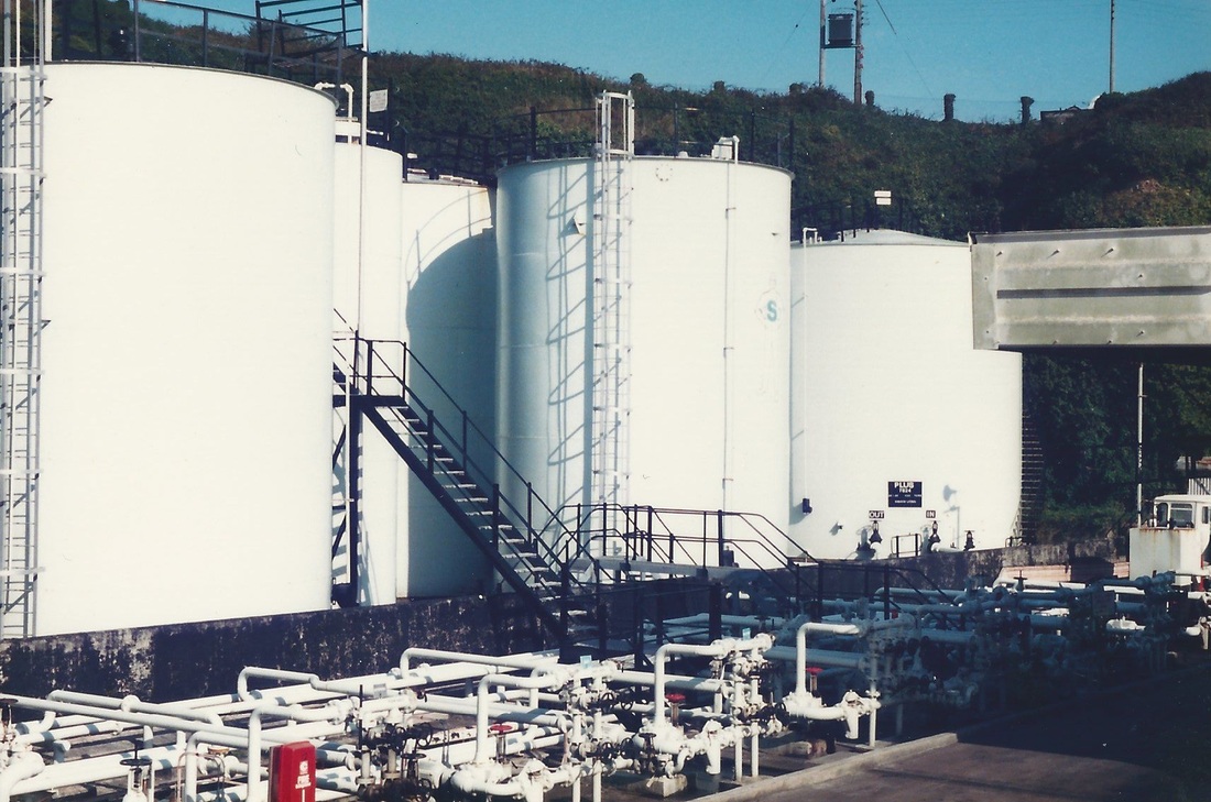
Also see inside the BP Depot with the John Lloyd collection, received April 2014, at bottom of this page.
Additional notes on the history of the Hayle Wharves line kindly provided by Roy Hart
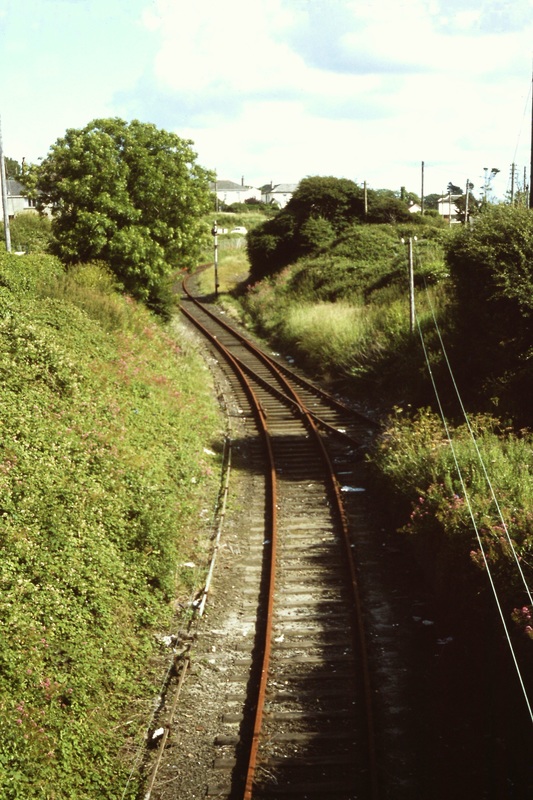
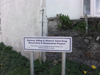
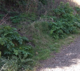
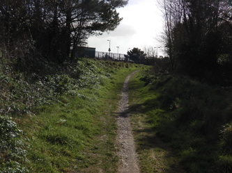
As is well known, the Hayle wharves branch resulted from the construction of the West Cornwall Railway's high level line through Hayle. The descent was steep and a catch point and sand drag (historically, the first, it is thought) had to be provided.
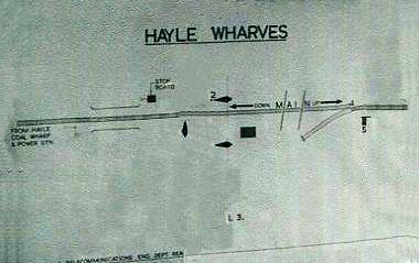
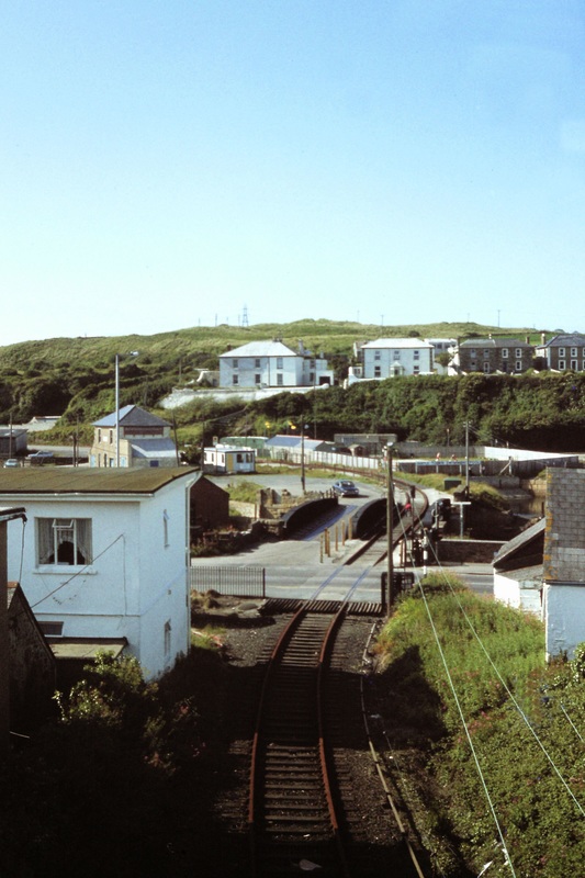
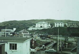
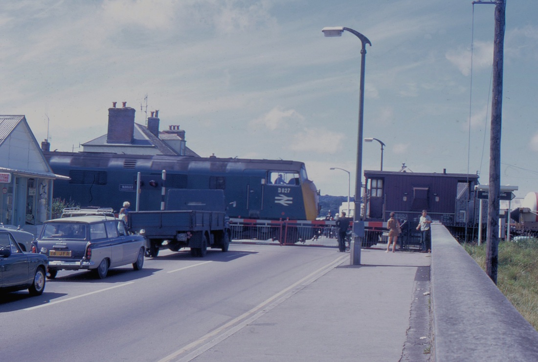
At the foot of the descent was a logistical nightmare: a railway line which split in two (either to wharves or left to Penpol) as it crossed the A30 road, coinciding with a road junction and a swingbridge.
The wharf branch was worked by wooden train staff and descending trains as they reached the crossing, met the junction on the left side for Penpol sidings. These were a fan of three sidings serving Hayle gasworks (the site is Philps' pasty emporium today!). A horse-worked spur led along Penpol Terrace, beneath the viaduct, to the site of Harvey & Co engineers.
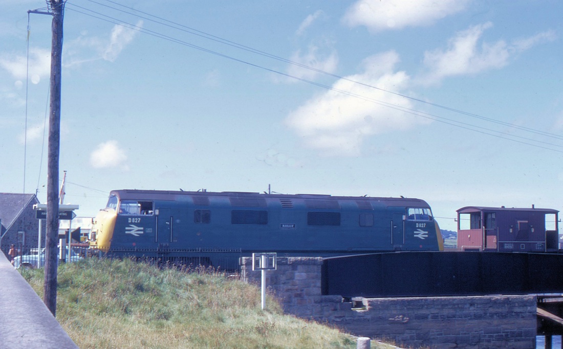
After passing over the level crossing and the swing bridge over Copperhouse Creek, the train passed a ground frame opating a catchpoint and a level crossing gate, protecting the wharf road and railway when the bridge was open.
Ahead lay the extensive wharf sidings. To the right, the old Hayle railway trackbed survives. It was relaid in 1917 to serve the explosive works at Upton Towans. This line closed about 1920, but the track was still there in the 1930s.
The operation of the swingbridge must have been great fun. Here's how it worked:
First, representatives of the gas and water utilities had to be present, to disconnect their pipes on the bridge. Permanent way had to disconnect the rails. A porter at the ground frame. The bridge operator in the pump house (this was a red-brick structure on the seaward side of the bridge. It contained the hydraulic pump which moved the bridge). No doubt various inspectors would be around as well.
First, the signalman would reverse the points leading to Penpol, thus diverting potential runaways to the gasworks (!). Attached to this lever was a key, which could only be withdrawn when the lever was reversed. This was handed to the man at the ground frame, who used it to release his levers to open the catch point and lock the gate across the road. Now the North end of the bridge was protected. At the GF, the reversing of the catch point lever released another key, which was handed to the man in the pump house, who inserted it into the lock to free the bridge mechanism. The bridge was then swung.
Then all of this was done in reverse!
I have found no record of when the bridge last moved. Possibly around the time of world war two.
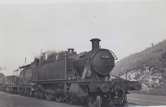
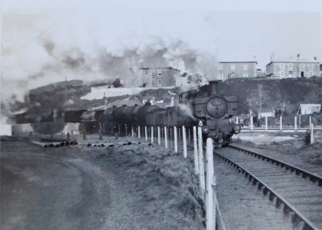
The branch was worked by panniers and prairies from PZ.
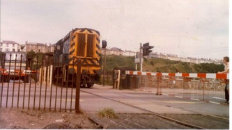
In 1964, the box was replaced by a ground frame and the gates by barriers. Later still, even the barriers went.
KJ wrote to thank Roy Hart for the above detailed paper . Roy replied 'Glad you liked Hayle Wharves: I guess that no-one has explained the bridge arrangement before. I 'acquired' the signal engineer's plans for it, dated 1914, when Par signal depot closed in the late 1960s. One assumes that there is no other record, so it may be unique'.
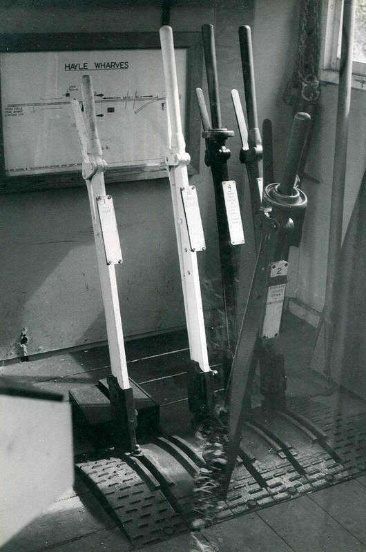
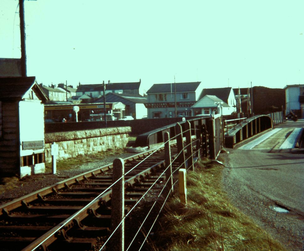
Prior to 1964 there had been a two storey signal box located on the north side of the level crossing between the tracks leading across the swing bridge to the coal wharves and the power station and the line serving the gas station and Penpol siding. This was replaced by this ground Frame. This picture is copyright of the late John Fill
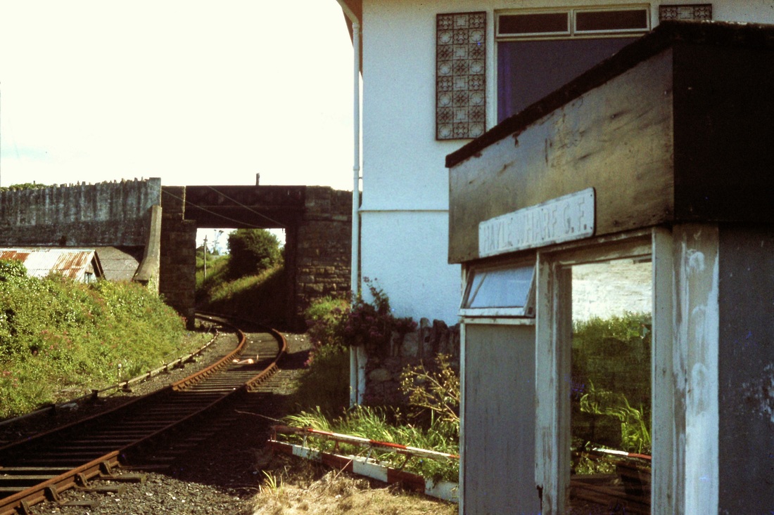
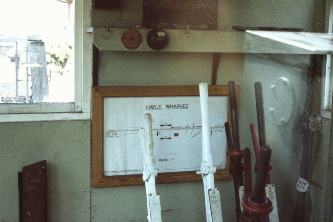
The photos which appear today are of the ground frame which replaced it in 1964. This was not a new frame, but was 'secondhand' from somewhere, for it had the 'stud' type interlocking, which was obsolete before the first world war! Many thanks for this info from Roy Hart.
A further note from Roy Hart in connection with the Hayle Wharf Ground Frame Recd 19th Aug 2017
I do not have the exact wording of the plates at Hayle Wharf GF.
If it's of any help, the levers at the ground frame were:
1. Barrier lock on main road (short handle lever)
2.Barrier lock on swing bridge road (short lever)
3. Points, down main facing to gasworks (carrying lock and annett's key for swingbridge)
4. Down facing points to sand drag
5. Down main home signal
*levers with short handles are conventionally provided where electrical, rather than manual operation is employed, so that the operator doesn't 'pull' them.
The ground frame was installed in May 1964. 5 levers with 'stud'interlocking. By the time of the photos on the website, the barriers had been removed. Penpol (gasworks) siding was removed in 1966, but the lever for the points (3) had to be retained because it was essential for swingbridge working. The barriers were removed about 1980 and the crossing became 'open'. At the time of closure, it worked 2 levers -the sand drag points and the home signal plus, of course, lever 3 which was still required to operate the (long defunct, but legally usable) swing bridge.
Roger Winnens's pictures taken just four days before the branch closed. From Rogers Archives
Roy Hart advises that this is the ground frame which protected the north end of the swingbridge. Centre right is the gate which was closed and bolted when the bridge swung. Out of picture to the left was the catch point protecting the bridge from the wharves direction -normally kept in the closed position, of course. The GF had the annett's key which when the gate was bolted and the catch point opened, released the bridge to swing. Many thanks for the info Roy.
Notes on the operation of the Hayle Wharves Branch compiled by Terry Richards.
We now continue with pictures of Hayle Wharves branch in action.
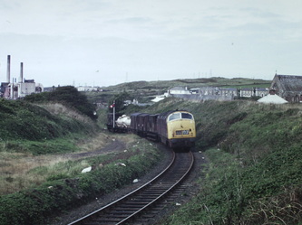
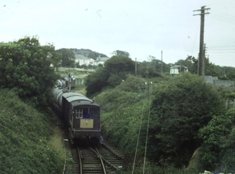
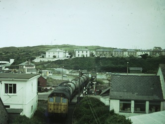
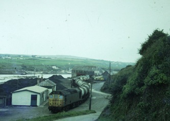
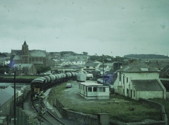
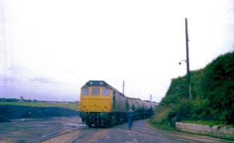
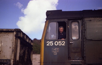
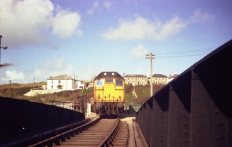
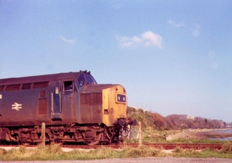
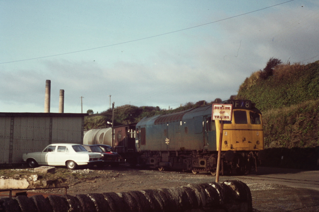
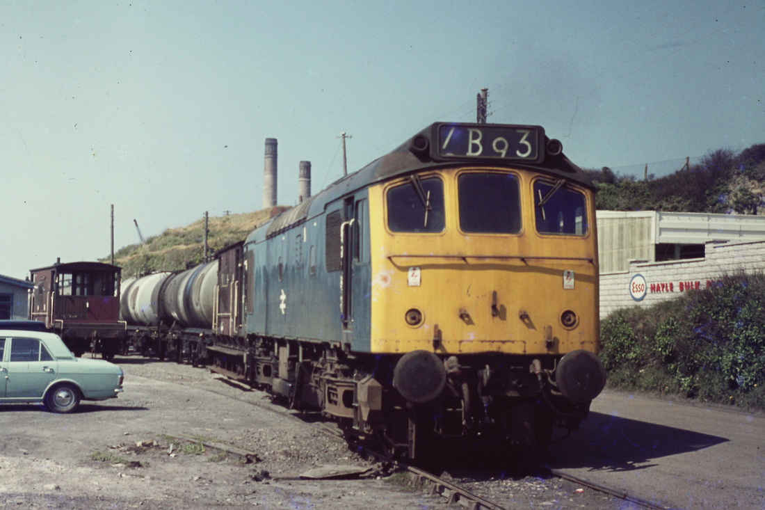
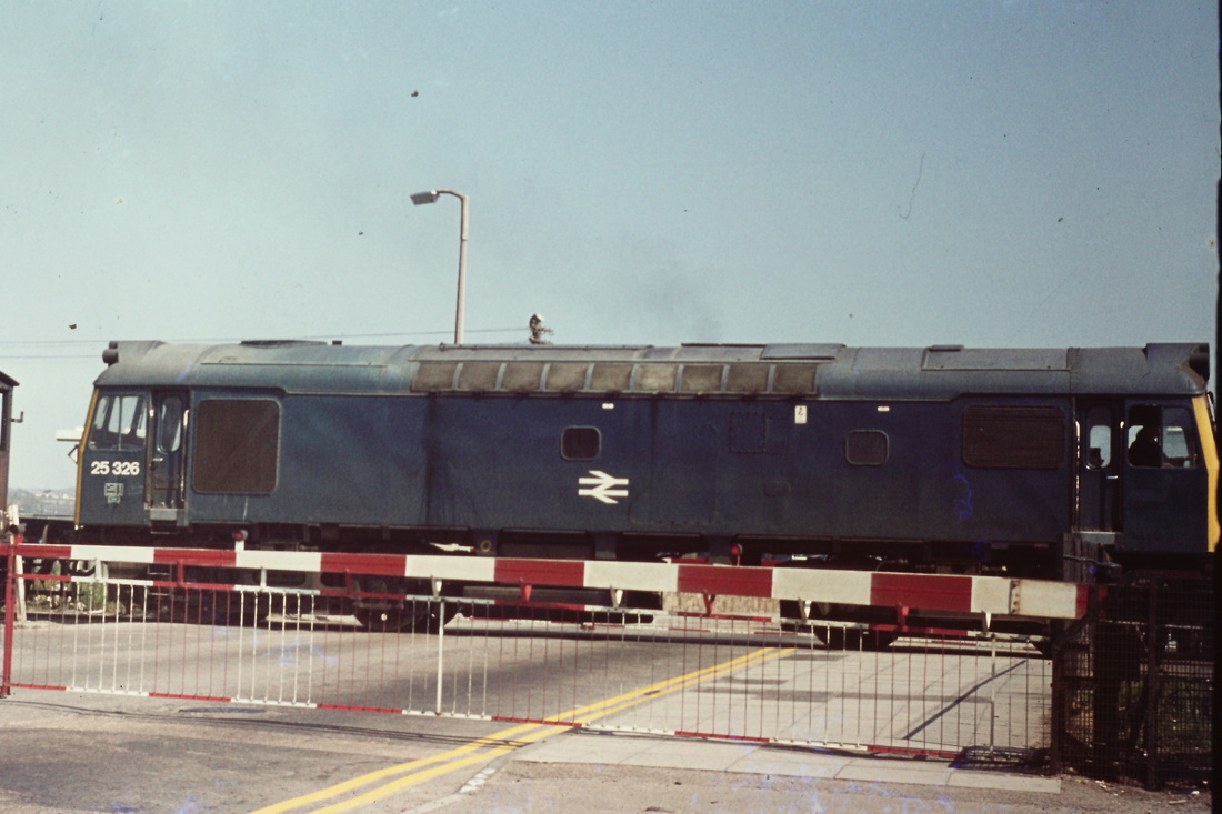
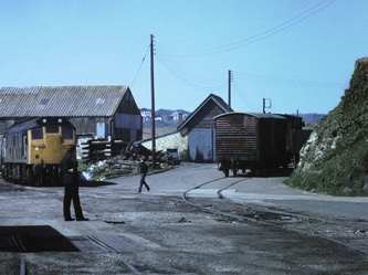
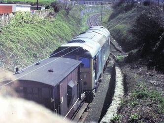
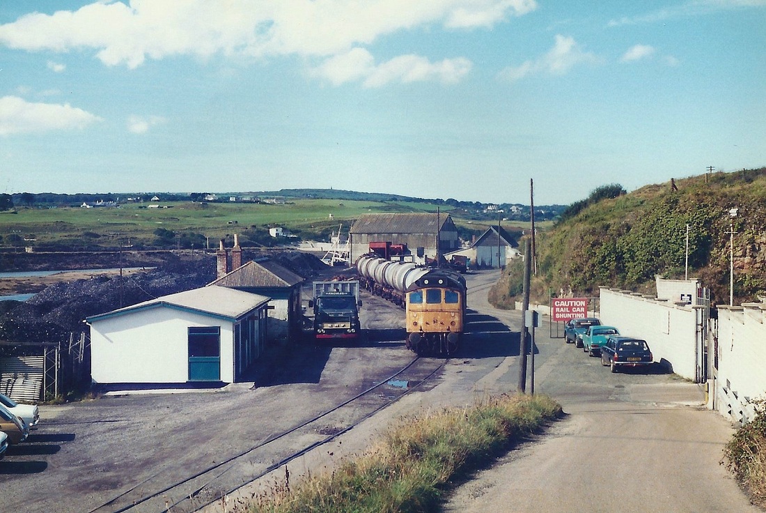
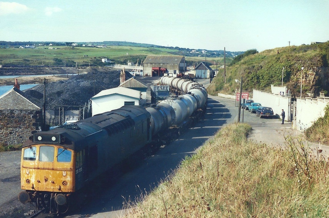
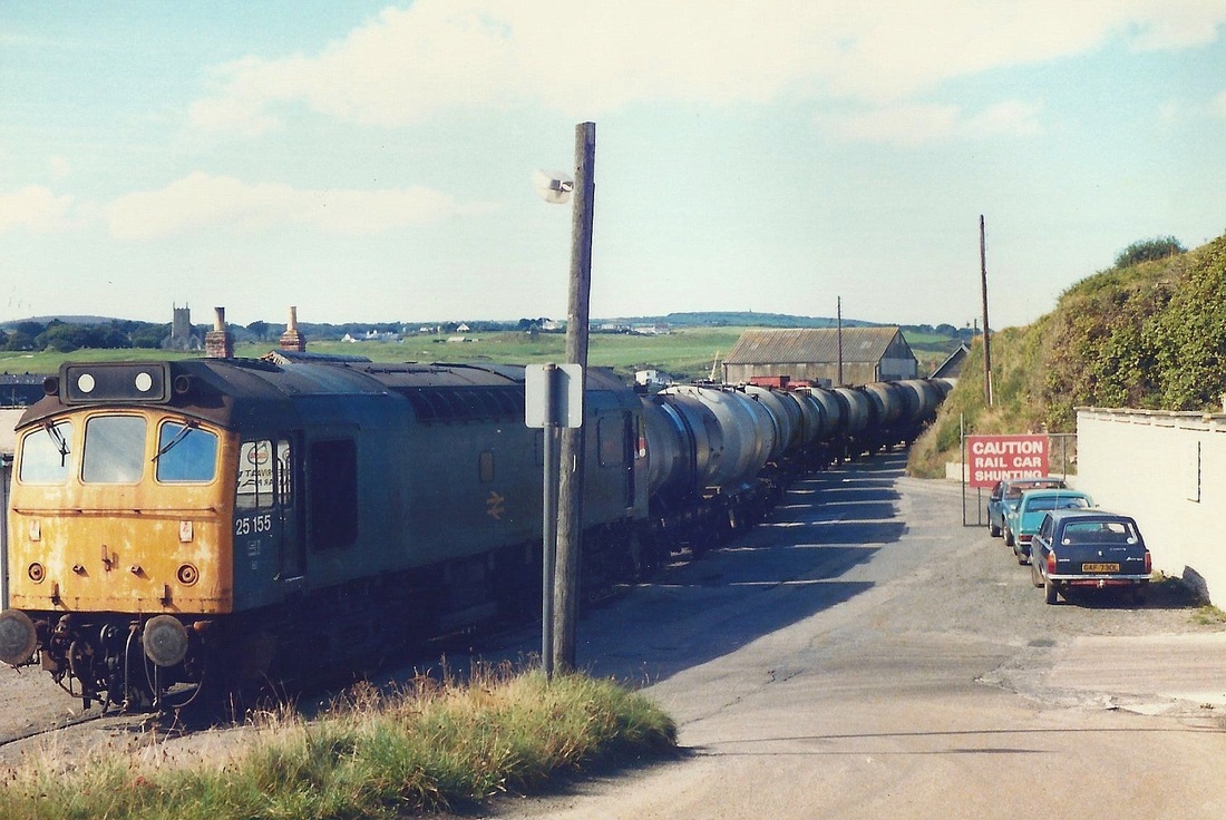
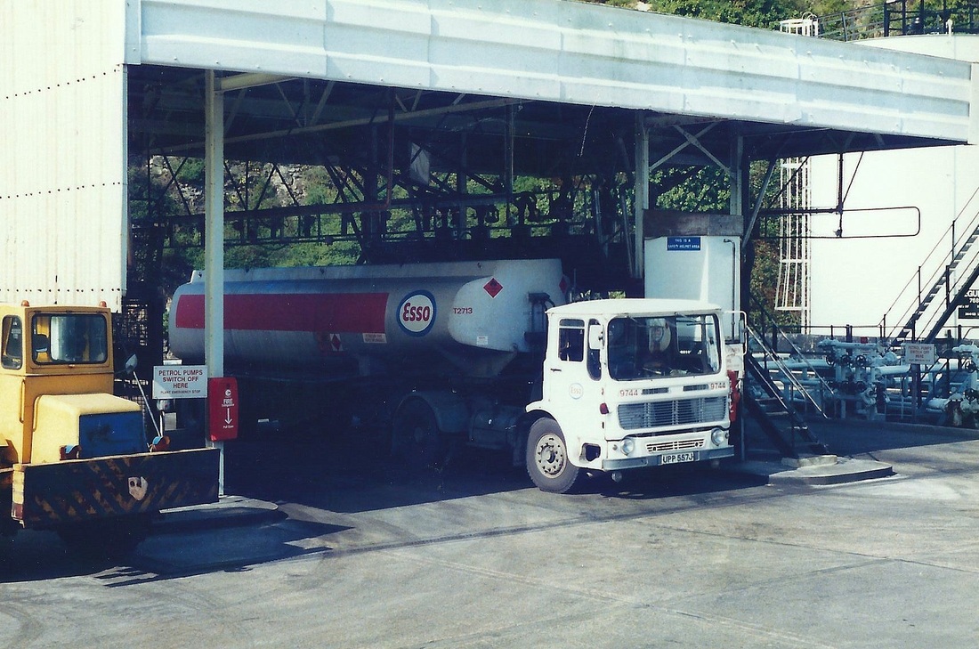
Above in pictures 7 to 11 is a sequence of train operations on the Hayle Wharves branch captured in about 1979. Unfortunately at that time, the lure of three miles of golden sands, was too much to tempt the photographer to follow the train movement further. However we have to be very grateful for what we have got.
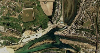
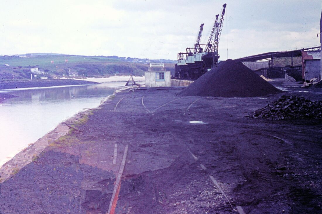
Reference to picture (16) This fine view courtesy Google Earth 2001 shows the complete branch. From left to right. The site of the power station, followed by, in the inset, the former ICI works. The extensive, though at this time, disused sidings do not show in this picture. The course of the line is clearly visible curving around behind the harbour office before crossing the waterway on a swing bridge bridge. From here it climbed the incline to the main line which it joined at the approach to the viaduct. Near the foot of the incline was a bridge carrying a minor roadway, a catchpoint and sand drag being to the right of this. The original Hayle Railway came along the bank of Copperhouse Creek from the top centre of this view curving past the site of the swimming pool to cross slightly downstream of the later swing bridge and then continue alongside the road to the original station which lay in the 'crook' below the viaduct.
As this is being written, in March 2012, the swing bridge is closed to all traffic as a new bridge to give access to the redeveloping North Quay is being constructed. Sadly last year all of the complicated and valuable former trackwork on North Quay was cut up and sent for scrap. By October 2012 a new road bridge providing access to North Quay was brought into use and the old swing bridge became disused.
More from the Roger Winnen Collection
The late John Wood Collection
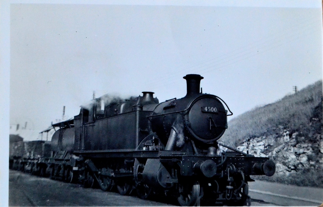
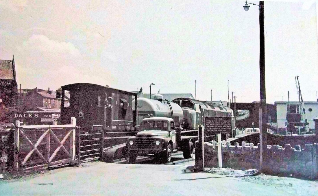
Andy Carlson wrote on 21st October 2013 and kindly passed on the following observations on the above photographs. The first observations is on the picture above and the second picture referred to is the one abve it. Many thanks to Andy Carlson. The tank wagon immediately behind the loco in the photo of 4500 at Hayle seems rather unusual. In particular the full length catwalks are unlike most other tank wagons of the period. The tank also seems rather small for a petroleum tank. A single photo might be dismissed as a random ‘one off’ but the same design seems to crop up in two other photos, both of them at Hayle and both in the early 1950s. To date no further photos of this design have been found although we still hope to find some that might offer more clues as to the payload, owner and possible destination.
The second photo is the one of 9717 also on the CRS site. The photo is fairly indistinct but the penultimate wagon in 9717’s train seems to be of the same design. The last wagon seems to be a chemical tank from the bromine factory – most likely an empty chlorine tank but just possibly an ethylene dibromide tank. The third photo is on the ‘Rail Photoprints’ site (URL below) and unfortunately shows very little further detail because a fence and a brake van are obscuring much of the wagon.
http://railphotoprints.zenfolio.com/p634808190/h3AEBC862#h3aebc862
The wagon uses an anchor mounted design so it was probably built between circa 1945 and the date of the photo. At the moment the two main theories about the tank. The first is that it was a petroleum tank in traffic to the Esso depot that has somehow not been covered in the various books on the subject. The second is that it was in traffic to the bromine plant. We are pretty sure that it was not owned by British Ethyl/Associated Octel but it could still have been working to the bromine factory, possibly carrying sulphuric acid to the plant during the sulphur shortage of the early 1950s. A third possibility is that it may have been in traffic to the power station.
We have asked several well known wagons experts for their thoughts on this vehicle but this has not so far resulted in a definite identification.
Any further information, particularly sightings of this design of wagon in other photos that might offer clues as to where they ran or any lettering on the tank or chassis would be very welcome. One person has a recollection of seeing something similar in an album of steam in the north west (possibly on Shap or the Settle and Carlisle) but we have not so far tracked down this photo.
More Hayle Wharves Action
(Through the camera of Roger Winnen, action took place on different days)
(Through the camera of Roger Winnen, action took place on different days)
A most informative e-mail from Andy Carlson for which many thanks.
Hi Keith,
I enjoyed the pictures of Hayle Wharves on your site. This is an area that has interested me for a long time.
You asked a question about tanker traffic after the bromine plant closed. I may be able to shed some light on this.
According to an (excellent) Article by Arthur Fairhurst in the 1999 Trevithick Society Journal, The bromine plant was closed by Associated Octel in 1973. You refer to it as being the ‘ICI’ works. In fact ICI ceased to have any involvement in the plant in 1948 but the plant continued to be referred to locally as ‘the ICI’.
The bromine plant was built rapidly at the beginning of WW2 to supply bromine and ethylene dibromide for petrol additives, site clearance beginning on 23rd August 1939 and production starting on 24th July 1940.
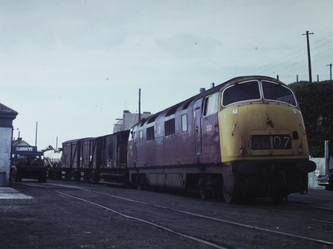
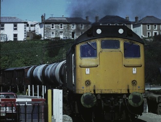
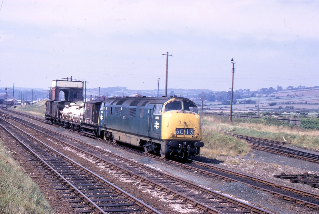
The pictures of D812 show a couple of chlorine rail tanks (the white ones). Chlorine was used by the bromine plant to extract bromine from sea water. Steam era photos also show sulphuric acid tanks – this was another of the raw materials in the process. Early 1970s photos also show RIV chlorine tanks and various flavours of bromine rail tanks, but I don’t see any examples on your site. Ethylene dibromide rail tanks are also a possibility but I can’t pick these out with any certainty in any Hayle photos.
As well as the bromine plant, North Quay was also home to coal merchants, the power station and an Esso oil depot. The oil depot was supplied by sea while the harbour was open but when the harbour closed the oil depot continued to operate. An article in the Cornishman (sorry, I don’t have the exact reference to hand) describes the changeover from sea to rail supply.
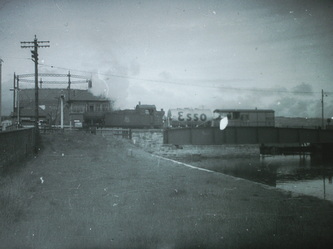
Conveniently, another Roger Winnen photo also shows an Esso tanker lorry leaving the quay area…
http://www.rmweb.co.uk/community/index.php?/topic/43018-demountable-bromine-tanks/page__st__50
The above web site is well worth looking at - excellent pictures, especially one of North Quay showing the enormity of the installations once there. There is detailed information on the tankers used.
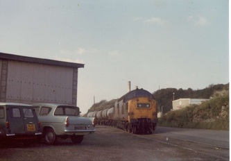
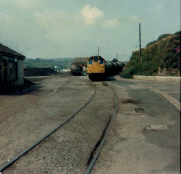
The oil depot was in the confined area to the east of the bromine works that looks like an old quarry and seemed to be in use as a fishermans’ store when I was there a year ago. Later photos (e.g. the one of 25 155 on your site) show a rail connection kicking back from the lines on North Quay to enter the depot. It seems likely based on the Cornishman article that this was put in at around the time of the harbour’s closure.
The picture seems to be more complex that that though, because the photos on your site and in other places show Esso rail tanks (with their logos removed) being shunted into the sidings belonging to the erstwhile bromine plant rather than using the kickback into the oil depot itself. Quite how this arrangement worked is not clear to me. Possibly the oil was unloaded here and piped to the depot or perhaps the tanks were moved again using a tractor.
Regards, Andy Carlson
And, further to this some extra words on the working of the Esso depot post 1977 (Supplied by Andy on 21st October 2013)
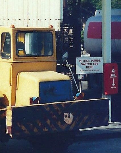
In my earlier words on the Esso depot I was puzzled about how the depot was worked given that all photos show tanks being shunted on the quay or in the former Octel sidings because the loco had no way to get to the opposite end of the train and access the kickback siding into the depot. I have now been shown some words from the 1980 BR Sectional Appendix which mentions a shunting tractor owned by Esso. The appendix says that the BR loco was not allowed to shunt until the train crew had an assurance that the Esso tractor would not move. I think this solves the puzzle of how the wagons reached the depot siding. Any photos of the Esso shunting tractor would be very welcome.
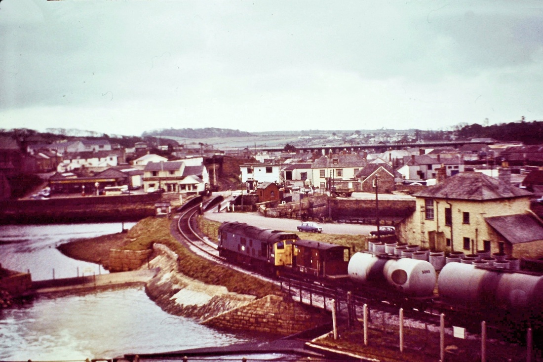
The classic scene at Hayle with 7575. This view has changed out of recognition nowadays (2013). A new road bridge springs out from the foreground and crosses the waterway to gain the far shore more or less to the left of the petrol station. The swing bridge is now completely out of use other than to pedestrians. Copyright Sid Sponheimer
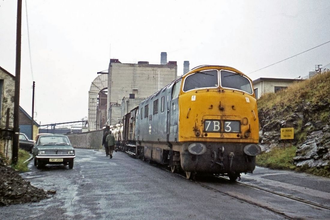
The Modern Image :- D855 Trimph at Hayle Wharves c1970.
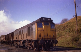
Only a few yards from the site of the ‘Steam Packet’ D855 shunts the siding of Associated Octel Ltd., one of the last sources of traffic at Hayle Wharves. Behind is Hayle power station (1910-73). Photograph the Alan Harris Collection Notes Roy Hart
MORE INFORMATION ON TRACTOR MOVEMENTS AT HAYLE WHARVES
With many thanks to Graham Harris
For a number of years I have been interested in the movements of the ESSO fuel trains at Hayle Wharf and Mike Hitchens photos have proved to be a valuable contribution.
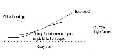
I outlined the possible movements of the ESSO wagons in a post on RMweb and this is repeated below along with a crude drawing of Hayle Wharfs for clarity.
"The Octel workings had ceased and the wagons are bringing in fuel for the Esso distribution point. I would estimate the moves required were as follows:
Propel brake van, barrier wagons and loaded tanks into one of two of the old Octel sidings, drop off brake van and barrier wagons
Move forward and drop off the loaded tanks into the other Octel siding
Move forward over the crossing and reverse back to pick up the empty tank wagons
Move forward and reverse the empty tank wagons to couple to the barrier wagons and brake van
Move forward and reverse the empty tank wagons, barrier wagons and brake van to couple to the full tank wagons
Move forward over the crossing and reverse back to drop off the loaded tank wagons
Move forward and request clearance to cross the A30 and head back up towards Hayle Station"
Further to Andy Carlson's request for a photo of the ESSO tractor at Hayle I have noticed a large yellow object by the shed in the centre of photo 10. Could this be the illusive tractor?
Regards
Graham Harris
From Geoff Salmon
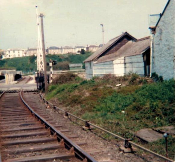
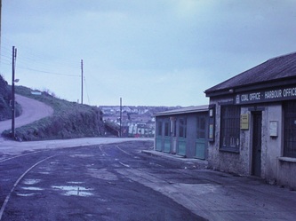
The picture is captioned 'Steam Packet Level Crossing'. There was once a hotel of that name (Formerly 'The Brittania') alongside the railway, the Hayle estuary side of it, about 25 yards beyond the harbour masters office. The point rodding on the right of the picture would have operated the points which would divert any runaway wagons from the station area into the worlds first sand drag. Copyright Geoff Salmon
The John Lloyd Collection
We are greatly indebted to John for allowing his collection to be published on this web site - gems of the past.
We are greatly indebted to John for allowing his collection to be published on this web site - gems of the past.
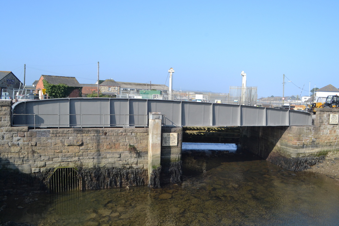
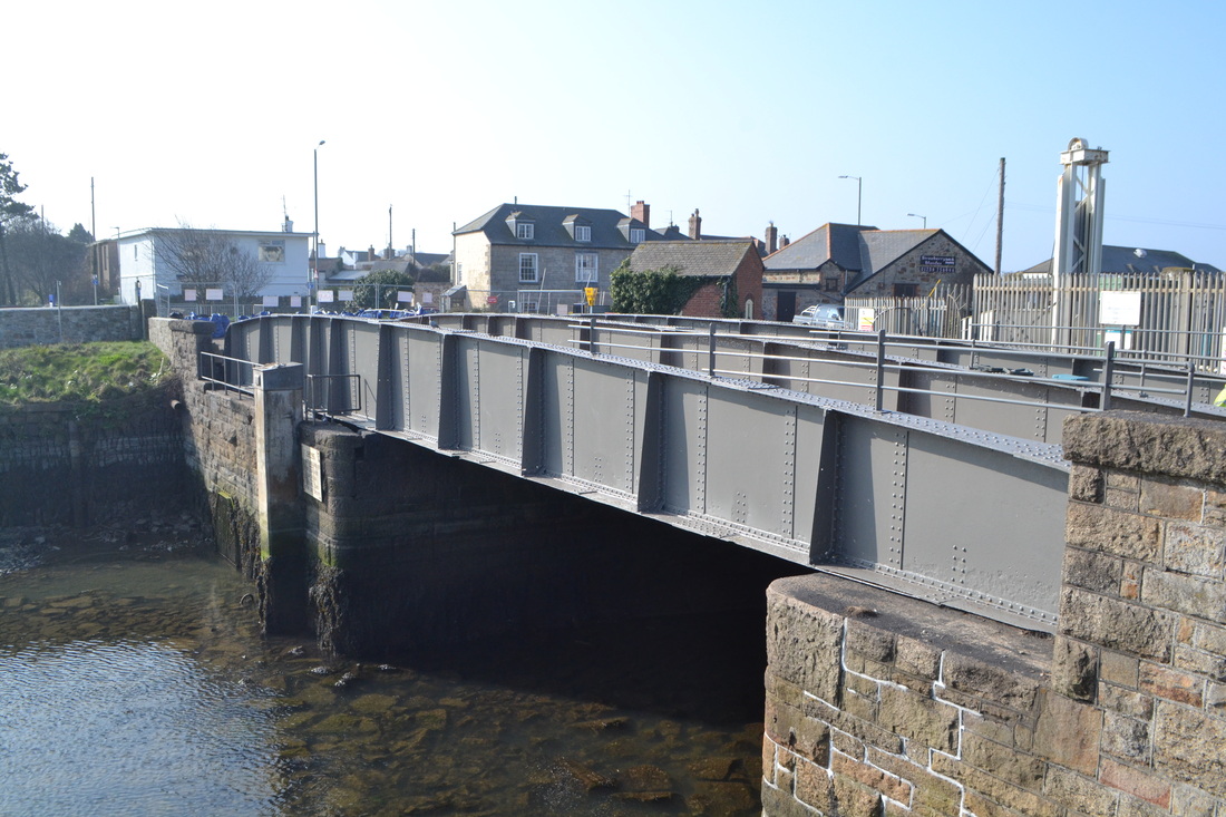
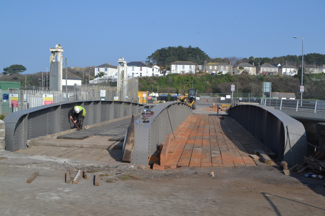
Recent pictures of the Swing Bridge on the former Hayle Wharves branch. Over the winter of 2014/15 the swing bridge at Hayle (No longer operational) has been refurbished. Thankfully it has escaped the attention of the scrap man and this valuable relic remains for all to see.
More recent discoveries
The Hayle Railway from Trenowin to Foundry Square. taking a look along the route
Pictures from the Alan Harris Collection, captions by Roy Hart.
Pictures from the Alan Harris Collection, captions by Roy Hart.
Let's look at it starting at Trenowin where the West Cornwall Railway parted company with the Hayle Railway.
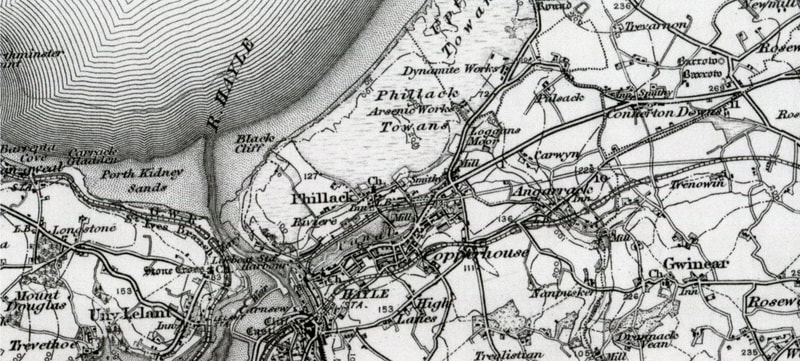
The Hayle Railway Route. The course of the old line can be seen deviating away from the current main line at Trenowin on the right hand side of the map. It then heads west and down the Angarrack Incline to run through Copperhouse and thence down the north side of Copperhouse Creek (King George V walk). From the OS One inch map -
Reproduced with permission of the National Museum of Scotland . Note the mention of Dynamite Works - this refers to the Upton Towans National Explosive Works which are detailed in the narrow gauge Industrial Railways section.
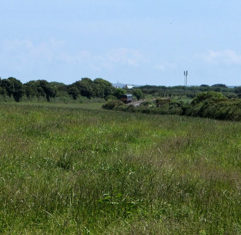
1 Trenowin where the West Cornwall - the main line towards the present Hayle station and Penzance line swings away from the Hayle Railway (left) which is making its way towards the Angarrack incline. A two car 150 en route towards Camborne on the up line. , the former Hayle Railway line comes in from the left.The structure on the distant hill is Carn Brea monument. 24th June 2014 Copyright Roger Winnen
Note : - Hayle is the name generally given to the development alongside the old A30 which at its east end is called Copperhouse.
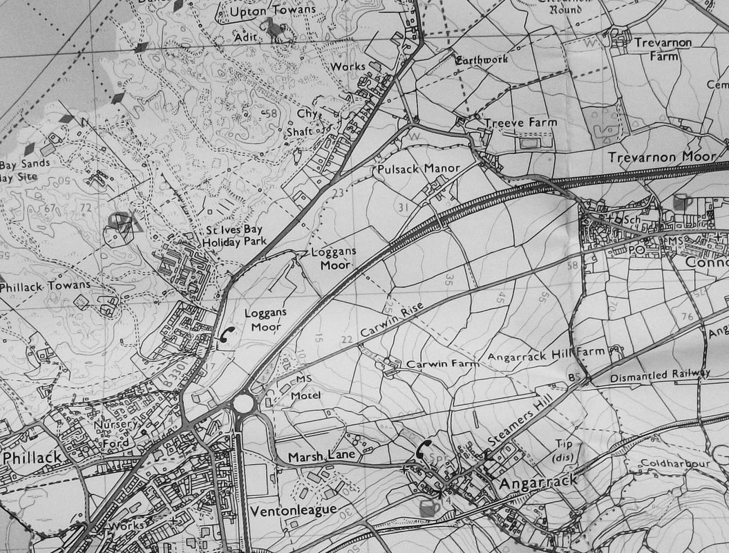
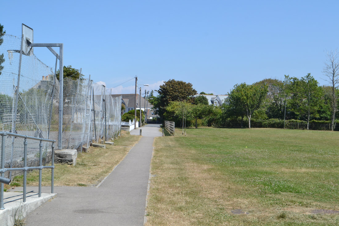
This map courtesy National Library of Scotland shows clearly the alignment of the Hayle Railway as it crosses the road at the top of Steamers Hill and drops down to cross Marsh Lane and pass to the south side of the old Penmere Hotel before crossing the main road and entering a triangle of land now a playing field. After closure of the Hayle Railway in 1852 the line was retained as a long siding from the Hayle end which saw further use forming the west end of the very short lived Explosive Works branch. This branch was formed from an extension of the siding as soon as it crossed the Phillack road - the route turning sharply north. See the section in Industrial Railways and Tramways - The 'National Explosive Works' branch.
In summary then:
Explosives works opened 1888 and developed its own n/g rail system. During WW1 great expansion takes place. GWR (under government control in wartime) built a new branch line to connect explosive works with Hayle wharves, the new line occupying
1. Track bed of former Hayle Railway (1837-1852) along north side of Copperhouse creek.
2. New formation from Loggan's Mill to Upton Towans (the subject of Derek's map).
Line opened 1917.
The product probably left Hayle by sea.
Works closed by 1920. Track remained into 1930s.
Roy Hart
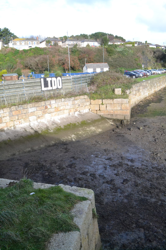
Looking back towards King George V walk the original Hayle Railway must have crossed what was to form a triangular creek by means of a timber bridge crossing here to gain the alignment of the later West Cornwall Railway Hayle Wharves branch. The location of this bridge can clearly be seen in the map below. 16th December 2017. Copyright Roger Winnen.
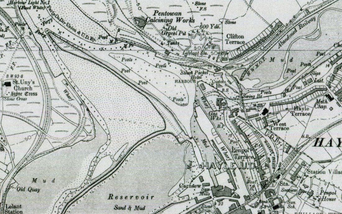
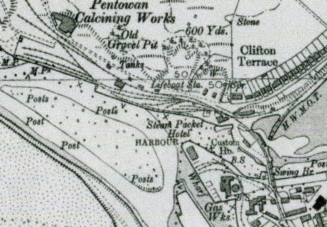
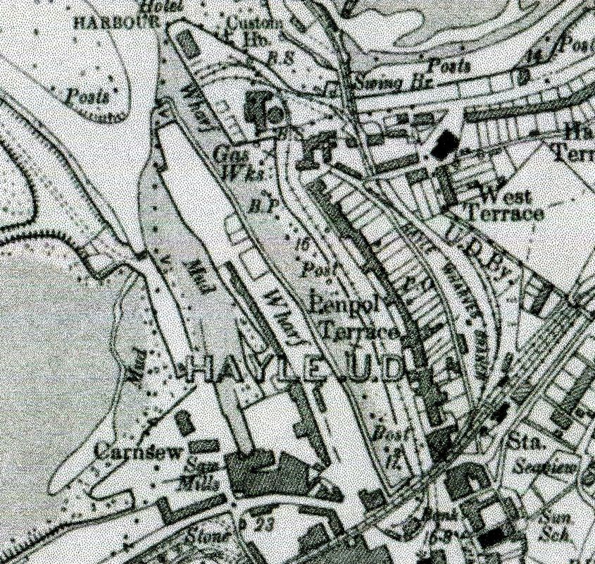
A general map showing much of the railways present at Hayle Harbour - taken from the 1902 6" to the mile map. Reproduced with the permission of the National Library of Scotland. In this map one can see the branch leaving the main line at Hayle station and dropping down the bank to feed both the wharves lines and the tramway to the original Hayle station located on the loop of track under the current Hayle viaduct.Also of interest the 'abandoned railway' shown to the north side of Copperhouse Creek - to the right. This is the route taken from the foot of the Angarrack Incline providing a direct route to the original Hayle station. It can be seen that this route had to cross the waterway before passing along the side of Penpol Creek. A single track continued on into the dunes for about a quarter of a mile north of this map. Also of interest is the long siding leading off the St Ives branch to serve the wharf on the west bank of the Hayle river.
Getting direct to the Penpol Terrace line and hence Foundry Square. Although the original Hayle Railway could have made a satisfactory curve to get to the current, but fixed, swing bridge the exit towards Penpol Terrace would have resulted in an impossible more than ninety degree bend. This led a bit of 'on site' research. If the Hayle Railway had made an ideal crossing of the waterway to the west of the current swing bridge it would have needed an exceptionally long bridge which would have had to have been capable of being swung or lifted to allow shipping up the Copperhouse Canal to the Cornish Copper Companies wharves at Copperhouse.
An enlargement from the above map showing in more detail the track arrangement in the days when the line to the old station were connected to the West Cornwall Railway main line at Hayle (New station). Wagons were taken down the incline by steam locomotives and shunted on to the wharf sidings - top centre left. From here traffic for the old Hayle station was taken along the tramway alongside Penpol Terrace by horse traction. It is unclear quite how the original Hayle Railway crossed the waterway though there are signs of a footing for a bridge on the logical route for the Hayle Railway having come down along 'King George V' walk to have made a crossing independently of the current swing bridge. The 1871 OS First Edition map shows a considerable number of sidings on the wharf on the west side of Penpol Creek - these would have been served by a continuation of the line past the old Hayle station making a second pass under the main line viaduct. Also on this map can be seen a siding serving the goods shed on the down side of the main line station and also a loop which passed behind the up platform, noticeable also are two sidings stemming off the Hayle Wharves branch at main level before it started its descent towards the wharves. Near the foot of the incline a catch point placed to prevent any runaways careering across the main high way - the A30 at that time.
The Hayle Railway made a direct connection with the then running line which, coming from the foot of the Angarrack incline and along what is now King George V walk before bearing south behind the Customs House, must have crossed the access to Copperhouse Pool by means of another bridge which itself must have been capable of being moved out of the way of any shipping requiring access to the canal which led up the South side of Copperhouse Creek and served the Cornish Copper Company. What form did this bridge take? It has been referred to as a 'drawbridge' - perhaps rather like the structures used to cross the moat of a castle.
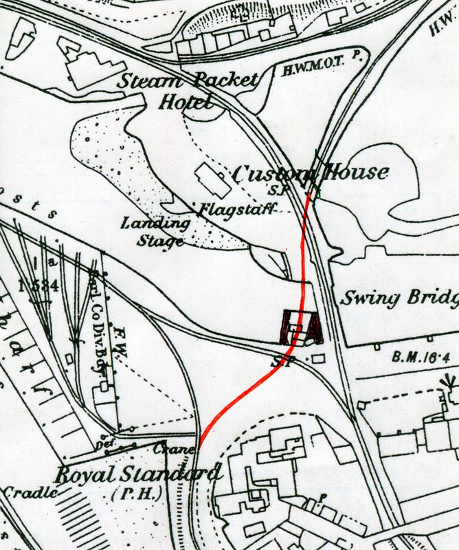
. On this map dated 1876 although the new swing bridge is in existence a likely landing place for a bridge can be seen on the south side direct from the Hayle Railway can be seen. . We have no details of this bridge though is suggested that it was a drawbridge (Which could be like that across a Castle moat). Whether it pivoted from the north or south side is anybodies guess. However on the southside a substantial projection of granite block construction hedged by walls protrudes from that side. Perhaps the drawbridge was hinged from that side and supported by a timber headgear. Nowadays and indeed in a later edition of the OS maps such a route would have been impossible being blocked by various substantial structures which at one time included Hayle Gas Works. However at the time of construction of the Hayle Railway this route - shown tentatively in red would have been possible making an 'end on' connection with the metals towards Foundry Square.
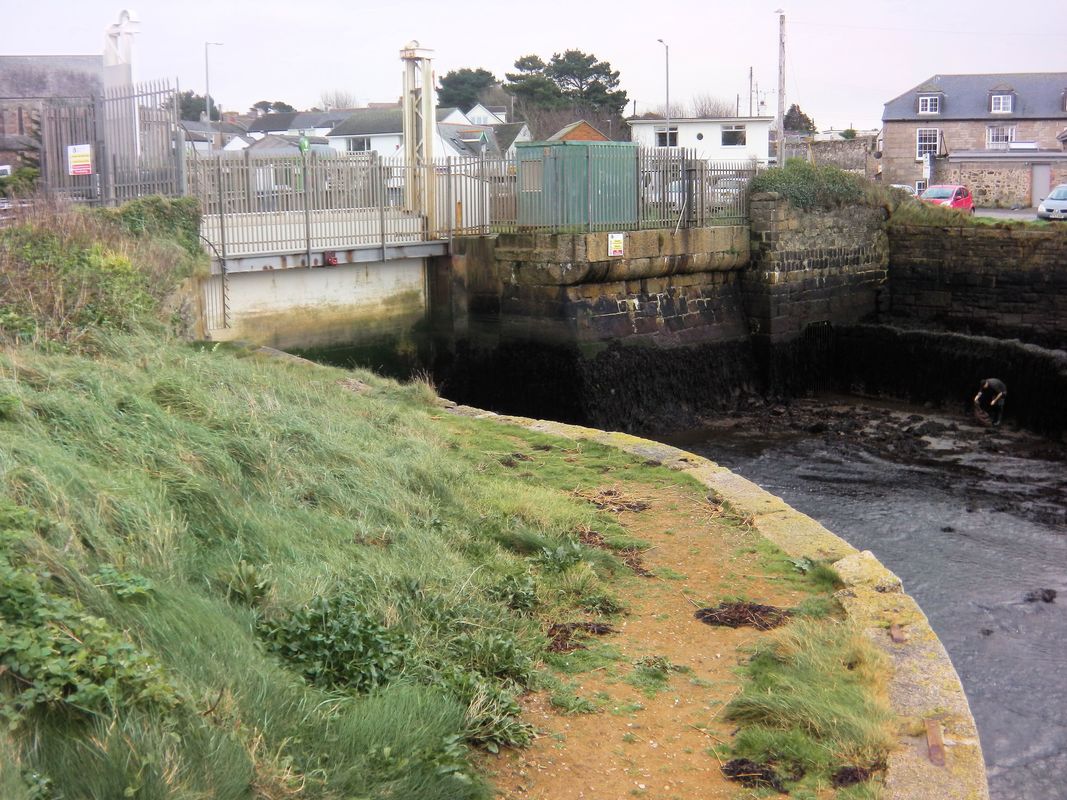
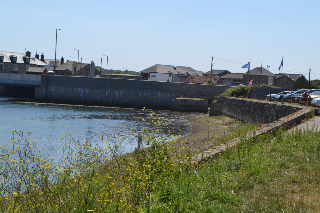
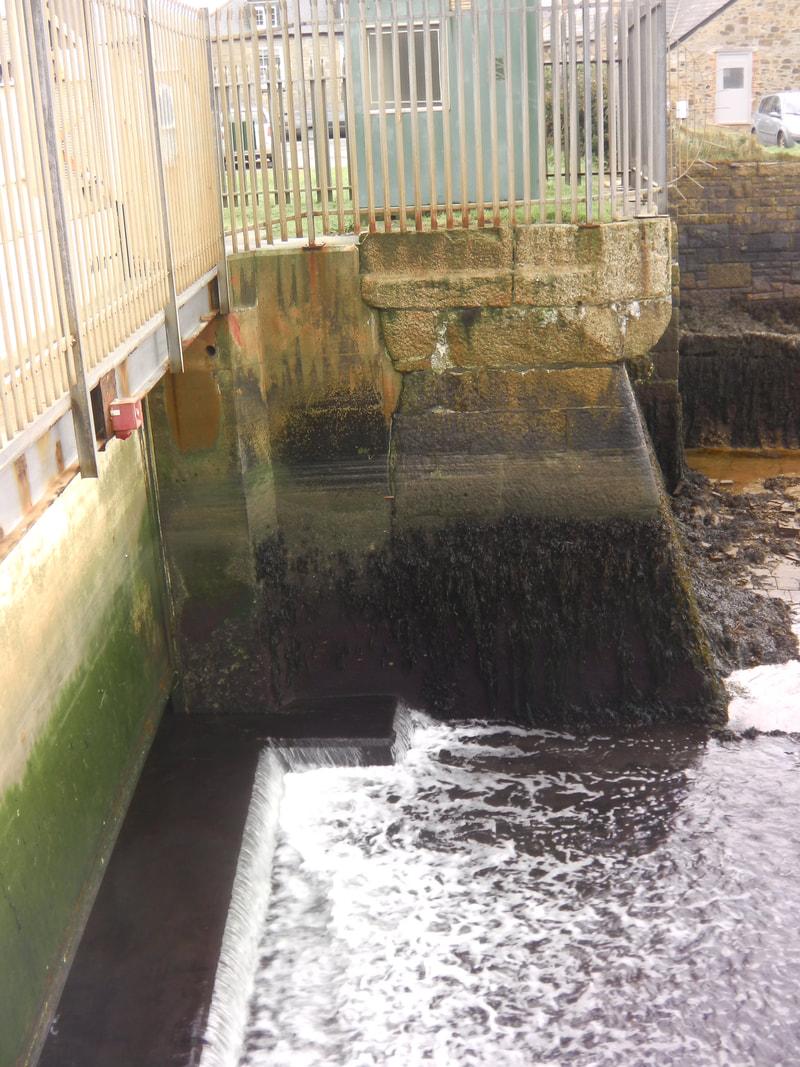
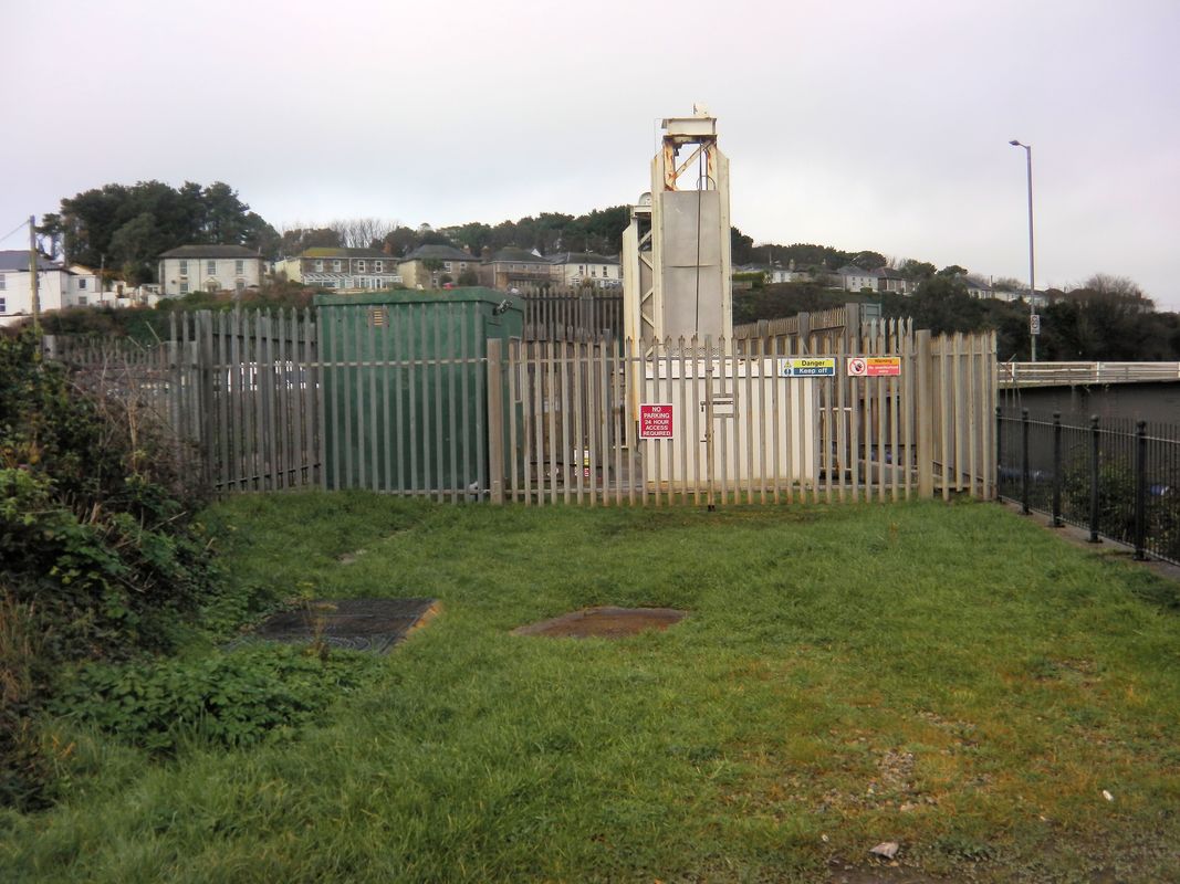
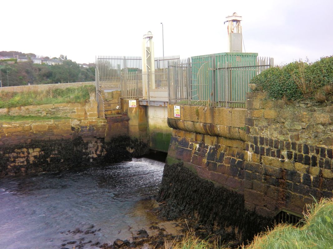
Looking across the Copperhouse Creek waterway at low tide from the north side. One can see the sluice gate which can be raised to 'flush out' the waterway down to the Hayle river and thence out to sea. When the sluice gate is opened the flow of water from the full creek into the waterway is very considerable, the torrent carrying away the mad and sand out to sea. A gentleman can be seen searching for crabs amongst the seaweed. Behind him there is a substantial deflecting wall to prevent the torrent from undermining the wharf beyond. It is supposed that the drawbridge for the direct route pivoted from the far side and dropped down more or less along the line of the sluice gate. December 2017 Copyright Keith Jenkin
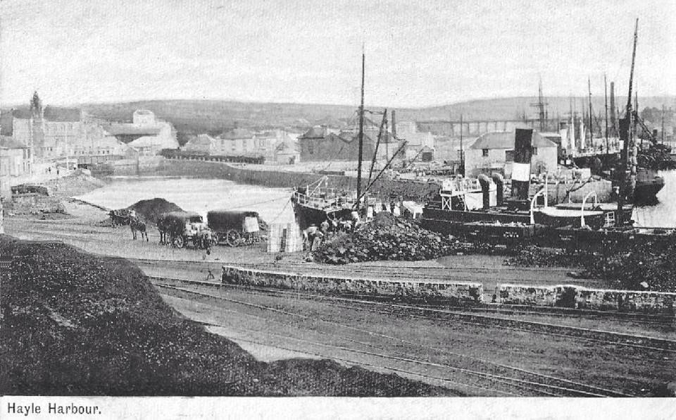
Postcard courtesy the Alan Harris Collection. A really old and interesting view showing in the foreground North Quay and the waterway leading up to Copperhouse Creek passing though the narrow confines where a sluice gate still controls the tidal flow into Copperhouse Creek. This narrow waterway was crossed by two bridges, the first carrying the Hayle Railway direct alongside Penpol Creek to the terminus (first Hayle station) situated at the head of the creek just beyond the viaduct. The second bridge - a swing bridge provided a connection to the West Cornwall main line at the second Hayle station. One can see quite a collection of rail wagons standing on Penpol sidings towards the top left of this picture.
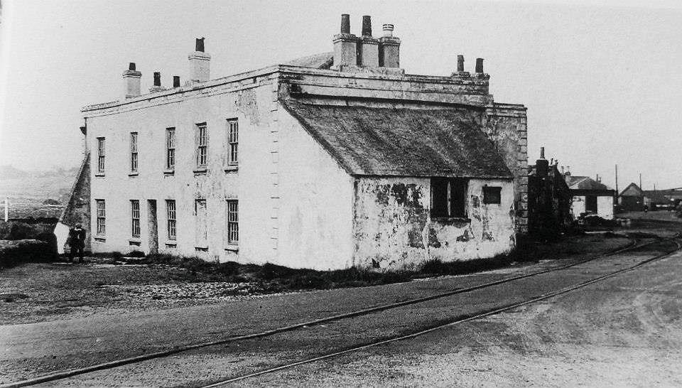
5. THE STEAM PACKET HOTEL, HAYLE.
This grand building stood adjacent to the slipway at North Quay (today,opposite the junction of King George V Memorial Walk). It was built in 1811. In the foreground is the wharf branch (‘Steam Packet Crossing’). The spot was known as ‘Bristolman’s Dock’.
Originally called ‘Burt’s House’ and then ‘The Britannia’, it was the’Steam Packet’ by 1840.
The passenger shipping service between Hayle and Bristol was at its peak between 1831 and 1860, operated by the Hayle and Bristol Steam Packet Company with paddlesteamers. Sailings departed from Hayle twice a week for Ilfracombe, Bristol and Liverpool. Railways took their toll, but the service staggered on until 1917.
The hotel was demolished in 1967.
Caption by Roy Hart. Photograph from Alan Harris Collection.
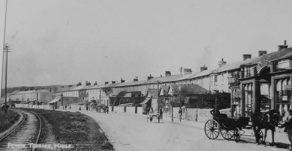
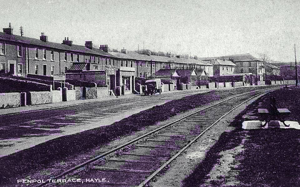
4. PENPOL TERRACE, HAYLE. Looking north from the foot of the viaduct.
A grand Victorian view of Penpol Terrace. A barouche awaits its owner (no doubt shopping at Bouchard’s emporium).
On the left is the track leading from the gasworks to Foundry square and Harvey’s foundry. This siding, accessed by a back-shunt in the gasworks siding) was worked by horses. Traffic was still running sporadically at the end of the 1950s. It was lifted around 1960. Almost all of the buildings visible here are recognisable today.
Caption by Roy Hart. Photograph from the Alan Harris Collection.
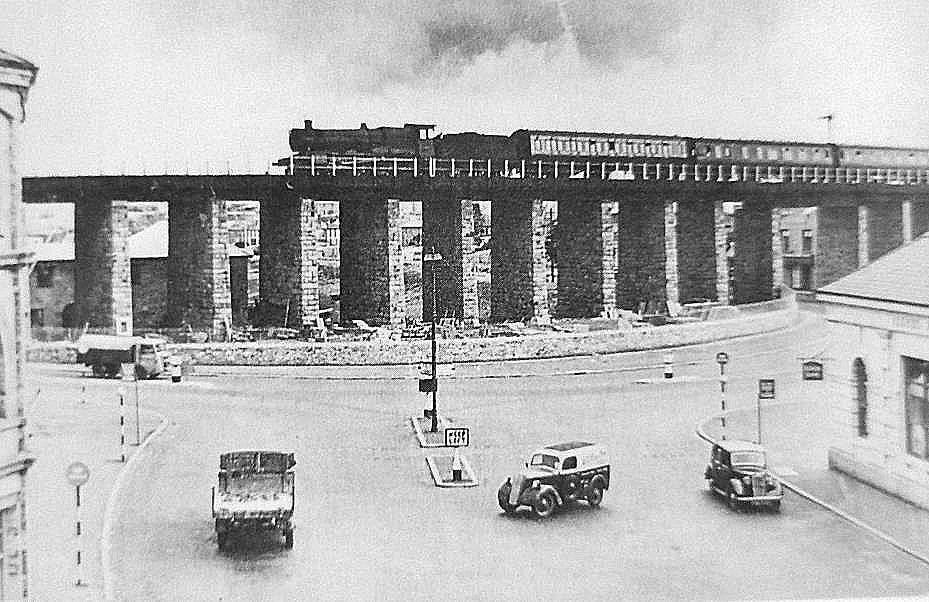
3. FOUNDRY SQUARE, HAYLE, EARLY 1950s
Rush-hour at Foundry square. A ‘Grange’ crosses the viaduct in the mid-1950s. Beneath the viaduct, Penpol siding, last remnant of the Hayle Railway, curls around to terminate on the quay (today’s Asda).
Caption by Roy Hart. Photograph from Alan Harris Collection.
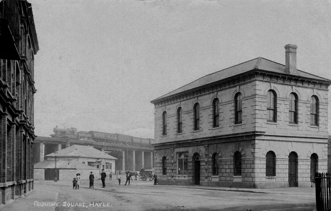 2. AN EDWARDIAN VIEW OF FOUNDRY SQUARE, HAYLE.
An Atbara class 4-4-0 crosses Hayle viaduct in about 1907. Centre left immediately below the engine are the remains of the Hayle Railway terminus of 1838. The tracks terminated on the far side of the building, with a spur continuing leftwards on the photograph to Harvey’s foundry. The foundry had already closed (1903) by the time of this photograph, The lower building of the two disappeared soon after the time of this picture, but the main building survived until 1949.
The substantial building on the right is the Devon and Cornwall Bank (later Lloyd’s). It still stands today, though only the ground floor remains. Caption by Roy Hart. Photograph from Alan Harris Collection.
According to R.A. Cooke's Track diagrams these metals which also included a spur into Harveys Foundry were removed pre 1904.
