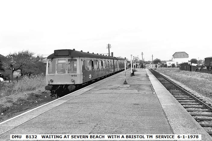
Bristol Temple Meads to Severn Beach
Three ways
Three ways
There were, at one time, three ways to get to Severn Beach by train from Bristol Temple Meads.
(1) The route taken today via Narroways Hill Junction, and Avonmouth.
(2) Prior to 23rd November 1964 one could travel via North Filton Platform, Henbury and Chittening platform to St Andrews Road or Avonmouth Dock and change, or
(3) Travel to Pilning High Level and change to Pilning Low Level for a service via Cross Hands Halt and New Passage Halt.
All three routes involved passing through Lawrence Hill and Stapleton Road even though some journeys involved changing at Lawrence Hill.
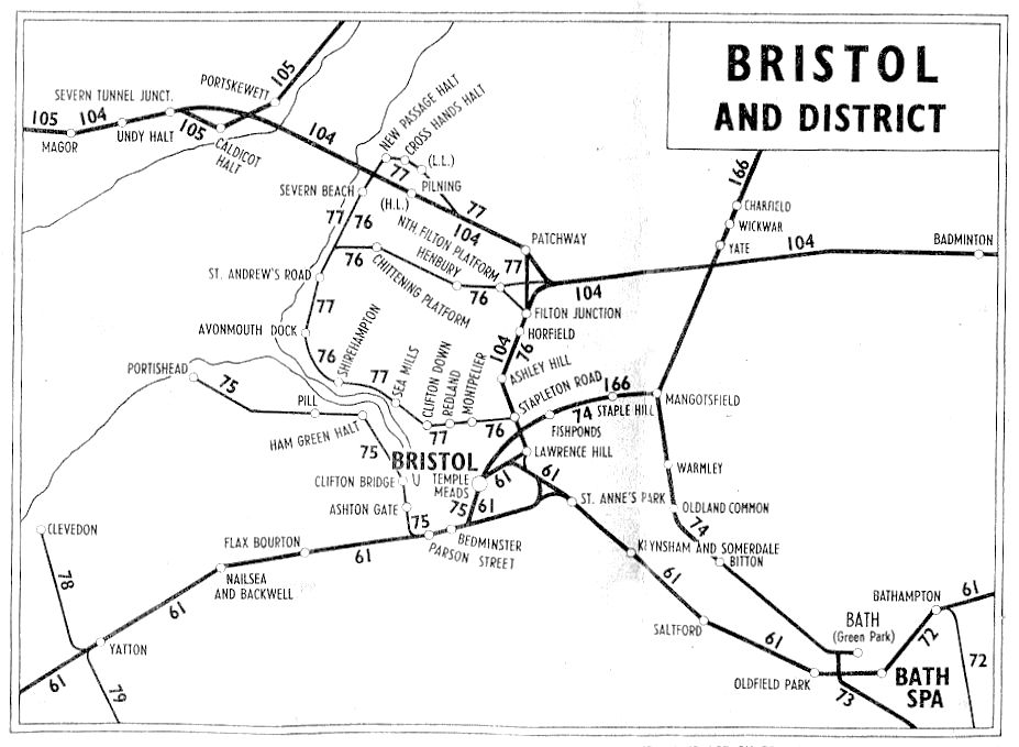
The map above is copied from the British Railways Passenger Services Timetable for the period June 18th to September 23rd 1951.

The superb map below has been taken from the Adlestrop Railway Atlas by Richard Fairhurst (Permission to use this map has been sought and it will not appear in the version available to the general public unless this permission is granted) , which very clearly illustrates the railways in the area covered.
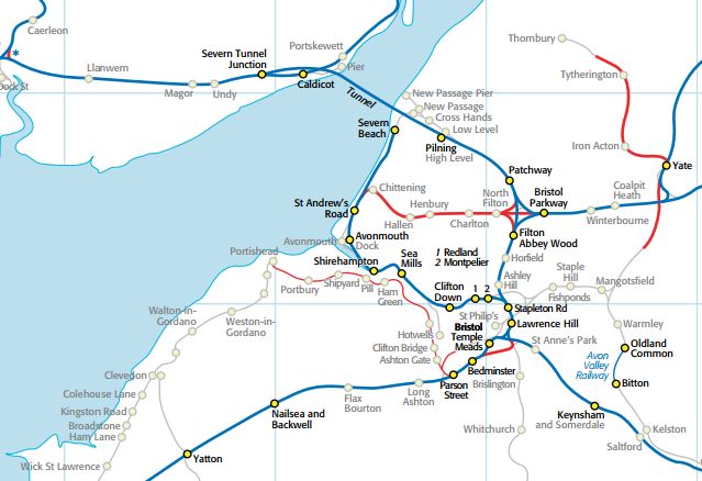
The three routes to Severn Beach from Bristol Temple Meads are clearly shown in this map from 'The New Adlestrop Railway Atlas' by Richard Fairhurst - his copyright. Permission has been sought to use this image. Starting at the top left and working clockwise the lines leaving the map are to Cardiff, Gloucester, Reading and Taunton.
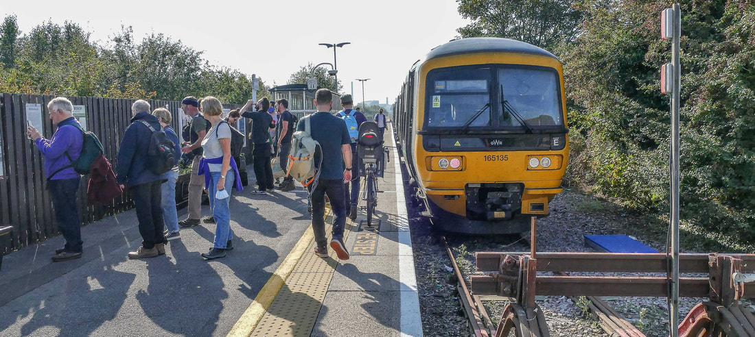
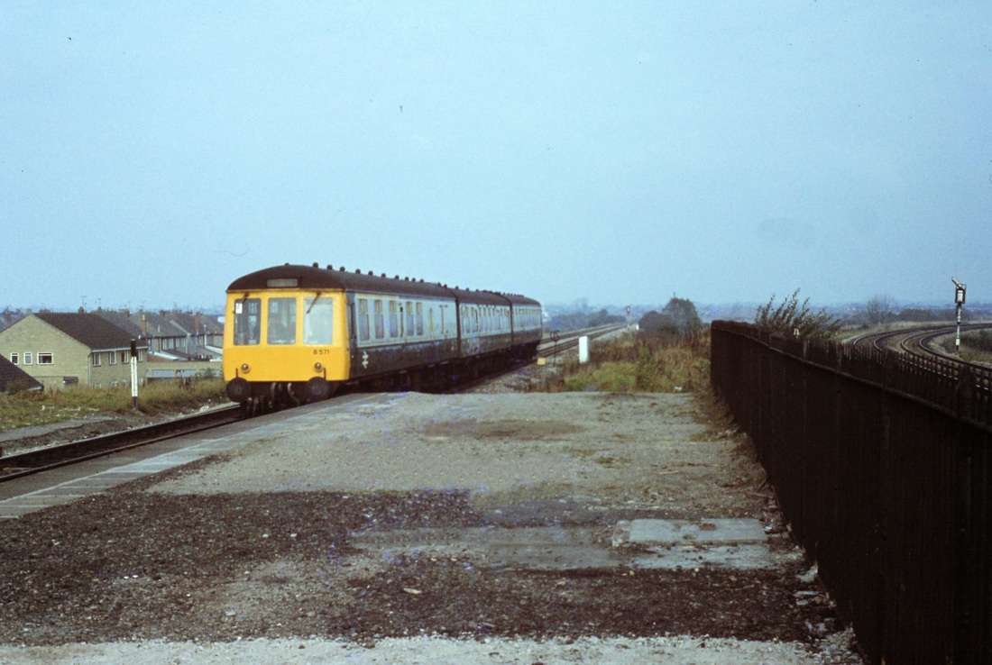
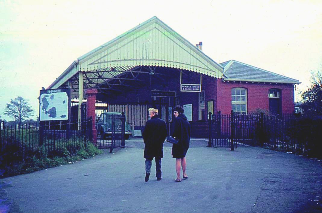
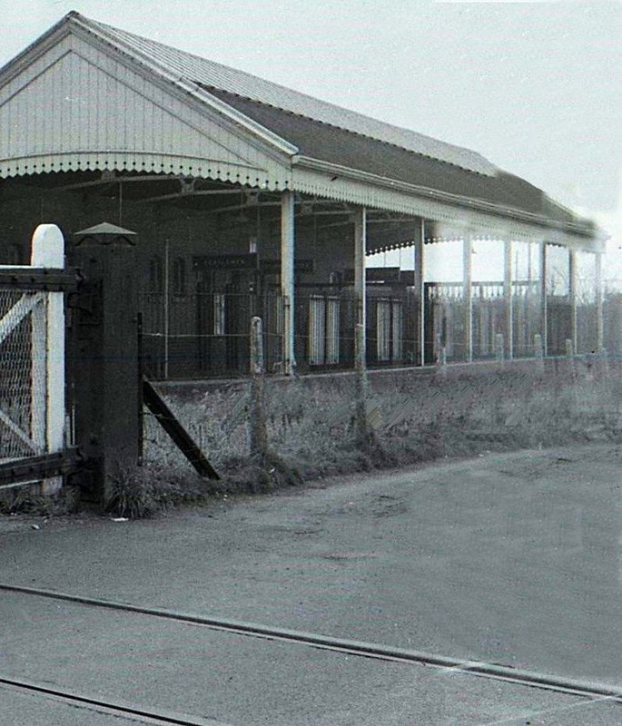
At Temple Meads - Severn Beach trains.
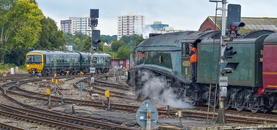
What a fine photograph. LNER/BR A4 4-6-2 No 60009 "Union of South Africa" waits for our ride to Severn Beach to clear the eastbound lines at Bristol Temple Meads Station after completion of the 1919 "Torbay Express" season the previous day. We were reminded of the final scene in "The Titfield Thunderbolt". 9th September 2019. Copyright Brian Pibworth.
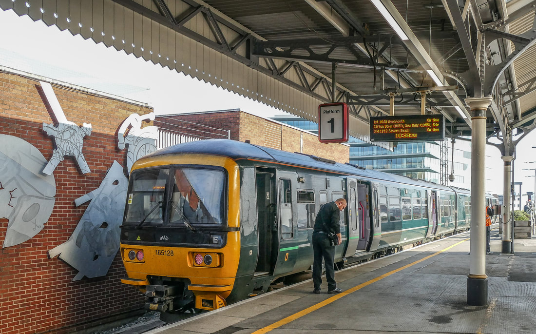
The guard checks his ticket machine as 65128 waits at platform 1 to form the 11.12 to Severn Beach at Bristol Temple Meads 9th September 2019. Copyight Brian Pibworth
====================================================================
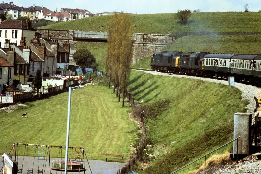
Overlooking the railway as the lines from Bristol East Junction approach Doctor Day's Junction. Seen on 27th October 1984 Copyright Roger Winnen.
A unit from Severn Beach approaches Doctor Day's Bridge en route to Bristol Temple Meads on the 27th October 1984. Copyright Roger Winnen
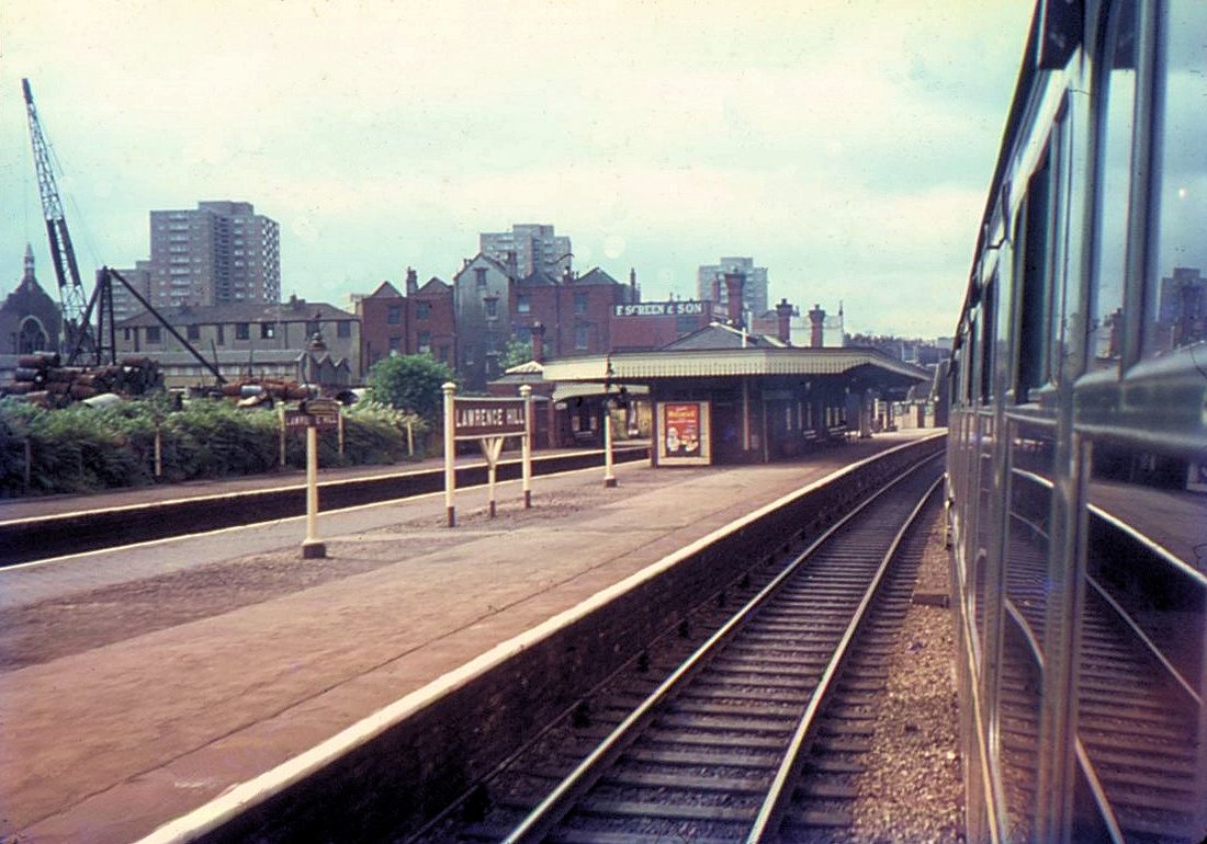
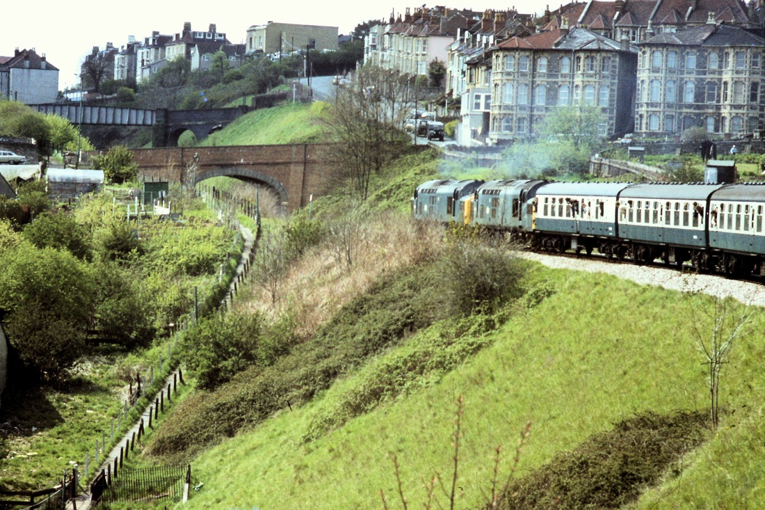
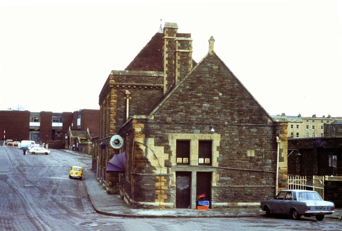
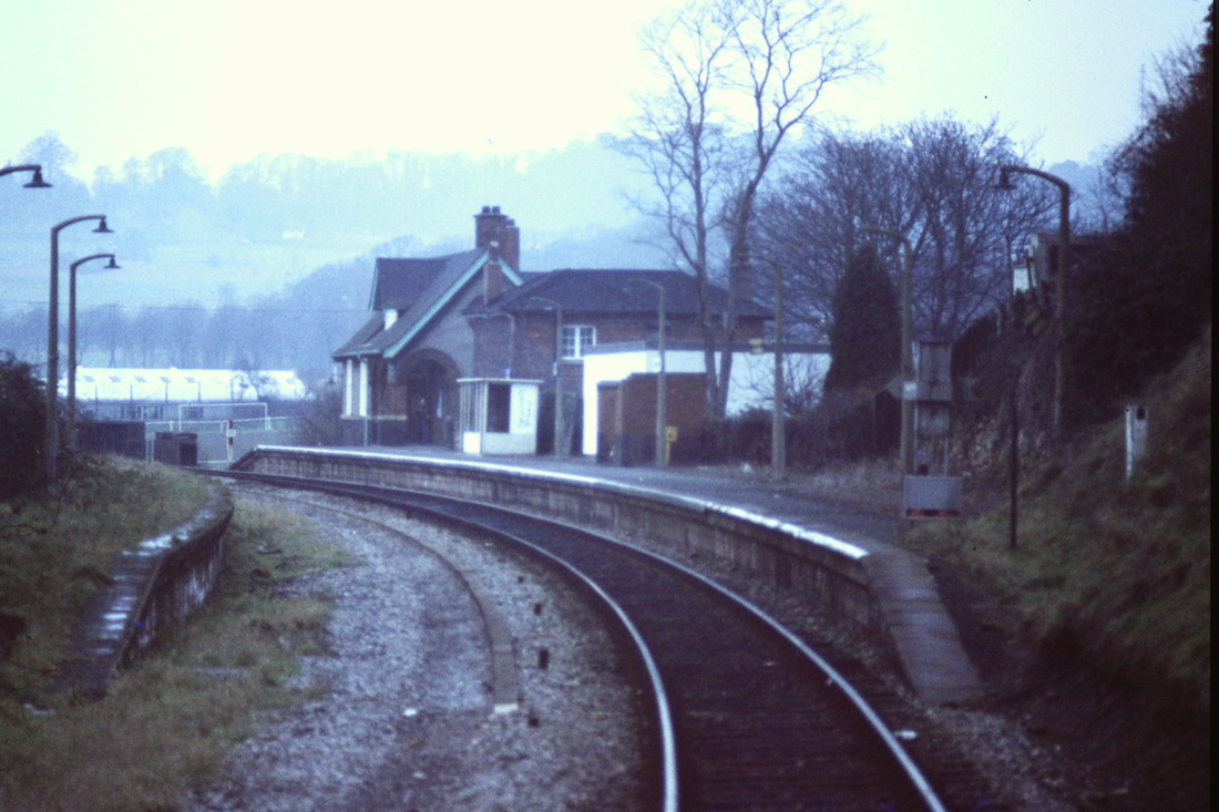
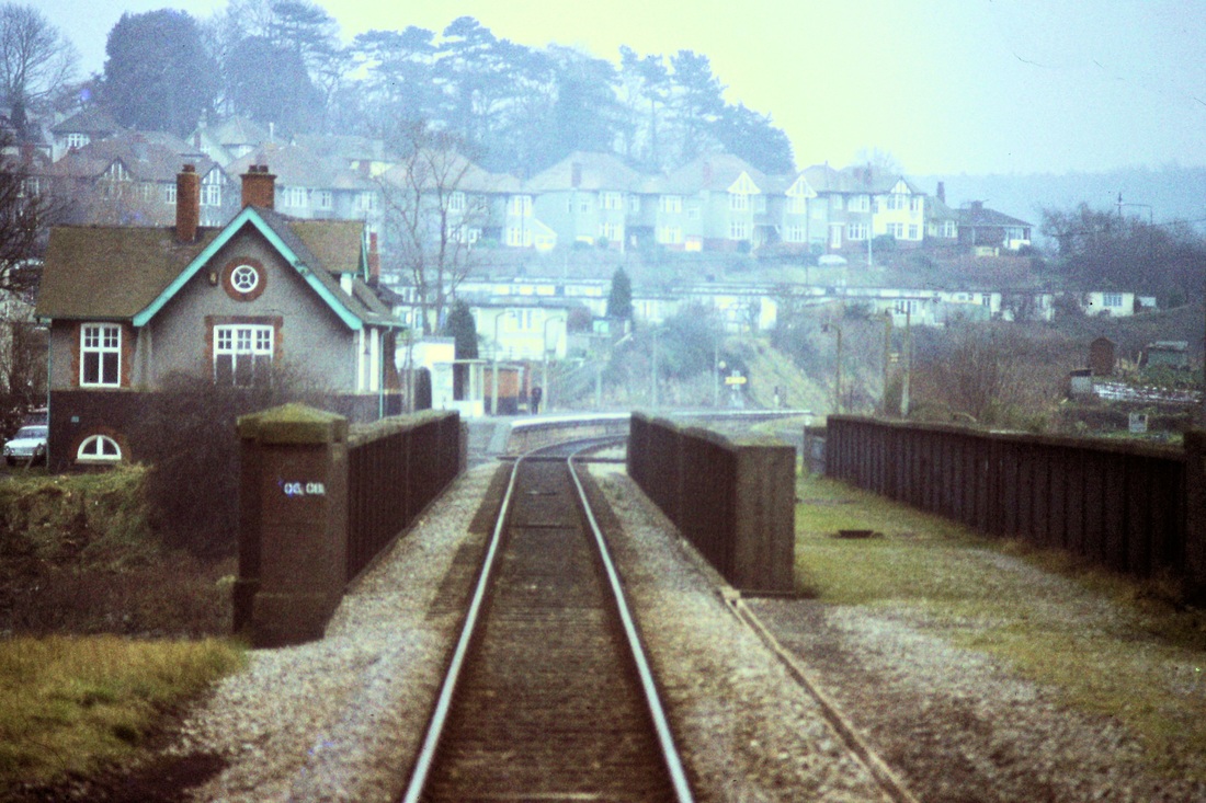
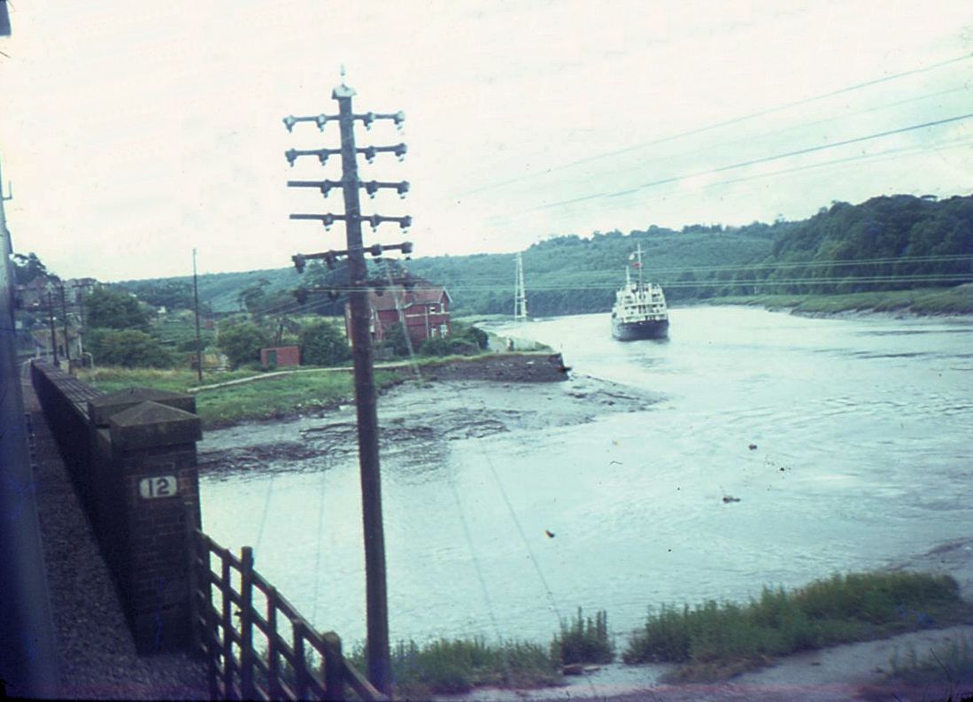
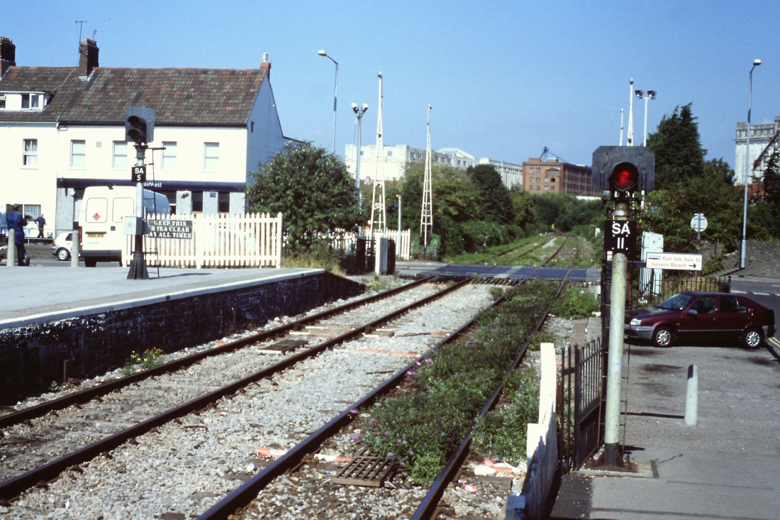
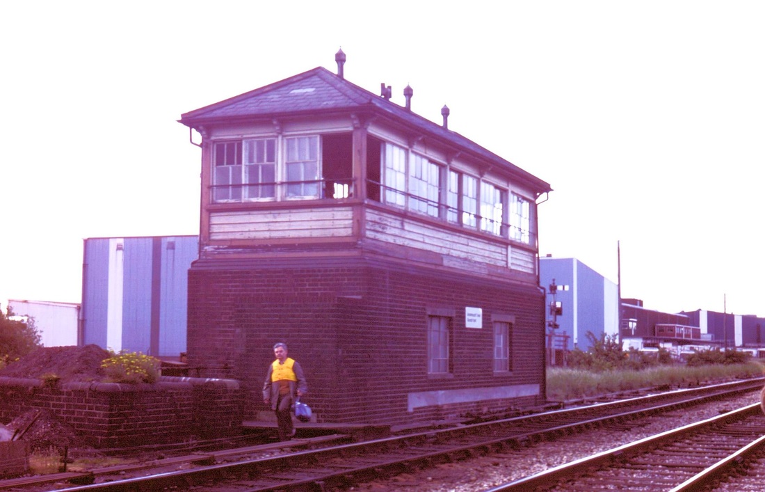
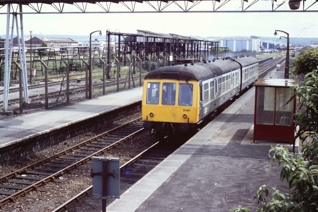
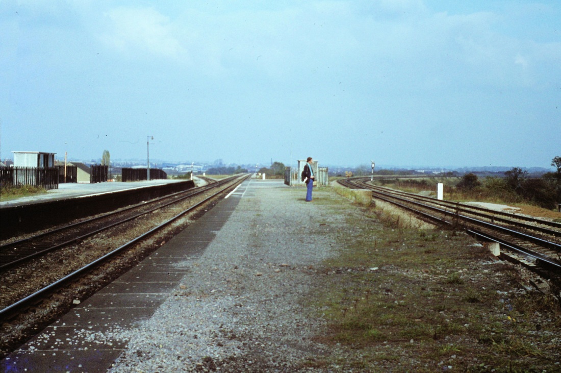
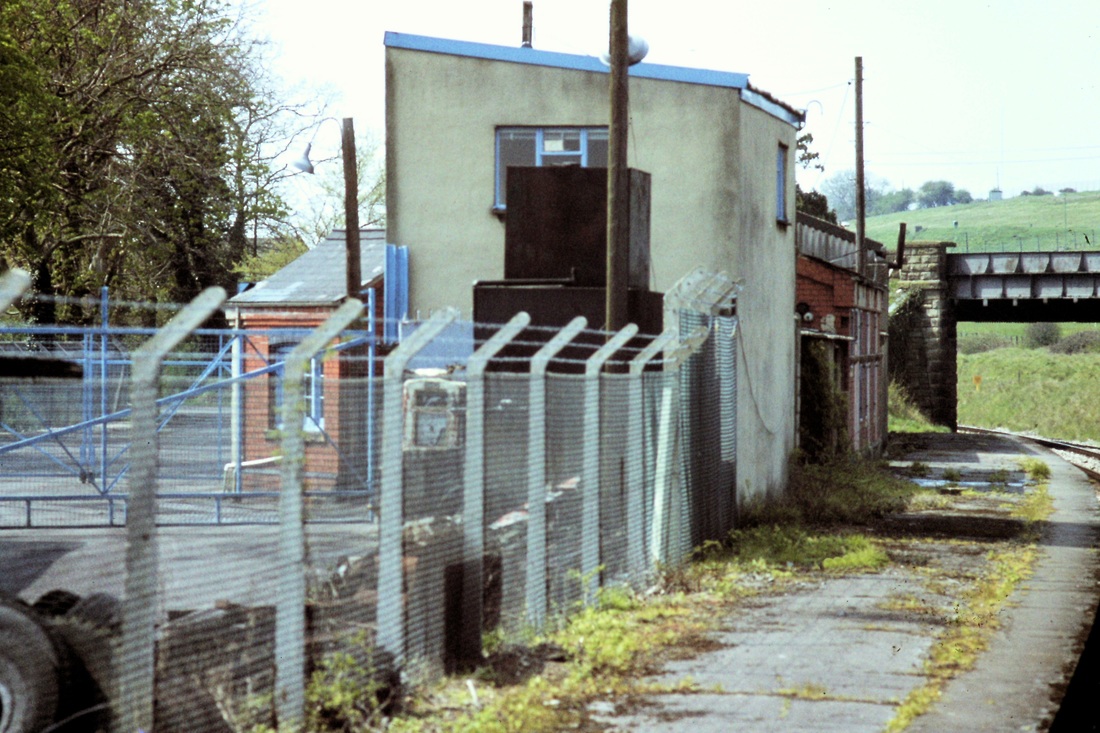
Lawrence Hill One mile from Bristol T M
Through the glass this picture may be but perhaps there's some important detail there for somebody. Lawrence Hill November 1964 Copyright Mike Roach

A fine view in the four track days of Lawrence Hill including the signalbox and a large crane at work in the scrapyard. November 1964 Copyright Mike Roach
A Severn Beach unit leaves Lawrence Hill for Bristol. 11th November 1978 Copyright Roger Winnen
Lawrence Hill as it looked on the 13th August 1967, before demolition of the buildings took place. Copyright Keith Jenkin
A smashing picture taken by Roger Winnen from a Peak hauled train bound for Bristol Temple Meads passing through Lawrence Hill The station had already been reduced to two platforms but this was before the later reduction to two tracks . On the right can be seen the goods yard, later the Bin Liner Terminal. Copyright Roger Winnen.
The stairway up to street level at Lawrence Hill. A Class 47 approaches Lawrence Hill with a north bound express. 11th November 1978 Copyright Roger Winnen
A class 25 running light engine heads for Bristol TM on the 11th November 1978. Note the vans over in the goods yard to the left. Copyright Roger Winnen
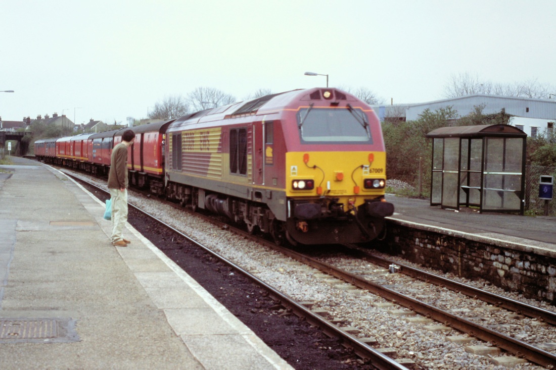
More modern times but still a while ago - the Royal Mail no longer operates. Here we see a class 67 bringing the train through Lawrence Hill on the 13th April 2001 Copyright Roger Winnen
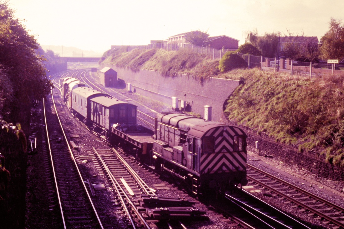
It is 27th October 1984 and track rationalisation is taking place Lawrence Hill. An 08 approaches Lawrence Hill with a freight. Copyright Roger Winnen

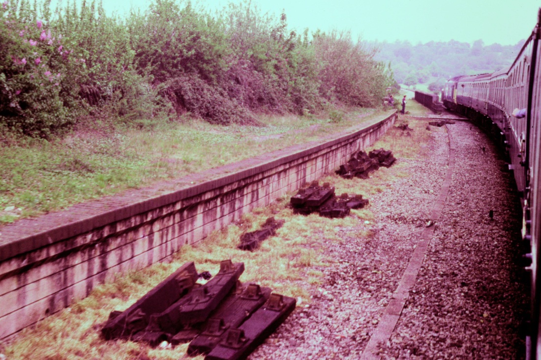
Another picture at Lawrence Hill again on the 27th October 1984. A class 47 In the foreground runs towards Bristol Temple Meads. The quadruple main line track installed in 1891 is being reduced to a double track. The reduction to double track officially took effect on 20th February 1984 Copyright Roger Winnen
The Midland crosses over the GWR.
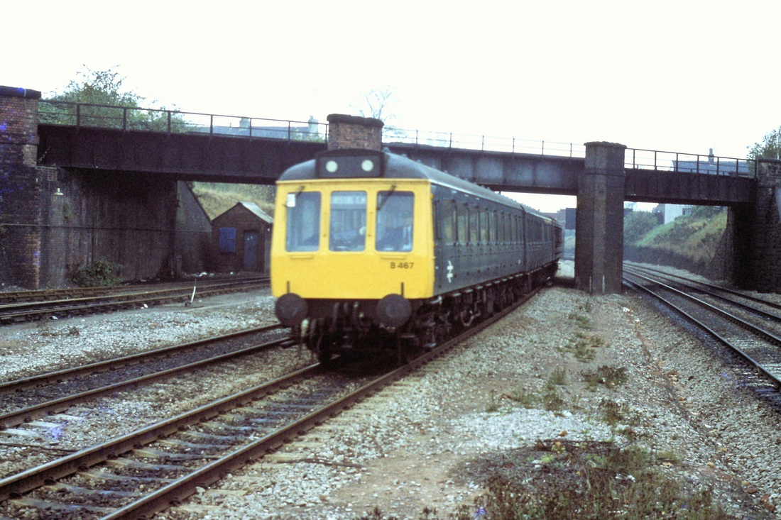
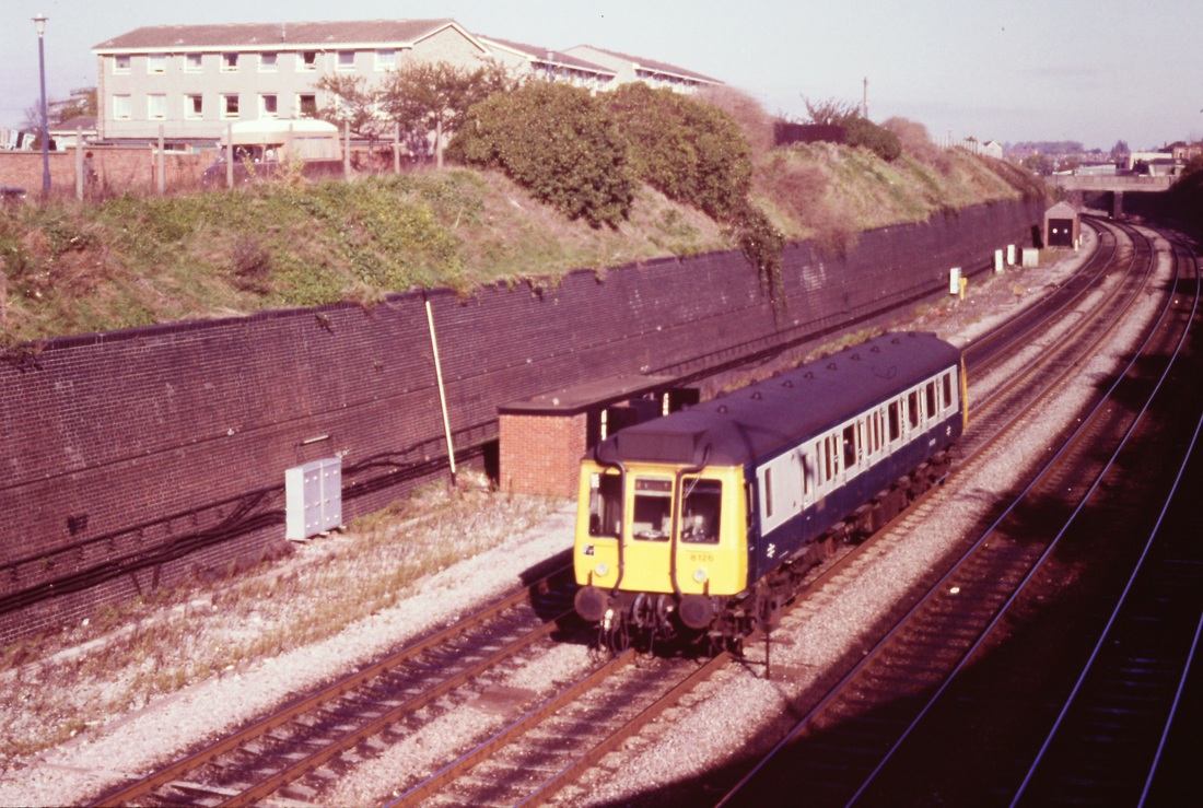
The old Midland Line crossed the GWR just north of Lawrence Hill. Here we see a DMU heading for Bristol Temple Meads. 11th November 1978 Copyright Roger Winnen
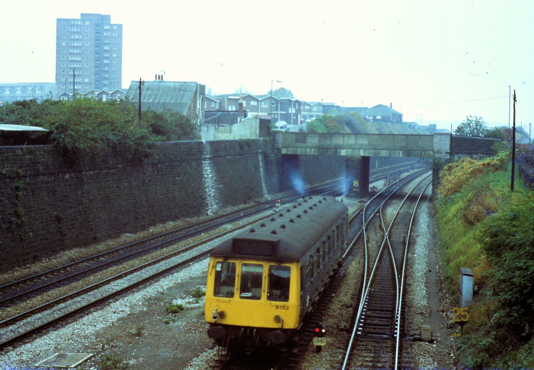
Lawrence Hill. The former Midland Line from Kingswood Jct to St Philips, Bristol crossed over the main lines by means of the bridge in the foreground. . Lawrence Hill station is just past this bridge. The quadruple track is being reduced to a double main line. As one can see, one face of the island platform, seen just beyond the bridge, is without track. The lines serving the sidings here at Lawrence Hill diverge off to the right under the bridge. The siding connection has more recently been used to serve the Barrow Road Refuse Transfer station . 27th October 1984 Copyright Roger Winnen
Lawrence Hill Bin Liner Terminal - Barrow Road Refuse Transfer station
A view looking towards Lawrence Hill station from the former Midland line bridge. The polished metals on the right are the former goods yard lines leading to the Bristol Bin Liner Terminal. Copyright Kevin Jenkin
Lawrence Hill 158958 2210 SVB-BTM 21st December 2022. Copyright Guy Vincent.
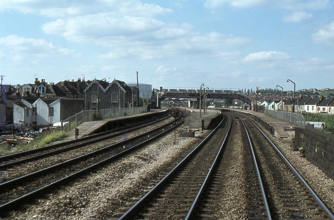
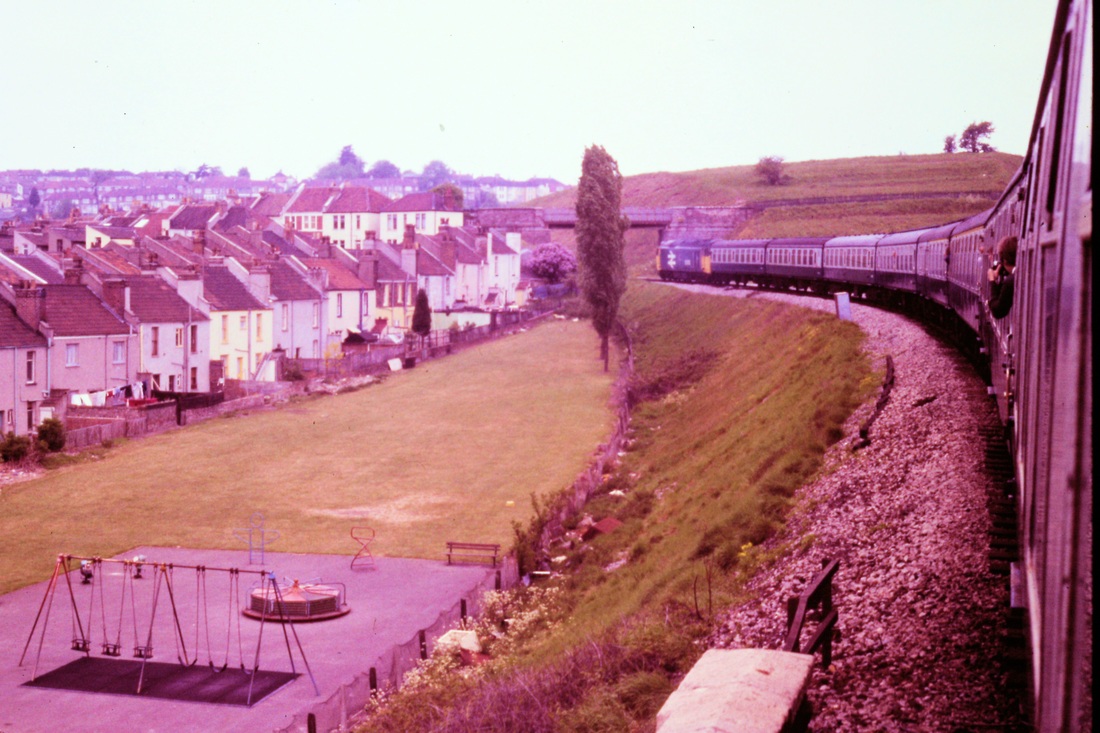
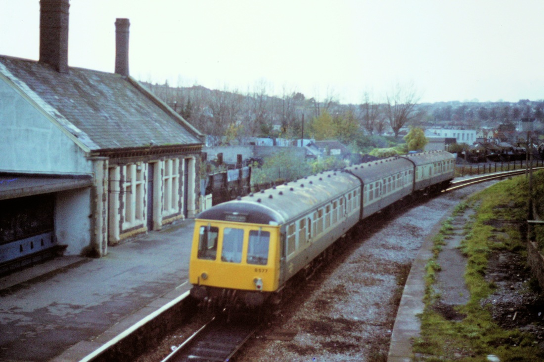
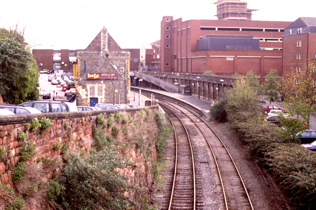
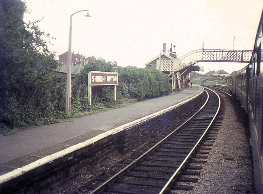
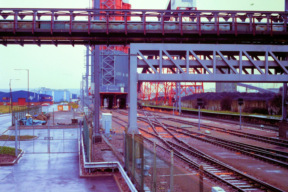
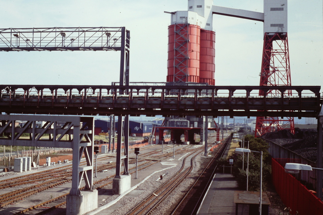
Stapleton Road One and a half miles from Bristol TM
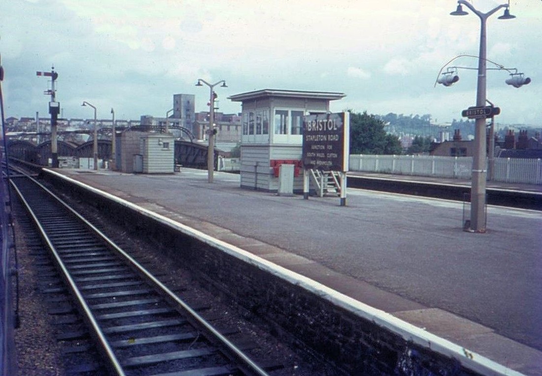
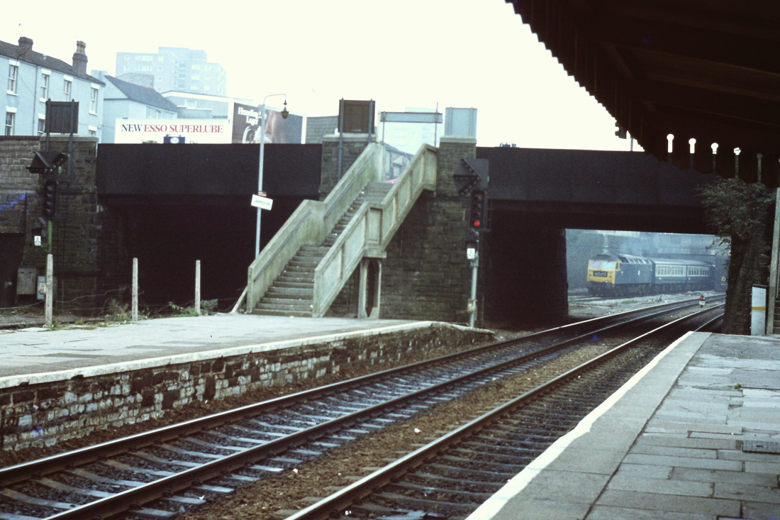
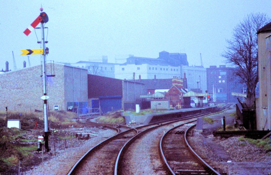
Stapleton Road on the 13th August 1967 - before the rationalisation to two tracks from four. The heavy bridges seen in the background, still to this day (2015) remain in position ready, maybe, for the return of the quadruple track. Copyright Keith Jenkin
The caption of the previous picture hopes for the return of quadrupled track. Now in 2017 this is to become a reality. The following article by Guy Vincent in most appropriate and extremely interesting.
Stapleton Road Girder Bridge - Demolition.
The large lattice steel girder bridge with cross-braced arches at Stapleton Road, Bristol, is about to be demolished according to local press reports. Work has now started to remove the landmark structure which was last used by trains in February 1984. A new bridge will be built in its place as part of the £33,000,000 (2014 cost, so probably much more by now!) 'Filton Bank Redoubling' project. Plenty of info on this work and the Stapleton Road bridge project by 'Googling' the subject and by checking out the bristol-rail.co.uk (Bristol Railway Archive) website. It is still just possible to photograph the bridge either from the platforms or footbridge of Stapleton Road station or from the public road close by although access is to be denied during the removal works.
The condition of the bridge was, I believe, given as the main reason for 'dequadrifying' the four-track section from Dr Day's Junction to Filton Junction. Also, of course, in the early 1980s when that decision was made nowhere near as many trains used the local Bristol rail network which was still in decline through the effects of the then economic recession. Improved motorway links (the M32 passes through the area close by) also caused traffic to be lost. Remember the BTM-Severn Beach service being almost totally in the hands of a single class 121 'bubble car?
I for one will miss the 3 span bridge as it is very much a part of the railway heritage of Bristol and a reminder of a now departed age in heavy engineering. I recall one of the last times I travelled over the structure. This was on January 3rd 1984 when returning from Birmingham New Street to Temple Meads on a 1307 York-Plymouth relief train hauled by 37263. The bridge always 'rattled' as trains passed through, especially at high speeds and this was exactly such an occasion! My last trip over it was, appropriately, on the last day it carried scheduled services, Saturday February 18th 1984. This was behind 45141 on the 1V95 1935 Birmingham New Street-Bristol Temple Meads.
Another source of very interesting information is the RM Web site, 'Western Region 1980s freight - West of England division'. Some excellent photos and recollections of the railway we all miss, not only around Bristol but, as the title suggests, covering the west country as a whole.
A similar recent casualty was the large girder bridge at the west end of Newport station which was replaced last year.
Guy Vincent

Stapleton Road Bridge 8th May 2013 Copyright Guy Vincent
Taken in the good old days when there were four tracks and indeed four platforms at Stapleton Road. Another aspect of the good old days was the opportunity to be in the last coach at the last drop down window, able to take fine panoramas like this. Copyright Roger Winnen
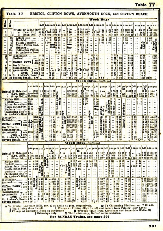
From the BR Timetable Table 77 valid from 18th June to the 23rd September 1951 giving times for the routes via Avonmouth and also via Henbury
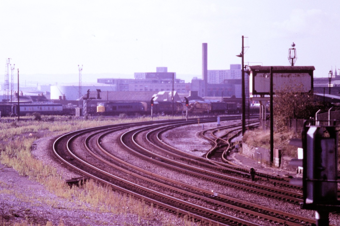
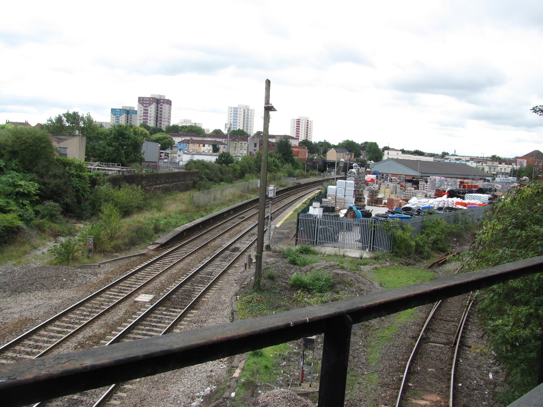
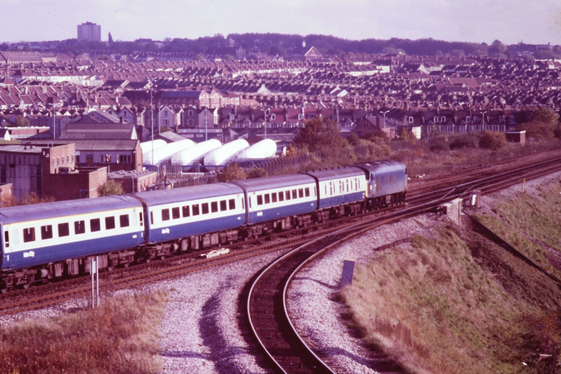
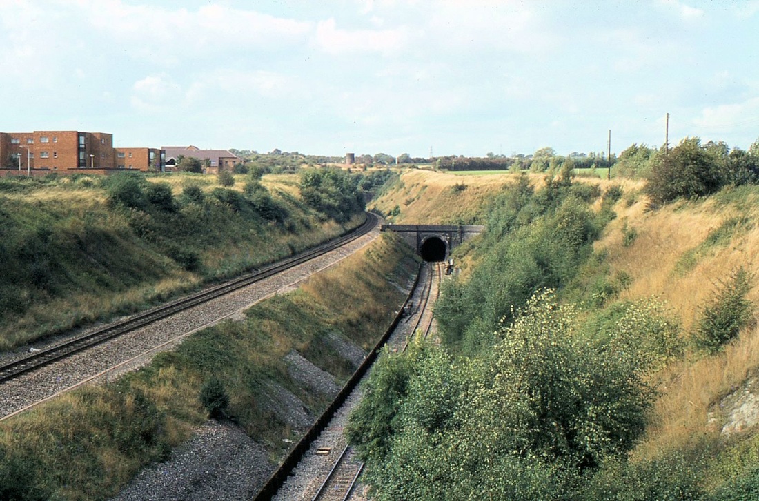
Narroways Junction
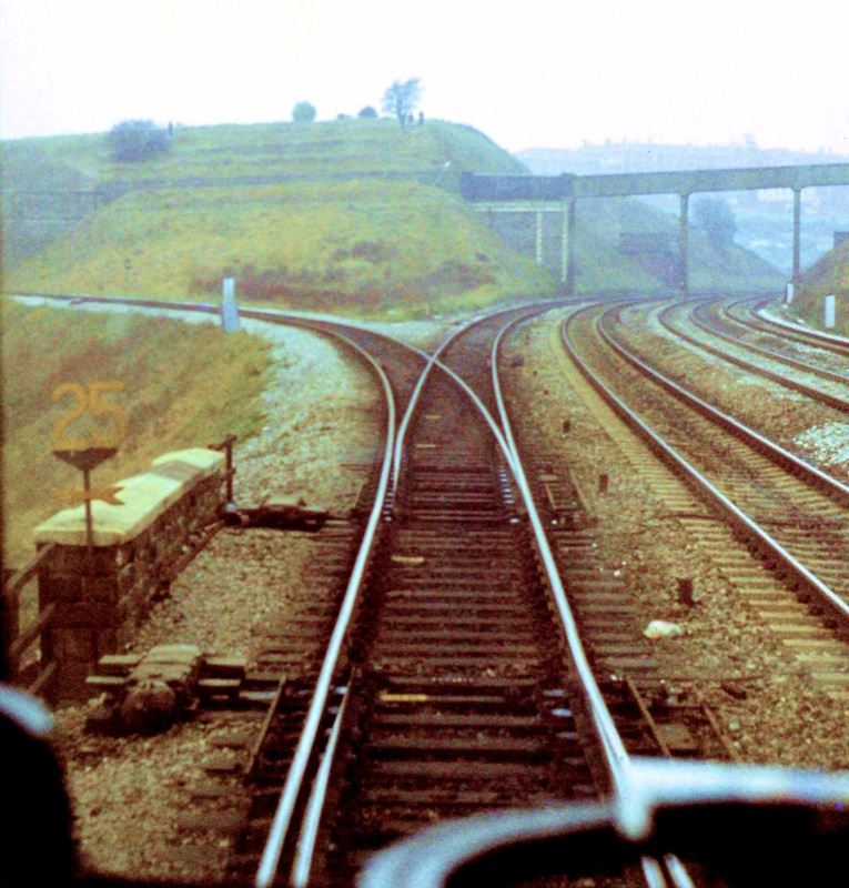
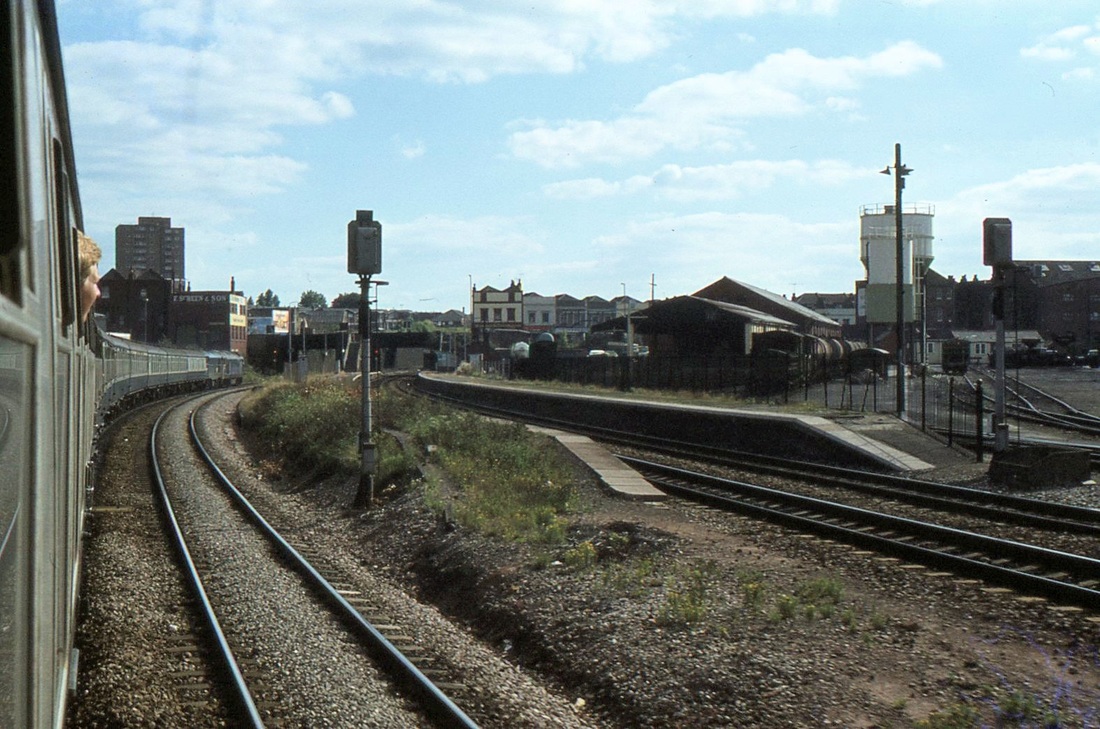
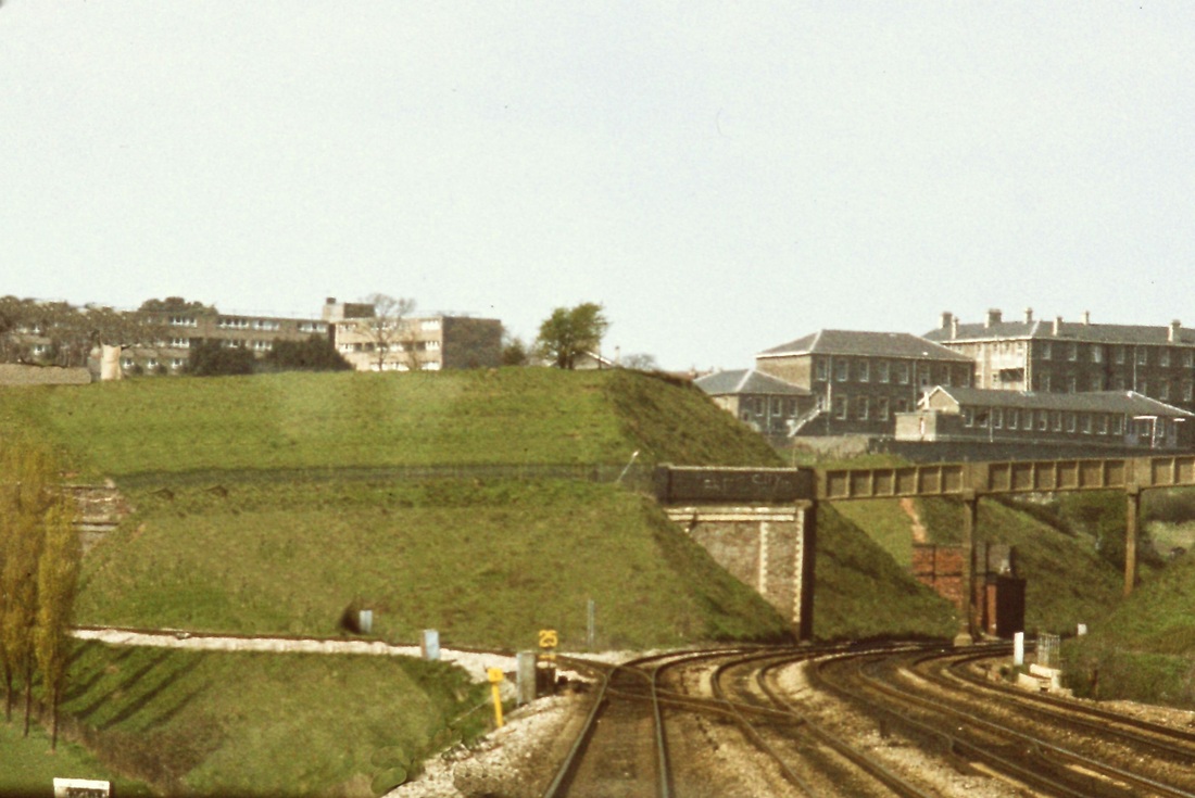
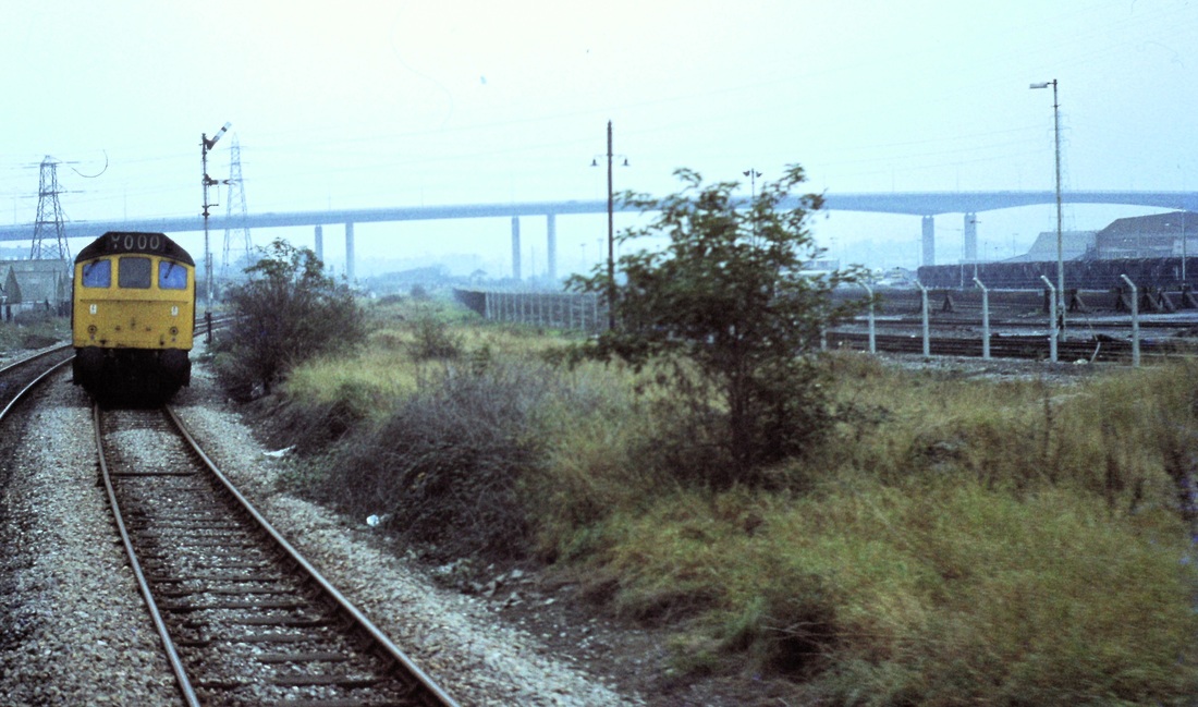
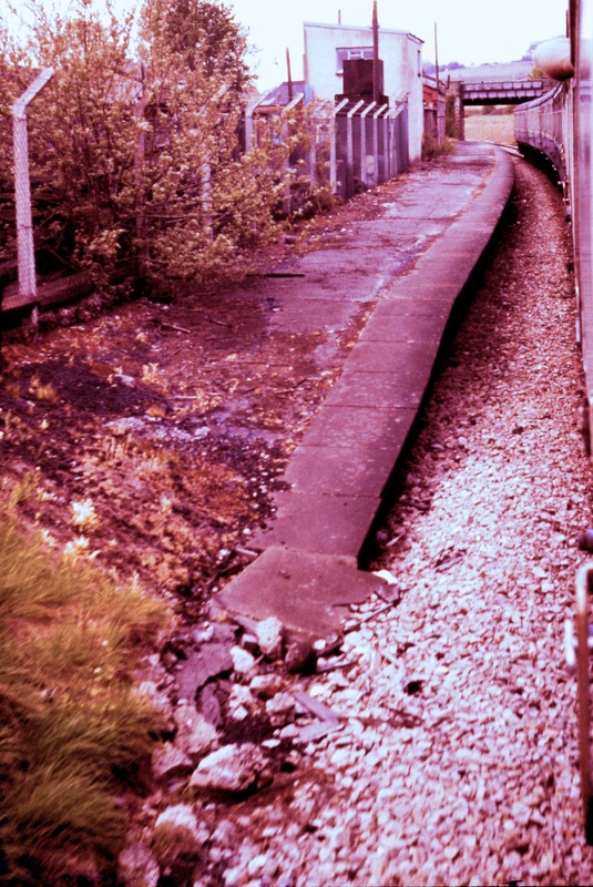
Narroways Jct 11th November 1978 The single track off to the left is towards Avonmouth and Severn Beach, straight on is towards Filton, Wales and the North. A bridge crossing the four tracks in front of the footbridge carried the Midland line from Kingswood Junction near Fishponds to join the Avonmouth metals at Ashley Junction. This line was opened in 1874 and closed completely on 14th June 1965. As the points are set for the Avonmouth route, that is the way we will go first. Copyright Roger Winnen
A 1982, 14th April, view from the cab window, of Narroways Junction Copyright Roger Winnen
A Class 33 with a Portsmouth Harbour - Cardiff service on 27th October 1984 at Narroways Junction. Copyright Roger Winnen
Narroways - a Peak descends the bank heading for Stapleton Road and Bristol Temple Meads. 27th October 1984 Copyright Roger Winnen.
Narroways, Just to the North East of the Junction. The Midland LIne to Avonmouth Docks crossed here. To the left lay Ashley Junction and to the right lay Kingswood Junction. This is the scene on the 27th October 1984. Note that the quadruple track arrangement is being reduced to two tracks, the additional tracks having been closed in 1971. Copyright Roger Winnen
Narroway again on the 27th October 1984, this time looking towards Bristol. Stapleton Road Station is in the distance as the line curves to the right. The single track from Avonmouth and Severn Beach comes in from the right. This picture also shows the removal of the left hand pair of tracks. In 2015 there is talk of reinstating the quadruple track. The formerly double track line from Avonmouth was reduced to single w.e.f. October 1970 Copyright Roger Winnen
Route (1) The first route, and that used nowadays to Severn Beach via Avonmouth
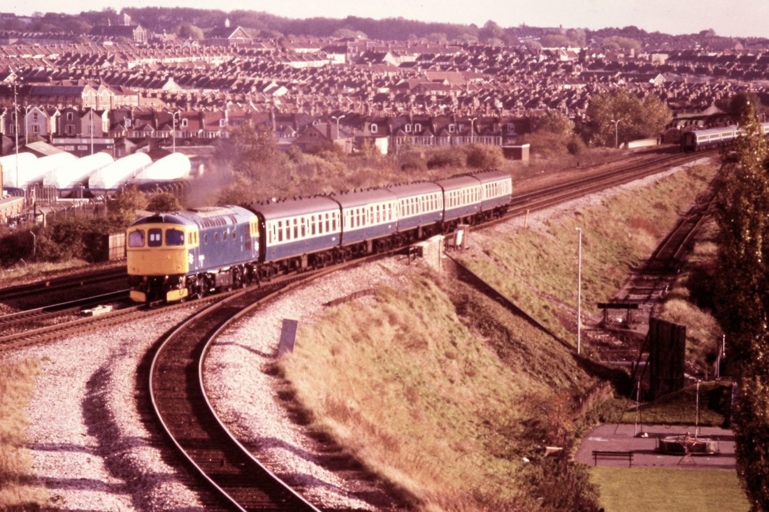
The ' Bristolian' taking the curve at Narroways Junction en route to Avonmouth on the 30th April 1983 Copyright Roger Winnen
Another fine view of the 'Bristolian' en route to Avonmouth. 30th April 1983 Copyright Roger Winnen
The first charter run by the Cornwall Railway Society was the Avon Explorer. Here we see it as it rounds the curve at Narroways Junction onto the Avonmouth and Severn Beach line. 12th May 1984 Copyright Roger Winnen
27th October 1984, track rationalisation is taking place, the quadruple track is being reduced to double, and the pointwork for the Severn Beach connection has been simplified. A Single Car heads away for Montpelier from Narroways Junction. Copyright Roger Winnen
Having just left the main line at Narroways Junction, a Single Car heads for Montpelier. 27th October 1984 Copyright Roger Winnen
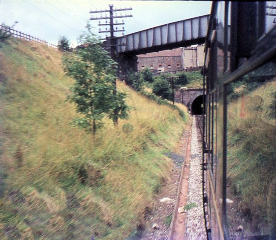
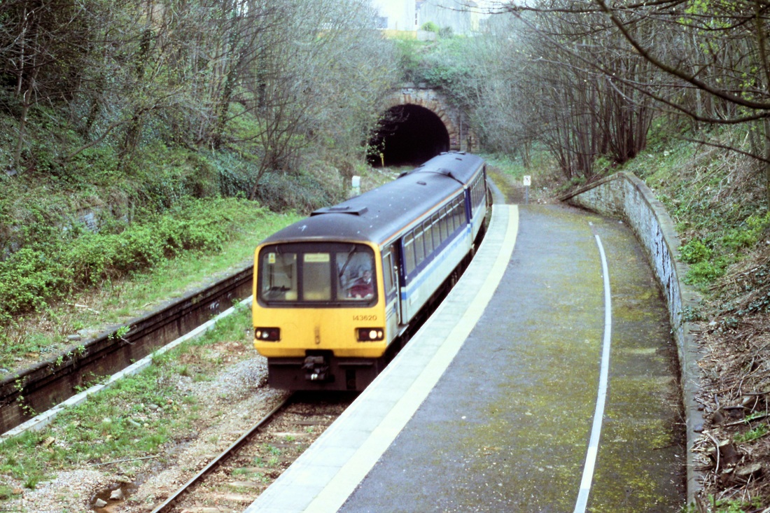
Approaching Montpelier tunnel 13th August 1967. Copyright Keith Jenkin
Montpelier Two and three quarter miles from Bristol TM
Montpelier - The main station buildings were, and still are, on the down side for passengers from Bristol. 13th August 1967 Copyright Keith Jenkin
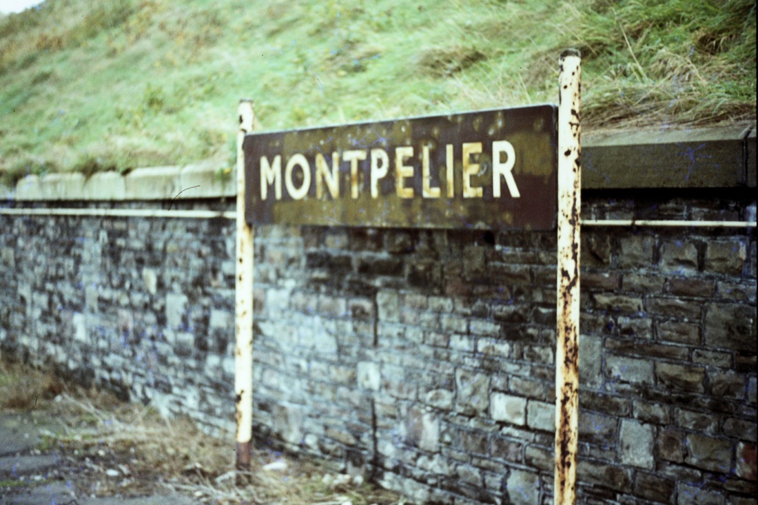
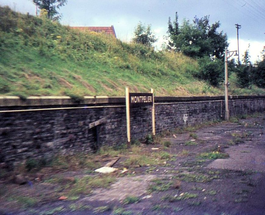
Still the same old sign on the 19th November 1977 Copyright Roger Winnen
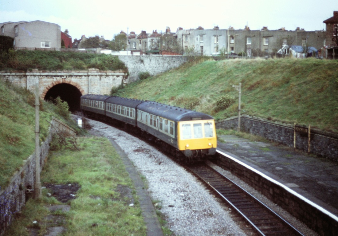
A Severn Beach bound train emerges from the tunnel at Montpelier on 19th November 1977 Copyright Roger Winnen
A Pacer emerges from the 288 yard long Montpelier Tunnel on the 13th April 2001. Copyright Roger Winnen
Montpelier - a Gloucester Cross Country Unit leaves for Severn Beach. 19th November 1977 Copyright Roger Winnen

The basic station at Montpelier - already unmanned but prior to 'decoration'. 19th November 1977 Copyright Roger Winnen

Montpelier after decoration - an awful lot of spray paint wasted!! 13th April 2001 Copyright Roger Winnen

Montpelier Station frontage. 13th April 2001 Copyright Roger Winnen Thankfully this side wasn't attacked by spray can vandals. Montpelier coal yard lay across Station Road from this building. Rail access to it was over a bridge which crossed over Station Road to the left and out of this picture.
From the notice on the door Montpelier station building already appears to have found alternative uses. A pity about the street lamp - vandals! 19th November 1977 Copyright Roger Winnen
Just to the north of Montpelier station the line crosses Cheltenham Roadon on this magnificent bridge. Advertisers seem to have made good use of every available space!! 19th November 1977 Copyright Roger Winnen
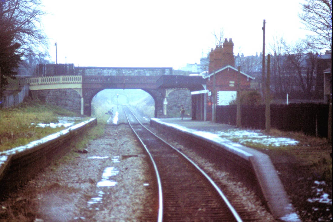
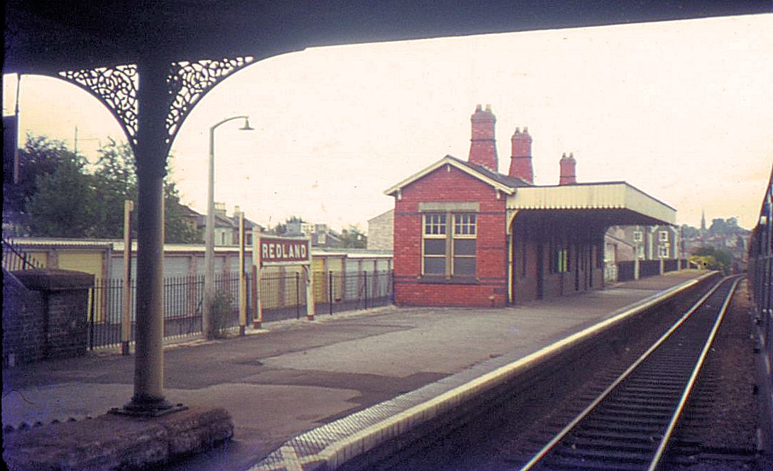
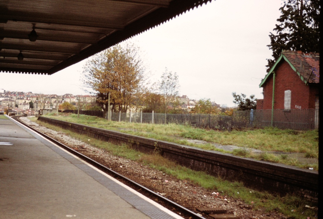
Redland Three and a quarter miles from Bristol TM
Redland Station through the cab window on a rather dismal January day. 12th January 1980 Copyright Roger Winnen
A picture taken in double track days, looking at the main station building which served the Bristol bound platform. Note the elegant ironwork on the footbridge which paralleled the road bridge at this point. Just beyond the end of the platform the line crosses Cheltenham Road on an impressive bridge. 13th August 1967 Copyright Keith Jenkin

Redland station 19th November 1977. Bristol Tramways provided a service along South Road ouside the station until WW2 Copyright Roger Winnen
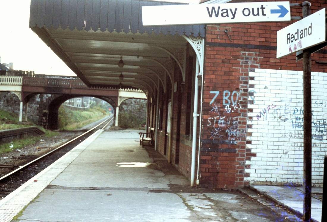
Redland station on the 19th November 1977. Mischief finds 'work' for idle hands and a spray can to do. The tiled wall suggests that this was once part of the toilet facilities provision. 19th November 1977 Copyright Roger Winnen
Looking towards Montpelier, the railway very soon crosses Cheltenham Road, the bridge can be seen just beyond the end of the station. 19th November 1977 Copyright Roger Winnen
Approaching Clifton Down
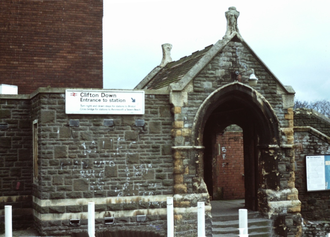
Clifton Down Station Four miles from Bristol TM

The bridge which was passed through just before the station carries Whiteladies Road. There were a number of sidings and even a turntable behind a wall at the back of the platform at which this train is standing. This is an older picture, note the canopies are still in position on both platforms and remained so until 1971. 13th August 1967 Copyright Keith Jenkin

A Pacer has the green light to enter Clifton Downs tunnel. 17th April 2001. Copyright Roger Winnen
The exterior of Clifton Down Station on the 19th November 1977. Copyright Roger Winnen
Clifton Down with the old siding area, now the base for a multi story car park. Note also the large number of cars parked outside the station and also that the station building now houses a retail outlet. The signalbox was at this end of the right hand, down platform. The goods yard had closed in 1965. 12th April 1990 Copyright Roger Winnen
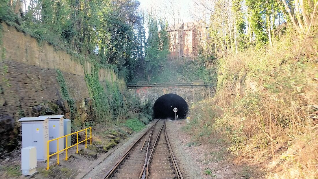
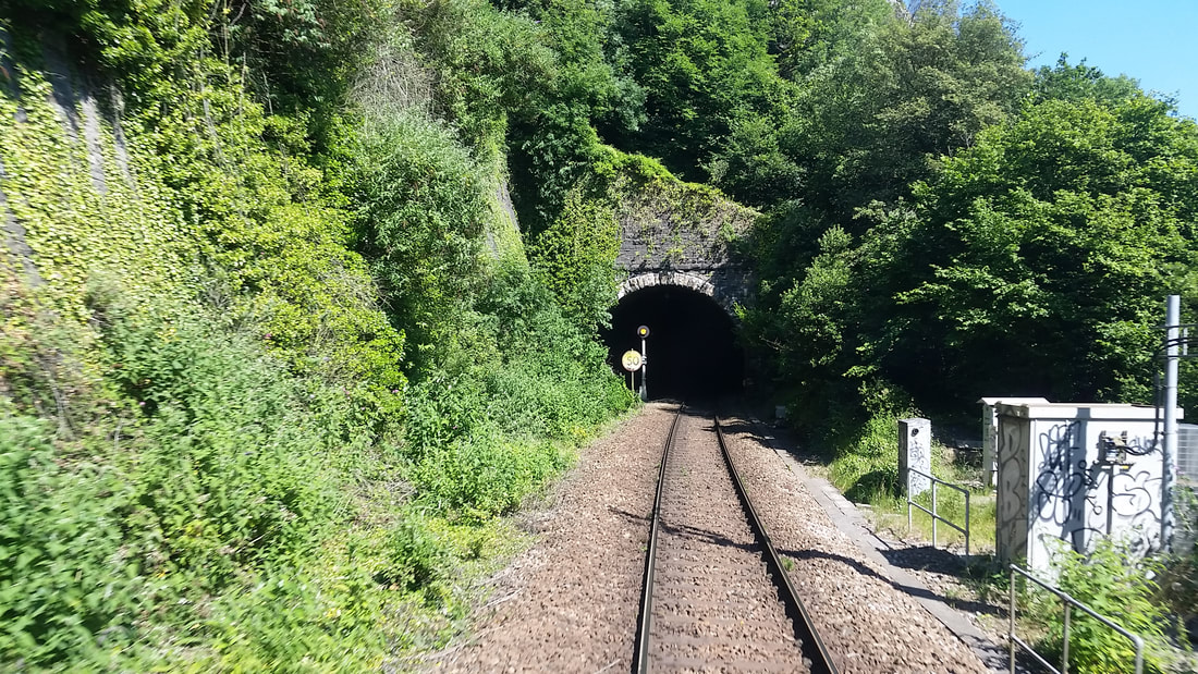
Clifton Down tunnel 1751yards
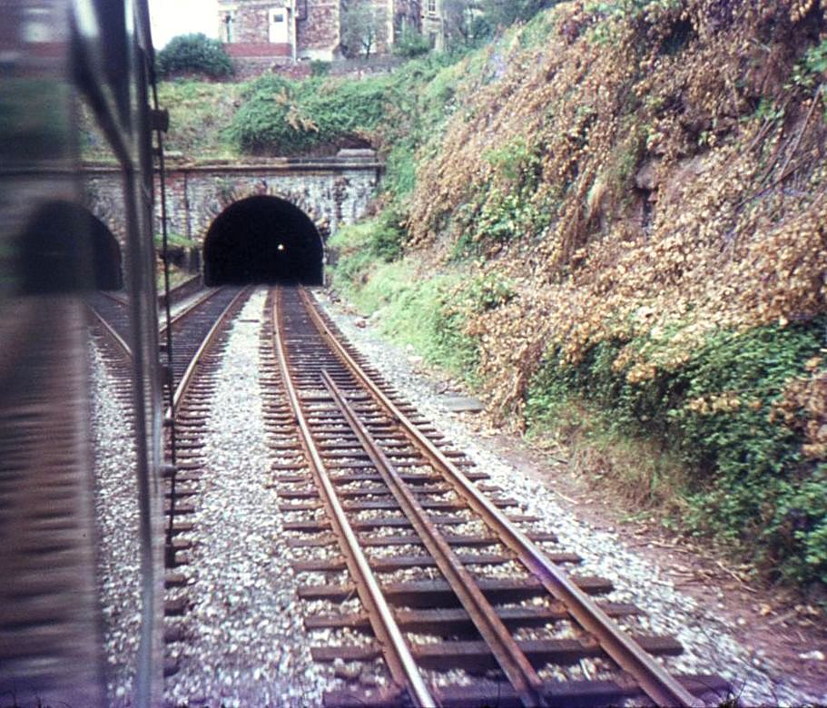
Clifton Down Tunnel - it has a straight bore: the far end can be seen in this picture. Again, this is history, as the line was singled soon after this view was taken. 13th August 1967 Copyright Keith Jenkin

A view of the entrance to Clifton Down Tunnel. Behind Roger Winnen (the photographer) is Clifton Down Station, relegated to being a passing loop on the branch. 19th November 1977 Copyright Roger Winnen.
The view from a train entering Clifton Down Station. As can be seen, by 1980 the sidings have been built upon. 12th January . Copyright Roger Winnen

Clifton Down on the 19th November 1977 showing the station and sidings area, which once housed rolling stock of special Bristol Zoo trains. Copyright Roger Winnen
The two platforms at Clifton Down station are connected by a footbridge - this is the ornate street level access to that bridge. 19th November 1977 Copyright Roger Winnen.
A query concerning Clifton Downs Tunnel received 20th December 2021
Good Morning,
I have often looked at photographs on your excellent website when undertaking pre site visit reconnaissance in my role as a drainage engineer for Network Rail on the Western Route.
The photographs on your website are an excellent source to see what was at certain sites before the advent of continuously welded rail across the Western Route which required larger ballast shoulders that unfortunately often covered many drainage assets.
My role often takes me to Devon/Cornwall and I have the pleasure of covering the entire geography of the Western Route. I’m due down on the 4th/5th January to inspect the St. Dennis Branch and parts of the Newquay branch.
As part of my duties I have a large team of maintenance and renewal staff working on drainage assets including many sites in Devon & Cornwall. Photographs are taken frequently and almost always provide a different perspective than would be available to the public.
If it would be of interest, I have extensive records of mostly infrastructure related photographs dating back to 2009 when I joined Network Rail.
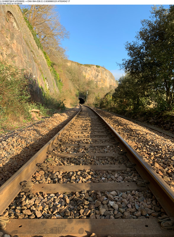
One of our upcoming jobs in February 2022, which is slightly off patch, is the refurbishment of the former 6ft drainage system through Clifton Down tunnel on the CNX in Bristol.
My team and I have walked the entire length of the tunnel and can only find a single drainage catchpit at the Clifton end of the tunnel, this has a 375mm internal diameter vitrified clay pipe which flows into the tunnel freely towards the Sea Mills end of the tunnel.
I have enquired with our records department who have unfortunately come back with only limited information.
I’ve got an active enquiry with the Great Western Society in Didcot via Richard Antliff on the same subject.
However, I’m hopeful that your membership might have some photographs or records of the tunnel or it’s drainage system.
Any help much appreciated.
Mark Dennis Howells BEng (Hons) MPWI MIAM
Senior Asset Engineer (Drainage & Lineside)
Western Route
Network Rail
Email: [email protected]
I have often looked at photographs on your excellent website when undertaking pre site visit reconnaissance in my role as a drainage engineer for Network Rail on the Western Route.
The photographs on your website are an excellent source to see what was at certain sites before the advent of continuously welded rail across the Western Route which required larger ballast shoulders that unfortunately often covered many drainage assets.
My role often takes me to Devon/Cornwall and I have the pleasure of covering the entire geography of the Western Route. I’m due down on the 4th/5th January to inspect the St. Dennis Branch and parts of the Newquay branch.
As part of my duties I have a large team of maintenance and renewal staff working on drainage assets including many sites in Devon & Cornwall. Photographs are taken frequently and almost always provide a different perspective than would be available to the public.
If it would be of interest, I have extensive records of mostly infrastructure related photographs dating back to 2009 when I joined Network Rail.
One of our upcoming jobs in February 2022, which is slightly off patch, is the refurbishment of the former 6ft drainage system through Clifton Down tunnel on the CNX in Bristol.
My team and I have walked the entire length of the tunnel and can only find a single drainage catchpit at the Clifton end of the tunnel, this has a 375mm internal diameter vitrified clay pipe which flows into the tunnel freely towards the Sea Mills end of the tunnel.
I have enquired with our records department who have unfortunately come back with only limited information.
I’ve got an active enquiry with the Great Western Society in Didcot via Richard Antliff on the same subject.
However, I’m hopeful that your membership might have some photographs or records of the tunnel or it’s drainage system.
Any help much appreciated.
Mark Dennis Howells BEng (Hons) MPWI MIAM
Senior Asset Engineer (Drainage & Lineside)
Western Route
Network Rail
Email: [email protected]
---------------------------------------------------------------------------------------------
Dear Mark,
Many thanks for your most interesting enquiry - it's made me look a bit more into what I thought was just a long straight tunnel, however, digging a little 'deeper' I find that it had vent shafts both to the surface in Clifton Downs Park and outwards level towards the Avon Gorge. This information with the help of Wikipedia. I have further found, with the aid of Google Earth Street view what I must assume is the vent chimney located in Clfton Downs, about 45 yards north of the junction between Upper Belgrave Road and Pembroke Road - I have an image courtesy Google Earth of the vent/chimney which I attach.
The Cornwall Railway Society is a group of enthusiasts which has been in existance for over 40 years now - the website is really a 'Scrap Book' of varous pictures collected by members over the years. Obviously, as well behaved railway enthusiatswe do not encourage any pictures inside the fence - we are lucky in that we get various views taken by railwaymen who have ligitimate business to be on railway property. So if you would be wlling to let us have some interesting views not normally possible to the general publc we would be more than grateful.
As far as Clifton Downs tunnel is concerned we used to live at Calne and took many trips from Chippenham to sample to 'glories' of the Severn Beach line . Severn Beach I believe has gone considerably 'up market' nowadays . In my time 1965-69 it comprised of a run down fun fair and a few houses.
Our journey took us everytime through the tunnel - double track at the time, the Hallen Marsh to Filton line was freight only. The line to Pilning had unfortunately just closed. One advatage, a big advantage, at the time were the Heritage DMU's with their drop down windows and of course - if the driver was obliging and kept the curtains back views forward from the front seats.
I attach one of my views taken of the tunnel mouth from the station end which shows very clearly the straight bore. The other view is of what I believe to be vent chimney- it looks as if it once had a plaque on it - no doubt this was removed during the war years - parhaps the chimney has been 'capped' as it looks as if a tree is peering out of the top?
I do hope that you can obtain more information on the history of the tunnel, and even, fi you have the time show us pictures of the evidence of the vents - especially the horizontal one out through a cave.
Maybe your letter to us and its publication in our news will generate some interest and hopefully contacts. I hope that our readers will reply however limited their knowledge.
I hope you don't mind us publishing your letter;
With Kind Regards,
Keith Jenkin , Webmaster.
Guy Vincent adds this valuable input :-
Having read appeal for information on the waste water drainage system that is apparently now hidden below the trackbed inside Clifton Down Tunnel I was unable to find anything specifically relating to the tunnel drains but in the course of searching some other facts came to light.
The Bristol Rail Archive (bristol-rail.co.uk) website has a small number of photos of Clifton Down tunnel air ventilation shafts and one of each portal. The two round, castellated masonry air shafts are located 1) on the Downs close to Bristol Zoo (Upper Belgrave Road / Pembroke Road area as Keith mentioned and provided a photo of) and the second, much smaller one in Walcombe Slade. The Walcombe Slade shaft is topped by a round wire mesh 'cage' to prevent objects being dropped down into the tunnel.
Colin G Maggs's book 'Bristol Railway Panorama' published by Millstream Books in 1990 has information on the tunnel on page 99. Maximum depth below ground is quoted as 160 feet. According to Maggs ''To improve the ventilation provided by the two vertical shafts, in 1950 an old shaft leading out to the face of the gorge was reopened after having been blocked for many years. Originally it had been used as a stable for ponies employed in tunnel construction. A ganger's cabin was hewn out of the side of the tunnel on the Down side, approximately midway''.
According to the Regional Appendix to the Working Timetable dated October 1960 the tunnel is1738 yards long and
today contains just the former 'Down' running line of continuous welded rails on steel sleepers. Singling was carried out in October 1970. Milepost reference mileages are 4m07.5ch and 5m 05.5 ch and there is a falling gradient of 1 in 64 towards Sea Mills throughout. Line speed through the tunnel is 50 mph and in the 'Up' direction there is a distant signal (Y-G) at the Sea Mills end and a 3 aspect R-Y-G just inside the tunnel at the Clifton Down station end where a passing loop is located.
On emerging from the tunnel at the Sea Mills end directly to the left is the A4 Portway which runs adjacent to the river Avon as it winds down towards 'the horseshoe' bend and Avonmouth. On the opposite side of the river runs the Portbury / Portishead branch through Leigh Woods although this is very hard to spot.
Sadly it seems that Network Rail may only find their drainage system inside this tunnel by digging out the ballast formation and then probing around for any openings or voids that might exist. Clifton Down is a relatively 'dry' tunnel with little evidence of long-term water seepage, unlike Saltford Tunnel between Bath and Bristol which has a spring-like constant flush of water running out of the down-side wall midway through!
With regards
Guy Vincent.
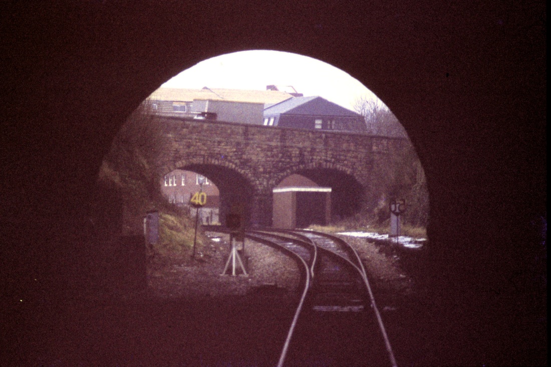
East end of Clifton Down Tunnel 26th February 2021 Copyright Guy Vincent
Clifton Down Tunnel west end 29th June 2018 Copyright Guy Vincent.
Further input concerning Clifton Down tunnel
- by Mark D. Howell. Senior Asset Engineer (Drainage & Lineside)
Western Route. Network Rail
- by Mark D. Howell. Senior Asset Engineer (Drainage & Lineside)
Western Route. Network Rail
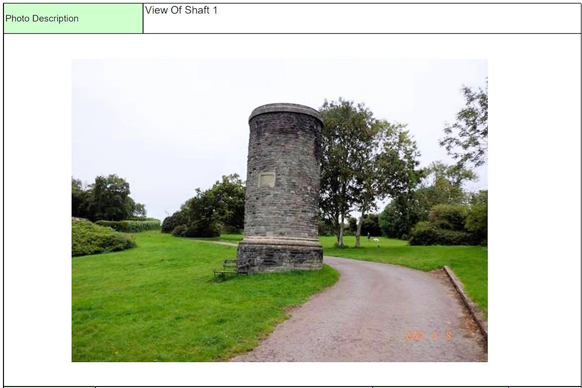
yards NW of Upper Belgrave Road and Pembroke Rd Jct. Copyright Mark D. Howells Senior Asset Engineer Drainage and Lineside. (1)
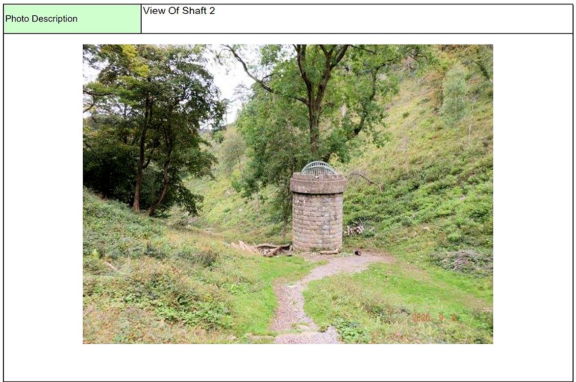
Clifton Down tunnel Vent shaft 2 in Walcombe Slade. Copyright Mark D. Howells Senior Asset Engineer Drainage and Lineside. (2)
in 1950 an old shaft leading out to the face of the gorge was reopened after having been blocked for many years. Originally it had been used as a stable for ponies employed in tunnel construction. A ganger's cabin was hewn out of the side of the tunnel on the Down side, approximately midway''. From uy Vincents report.
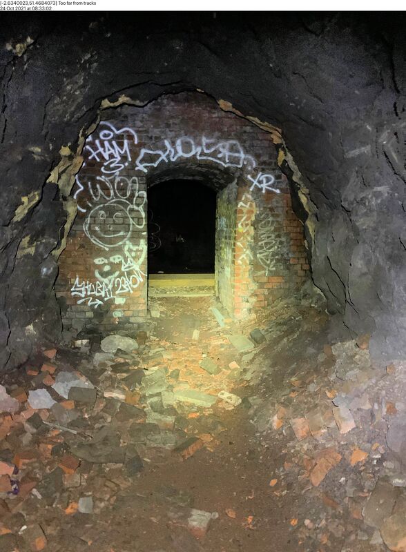
Clifton Down tunnel Horizontal vent 1 Copyright Mark D. Howells Senior Asset Engineer Drainage and Lineside.
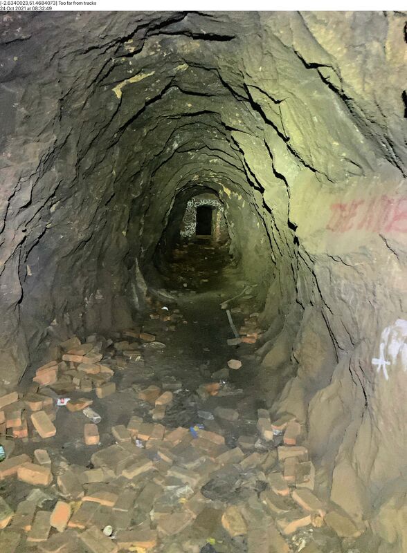
Clifton Down tunnel Horizontal vent 2 Copyright Mark D. Howells Senior Asset Engineer Drainage and Lineside.
===================================================================
Drainage Inspection work - Clifton Downs tunnel.
Mark Howells
Mark Howells
Evening Keith,
Several months ago you and your members kindly responded to my request for any information about the drainage system in Clifton Down tunnel.
Following several further enquiries with the Didcot Railway Centre and John Mann we were able to gather enough detail to excavate trial holes with confidence.
Please find attached several images taken during a visit to our current worksite yesterday.
Thank you for all the help and pictures provided – I shall be visiting the site later this week again to see the works as they progress and will send through further pictures.
Kind Regards,
Mark Dennis Howells BEng (Hons) MPWI MIAM
Senior Asset Engineer (Drainage & Lineside)
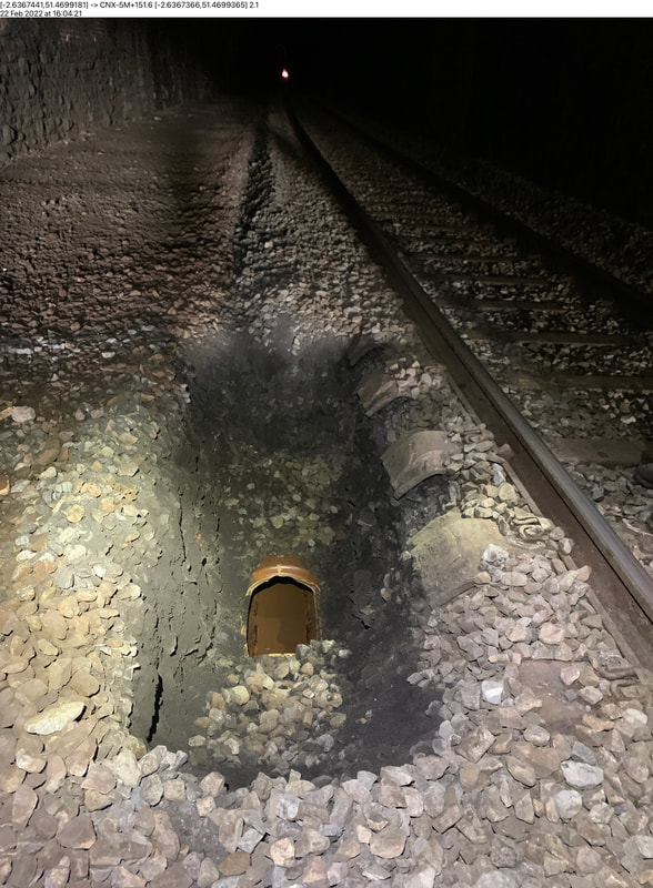
Clifton Downs tunnel drainage 1 22nd Feb 22. Copyright Mark Howells - Network Rail.375mm Vitrified Clay pipe in the former 6ft
Clifton Downs tunnel drainage 2 22nd Feb 22. Copyright Mark Howells - Network Rail. West cutting of Clifton Down tunnel
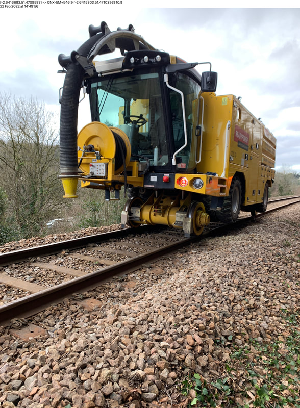
Clifton Downs tunnel drainage 3 22nd Feb 22 Copyright Mark Howells - Network Rail.. Drainage Clearence Road Rail Vehicle
---------------------------------------------------------------------------------------------
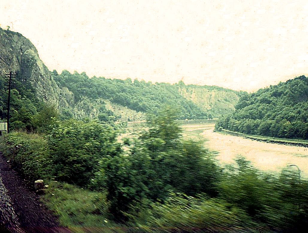
At the far end of Clifton Downs tunnel the line emerges into the lower end of Clifton George - Clifton Suspension Bridge is just out of sight around the bend. At one time the railway continued alongside the river to a station at Hotwells situated just below Clifton Suspension bridge, this closed in 1921. The Portishead branch runs on the far side of the river. 13th August 1967 Copyright Keith Jenkin
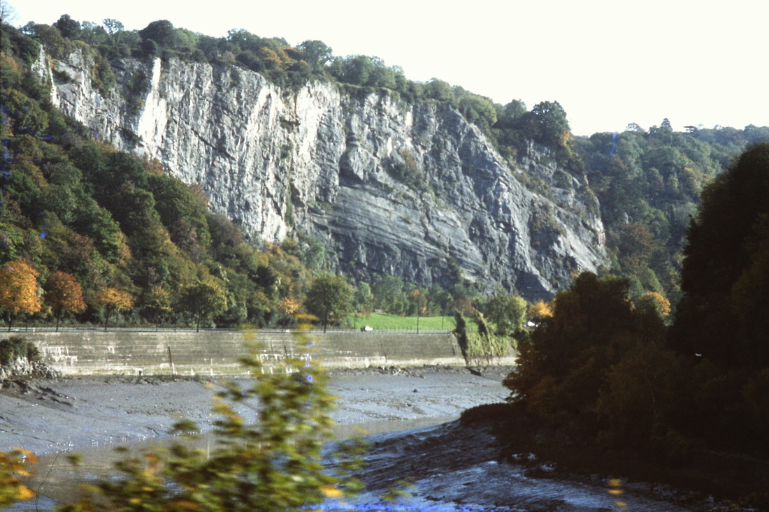
By using his telephoto lens Roger Winnen was on 13th January 1981 able to obtain this superb photo looking up the Avon George. Viewed from the Severn Beach Train. Copyright Roger Winnen N.B. The roadway is the Portway constructed along the formation of the Hotwells branch - Hotwells railway station was the original southern terminus of the Bristol Port Railway and Pier which ran to a station and pier at Avonmouth. The station opened in 1865, originally named Clifton station, and was situated in the Avon Gorge almost underneath the Clifton Suspension Bridge, adjacent to the Clifton Rocks Railway. The station closed in 1921. Copyright. Reference Wikipedia
Sea Mills Six miles from Bristol TM
Sea Mills Station, single track days, the approach from the Bristol direction. The platform shelter is relegated to a bus shelter. There is a pedestrian level crossing at the far end of the station, before the rail bridge over the inlet. This crossing gives access to the riverbank. 12th December 1980 Copyright Roger Winnen
The Avon Explorer passes through Sea Mills station over the board crossing and heads out onto the river Trym bridge. The downside platform had been taken out of use on the lines singling in 1970. This picture 12th May 1984 Copyright Roger Winnen
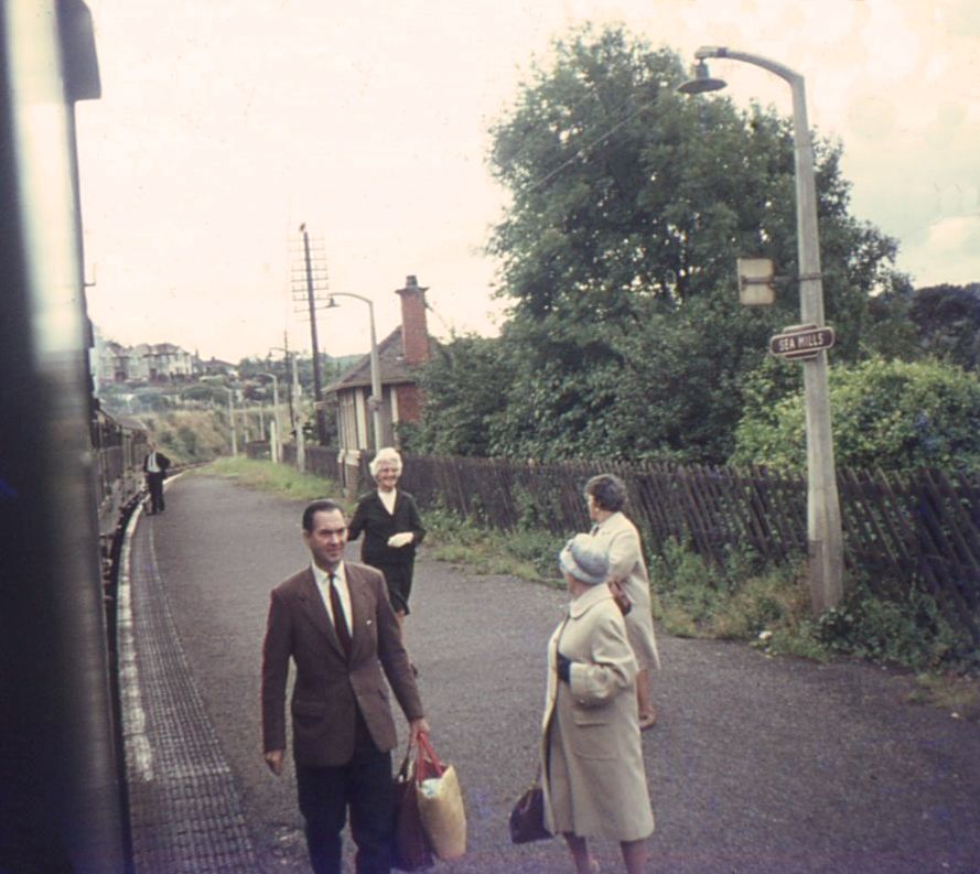
Passengers disembark onto the down side platform at Sea Mills in double track days. There was no footbridge here, passengers had to cross the line by means of a board crossing at the Shirehampton end of the station. For a short time a subway was available - however, as high tides rendered this unusable, it was taken out of use. 13th August 1967 Copyright Keith Jenkin
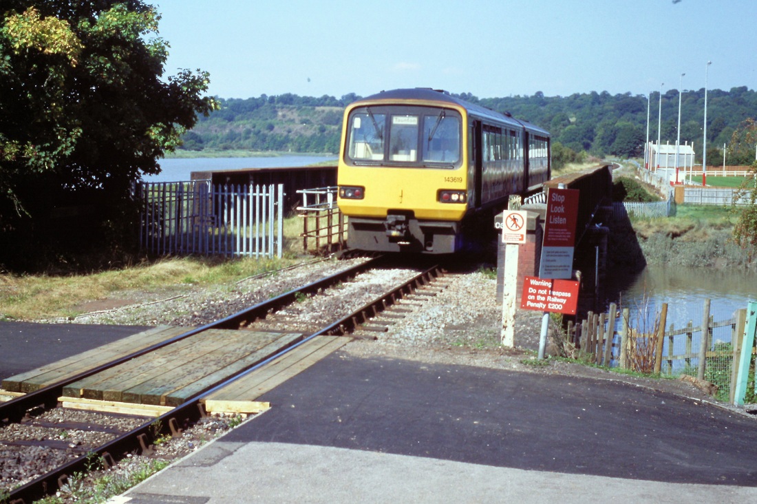
A pacer arrives at Sea Mills from Severn Beach . 4th September 2003 Copyright Roger Winnen N.B. Public access to the river Avon bank is over this crossing.
Sea Mills Station seen from the Shirehampton direction. On a rather dull and foggy December day. 12th December 1980 Copyright Roger Winnen

Sea Mills. A pacer has just left the station, with its attractive station master's house, and obstructs the pedestrian crossing leading to the Avon river side. 4th April 2003 Copyright Roger Winnen
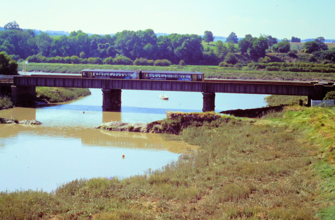
Sea Mills - The unit is now well onto the 88 yard bridge over the River Trym on the 4th September 2003 Copyright Roger Winnen
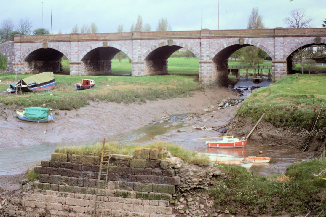
A view from the train of the road bridge from which the previous two pictures were taken and also of the remains of Joshua Fanklyn's wet dock alongside the river Trym. The river seems to diminish in size rather rapidly! 12th April 1999 Copyright Roger Winnen
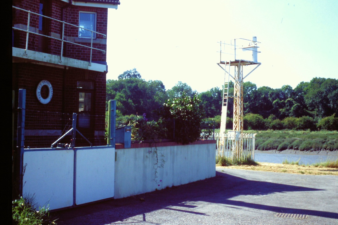
Sea Mills - a closer view of the navigation marker on its tower. 4th September 2003 Copyright Roger Winnen
From Wilkipedia By the middle ages Bristol had become a major port, with all traffic between the port and the sea having to pass through the Avon Gorge and past Sea Mills. In 1712, Joshua Franklyn, a Bristol merchant, built a wet dock at Sea Mills, to eliminate the need for large sailing ships to navigate the dangerous River Avon any further upstream. This was located where the river Trym enters the river Avon. However, poor transport links doomed the enterprise and the harbour facilities fell into disrepair by the end of the 18th century. Some remains of the dock still exist, and are used as a harbour by pleasure craft
In the 1920s and 30s, Sea Mills was developed as a planned green suburb. Much of the housing was local authority, although it is now mainly in private ownership.
In the 1920s and 30s, Sea Mills was developed as a planned green suburb. Much of the housing was local authority, although it is now mainly in private ownership.
As the train leaves Sea Mills it crosses Trym bridge over the river Trym, a small tributary off the Avon River. A ship, possibly a coaster, can be seen making its way up the Avon towards the Avon George and the Port of Bristol. The mast seen on the jetty at the centre of the picture is one of the navigation aids for shipping. 13th August 1967 Copyright Keith Jenkin
Horseshoe Bend - beyond Sea Mills the line climbs following the left hand curve of the river on a shelf cut in the cliff face before entering a cutting and bearing right to head into Shirehampton.
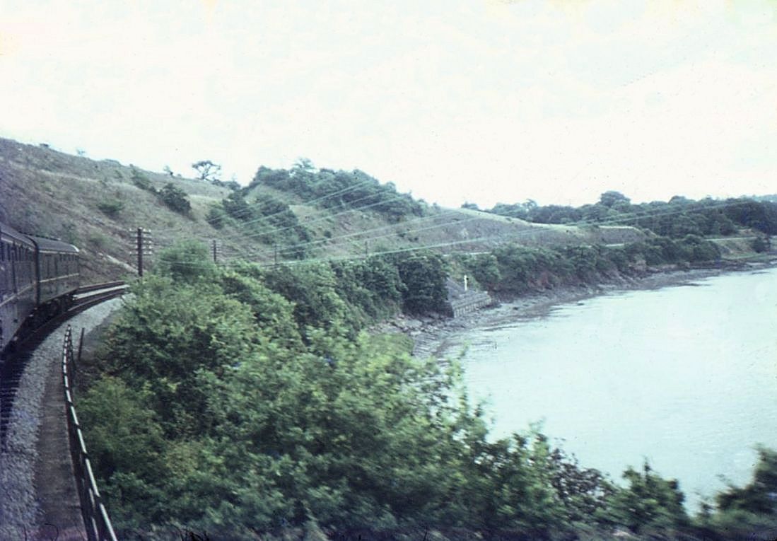
This picture, taken on the 13th August 1967, shows the train on the double track formation following the curve of the River Avon. Copyright Keith Jenkin
The Avon Explorer headed by 50035 tackles the climb around the Horseshoe bend, by now single track. Note the heads out of windows to enjoy the spectacular views at this point though sadly the trees have grown somewhat since the 1967 shot. 12th April 1984 Copyright Roger Winnen
Shirehampton Seven and a half miles from Bristol TM
Shirehampton in double track days, note the vandals have been at work on the nameboard. The goods yard here lay on the up side behind the station building, there were three sidings. 13th August 1967 Copyright Keith Jenkin
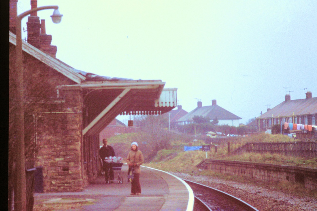
Shirehampton Station, now with single track and the same platform building though these are looking a little jaded on 12th December 1980. Movements at the station were controlled by a 20 lever signalbox located on the downside platform, thus on the outside of the curve . Copyright Roger Winnen
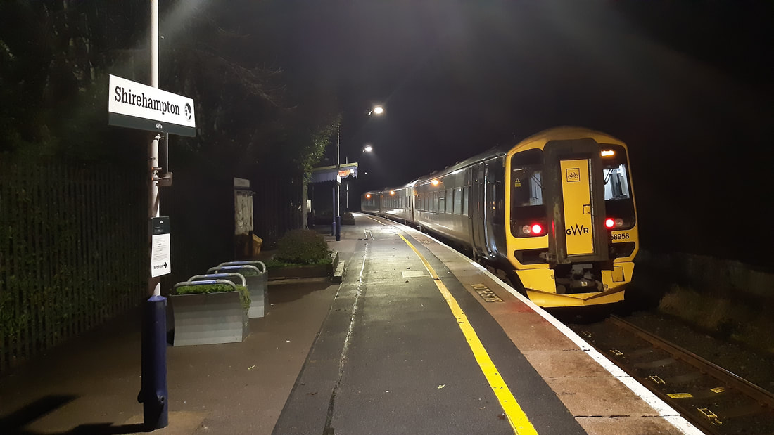
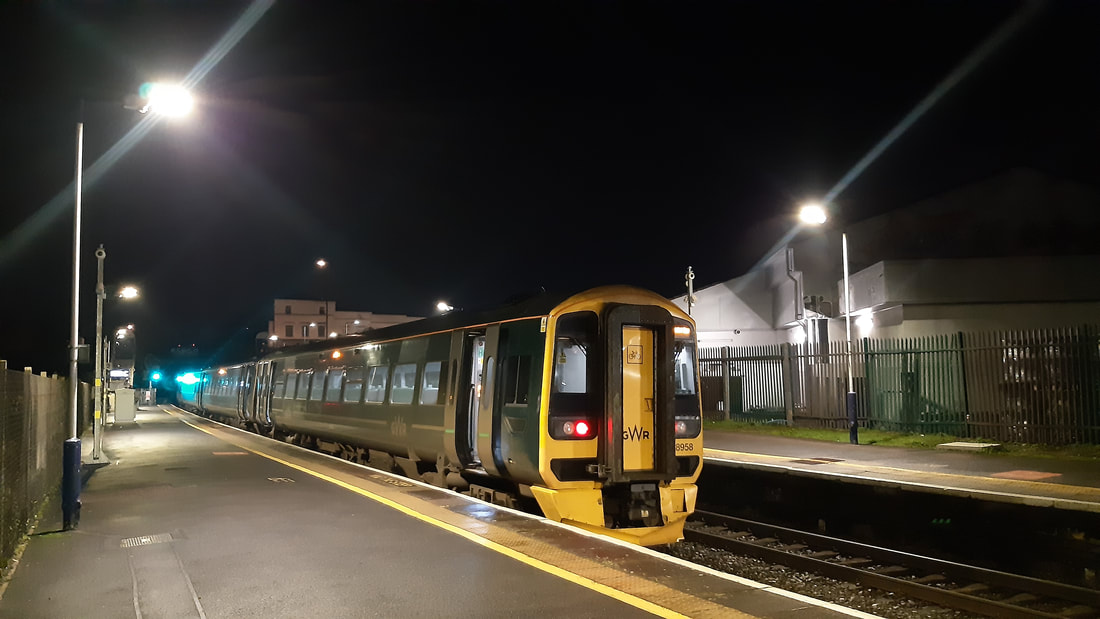
Shirehampton 158958 2210 SVB-BTM 21st December 2022. Copyright Guy Vincent.
New station at Portbury Park & Ride
On the return leg of a trip from Bristol to Severn Beach and back I passed the now complete but yet to open Portway Park and Ride station, so grabbed a photo as the train went through. The station has been given the CIS code PIR and appears to be located at approximately 8 miles and ten chains (mid-point of platform) on the single line between Shirehampton station (7m50ch) and Avonmouth Dock Level Crossing (8m29ch). The 5-car platform is on the right-hand side of trains travelling from Bristol TM towards Avonmouth. No opening date has yet been announced as the car park has yet to be finished but the entire site is fully illuminated during the hours of darkness and the CIS screens appear to be working. The cost of the project has been given as £4.2 million. Like most modern stations the area resembles a bright steel fortress with long lengths of contrasting green palisade security fencing currently being erected. The tall viaduct that carries the M5 motorway across the river Avon and docks area can be seen in the background.
Regards, Guy Vincent
Regards, Guy Vincent
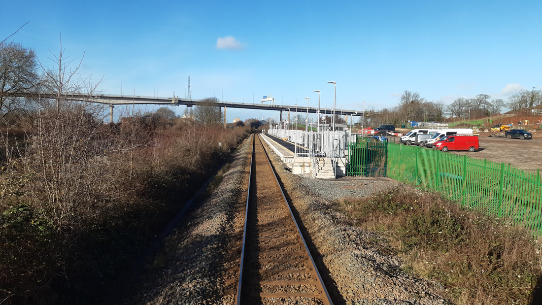
Portway Park and Ride station (PIR) towards AVN with M5 viaduct in background. Photograph taken on the 13th January 2023, the station is expected to open early in 2023. Copyright Guy Vincent
The first day and first ticket to Portway Park and Ride. 1st August 2023.
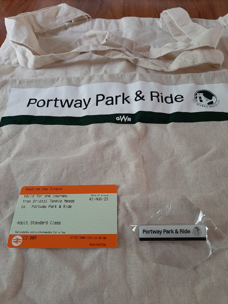
The souvenirers 'First Day Ticket' etc. 1st August 2023. Copyright Richard Giles.

The 05.10 Bristol TM to Severn Beach. The first public service to PortwayPark and ride. 1st August 2023.Copyright Richard Giles.
A special thanks to Richard Giles who was there - bought the first ticket and rode the first train.
Hello Keith
There did seem to be people who have travelled from near and a far for this ‘inaugural’ public passenger train serving the Portway Park & Ride opening on 1st August 2023. Like Marsh Barton, Exeter the project saw a number of delays affected by the Pandemic and financial change. At one time both stations were reported to be opening for public passenger trains on the same day – Saturday 3rd June!
August 1st - Train details were; 165108 – 2K00 0510 Bristol TM – Severn Beach calling 0537 – 0539.
GWR management, NR officials and Council staff (Bristol City Council own and operate the adjacent car park now with over 800 spaces) along with Transport Minister Mark Harper MP (who also opened Marsh Barton) had used the 2K16 0910 Bristol TM – Avonmouth service (calling 0940 – 0942) formed with 165112 to perform the official opening of the £5.8 million station on the day before. The station had been added to the Working Timetable as an unadvertised stop from the Winter 2021 timetable change (from 12th December) which saw a new 30 minute timetable introduced for the this part of the Severn Beach line - despite very little work having taken place at that point!
Two souvenirs available for those present on the day are depicted in the second view, with what is believed to have been the first ticket issued to the station at Temple Meads within an hour of opening, purchased on 31st July.
Next station for the Bristol area will be Ashley Down (2024) with Filton North and Henbury (possibly 2026) and two more for the Portishead Branchline, where contractor Volker Fitzpatrick are undertaking survey work for the authorized re-opening business plan to be submitted to the Government early or during the Summer of next year.
Hope of use, in case of no reports for your ‘latest inputs and news section’ from elsewhere,
Regards, Richard Giles, Clevedon, North Somerset.
Between Shirehampton and Avonmouth Dock
Avonmouth Dock Junction Signalbox was the first one coming from the Shirehampton Direction.
Avonmouth Dock Junction Signalbox was the first one coming from the Shirehampton Direction.
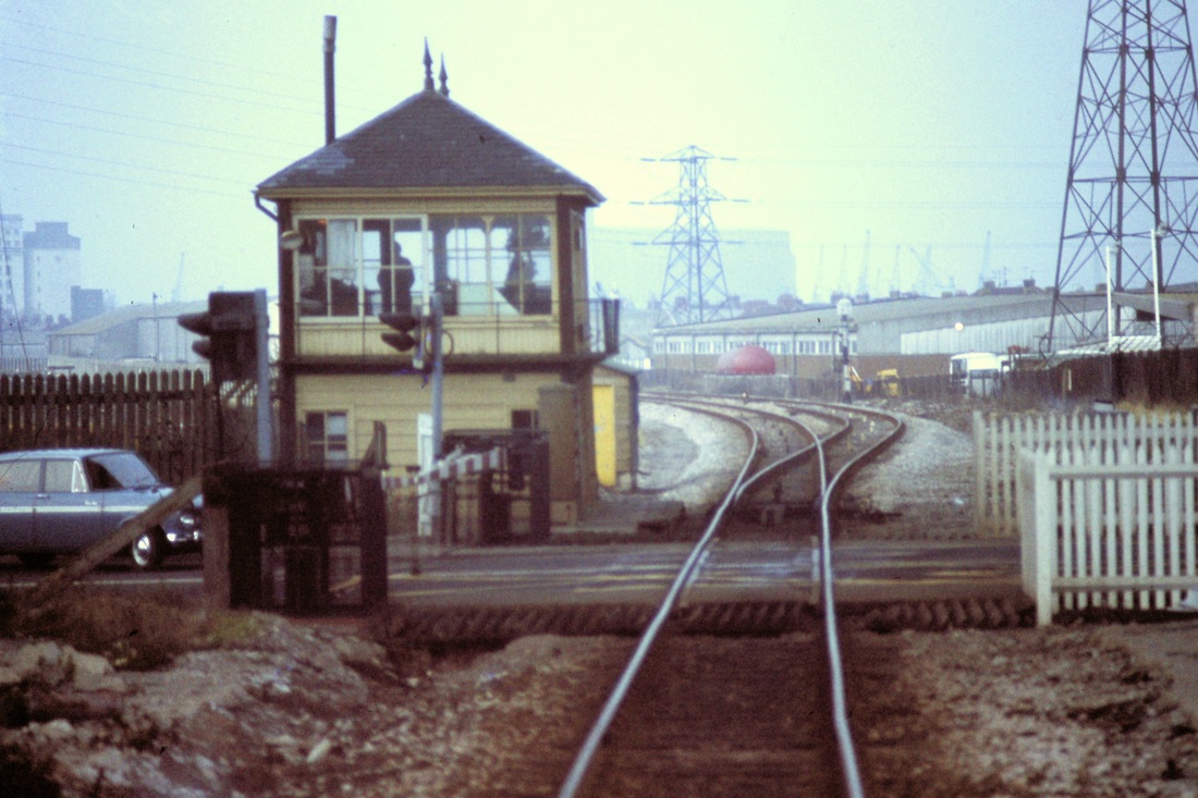
Avonmouth Dock Junction Signalbox - where begins the long loop which extended as far as Avonmouth. Beyond the box there were once very extensive West Town sidings on the left of this picture. 12th January 1980 Copyright Roger Winnen.
Avonmouth Dock Junction Signalbox 15th June 1985 Copyright Chris Osment
Avonmouth Dock Junction signalbox 15th June 1985 Copyright Chris Osment
Avonmouth Dock Jct Signalbox 15th June 1985 Copyright Chris Osment
A class 25 approaches Avonmouth from Shirehampton - the massive M5 bridge certainly dominates the area. 11th November 1978 Copyright Roger Winnen
Above is a map of the Avonmouth area courtesy Google Maps. Zoom in and pan around to see recent track layouts.
Avonmouth Dock Nine miles from Bristol TM
Entering Avonmouth Station on the 12th January 1980 Copyright Roger Winnen. Note the fixed distance signal and the white diamond on the signal post, denoting that the section beyond is protected by track circuiting. The level crossing barriers are up, allowing road traffic to cross the line, therefore the next signal is at Red. Copyright Roger Winnen.
A view of Avonmouth station from a Severn Beach bound train. Beyond the station can be seen a level crossing. 13th August 1967. Copyright Keith Jenkin
The train for Severn Beach has stopped at Avonmouth. Note the generous canopy which once served this platform. 13th August 1967 Copyright Keith Jenkin

Leaves litter the platform in this autumnal scene at Avonmouth Station on the 11th November 1978. The up platform on the left in this view was added in 1918. Copyright Roger Winnen
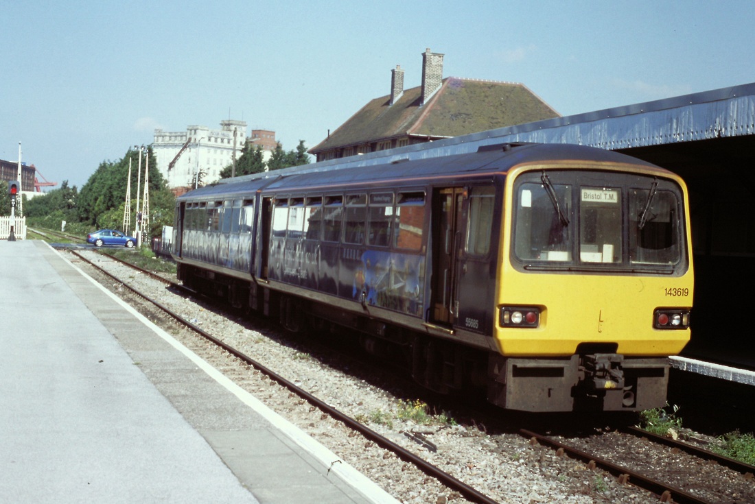
143619 waits to return to Bristol from Avonmouth. It is the 4th September 2003. Copyright Roger Winnen
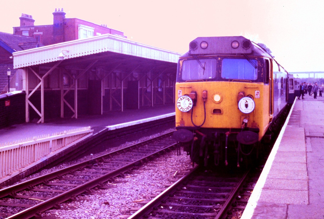
The Cornwall Railway Society's 'Avon Explorer' charter stands at Avonmouth, headed by 50035 Ark Royal. 12th May 1984 Copyright Roger Winnen
We were allowed to stop, within reason, as long as we wished at Avonmouth. However the driver has been given the 'nod' that we'd like to move on and is on the phone (near by the signal) to get the barriers lowered. 12th May 1984 Copyright Roger Winnen

One more shot before we move on!! 12th May 1984 Copyright Roger Winnen
A single car unit departs Avonmouth for Severn Beach, the barriers have yet to come up. On a cheerful note, a mortuary was sited at the far end of the terraced houses on the right hand side. 11th November 1978 Copyright Roger Winnen
Avonmouth Station crossing, looking towards the former St Andrews Junction on the 4th September 2003. Looks as if the weeds need a little attention! Copyright Roger Winnen
Avonmouth Dock Station (From WR Weekly Engineering Notices K2/3/69 and K2/39/73)
Signalbox closed and new 6-Lever Ground Frame provided to control Home and Distant signals and Gate Locks with control of existing 4-Half Gates by wheel in GF retained.
Signalbox/GF abolished as a Block Post.
All commissioned 19/01/1969.
4-Half Gates replaced with 4-Half Lifting Barriers commissioned and controlled from St.Andrews Junction using CCTV.
Avonmouth Dock GF abolished.
All commissioned 30/09/1973.
Kind Regards,
Chris Bellett
Retired S&T Engineer
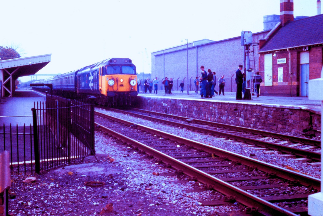
The CRS charter moves on towards St Andrews Junction. 12th May 1984. Copyright Roger Winnen
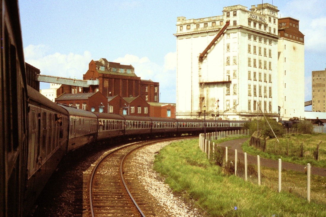
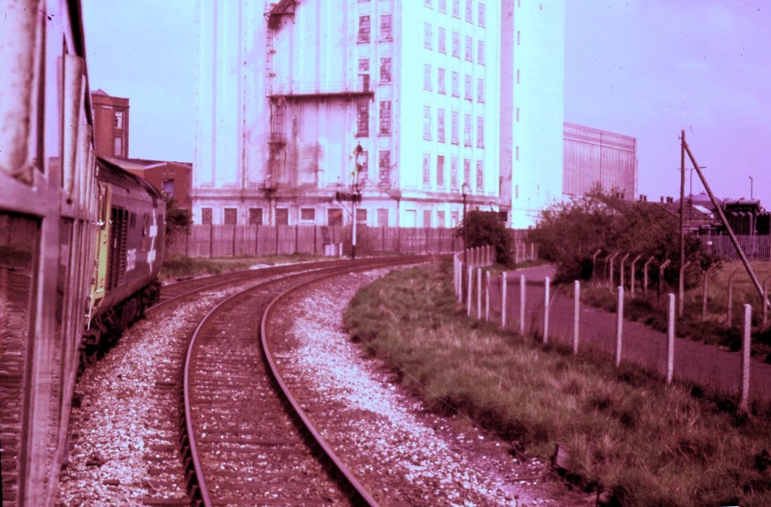
Rounding the sharp curve at Avonmouth, the Bristolian passes the CWS Flour Mills. 30th April 1983 Copyright Roger Winnen
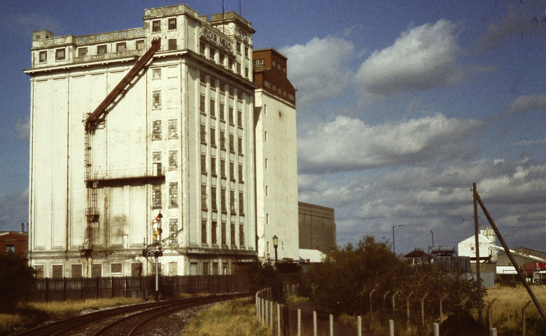
17th September 1983 Copyright Roger Winnen

St Andrews Junction signalbox controlled the busy level crossing and also junctions to the docks both to the north and south of the box. Taken on 17th September 1983 Copyright Roger Winnen

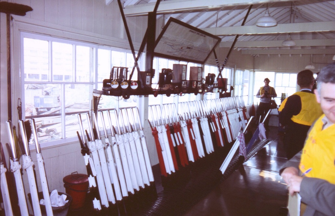
An internal view of St Andrews Junction Signalbox - taken on the 15th June 1985 on a Signalling Record Society visit. Copyright Chris Osment
Avonmouth Town Goods Yard Signal Box
Avonmouth Town Goods Yard Signal Box. Taken on a Signalling Record Society visit on the 15th June 1985 Copyright Chris Osment
Avonmouth Town Goods Yard Signalbox interior 15th June 1985 -1 - Copyright Chris Osment

Avonmouth Town Goods Yard Signalbox interior 15th June 1985 -2 - Copyright Chris Osment
St Andrews Road Ten miles from Bristol TM
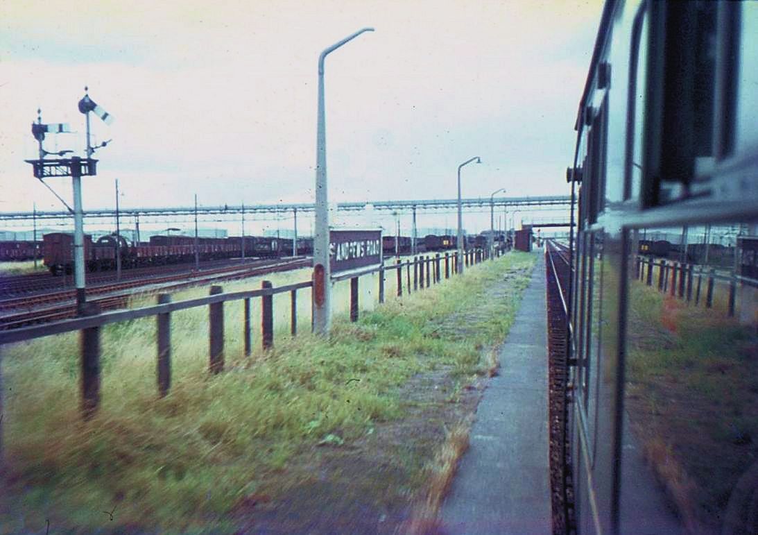
As can be seen, there were very long platforms at St Andrews Road. The busy dock sidings lie to the left. Bristol Docks had, in all, over thirty one and a half miles of sidings. !3th August 1967. Copyright Keith Jenkin
St Andrews Road station 10th June 1989 Note the stacks of imported coal. Copyright Roger Winnen
St Andrews Road Station, with a heritage set arriving - 10th June 1989 Copyright Roger Winnen
Note that in the previous two images, the up platform, for Bristol bound passengers, is still in use. It had been removed in the following sequence.
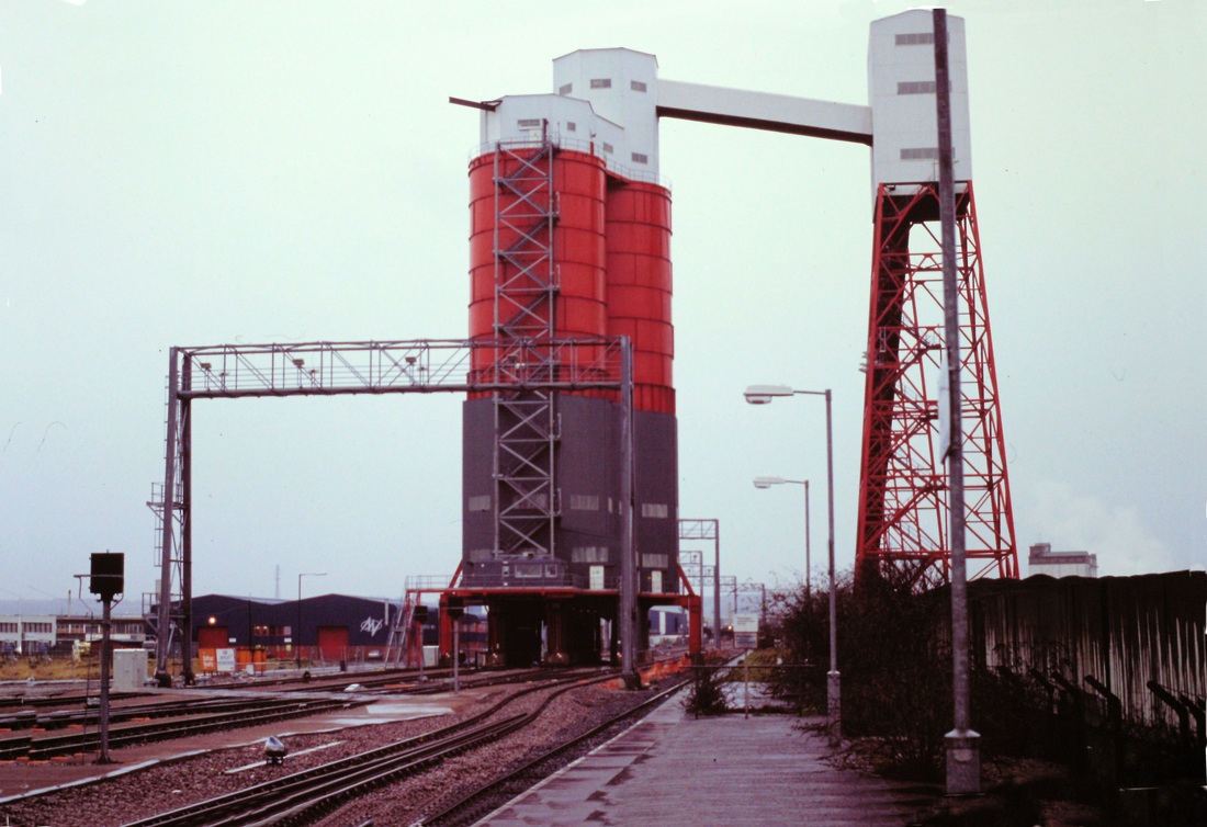
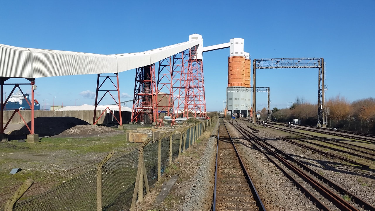
The impressive New Coaling Facilities at St Andrews Road - these came into use in 1993. 30th December 1993 Copyright Roger Winnen
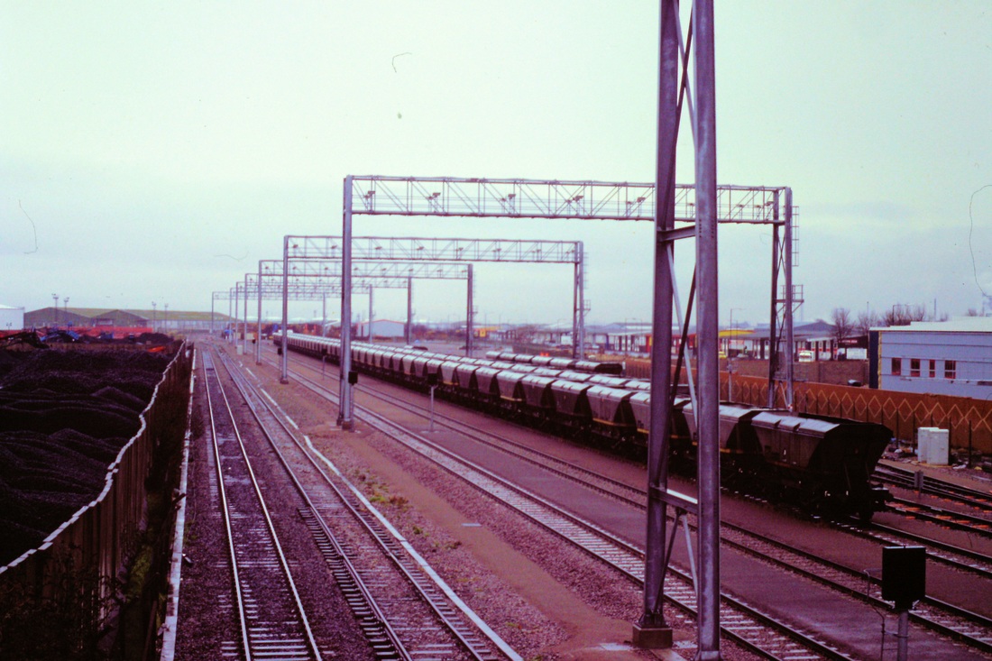
Long rakes of coal hoppers await attention. Hallen Marsh Junction box was once in the distance. 30th December 1993 Copyright Roger Winnen
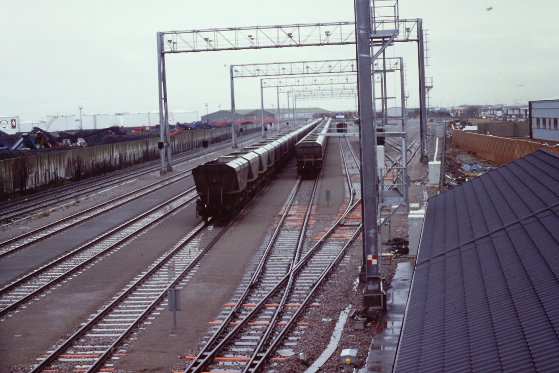
St Andrews Road 931230d The new sidings at St Andrews Road. Copyright Roger Winnen
Over the back of the remaining platform at St Andrews Road, an array of trackwork has been installed - part of the new coal import plant - built to serve, amongst others, Didcot Power station. However, the Didcot Power station has been decommissioned (in 2014) and, latterly, demolished. 30th December 1993 Copyright Roger Winnen
Another shot of the coaling plant on the 30th December 1993. Copyright Roger Winnen.
A unit heads away from St Andrews Road for Severn Beach 30th December 1993 Copyright Roger Winnen
Avonmouth Coaling Plant - the removal of 2022.
An article & pictures by Guy Vincent
An article & pictures by Guy Vincent
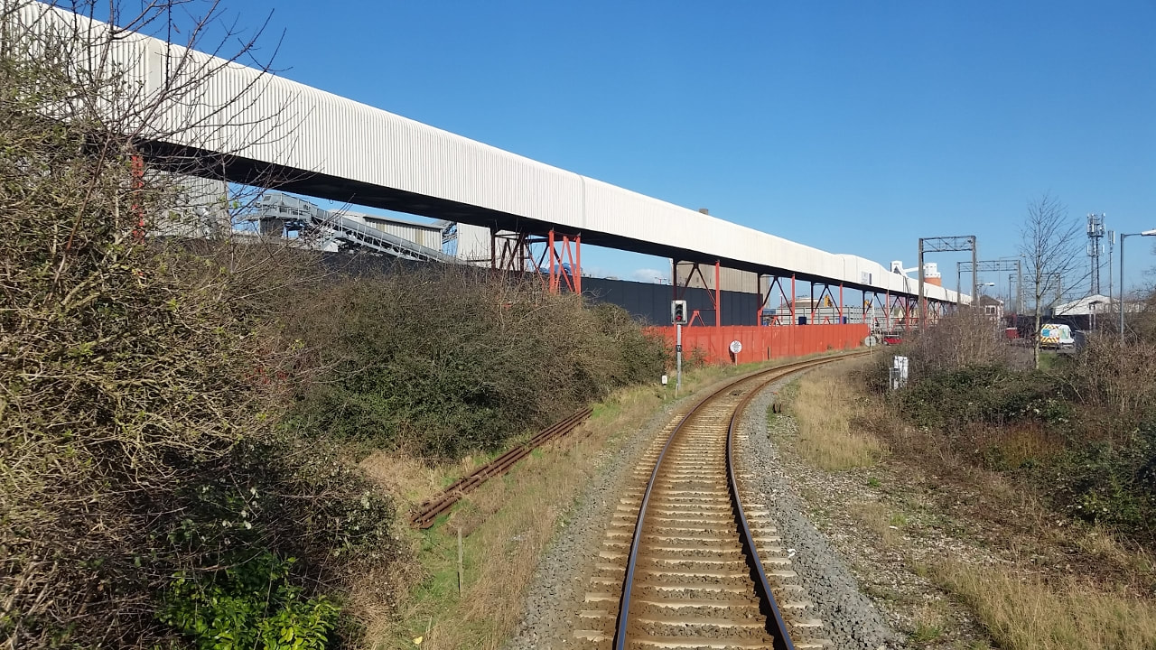
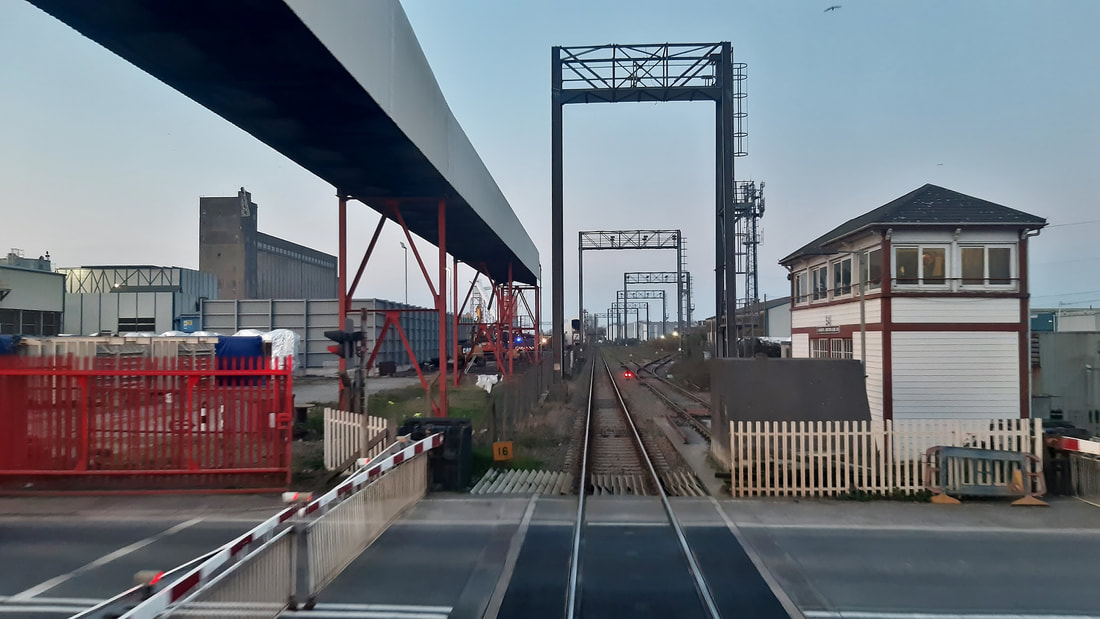
It is worth putting on record that a long stretch of the elevated coal conveyor situated adjacent to the Severn Beach line between Avonmouth and St Andrews Road is in the process of being dismantled for scrap. A trip along the line last weekend found a large section had already gone and workmen were engaged on cutting up the remains close by St Andrews Junction Signal Box. The conveyor was built in the early 1990s to enable coal brought by ship into Portbury docks (on the opposite side of the Avon) to be loaded into coal trains for movement to power stations. Didcot Power Station was a major user of this coal and many millions of pounds were spent building a brand new siding complex at St Andrews Road, including full signalling provision and improvements made to the line towards Bristol Parkway. Further east long running loops were installed between Swindon and Didcot. As we know coal is no longer used for power station fuel in the UK and the conveyer has been disused for some time. I believe Storm Eunice caused a certain amount of damage to the conveyer and this could be why demolition is under way.
Regards for now
Guy Vincent
Regards for now
Guy Vincent
Avonmouth coal plant 1 Avonmouth St Andrews Junction Signal Box 23rd September 2016 Copyright Guy Vincent
Avonmouth coal plant 2 Avonmouth Coal Conveyor Feb 2021. Copyright Guy Vincent
Avonmouth coal plant 3 St Andrews Road Coal Discharge Plant Feb 2021 Copyright Guy Vincent.
March 2022 pictures.
Avonmouth coal plant 4 Avonmouth Conveyor Removal March 2022 (1) Copyright Guy Vincent
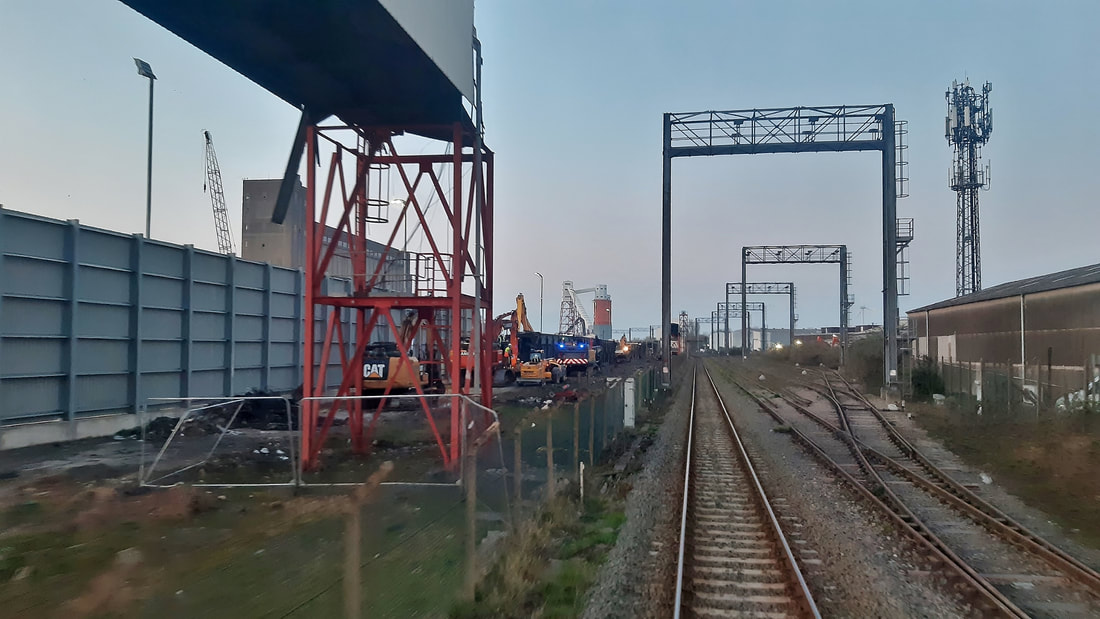
Avonmouth coal plant 5 Avonmouth Conveyor Removal March 2022 (2) Copyright Guy Vincent
Avonmouth coal plant 6 Avonmouth Coal Conveyor Removal March 2022 (3) Copyright Guy Vincent
Avonmouth coal plant 7 Avonmouth Coal Conveyor Loading Tower St Andrews Road March 2022 Copyright Guy Vincent
Courtesy Wikipedia - At the Royal Edward, a Gottwald HSK 260 Harbour Crane can unload up to 10,000 tonnes of coal per day; whilst two 2,500 tonne rapid bulk-handling conveyors at Royal Portbury discharge into a conveyor system which runs under the River Avon in a tunnel. Freight trains are moved automatically under the bunkers at 0.8 kilometres per hour (0.50 mph), allowing a 1,750 tonnes (1,930 tons) train to be fully and automatically loaded in under 36 minutes.
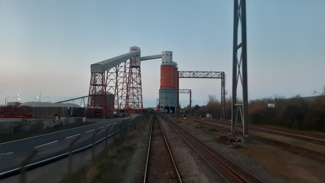
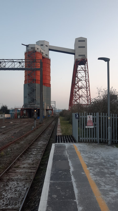
Holesmouth Junction
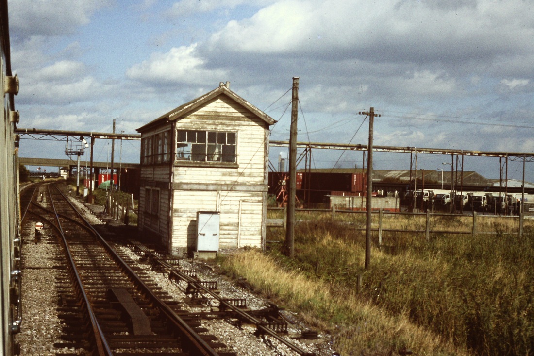
Holesmouth Junction Box controlled entry to the massive collection of Docks Sidings. It was very close to Hallen Marsh Junction signalbox which can be seen in the distance. Holesworth Junction box dated from 1941, being a replacement for a 1910 box destroyed in an air raid. The box finally closed on 25th January 1988. (Quote from Middleton Press "Branch lines Around Avonmouth" ) This picture was taken from a Severn Beach bound service on the 17th September 1983. Copyright Roger Winnen
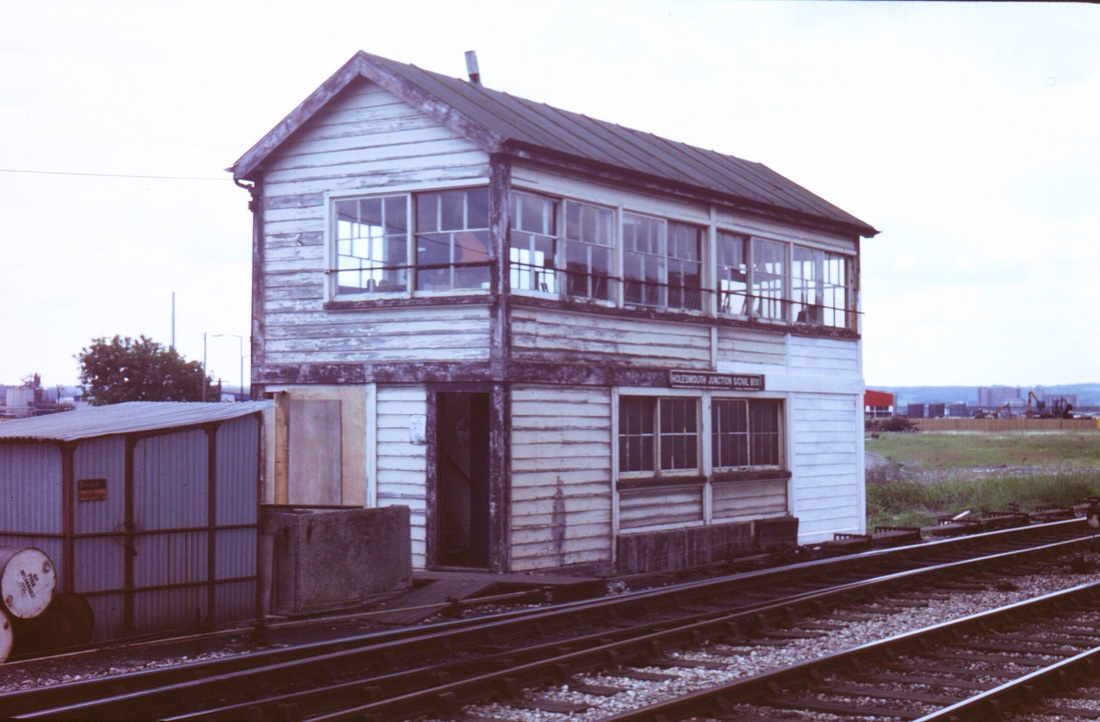
Holesmouth Junction Signalbox, taken during a Signalling Record Society visit 15th June 1985. Copyright Chris Osment
Holesmouth Junction Signalbox interior, taken during a Signalling Record Society visit on the 15th June 1985 Copyright Chris Osment
Hallen Marsh Junction
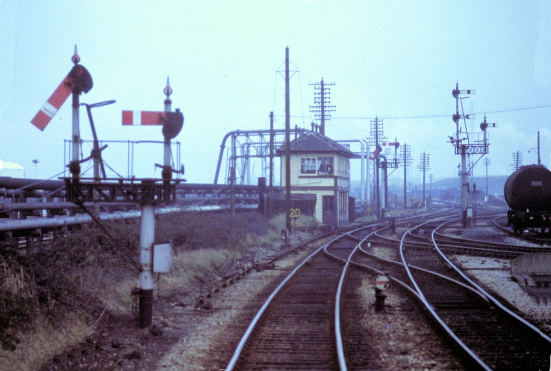
Hallen Marsh Jct. At least a dozen sidings, including the Imperial Smelting Works, were served from the double line connection exiting this picture on the right hand side. Again to the right, but beyond the box, are the lines to Filton Junction, whereas the double tracks continuing more or less straight on soon become single and form the line to Severn Beach. As seen on 12th January 1980 Copyright Roger Winnen
Hallen Marsh Junction seen here three and half years after the previous shot and on a much better day. Little seems to have changed! Note the number of chimneys reminding us that this is predominantly an industrial area. The bracket signal is pulled off for us to continue, the higher level signal is for the faster route towards Filton. 17th September 1983 Copyright Roger Winnen
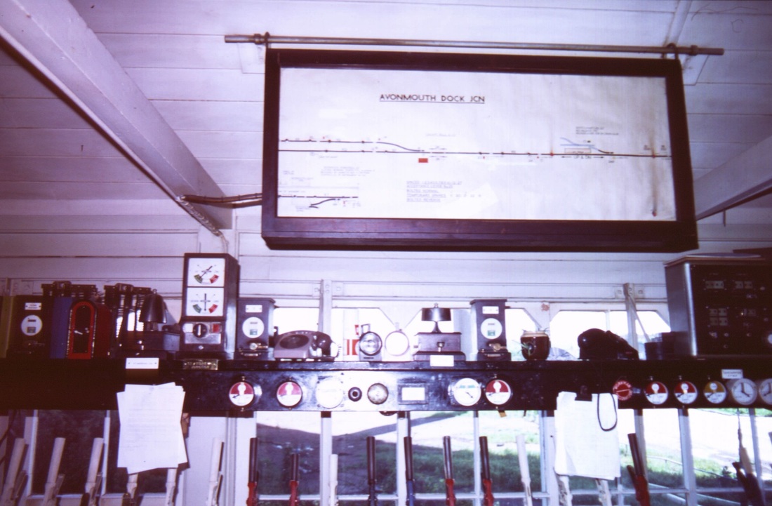
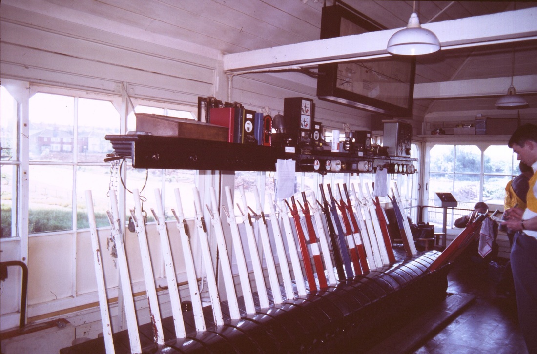
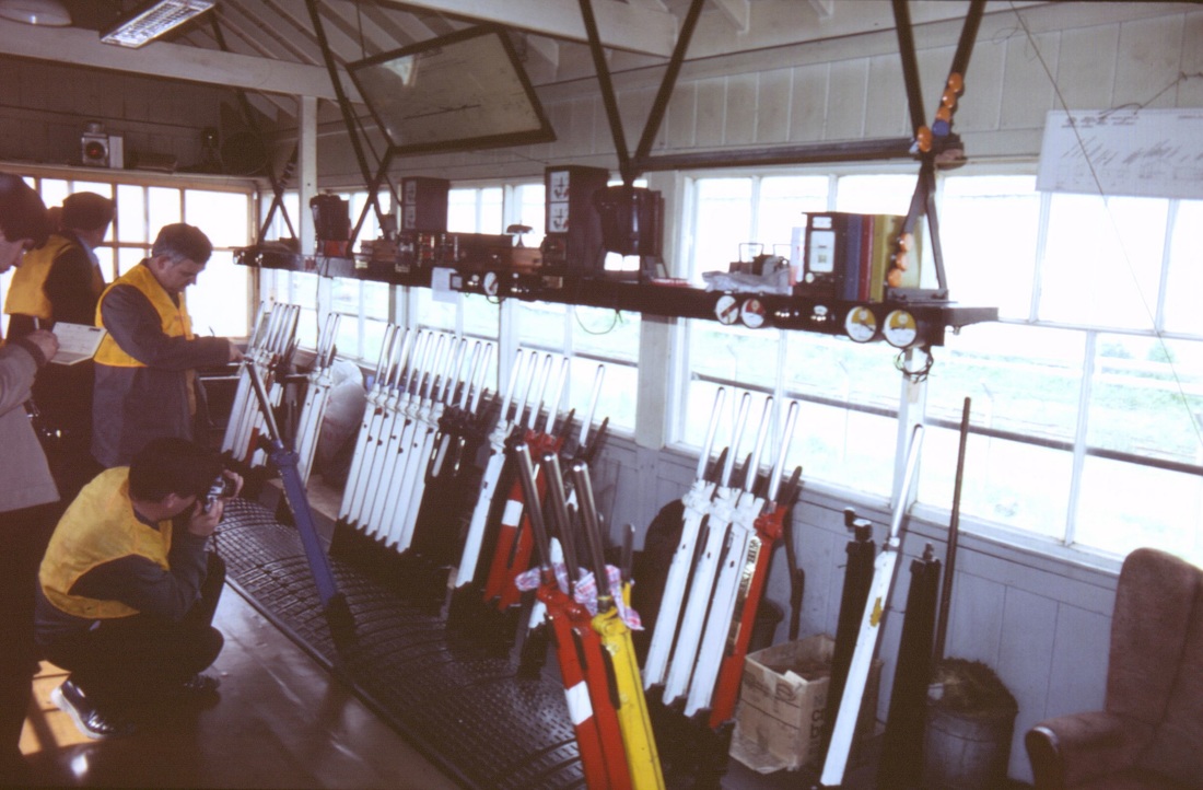
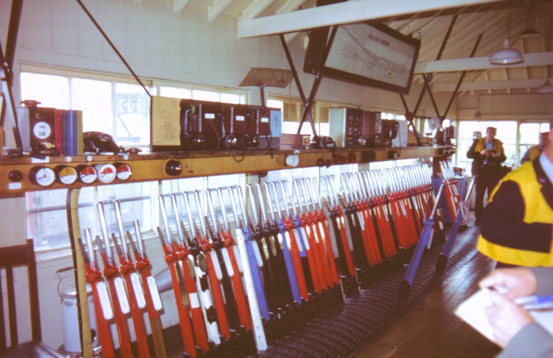
And now for a treat - Chris Osment was on a Signalling Record Society visit to boxes in the Avonmouth area on 15th June 1985. Particularly interesting was his visit to Hallen Marsh Junction whence drivers on the run to Severn Beach collected the token for the single line running to the terminus - at one time the through line to Pilning. We are indebted to Chris for his pictures in and from this box and others on the line.

Hallen Marsh Signalbox 15th June 1985 This box opened in 1917 and remained in use until 1988. Copyright Chris Osment
Hallen Marsh Signalbox interior 1 15th June 1985 Copyright Chris Osment
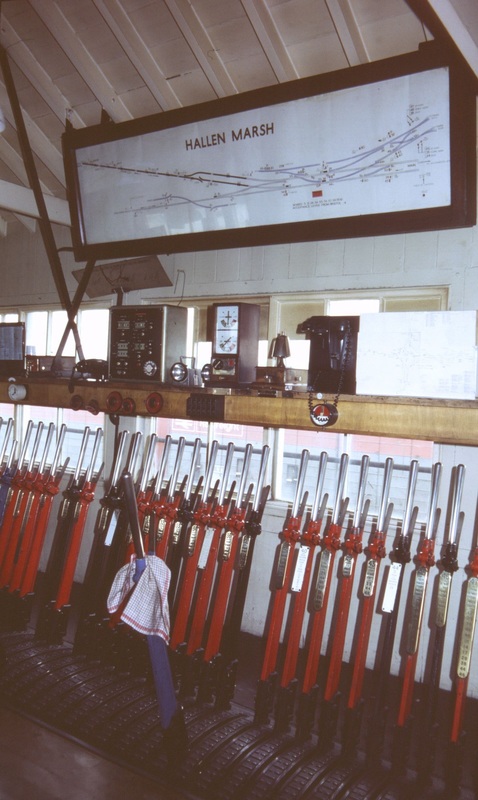
Hallen Marsh Signalbox interior -2 15th June 1985 Copyright Chris Osment
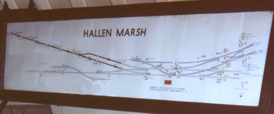
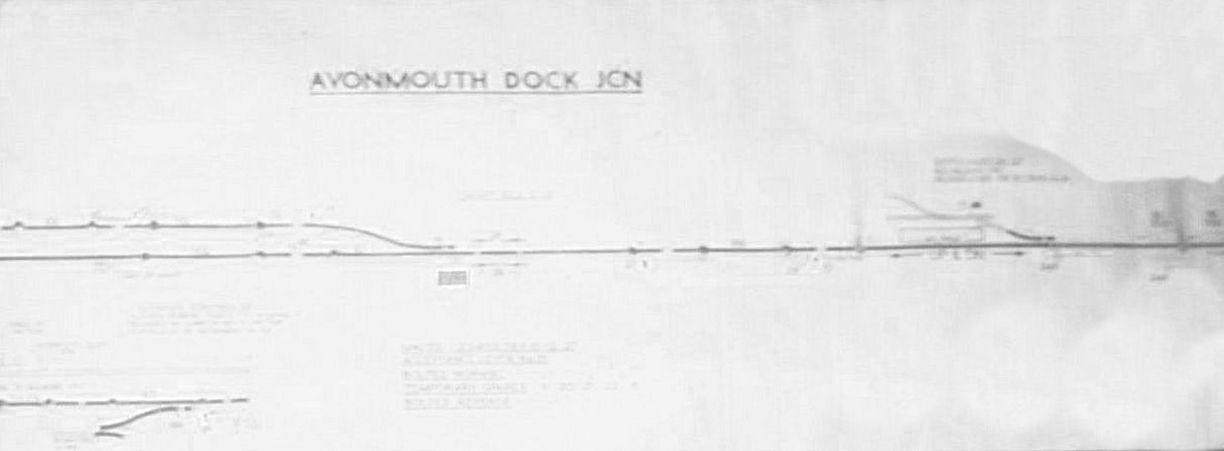
Hallen Marsh Signalbox - the track diagram. There was a 65 lever frame here. 15th June 1985 Copyright Chris Osment

A view looking South as a heritage DMU on a service to Severn Beach approaches. 15th June 2015 Copyright Chris Osment.
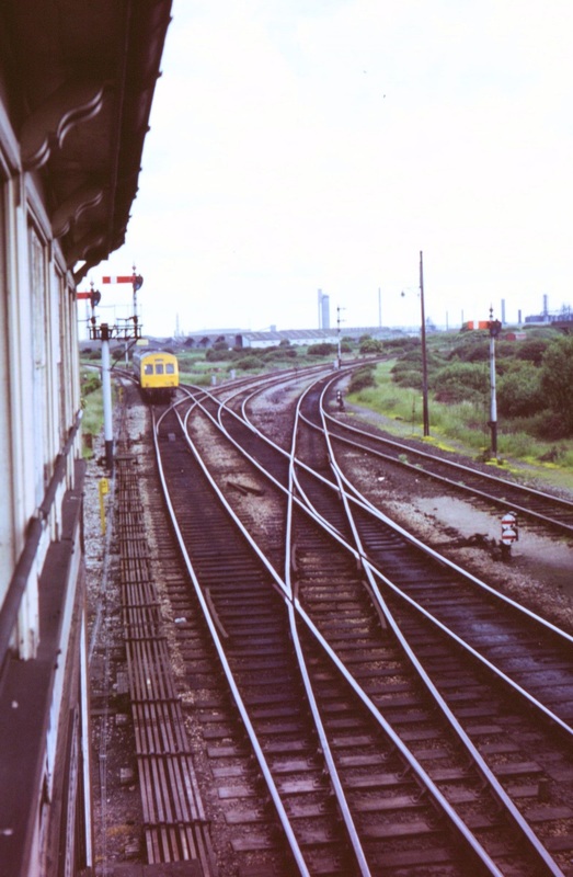
A view looking north as the heritage set continues on its way towards Severn Beach. The signalman has been quick to restore his signals as soon as the unit passes. The double track metals heading off to the right at the top of this picture are for Filton Junction. 15th June 2015 Copyright Chris Osment
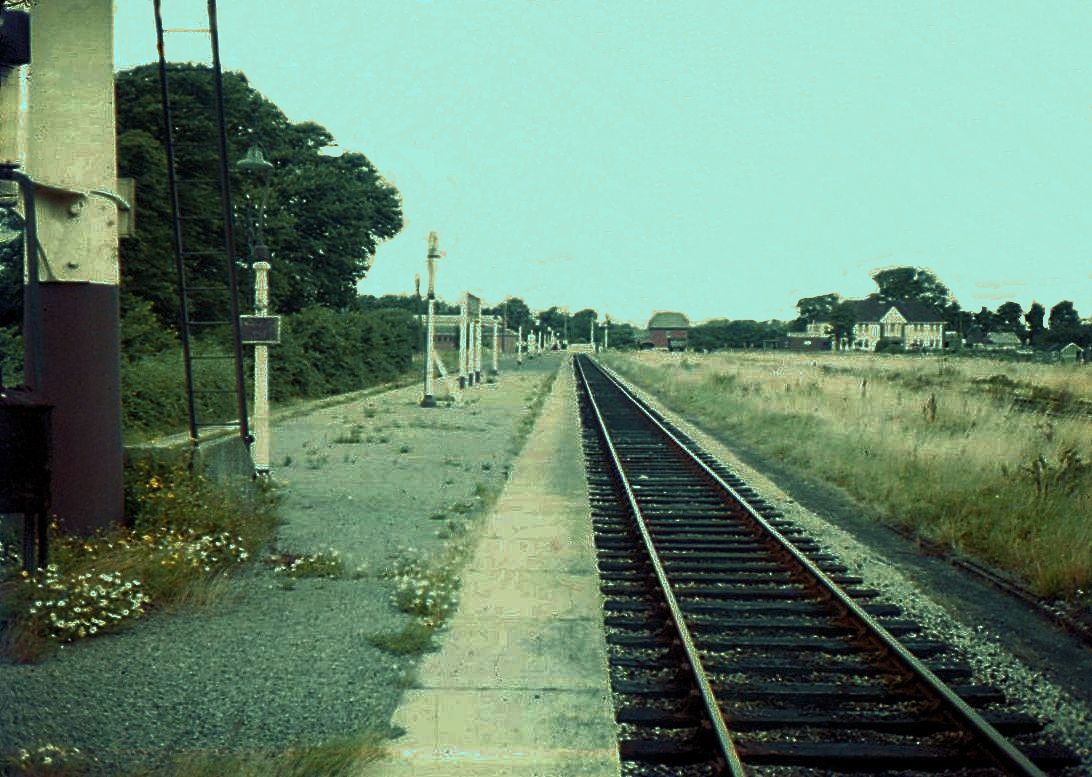
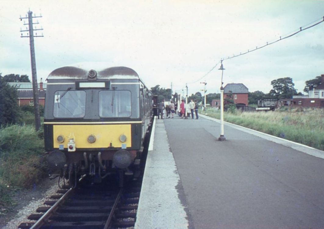
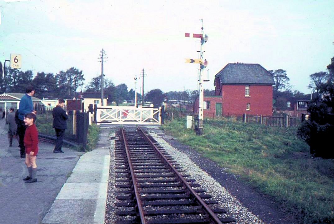
Severn Beach Thirteen and a half miles from Bristol TM
Copyright John Cornelius

Trying to squeeze the best out of a poor picture but here one can see the signalbox at Severn Beach: it turns ts back on the sea and looks out over the line, which came in alongside the left hand side of the platform in this picture, and served Pilning. The metalwork on the platform is part of the old water column. 13th August 1967.
Severn Beach, looking along the Pilning side of the platform. 13th August 1967 Copyright Keith Jenkin
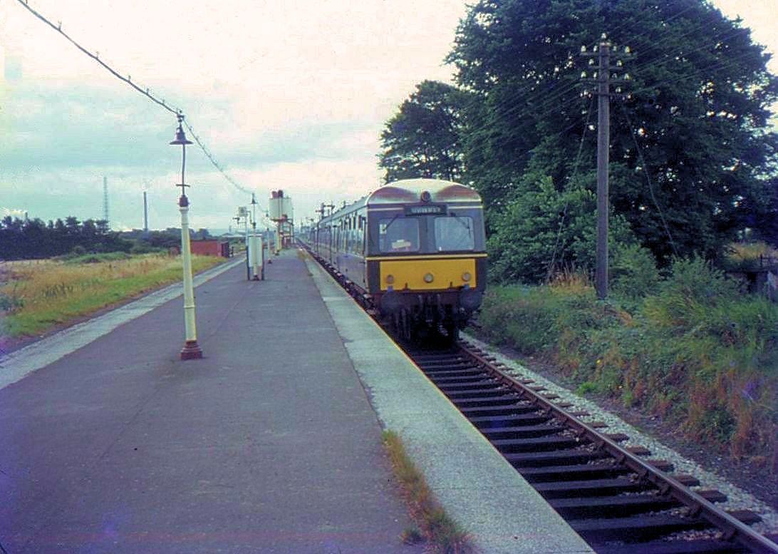
A service arrives from Bristol Temple Meads. Note the water column still extant on the platform. The area between Avonmouth and Severn Beach was highly industrialised, The chimney spewing smoke into the atmosphere is but a very small part of it. 13th August 1967. Copyright Keith Jenkin
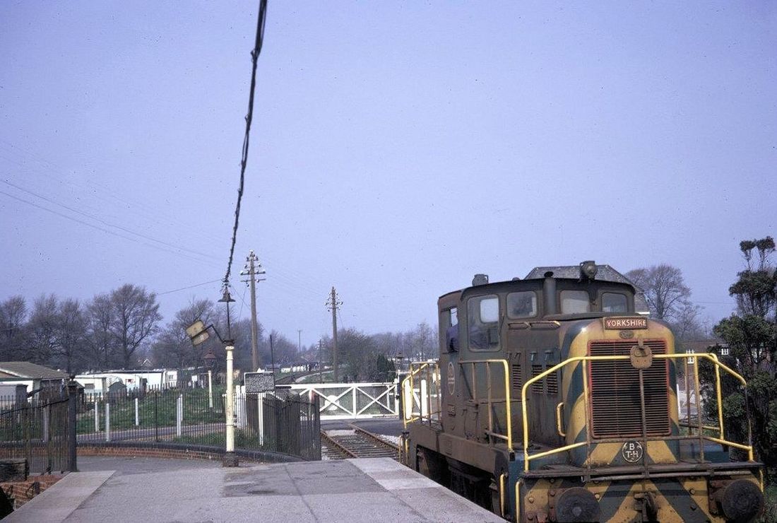
This picture taken in the early 70's many thanks to Derek Buttivant - his copyright. In response to a request for further information Guy Vincent writes :- Just time to look up and briefly reply to your query regarding the shunter shown at Severn Beach station in Derek's excellent and rare image. Incidentally, the white house that is visible in Ron's shot that started this topic was almost certainly built by the GWR for the resident stationmaster's use. The house still stands today, although now it is surrounded by more modern properties.
ICI Severnside Two 0-6-0 Yorkshire Engine Co 'Janus' shunters. These were: 'Iburndale', Works No 2725 built in 1958 and 'Kildale', Works No 2741 built in 1959. I would say Derek's picture shows 'Kildale' based on the nameplate size.
According to information posted on the RCTS Mystery Photographs site along with a 1968 photo of a single car DMU at Severn Beach, the Janus shunters used to come out onto the former Pilning line to assist with shunting trains into and out of the ICI plant that was located on the Avonmouth side of Severn Beach station.
Reference: The Bristol Railway Archive. Post subject: Industrial Railways in the Bristol area, date posted 23.04.2010
Reference: RCTS Mystery Photographs. Severn Beach. Posts dated between November 2010 and February 2011
Reference: Flickr EN L Kildale Severnside. A good B/W shot of 'Kildale' working within the Severnside plant on 25th June 1990. No other details found on the fate of this loco.
Reference: Flickr Gordon Edgar ICI Severnside Works. A nice photo dated 07.03.1970 of 'Iburndale' in the ICI Severnside complex. A comment below the photo says that this loco was located at Flixborough Wharf in 1994, was moved to Morley Waste Traders at Ripponden, West Yorkshire by 22.08.2008 and scrapped before 18.03.2011. The shunters were both plated to run on BR metals.
Another good week of contributions on the site, especially Ron's D1057 shots and John's Somerton 'Western' to name two.
Best regards for now
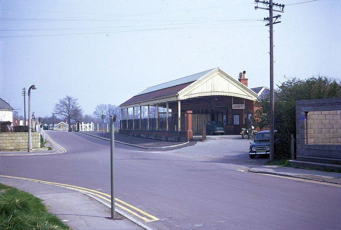
Another early 70's picture from Derek Buttivant (copyright) for which many thanks. Derek tells us that the white house was the crossing keepers residence - it is still there though surrounded by modern housing.

Severn Beach Comparisons 1 Taken on the 16th August 1972 Note the metals of the line to Pilning Low level continue disused beyond the level crossing gate. The general air of neglect with the running in board savagely removed and poor platform lighting festooned from the top of the old lamp posts. Copyright Ron Kosys (Now move on several frames to Severn Beach comparisons 2,3, & 4.
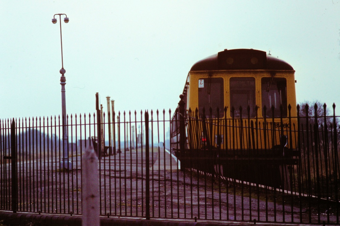
You can't get much further than this! A unit stands at the buffers. 1st December 1980 Copyright Roger Winnen
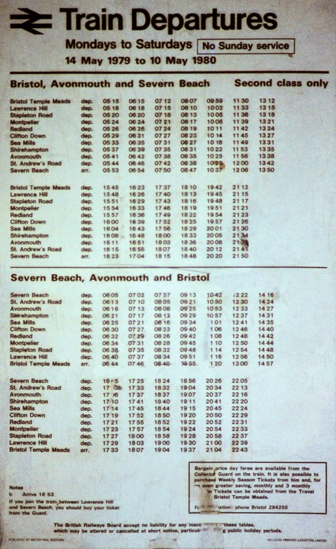
The timetable for 1979/80. 13 trains each way.

An unusual visitor to Severn Beach on the 14th April 1982. The Leyland Railbus awaits its return working at Severn Beach. Copyright Roger Winnen.
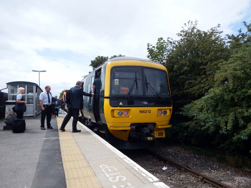
Thirty five years on from the previous picture the 3rd July 2017 saw the first day of the Turbos on the Severn Beach line. 166212 at Severn Beach, following arrival with 2K18 from Bristol T.M. Andrew Triggs
A note from Guy Vincent. Three pictures to compare with Ron's super 1972 image showing Severn Beach in recent times. The land beyond the station towards Pilning has been built on and the sidings area next to the former island platform has been fenced off, it is overgrown with a few pieces of track still evident. On my last visit, 23rd December 2017, the single line into the station had been replaced the previous weekend. Brand-new concrete sleepers, welded rails and fresh ballast now instead of worn-out 1950s wooden sleepers sitting in mud! Traction-wise class 150 and 158 sets have recently been superseded in the main by class 166 units although 153s used to make occasional appearances as on 21st August 2015 when 153325 worked the 0716 to Temple Meads following an earlier failure. Many thanks Guy.
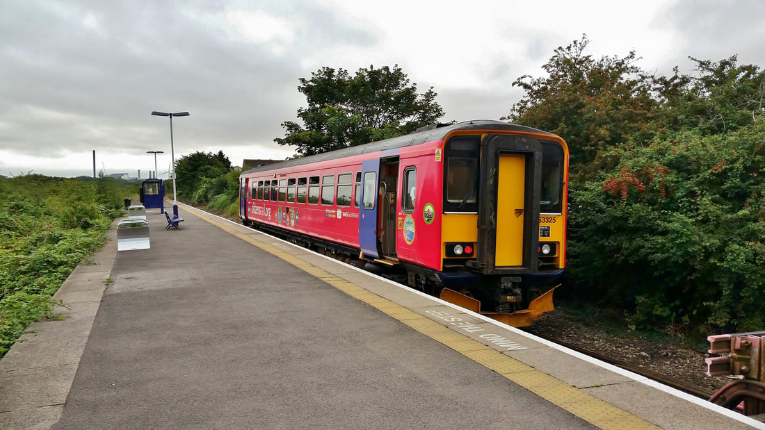
Severn Beach comparison 2 21st August 2015 153325 on the 2K05 0716 SVB-BTM Copyright Guy Vincent
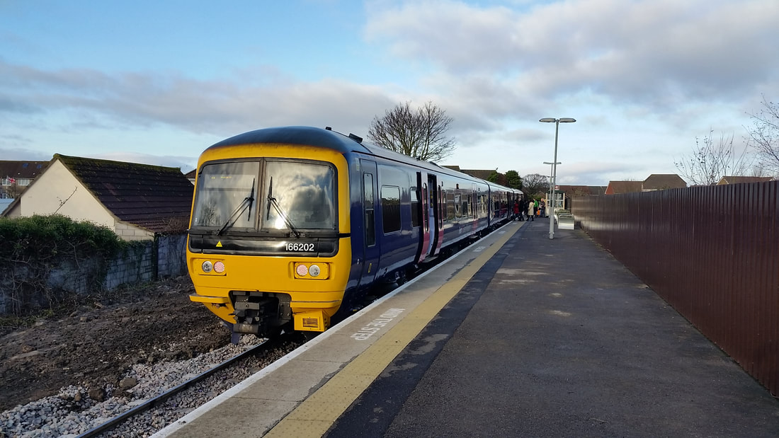
Severn Beach comparison 3 166202 Severn Beach 23rd December 2017 Copyright Guy Vincent
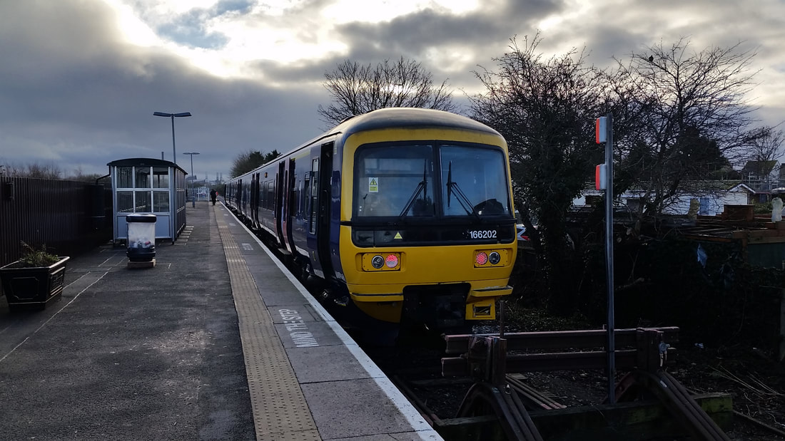
Severn Beach comparison 4 166202 23rd December 2017 Copyright Copyright Guy Vincent
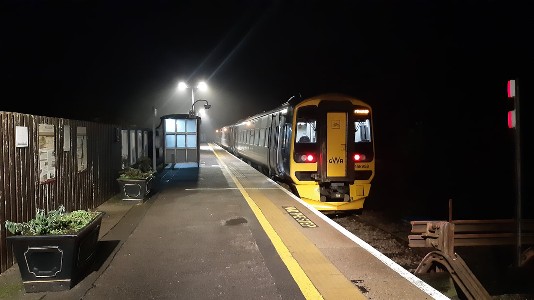
Severn Beach 158958 2210 SVB-BTM. 21st December 2022. Copyright Guy Vincent.
A trip to Severn Beach - Brian Pibworth.
Dear Keith,
Your piece on Clifton Tunnel reminded me of our recent caravan trip to Bath on the 9th October 2021 and an "Awayday" we took from Bath Spa to Severn Beach. We have done the trip several times and have to admit that Severn Beach is rapidly changing from "Southend-on-Severn" to a sought after Bristol commuter suburb . The only reservation we have is that you will need triple glazed windows or poor hearing, or both, as the noise of traffic crossing the "Prince of Wales" bridge is all-pervading. This not withstanding, the area is paradise for birders and in Winter, huge flocks of waders feed on the extensive low tide mudflats or roost in the salt marshes.
The GWR marketing dept have combined the name "Seven Beach Line" with a logo showing the Clifton Suspension Bridge. However, try as I might, I have been unable to see this from the passenger seats as encroaching foliage has narrowed the view. Perhaps a friendly driver could provide a shot for our records?
On our return we passed a red DB Class 66 waiting in Avonmouth Stn for a clear road into SUEZ "Power From Waste" plant and now that the line is to be upgraded to a half-hourly service, there may be opportunities for photography here.
Good wishes to all, Regards, Brian Pibworth
1) Busy morning at Severn Beach Station as arrivals on the 11.12 from Bristol Temple Meads read the information boards before setting out for a day's birding. 9th October 2021. Copyright Brian Pibworth.
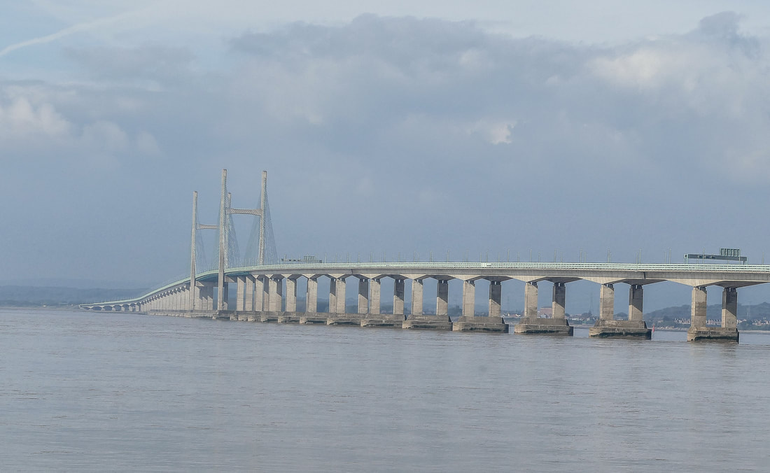
2) The magnificent second Severn Crossing. 9th October 2021.
Copyright Brian Pibworth.
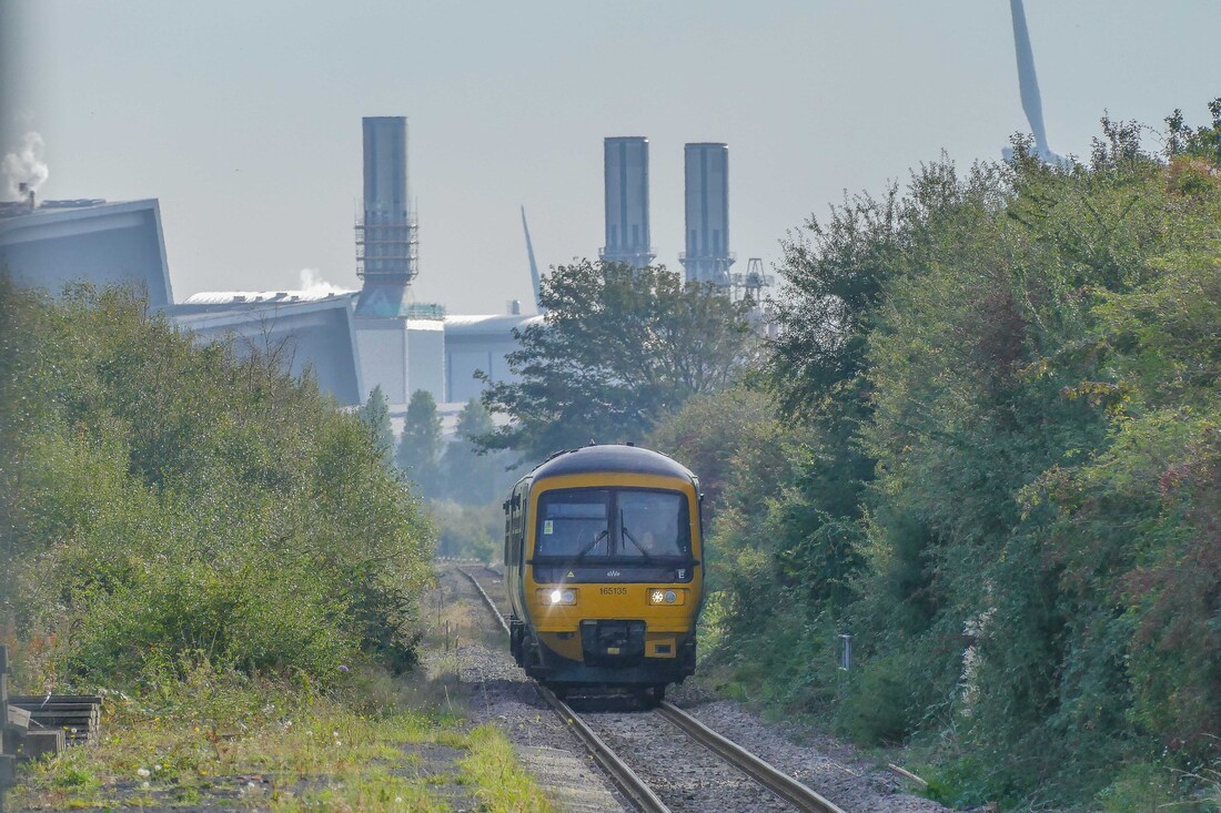
3) Our return service approaches Severn Beach with the power station providing a suitably industrial backdrop. 9th October 2021.
Copyright Brian Pibworth.
Many Thanks Brian.
Route (2) The second route to Severn Beach, via Henbury and Hallen Marsh Junction

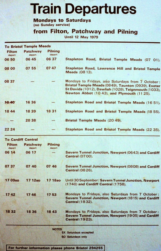
This timetable from the British Railways timetable for the period June 18th to September 1951 gives the times for both the Avonmouth route to Severn Beach, and that via Henbury (although there were very few through trains to Severn Beach via Henbury - this would involve a change onto another train at Avonmouth and inevitably a long wait!!)
Ashley Hill (Down) Two and a half miles from Bristol Temple Meads
Work is now underway (18th May 2023) in Bristol on preparing the site of the former Ashley Hill station (closed 23rd November 1964) for re-opening as Ashley Down. This station will be located just to the north of Narroways Hill Junction (2m 3ch) on the up and down Filton relief lines at 2 miles 42 chains. The station, which is located next to Concorde Way, will be accessible to pedestrians and cyclists only as there is no car parking close by. Lifts will reportedly be provided linking the two platforms. The two photos attached were taken on 18th May showing initial groundworks taking place.
Guy Vincent see also https://en.wikipedia.org/wiki/Ashley_Hill_railway_station
Guy Vincent see also https://en.wikipedia.org/wiki/Ashley_Hill_railway_station
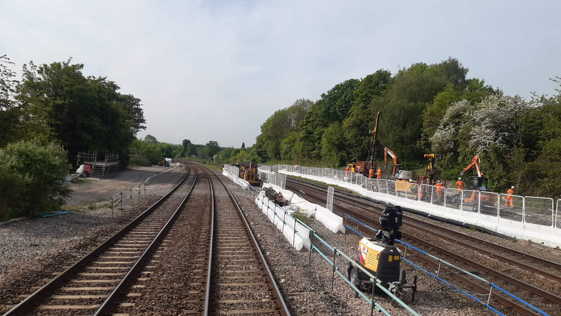
Ashley Down Station Site from Up Filton Main looking South 18th May 2023 Copyright Guy Vincent
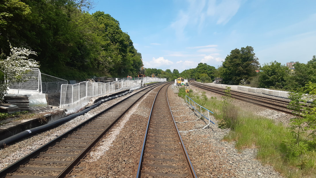
Ashley Hill Station Ashley Down Station Site from Down Filton Main looking North 18th May 2023 Copyright Guy Vincent
The original station extensive sidings - it closed 22nd November 1964.
Lochleaze - never a station.
We are overlooking Filton bank near Lochlease as the 07.20 Penzance to Edinburg - the 'Cornish Scot. climbs the bank on the 7th February 1996. Copyright Chris Harvey Work is in progress on this section of line in 2017/18 to re-quadruple the track at this location.
Horfield Three and three quarter miles from BTM
Horfield was rebuilt when Filton Bank was quadrupled in the 1930's and reopened on the 30th April 1930. It closed on the 22nd November 1964
The old Horfield Station, pictured on the 28th October 1978 Copyright Roger Winnen There is a steady 1 in 75 grade from Narroways Junction almost to Filton Junction.
A lovely shot of a Class 47 hauling ten coaches up the bank to pass Horfield on the 28th October 1978. Copyright Roger Winnen
A smart DMU approaches Horfield again on the 28th October 1978 Copyright Roger Winnen
Filton Junction Four and three quarter miles from Bristol TM
A Peak class at Filton Junction. 28th October 1978 Copyright Roger Winnen.
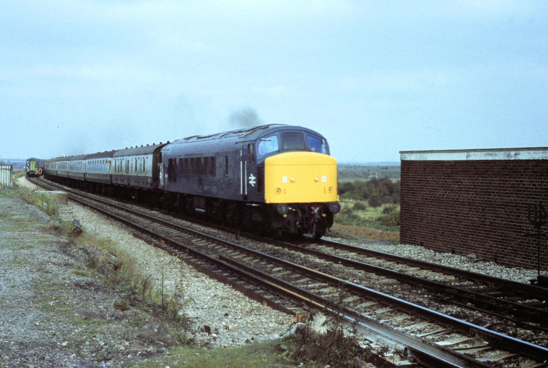
The Liverpool - Penzance at Filton Junction on 28th October 1978 Copyright Roger Winnen
Filton Junction Station. 28th October 1978 Copyright Roger Winnen
Filton Junction Station 28th October 1978 As can be seen, facilities were rather basic - not even a protective fence on the right hand side of this platform - yet the platform was in use - before the days of health & safety !! Copyright Roger Winnen
Looking out from the rear of the train as we approach Filton. 12th May 1984 (From The Avon Explorer) Copyright Roger Winnen
A Peak class at Filton Junction. 28th October 1978 Copyright Roger Winnen
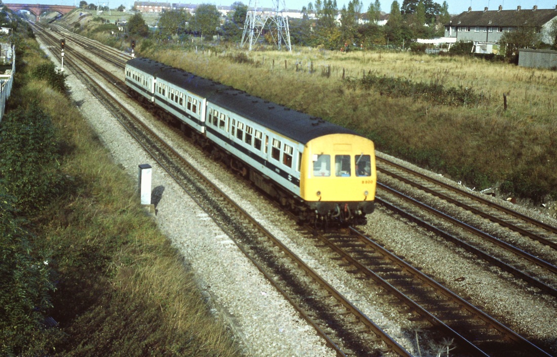
North Filton Platform Five and three quarter miles from Bristol TM
North Filton - opened as Filton (Gloucester Road) on the 9th November 1910. Closed on the 27th September 1915. Reopened 12th July 1926, closing on 22nd November 1964 but remaining in use for unadvertised workmen's services, until finally closing on the 9th May 1986. Ref Nick Catford.
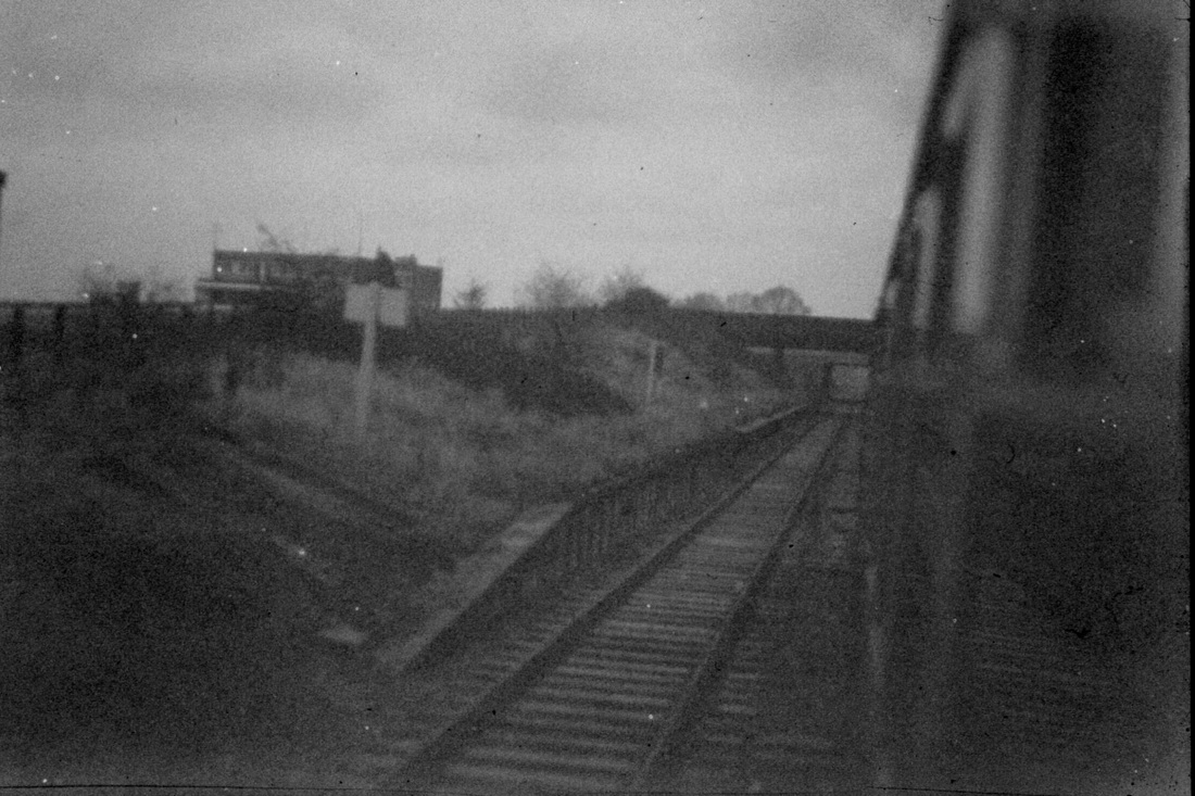
North Filton station on the 9th November 1974. Taken when it was very nearly dark from a diverted passenger service. Copyright Roger Winnen Note double track still in existance.
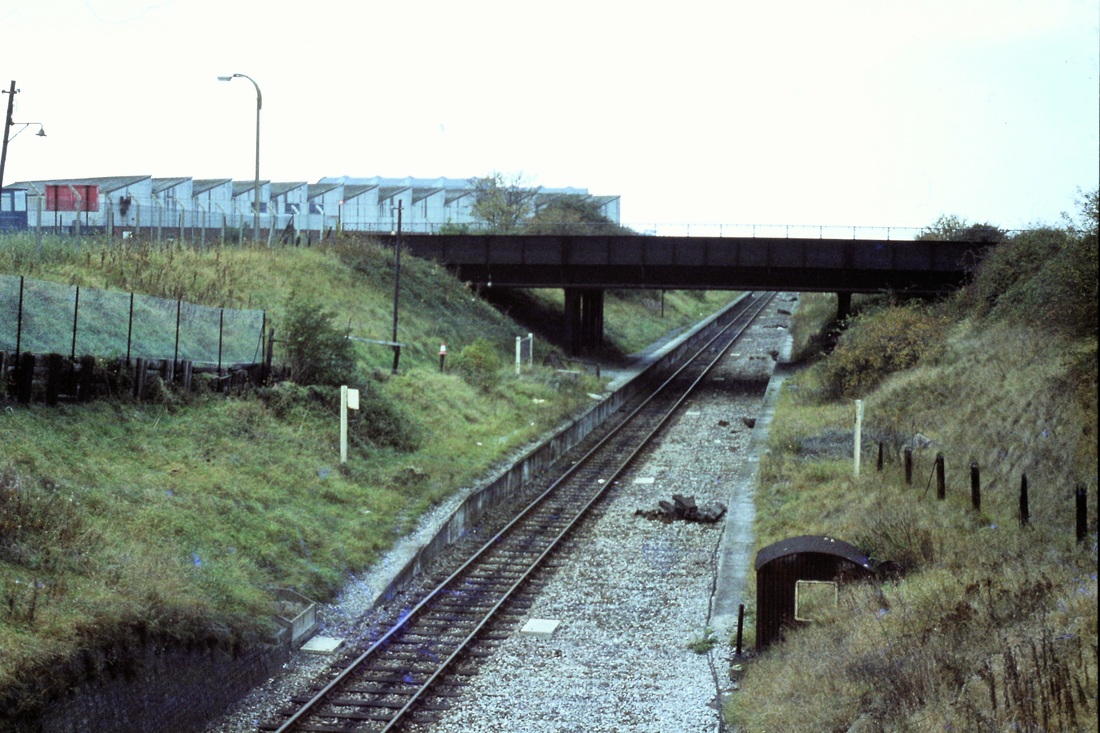
Looking down on North Filton Platform on the 28th October 1978 Copyright Roger Winnen
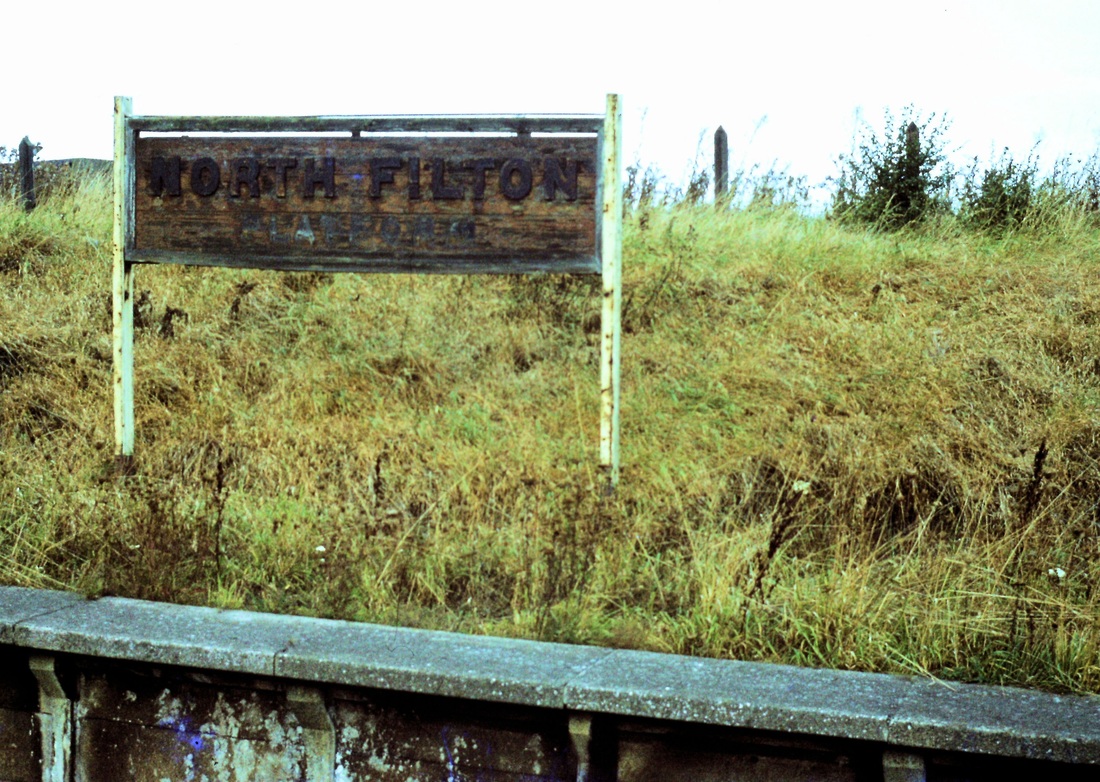
The station nameboard 28th October 1978 Copyright Roger Winnen
Filton airfield level crossing

A rare and rather grotty view taken from the Cheddar Valley Railtour as it flashed over the level crossing over the taxiway at Filton Airfield - note the long retracting barriers.18th November 1968 Copyright Keith Jenkin This barrier was brought into use between the 13th October and 10th November 1947 to allow for a new aircraft crossing for BAC. A ground frame at 113 miles 28 chains was brought into use to control this crossing. (Quote: Mike Vincent 'Lines to Avonmouth')
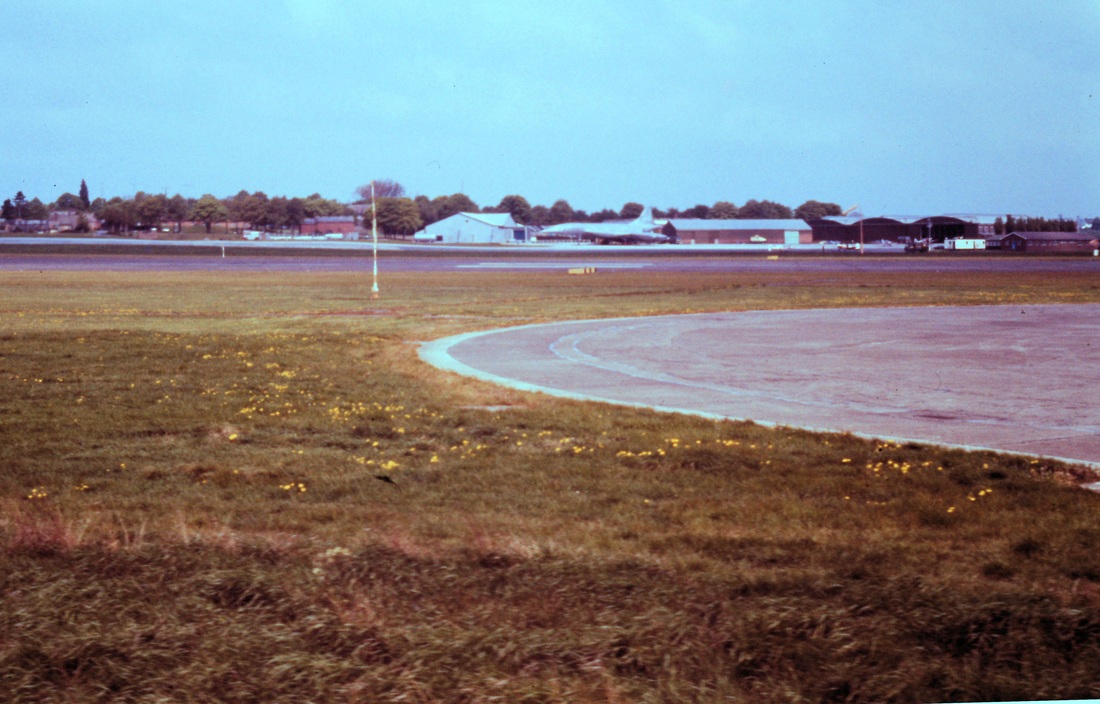
A view from very near the aircraft level crossing, taken by Roger Winnen for the 'Avon Explorer' railtour on 12th May 1984. The aircraft in the centre of the picture is no less than one of the Concorde Fleet. Copyright
Charlton Tunnel 302 yards
Henbury Eight miles from Bristol TM
Opened with the line on the 9th May 1910, closing between 22nd March 1915 and 12th July 1926. It finally closed 22nd May 1986.
A view of Henbury station taken from the Bristolian Railtour 30th April 1983 The station still appears to be there in 2015 (Google Earth) Copyright Roger Winnen
This is the view from 'The Avon Explorer' on its way between Hallen Marsh and Filton Junction. 12th May 1984 Copyright Roger Winnen
Hallen Halt
Chittening Platform Ten and a half miles from Bristol TM
(Quote: Wikipedia.) The station was opened on 5 March 1917 to serve a large government munitions factory at Chittening The factory project was abandoned when the United States entered the First World War, but the station remained open to serve employees at the Chittening Trading Estate. It was closed on 23 November 1964, when passenger traffic ceased on the Avonmouth and Filton line. The line remains in use for freight working. In 2012 there was talk of the line returning to passenger use with a circular service from Bristol Temple Meads.
Proof that the station once existed - the remaining decrepit nameboard at Chittening - taken from the Cheddar Valley Railtour 18th November 1968. Copyright Keith Jenkin
Chittening, a view by Roger Winnen, Copyright
The Cheddar Valley Railtour waits on the line from Filton Junction, for the 11.08 service from Severn Beach to clear Hallen Marsh Junction. 18th November 1968 Copyright Keith Jenkin
Hallen Marsh Junction
Hallen Marsh Junction. The double track heading away to the right is towards Filton. That to the left is towards Severn Beach 9th November 1974 Copyright Roger Winnen
St Andrews Road Twelve miles from Bristol TM
Plus Three and half miles to Severn beach via Filton
Plus Three and half miles to Severn beach via Filton
Looking back at St Andrews Road, 9th November 1974 Copyright Roger Winnen. Note the complicated trackwork in the yard. Access to St Andrews Road station is by means of a 75 yard footpath from the road, which is off to the right in this picture.
The Cheddar Valley Railtour reversed at Hallen Marsh Junction and proceeded to Severn Beach
The railtour at Severn Beach passengers walk, and the young man runs, the one hundred yards or so to the sea front. The line to the left, at that time went through to Pilning Low Level but had already closed. This picture was taken on the 18th November 1968. Copyright Keith Jenkin
18th November 1968. The line towards Pilning Low Level, which closed 23rd November 1964, lies ahead, although the crossing gates seem to be spick and span - as do the signals protecting the crossing from either direction. Copyright Keith Jenkin. Note: It is presumed that, when the line was operational, the gates were operated by staff housed in the station building or maybe in a hut at the crossing.
Severn Beach station on the 18th November 1968. Quite unusual in that it was at right angles to the line - the awning protected road vehicles, as can be seen. Copyright Keith Jenkin
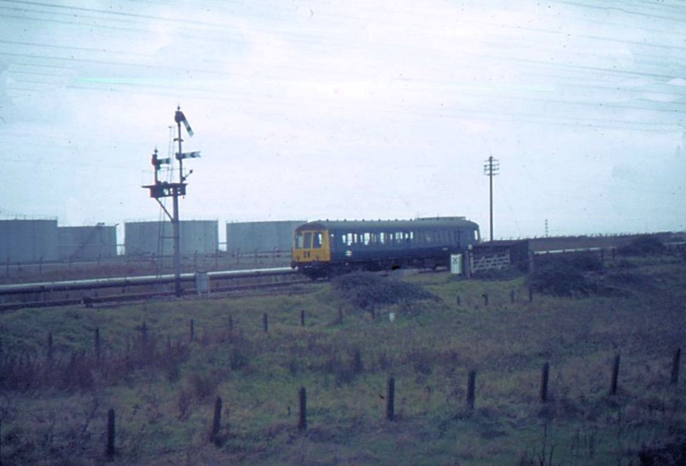
A picture taken four years earlier across the then active level crossing at Severn Beach. November 1964 Copyright Mike Roach
A quick dash to see Severn Beach, not particularly inspiring: acres of muddy sand, and a vicious tidal flow. However, on a good day there is a nice view out across the Severn to Wales. The shanty town that previously existed here has been swept away and modern housing has appeared in its place. 18th November 1968 Copyright Keith Jenkin

Back to rejoin the LCGB railtour. The unit was just out of Swindon works and in pristine condition. 18th November 1968
Route (3) Now the third route to Severn Beach via Pilning
Colin Burges explored the Pilning - Severn Beach section of this route in July 2017 for his report which is part of a longer report in another section, please click here and scroll down to the bottom.
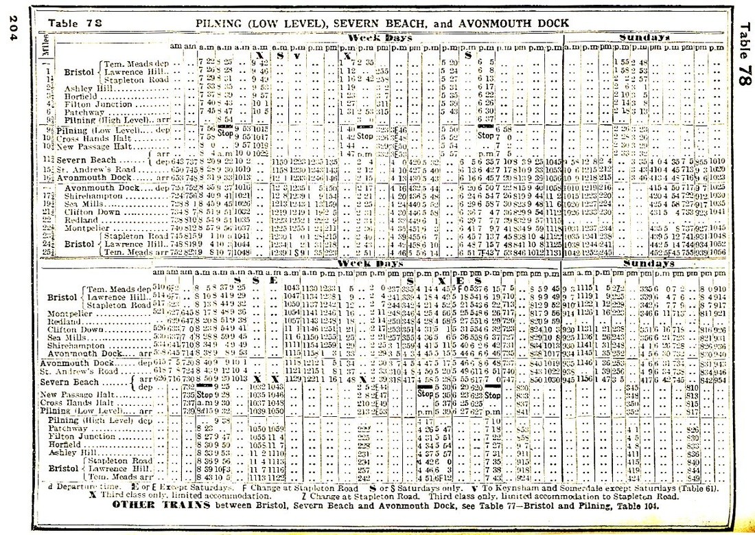
Timetable for the Pilning Low Level to Severn Beach is included in table 78 above.
Patchway Six Miles from Bristol TM
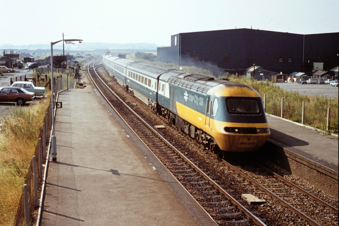
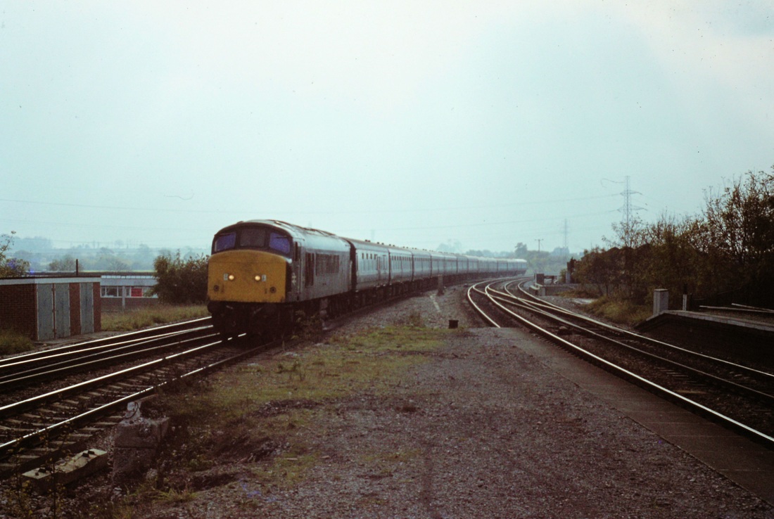
As can be seen from these two views of Patchway station, taken on 2nd August 1977, the station had already been reduced to 'bare bones'. Here HST 253013 passes Patchway Station, bound for Cardiff and Swansea. Copyright Roger Winnen
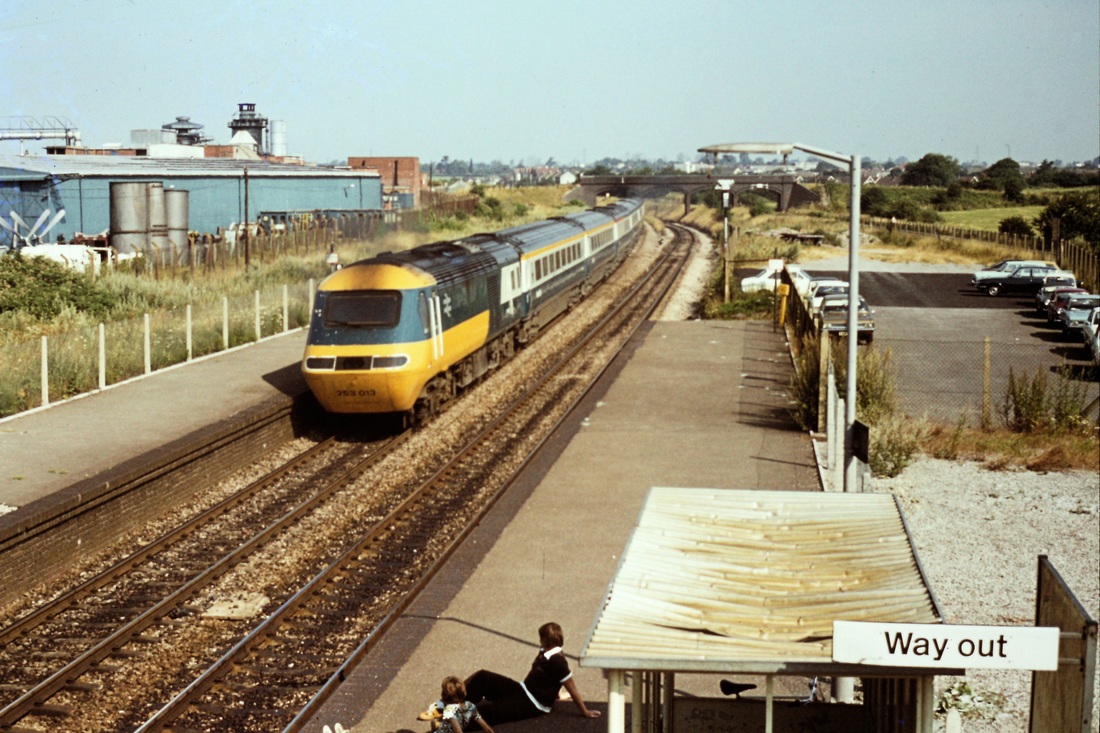
Patchway - looking towards Wales. The same train heads away from Patchway on the 2nd August 1977 Copyright Roger Winnen

Now to colder times!! First train Eastbound - GWR's 43053 University of Worcester blasts the snow off the platform at Patchway on 1L32 Cardiff Central to Paddington. 18th March 2018 Copyright David Field
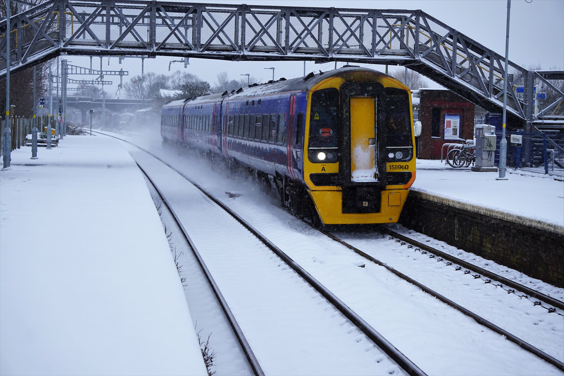
GWR's 158960 heads through Patchway with the delayed 1F07 Cardiff Central to Southampton Central. Patchway is in the midst of electrification at present, and the footbridge in the photos is planned to be replaced with a new accessible structure later this year.
18th March 2018 Copyright David Field
Patchway tunnels - Down line: Long tunnel 1246yds & Short tunnel 62yds Up line: New tunnel 1760 yards
Patchway tunnels in 1983. Copyright Keith Jenkin
Pilning High Level Nine and half miles from Bristol TM
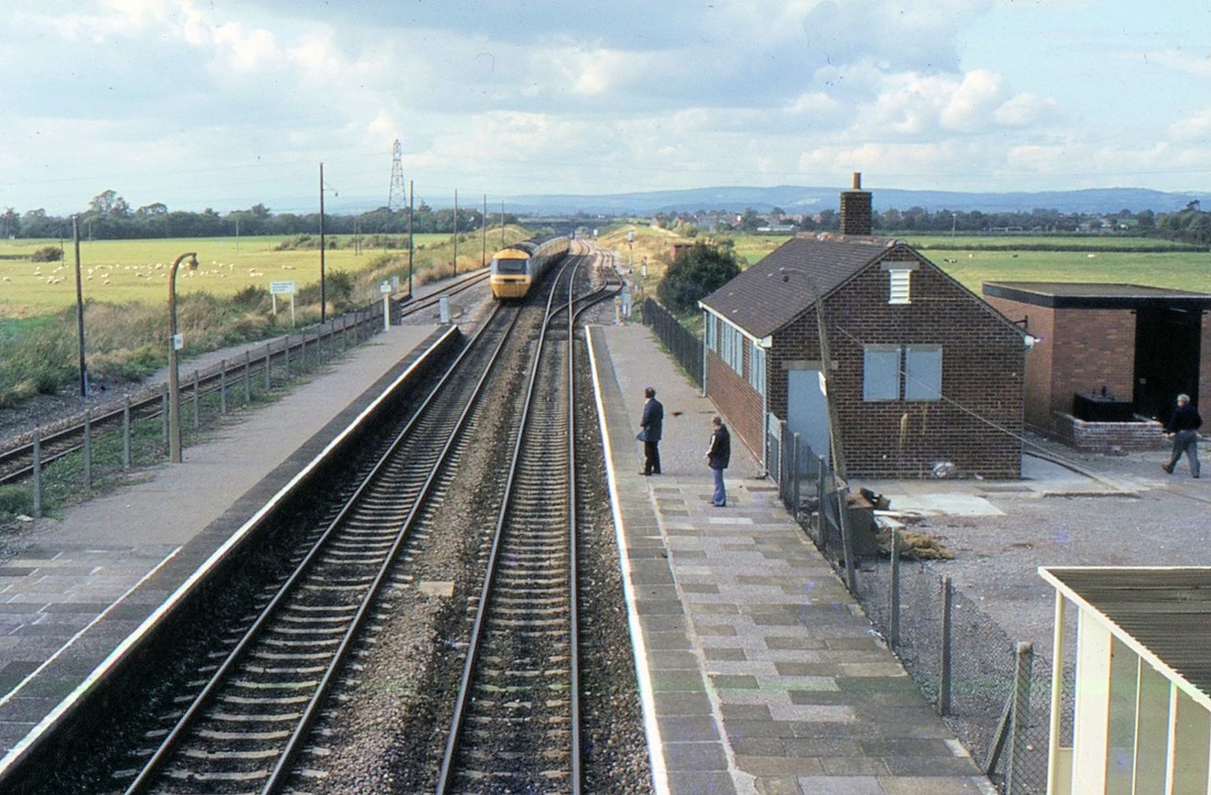
The HST continues en route for Filton Junction and almost certainly for London Paddington. 1983 Copyright Keith Jenkin
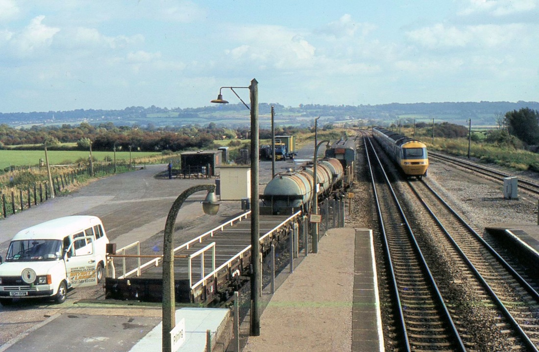
Pilning High Level - an HST approaches from Wales. The assorted rolling stock on the siding to the left was that held in readiness for any problems in the Severn Tunnel. 1983 Copyright Keith Jenkin
Pilning Low Level Opened 8th September 1863 and closed in 1964 Nine and half miles from Bristol TM
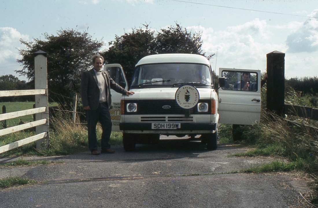
The minibus stands on the trackbed of the branch to Severn Beach at Pilning Low Level. 1983 Copyright Roger Winnen. Much appreciation to David Forty for the advice that this is/was known as Green Lane Crossing.
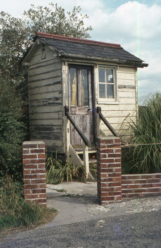
Photograph by Roger Winnen . This picture was a bit of a mystery to us, as to exactly where we were when it was taken. We do, however, think that it was on the Pilning branch somewhere. Chris Osment has kindly advised us that at the west end of Pilning LL station there was another crossing, which he believes was a footpath only. Near to that, but not related to it, was a hut with a 5-lever (?) ground-frame to control that end of the sidings. However, from a comparison between a picture of the PLL GF hut and the one shown on your page it is clear that (1) the former was at ground-level, whereas the latter seems to have been slightly elevated and (2) they are mirror-images in terms of door and window layout etc. It seems very unlikely therefore that the picture on this site is the PLL example, but where was it?
Cross Hands Halt O 9th July 1928 C 23rd November 1964 Ten and half from Bristol T M
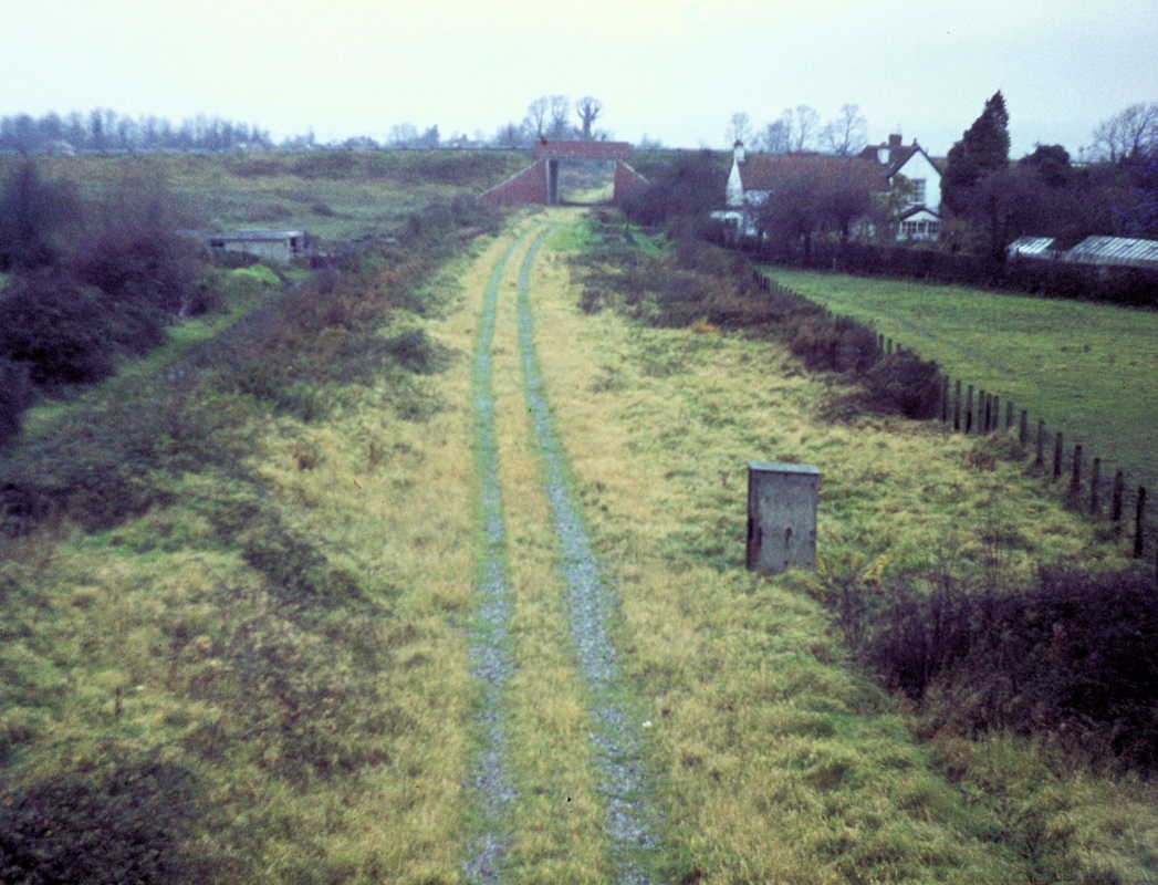
The location of Cross Hands Halt was on the trackbed seen in the foreground. Like New Passage Halt, the platform was a simple affair with an ash-sleeper faced platform. However, it did boast a standard GWR curved roof galvanised shelter. The site, as seen on 9th November 1974 Copyright Roger Winnen
New Passage Halt Eleven and a quarter miles from Bristol TM
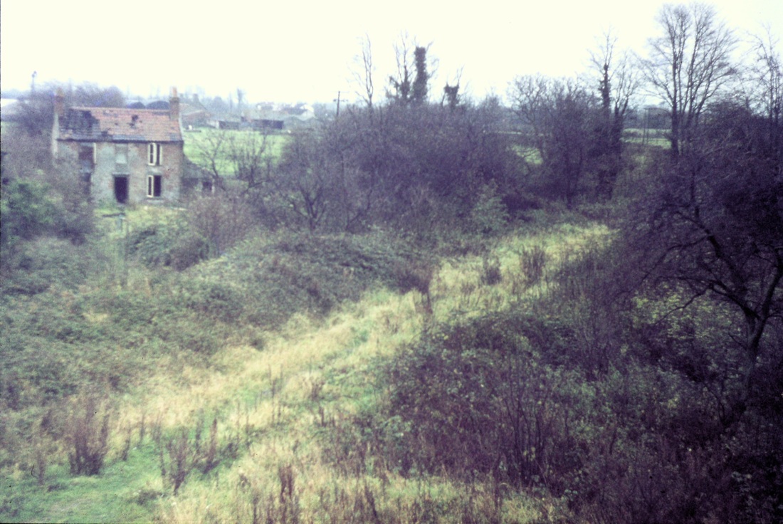
The site of New Passage Halt as found on 9th November 1974 Copyright Roger Winnen Note:- The halt, consisting of an ash-sleeper faced platform lay more or less along the line of brambles in the middle of this picture. It was served by means of a ramp access from the lane, which also served the cottage which is in a derelict condition in the background. The lighter coloured grass running across this picture indicates the line of the track ballast. Checking on Google Earth, this cottage seems now (2015) to have completely vanished.
Exploring the route from Severn Beach to Pilning Low Level in 1974 was possible using by-roads. One of these from Severn Beach accompanied the old formation for some distance to a point where allotments were being cultivated. An open gate to the allotment area invited inspection and the line of ballast gave a clue to the old formation of the railway. Just beyond this, and with no fencing, it was possible to see the entry to the Severn tunnel which passed under the old formation at this point. Too good an opportunity to miss! However no doubt in the passage of time (40 years) and in the interests of safety this area has been secured.
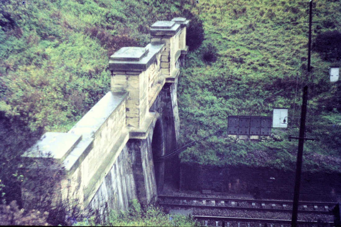
Severn Tunnel 741109n The southern mouth of the Severn Tunnel. 9th November 1974
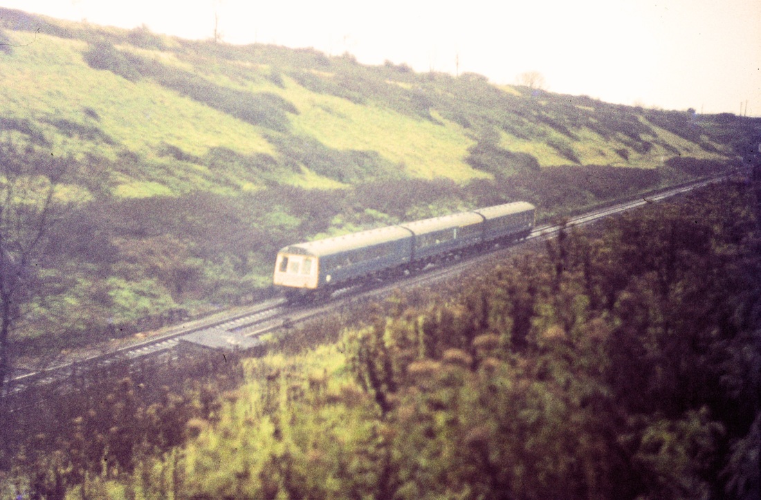
A three car DMU climbs away from the Severn Tunnel heading for Filton Junction. 9th November 1974 Copyright Roger Winnen
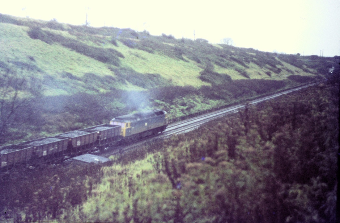
A class 47 pulls its load up the steady 1 in 100 gradient which began at midway point through the four mile 624 yard long tunnel. 9th November 1974. Copyright Roger Winnen
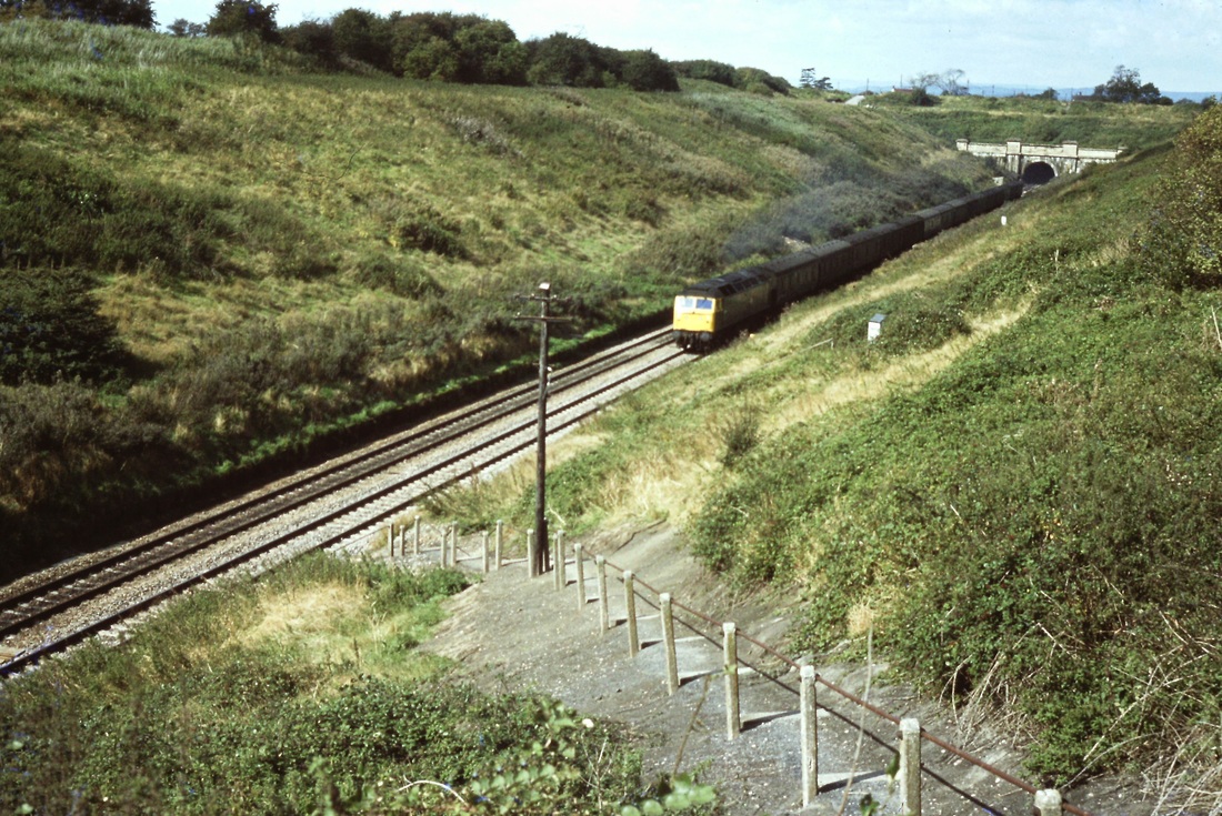
830917a A parcel train climbs out of the Severn Tunnel. 17th September 1983. The Pilning LL to Severn Beach line ran right to left across the the ground above the tunnel entrance. Copyright Roger Winnen. Access to this spot is now impossible.
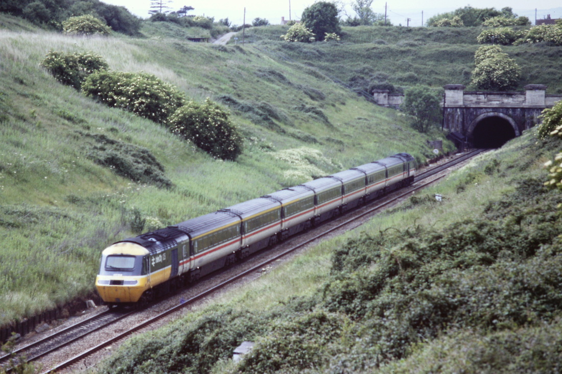
An HST heads for the Severn Tunnel. Next stop: Newport. 10th June 1989. Copyright Roger Winnen
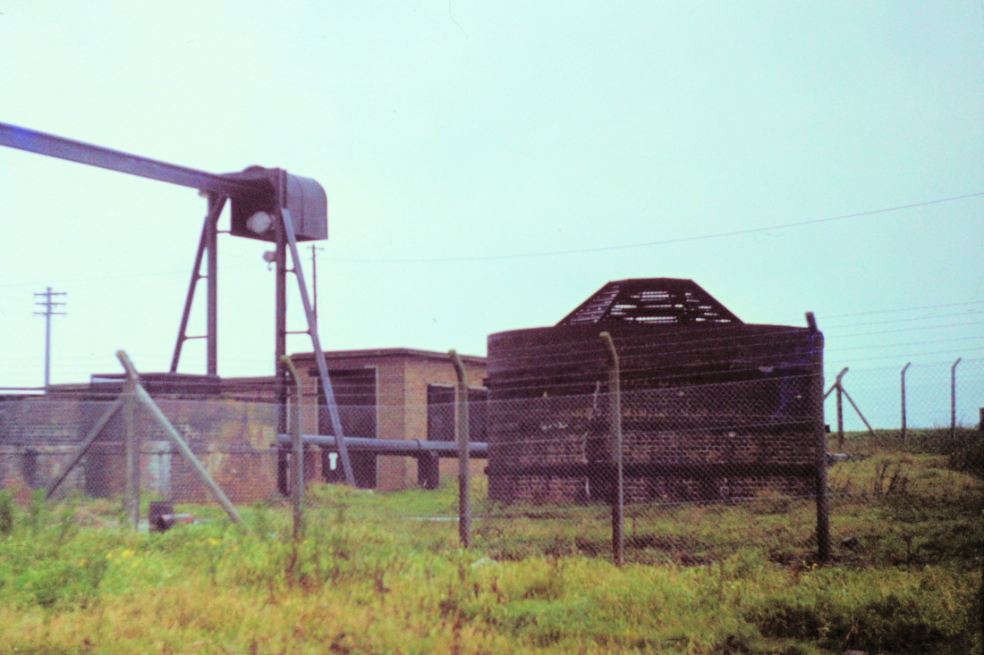
Also found on the 9th November 1974 were the Severn Tunnel air vents. Trains can be heard rumbling below. Copyright Roger Winnen
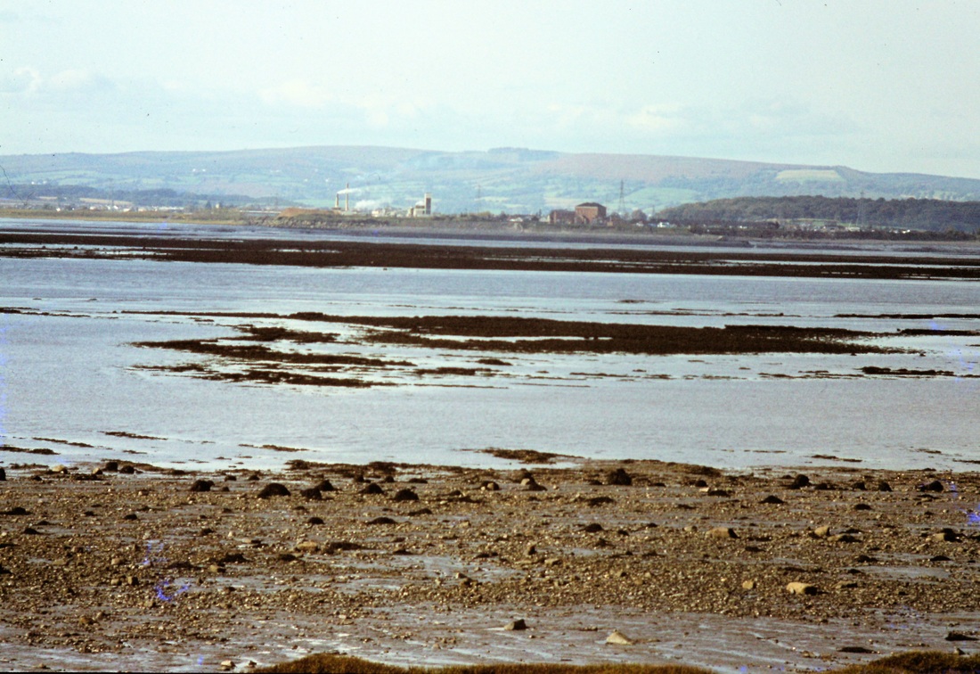
Walking to the coast from the location above, one can see Sudbrook Pumping station an the far bank of the Severn. 31st January 1981 Copyright Roger Winnen
Severn Beach Eleven and three quarters from Bristol TM
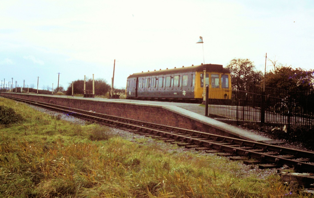
A bubble car stands at the terminal platform on the 19th November 1977. Copyright Roger Winnen
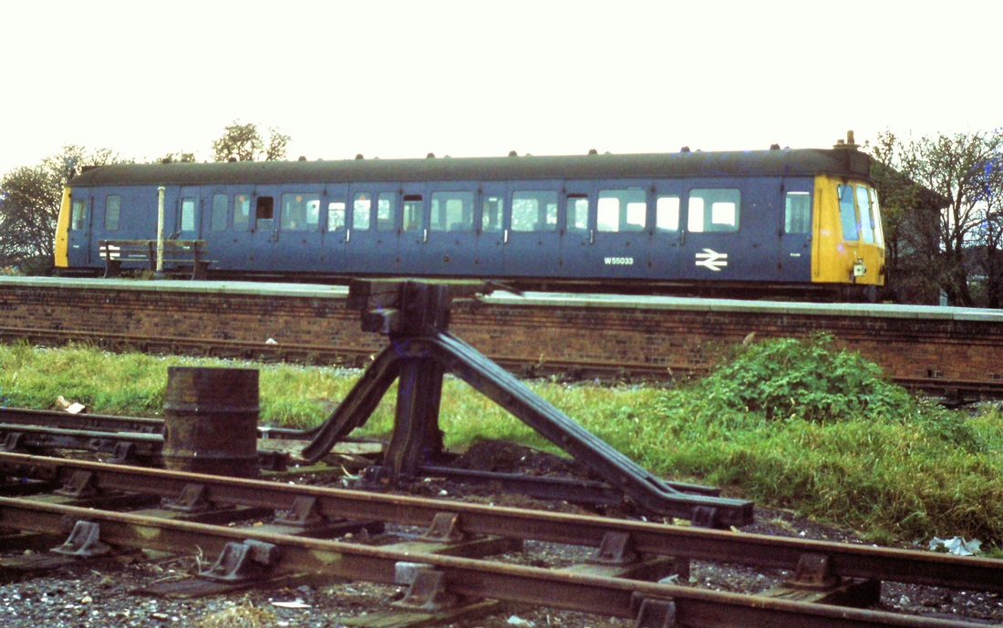
Severn Beach on the 19th November 1977 as a 'bubble car' stands at the 'terminus side' of the platform. The metals are still in place for the Pilning line as are the sidings. Copyright Roger Winnen

9th November 1974. A view across the the level crossing at Severn Beach. This view is very different now, the gates and rails have gone. The station buildings have gone, and new buildings have appeared on either side of the road. Copyright Roger Winnen
"Where's my master gone"? Not Roger's dog but a tailpiece to our Severn Beach collection for the day. 19th November 1977. Copyright Roger Winnen