This section is compiled by Andrew Jones and is split into six parts:-
(1) Boscarne to Wadebridge
Andrew Jones
Andrew Jones
This section has been compiled based on the considerable efforts of Councillor Andrew Jones to at least retain the Boscarne to Wadebridge section of the rail route and make it available for use by pedestrians, bicycles and horses. Thankfully that aim has been achieved and perhaps, one day we may see trains return to this section once more from the extended Bodmin and Wenford Railway.
We cover the (a) The last trains, (b) The demolition works and (c) An article by Andrew Jones plus a small portion of the large file of letters as a result of Andrews efforts.
We cover the (a) The last trains, (b) The demolition works and (c) An article by Andrew Jones plus a small portion of the large file of letters as a result of Andrews efforts.
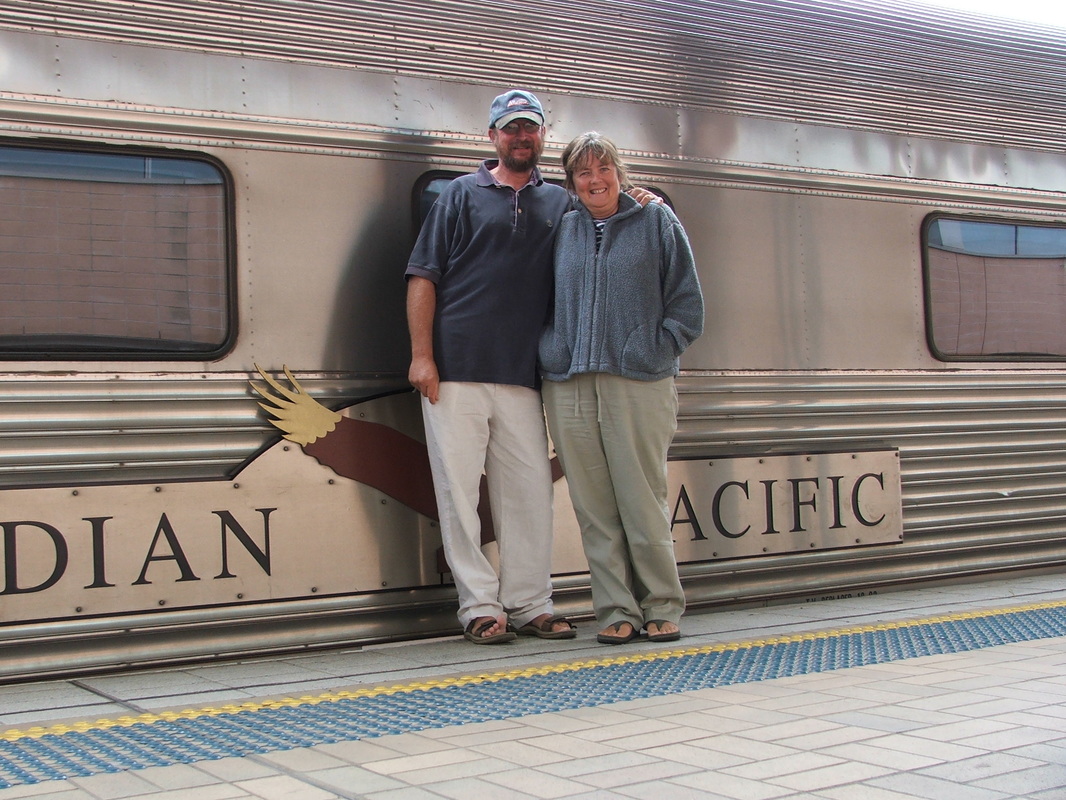
Meet the man and his wife. Andrew and Diane on safari, far away from the Boscarne - Wadebridge Railway.
(2) The Last
Trains to Wadebridge
17th December 1978
Trains to Wadebridge
17th December 1978
From Six Bells Charter Railtour Files
17th December 1978
Bodmin Lions Club
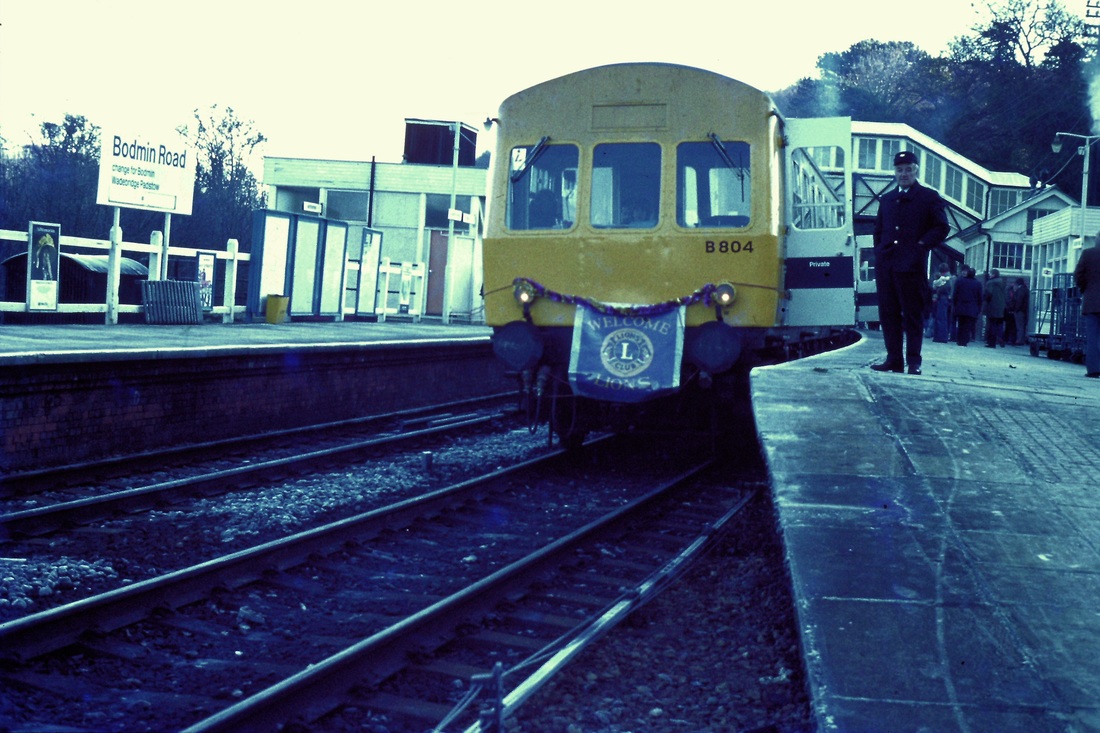
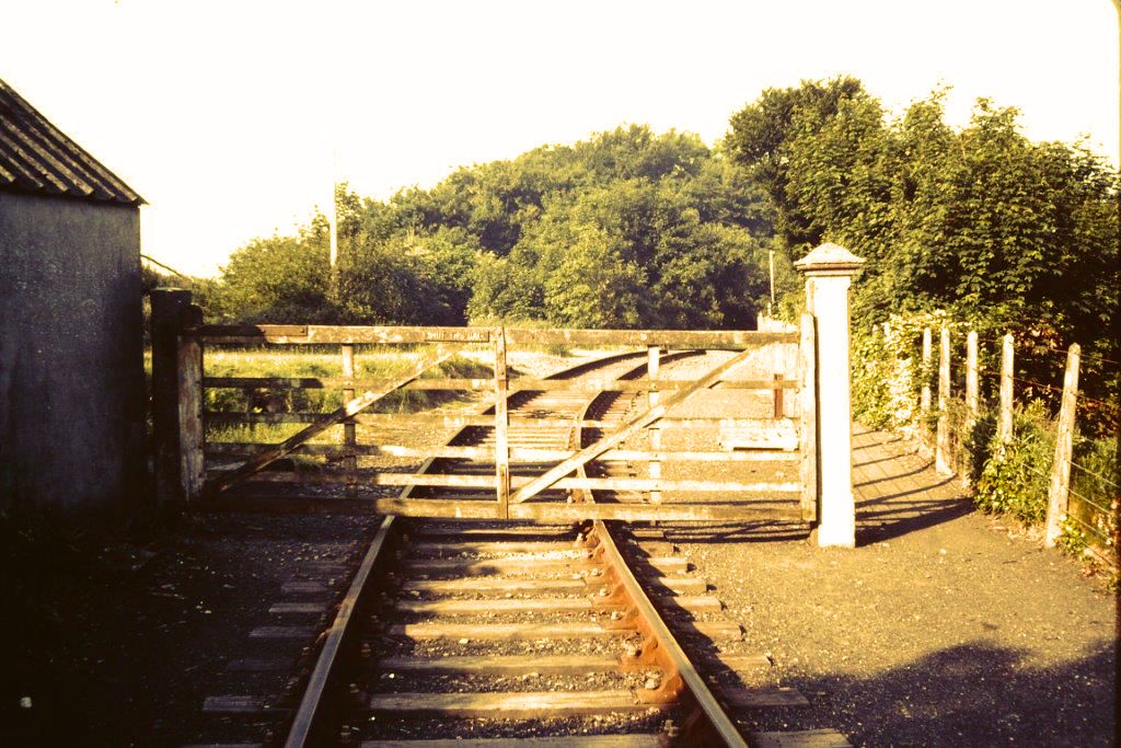
The Last Train to Wadebridge
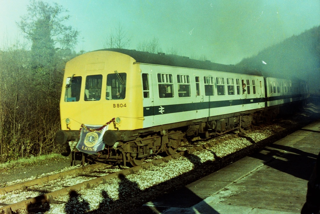
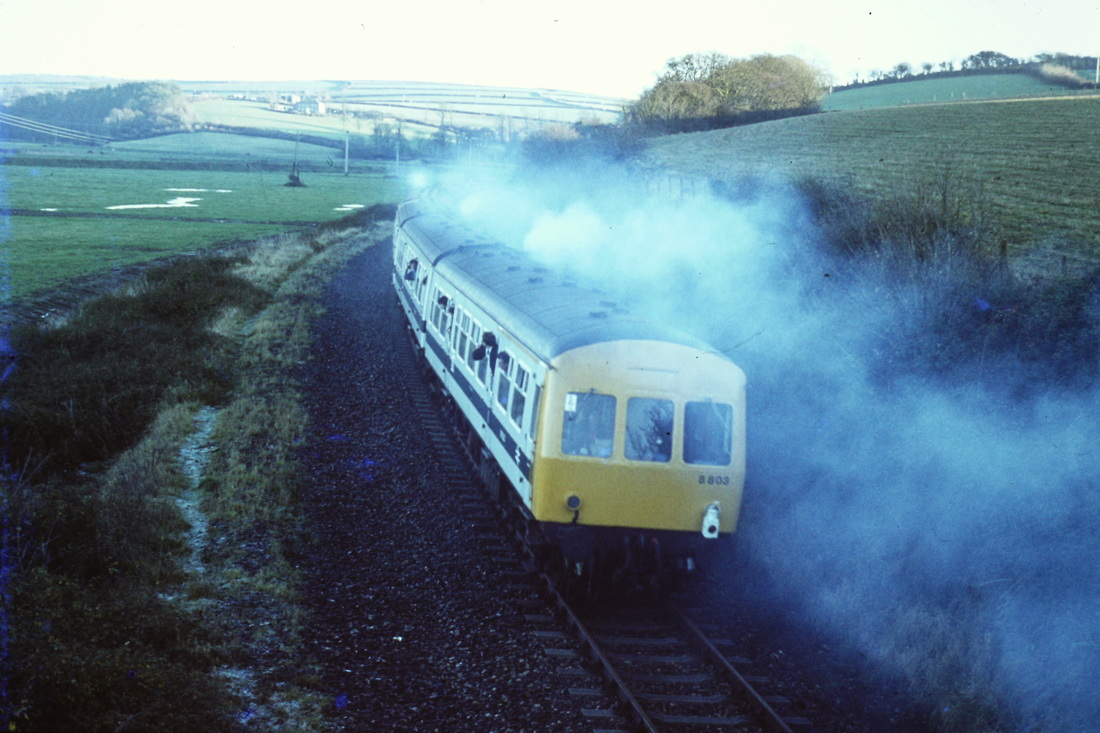
DMU's Used2x 3-car Met-Camm sets (B803+????)Route :
DMURoute
Two return runs Bodmin Road to Wadebridge.
Timings (Booked Only)
(from Roger Geach)
Bodmin Road dep 10.00 & 14.00
Wadebridge dep 11.00 & 15.00
17th December 1978
Bodmin Lions Club
The Last Train to Wadebridge
DMU's Used2x 3-car Met-Camm sets (B803+????)Route :
DMURoute
Two return runs Bodmin Road to Wadebridge.
Timings (Booked Only)
(from Roger Geach)
Bodmin Road dep 10.00 & 14.00
Wadebridge dep 11.00 & 15.00
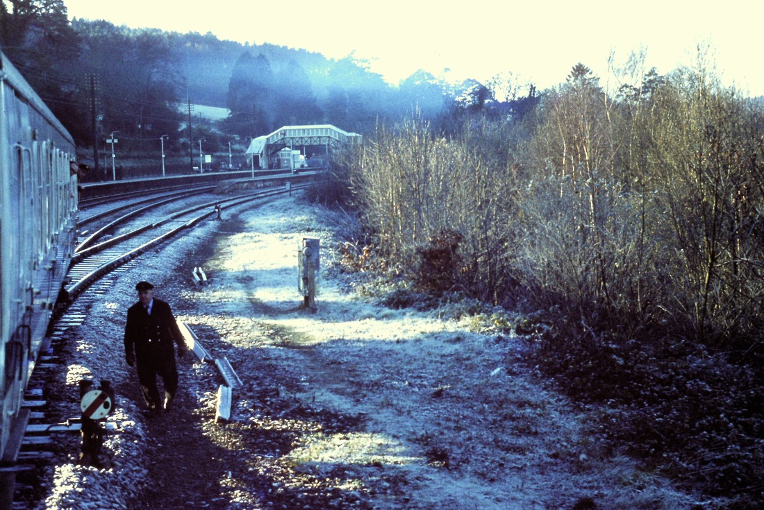
Andrew Jones writes :- On the last day my wife and I positioned ourselves at different points, dashing back and forth to cover as much as possible. I covered the last trip whilst my wife took a few line side shots. All passengers at Bodmin Rd joined the train on the down mainline platform, the train then crossed over and gained access from the up line on the Plymouth side of Bodmin Rd. Many thanks to you both.
Also to see some video footage of this train please click below:-
https://player.bfi.org.uk/free/film/watch-the-bodmin-and-wadebridge-branch-railway-line-1978-online
https://player.bfi.org.uk/free/film/watch-the-bodmin-and-wadebridge-branch-railway-line-1978-online
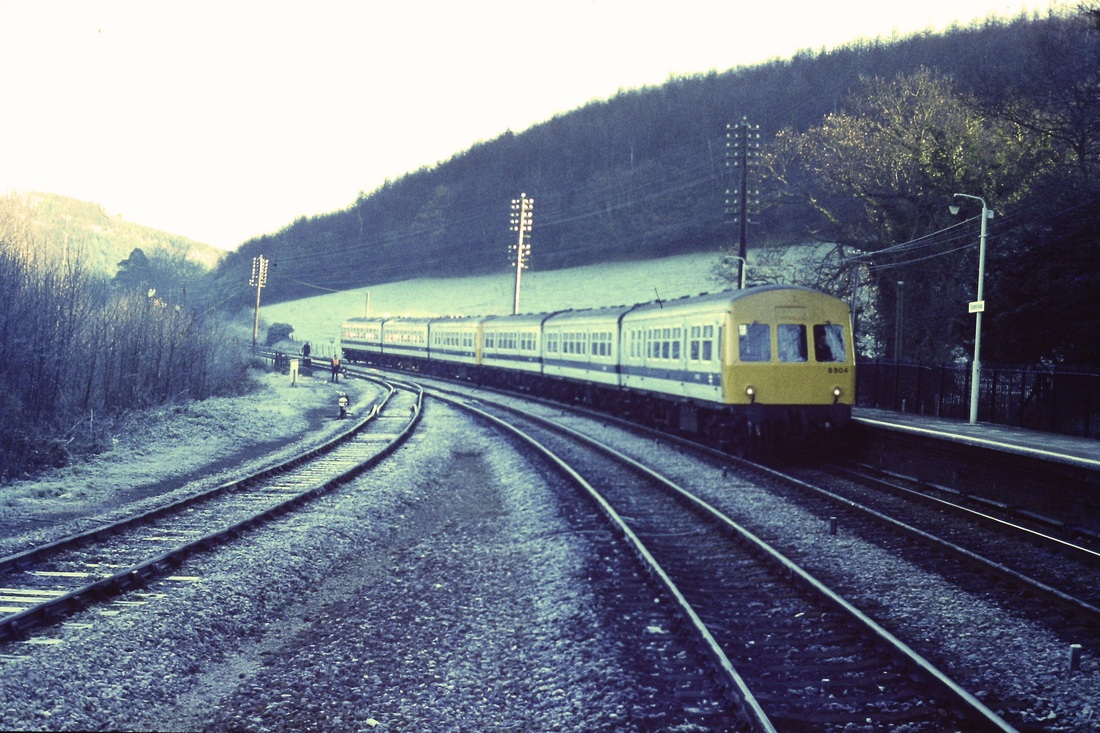
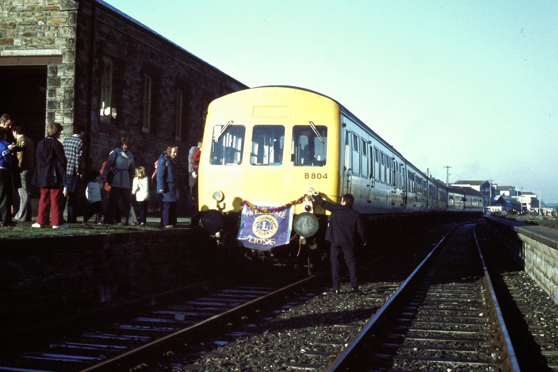
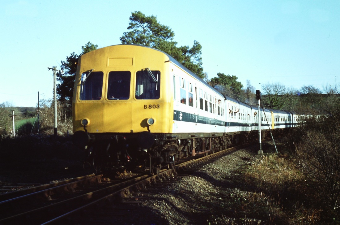
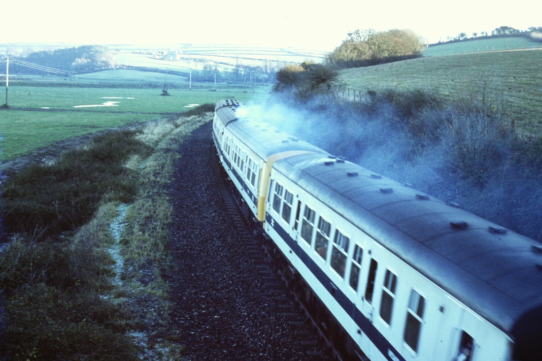
On a bitterly cold morning the train, comprising of two DMU's B804 & B803 runs into Bodmin Road. 17th December 1978. Copyright Roger Winnen
The train stands at the down platform at Bodmin Road. 17th December 1978 Copyright Roger Winnen
With the ground disc signal pulled off the first of the two specials to Wadebridge starts to leave the main line. 17th December 1978. Copyright Roger Winnen
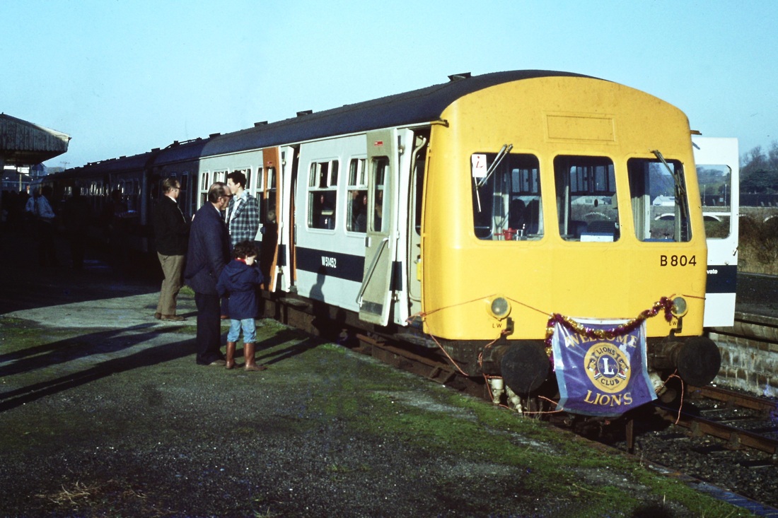
The Lions Club, last trains to Wadebridge. 17th December 1978. Copyright Anne Rawle
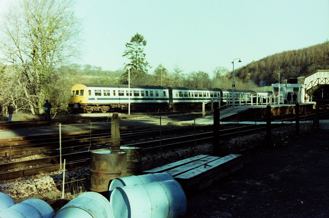
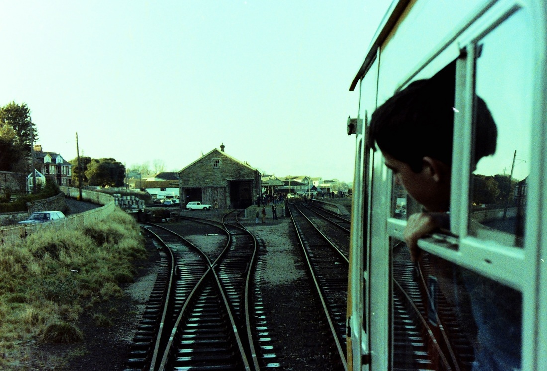
The LIons charter at Bodmin Parkway. The line serving the platform had been taken out of use on the 27th March 1968. This picture taken on the. 17th December 1978. Had the main line connection remained at the east end of this loop it would have proved very useful in following years. Copyright Andrew Jones
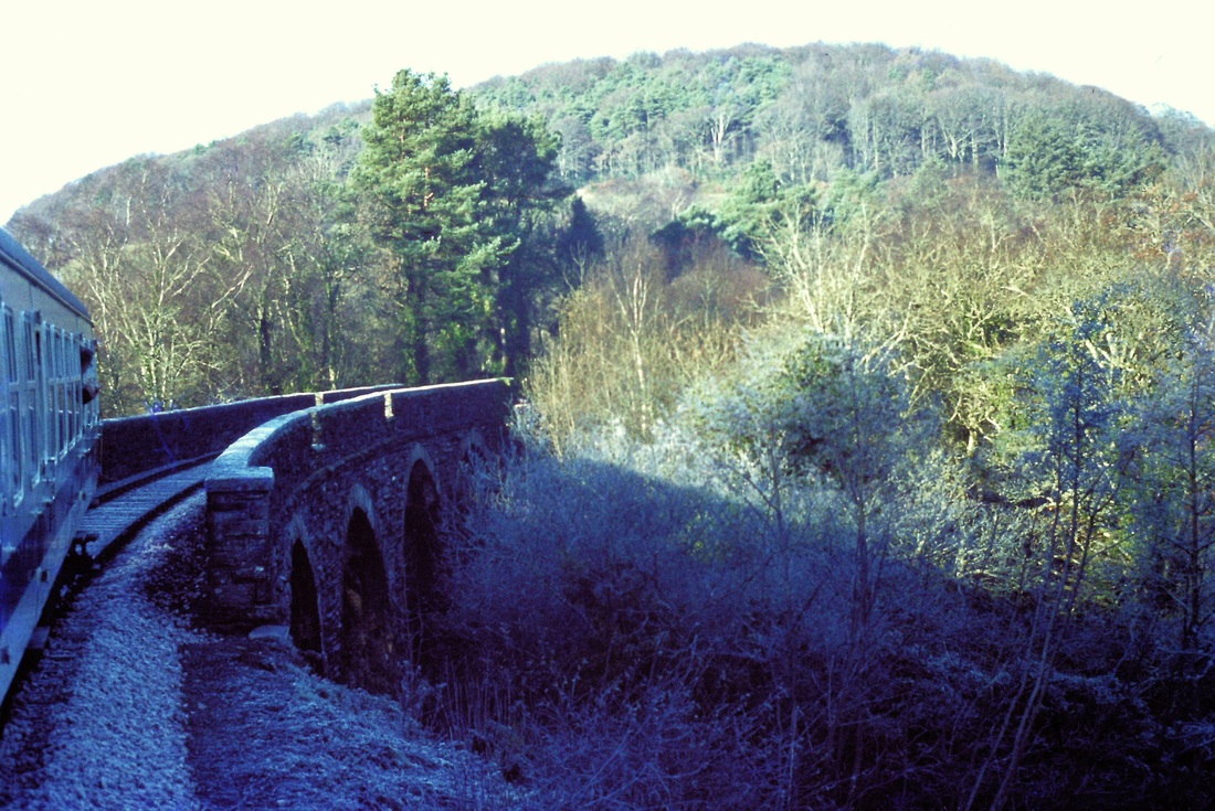
Crossing the viaduct over the river Fowey 9now just a small stream) at the commencement of the climb to Bodmin General. 17th December 1978. Copyright Roger Winnen
The first train at Bodmin General en route to Wadebridge. 17th December 1978. Copyright Roger Winnen
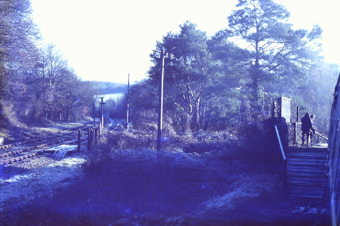
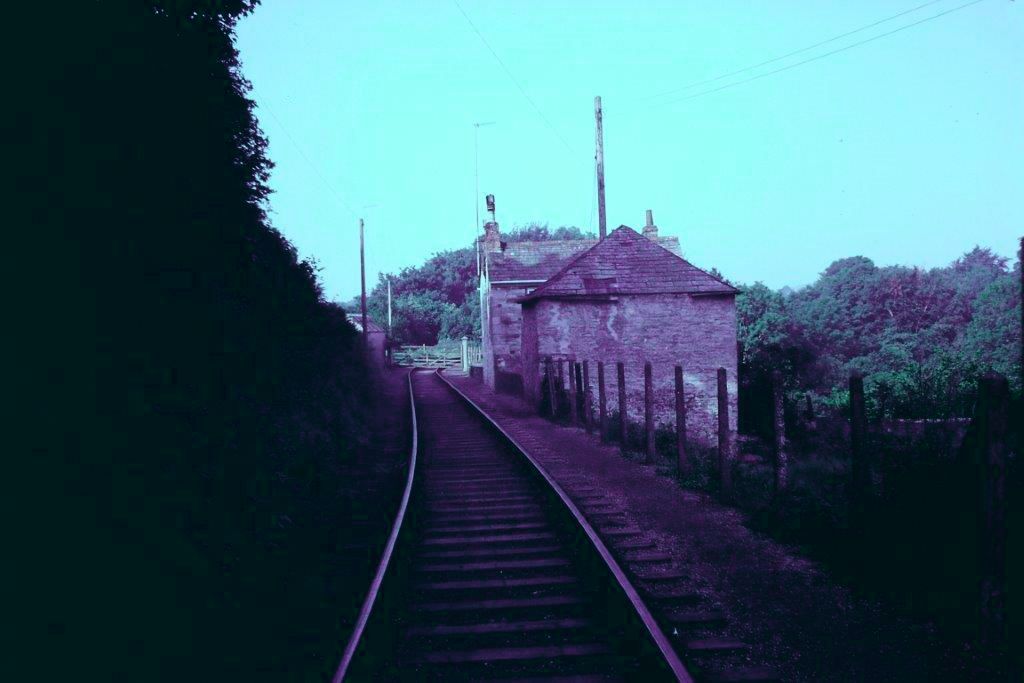
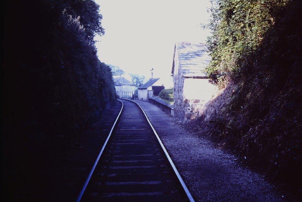
Two photographers witness the passing of the penultimate train to Wadebridge from the short, and short lived, timber platform at Boscarne Junction. The low level platform erected to serve the railbus connection to Bodmin North, some one and a half miles distant, can clearly be seen. 17th December 1978 Copyright Roger Winnen
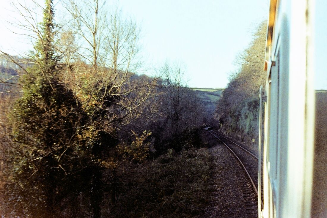
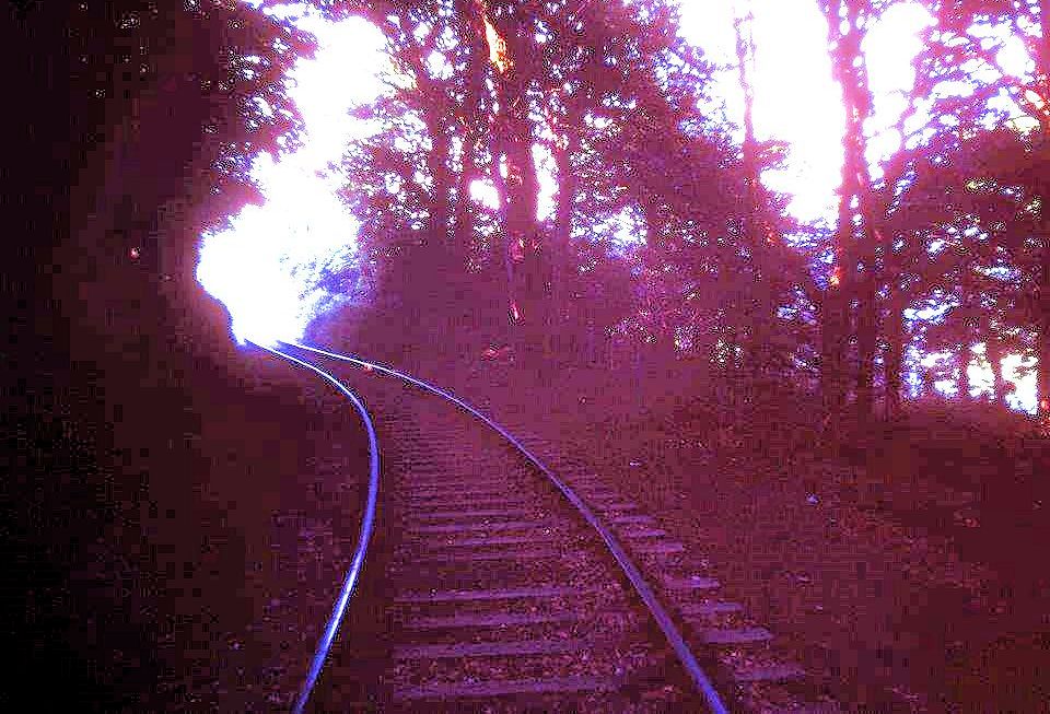
The penultimate train in the Camel Valley on route to Wadebridge. 17th December 1978 Copyright Andrew Jones.
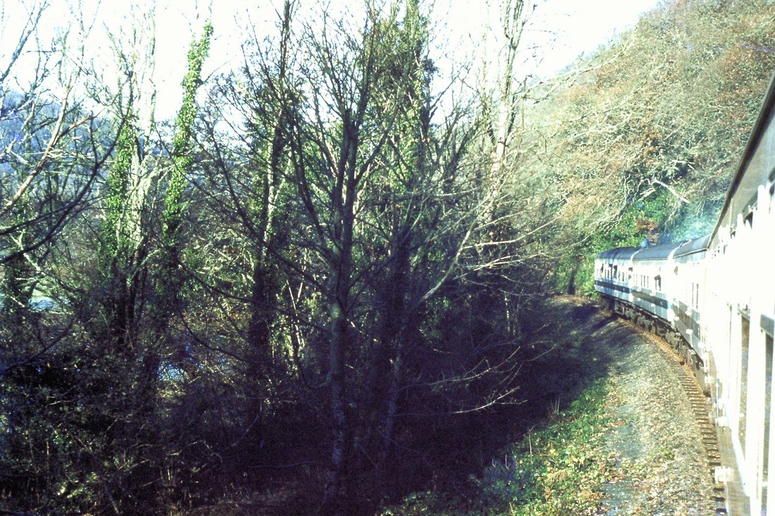
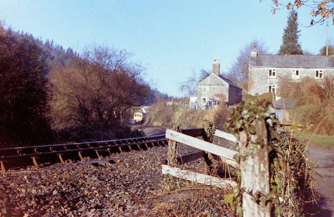
A photograph from the train as it passes down the Camel Valley just after Grogley Halt. 17th December 1978 Copyright Roger Winnen
Scenes at Wadebridge - the last trains.
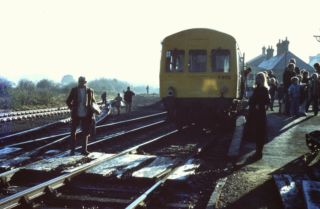
The penultimate train stands at Wadebridge 17th December 1978 Copyright Roger Winnen.
The penultimate train stands at Wadebridge - one wonders if the very young man in the picture remembers the event. In the distance can be seen the road bridge over the Camel. 17th December 1978
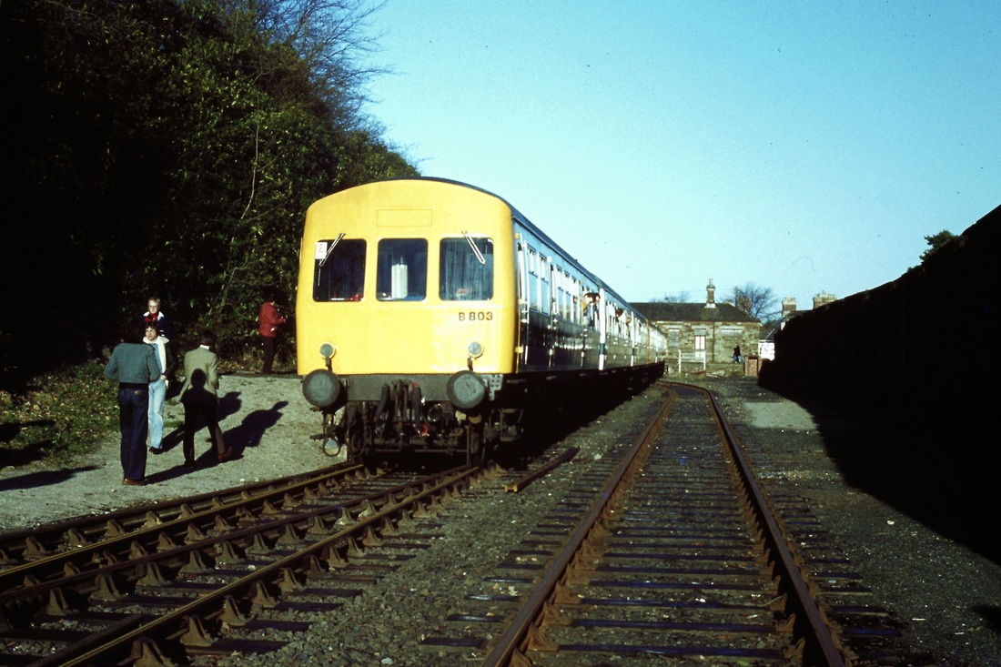
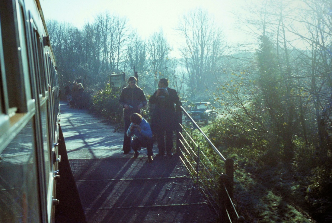
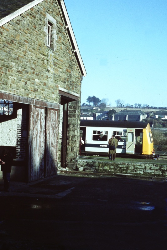
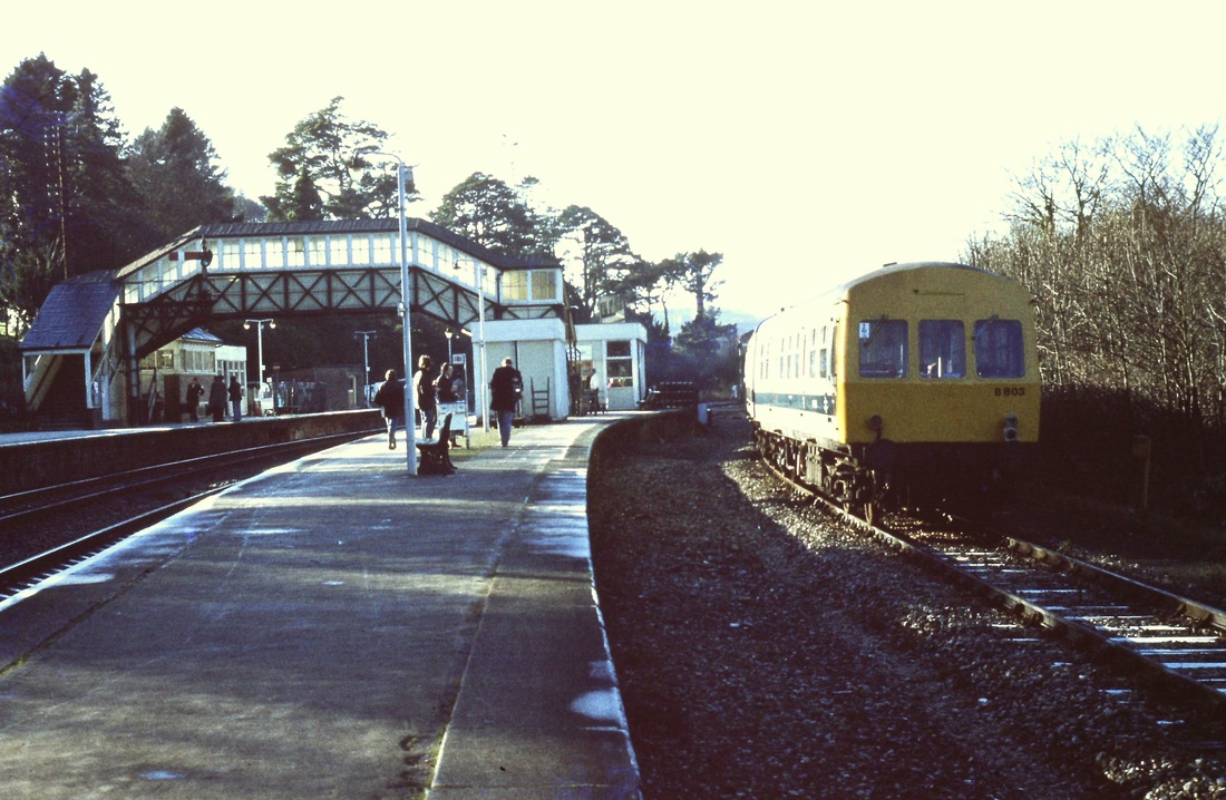
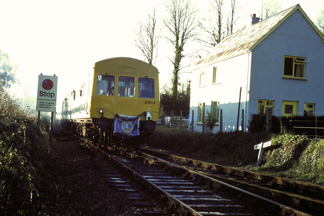
Unit B803 stops at the Padstow end of the platform. Various members of the party inspect the remains of the station, careful on that crossing, it looks very slippery! 17th December 1978. Copyright Roger Winnen
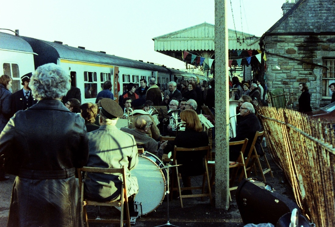
The last train stands at Wadebridge station with St Minver band in attendance. This included CRS member Jerry Chandler. 17th December 1978
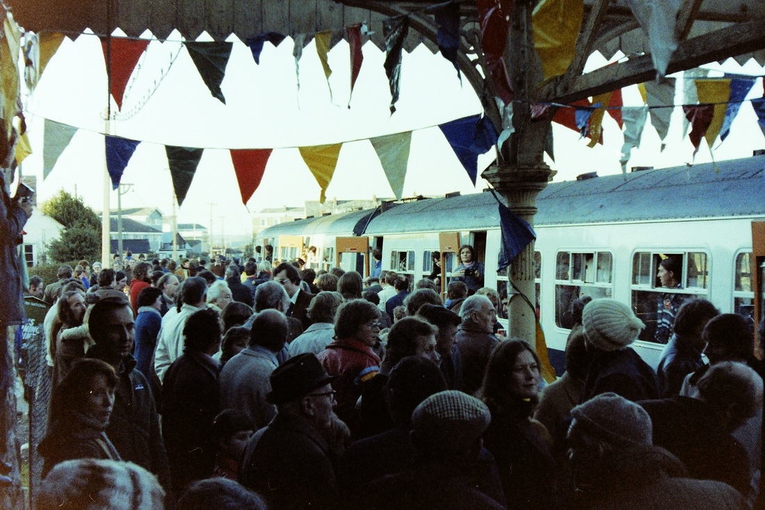
The platform thronging. Great excitement at Wadebridge station as the last train stands at the platform. A sad day - 17th December 1978 Copyright Andrew Jones
The penultimate train seen alongside the goods shed. 17th December 1978. Copyright Roger Winnen
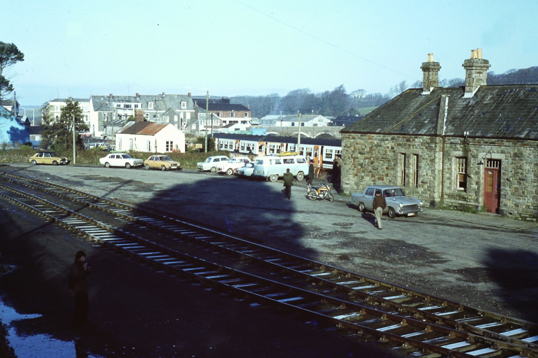
Wintertime long shadows cross the goods yard at Wadebridge. 17th December 1978. Copyright Roger Winnen
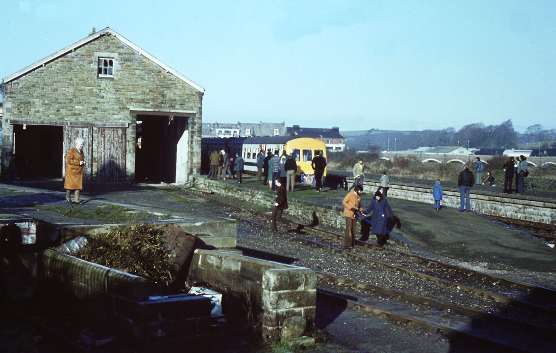
A general view of participants exploring before the penultimate train departs. 17th December 1978. Copyright Roger Winnen
Looking back from the penultimate train at those left behind. 17th December 1978 Copyright Andrew Jones
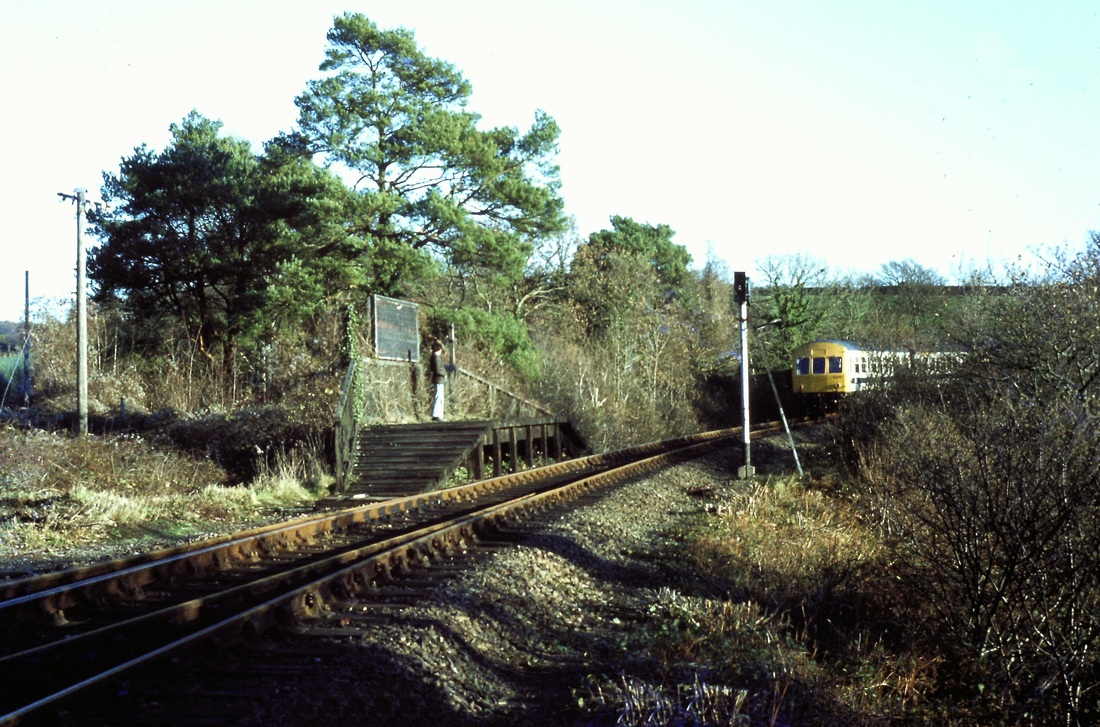
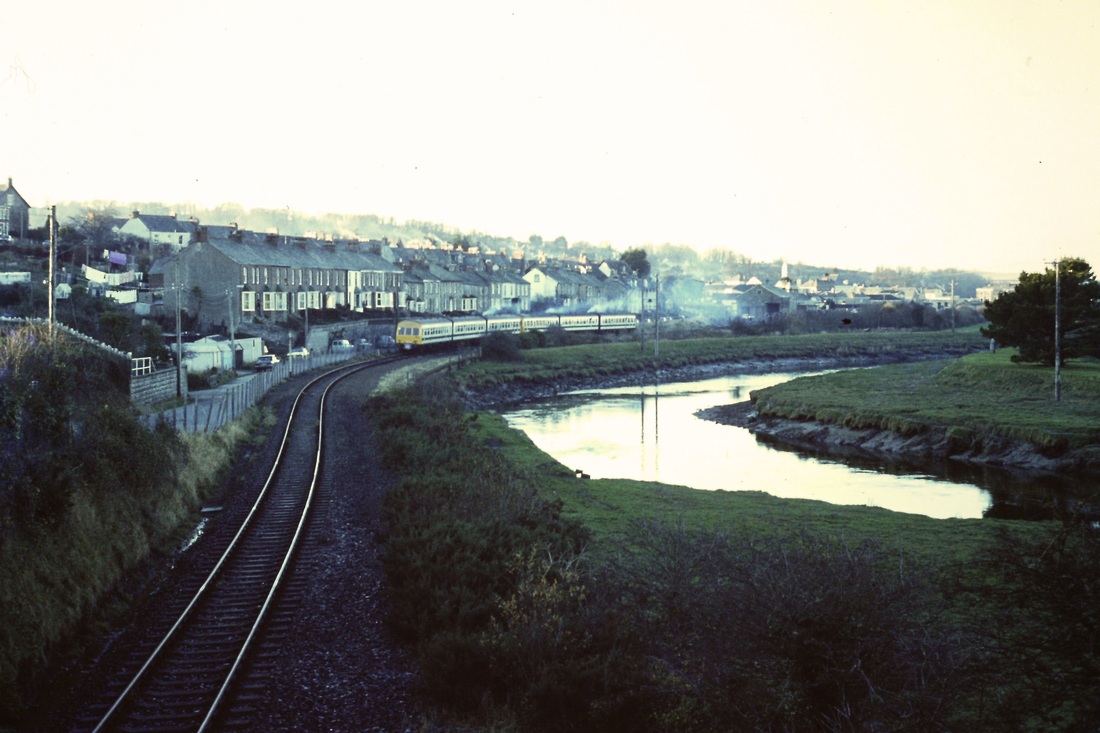
Lineside view at Polbrock of the very last train approaching. 17th December 1978 Copyright Ann Rawle
The penultimate train heads back towards Bodmin. 17th December 1978 Copyright Andrew Jones.
A view back from the last train leaving a few spectators on the now distant platform at Grogley Halt. 17th December 1978 Copyright Andrew Jones
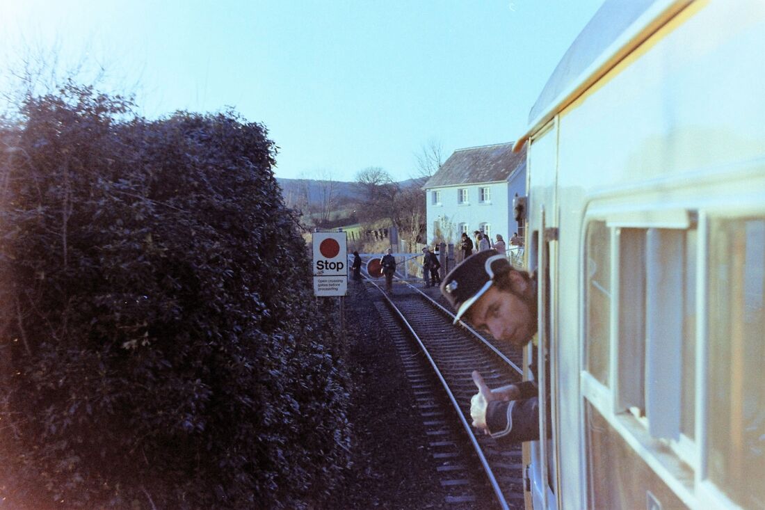
The guard gives the thumbs up, perhaps rather inappropriate for the last train! Behind the gates have closed and a few spectators linger to witness the departing train. 17th November 1978. Copyright Andrew Jones
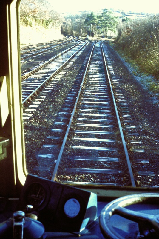
A cab view at Boscarne Junction. To the left, To Dunmere Halt & Bodmnin North, also the Wenford branch. The the right for Bodmin General and ultimately Bodmin Road. 17th December 1978. Copyright Roger Winnen
(3)
The final run to Wadebridge
The final run to Wadebridge
The second & final run to Wadebridge passes the trackless Padstow platform at Bodmin Road. 17th December 1978. Copyright Roger Winnen
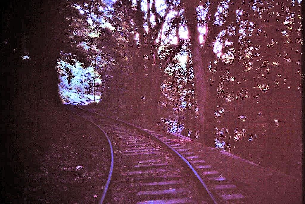
The last train nears Boscarne Exchange Platform. 17th December 1978. Copyright Roger Winnen.
Looking very smart in the winter sunshine B803 leads the formation towards Wadebridge. 17th December 1978. Copyright Roger Winnen
Departing Boscarne for Wadebridge. 17th December 1978. Copyright Roger Winnen
The END. The final train leaves Wadebridge. 17th November 1978. Copyright Roger Winnen
Wadebridge 17th December 1978. Copyright Roger Winnen
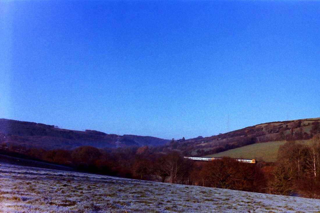
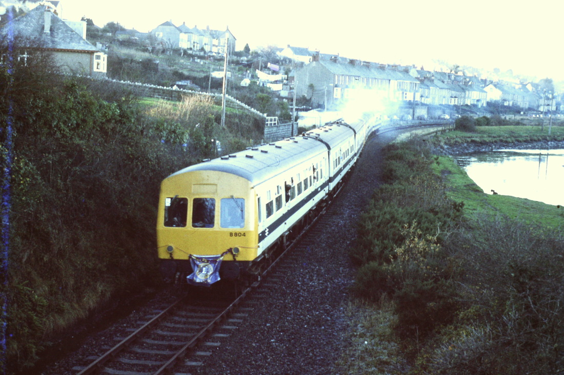
It's still frosty on the distant hills as the very last train of all heads back towards Bodmin. 17th December 1978 Copyright Roger Winnen
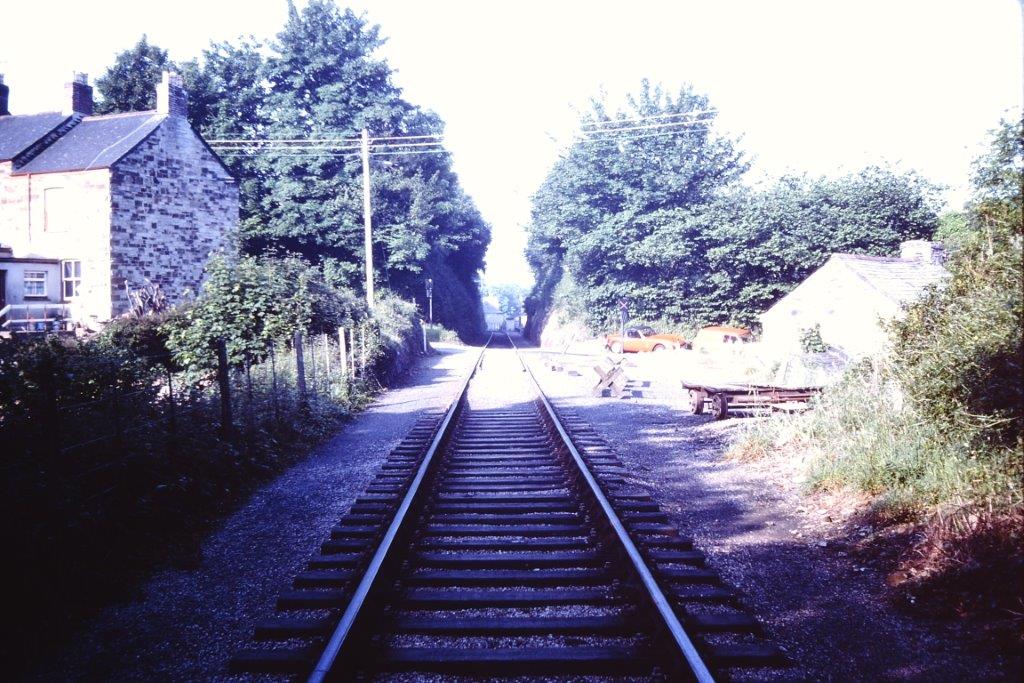
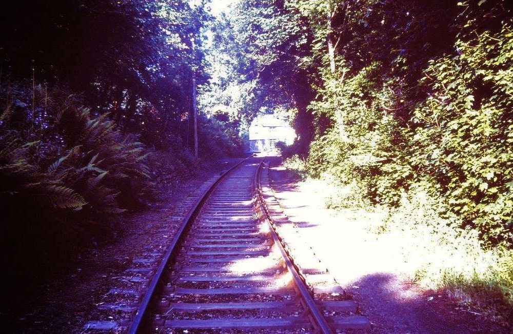
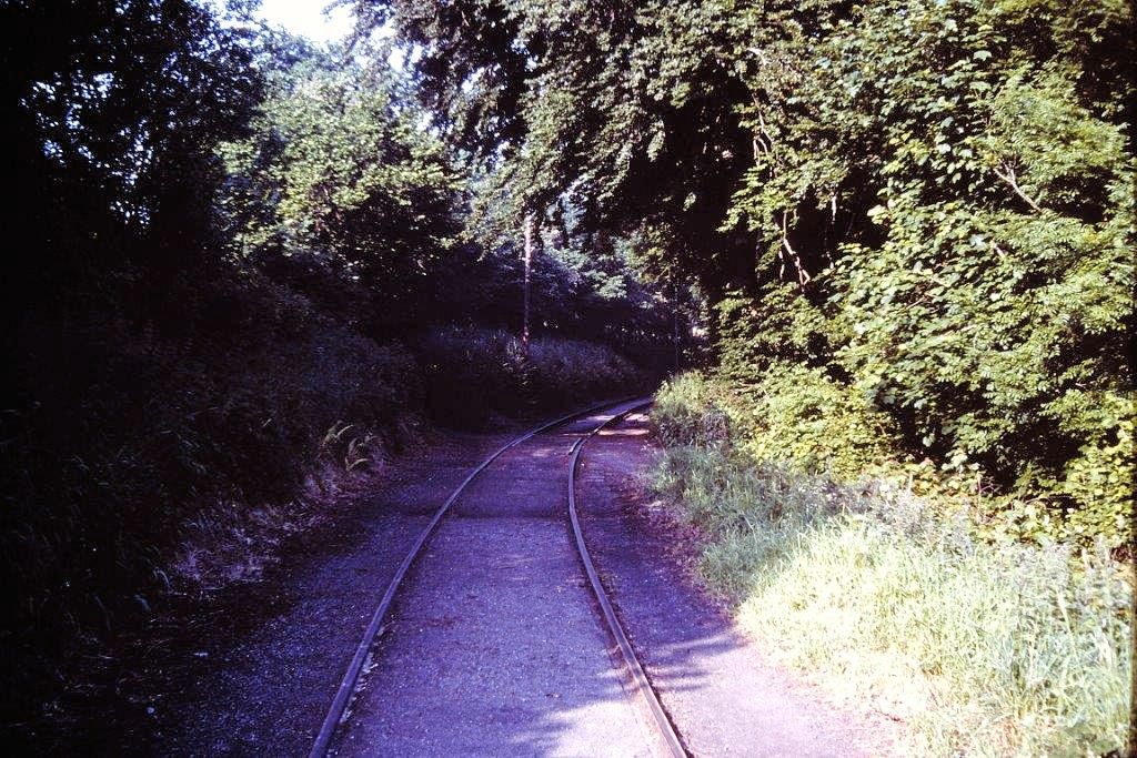
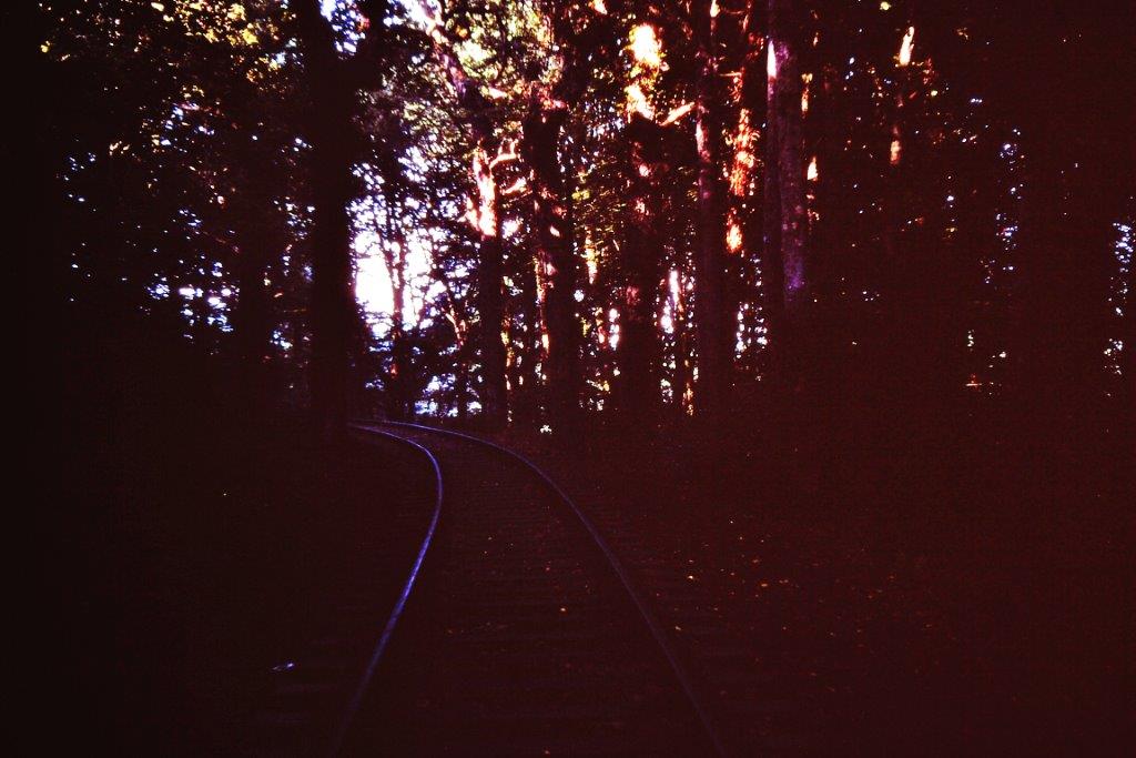
These rails will never be polished again. 17th November 1978. Copyright Roger Winnen
(4) Demolition in progress
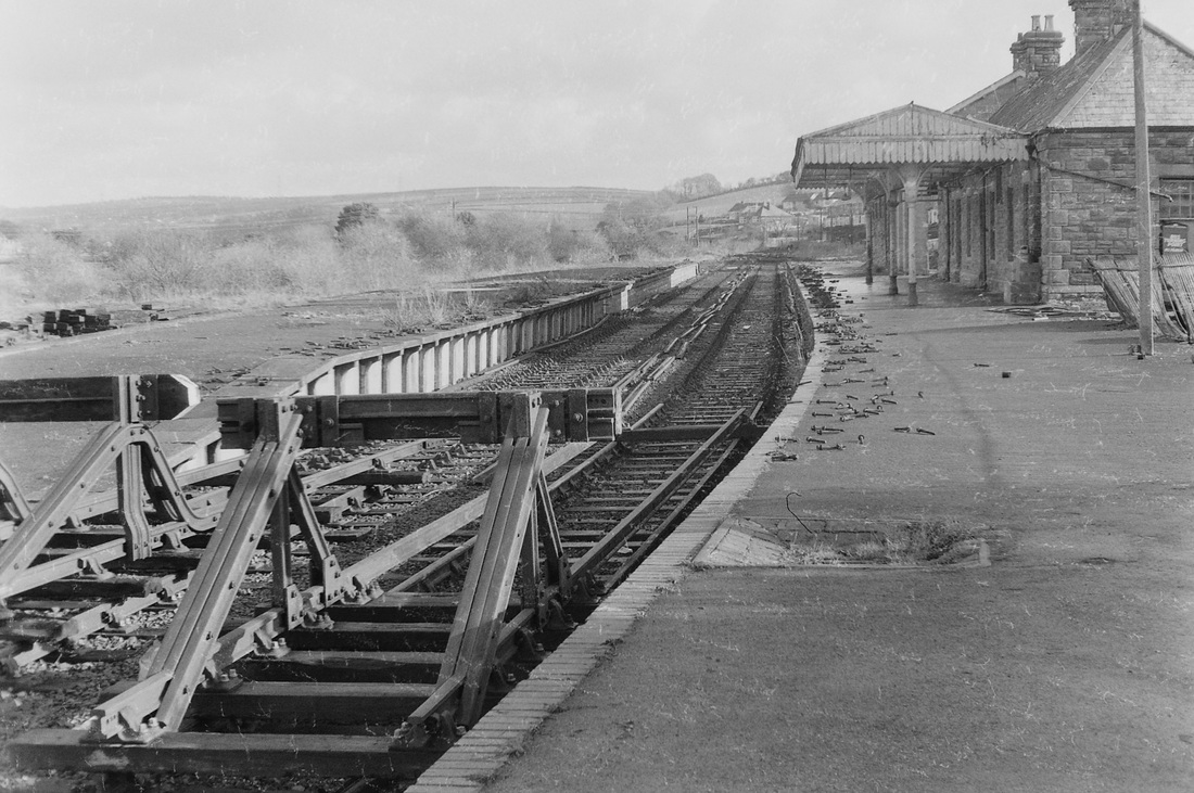
A view from the buffers at Wadebridge station of the demolition in progress. One wonders if the buffers were kept complete with a view to their future use elsewhere? Picture by Andrew Jones Copyright
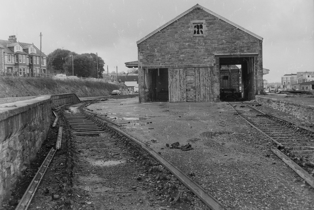
Demolition in progress outside the goods shed at Wadebridge. Copyright Andrew Jones.
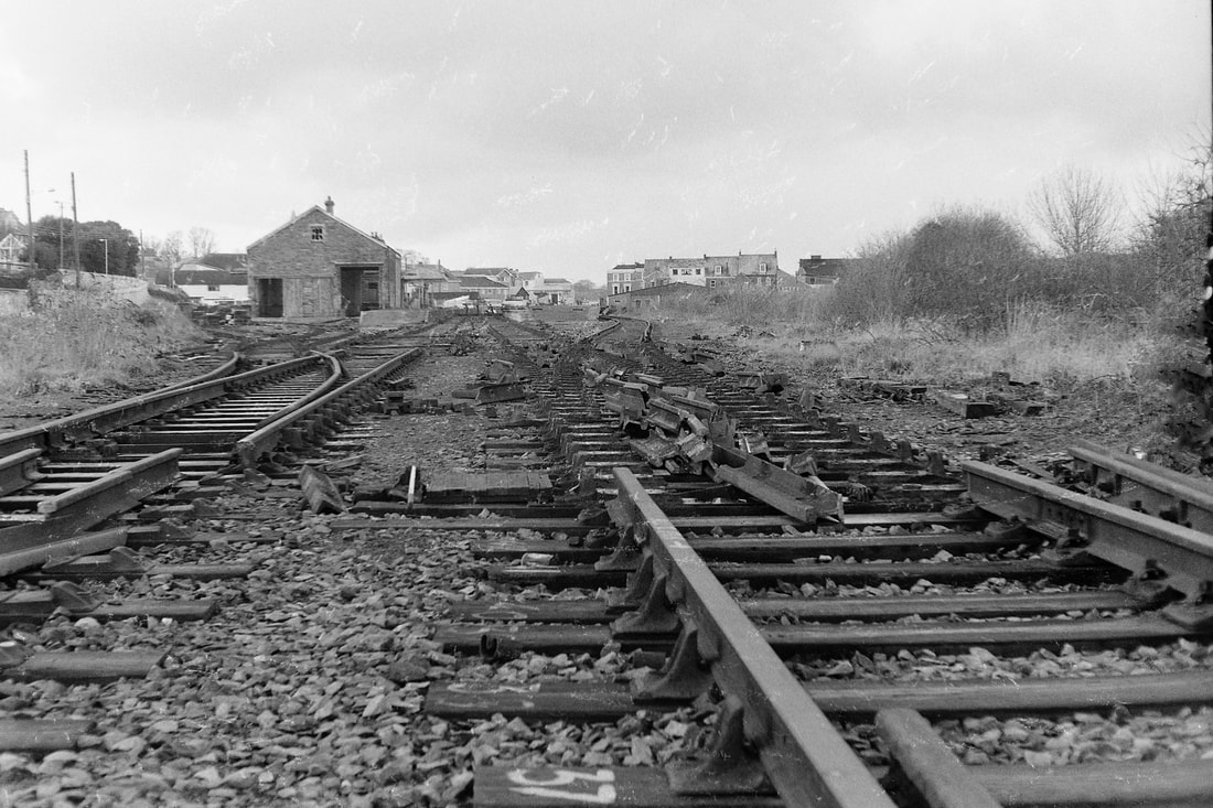
A panorama of the destruction at Wadebridge - the demolition team have moved in. The date is?? Copyright Andrew Jones
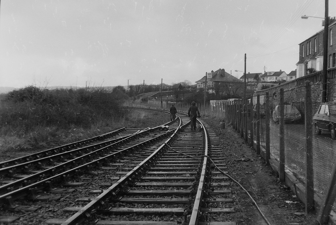
The demolition team walk out on the track at Wadebridge.. Prior to the lifting of the North Cornwall line there were two parallel single track from here. Copyright Andrew Jones
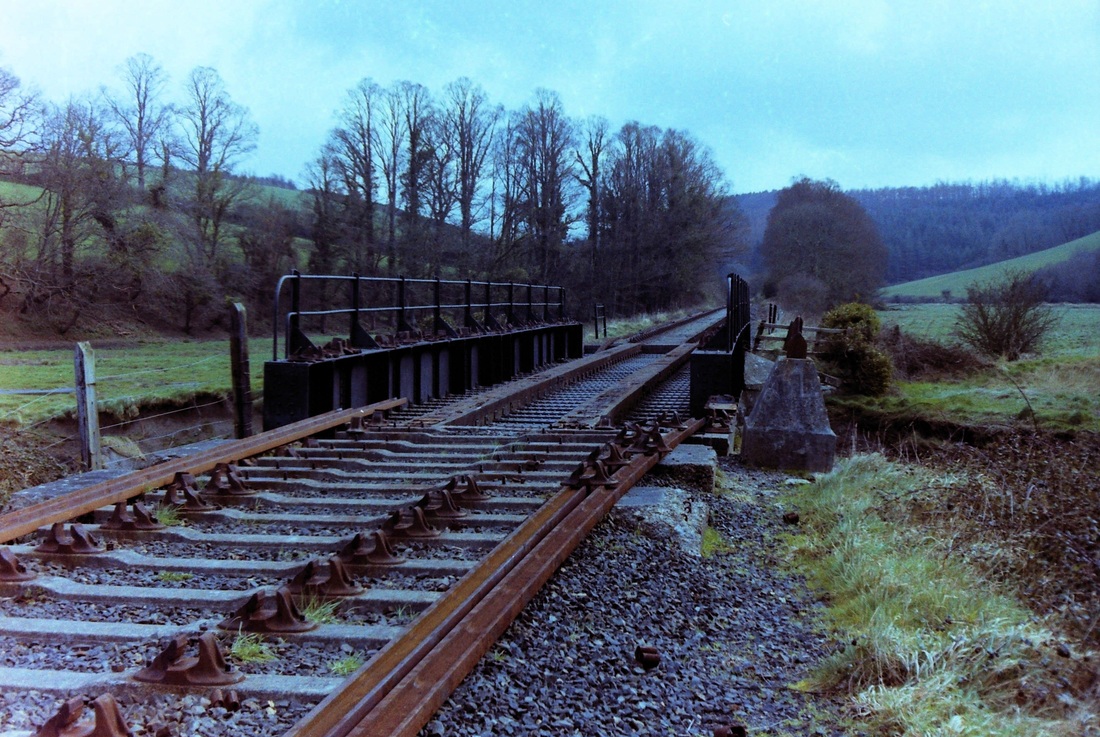
The demolition team has reached and proceeded beyond Pendavey Bridge. Copyright Andrew Jones
A striking p[icture from Polbrock Bridge - demolition gang have moved on towards Grogley leaving complete lengths of rail to be picked up later , possibly towed along over the still present sleepers. Copyright Andrew Jones
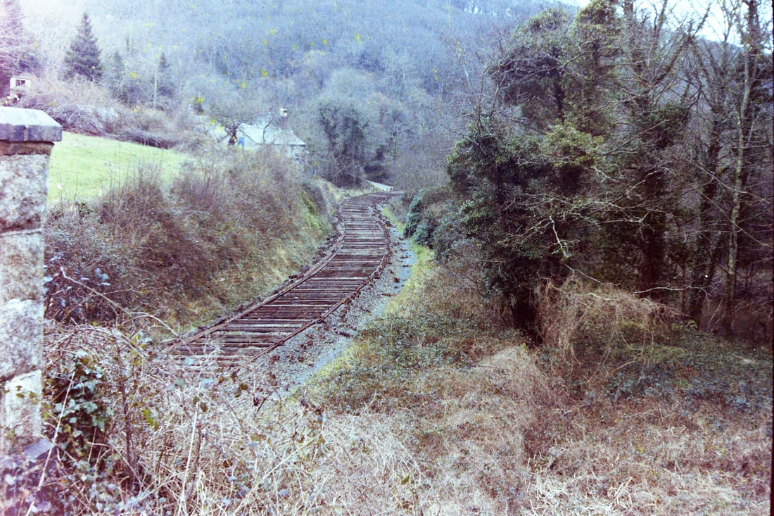
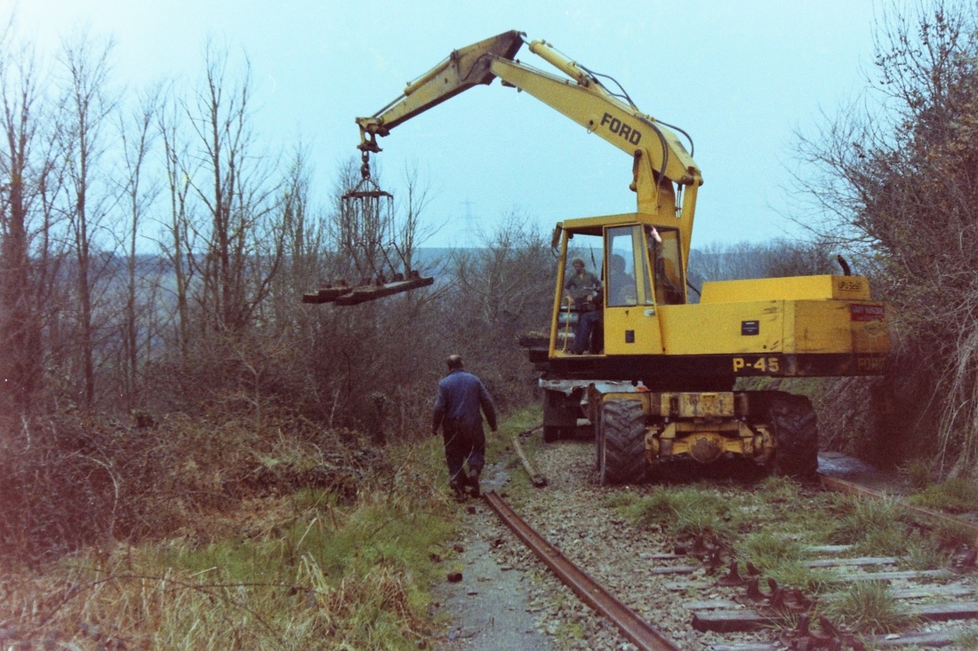
The demolition nears Grogley, it would appear that the rails are being cut with an oxy-acetylene cutter. Andrew expresses surprise that they didn't simply undo the fishplates. DATE. Copyright Andrew Jones.
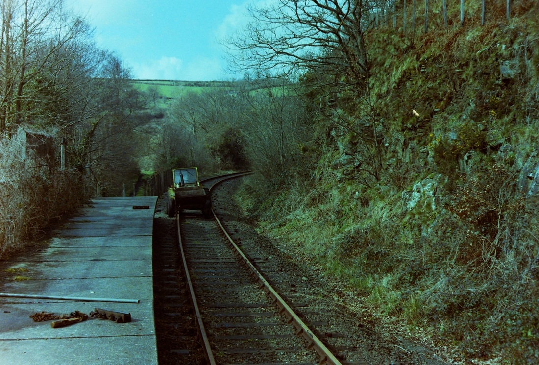
We move on to Grogley now where the track is still in situ. However the contractors tractor has been vandalised - the tyres have been let down. Andrew hastens to point out that he was not guilty!. DATE Copyright Andrew Jones
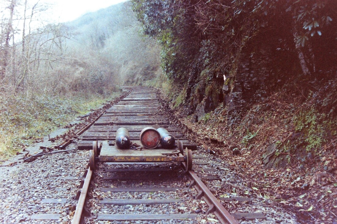
In this picture near Nanstallon it would appear that the contractors are removing recovered sleepers, chairs and rail piecemeal loading them onto a lorry for transport in the Wadebridge direction. DATE Copyright Andrew Jones
Andrew writes :- Nanstallon, Contractors unfortunately doing their job. DATE Copyright Andrew Jones
(5) Saving the
Boscarne to Wadebridge
rail route
Andrew Jones
Boscarne to Wadebridge
rail route
Andrew Jones
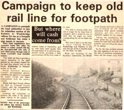
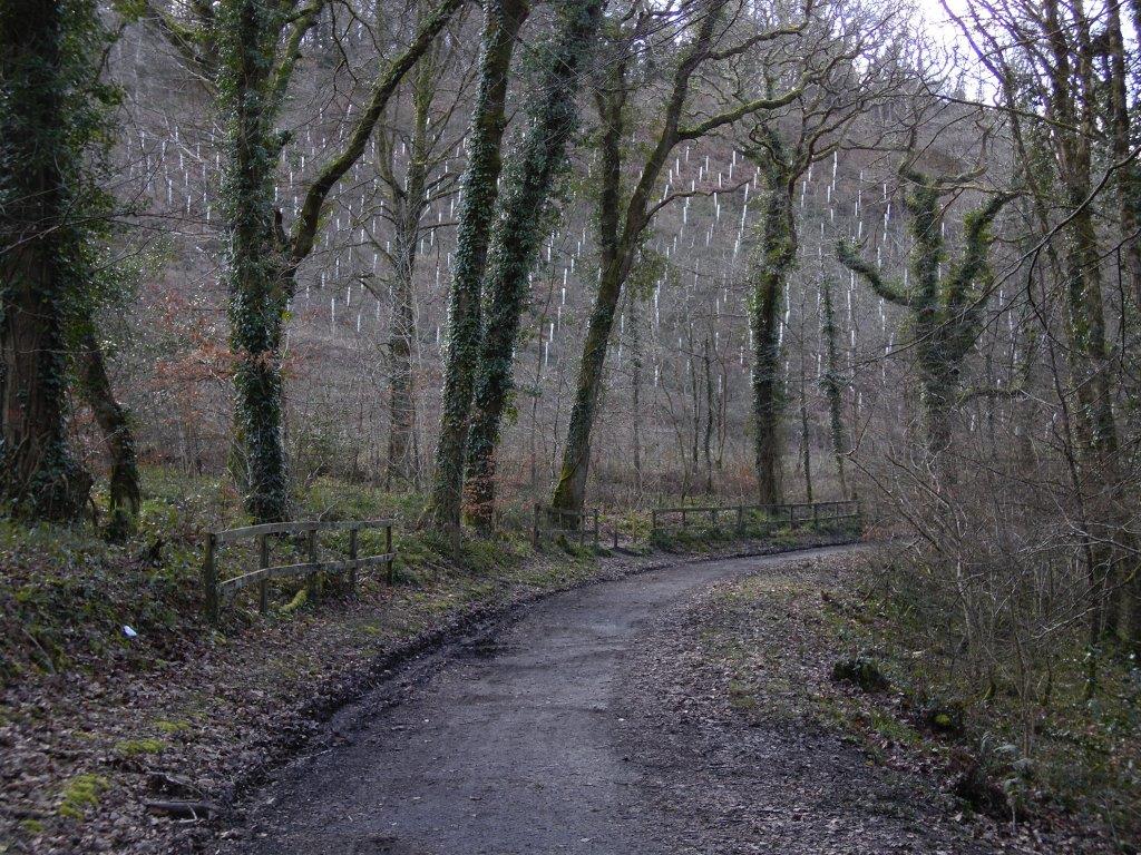
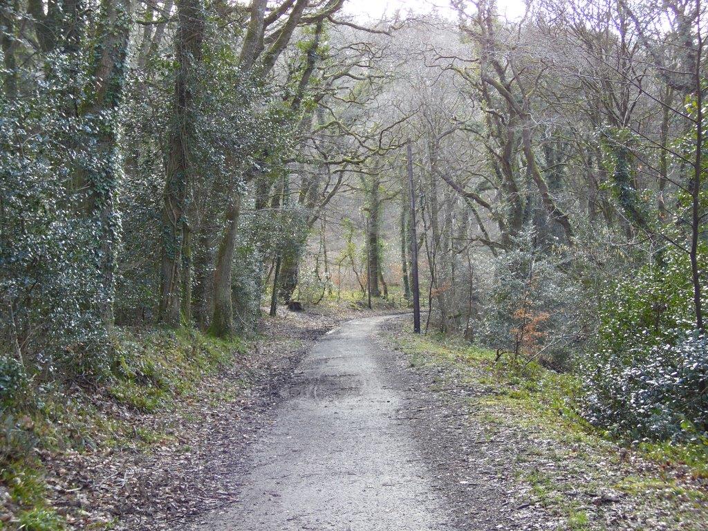
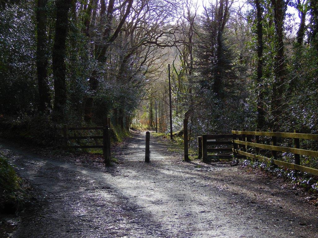
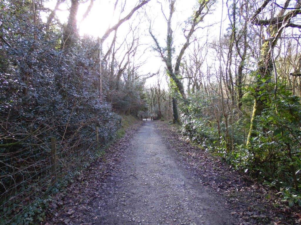
Had it not been for the efforts of Andrew Jones the current footpath, bridleway and cycleway along the course of the old railway route between Boscarne and Wadebridge would likely never have been saved.
Andrew is Councillor on St Breock Parish Council. Lets let him tell the story in his own words.
Andrew is Councillor on St Breock Parish Council. Lets let him tell the story in his own words.
Preserving the route of the Bodmin to Wadebridge Railway
by Andrew Jones
How can you write anything positive, when posting photographs about the demolition of a branch line?
The Bodmin to Padstow, line should never have closed. Politically, it was in the wrong place, at the wrong time. Well used, right up to passenger closure in 1967, the line lingered on, as a freight outpost, into Wadebridge, until 1978. (the Padstow section was lifted, in 1967, some say, with indecent haste.)
It was during the freight period 1967-1978, that I decided, before all was lost, to catalogue the remaining infrastructure, somewhat obsessive you might say! I actually know, how many sleepers there were, dates of rail-chairs and even the number of track sections laid.
I had hoped, that the embryonic Bodmin preservation society, would some how, perhaps by magic, manage to finance, the complete purchase to Wadebridge, but given the immense effort and expense already committed, the Dunmere to Wadebridge section could have pushed their limited resources and even jeopardised the whole project.
It would be very easy, in retrospect, to look at the costs, in 1978 and assume that the £26,000 scrap value of the 5 mile section of track, was a reasonable price to pay and again the total land value, excluding the Wadebridge Station site, of approx £4,000 should have been within reach.
In 1978, you could buy an average, 3 bedroomed house for approx £4,000, in 2016 terms, this equates to approx £200,000, so with a little maths, the total scrap and land costs, if purchased today, would easily have exceeded £1,000,000.
Recently, in the railway press, the Gloucester Railway has quoted the rebuild cost, for the 2 mile stretch of railway, to Broadway, using volunteer labour, at £2,000,000 a mile.
This illustrates the mountain to climb, when applied to railway preservation.
Now add the next mountain. What happens, if the route of the railway, has not been safeguarded.
There is absolutely no doubt, that the Victorian railway legacy, was squandered during the 1960’s.
The visionary entrepreneurs of the 1800’s, provided a massive integrated, transport system, opening up routes, which would be unthinkable, let alone affordable, in 2016.
Witness the wholesale closure and removal of the North Cornwall Line. Serving an area of low population, it provided a social need, both for employment and the greater community at large.
The fact, the railway line, was only built, in the first instance, so that the LSWR could gain access to Cornwall and compete with its rival, the GWR, thus providing this impoverished area, with a lucky break, has been largely forgotten!
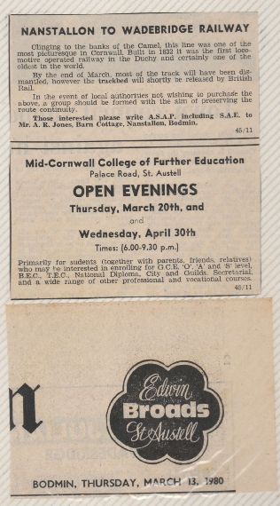
First step, 'testing the water' so to speak, find out who is interested. Andrew placed an advert in the Cornish Guardian - this appeared in the paper on Thursday 13th March 1980
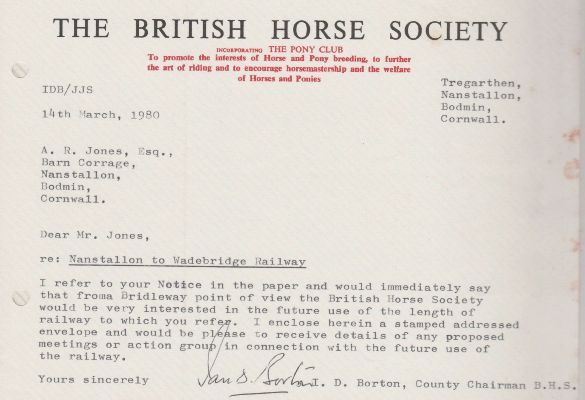
The response was pretty rapid. A letter dated the very next day from The British Horse Society.
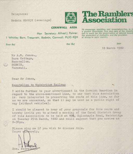
The Ramblers Association were also quick to reply - where better place to ramble?
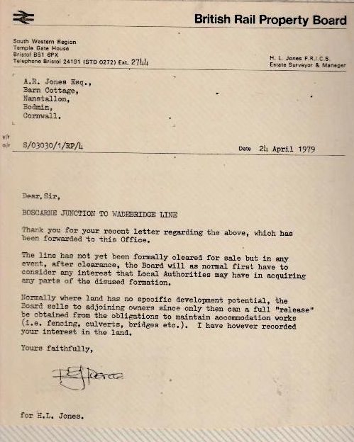
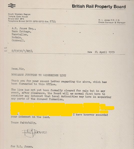
Letter from British Rail Property Board dated 24th April 1979
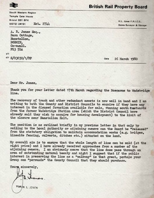
Letter from the British Rail property Board dated 26th March 1980
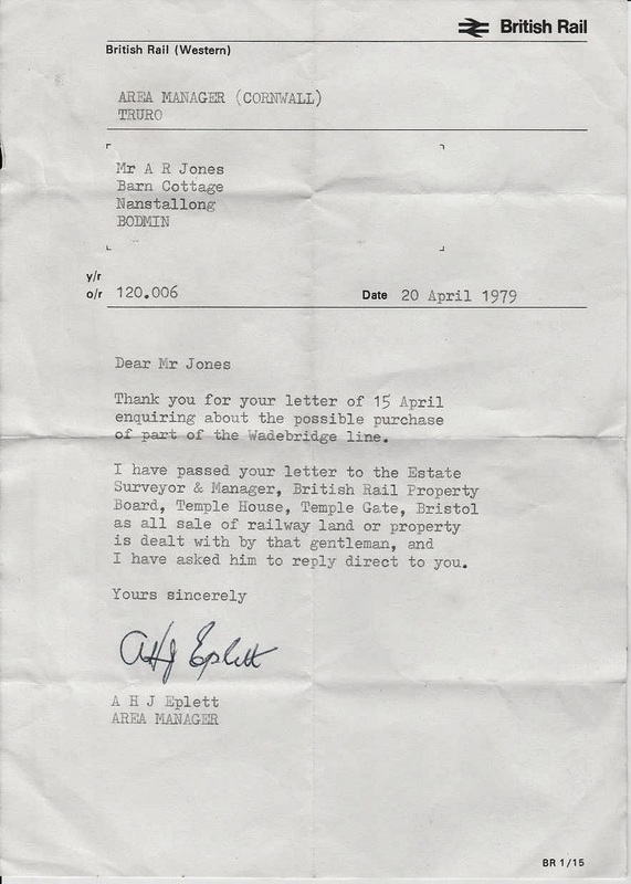
Andrew wrote the Area Manager for Cornwall Railways, the late Arthur Eplett
Letter from BR Property Board dated 24th April 1980
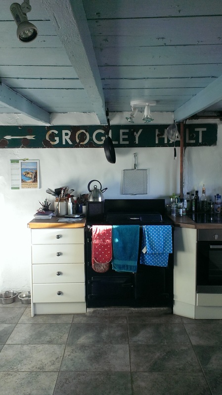
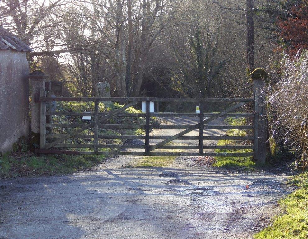
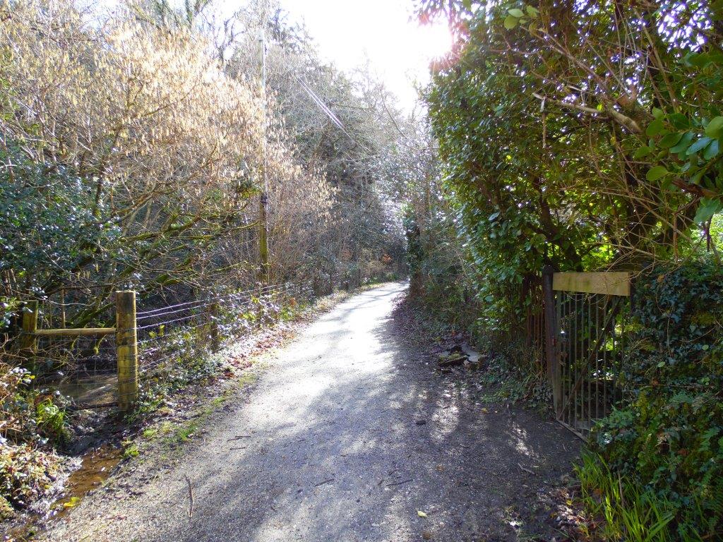
This sign once stood roadside on the approach to Grogley Halt. It was rescued by somebody an for a small sum now hangs safe and sound in Andrew's kitchen. It is Andrew's wish that once trains return to Grogley that this sign, or a similar replica can be re-instated on the posts vacated 50 years ago. Let's hope that this is sooner rather than later.. Copyright Andrew Jones.
Another route lost!!
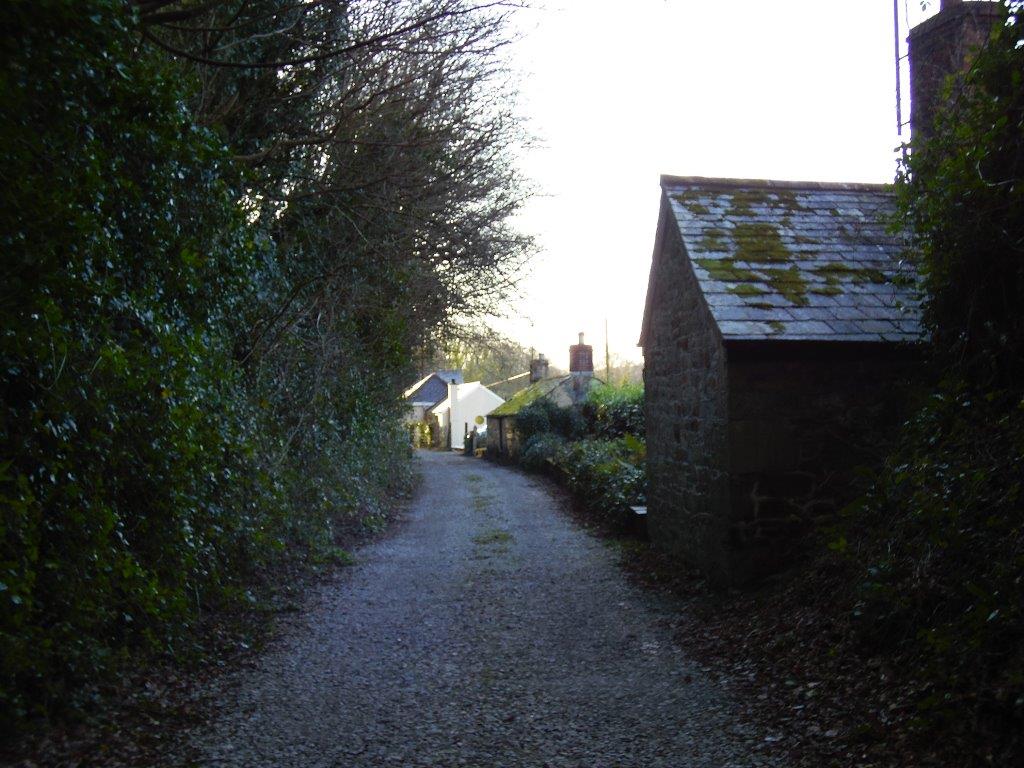
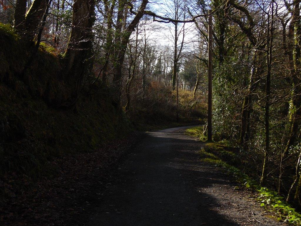
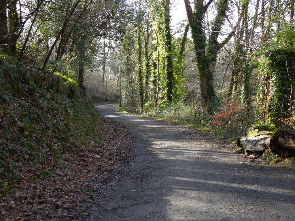
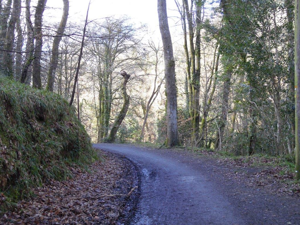
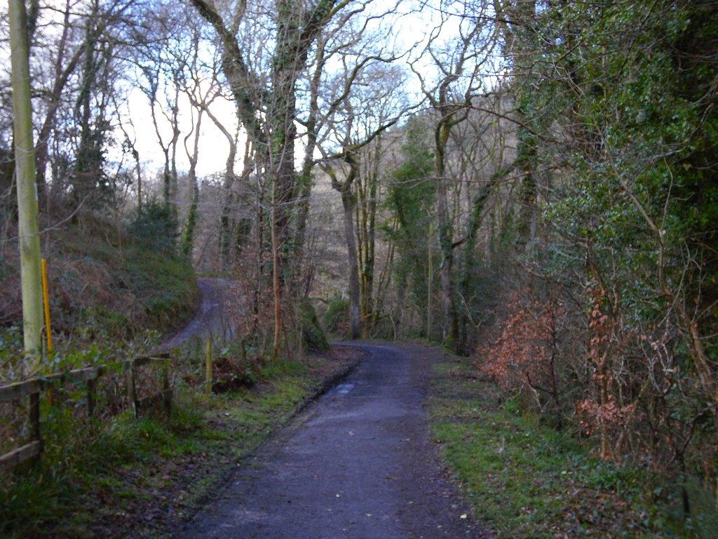
The North Cornwall line was another prime candidate for conversion to a cycle/walkway once the track had been lifted. However, sadly, this has never been done and the route sold off piecemeal, embankments removed, cuttings filled and grassed or built over. One or two reminders that a rail route once ran this way - see the pictures below. Ah well, Sobeit. Andrew certainly deserves congratulations for all his endeavors - perhaps one day trains will return to the outskirts of Wadebridge - we can only help
The North Cornwall line was another prime candidate for conversion to a cycle/walkway once the track had been lifted. However, sadly, this has never been done and the route sold off piecemeal, embankments removed, cuttings filled and grassed or built over. One or two reminders that a rail route once ran this way - see the pictures below. Ah well, Sobeit. Andrew certainly deserves congratulations for all his endeavors - perhaps one day trains will return to the outskirts of Wadebridge - we can only help
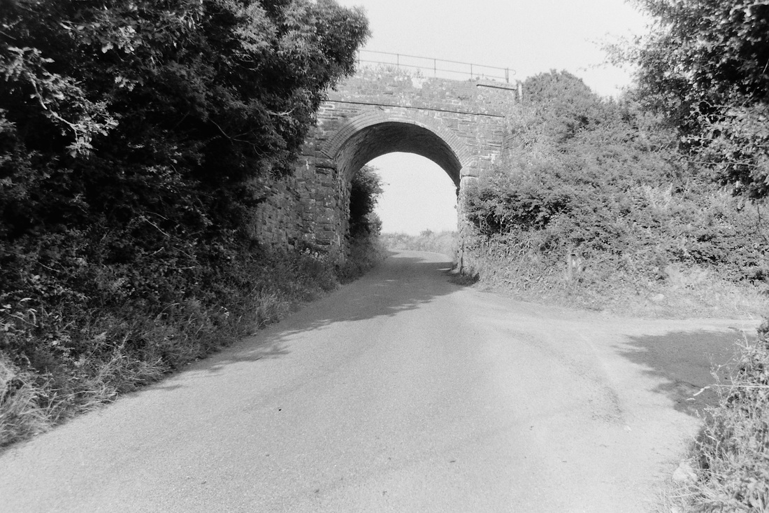
A rail over road bridge at Port Isaac Road, fortunately this has been listed. 1990. Copyright Andrew Jones
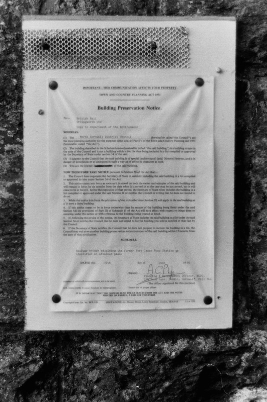
The preservation notice in 1990. Copyright Andrew Jones.
Many thanks to Andrew Jones
(6) Andrew Jones takes a look at the Wenford Bridge branch - then, 1980, and now 2017.
I am working through my 1970/80s photographs of the Wenfordbridge branch.
This month I have included the start of the, I suppose, lengthy siding just south of Dunmere Platform, to Wenford.
The locked gate in the foreground, of this October 1980 photograph, provided secure protection to the branch and performed faultlessly throughout its lifetime.
The branch to Bodmin North had been lifted many years before, but regular freight trains were still evident, with the rails well polished.
There is a permanent way trolley, adjacent the original concrete post fence and the building to the right of the gate, once housed the original gangers trolley.
Unusually the railway continued past the gate on a shared access with the houses and for the most part, caused very little inconvenience to the owners or railway.
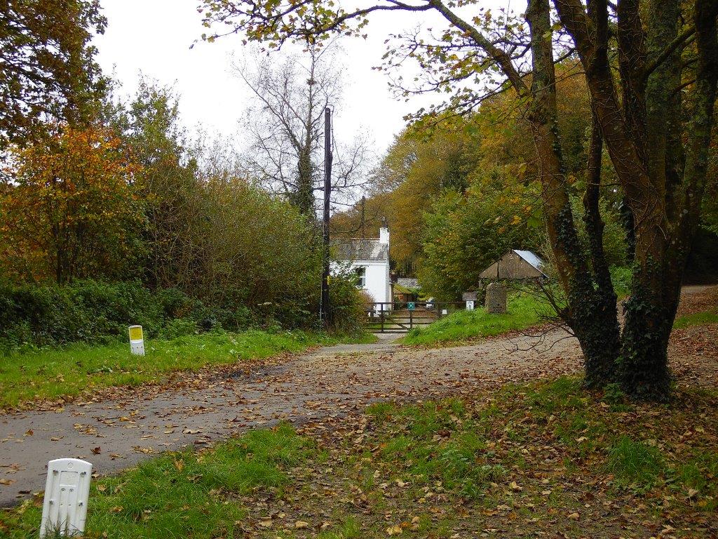
I was surprised to see how the view has changed in 37 years. As you can see in the second photograph, taken on the 28th October 2017, vegetation has encroached from all sides, bushes have now become trees and the busy Camel trail now utilises the Bodmin North Branch, the land beyond the gate is now a private access lane.
Cyclist now regain access to the Wenford branch by a path a few metres north beyond Dunmere Platform, thus avoiding the original level crossing and busy main road.
I am preparing a number of Now and then photographs of the Wenfordbridge branch and will forward them over the coming months. I have a complete pictorial record of the branch taken just before closure and if anyone needs a particular section I am sure I can assist.
Best wishes Andrew
This month I have included the start of the, I suppose, lengthy siding just south of Dunmere Platform, to Wenford.
The locked gate in the foreground, of this October 1980 photograph, provided secure protection to the branch and performed faultlessly throughout its lifetime.
The branch to Bodmin North had been lifted many years before, but regular freight trains were still evident, with the rails well polished.
There is a permanent way trolley, adjacent the original concrete post fence and the building to the right of the gate, once housed the original gangers trolley.
Unusually the railway continued past the gate on a shared access with the houses and for the most part, caused very little inconvenience to the owners or railway.
I was surprised to see how the view has changed in 37 years. As you can see in the second photograph, taken on the 28th October 2017, vegetation has encroached from all sides, bushes have now become trees and the busy Camel trail now utilises the Bodmin North Branch, the land beyond the gate is now a private access lane.
Cyclist now regain access to the Wenford branch by a path a few metres north beyond Dunmere Platform, thus avoiding the original level crossing and busy main road.
I am preparing a number of Now and then photographs of the Wenfordbridge branch and will forward them over the coming months. I have a complete pictorial record of the branch taken just before closure and if anyone needs a particular section I am sure I can assist.
Best wishes Andrew
Wenford Bridge Comparisons 001 Dunmere Junction October 1980 Copyright Andrew Jones
Wenford Bridge Comparisons 002 Dunmere Junction 28th October 2017 Copyright Andrew Jones
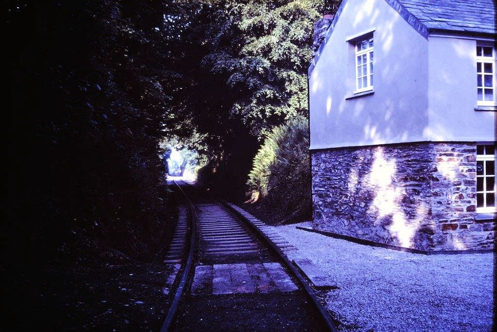
Dear Keith, Today, 27th December 2017, I returned to Boscarne, with the aim of illustrating the many changes to this once busy junction.
My first photograph was taken in 1978, looking towards Wadebridge, from the level crossing gates at Boscarne.
You might say, hang on a minute! This location is not part of the Wenfordbridge branch and for most of the railways life this was true. All changed with the complete closure to Wadebridge and from 1978, this section formed part of the exchange siding.
Remarkably the sign on the left, had only recently been erected and states on the reverse “STOP, open crossing gates before proceeding”
Slightly obvious, you might think, however there had been a spate of gate bashing during the 70’s, on goods only lines.
I can remember as a child that also a large steel roller used to be propped up against the fence on the ballast at this location, for what reason perhaps one of your readers may know.
Looking towards the horizon, we can see a hill which today is covered by Grogley Forest.
In the second photograph taken on the 27th December 2017, we can see the massive change which has taken place.
Trees have formed a tunnel effect, the” Open “ gate sign just survives, (posts only), the camel trail partnership have erected a railway sleeper platform for the benefit of horse riders and during the night a heavy storm has brought down one of the many trees lining the old trackbed.
Without the Camel Trail conversion, this photograph would have been the point of no hope, but with a bit of luck and an awful lot of money who knows, A Beattie or T9 back in Wadebridge! Now that would be a good Christmas present.!
best wishes and a brilliant new year to all at the Cornwall Railway Society
from Andrew
WENFORD BRIDGE COMPARISONS 003 Boscarne level crossing 1978 Copyright Andrew Jones
WENFORD BRIDGE COMPARISONS 004 Boscarne level crossing 27th December 2017 Copyright Andrew Jones
Boscarne Exchange Siding - see below:-
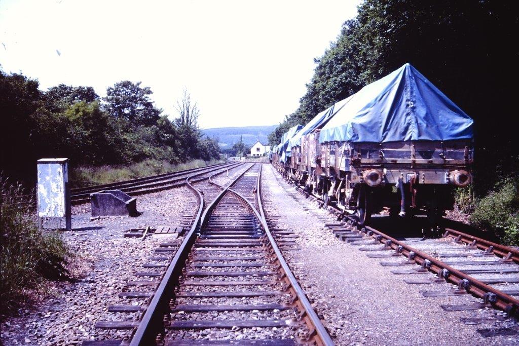
The 1978 photograph depicts the final layout, before closure and conversion. The empty china clay hoods are waiting collection by the frequent 08 shunting locomotive, having been deposited by a class 37 the previous day.
850 of these wagons were built by BR in 1955, unusually small, they had a 9 foot wheelbase and were only 16 foot six inches long with an end opening tipper door, for emptying on an inverter mechanism at Fowey Docks.
The once extensive clay railways were in the main lightly built with restrictive curves.
The first 300 wagons were unfitted, but within a short space of time, vacuum brakes were installed. These wagons replaced a similar GWR design fitted with patented Williams sheets,(the distinctive A frame shape covered with a blue tarpaulin in ECLP corporate colours).
They served the china clay system perfectly, simple in design, reliable and easily maintained at the dedicated wagon works, in St Blazey.
Typifying the Victorian philosophy of mechanical simplicity combined with sound design and build quality.
Please note the rail chair packing, on the right hand exchange siding, wooden blocks were rare even in the 70’s.
Access to this siding was only via a set of points adjacent the signal box next to the crossing gates and could accommodate a considerable amount of wagons.
Today the transformation is complete. Only a loop exists serving the excellent new build station. The triangle of land to the left, once part of the short lived exchange platform, has no apparent function and unfortunately this latest update photograph is slightly to the right of the original 1978 shot as I did not want to trespass onto railway property.
Best wishes Andrew Many thanks Andrew
WENFORD BRIDGE COMPARISONS 005 Boscarne Exchange siding 1978 Copyright Andrew Jones
WENFORD BRIDGE COMPARISONS 006 Boscarne Junction 27th December 2017 Copyright Andrew Jones
Boscarne Junction - Then & Now Continued
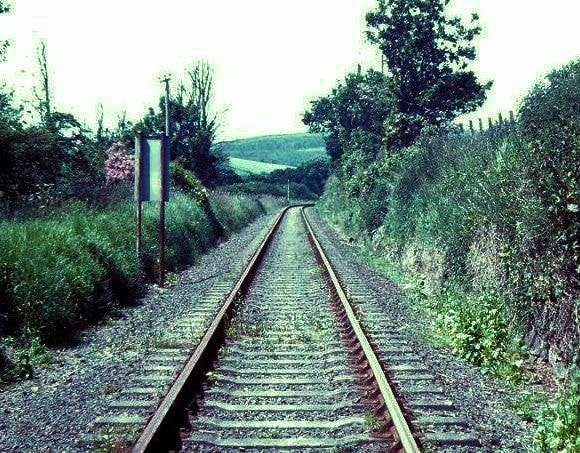
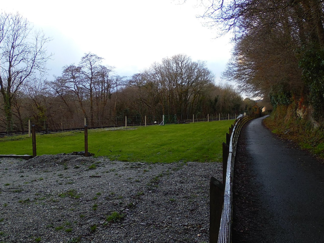
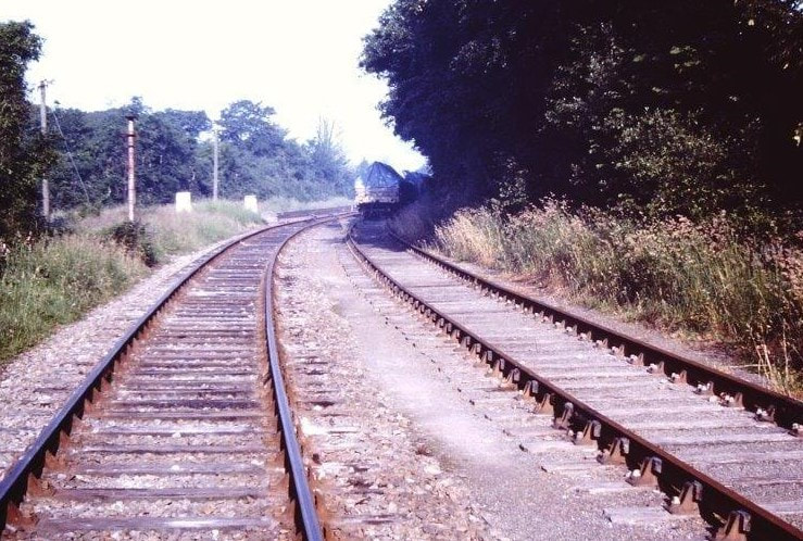
See map and photographs below :- In this 1978 photograph we have now entered the joint section serving Wenfordbridge and Bodmin North, closed some 12 years earlier. The rails are shining and freight was daily with record tonnages being reported at the time.
The 'Stop Lamp' post can be seen to the left of the photograph, although already souvenir hunters had removed the top.
One can see just how long the siding was on the right and it was always well used.
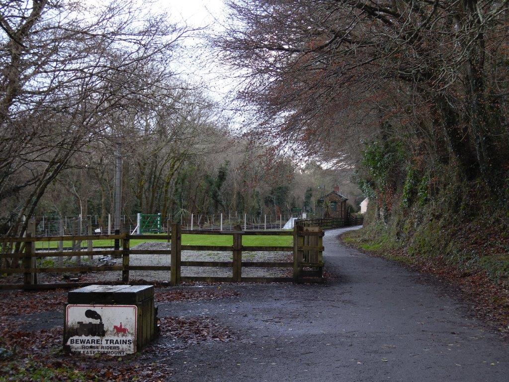
In the December 2017 photograph the only railway infrastructure left is the shunt limit post. This once busy junction now hosts the camel trail and the ‘new exchange’ platform on the left is for horse riders.
Moving on up the line we pass a foot crossing, which although not dedicated as a public footpath was popular with locals as a short cut from the nearby village of Nanstallon to the Borough Arms pub at Dunmere.
The path passed behind Boscarne Junction signal box and crossing keepers house, ran adjacent the sidings on a high embankment gradually returning to rail level at a point 20 yards north of this photograph as shown in the next 1978 photograph.
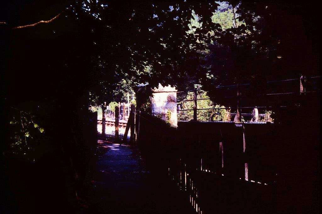
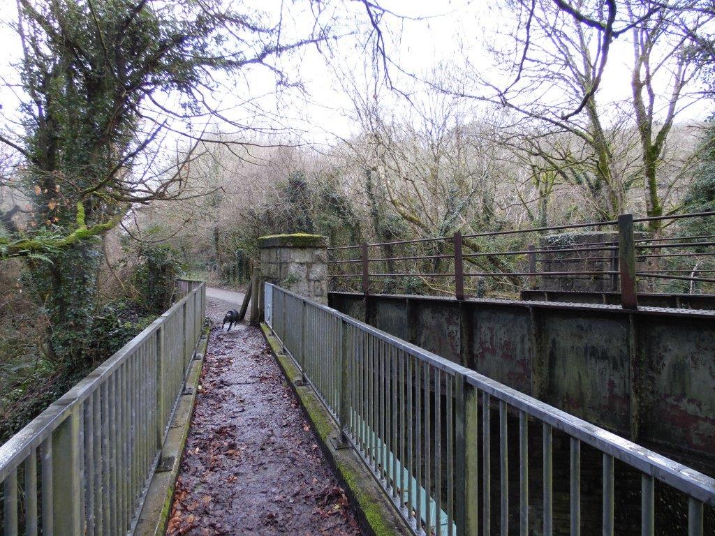
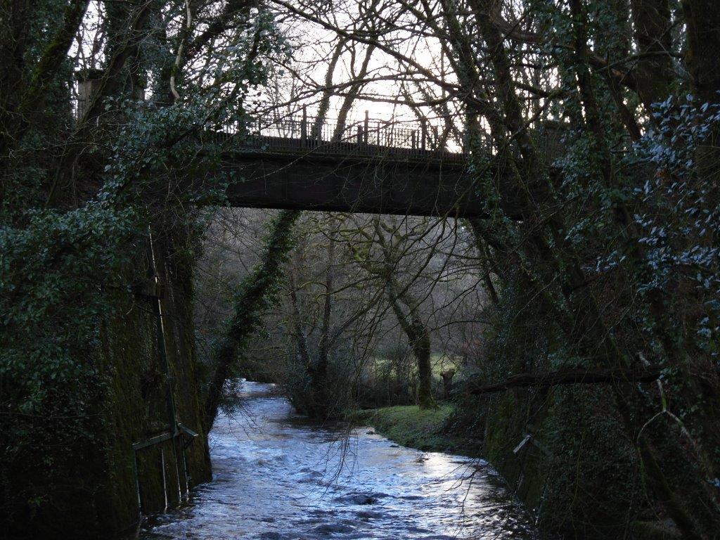
This footpath must have been quite important at one time, as it has it own very substantial bridge parallel to the railway bridge which both tower well above the river Camel and are extremely impressive from river level, although almost impossible to photograph without the use of a boat even in winter. I had a go and have included a recent photograph for reference, the bridge is well worth a look at and is one of two crossing the Camel within a short distance, the other being the bridge carrying the Bodmin to Wadebridge railway.
The December 2017 photograph shows the footbridge complete with modern railings and is still well used although no longer protected from the railway, the kissing gates were removed on conversion to the Camel Trail and all the original cast iron signs have disappeared. Many thanks Andrew
The 'Stop Lamp' post can be seen to the left of the photograph, although already souvenir hunters had removed the top.
One can see just how long the siding was on the right and it was always well used.
In the December 2017 photograph the only railway infrastructure left is the shunt limit post. This once busy junction now hosts the camel trail and the ‘new exchange’ platform on the left is for horse riders.
Moving on up the line we pass a foot crossing, which although not dedicated as a public footpath was popular with locals as a short cut from the nearby village of Nanstallon to the Borough Arms pub at Dunmere.
The path passed behind Boscarne Junction signal box and crossing keepers house, ran adjacent the sidings on a high embankment gradually returning to rail level at a point 20 yards north of this photograph as shown in the next 1978 photograph.
This footpath must have been quite important at one time, as it has it own very substantial bridge parallel to the railway bridge which both tower well above the river Camel and are extremely impressive from river level, although almost impossible to photograph without the use of a boat even in winter. I had a go and have included a recent photograph for reference, the bridge is well worth a look at and is one of two crossing the Camel within a short distance, the other being the bridge carrying the Bodmin to Wadebridge railway.
The December 2017 photograph shows the footbridge complete with modern railings and is still well used although no longer protected from the railway, the kissing gates were removed on conversion to the Camel Trail and all the original cast iron signs have disappeared. Many thanks Andrew
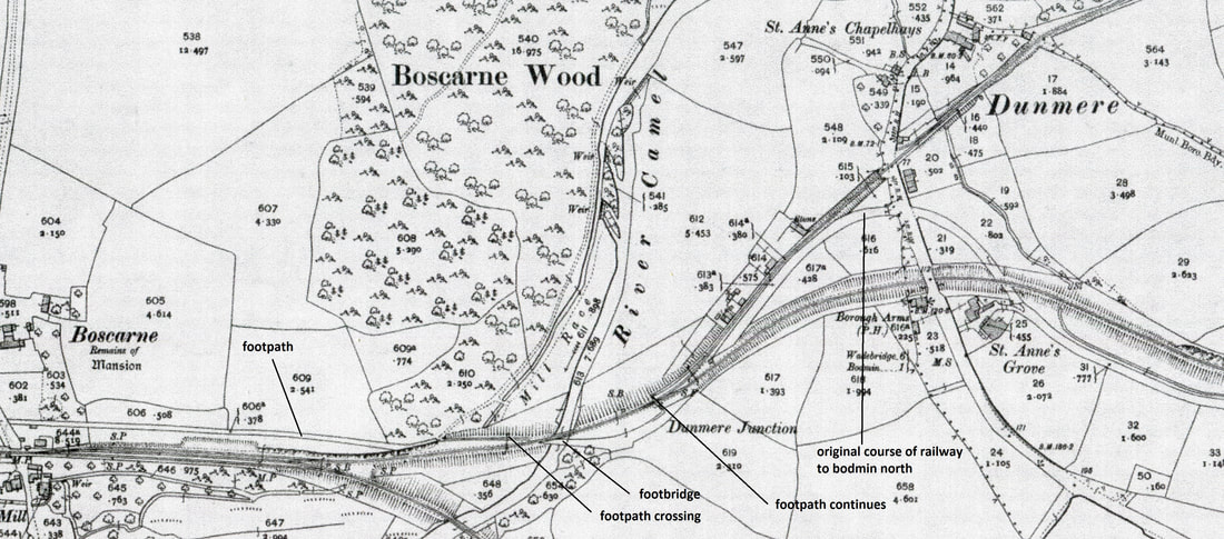
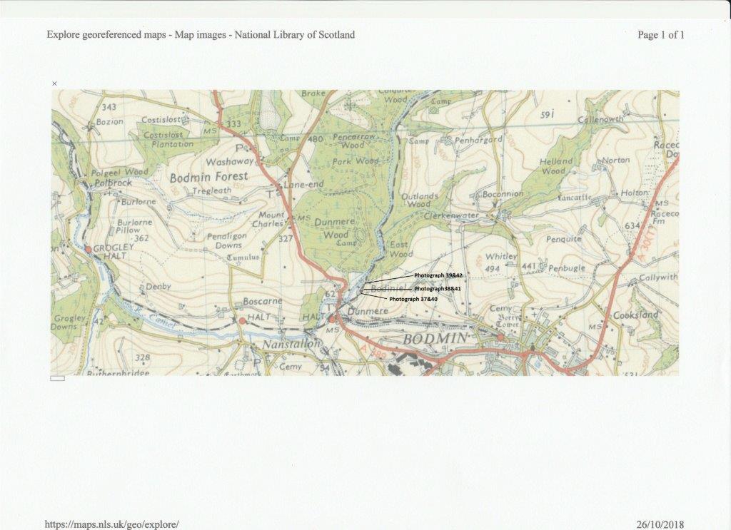
Map of Boscarne Junction to Dunmere Junction showing various points of interest. Reproduced from the 25" OS map C 1900 with permission of the National Library of Scotland.
WENFORD BRIDGE COMPARISONS 007 Boscarne Junction 1978 Note 'Stop Lamp' post.
Copyright Andrew Jones
WENFORD BRIDGE COMPARISONS 008 Boscarne Junction 27th December 2017 Copyright Andrew Jones. The 'Stop Lamp' post is still in position.
WENFORD BRIDGE COMPARISONS 009 Boscarne Junction, Boscarne Pedestrian bridge in 1978. Copyright Andrew Jones
WENFORD BRIDGE COMPARISONS 010 Boscarne Junction 27th December 2017 Copyright Andrew Jones Boscarne Pedestrian Bridge Dec 2017
WENFORD BRIDGE COMPARISONS 011 Boscarne Junction. Boscarne Pedestrian and Railway Bridge 27th December 2017. Copyright Andrew Jones
Dunmere Junction and Towards Dunmere Crossing Andrew Jones
We are now entering the Wenfordbridge Branch, in the 1978 photograph, the branch gate is closed, it still has its southern pattern cast iron ‘shut the gate ‘ sign and is in good condition. The footpath mentioned in an earlier posting is clearly there.
The building to the left is the permanent way trolley house and it is possible this once contained the ‘Camel Trolley’ which if I remember correctly was used to give rides at the April 1970 open day, at Bodmin General, hopefully Roger could verify. It did!
This building is situated at the start of what was the original trackbed to Bodmin, (later Bodmin North), sandwiched between the Wenfordbridge branch and the later deviation.
It is still possible to follow, adjacent and above the Wenfordbridge branch. Unfortunately in recent years the owner has allowed the track bed to return to nature, but it is still discernable.
In use from 30th September 1834 until the 1st November 1886, it crossed the main road on a level crossing approx 20 yards above and east of Wenfordbridge branch level crossing.
Major restructuring took place starting on the 1st November 1886, involving the closure of Bodmin station and the construction of a new alignment. This required a substantial cutting to the east and a road bridge, which can be seen on the map supplied by Keith.
The new alignment was opened after a lengthy closure, on the 1st November 1895.
It was not until the 2nd July 1906 that Dunmere Halt was commissioned.
The Jan 2018 photograph shows that the gate is still there, closer examination reveals that a faithful replica has been built, although not quite the same height, giving the gate a wider appearance.
The footpath is still usable to the right of the gate, but is restricted to pedestrian use, take a bicycle at your peril!
WENFORD BRIDGE COMPARISONS 012 Dunmere gate 1978 Copyright Andrew Jones
WENFORD BRIDGE COMPARISONS 013 Dunmere gate 2018 Copyright Andrew Jones
Moving on, the next 1978 photograph, time has stood still, its unlikely that this view has changed in over a 100 years, apart from the telegraph posts.
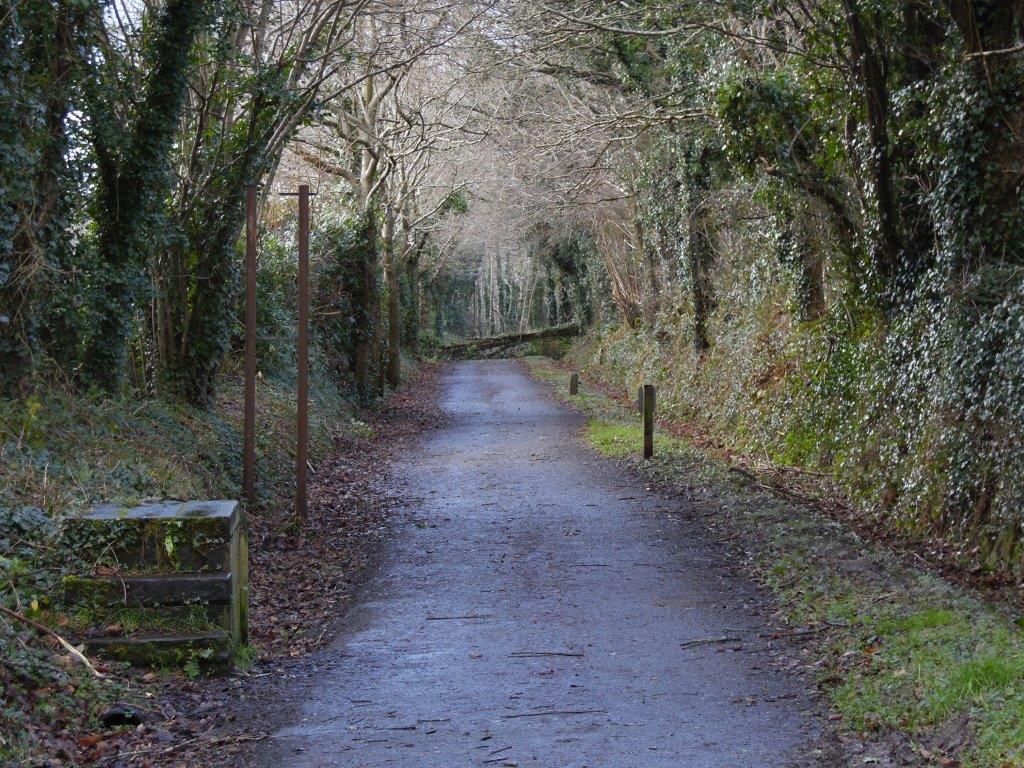
In the latest photograph taken in Jan 2018, the rails have been lifted and the track bed is now a private road. The original buildings have been extended and vegetation has started to encroach.
In the latest photograph taken in Jan 2018, the rails have been lifted and the track bed is now a private road. The original buildings have been extended and vegetation has started to encroach.
WENFORD BRIDGE COMPARISONS 014 East of Dunmere Junction. 1978 Copyright Andrew Jones
WENFORD BRIDGE COMPARISONS 015 East of Dunmere Junction. 2018 Copyright Andrew Jones
Dunmere Crossings Andrew Jones
Moving through the cutting between the branch gate and Dunmere road crossing, we are running parallel with the original Bodmin Branch formation. This has always been a dark and damp place.
Looking towards Boscarne, situated just to the left of the road crossing is a granite marker post, (please see photograph which I think is inscribed ½, I am not sure if this denotes a distance from Boscarne, or even if its a chain/furlong or mile marker 018. ( perhaps one of your members could enlighten.)
Having crossed the now busy road looking towards Wenfordbridge, adjacent the site of Dunmere Wharf, to the right, are the modern remains of a Crane warning sign, (please see photograph 019)
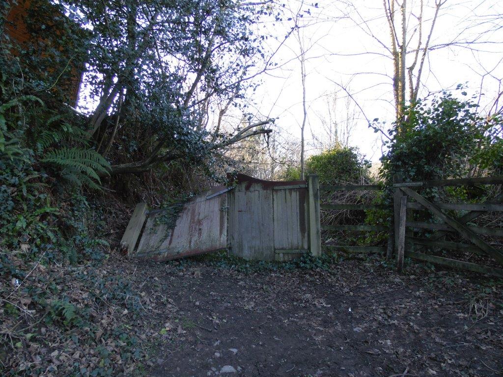
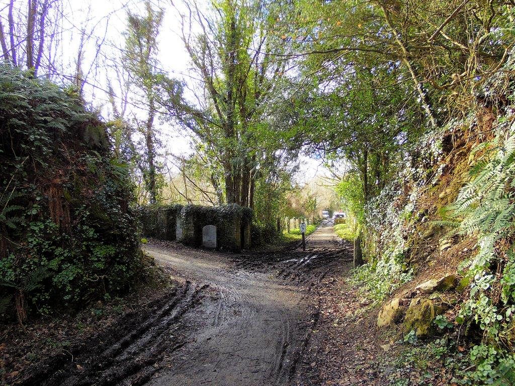
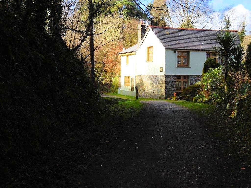
Before continuing, just a short walk up the hill towards the Borough Arms Public House, on the right, (please see Jan 2018 photograph) one can see some derelict gates. This is where the original alignment, crossed the road on its way to Bodmin. On the otherside of the road, a bungalow has been built on what was a righthand curve towards Bodmin.
Continuing past the site of Dunmere Wharf, 5 miles 44 chains from Wadebridge ( closed on the 14th May 1969, siding removed in November 1969) we pass on the left the remains of a concrete wall. This was one of the many products produced for the southern railway at Exmouth Junction concrete works and is one of the few ex railway items to be found along this route.
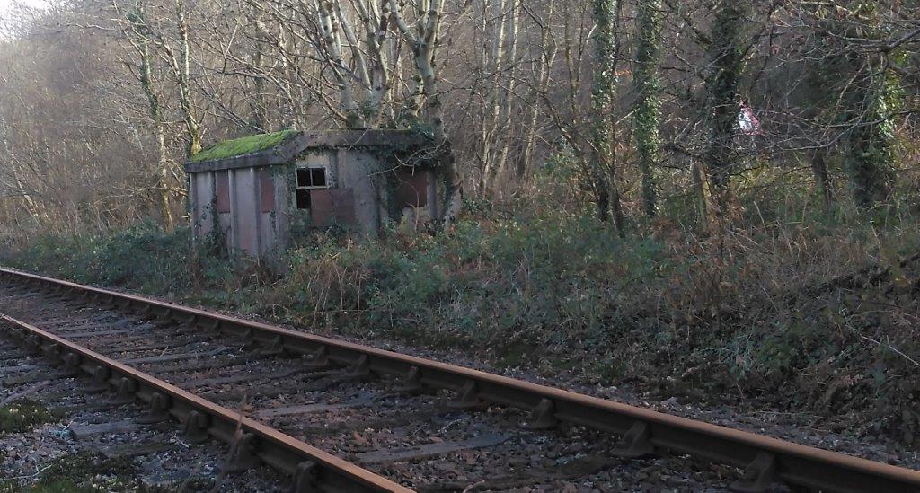
The products were produced from the early part of the 20th century by the LSWR and continued by the southern railway and eventually BR up until the 1960,s, anything from fence posts, platforms, footbridges and the many famous line side workmans huts once found all over the southern region, they were specially designed to fit under the ruling loading gauge when being delivered to various sites, on railway wagons. (please see Jan 2018 photograph of hut, which remains in situ just before Meldon Quarry 025)
There is a new publication called “Southern Nouveau” from Irwell Press, which is an update of an earlier version by Chris Hawkins and George Reeve, providing a comprehensive record of the Exmouth Junction concrete works.
Unfortunately my current photograph of Dunmere Wharf is marred by parked vehicles, try as I did every visit was the same!
Best wishes Andrew
Looking towards Boscarne, situated just to the left of the road crossing is a granite marker post, (please see photograph which I think is inscribed ½, I am not sure if this denotes a distance from Boscarne, or even if its a chain/furlong or mile marker 018. ( perhaps one of your members could enlighten.)
Having crossed the now busy road looking towards Wenfordbridge, adjacent the site of Dunmere Wharf, to the right, are the modern remains of a Crane warning sign, (please see photograph 019)
Before continuing, just a short walk up the hill towards the Borough Arms Public House, on the right, (please see Jan 2018 photograph) one can see some derelict gates. This is where the original alignment, crossed the road on its way to Bodmin. On the otherside of the road, a bungalow has been built on what was a righthand curve towards Bodmin.
Continuing past the site of Dunmere Wharf, 5 miles 44 chains from Wadebridge ( closed on the 14th May 1969, siding removed in November 1969) we pass on the left the remains of a concrete wall. This was one of the many products produced for the southern railway at Exmouth Junction concrete works and is one of the few ex railway items to be found along this route.
The products were produced from the early part of the 20th century by the LSWR and continued by the southern railway and eventually BR up until the 1960,s, anything from fence posts, platforms, footbridges and the many famous line side workmans huts once found all over the southern region, they were specially designed to fit under the ruling loading gauge when being delivered to various sites, on railway wagons. (please see Jan 2018 photograph of hut, which remains in situ just before Meldon Quarry 025)
There is a new publication called “Southern Nouveau” from Irwell Press, which is an update of an earlier version by Chris Hawkins and George Reeve, providing a comprehensive record of the Exmouth Junction concrete works.
Unfortunately my current photograph of Dunmere Wharf is marred by parked vehicles, try as I did every visit was the same!
Best wishes Andrew
WENFORD BRIDGE COMPARISONS 016 Cutting leading to Dunmere Crossing 1978 Copyright Andrew Jones
WENFORD BRIDGE COMPARISONS 017 2018 Copyright Andrew Jones
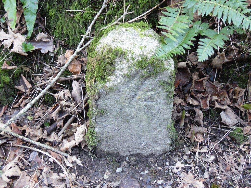
WENFORD BRIDGE COMPARISONS 018 Marker adjacent Dunmere Crossing 2018 Copyright Andrew Jones
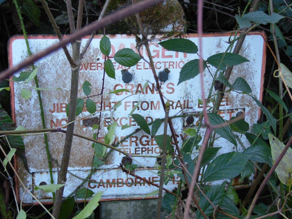
WENFORD BRIDGE COMPARISONS 019 Crane sign adjacent Dunmere Crossing Jan 2018 Copyright Andrew Jones
WENFORD BRIDGE COMPARISONS 020 Original Formation to Bodmin Jan 2018 Copyright Andrew Jones
WENFORD BRIDGE COMPARISONS 021 Dumere Level Crossing where the rails remain. (the rails look a little worn by road traffic) Jan 2018 Copyright Andrew Jones
WENFORD BRIDGE COMPARISONS 022 Dunmere Crossing and site of Dunmere Wharf 1978 Copyright Andrew Jones
WENFORD BRIDGE COMPARISONS 023 Site of Dumere Wharf Jan 2018 Copyright Andrew Jones
WENFORD BRIDGE COMPARISONS 024 Remains of Southern Railway Concrete Fence Jan 2018 Copyright Andrew Jones
WENFORD BRIDGE COMPARISONS 025 Concrete Workmans Hut situated just before Meldon Quarry Jan 2018 Copyright Andrew Jones
Before leaving the Dunmere area, I thought it would be helpful to show the remains of the original track formation after crossing the main road.
Photograph 27 shows the alignment behind the recent build bungalow, following the dotted red line. (please refer to location map)
Photograph 28 shows the old Bodmin and Wadebridge alignment crossing the new LSWR deviation, Dunmere road crossing bridge is in the background and on closer examination it appears that the bridge could accommodate a double track layout, although never carried out I wonder if this was the intention, perhaps someone in the society knows the answer?
Photograph 29 shows the Bodmin Town leat, a major engineering feat in its own right. The new alignment is on a substantial embankment at this point. The old Bodmin and Wadebridge formation is still evident and originally avoided the leat, following an easier route to the south.
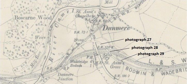
Map from the OS 25 inch map 1895 - 1902. Reproduced with permission of the National Library of Scotland.
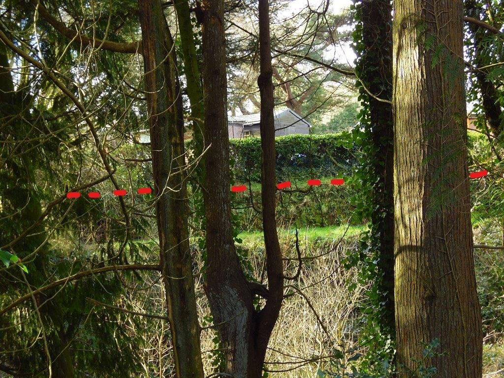
WENFORD BRIDGE COMPARISONS 027 photograph 27 13th February 2018 Copyright Andrew Jones
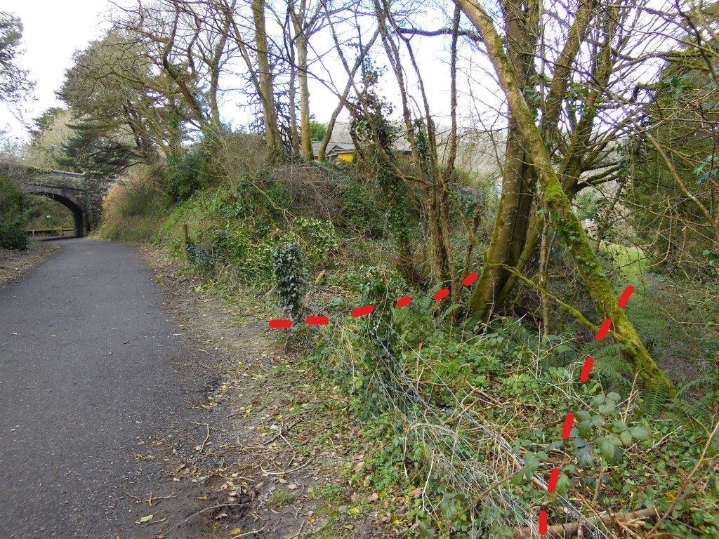
WENFORD BRIDGE COMPARISONS 028 photograph28 13th February 2018 Copyright Andrew Jones Dunmere Halt platform beyond.
WENFORD BRIDGE COMPARISONS 029 photograph 29 13th February 2018 Copyright Andrew Jones
When the Wenfordbridge Branch was converted in to the cycle trail, thought was given to a deviation for cyclists, avoiding the busy A389 crossing, which is situated on a dangerous bend.
Please see photograph 30, a lane always existed at this point and on conversion to the trail, a link was provided, which leads to the Bodmin North line just north of Dunmere Platform, rejoining the Camel Trail, without physically crossing the busy main road.
Photograph 31 depicts the line in 1983, the clearing at the mid-point of this photograph is where the new link joins. The property on the right had just been renovated
Photograph 32, 2018, The same, but extended property on the right is now St Annes Cottage B&B, it looks delightful, hard to believe that trains passed within touching distance, as the photograph, clearly illustrates.
We are now moving on, unusually even in 1978, the branch line shared a country lane, with the minimum of protection. (those were the days!)
Photograph 33 shows the first of many basic road crossings on this branch. Throughout this lower stretch, goods trains barely reached 5 mph, so any potential road users had plenty of warning.
Photograph 34, in 2018, gives a clearer view of the crossing.
Photograph 35 now incorporates the 1st and 2nd crossing, in 2018.
Photograph 36 looks back at the 2nd crossing in 1978.
WENFORD BRIDGE COMPARISONS 030 The new cycle link - a recent picture. A lane always existed at this point and on conversion to the trail, a link was provided, which leads to the Bodmin North line just north of Dunmere Platform, rejoining the Camel Trail, without physically crossing the busy main road. Copyright Andrew Jones
WENFORD BRIDGE COMPARISONS 031 Depicts the line in 1983, the clearing at the mid-point of this photograph is where the new link joins. The property on the right had just been renovated. Copyright Andrew Jones
WENFORD BRIDGE COMPARISONS 032 Taken in 2018, the same, but extended property on the right is now St Annes Cottage B&B, it looks delightful, hard to believe that trains passed within touching distance, as the photograph, clearly illustrates. Copyright Andrew Jones
WENFORD BRIDGE COMPARISONS 033 Outlands lane 1st crossing. Here the first of the many basic road crossings on this branch. Throughout this lower stretch, goods trains barely reached 5 mph, so any potential road users had plenty of warning. Copyright Andrew Jones
WENFORD BRIDGE COMPARISONS 034 Gives a clearer view of the crossing. Copyright Andrew Jones
WENFORD BRIDGE COMPARISONS 35 Outland lane 1st crossing 2018 This poicture incorporates the 1st and 2nd crossing, in 2018. Copyright Andrew Jones
WENFORD BRIDGE COMPARISONS 036 Outlands lane 2nd crossing Copyright Andrew Jones
Continuing up the branch towards Wenford
Dear Keith, Using map 36b, the next series of photographs start a few yards north of photograph 36. The Wenfordbridge branch was always ‘woody’, but even in 1978 the lower stretch was still quite open as can be seen in photographs 37, 38 and 39, compared with the 2018 photographs 40,41 and 42.
Photographs 39 and 42 show the third crossing just before entering East Wood.
The area to the west of the line is famous for the Bronze age fort, pre dating the railway by a few thousand years and interestingly ‘Dun’ means Fort, and ‘mere’ lake or marsh or pond. (sorry I am deviating a bit!)
Photography on the next stretch becomes more challenging as we enter forest conditions. Back in the 1978 pre the digital age, exposure times were slow in poor light and 200 asa film was good going! I had forgotten how expensive film and development costs were, but I seem to have been lucky most of the time, although one or two photographs are too underexposed for publication. (although I do have them for reference if anyone needs them.)
Map 42a I have revised the last contribution on the Wenfordbridge branch, under the last heading ‘continuing up the branch towards Wenford’
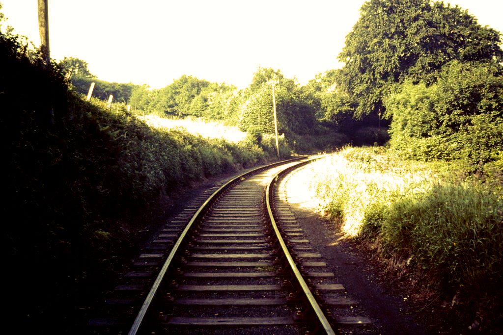
Wenford Bridge Comparisons A (Photo 37)
Copyright Andrew Jones
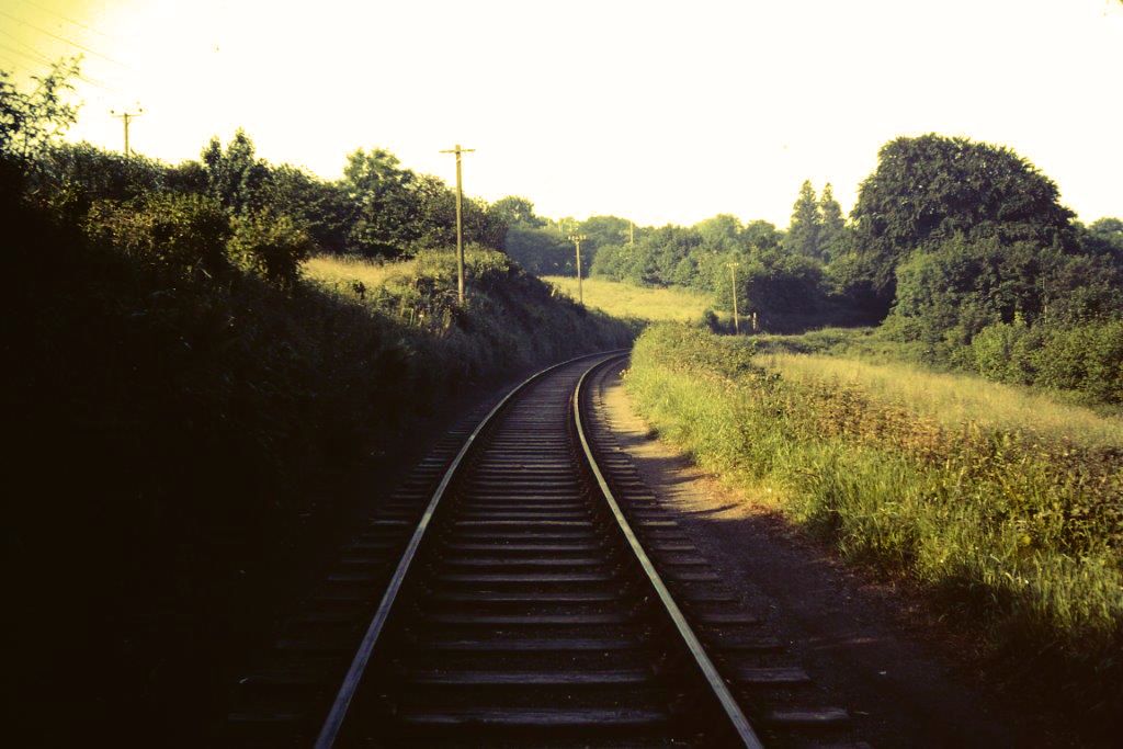
Wenford Bridge Comparisons B Photo 38
Copyright Andrew Jones
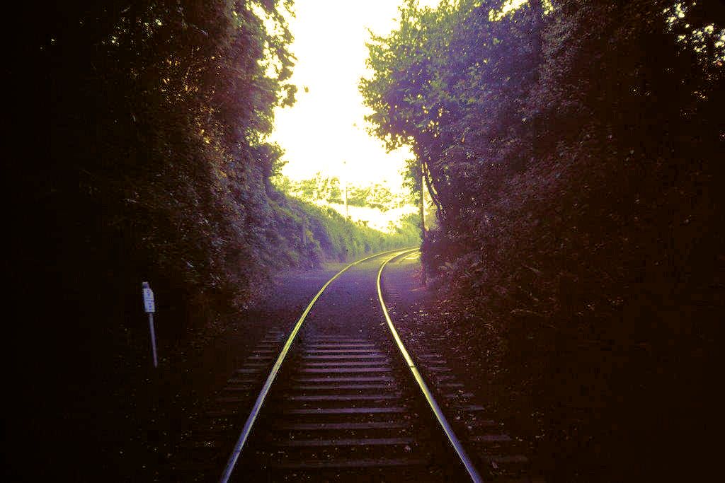
Wenford Bridge Comparisons C Photo 39
Copyright Andrew Jones
Wenford Bridge Comparisons D Photo 40
Copyright Andrew Jones
Wenford Bridge Comparisons E Photo 41
Copyright Andrew Jones
Wenford Bridge Comparisons G Photo 42
Copyright Andrew Jones
WENFORD BRIDGE COMPARISONS Photograph 043 Copyright Andrew Jones
WENFORD BRIDGE COMPARISONS Photograph 044 Copyright Andrew Jones
WENFORD BRIDGE COMPARISONS Photograph 045 Copyright Andrew Jones
WENFORD BRIDGE COMPARISONS Photograph 046 Copyright Andrew Jones
WENFORD BRIDGE COMPARISONS Photograph 047 Copyright Andrew Jones
WENFORD BRIDGE COMPARISONS Photograph 048 Copyright Andrew Jones
WENFORD BRIDGE COMPARISONS Photograph 049 Copyright Andrew Jones
WENFORD BRIDGE COMPARISONS Photograph 050 Copyright Andrew Jones
WENFORD BRIDGE COMPARISONS Photograph 051 Copyright Andrew Jones
WENFORD BRIDGE COMPARISONS Photograph 052 Copyright Andrew Jones
WENFORD BRIDGE COMPARISONS Photograph 053 Copyright Andrew Jones
And on to OUTLANDS
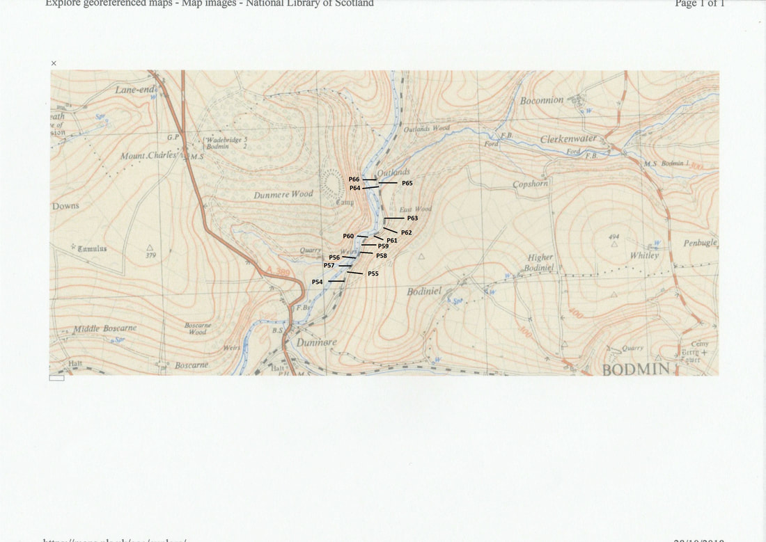
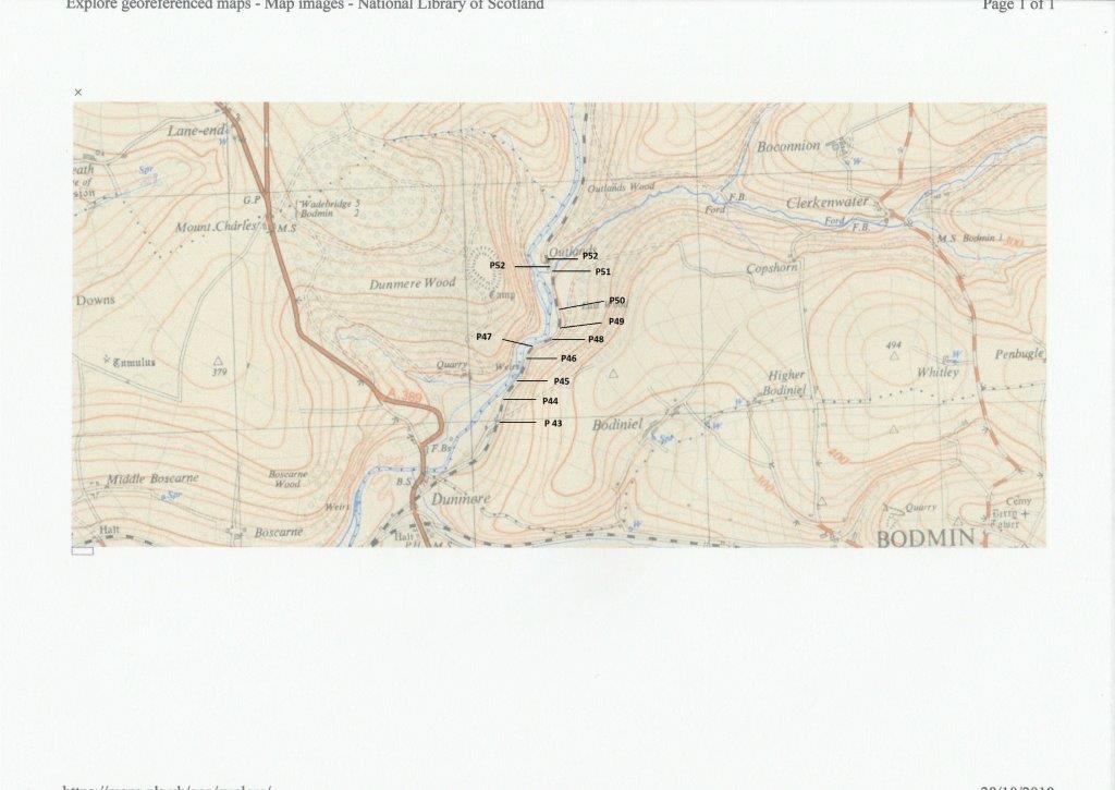
WENFORD BRIDGE COMPARISONS 053A Photograph location map present day
On to Outlands Present Day.
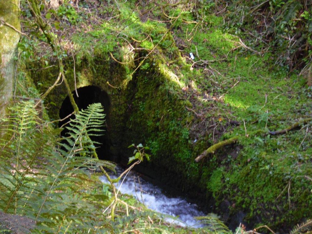
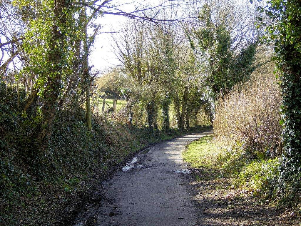
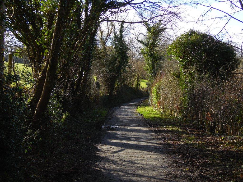
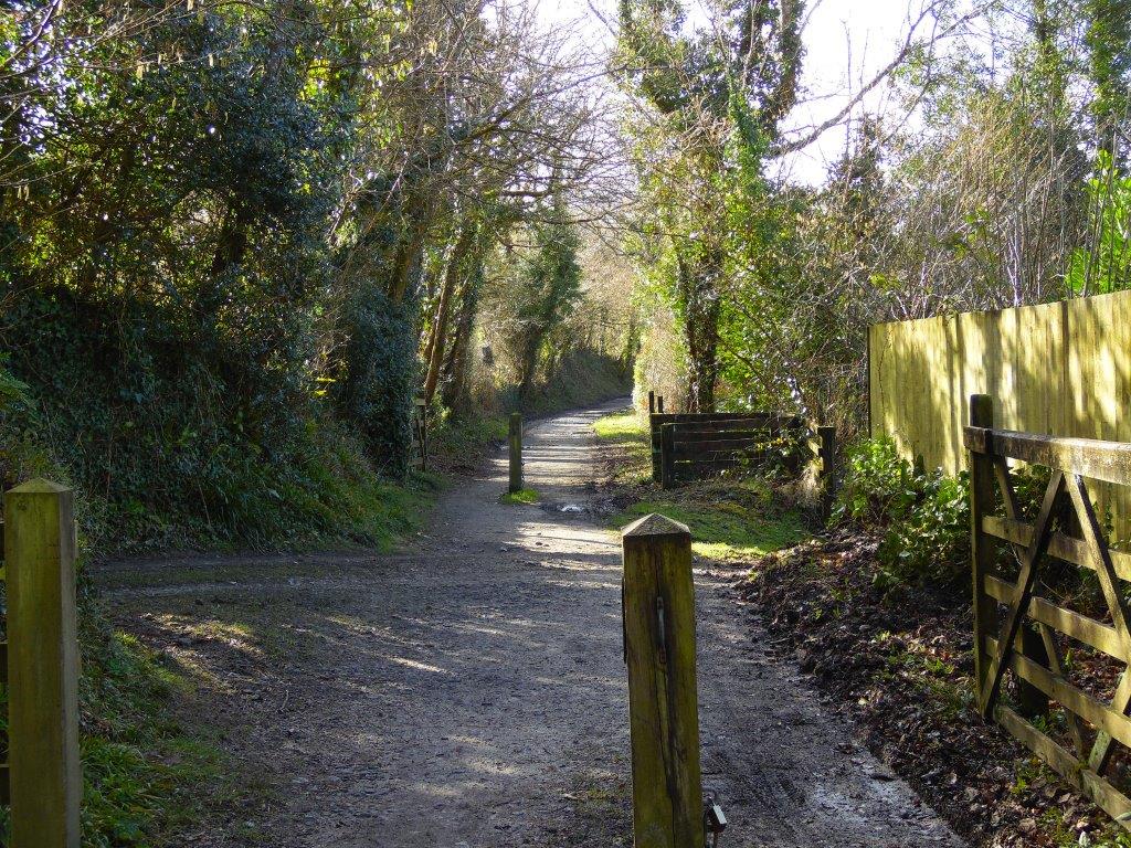
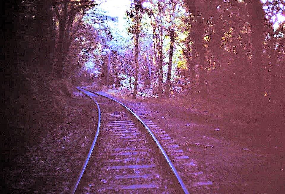
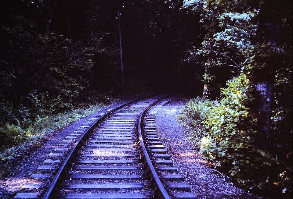
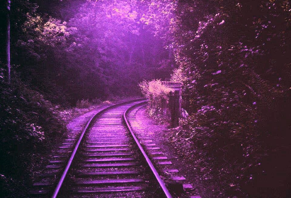
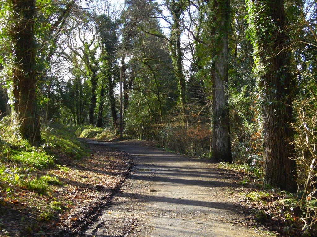
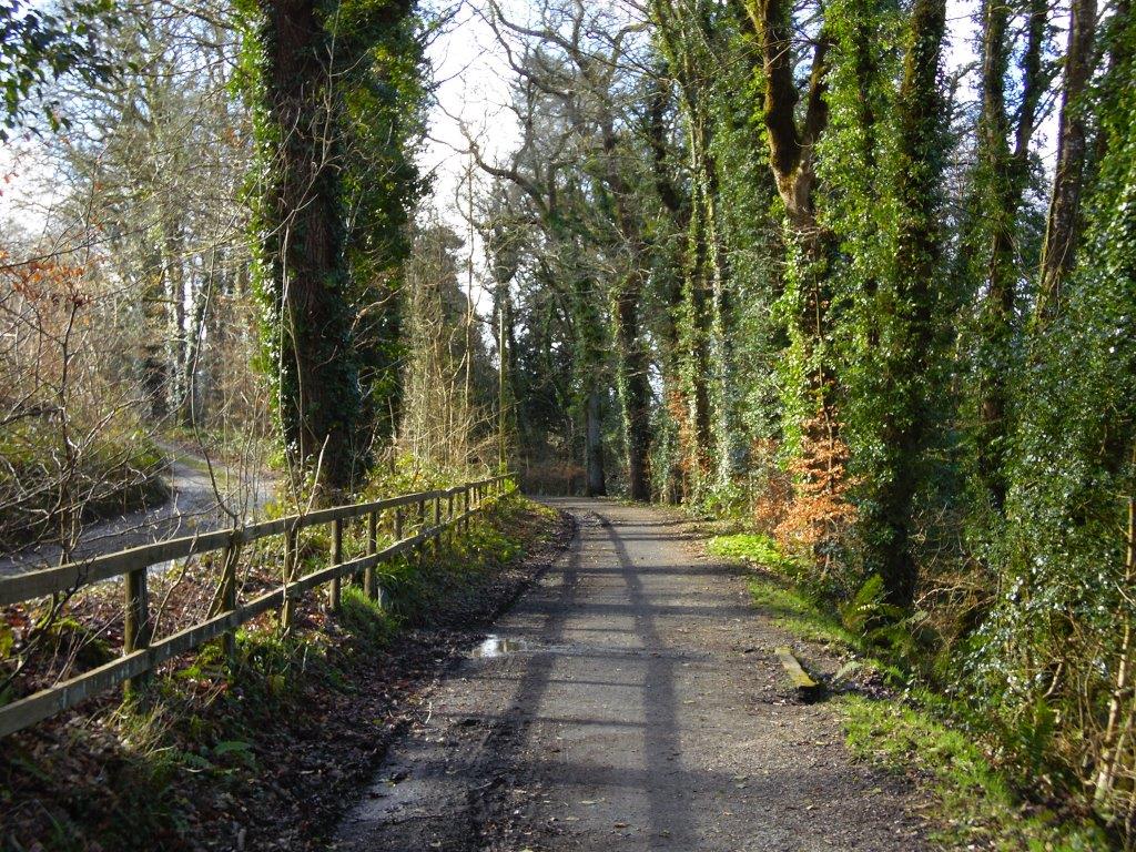
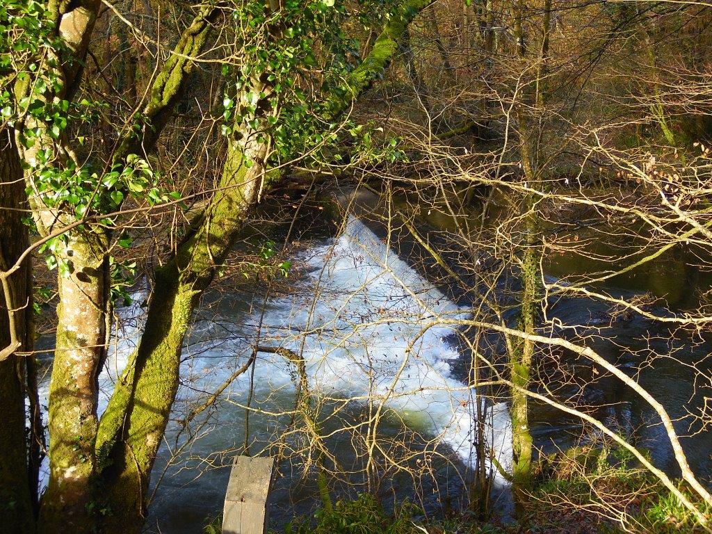
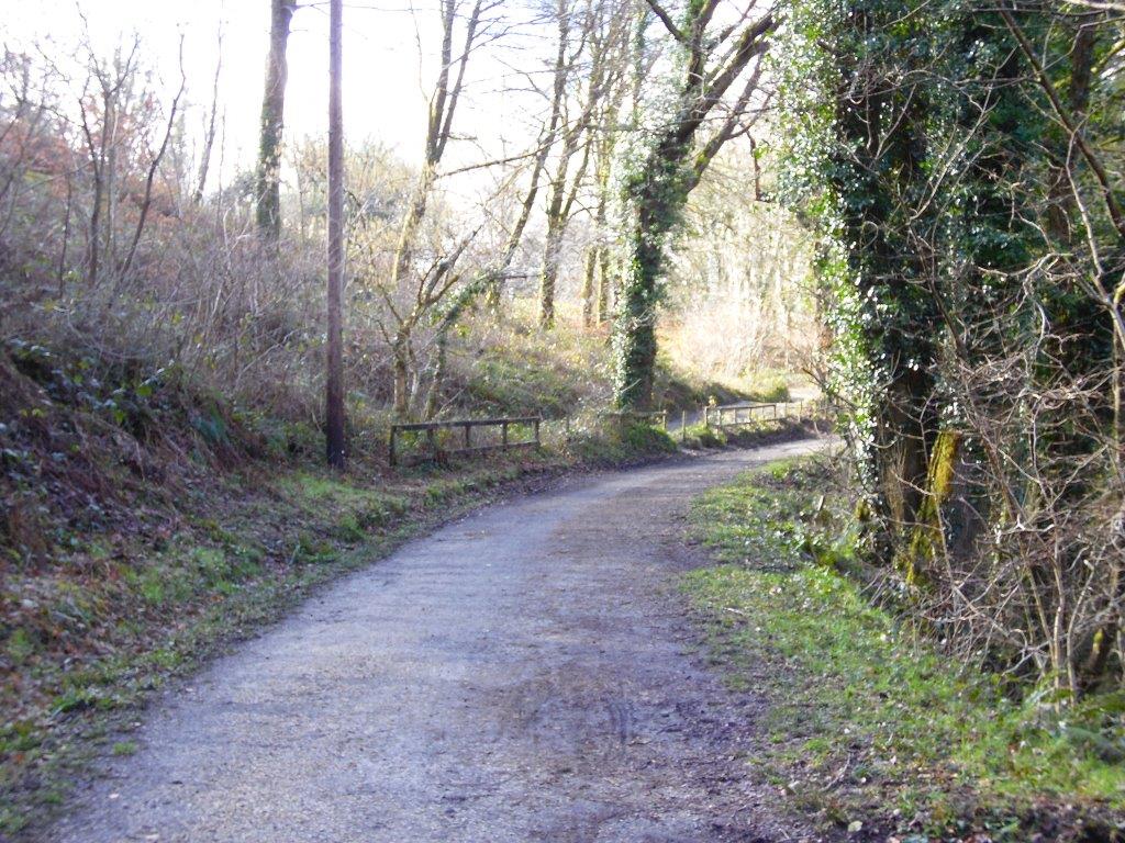
Photographs 54 to 66 show the amazing changes, some parts of the woodland have been opened up and you can see Dunmere Weir in photograph 56, which illustrates the height of the railway above the river Camel.
We can see the adjacent forestry track following the course of the railway quite clearly and apart from the railway removal the same fence is still visible at Outlands Cottage in photograph 66.
Wenford Bridge Comparisons Photograph 54 2018 Copyright Andrew Jones
WENFORD BRIDGE COMPARISONS photograph 55 Copyright Andrew Jones
WENFORD BRIDGE COMPARISONS photograph 56 Copyright Andrew Jones
WENFORD BRIDGE COMPARISONS photograph 57 Copyright Andrew Jones
WENFORD BRIDGE COMPARISONS photograph 58 Copyright Andrew Jones
WENFORD BRIDGE COMPARISONS photograph 59 Copyright Andrew Jones
WENFORD BRIDGE COMPARISONS photograph 60 Copyright Andrew Jones
WENFORD BRIDGE COMPARISONS photograph 61 Copyright Andrew Jones
WENFORD BRIDGE COMPARISONS photograph 62 Copyright Andrew Jones
WENFORD BRIDGE COMPARISONS photograph 63 Copyright Andrew Jones
WENFORD BRIDGE COMPARISONS photograph 64 Copyright Andrew Jones
WENFORD BRIDGE COMPARISONS photograph 65 Copyright Andrew Jones
WENFORD BRIDGE COMPARISONS photograph 66 Copyright Andrew Jones