Aerial views
- in most cases obtained from high vantage points rather than from aircraft.
- in most cases obtained from high vantage points rather than from aircraft.
Plymouth
Views from the Tower Block at Plymouth station.
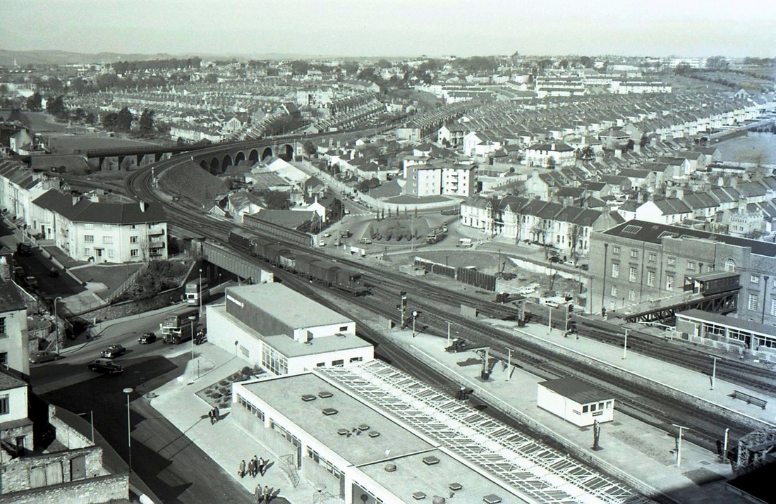
Plymouth aerial view Looking towards Cornwall Junction. There was a turntable within the triangle from 1913 to 66. A bridge connects the Post Office building with the station. Note the early warship setting out with a short freight. Mar62 Copyright Mike Roach
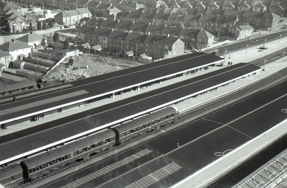
Plymouth aerial view looking north across the station. Note the contrast of a modern heritage unit in platform 5 and over on the far side in platform 8 a '55' ready to take out the service to Tavistock Mar62 Copyright Mike Roach
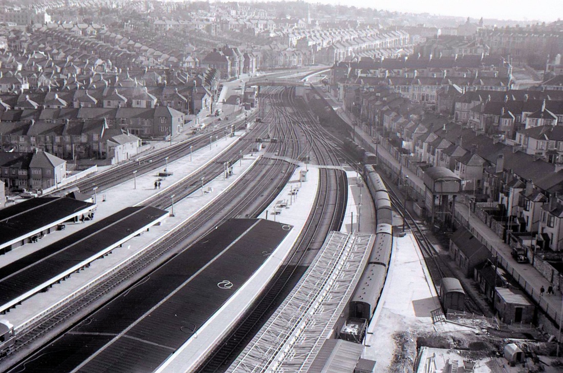
Plymouth looking east. Note the water tower on the RHS. Mar62 Copyright Mike Roach
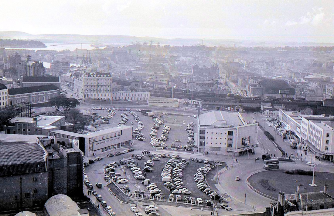
Views from the Civic Centre December 1961
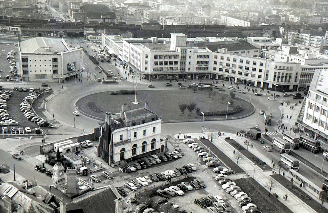
Plymouth. Looking at the bridge over Union Street which carried the approach tracks to Millbay station. Plenty of stock in evidence here, note the back of the large signalbox. The station closed to passengers 22nd April 1941 due to heavy bombing. Picture December 1961 Copyright Mike Roach. --------------- N.B. in the foreground lies Derry's Clock, looking to the right of this in front of the building in the roadway an be discerned the double track of the tramway. This monument to the past was sadly lifted when the Theatre Royal was built.
Looking out over the west end of the Hoe at Drake Island. Millbay station can be seen the large buildings. Note the tall dockyard cranes in Millbay Docks. Dec61 Copyright Mike Roach
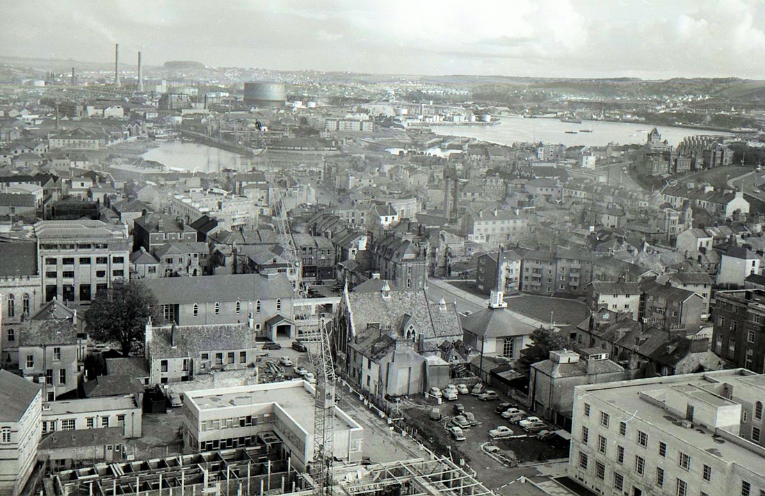
Looking east one obtains a fine view of Sutton Harbour - the coal trucks at the quayside were only used to take coal to a gas plant. in the distance stand the tall chimneys of Prince Rock Power Station. Dec61 Copyright Mike Roach
Redruth - Aerial Views.
From the Paddy Bradley Collection
From the Paddy Bradley Collection
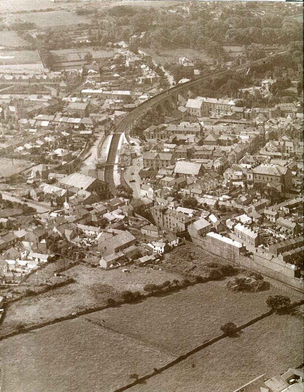
An aerial view of Redruth taken from the east on the18th August 1932. It is understood that this was taken at the behest of some students from Southampton. Redruth station and its signal box is clearly visible as is the main line coming in from the Drump Lane, Scorrier direction. This can be seen passing through the 22 yard tunnel just prior to the station. It would appear that much of the station platform has been resurfaced. Note the siding on the up side of the line contains one wagon. The sidings which served the downside have been removed. The large building to the centre right of the picture is Flower Pot Chapel and forms a key reference to the picture below, From the Paddy Bradley Collection.
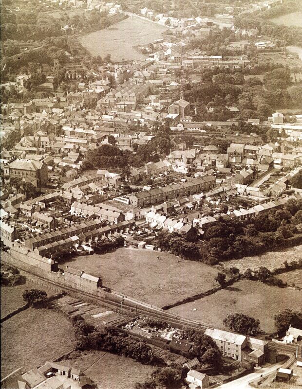
This is the second half of an Aerial view of Redruth taken from the east on the18th August 1932. This view is to the right of the above picture - again the large Flower Pot Chapel forms a reference point - this time to the left. In the Foreground can be seen the main line, recently doubled between Redruth and Scorrier - it is passing over Drump Road Bridge. At the top of the picture the grass area is where in later years the fun fair was staged. Note the bracket signal. Courtesy of the Paddy Bradley Collection
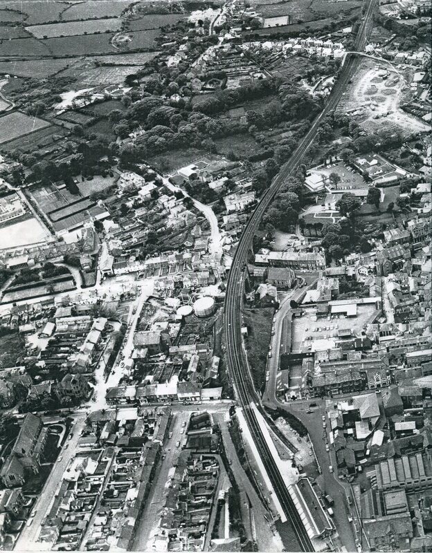
An aerial view taken in the late 1950's or early 60's. The loading bay at the station is still there but the tracks have either been removed or are extremely rusty. The site of the signalbox is seen but whether the box is there is questionable. The platforms show up well in this view as does the new station. Note the gas works to the left at the nearest end of the viaduct. On the right of this picture very close to the bottom can be seen the Post Office Building - this was built on the site of Jack's Platt . The main line curves away to pass on its right the fairground - the fairground looks to have had recent usage. Beyond this Coach Lane crosses the railway. The Tresavean branch Formation can be seen coming in from the top left to join the main line. On the right of this junction lay the coal yard originally terminus of the Hayle Railway. Photograph courtesy of the Paddy Bradley Collection'