Accounts of Three Visits to
Portreath and the branch
in 1965, 1968, and 1996
Michael Bussell
My first, if brief, visit to Portreath was on the same April 1965 family holiday in Cornwall that had given me the opportunity of visiting Pentewan, my photographs from which are now also on the Society’s website. I was attracted to Portreath being then a student civil engineer and also keenly interested in the nascent field of industrial archaeology, both of which drew me to see the Portreath incline, which from descriptions sounded as impressive as the Brendon Hills incline on the erstwhile West Somerset Mineral Railway that I had explored on an earlier summer holiday. The Portreath incline is the most prominent and substantial survivor of the four built by the Hayle Railway in the late 1830s, being located on its branch line built to carry copper ore from mines in the Redruth-Camborne area to Portreath Harbour. From here it could be transported to ‘Copperopolis’, i.e. Swansea in South Wales, in ships that returned with coal to power the steam engines that served the mines from which the ore had been extracted. The branch line in due course passed into the hands of the GWR; it survived the late 19th century virtual collapse of copper mining in Cornwall, continuing to carry coal shipped into Portreath and general freight, until it finally closed in 1936.
Although I took only four black-and-white photos on that first visit, they are of interest in showing the quays around the docks in the last days of what was now minimal industrial use, before the character of the harbour was transformed by the construction of a substantial low-rise terraced housing development, which I was to see on my second visit in June 1968. For this I had with me my first camera using 35 mm film, on which I took six half-frame colour slides.
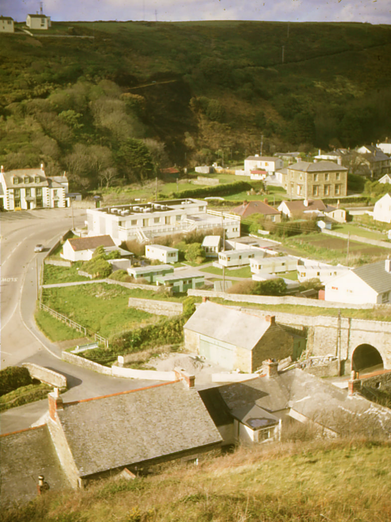
It was another 28 years before I returned to Portreath, this time as an excursion on foot following a Newcomen Society short tour of Cornish industrial sites in August 1996, for which we were accommodated at The Camborne School of Mines. On a sunny Sunday morning I headed towards Illogan, where I enjoyed a hearty and cheap roast lunch before continuing towards the head of the incline. The luxuriant summer vegetation and the appearance of new dwellings made it difficult to decipher the layout here (a drone would have been handy!), so I headed down into Portreath taking a few 35 mm colour slide photos. I then photographed the incline and the village, seen from the north, on both the remaining frames of slide film and the first frames of a black-and-white negative film, and rambled along the north side of the docks to look back towards the harbour mouth, before inspecting the excellent stone masonry of the lower part of the incline, in particular the archway that carries it across what I believe is Glenfeadon Terrace.
A slow climb took me back to the level of the incline head, and eventually back to Camborne after an enjoyable trek, if a rather lengthy one – I reckoned 12 miles…
I should say that, while I was and am aware of the earlier Poldice Tramroad that also served Portreath and the mines inland, I have not attempted to explore that. I applaud the Mineral Tramways Project that has done much to increase public awareness of this and other early industrial activity in Cornwall.
It was not until after my 1996 visit that I learned of, and subsequently obtained a copy of, an informative and well-illustrated article, ‘The Portreath Branch’ by Roger Carpenter in British Railway Journal, No. 33, Autumn 1990. He acknowledges, and I have read, the useful earlier study ‘Portreath – Some Chapters in Its History’ by Michael Tangye, published in 1968 by John Olson of Redruth and priced in that distant pre-decimal coinage time at just 3s 6d (17½p )
Portreath and the branch
in 1965, 1968, and 1996
Michael Bussell
My first, if brief, visit to Portreath was on the same April 1965 family holiday in Cornwall that had given me the opportunity of visiting Pentewan, my photographs from which are now also on the Society’s website. I was attracted to Portreath being then a student civil engineer and also keenly interested in the nascent field of industrial archaeology, both of which drew me to see the Portreath incline, which from descriptions sounded as impressive as the Brendon Hills incline on the erstwhile West Somerset Mineral Railway that I had explored on an earlier summer holiday. The Portreath incline is the most prominent and substantial survivor of the four built by the Hayle Railway in the late 1830s, being located on its branch line built to carry copper ore from mines in the Redruth-Camborne area to Portreath Harbour. From here it could be transported to ‘Copperopolis’, i.e. Swansea in South Wales, in ships that returned with coal to power the steam engines that served the mines from which the ore had been extracted. The branch line in due course passed into the hands of the GWR; it survived the late 19th century virtual collapse of copper mining in Cornwall, continuing to carry coal shipped into Portreath and general freight, until it finally closed in 1936.
Although I took only four black-and-white photos on that first visit, they are of interest in showing the quays around the docks in the last days of what was now minimal industrial use, before the character of the harbour was transformed by the construction of a substantial low-rise terraced housing development, which I was to see on my second visit in June 1968. For this I had with me my first camera using 35 mm film, on which I took six half-frame colour slides.
It was another 28 years before I returned to Portreath, this time as an excursion on foot following a Newcomen Society short tour of Cornish industrial sites in August 1996, for which we were accommodated at The Camborne School of Mines. On a sunny Sunday morning I headed towards Illogan, where I enjoyed a hearty and cheap roast lunch before continuing towards the head of the incline. The luxuriant summer vegetation and the appearance of new dwellings made it difficult to decipher the layout here (a drone would have been handy!), so I headed down into Portreath taking a few 35 mm colour slide photos. I then photographed the incline and the village, seen from the north, on both the remaining frames of slide film and the first frames of a black-and-white negative film, and rambled along the north side of the docks to look back towards the harbour mouth, before inspecting the excellent stone masonry of the lower part of the incline, in particular the archway that carries it across what I believe is Glenfeadon Terrace.
A slow climb took me back to the level of the incline head, and eventually back to Camborne after an enjoyable trek, if a rather lengthy one – I reckoned 12 miles…
I should say that, while I was and am aware of the earlier Poldice Tramroad that also served Portreath and the mines inland, I have not attempted to explore that. I applaud the Mineral Tramways Project that has done much to increase public awareness of this and other early industrial activity in Cornwall.
It was not until after my 1996 visit that I learned of, and subsequently obtained a copy of, an informative and well-illustrated article, ‘The Portreath Branch’ by Roger Carpenter in British Railway Journal, No. 33, Autumn 1990. He acknowledges, and I have read, the useful earlier study ‘Portreath – Some Chapters in Its History’ by Michael Tangye, published in 1968 by John Olson of Redruth and priced in that distant pre-decimal coinage time at just 3s 6d (17½p )
April 1965 photos
1.
Looking north-west to the seaward area of Portreath Harbour, viewed from the B3301 road just south of the village and with the incline out of view a little to the east. Just to the left of centre, behind a shed, is the bulk of a disused limekiln shown on the 1906 25 inch Ordnance Survey. Tangye (1968) gives its size at some 54 feet long by 24 feet wide by 18 feet high, and states that it was demolished in 1967 when the harbour area was redeveloped for housing. Copyright Michael Bussell.
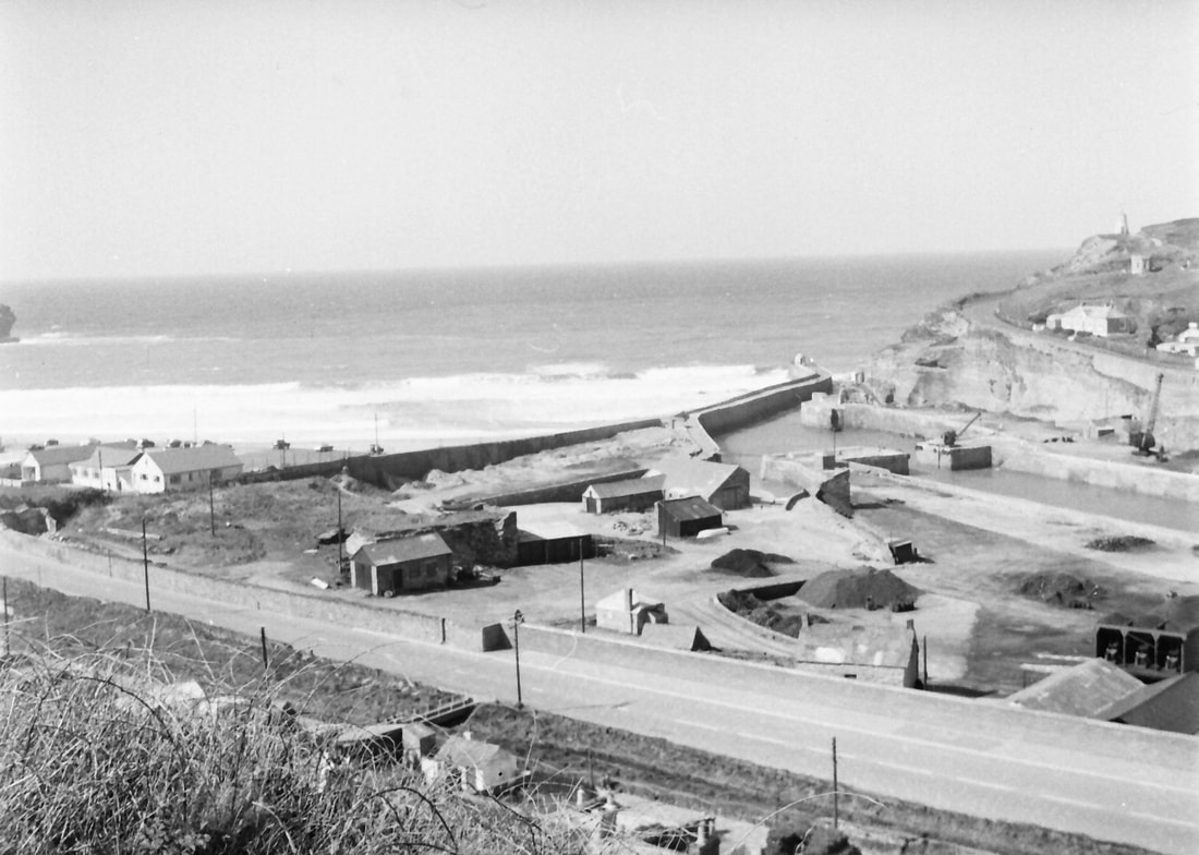
2. Looking due north to the landward area of the harbour, from the same viewpoint as 1. I did not explore the harbour on this brief visit, so I am unsure whether the neat pyramidal piles of material in both photos were coal held by a local merchant for domestic sale (but by now brought here by lorry rather than by ship!), building aggregate, and/or rubble.
Copyright Michael Bussell.
3.
Turning 90⁰ east from 2 is a side view of the incline about a quarter of the way up it, here as a stone-built embankment. Copyright Michael Bussell.
4.
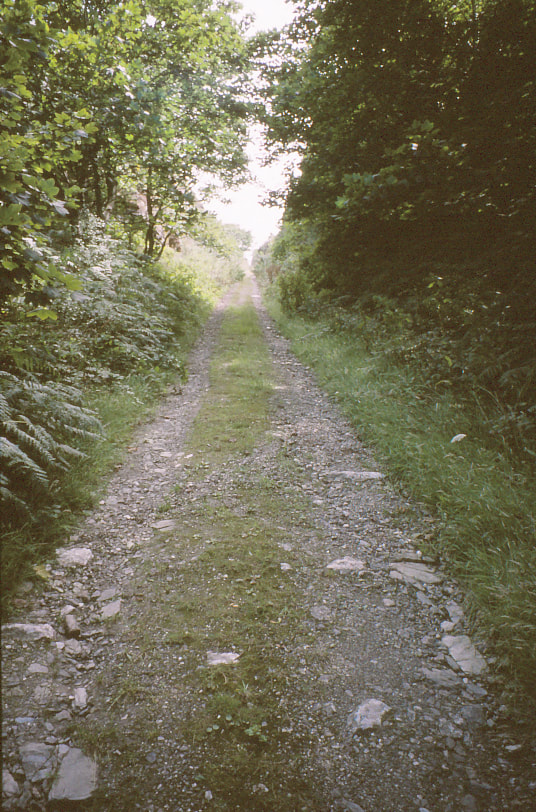
A view down from near the top of the incline, here in a deep cutting through the rocky hillside. Copyright Michael Bussell.
June 1968 Slides
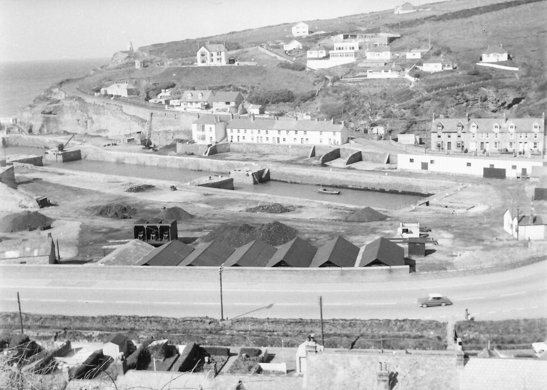
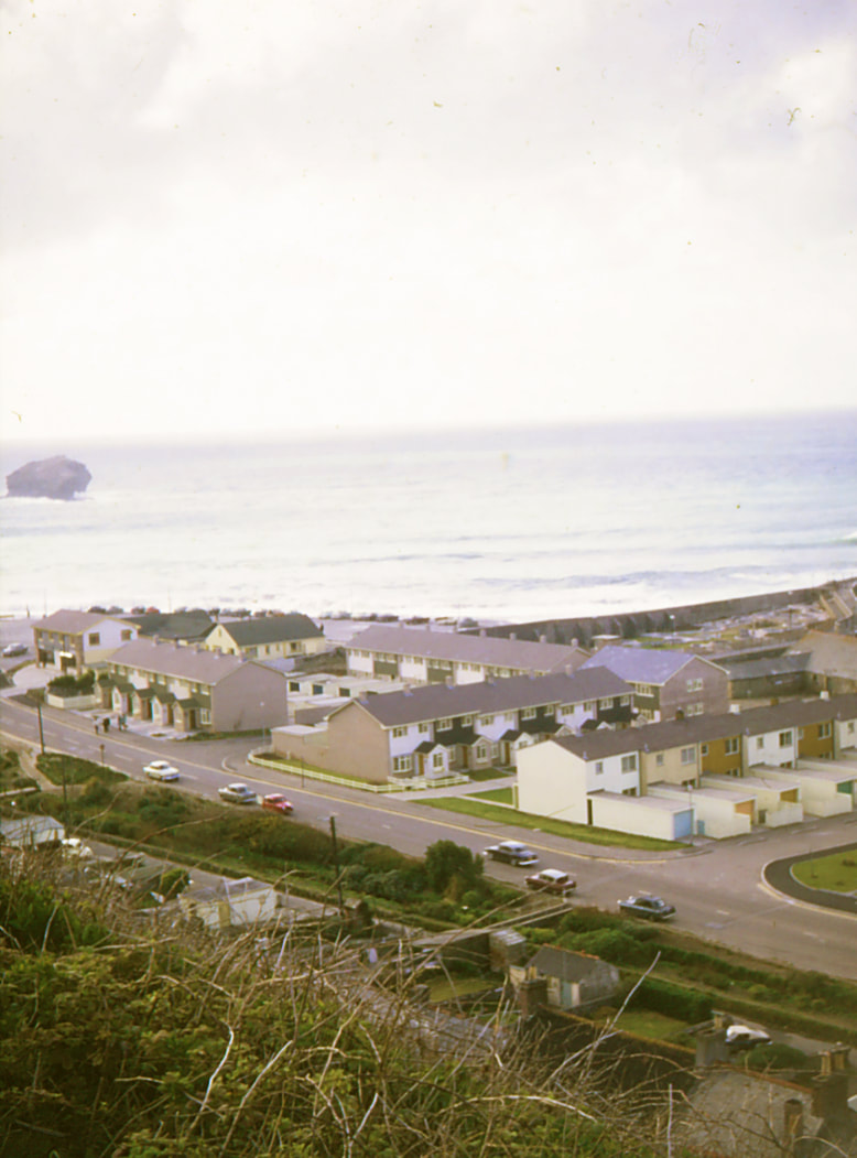
Five overlapping photographs taken from a viewpoint near that of photos 1 and 2 in April 1965, panning from north west to north east and showing the large new housing development on the harbour quays, built since my 1965 visit. The transformation of the appearance of the harbour area is evident. In number 9 can be seen the foot of the incline.
5. Copyright Michael Bussell.
6. Copyright Michael Bussell.
7. Copyright Michael Bussell.

8. Copyright Michael Bussell.
9. Copyright Michael Bussell.
10.
Looking up the incline from the main road through the village. Copyright Michael Bussell.
'August 1996 slides'
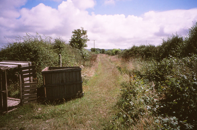
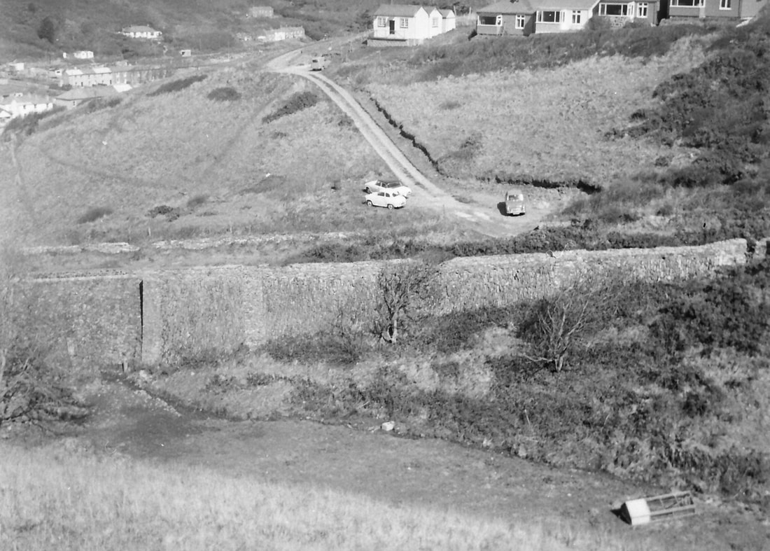
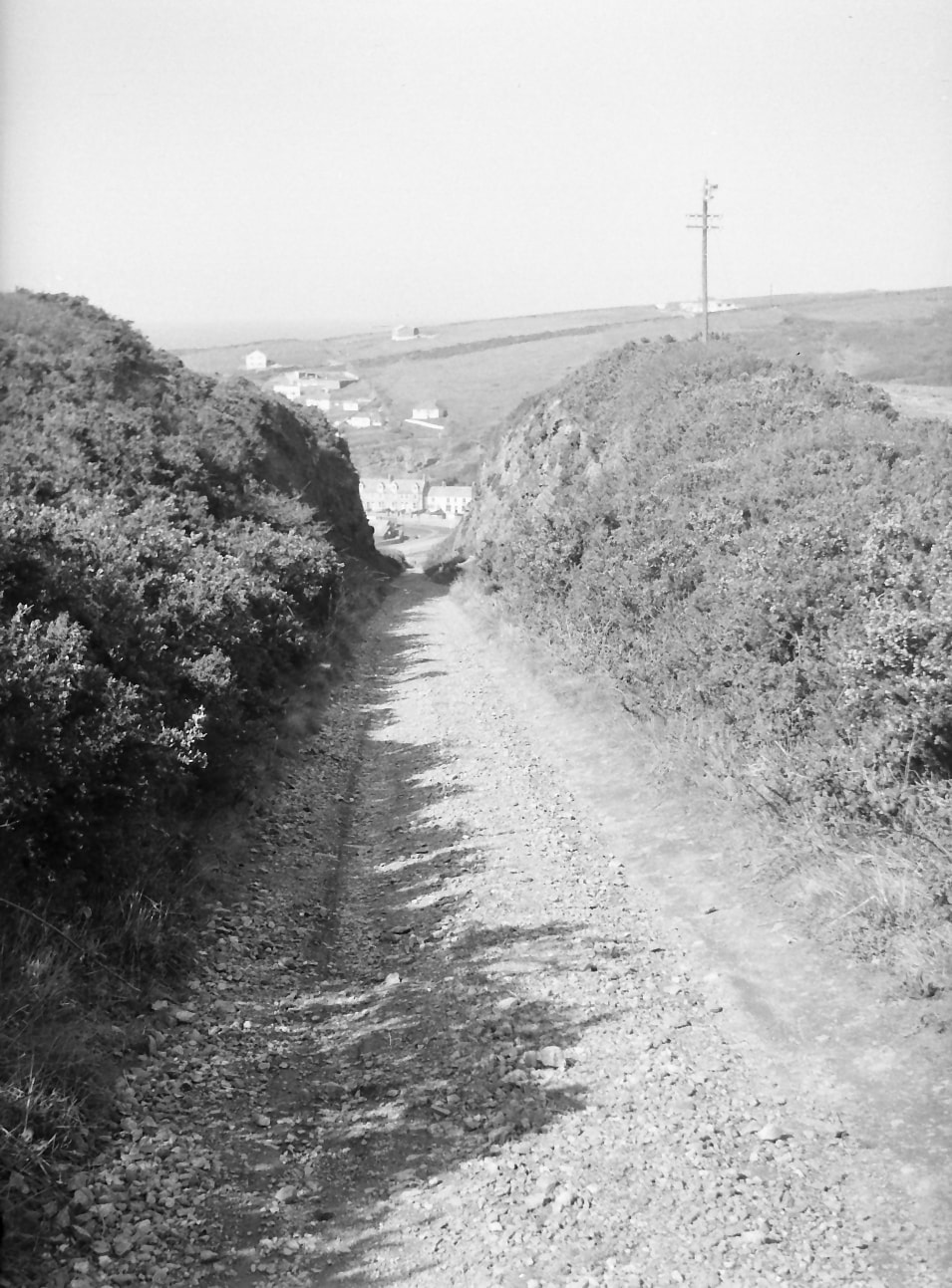
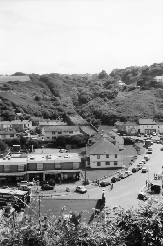
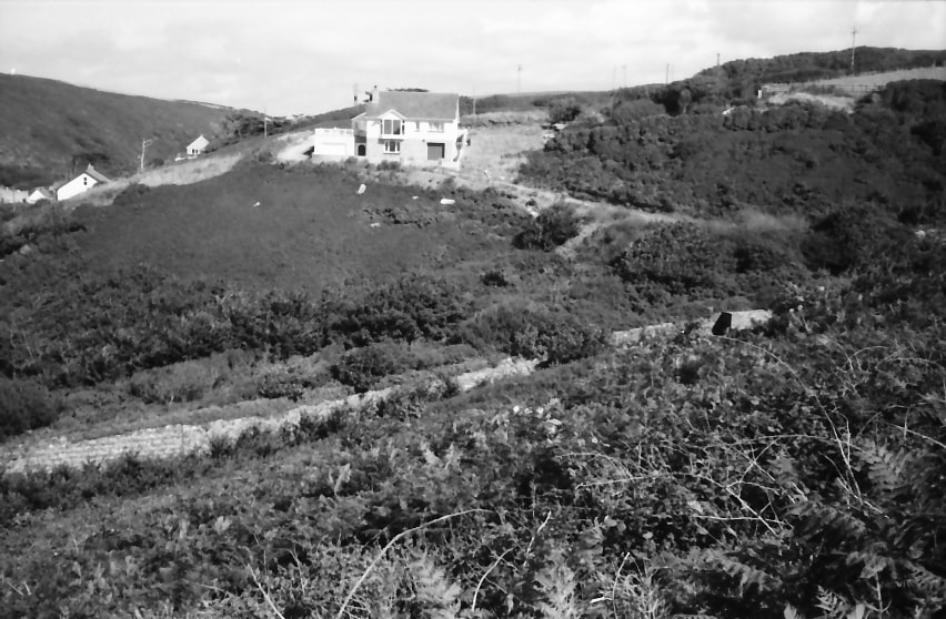
11. Route of the branch line, now rough trackway, approaching incline head. Copyright Michael Bussell.
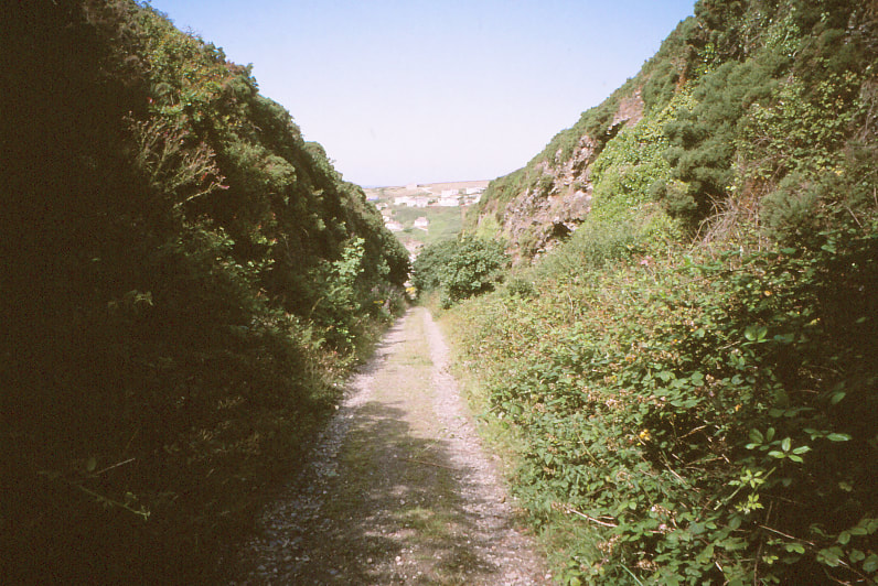
12. Looking down the incline, here in cutting. Copyright Michael Bussell.
13. Further down the incline. Copyright Michael Bussell.
14.
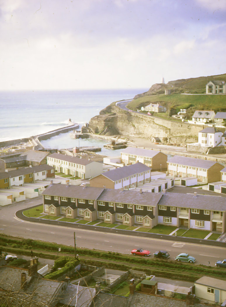
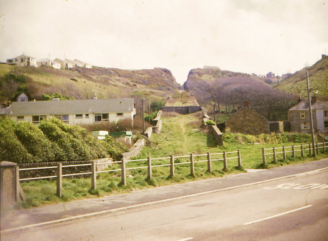
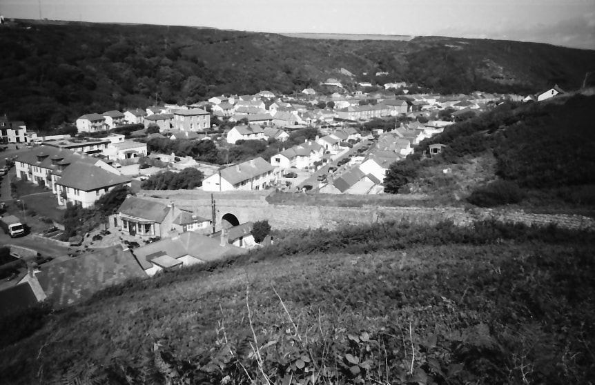
Looking north-west across the harbour area; incline in cutting in the foreground. Copyright Michael Bussell.
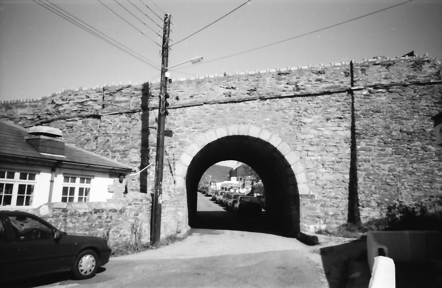
15.
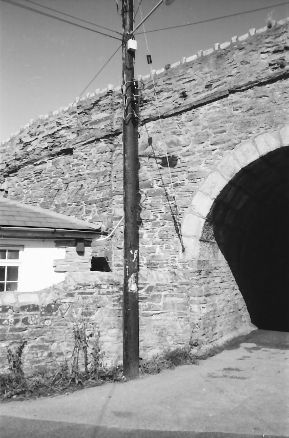
Archway carrying the incline over the road to Glenfeadon Terrace. Copyright Michael Bussell.
16.
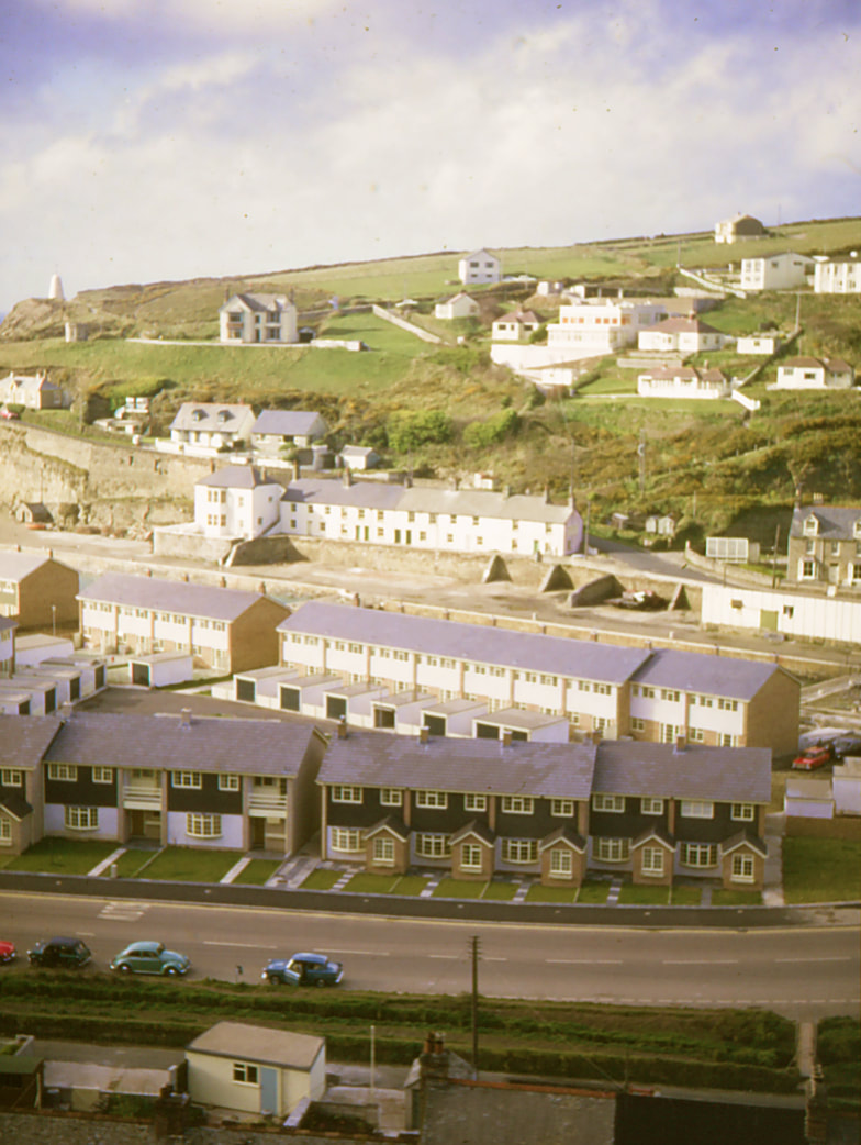
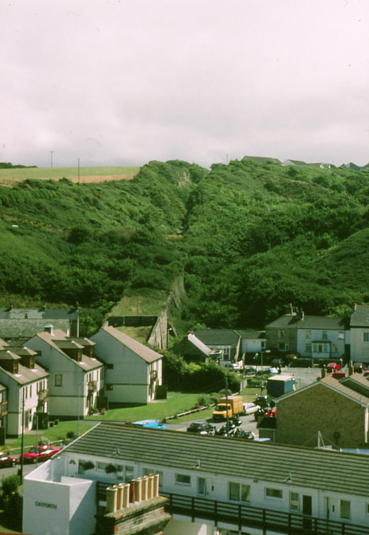
Looking south towards the incline from the hillside to the north of the village. Copyright Michael Bussell.
17.
A closer view of the incline from the north, with new buildings on the site of the foot of the incline embankment, which has been cut back to accommodate them. Copyright Michael Bussell.
18.
Another view of the incline from the hillside to the north of the village. Copyright Michael Bussell.
Photos August 1996
19.
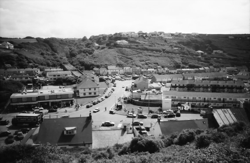
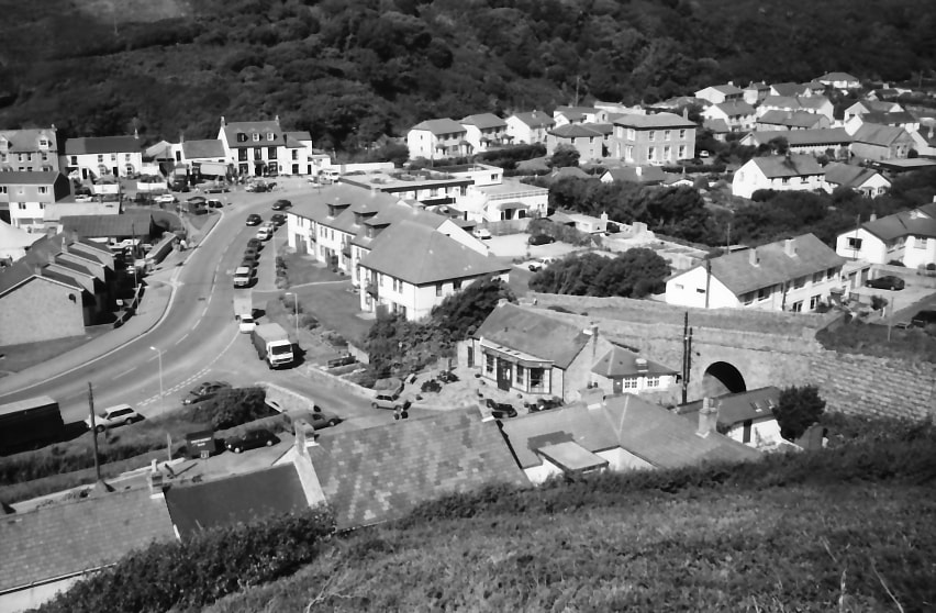
The first of a series of black-and-white images taken the same day; a wider view south towards the incline from the hillside to the north of the village. Copyright Michael Bussell.
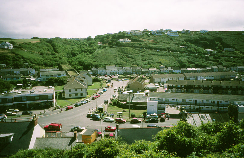
20.
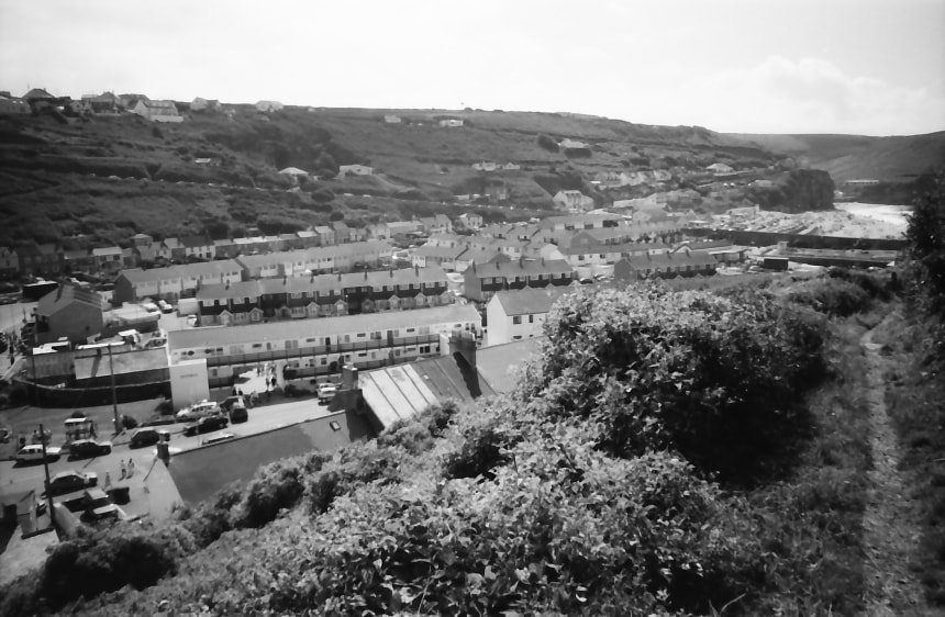
A second wider view, this one looking south-west across the village. Copyright Michael Bussell.
21.
A closer view of the incline, with the new buildings on the site of the foot of the incline embankment, which has been cut back to accommodate them. Copyright Michael Bussell.
Four further views of the incline from the hillside to the north of the village, from locations each successively a little further west.
22. Copyright Michael Bussell.
23. Copyright Michael Bussell.
24. Copyright Michael Bussell.
25. Copyright Michael Bussell.
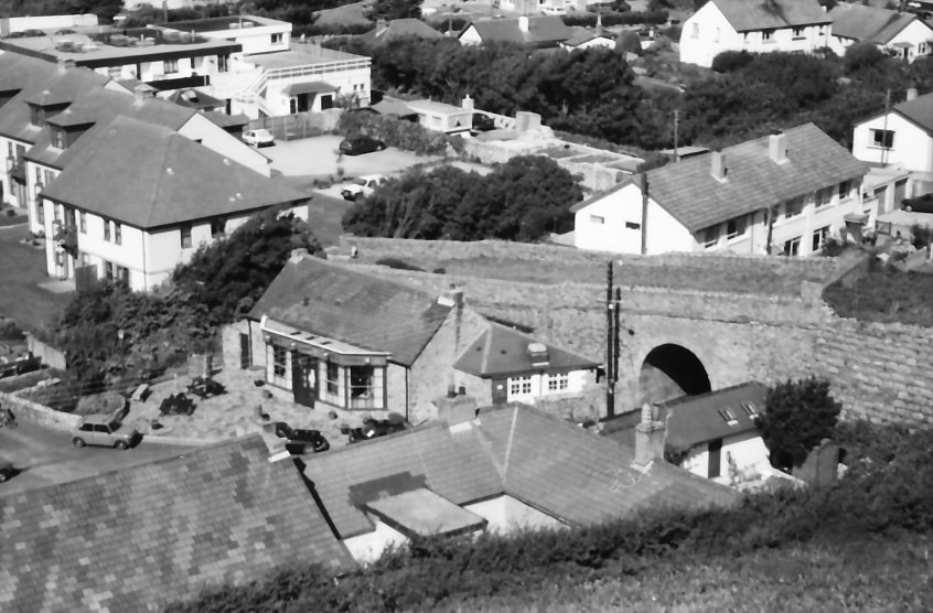
Three interpretation boards on the area which cover the harbour, the incline, and the Portreath (Poldice) Tramroad.
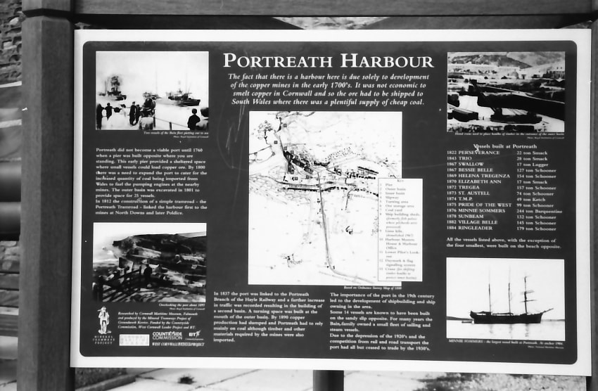
26. Interpretation board on the harbour .Copyright Michael Bussell.
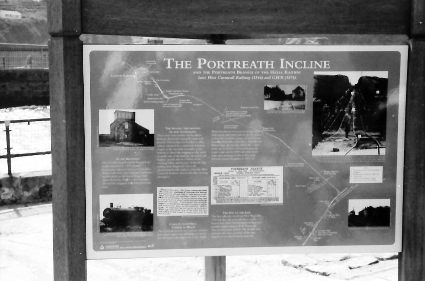
27. Interpretation board for the incline.
Copyright Michael Bussell.
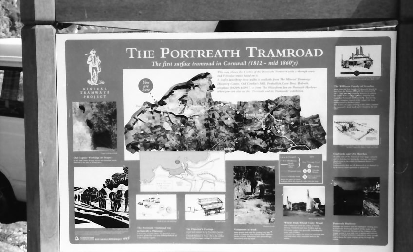
28. Copyright Michael Bussell.
29.
Looking out to sea from the north side of the harbour entrance channel, with the breakwater on its west side. Copyright Michael Bussell.
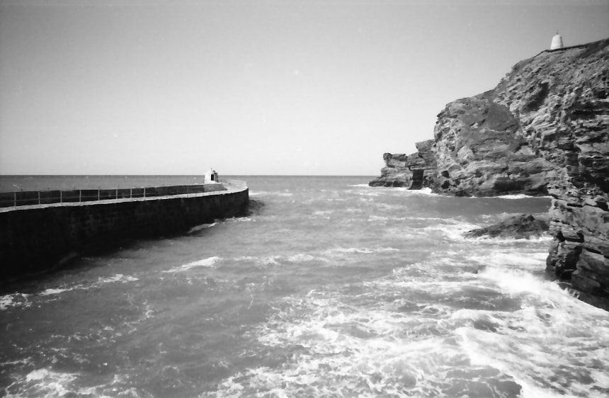
30.
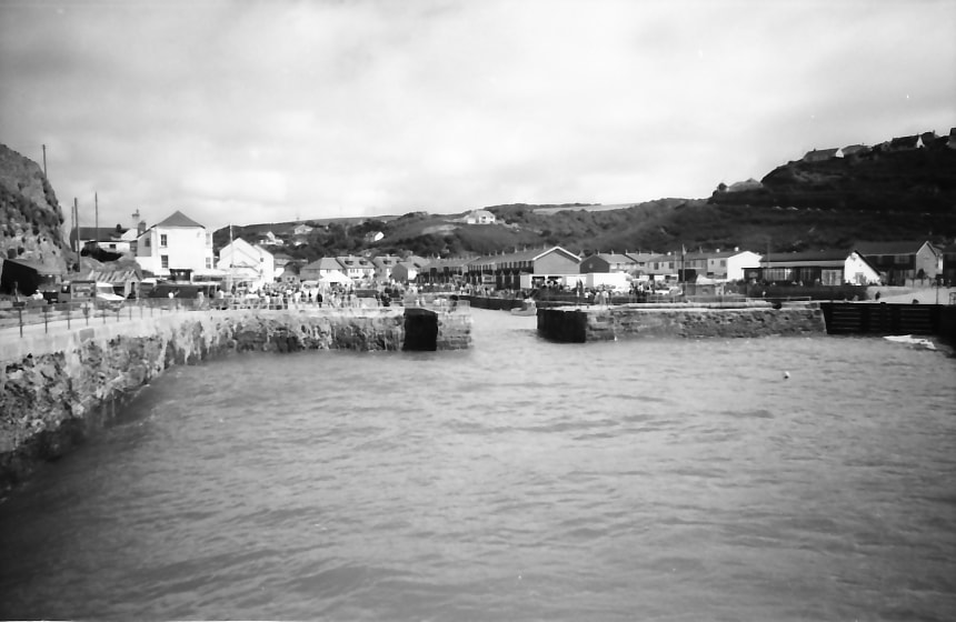
From the same viewpoint, looking south to the narrow entrance into the docks. Copyright Michael Bussell.
31.
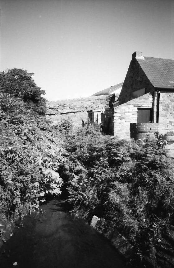
Looking south towards the incline from the nearby footbridge across the Red River. Copyright Michael Bussell.
32.
Another view of the lower part of the incline from just south of the footbridge. Copyright Michael Bussell.
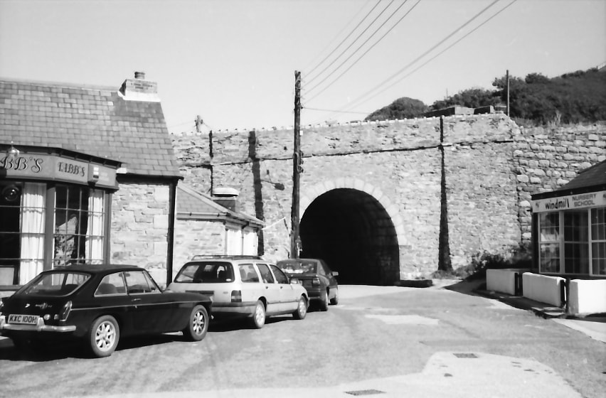
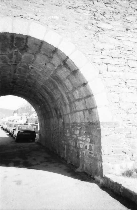
33.
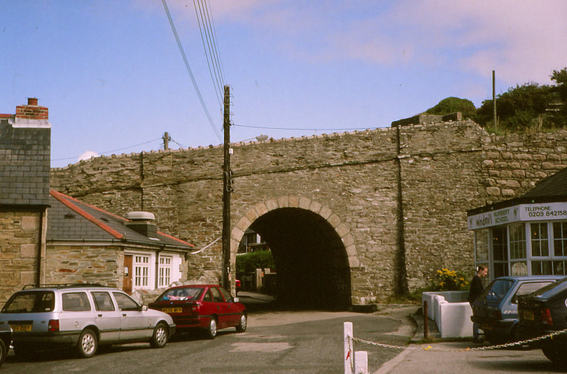
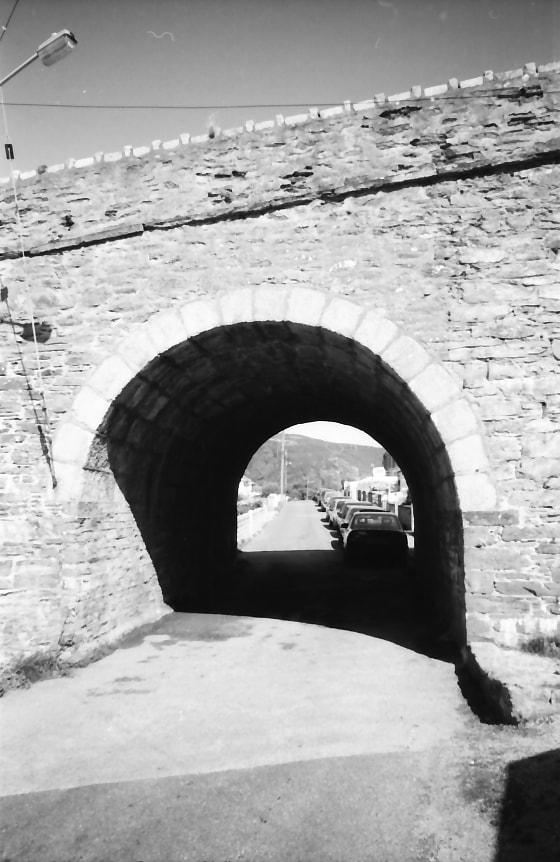
The incline passing over an archway through which leads the road to Glenfeadon Terrace. Copyright Michael Bussell.
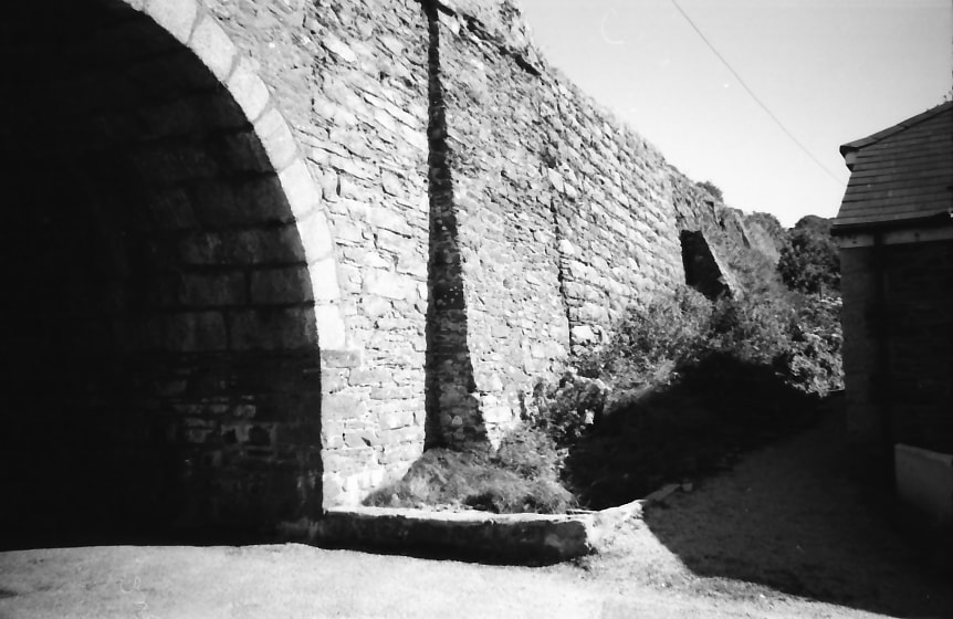
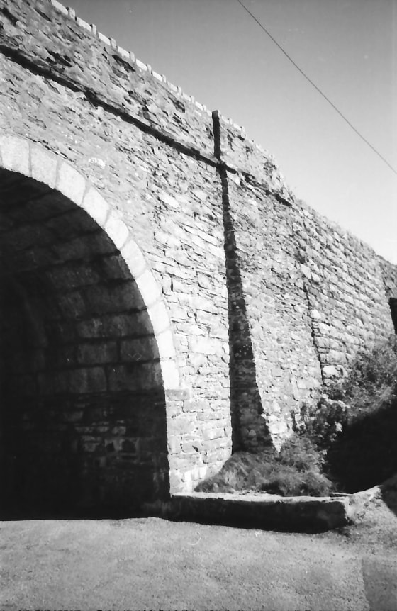
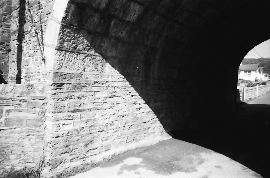
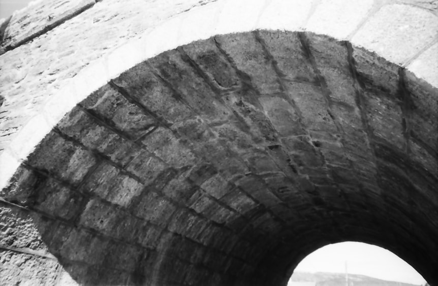
34,35,36,37,38,39 & 40.
Detailed views of the incline archway, a simple structure that is a beautiful example of the skilled stone mason’s art, and in perfect condition after more than a century and a half. Copyright Michael Bussell.
35. Copyright Michael Bussell.
36. Copyright Michael Bussell.
37. Copyright Michael Bussell.
38. Copyright Michael Bussell.
39. Copyright Michael Bussell.
40. Copyright Michael Bussell.
41. A view through the archway looking east toward Glenfeadon Terrace. Copyrtight Michael Bussell.
42. The incline in transition, the lower section being on a stone embankment and then going into a cutting through rock on the upper section, seen from the B3301 road that climbs up the hillside west of the incline. Copyright Michael Bussell.
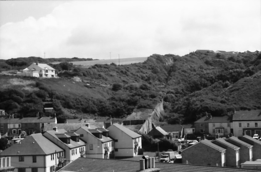
43.
A panoramic view of the incline and the inland part of the village looking north-east from the same location as the preceding photo. Copyright Michael Bussell.
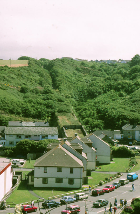
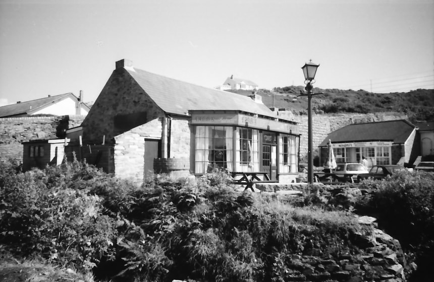
44.
A closer view of the lowest, truncated section of the incline in the village centre.
Copyright Michael Bussell.
45. A further and closer view of this lowest, truncated section. Copyright Michael Bussell.
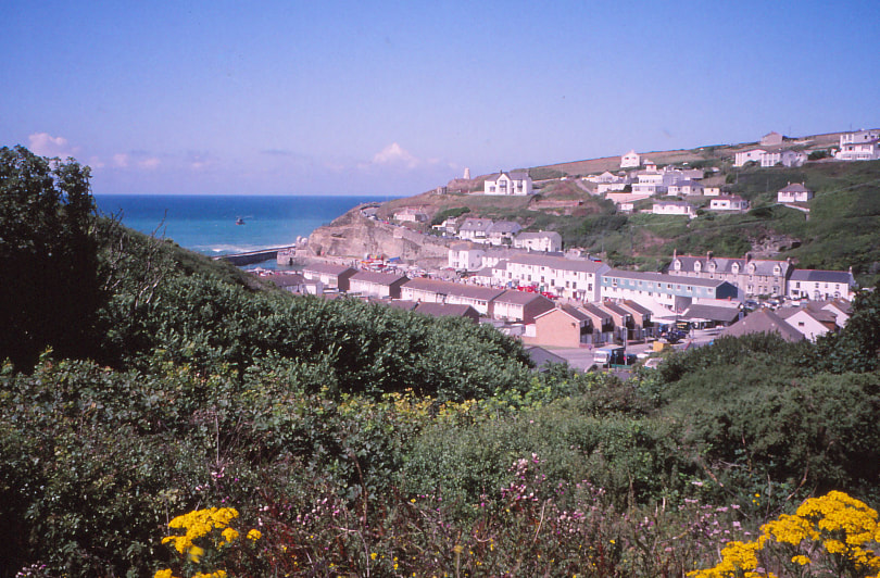
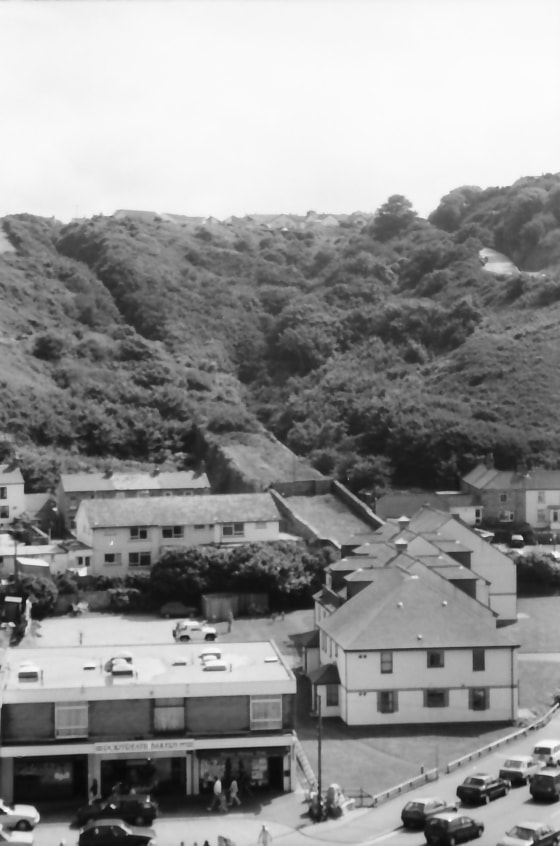
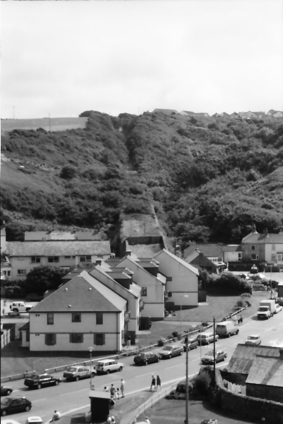
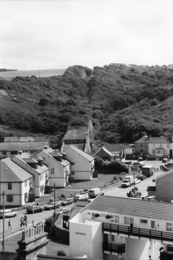
Three final photographs giving a panoramic view west to east across Portreath, again from the B3301 weat of the incline.
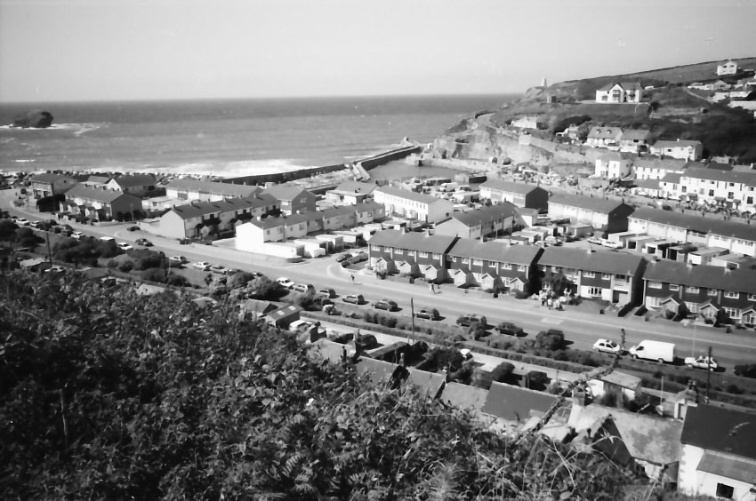
46. Copyright Michael Bussell.
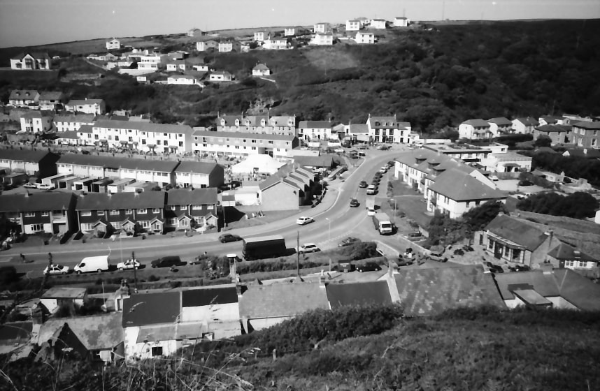
47. Copyright Michael Bussell.
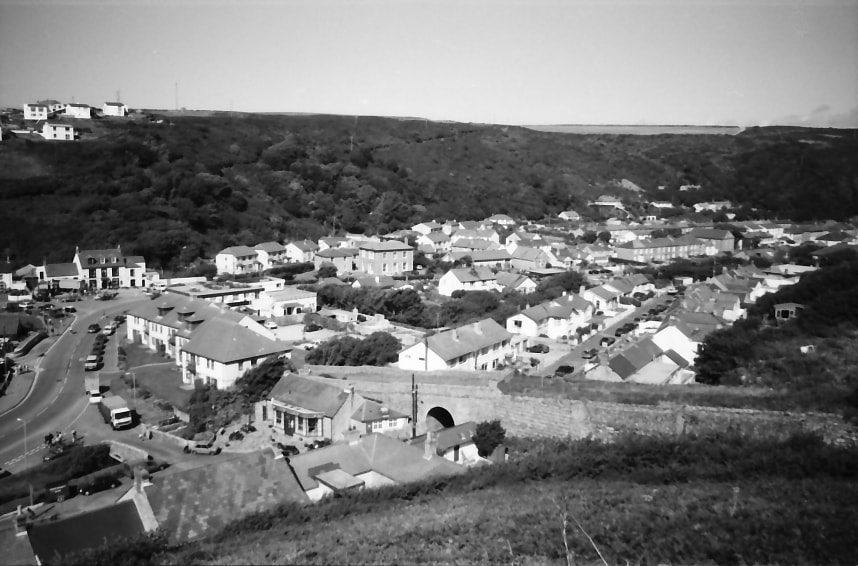
48. Copyright Michael Bussell.
Many thanks Michael. Your records are much appreciated.